2. Materials and Methods
In 2021–2022, the activity within our project focused on remote sensing research. Expanding upon basic hints in the literature [
13,
14], we identified the following kinds of data that could potentially be used to identify ancient roads: archival cartographic sources; archaeological data, especially on settlement; GIS simulations, especially Least Cost Paths (LCP) and Least Cost Corridors (LCC); archival aerial imagery, especially the APAAME project; archival satellite imagery, especially CORONA satellite images; recent open-access satellite imagery; and very high resolution imagery. All of these data types were tested as tools for detecting features using the few ancient pre-Roman Imperial roads that had been archaeologically attested in the Southern Levant. Our study led to several conclusions [
12]. Most important among these is that old topographic maps (especially British and German colonial maps) represent a very promising source of data for potential discoveries since they include both implicit and explicit clues suggesting the existence of ancient roads. What is more, information about archaeological data (especially settlement but also road-related infrastructure) and the Roman network of Imperial roads may also offer valuable insights, especially if the quality of databases improves considerably in the near future. Finally, the use of GIS simulations on the basis of widely available 30 m digital elevation models has substantial limitations. In particular, the use of Least Cost Paths and Corridors for modeling short-distance travel (which struggles with local obstacles within a valley, plateau, etc.) appears to be ineffective. At the same time, the use of Least Cost Corridors for simulating long-distance travel (at least regional routes crossing many geophysical obstacles along the way) offers some promising results.
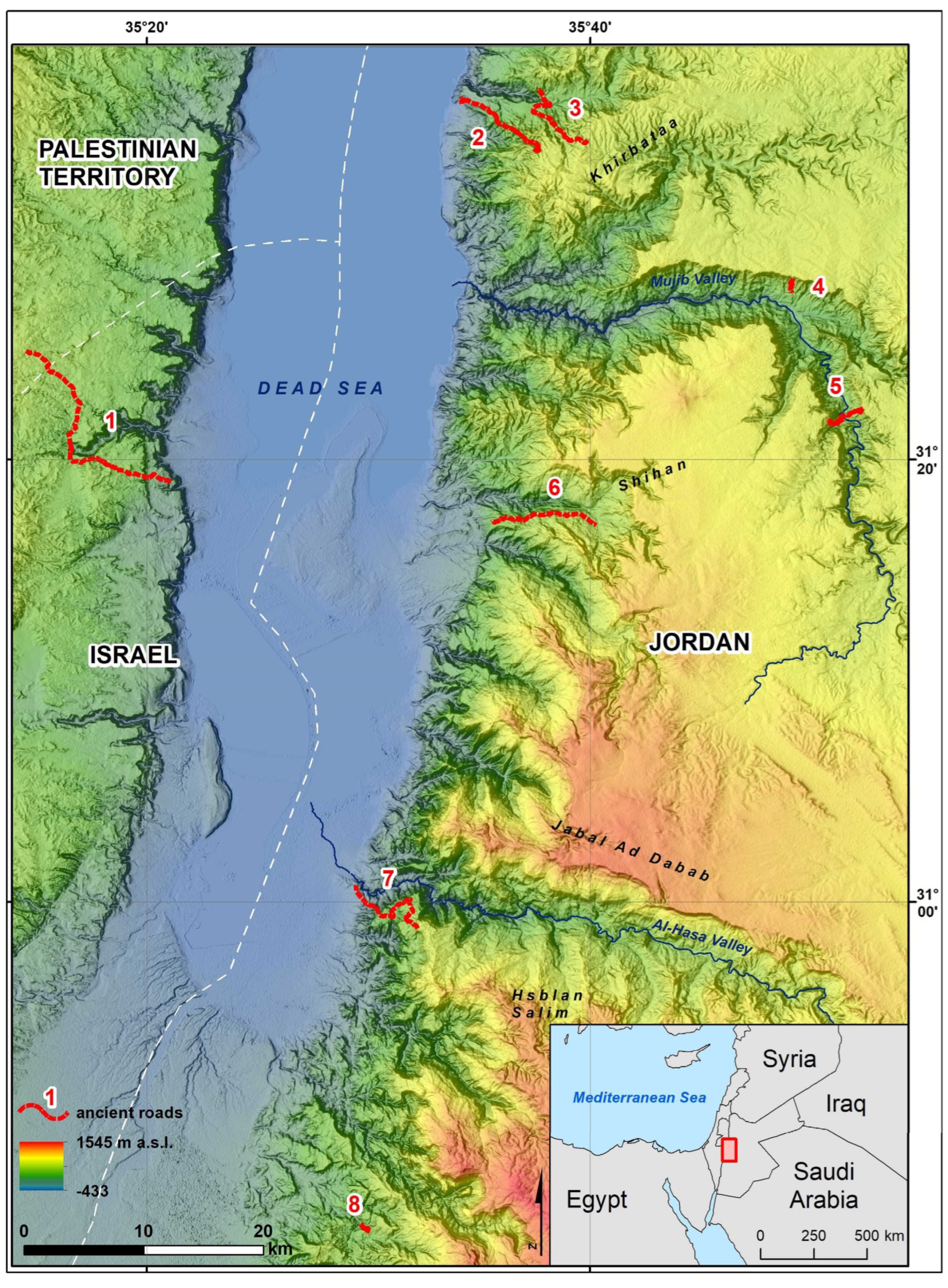
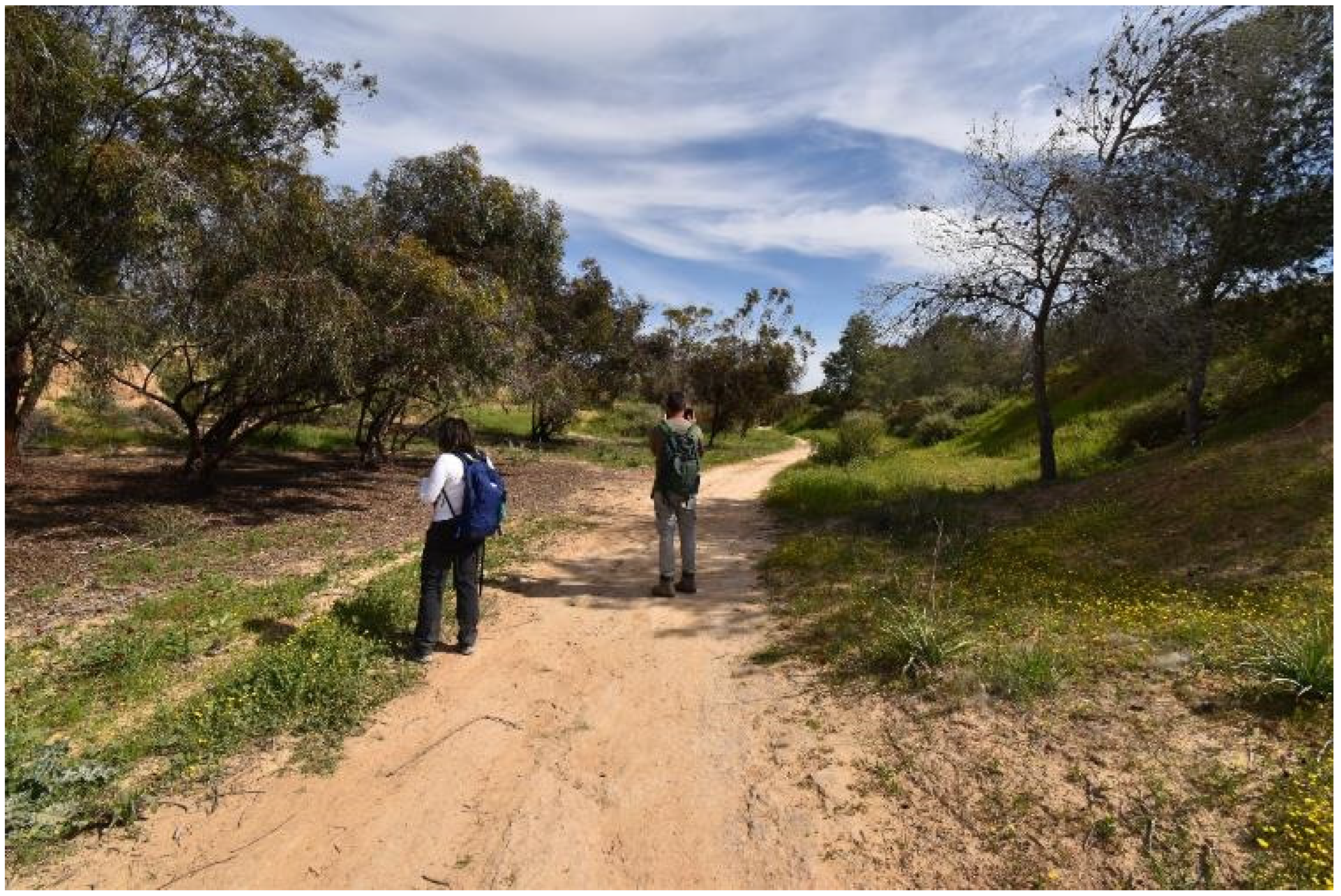
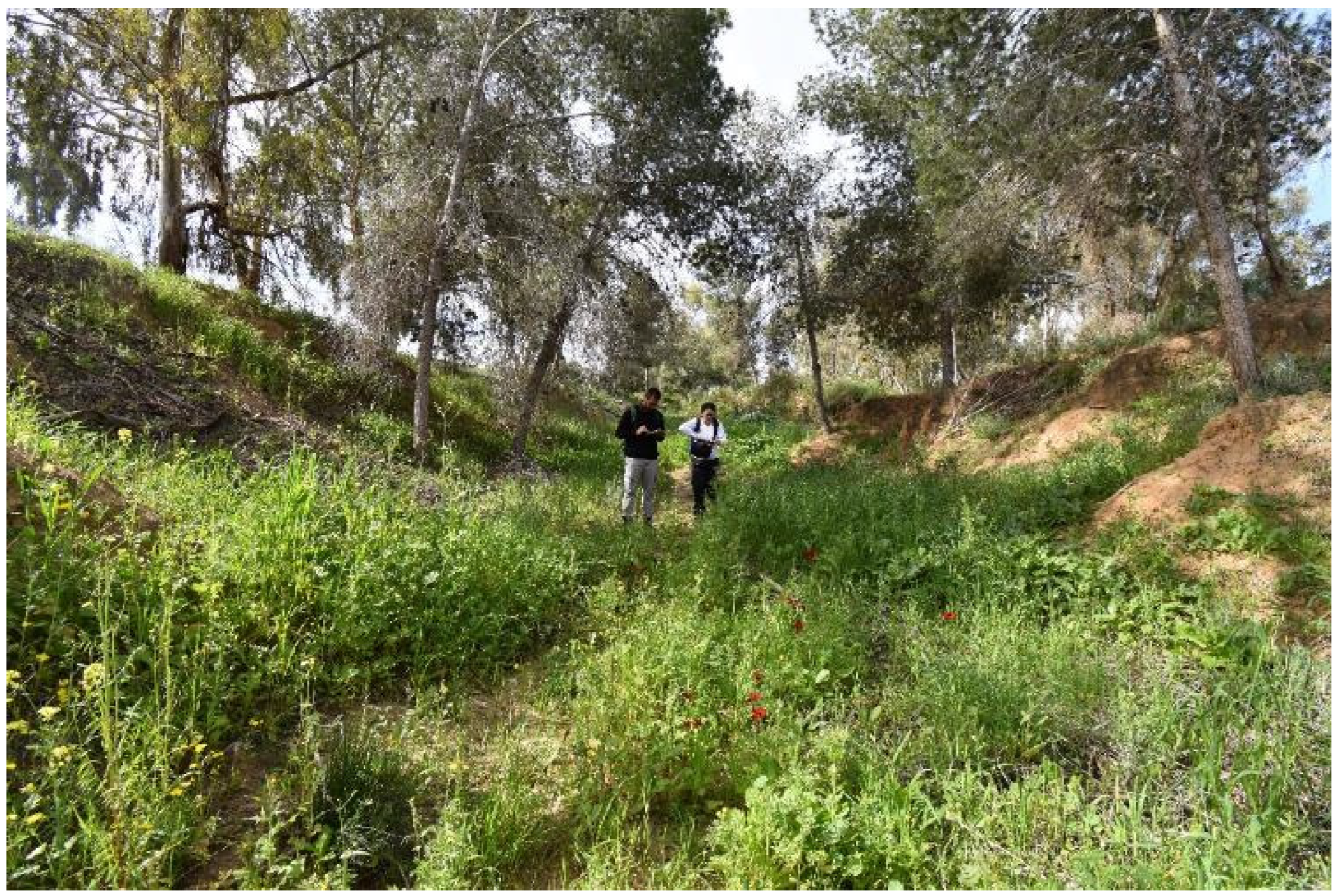
Following the remote sensing research, the next step in our project was a study trip to Jordan and Israel; the results of which are reported and discussed in this paper. The fieldwork took place in Jordan from 22 February to 5 March 2023 and in Israel from 6 March to 23 March 2023. The research team included Michał Marciak (ancient historian), Daniel Sobczyński (GIS researcher), Omri Abadi (archaeologist), and Miroslava Čilová (Bible scholar). The main goal of the expedition was to ground-truth (including GPS recording) the material remains of the few ancient pre-Roman roads that had previously been discovered in the research area (see
Figure 1). In this case, the team used GIS shapefiles imitating the courses of the ancient roads. The shapefiles were created on the basis of cartographic evidence from the subject literature (sketches and maps of roads, although they were of a mostly non-satisfactory quality or scale) and the team’s research on satellite images (see
Figure 2).
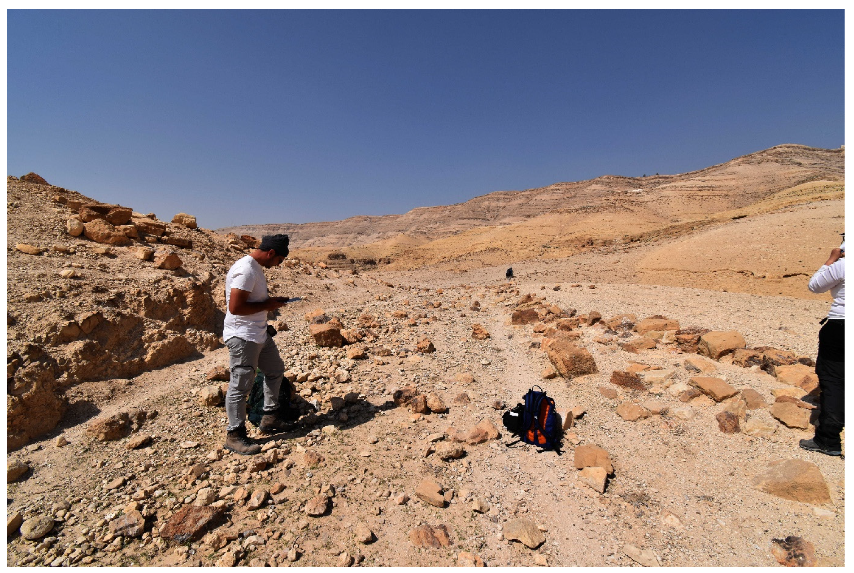
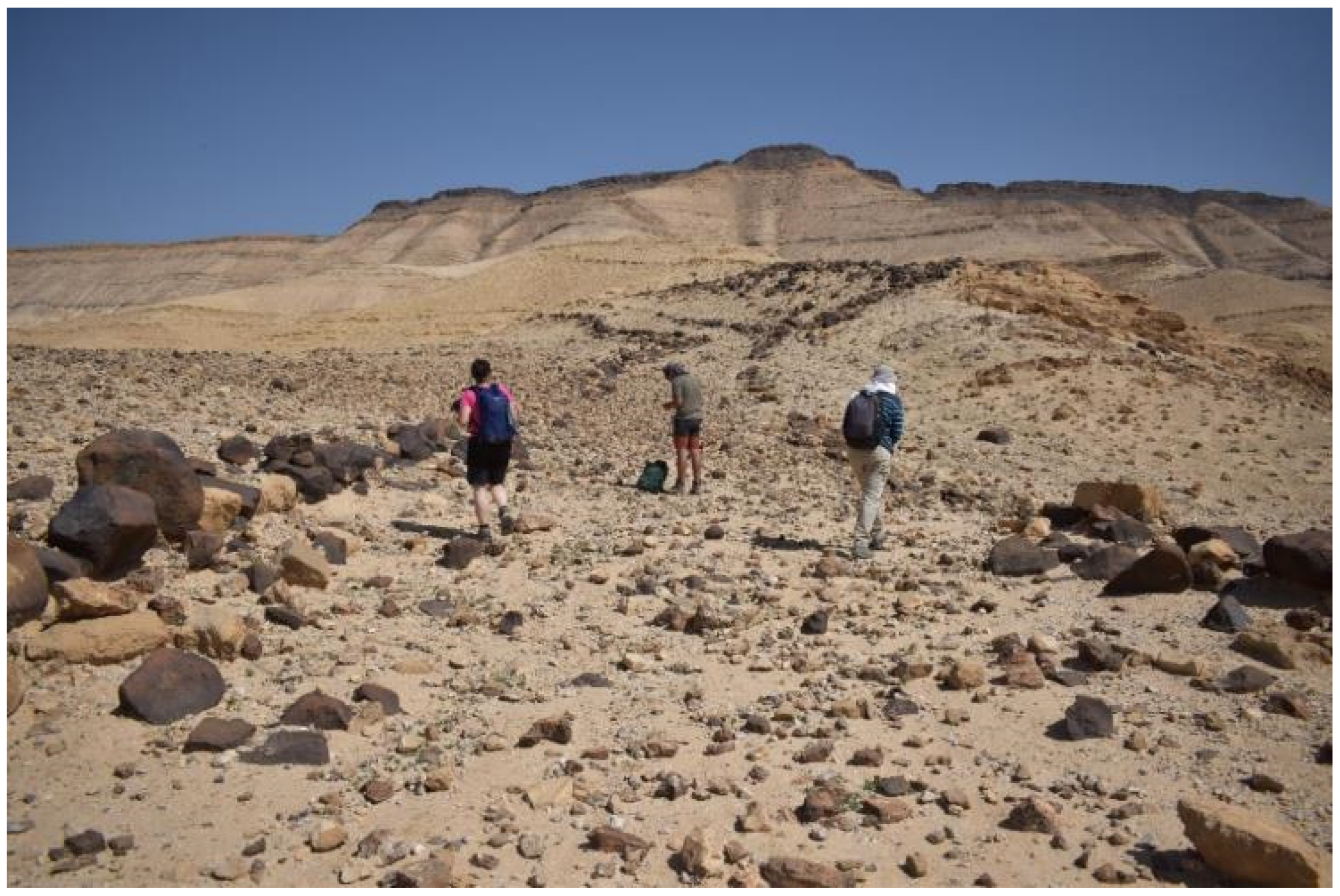
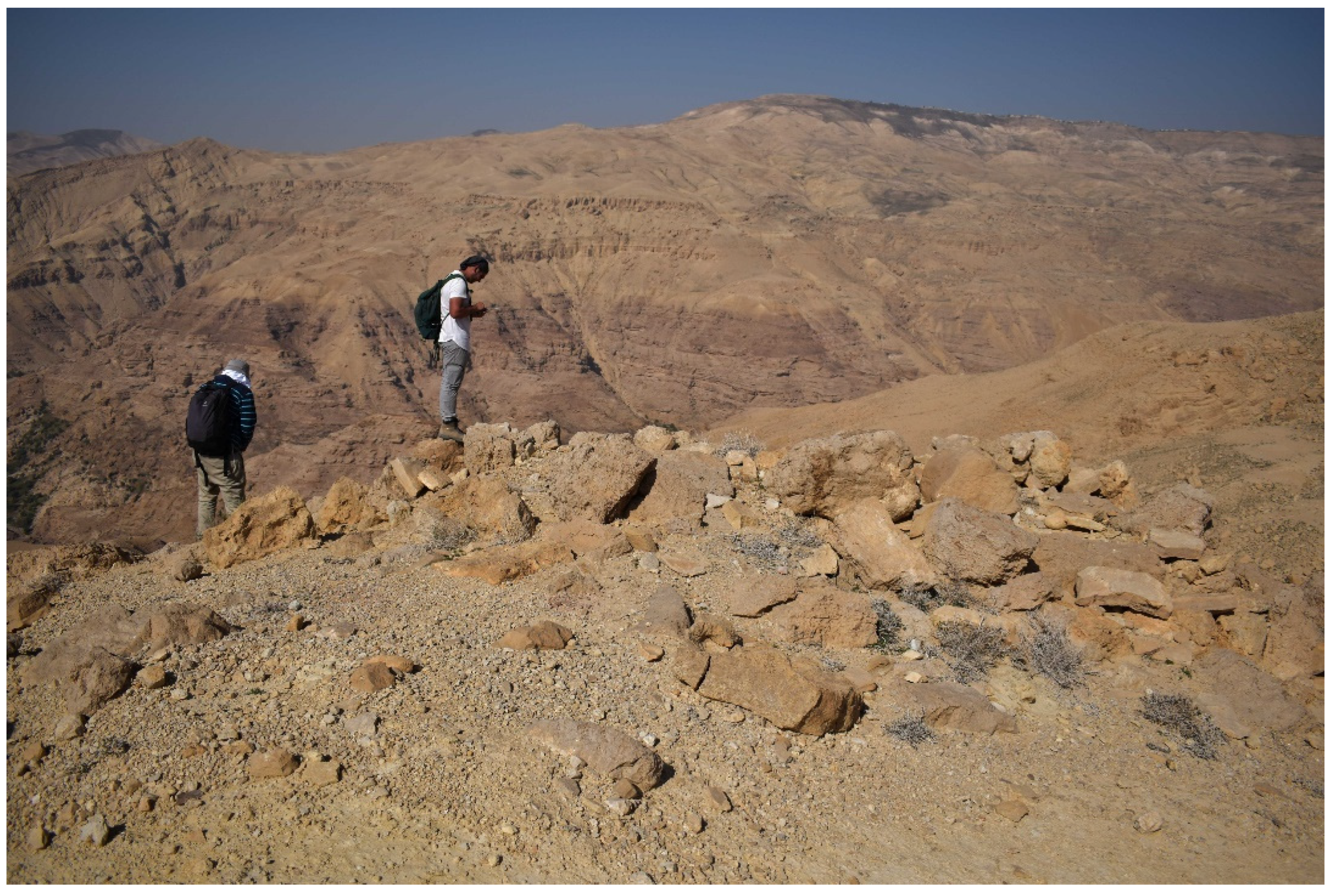
During the fieldwork, an extensive, mixed survey was adopted based on a motor vehicle survey combined with field-walking due to the large geographical area of interest. The methods of ground-truthing followed the standard procedures in the research field. Namely, verification was made via the observations of landscape features (e.g., terrain features, vegetation coverage, and soil colors), the presence or lack of diagnostic signs of anthropic features in the terrain, or the existence of concentrations of archaeological finds (especially the presence and character of surface pottery finds). Fieldwork was non-invasive: in the case of the findings of archaeological artifacts (especially pottery), no artifacts were collected, but photographic documentation was gathered; their positions were marked with a handheld GPS (Garmin GPSMAP 66sr), and ground observations were recorded in a Lenovo Tablet P11. Using the ArcGIS Field Maps application, all data were simultaneously integrated into a GIS spatial database (ArcGIS online). In essence, all gathered data may be divided into four categories: detected road remains (RR), archaeological sites (AS), pottery findings (PF), and GPS tracks of longer sections of the road courses (TR). With regard to the road remains, the ground observations included preliminary identifications of their width, the presence of curbstones, the types of pavement, substrate, topography, and an approximate degree of the slope. As far as the archaeological sites are concerned, observations about the type of structure and additional comments were recorded. As for the pottery findings, information about the type, color, material, firing method (if evident), thickness, admixture, and possible date were noted.
3. Results
The following previously discovered ancient roads were ground-truthed: the Wadi Zarqa-Main road (southern section), the Callirrhoe–Machaerus road, the Aroer Ascent, Glueck’s Road in Wadi an-Nukhayla, Naqb Sfai, Naqb Abrash, and the Masada–Hebron road.
3.1. The Wadi Zarqa Main Road
The Wadi Zarqa-Main road was first identified by Strobel [
6], see also [
15] and surveyed in much more detail by Ji [
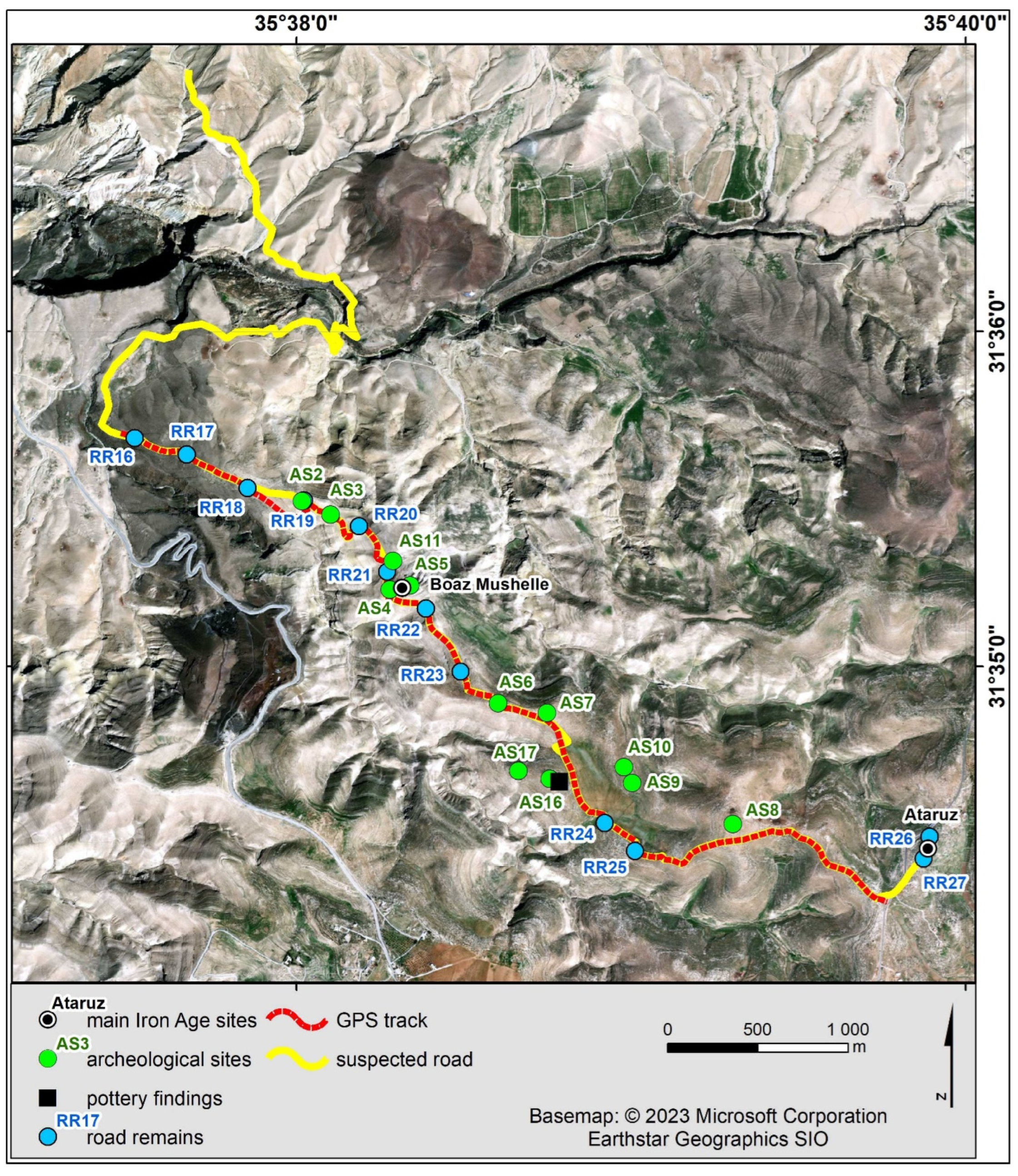
10]. Its length is about 12 km (width mostly between 2 and 4 m), and it connects the site of Ataruz in the Moab Plateau with the Jordan Valley, especially Jericho, via the site of Boz al-Mushelle, also known locally as Farsh al-Mesala, perhaps to be identified with Zereth Schahar from Josh. 13:18 (see
Figure 3).
The origin of the road was dated to the 9th–8th centuries BCE, mainly on the basis of the pottery finds, and its further intensive use was dated to the period from the 2nd century BCE to the 1st century CE [
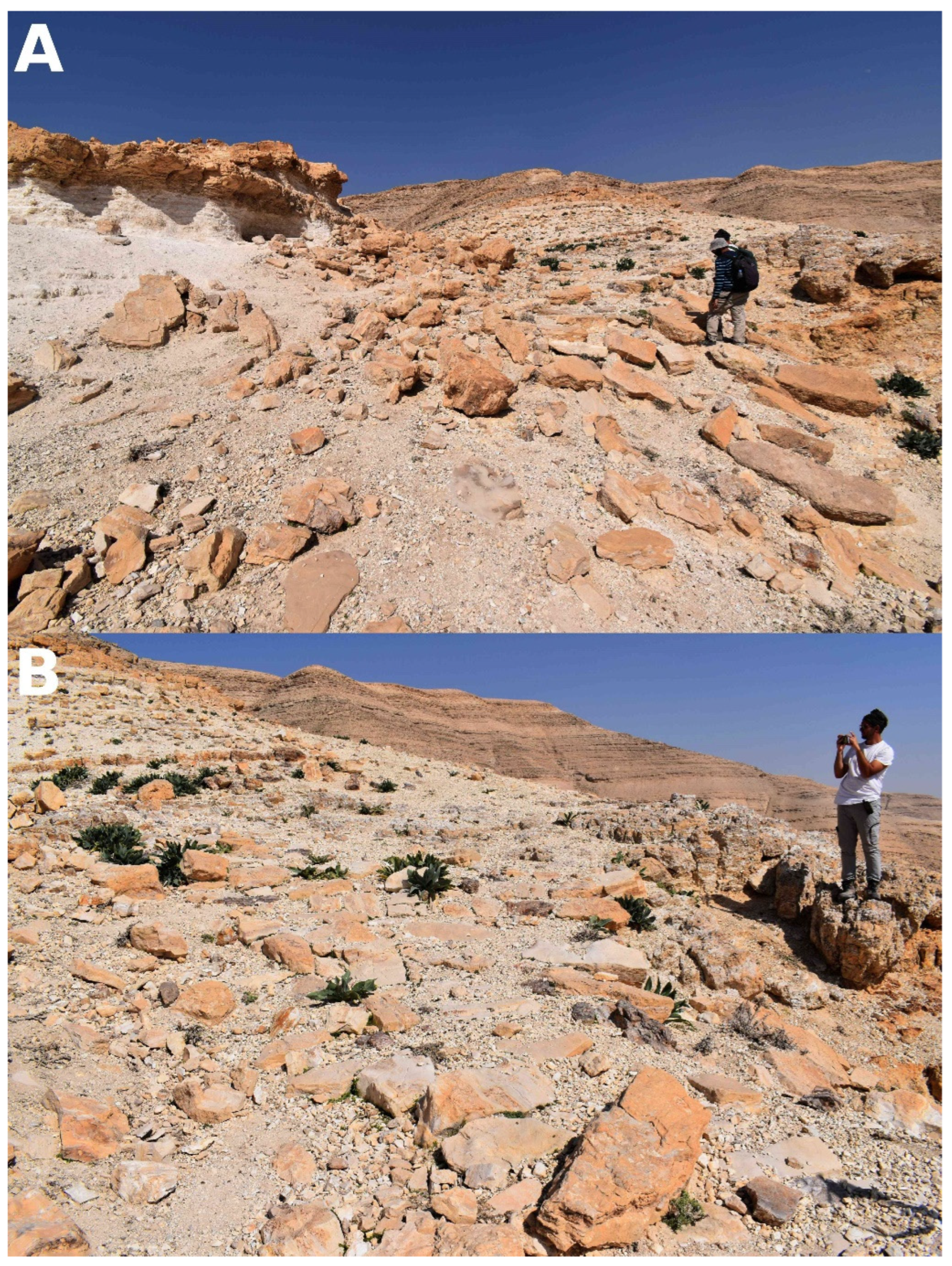
10]. Ji’s research made clear that the course of this road is marked by the presence of several archaeological sites (Ji’s AS 19, AS 41, AS 42, and AS 45), which is mostly interpreted as watchtowers (AS 19, AS 41, and AS 42). The ancient road is partly detectable on the ground, especially via remnants of retaining walls in the vicinity of Boz al-Mushelle (see
Figure 4A,B), and partly via the course of a modern dirt road running northwest from Ataruz for some 2 km.
Our team inspected the southern course of this road from the site of Ataruz to the Wadi Zarqa-Main road (see
Figure 3). In this section, the road descends from 740 m to 200 m above sea level. The course of the road follows the ridge running northwest from Ataruz, which is located at a junction connecting three different ridges. At the beginning, the road descends to a pass at an altitude of 690 m, then ascends a hill with a height of 710 m and, using one of its ridges, descends to a flat valley located at an altitude of 600 m. From here, the road climbs a westbound ridge, then turns northward to pass below the Boz-Al Mushelle site, after which it takes a westbound ridge for a gentle descent. In this section, 12 locations of road remains (RR 16–27), 11 archaeological sites (AS 2–11, 16–17), and one pottery finding (PF 1) were recorded. Our AS 8 matches Ji’s AS 19, while AS 6–7 and AS 16–17 (with PF 1 at AS 16) corresponds to Ji’s AS 45 (a fortress or fortified villa with adjacent structures) and AS 41–42, respectively. Likewise, AS 4–5 and AS 11 refer to Boz al-Mushelle (AS 11 being a cistern, AS 5 an acropolis, and AS 4 a middle town). Thus, AS 9–10 and AS 2–3 were not reported by Ji [
10]. AS 9 and 10 are large circular structures (20 m in diameter) which were tentatively interpreted as camps, but no conviction on their dating could be reached.
In turn, AS 2 appears to be a small water cistern, and AS 3 a circular structure (18 m in diameter). Both sites are located on a ridge located northwest of Boz al-Mushelle, just after the point where Ji [
10] seems to locate the road’s turn to the northwest before further leading to a basalt stone field.
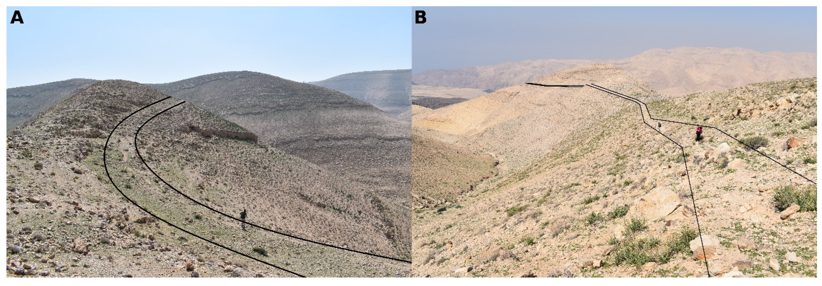
In fact, the best preserved sections of the road course can be found in the vicinity of the site of Boz al-Mushelle (RR 22–23) and in the basalt stone field (RR 16–17) some 2 km northwest of Boz al-Mushelle. As far as RR 16–17 are concerned (see
Figure 5), the road runs on a hillside along the ridge; its width is about 2–3 m, and the retaining walls can be found on the northern side of the road. The pavement features a deposit of erosion, the substrate is a limestone and basalt conglomerate, and the slope of the road can be judged as medium.
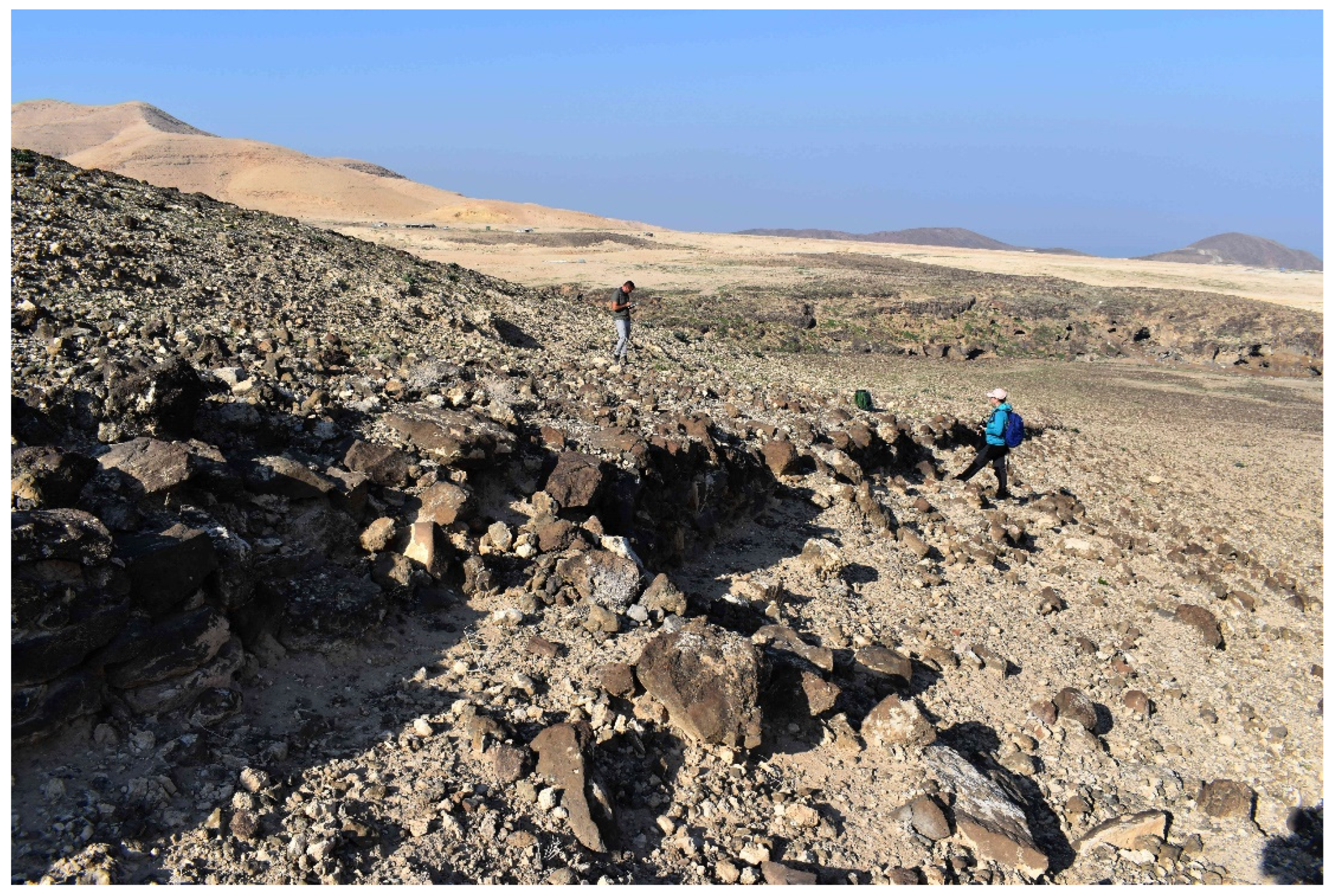
In turn, RR 22 (see
Figure 6) are the remains of the retaining wall on the western side; the road runs on a hillside along the ridge, and its width is about 2–3 m. The pavement features a limestone aggregate, the substrate is an erosion deposit, and the slope of the road appears to be medium.
3.2. The Callirrhoe–Machaerus Road
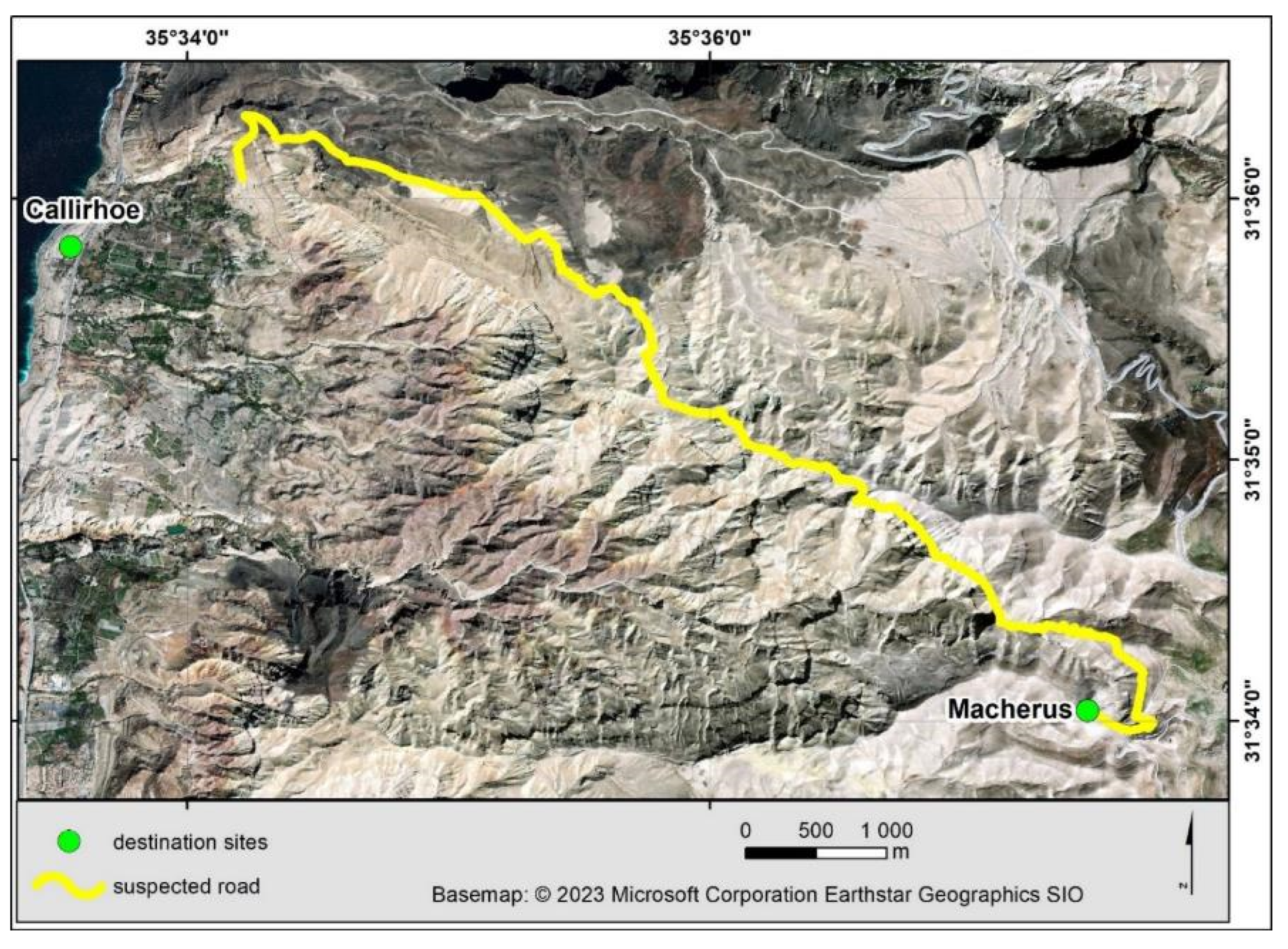
An ancient road between two famous Herodian sites, Callirrhoe and Machaerus, was reported in the 19th century CE [
16,
17]. However, additional light has only more recently been shed on both its course and dating by Ben David [
9]. Given the undisputed fact that the Machaerus fortress was conquered by the Romans in 72 CE and abandoned afterwards, the road from Machaerus must be dated to the Early Roman period at the latest. The road was reported to be more than 2 m wide along its entire length and occasionally features curbstones, retaining walls, and paved sections.
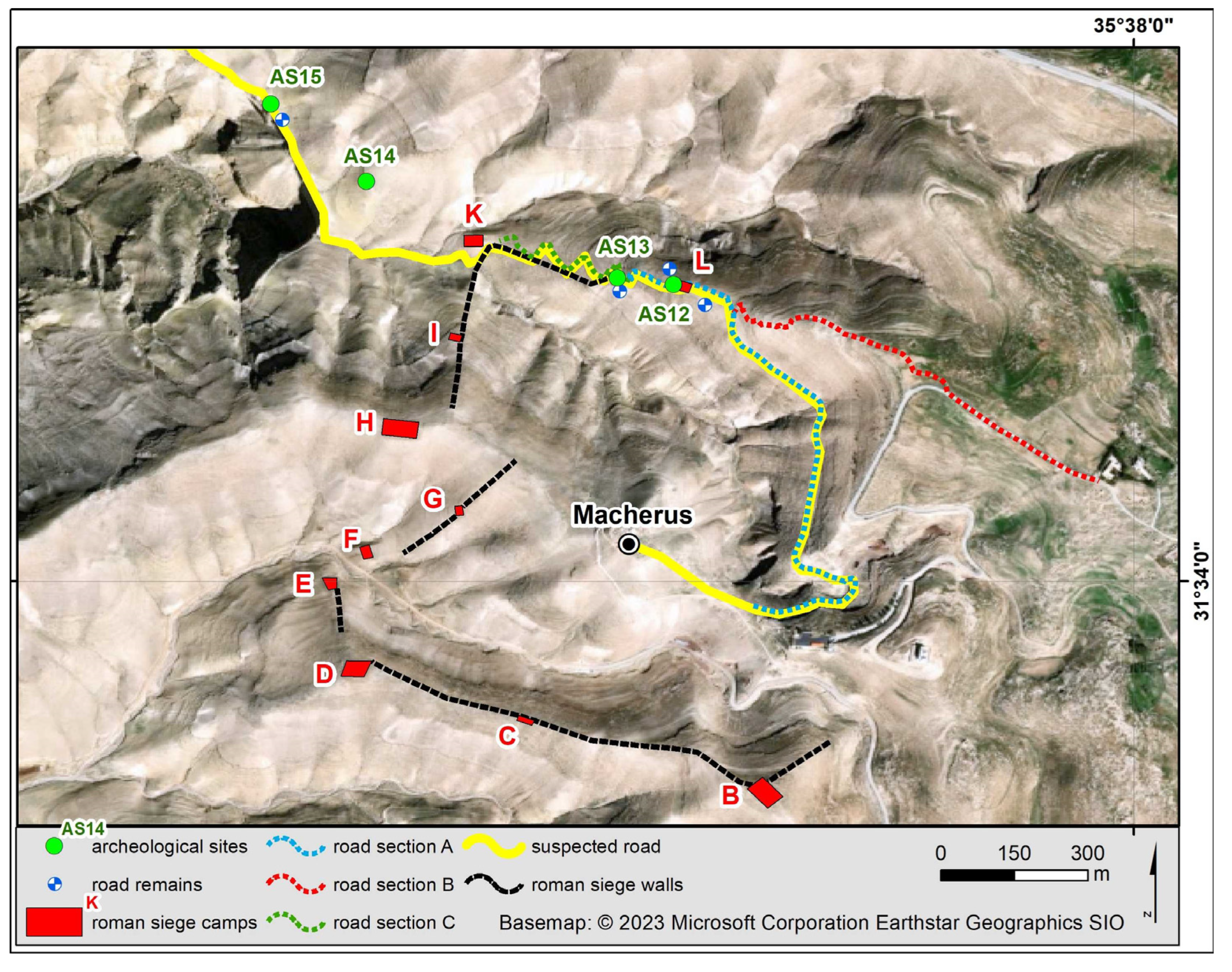
Due to logistical difficulties, our team ground-truthed only part of the road, about 3 km long, starting from Machaerus onwards (see
Figure 7 and
Figure 8). The identified stretch begins at 600 m above sea level on a ridge northeast of Machaerus, to which it is now connected by a rather narrow path. The path runs down the ridge, traversing its slopes towards the confluence of two valleys. It then runs westward along the bottom of Wadi Maghara until it reaches a barrier in the form of a cliff several dozen meters high. Here, the path turns northwest, running along the crest of the cliff where horizontal geological layers form a flat but narrow passage. Further on, the path continues along the slope towards the northwest and then crosses numerous small passes.
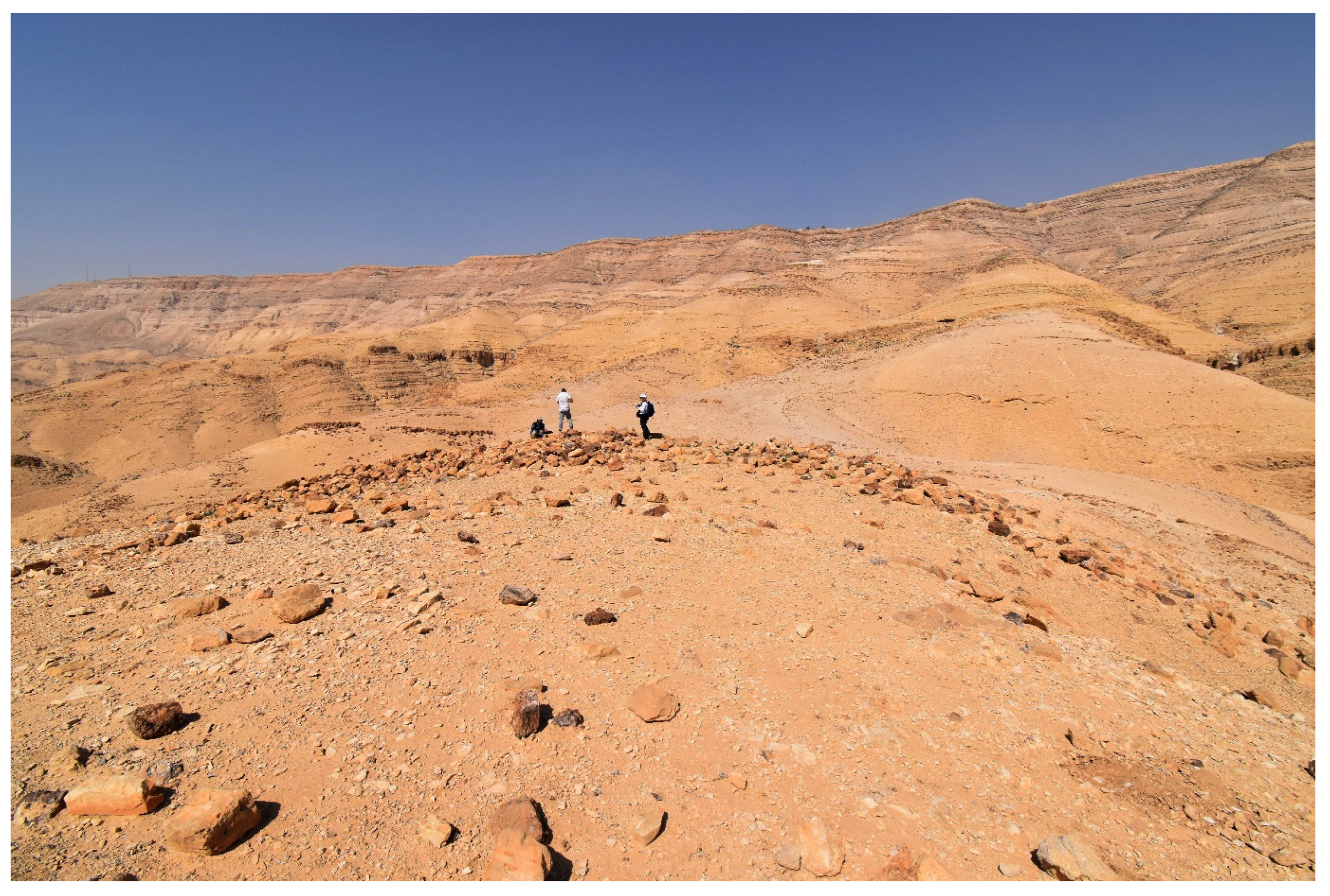
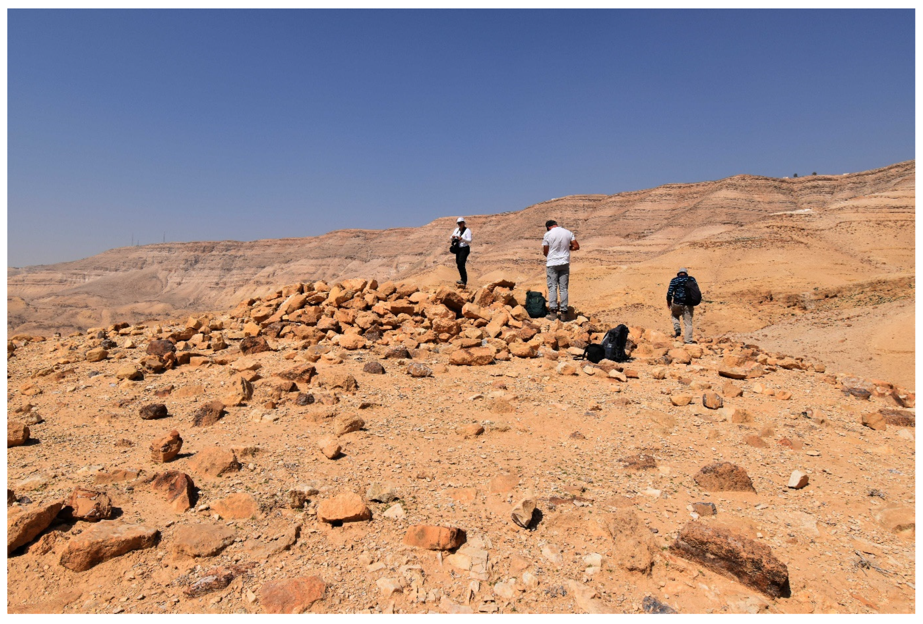
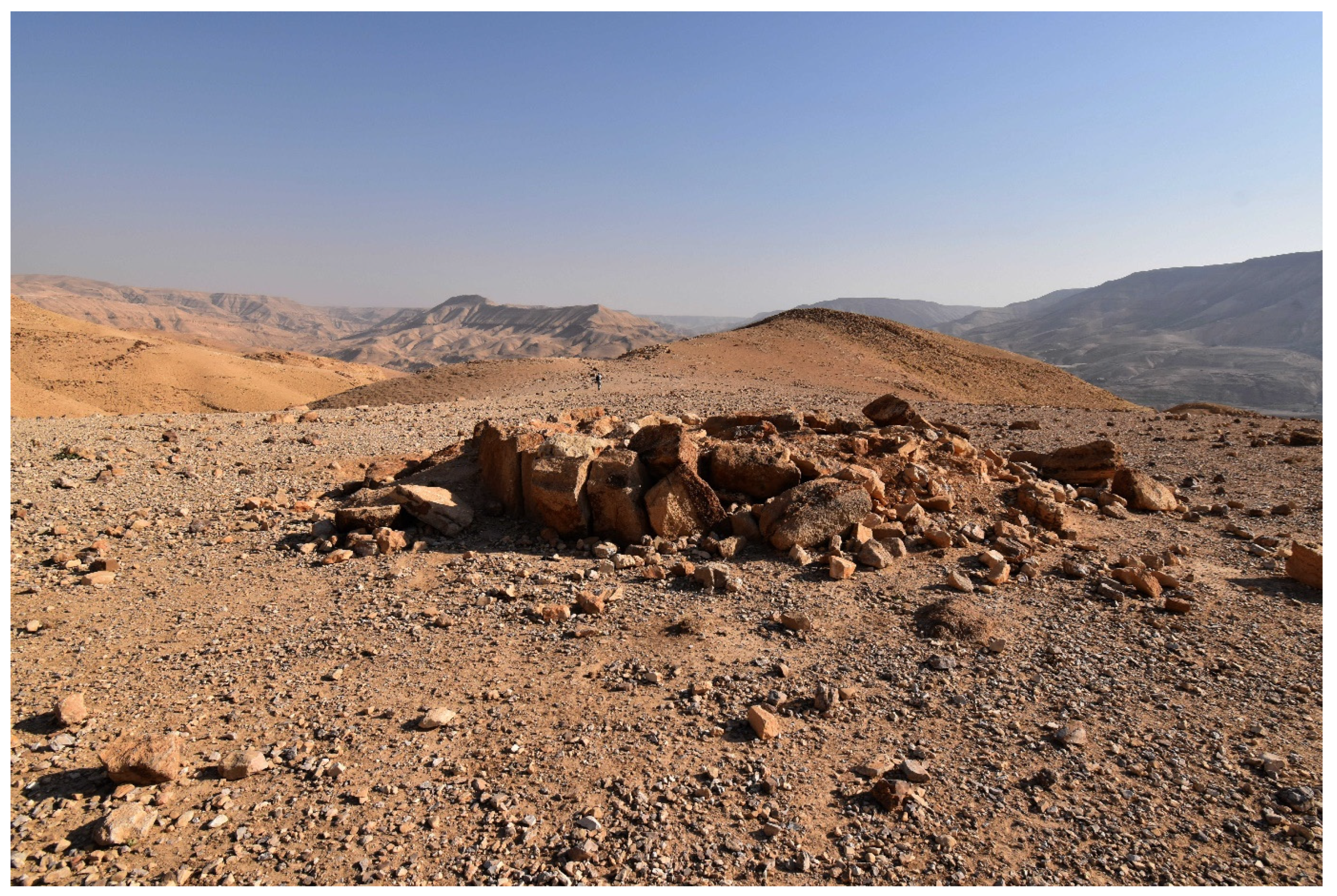
Although the road is not as impressive in this section as further onwards, its course is still traceable as a path about 1–2 m wide and is also marked by the road remains. The recorded road remains are the retaining walls located on one (RR 28, 30–31) or two sides of the road (RR 29). The pavement presents a limestone aggregate, and the substrate is an erosion deposit. In turn, most archaeological sites in this section are clearly the remains of Roman siege fortifications (AS 12: fortification; AS 13: wall; AS 14: camp). In this context, the question arises as to the relationship between the Roman structures and the remains of an earlier road, as well as the possible existence of later (post-Roman) structures. In fact, the preserved sections of the course of the road could tentatively be divided into several subsections (see
Figure 8): A—a path coming from the Machaerus fortress, B—a path (possibly post-Roman) coming from the Mukawer village, and C—a serpentine path located inside the Roman siege walls. It should be noted that the path intersects the Roman camps twice (camps K and L). What is more, AS 12 with RR 29 and AS 13 with RR 30 are located on the line of the Roman structures, the siege wall and camp L, respectively. In this light, section C (serpentine path) could also be understood as the lines of Roman communication between camps K and L. Indeed, the serpentine path is better preserved than the path in subsections A and B. Likewise, AS 12 with RR 29 and AS 13 with RR 30 could tentatively be understood as openings (gates) in the Roman system of fortifications. At the same time, the intersection of the path and Roman camps K and L is not regular (it is not based on right angles). Thus, it follows that the Roman fortification was at least partly built upon the course of the road [
18], especially in the case of camp K (while our impression of the layout of the remains in camp L is that it may have been a result of later local activity). At any rate, there can be no doubt that the road starts at Machaerus and continues towards Callirrhoe past the Roman siege fortifications. Thus, the Roman activity, as well as possible later local activity, was only secondary to the course of the earlier road connecting Machaerus and Callirrhoe.
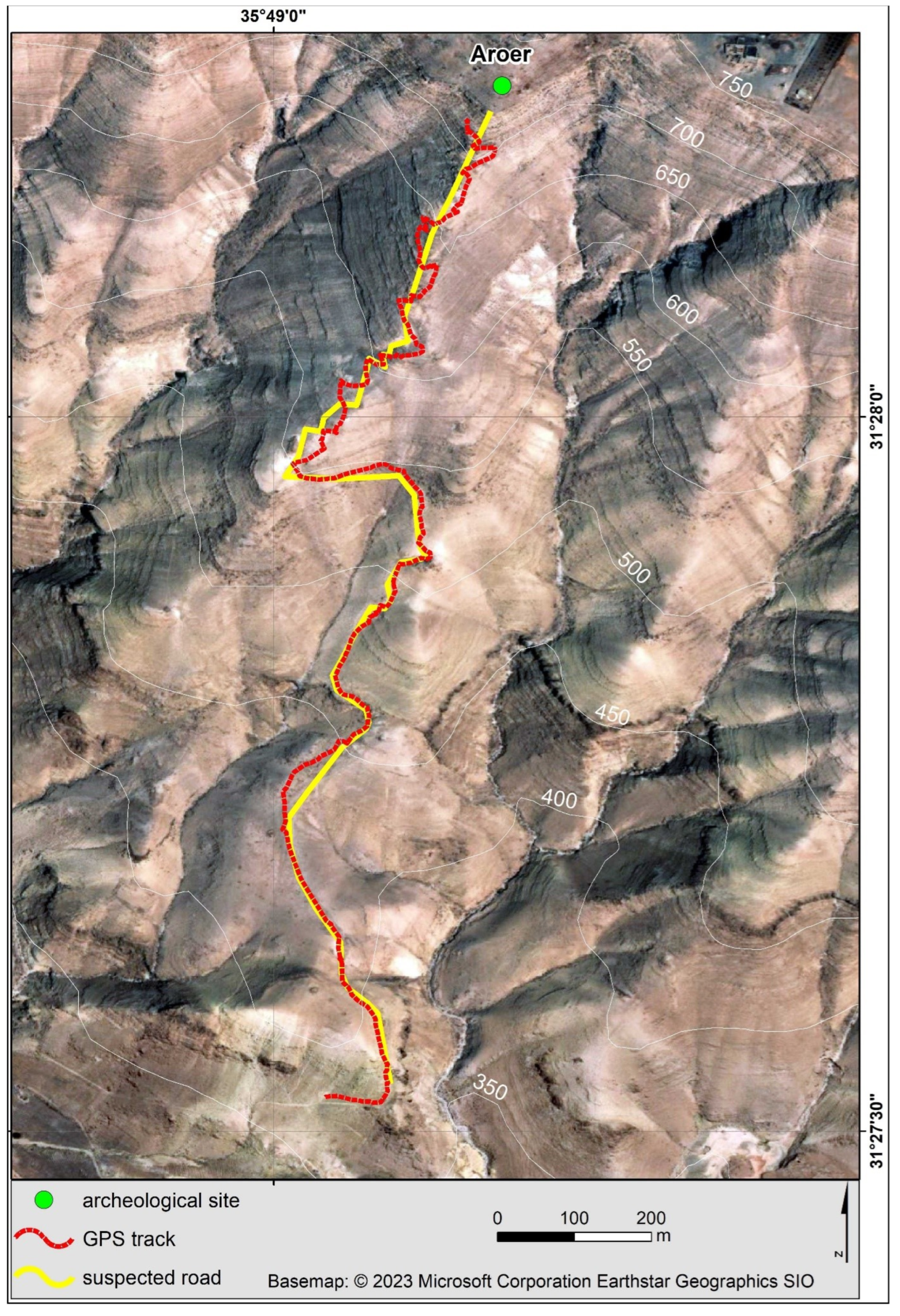
3.3. The Aroer Ascent
The Aroer Ascent is one of possibly three ancient pathways ascending the northern face of the Wadi Mujib (the two others lead to Dibbon and Lahun). It was recently well argued by Kloner and Ben David [
7] to have been an Iron Age road, possibly part of the King’s Highway. The road was reported to have been of an irregular width (with sections 4–6 m and 1–2 m wide) and to occasionally feature the remains of curbstones and retaining walls.
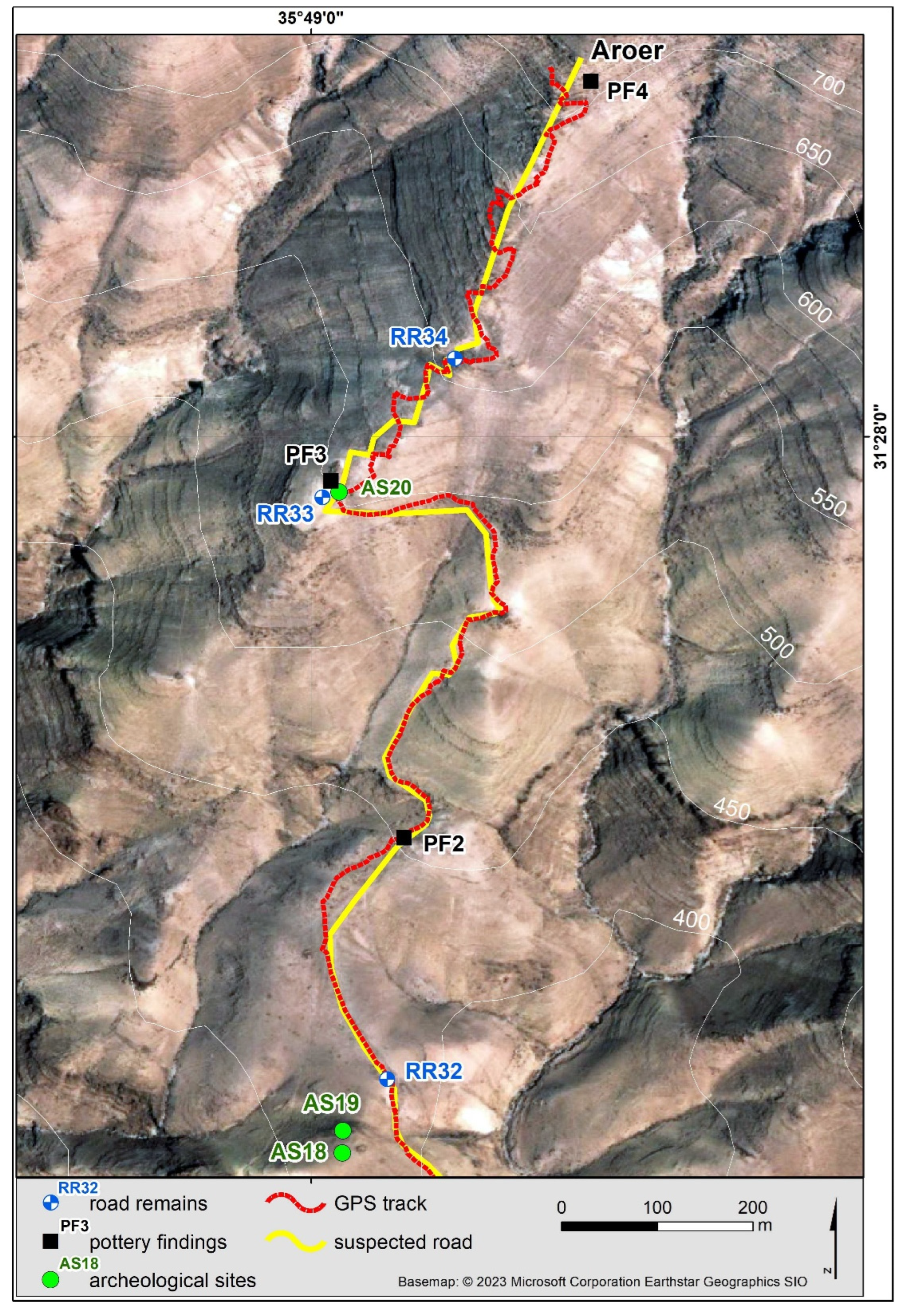
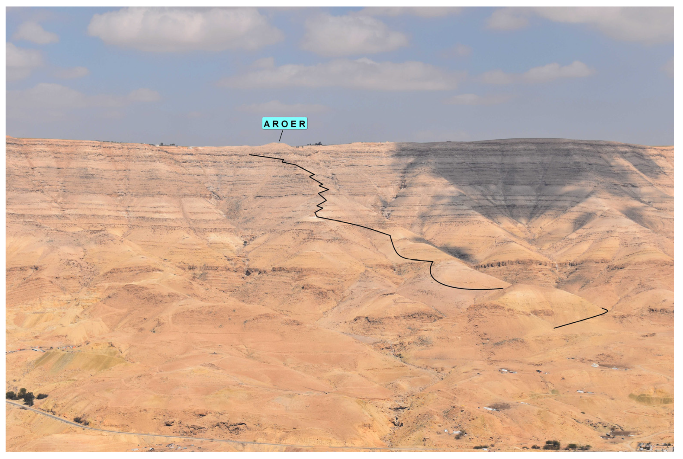
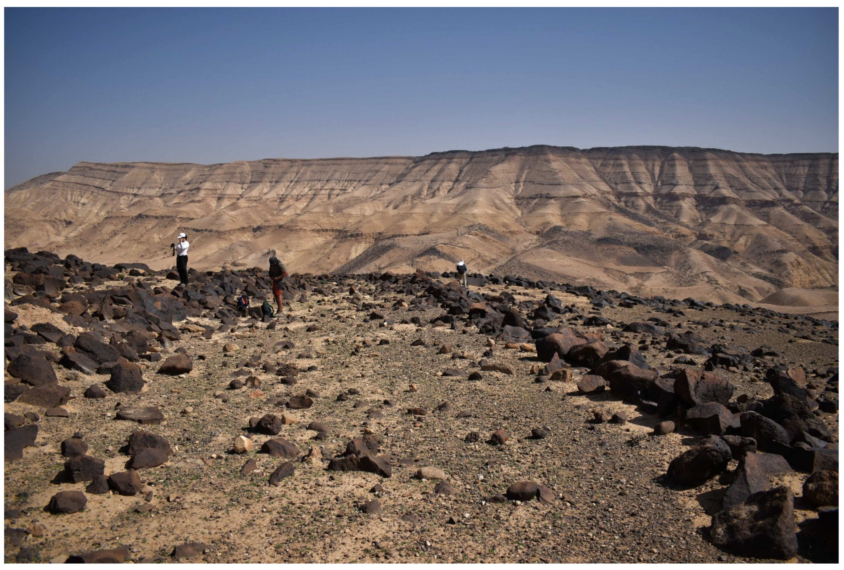
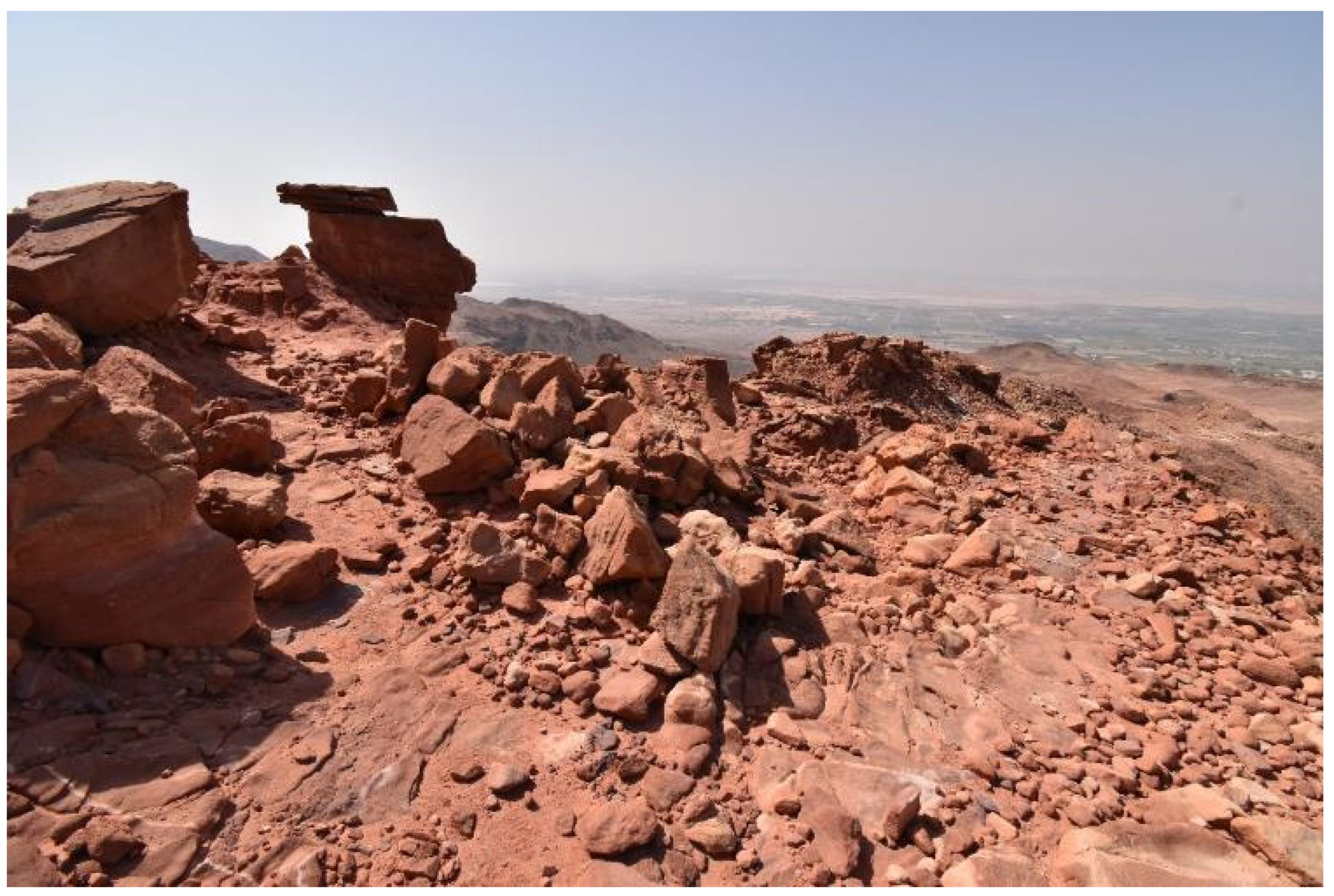
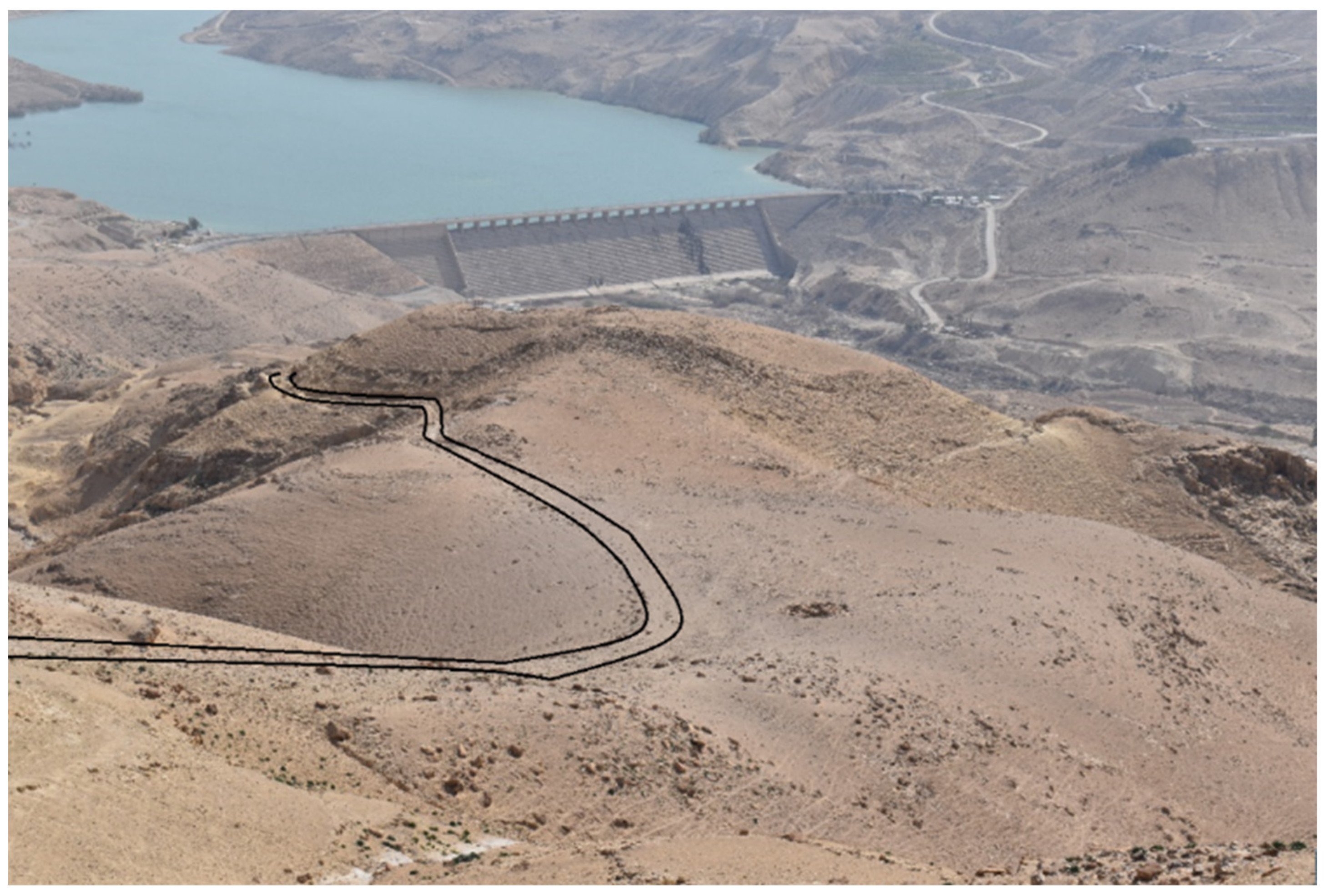
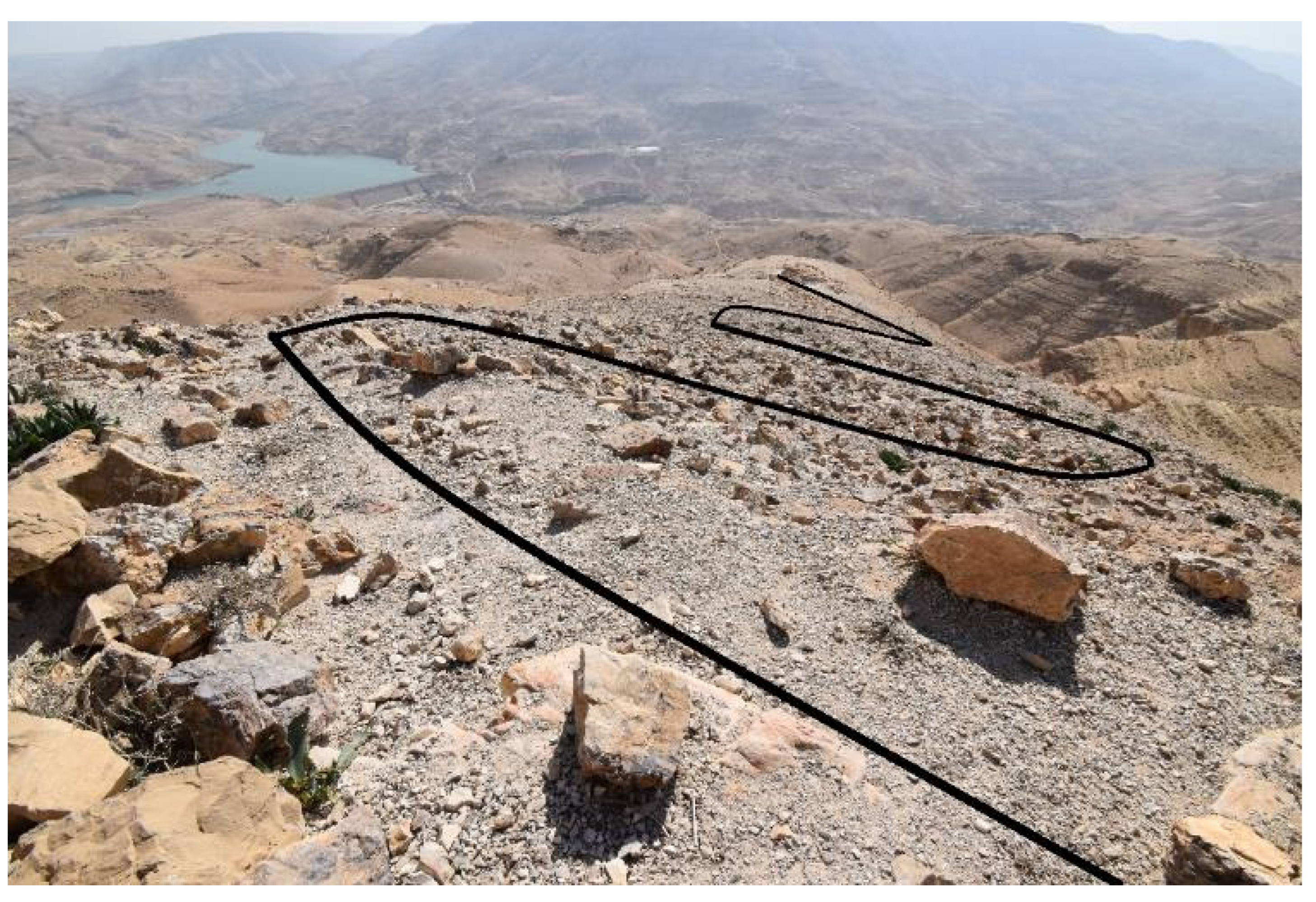
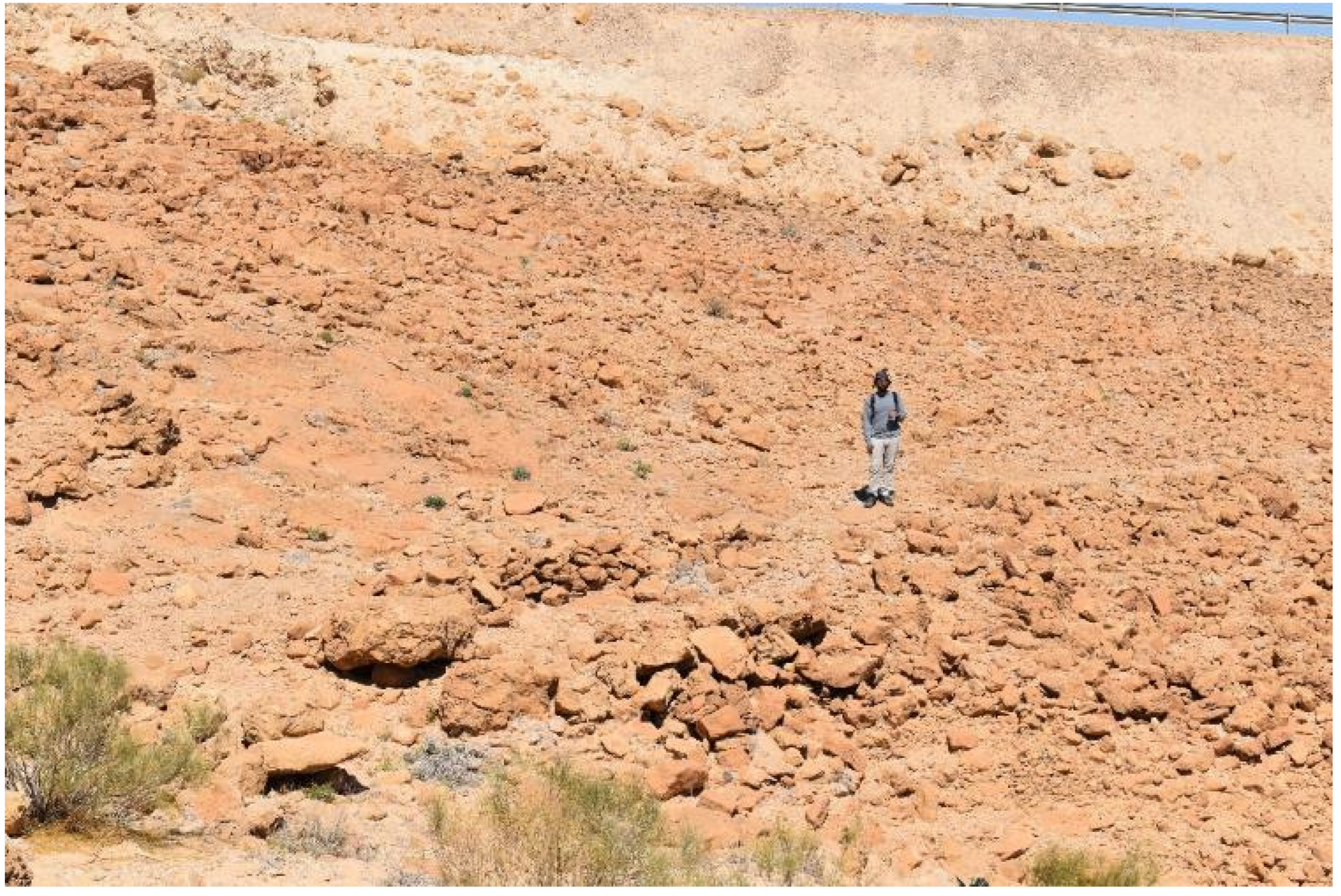
Our team inspected the entire course of this road (see
Figure 9 and
Figure 10). The remains of the road start below 400 m, where the road clearly cuts into the terrain, circling the hill from which it was possible to observe the crossing of the Wadi Mujib. The road continues to the northwest and then to the northeast, matching the course of the ridge. At an altitude of 500 m above sea level, when the slopes become quite steep, the road moves westwards to traverse a neighboring ridge. From there, the road follows the ridge to the site of Aroer in many switchbacks, battling the steep slope of the terrain.
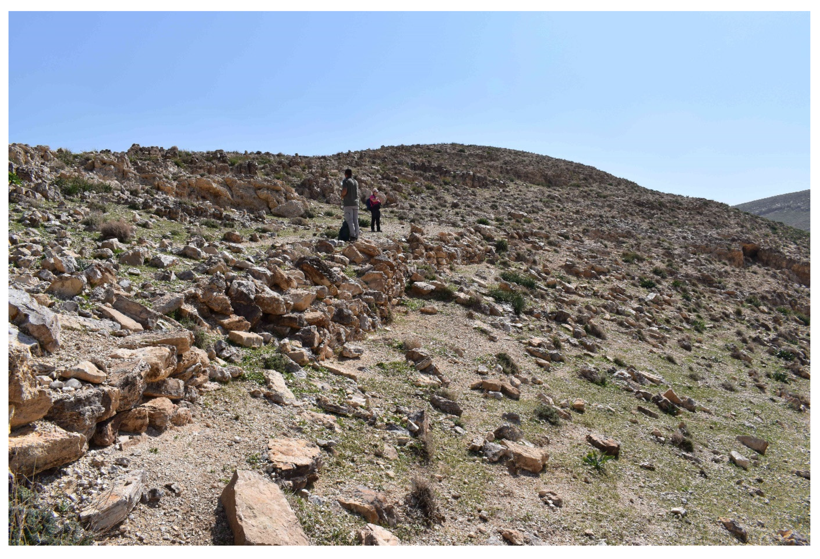
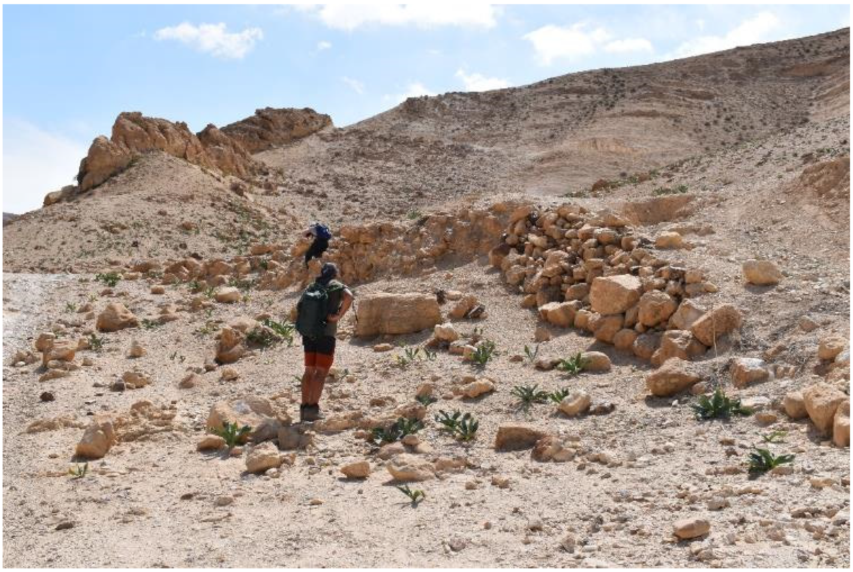
Altogether, the locations of three road remains (RR 32–34), three archaeological sites (AS 18–20), and three pottery findings (PF 2–4) were registered along the course of the Aroer Ascent (none of which are known to the MEGA-Jordan database). The first detectable road remains are located next to a hill (named by Ben David [
8] as “a hill marked on some maps as triangulation point 432”), on top of which our team discovered the remains of a fortification wall along the hill ridge (AS 19, see
Figure 11) and the remains of a square structure, possibly a watchtower (AS 18, see
Figure 12). What is more, the area to the northwest of the hill features a large accumulation of stone structures with different diameters, from 4–5 m to 15 m, which may tentatively be interpreted as tumuli burials (see
Figure 13).
RR 32 (see
Figure 14), located on the northern hillside of AS 18–19, features curbstones on one side built of rocks up to 0.5 m in diameter. The pavement consists of limestone aggregate, and the substrate is soil. The road at this point is about 6.5 m wide. Indeed, as reported by Ben David [
8], this wide section of the road continues for about 1 km (see
Figure 15).
In contrast, the upper sections narrow to a width of about 1–2 m and can only be traced as a path with difficulty (see
Figure 16).
For instance, RR 34, located on a ridge in the steep upper section of the road, shows a retaining wall on one side (pavement: limestone aggregate; substrate: erosion deposit) with a width of only 1 m. Remarkably, our team also identified a paved section of the road 2–3 m wide (RR 33) in the upper section of the ascent that consists of limestone rocks up to 0.5 m in diameter (see
Figure 17).
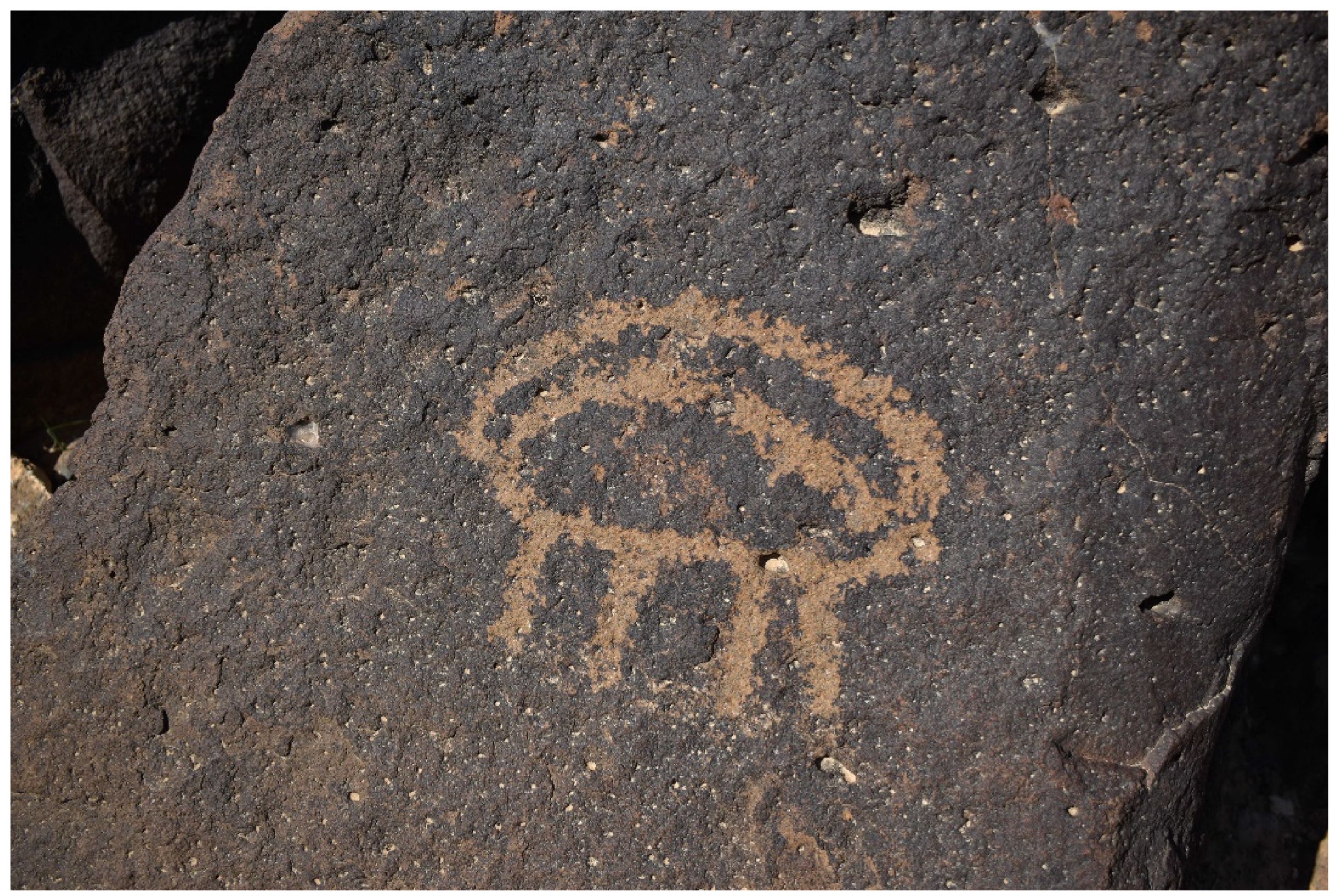
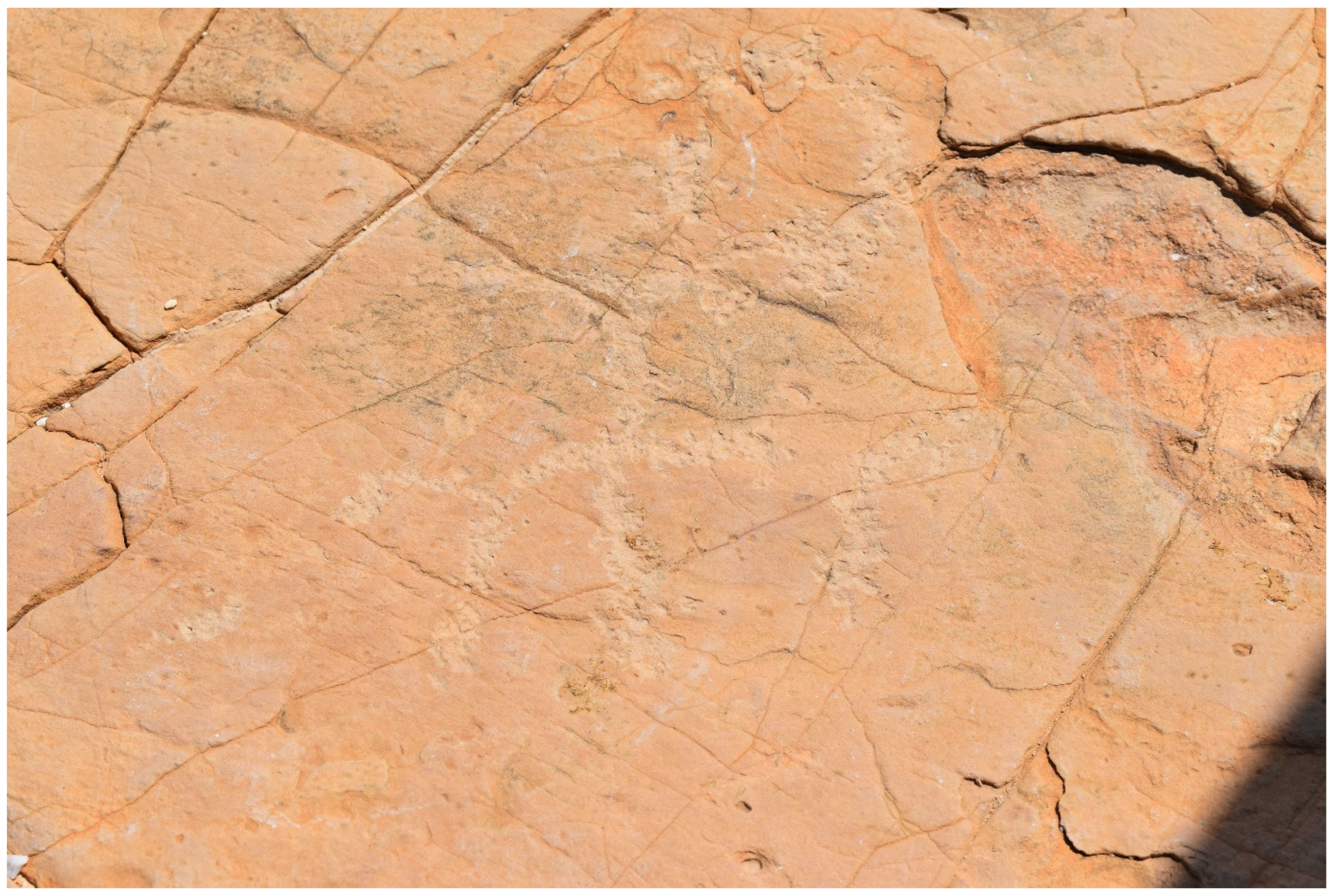
Pottery findings, including fragments of a jug ear (PF 2) and cooking pot (PF 4), were tentatively identified as Iron Age pottery. One rock inscription (AS 20, see
Figure 18) was also found in the immediate vicinity of RR 33 and PF 3 (dating unknown).
The carving, roughly executed, presents a rider facing right on an animal. In one of his hands (probably in the right hand), the rider holds a curved object, most likely a sword. This type of image is mostly related to the early Islamic period (638–1099 CE) and is common in rock art of the Southern Levant.
When approaching the ascent from the bottom of the Wadi Mujib, our team found the last section of the ascent to either be unpreserved or eroded to an extent that would make an ascent attempt very risky.
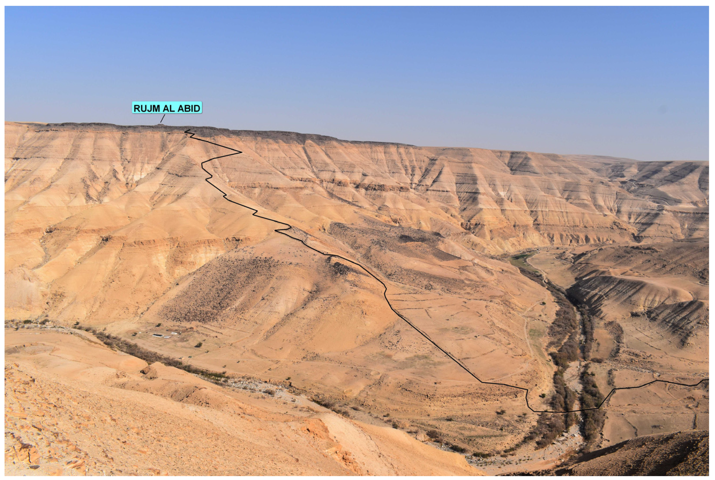
3.4. Glueck’s Road
The road known as Glueck’s Road was first photographed by N. Glueck in 1937 and wrongly attributed by many scholars to the Wadi Mujib. It was identified on the ground only recently by Kloner and Ben David [
7] in the Wadi Nukhayla. This Iron Age road apparently served the communication between an Iron Age fort known locally as Rujm al-ʿAbid, located on top of the road’s ascent, and the site of Balu in the Kerak Plateau. The road was reported to be built on packed dirt without pavement, to have a width of less than 4 m, and to feature the remains of curbstones arranged in rows along its way [
7,
8].
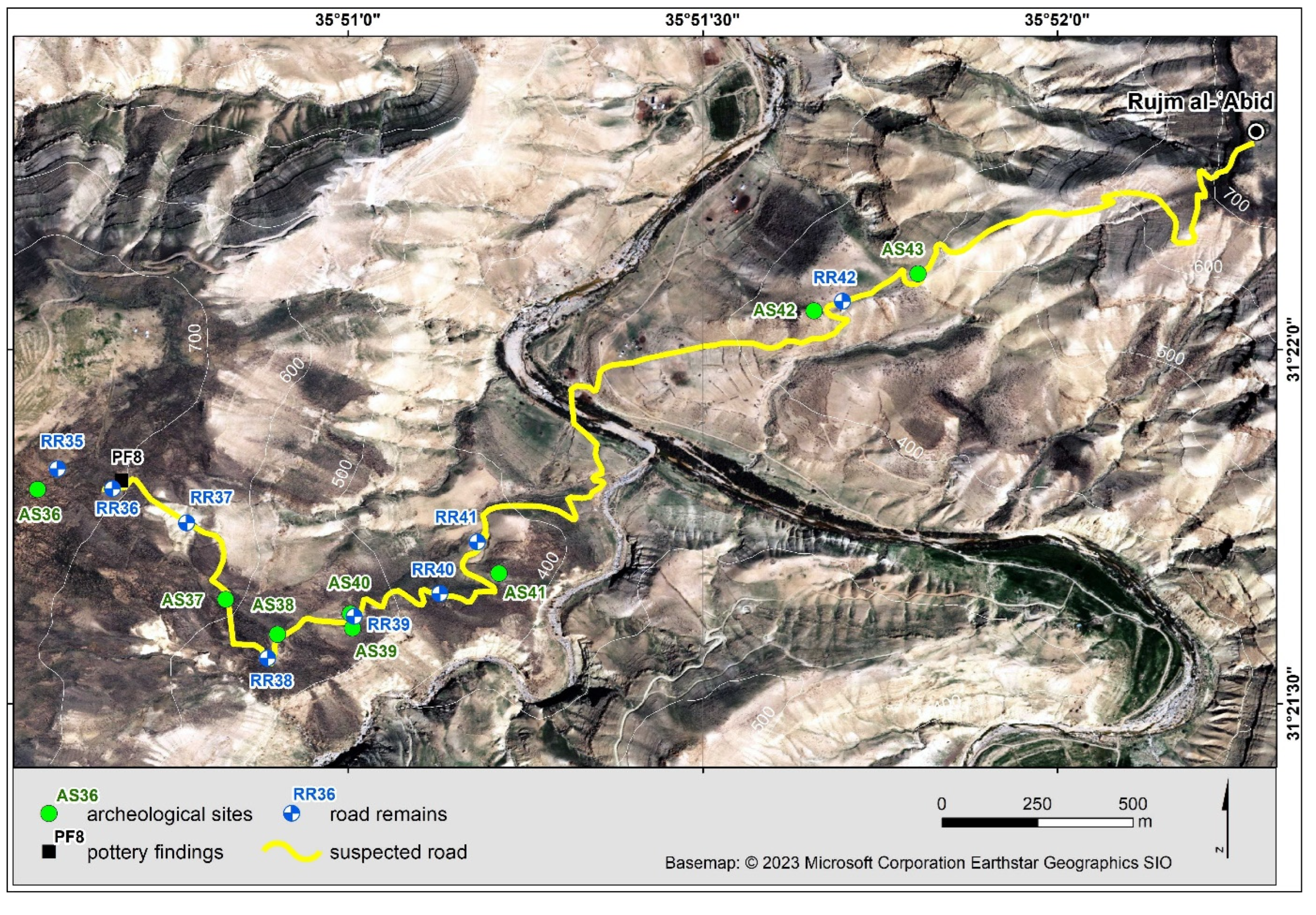
The entire course of the road was inspected by our team (see
Figure 19). Eight archaeological sites (AS 36–48), seven road remains (RR 35–42), and one pottery finding (PF 8) were recorded. The road can clearly be divided into two sections: one part descending the western bank of the Wadi Nukhayla (see
Figure 20), and another ascending the eastern bank of the Wadi Nukhayla (see
Figure 21). The western part is also marked by the presence of a basalt field through which the road runs and where many inscriptions were found (AS 36–39, 41).
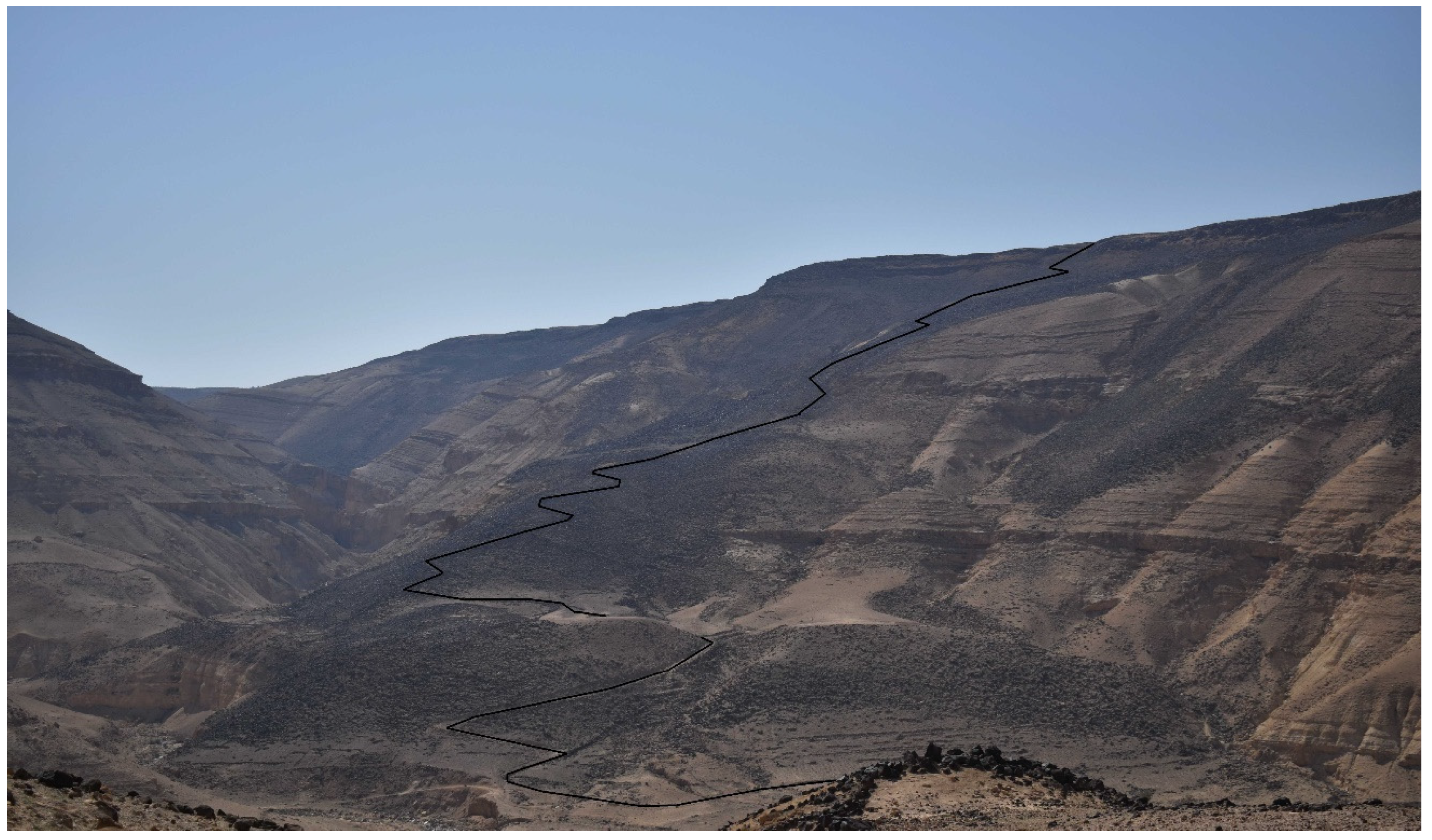
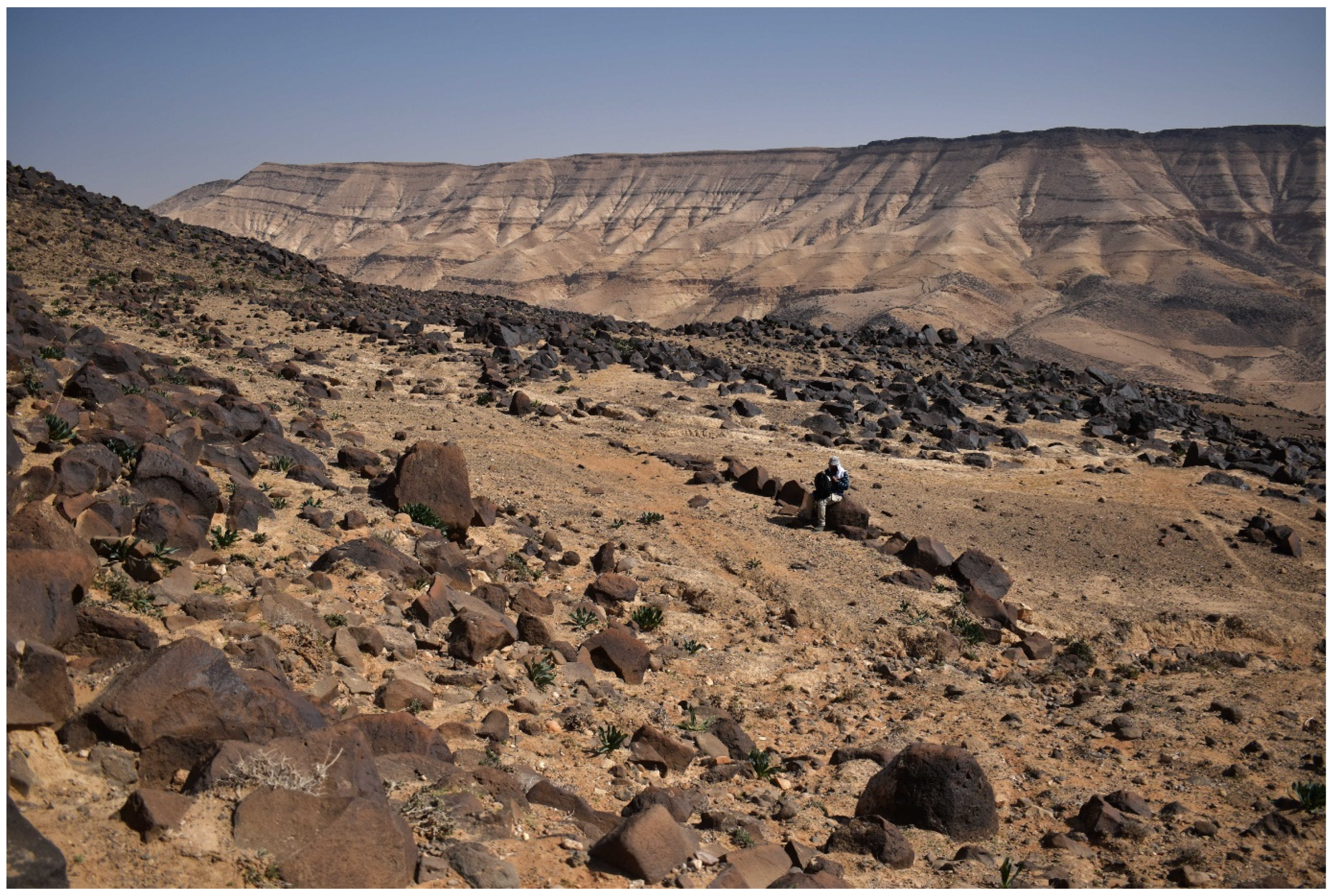
The elevation difference of the road from west to east is more than 440 m, descending from 760 m above sea level at the edge of the plateau to 320 m at the bottom of the Wadi Nukhayla. It initially runs southeast, traversing the eastern slopes of the plateau. After reaching the ridge running towards the bottom of the valley, the road turns northeast, following the direction of the ridge. After crossing the river, the road takes one of the longest and gentlest ridges leading to the plateau on the eastern side of the Wadi Nukhayla. The road attempts to imitate the ridge line; however, in areas of significant steepness, it is disturbed by serpentines. This is especially visible on the highest section, where the steepness is so great at an altitude of about 600 m above sea level that the road traverses the slope and uses the adjacent ridge to climb the plateau.
The course of the western part of Glueck’s Road is well marked by the appearance of curbstones (RR 35–42). The curbstones are built of stones measuring up to 1 m in diameter. They are placed on both sides of the road, making the road 4–7 m wide (see
Figure 22 and
Figure 23). The pavement consists of a basalt aggregate, and the substrate is a basalt erosion deposit. The road leads through a hillside.
The beginning of the eastern part of Glueck’s Road initially follows the characteristics of the western part (see
Figure 24: RR 42): its course is marked by the presence of curbstones. However, as reported by Kloner and Ben David [
7], the width of the upper section of the eastern part of Glueck’s Road diminishes to a narrow camel’s naqeb. In this section, an inscription (AS 42) and the remains of a square structure (AS 43), possibly a watchtower, were recorded.
A highly interesting feature of Glueck’s Road, especially in its western part, is the presence of rich evidence of rock art. It should be stressed that although similar evidence is known from other parts of Jordan, this is the first-ever attestation of this kind of material from the Wadi Mujib and the Wadi Nukhayla. The collected material includes carvings and images of animals such as camels, goats, and ibexes (see
Figure 25). Generally speaking, rock art evidence is complex; some artifacts are not datable (a linear style common in many periods), but most images appear to come from early Islamic and later times due to their style and light color patination [
19]. At any rate, a proper rock art survey along the entire course of the road remains an important desideratum. Some of the images could have a ritual meaning, such as the double-headed ibex [
20].
3.5. Naqb Sfai
Naqb Sfai was first reported in the survey of Musil [
21] as an “ancient road” and was next researched by Worschech [
22] (sites 78 and 78.1), who, however, focused mostly on the watchtowers near the ancient road. The first survey to thoroughly investigate Naqb Sfai as an ancient road was conducted by Ben David, Davidovich, and Porat [
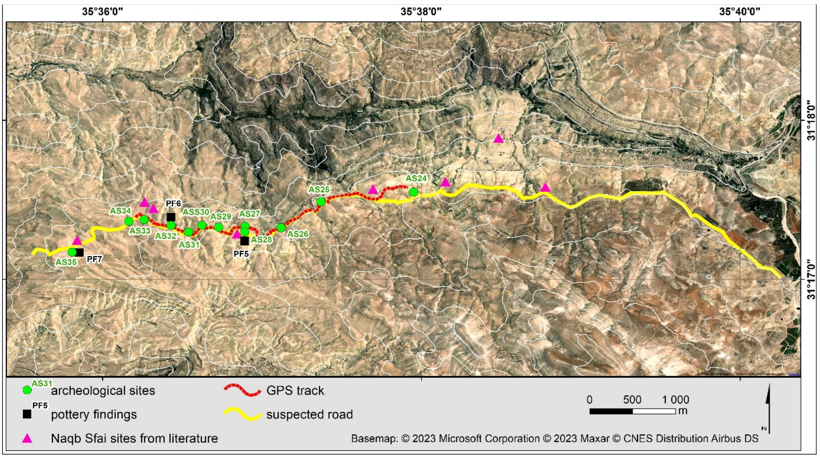
23]. This road, dated to the Roman period, connects the Karak Plateau, especially the site of Ar-Rabba (Roman Areopolis), with the Lisan Plain (see
Figure 26). Our team inspected its course along the southern bank of Wadi Bin Hammad, where Ben David, Davidovich, and Porat [
23] reported the presence of four Roman towers: Sila al-Karach, “Ein Sheikh,” the Knee Tower, and Umm el-Hashim. In this part of the route, 11 archaeological sites (AS 24–35) and three locations of pottery findings (PF 5–7, directly connected with AS 28, 32, and 35, respectively) were recorded. In fact, the course of Naqb Sfai may be traced as a path (see
Figure 26), but it is also well marked by the presence of numerous archaeological sites along its course, especially the remains that were tentatively identified as tumuli (AS 25, 27, 29 [a double tumulus with an adjacent graveyard], 30, 31 [with adjacent enclosure], 32, and 34) and watchtowers (24 [may also be a tumulus], 26, 28 [Ein Sheikh], 33 [The Knee Tower], and 35 [Umm el-Hashim]). In light of our fieldwork, the localizations of the road-related structures, some previously mentioned by Ben David, Davidovich, and Porat [
23], now have an accuracy of about 1 m (see
Figure 26). It should be stressed that although it may be speculated that the current road covered an earlier pre-Roman road, no tangible evidence has been revealed to support this speculation. The pottery and masonry detected on the ground belong to the 2nd–3rd centuries CE.
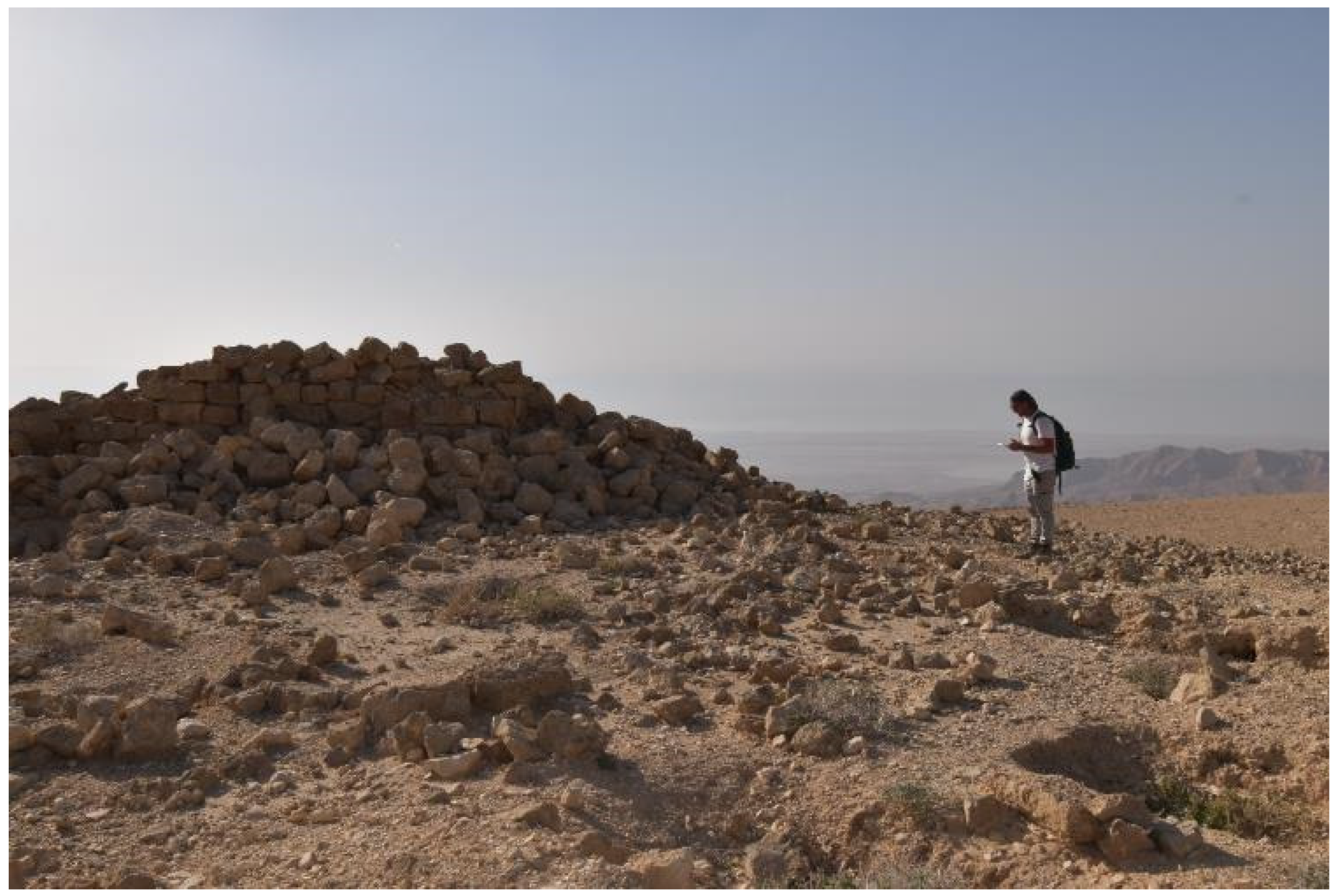
AS 28 and AS 35 are especially noteworthy. AS 35 (Umm el-Hashim) is a rectangular structure built of limestone and preserved to a height of around 2 m (see
Figure 27). The pottery findings (PF 7) at AS 35 included a fragment of a cooking pot handle (color: red, beige; 0.5 mm thick) that may be dated to the Roman period. In turn, AS 28 (Ein Sheikh) is a square structure preserved to a height of 0.5 m (see
Figure 28). The pottery findings (PF 5) at AS 28 were fragments of cooking pots (color: red, brown; 0.5 mm thick). The pottery may be dated to the Roman period, most likely to the 2nd century CE. In this light, both AS 28 and AS 35 appear to be Roman-period watchtowers, as reported by Ben David, Davidovich, and Porat [
23].
3.6. Naqb Abrash
Naqb Abrash is an ancient road connecting the Plain of Zoar, located at the very southeastern corner of the Dead Sea, with the northwestern part of Edom, located south of Wadi al-Hasa. The route was first described in 1858 by J.R. Roth, but was only inspected in more detail by Ben David [
24].
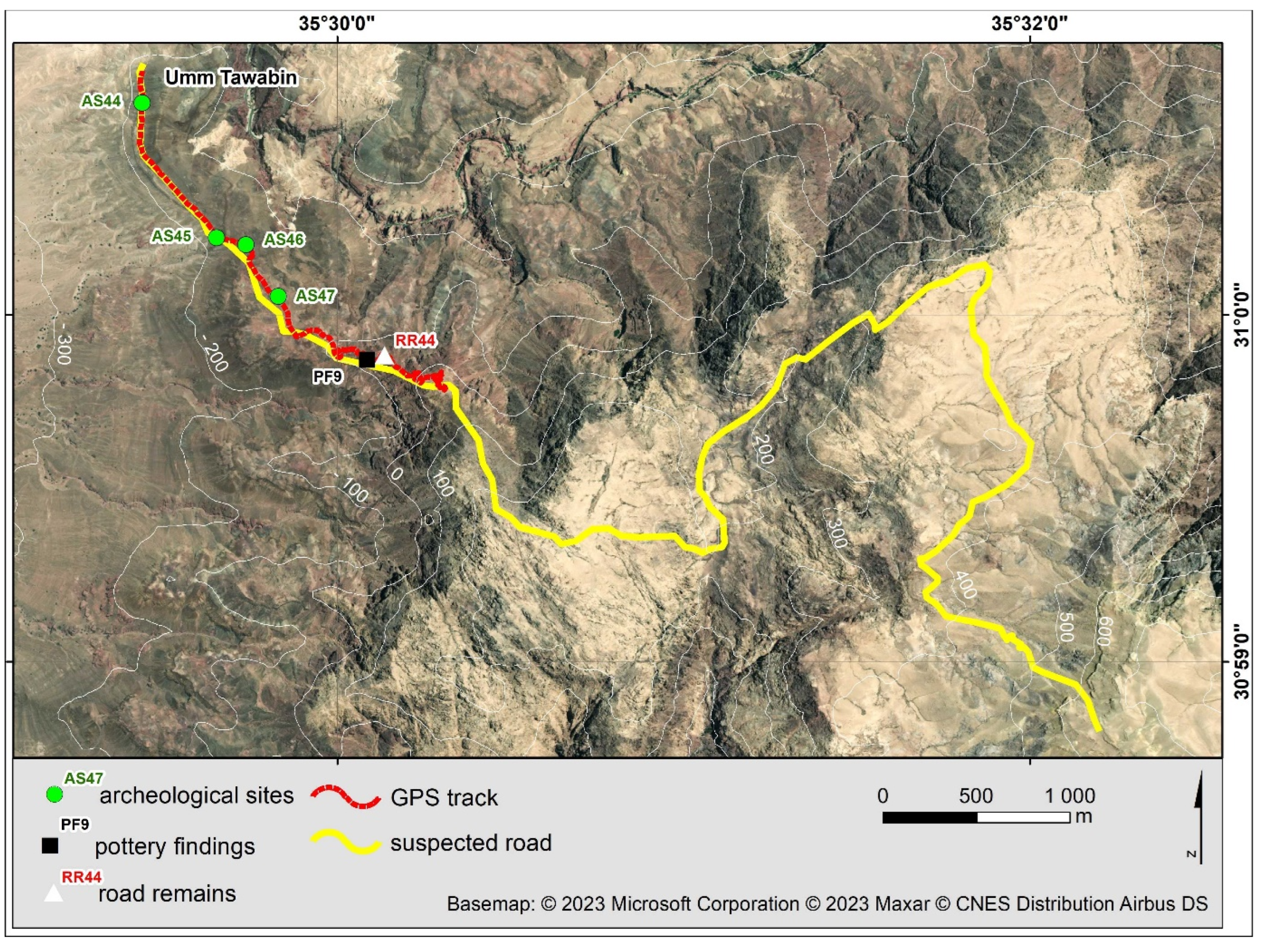
Our team only inspected the lower section of the route (see
Figure 29) where four archaeological sites (AS 44–47), one location with road remains (RR 44), and one pottery finding were recorded (PF 9). AS 44–45 match the most northern and southern extension of the wall of Umm Tawabin. At the same time, AS 46 is a rectangular structure 4 m in diameter with rocks up to 0.7 m in diameter, while AS 47 is a circular structure with wall remains 5 m in diameter and up to 1 m high. Both structures may be tentatively interpreted as watchtowers. RR 44 (see
Figure 30) features the course of a path 1 m wide (no curbstones; pavement: bedrock; substrate: sandstone bedrock). All in all, the lower section of Naqb Abrash is indeed a narrow camel’s path no wider than 1–2 m, and the available evidence suggests a 2nd–3rd century CE dating.
3.7. The Masada–Hebron Road
Part of the Masada–Machaerus road was identified as an ancient road on the Survey of Western Palestine map, but its exact course has been subject to debate among scholars such as Y. Aharoni [
25], F. Frank [
26], and M. Marcus [
27], and, recently, Davidovich et al. [
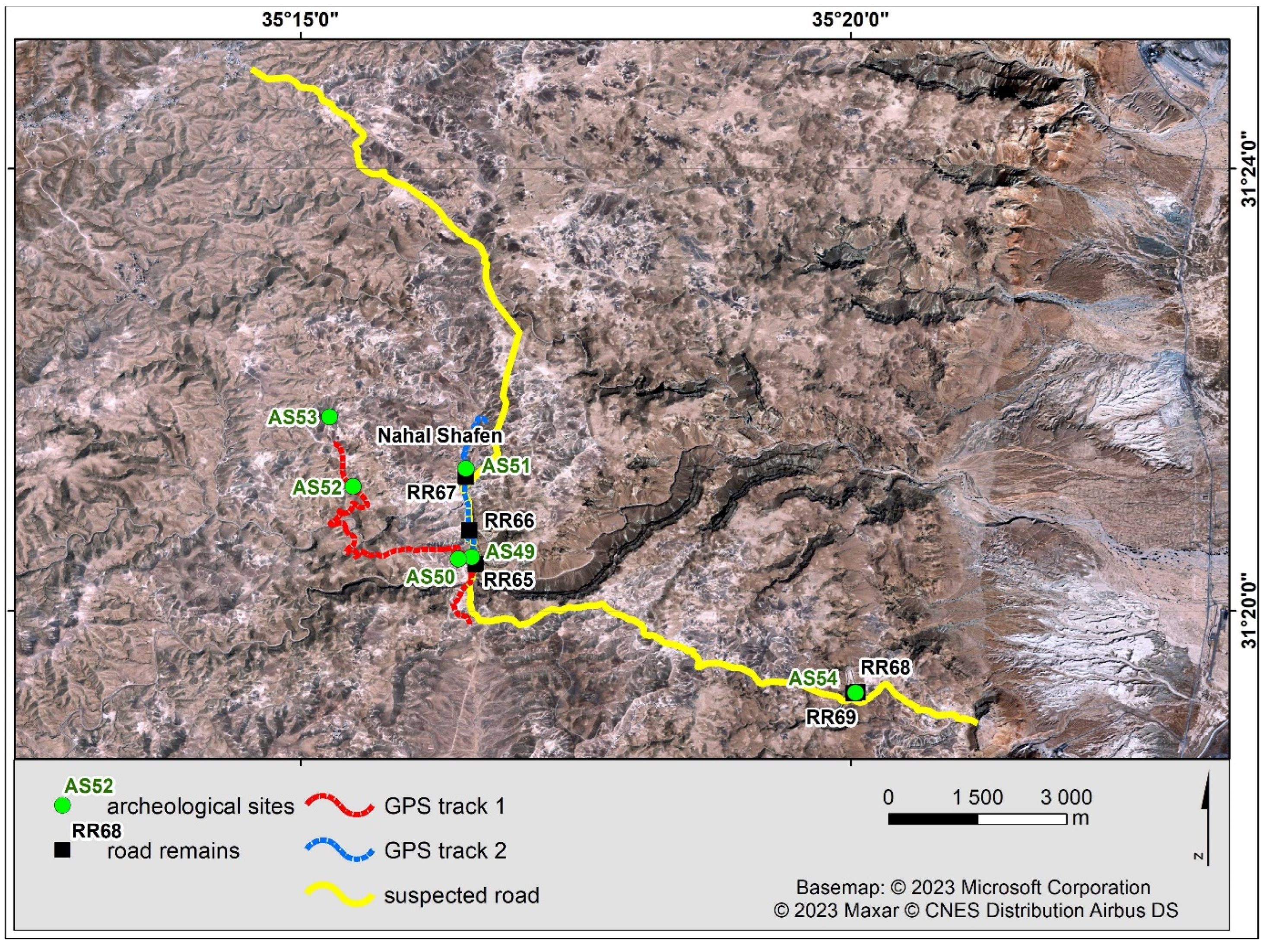
11]. In particular, two main options of the road course in the Nahal Tzalim basin have been suggested: one along the Nahal Shafen, and another more to the northwest via Mezad Tsipirah and Mezad Bedar (see
Figure 31).
Our team inspected the two alternative routes and recorded the locations of six archaeological sites (AS 49–54) and five road remains (RR 65–69). AS 49 and AS 51 account for small tumuli, while AS 50 and AS 53 are the recently excavated Roman sites of Mazad Tsipirah and Mazad Bedar, respectively. AS 52 is a water cistern located en route between AS 50 and AS 53. In turn, RR 65–67 include the remains of retaining walls. RR 65 features the remains of a retaining wall on one side and the traces of rock cuttings on another side, while RR 66 features the remains of a retaining wall only on one side. The road width at both RR 65 and RR 66 is about 5–6 m (see
Figure 32), the pavement features a limestone aggregate, and the substrate is limestone bedrock. In turn, at RR 67, the remains of a retaining wall can be found on one side, but the road is only a beaten path 3–4 m wide, and the substrate is eroded limestone.
In turn, RR 68–69, together with AS 51 (a small tumulus), are located much closer to Masada, some 2 km west of the fortress. At both RR 68 and RR 69, the width of the path is about 4 m (see
Figure 33), and its course is marked by the remains of retaining walls on one of its sides (the pavement consists of a limestone aggregate, and the substrate is a limestone erosion deposit).
Despite the existence of some road remains along Nahal Shafen (which could not be precisely dated), our team had no doubt that the course of the Masada–Machaerus road in the Nahal Tzalim basin must have run along the line marked by Mazad Tsipirah, Mazad Bedar, and AS 52. Today, this route can be followed using a modern dirt road. At any rate, more research is needed to specify the character and dating of the alternative route along Nahal Shafen.
3.8. Hollow Ways
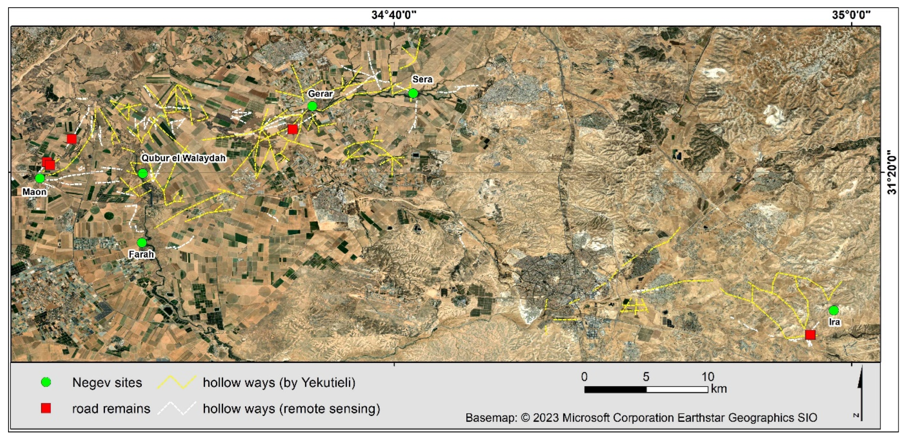
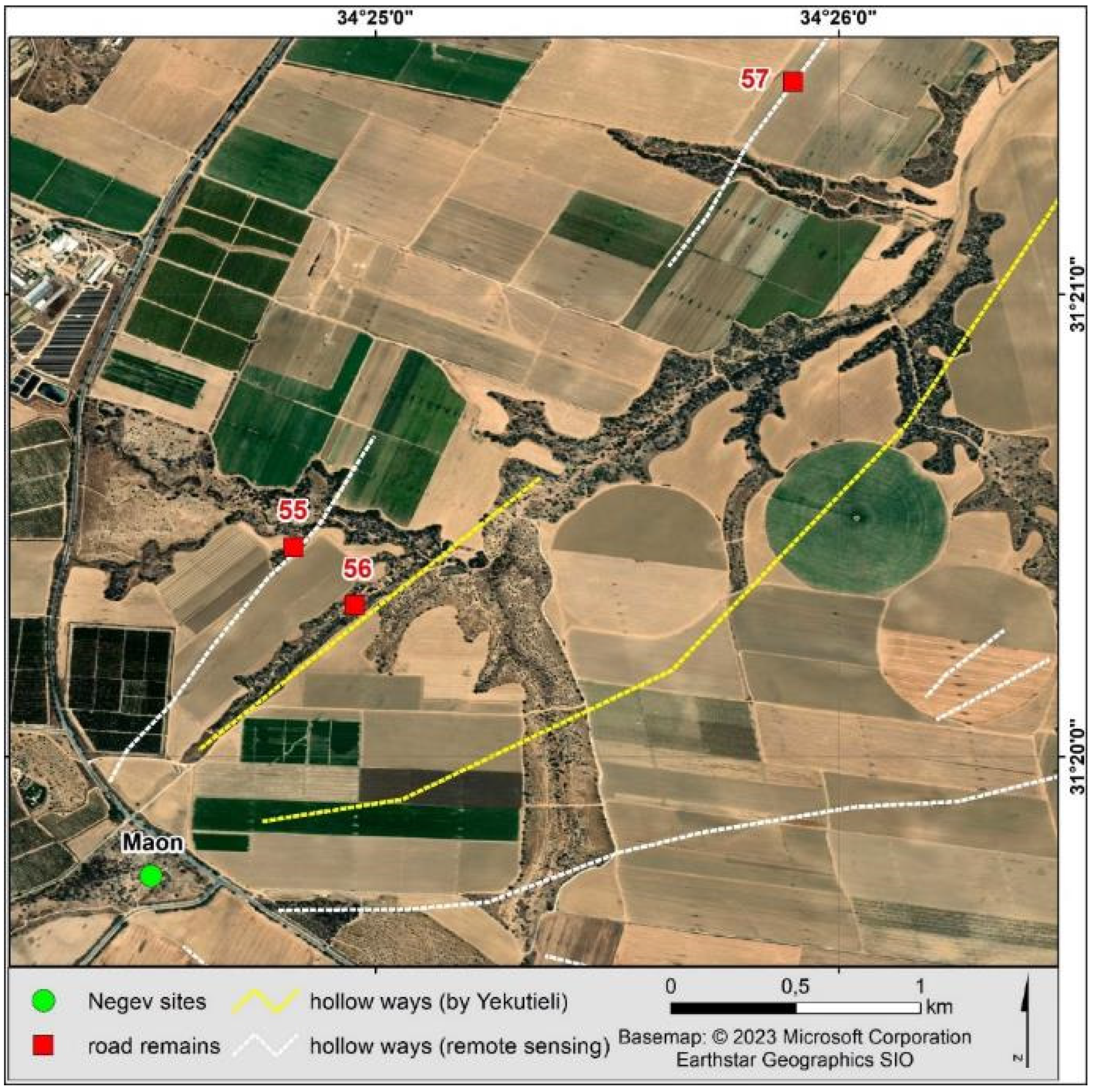
As previously mentioned, Near Eastern archaeology has recently witnessed the discovery of many hollow ways (sunken lanes/linear valleys) in the Middle East. However, this research trend has mainly been limited to the landscapes of modern Iraq and Syria. In fact, only one publication has thus far dealt with the hollow ways in our area of interest: Tsoar and Yekutieli [
28] identify the remains of linear valleys on archival aerial imagery in the northern Negev. While the lack of more discoveries in Israel and Jordan may be connected to specific geomorphological conditions in this part of the Middle East, one may also argue that this question requires more systematic research. In preparation for our fieldwork, an attempt was made to identify the hollow ways described by Tsoar and Yekutieli [
28] and to suggest other hollow ways in the northern Negev (see
Figure 34).
It should, however, be mentioned that the cartographic value of Tsoar and Yekutieli [
28] is of very limited value for modern geography, especially because of the quality of the maps and their scale. Furthermore, the timing of our fieldtrip coincided with the coming of spring in the northern Negev on 7–8 March 2023. The vegetation made ground reconnaissance very difficult. Nevertheless, it was still possible to gain some insight and reach certain conclusions. It seems that additional scientific attention should be focused on the hollow ways indicated by Tsoar and Yekutieli [
28], to distinguish the naturally formed ravines from the anthropogenic hollow ways. The vast majority of the surrounding ravines are the result of water erosion, which produces their V-shaped profile. Some of them, however, are so evolutionarily old that they have a flat bottom due to the deposit of accumulated material. They can be mistaken for the effect of human pressure on the environment (deforestation and the development of permanent communication routes), which is characterized by a U-shaped profile. For instance, RR 56 was marked in an unnaturally straight, wide ravine that leads to the main gully that was apparently interpreted as an original hollow way by Tsoar and Yekutieli (Ref. [
28] see
Figure 35). In contrast, a nearby sunken lane containing RR 55, some 300 m northwest of the previous one, aptly has a U-shape form that continues further, crossing the ravine branches in the northeastern direction (see
Figure 36). This route can be continued at the point marked as RR 57, which runs parallel to the ravine indicated by Tsoar and Yekutieli (Ref. [
28] see
Figure 37).
4. Discussion and Conclusions
Although one may sometimes find various hints scattered throughout the literature suggesting the course of ancient pre-Roman Imperial roads [
2,
14,
29], a well-tested and established research methodology has yet to be defined in this respect. In our recent study [
12], we tested the following types of remote sensing data against ancient pre-Roman roads that have already been attested: archival cartographic sources, archival aerial imagery, archival satellite imagery, high-resolution satellite imagery, the databases of archaeological sites, the datasets of Roman Imperial roads, and various GIS simulations (especially the Least Cost Paths and Corridors) based on a digital elevation model (DEM).
Seven different old cartographic sources of comparatively good quality were obtained for the study area: the Map of Western Palestine created by the Palestine Exploration Fund (PEF) in 1872–1880 [
30], the Survey of Eastern Palestine from 1881 [
31], the Karte des Ostjordanlandes [
32], Arabia Petraea by Alois Musil [
33], the Map of Palestine by the German Vermessungsabteilung from 1918 [
34], the British topographic Map of the Levant from 1946 drawn by the No. 1 Base Survey Drawing and Photo Process Office [
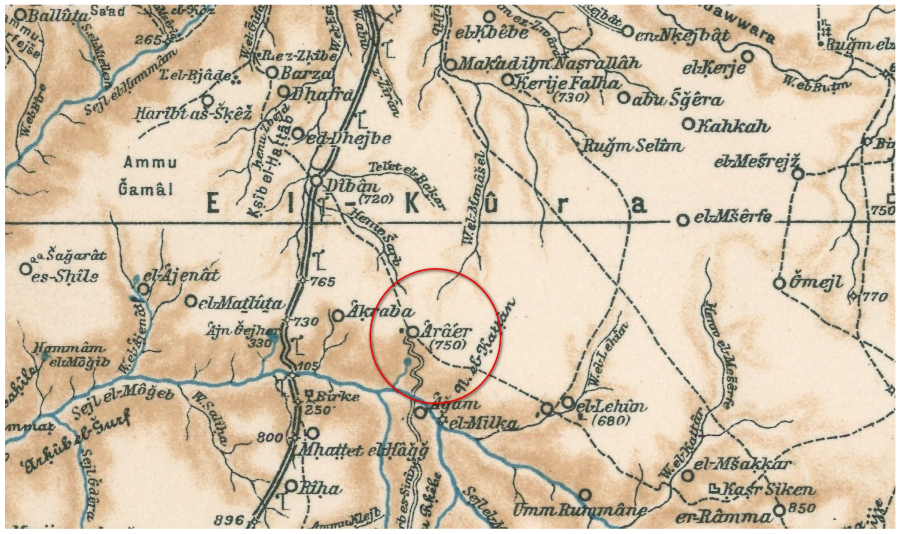
35], and the Map of Israel from 1956 [
36]. Despite the imperfect cartometry of these maps (distortions between 100 and 800 m), they are invaluable because of their content: they document the remains of older roads and archaeological and historical monuments from before the destructive influence of modern industrialization and urbanization in the Middle East. In fact, four out of six of the pre-Roman Imperial roads that have already been attested can be found on old cartographic sources: the Wadi Zarqa-Main road on both the PEF’s Survey of Eastern Palestine and the maps of the German Vermessungsabteilung, the Masada–Hebron road on the Survey of Western Palestine map, the Aroer Ascent on Alois Musil’s map [
33] (see
Figure 38), and Naqb Dahal on the Map of Israel from 1956.
Much like the old topographic maps, the archival satellite imagery documents the Near Eastern landscape from before the advent of major changes connected with modern industrialization and urbanization. This especially refers to satellite imagery from US intelligence aerial and satellite missions that were active in the times of the Cold War. Although their use for Near Eastern archaeology in Syria and Iraq, especially CORONA satellite imagery from 1959 to 1972, has produced spectacular results [
3], their application in our study area has thus far been marginal. Our own study (using a dataset of CORONA images taken in 1968–1970 from the repository of the CORONA Atlas & Referencing System provided by the Center for Advanced Spatial Technologies) did not record any advances in this regard, either. The apparent reason is the difference in the width between the hollow ways on the Mesopotamian plains and pre-Roman Imperial roads in much more diverse terrain in the Southern Levant being of a small width (1–7 m); the latter are usually impossible to detect on the CORONA images. In fact, the two widest roads in our study area were the only ones even partially visible on the CORONA images (the Callirrhoe–Machaerus road and Glueck’s Road).
Unlike the available CORONA images, the archival aerial photos from the APAAME project are of very good resolution. These images have long been successfully used for archaeological survey in the region [
37]. Indeed, all six roads under examination in our study area could be found in the APAAME archive, and the resolution of the images even allows for the correction of the course of the roads identified on the satellite data.
The importance of archaeological data, especially on settlement, for the study of a road network has long been acknowledged [
2,
38]. Indeed, roads do not lead to nowhere, and travelers have always been and still are dependent on settlement for rest, water, food supplies, and security. Thus, every search for a road network must start with the settlement data. In this context, the significant importance of the availability of archaeological data in the GIS format must stressed. In our study area, two repositories in the GIS format are particularly important: the MEGA-Jordan (
http://megajordan.org/ (accessed on 12 January 2023)) and Archaeological Survey of Israel databases (
https://www.antiquities.org.il/survey/new/default_en.aspx (accessed on 12 January 2023)). In addition, there are several other less geographically focused repositories (e.g., the Pleiades project [
https://pleiades.stoa.org/places (accessed on 12 January 2023)] or the New Digital Atlas of the Roman Empire [DARE,
https://dh.gu.se/dare/ (accessed on 12 January 2023)]). For instance, in our study case, only 56% of the major archaeological sites under examination could be found on the MEGA-Jordan website. Thus, despite the very positive fact of the existence of such databases (compared to past decades), many limitations of their use remain. In particular, the coverage of even the most detailed databases leaves much to be desired, and the databases are still not good enough to enable a detailed study of a road network on the basis of the settlement pattern on a medium or detailed scale (for instance, Galilee and its toparchies).
It is widely held that the Roman Imperial network of roads covered earlier roads [
8]. There exists both historical evidence [
39] and archaeological evidence [
40,
41] for this phenomenon, although the latter is still limited. Therefore, the extent of the Roman Imperial network of roads may be somewhat indicative of the extent of the earlier roads. At the same time, both the historical data (the Romans possessed engineering skills much greater than those of earlier roadbuilders) and the archaeological data, including the case studies presented in this paper, indicate that the relationship between the Roman Imperial network and the earlier (as well as later) road networks was not a perfect match. In particular, pre-Roman Imperial roads tended to avoid physical difficulties that were not a hindrance to the Roman engineers. The pre-Roman roads were thus much more dependent on the natural topography.
In this context, the GIS simulations may appear to be a useful tool in the search for ancient pre-Roman roads [
42,
43,
44,
45]. By avoiding natural barriers and excessive effort, the Least Cost Paths and Corridors simulate travel in a way that mirrors the experience of the ancient roadbuilders (especially those prior to Roman engineers), who had much less effective means of roadbuilding than modern people [
12]. However, the main difficulty in their application in Near Eastern archaeology is the lack of DEMs with a resolution greater than about 30 m [
46]. In the current situation, GIS simulations may only be seen as a useful tool for predicting long-distance travel on a medium or general scale of detail, not for simulating travel on a detailed scale for short distances [
12].
The recent worldwide development of technology in many fields has also translated into a large diversity of techniques for observing the Earth, including the registration of data on the surface of the terrain in various spatial resolutions and in a wide spectrum of electromagnetic radiations, including visible, infrared, and microwave [
47]. This development has also been followed by the increasing availability of image data, including aerial and satellite photos (predominantly in the visible range), on well-known websites such as Google Maps or Bing [
47]. In our study case, the most valuable high-resolution satellite images were found on Bing, including the Bird’s Eye satellite images in a resolution of 0.5 × 0.5 m per pixel. These images were an invaluable source for remote surveys and mapping.
It goes without saying that even the most detailed methods of remote sensing must be verified via ground archaeology [
48]. The results of remote sensing in our study case were verified during a fieldtrip to Jordan and Israel from 22 February to 23 March 2023 (see
Table 1).
We were able to achieve several goals through this fieldtrip. First, modern methods such as the use of GPS enabled us to provide a high-resolution capture of previously detected and published artifacts, including the courses of ancient roads and the locations of road-related archaeological sites. Altogether, 105 road remains, 62 archaeological sites, and 14 pottery findings were identified; what is more, 11 GPS tracks of ancient roads were registered. Second, we suggested necessary revisions to the previous state of research in some cases and reported many new findings. For instance, newly discovered rock art evidence found along Glueck’s Road sheds more light on the dating of the use of this road. Glueck’s Road was dated to the Iron Age because of the dating of the main occupation phase of two sites connected by this road: Balu and Rujm al-ʿAbid. Additionally, the road did not have any characteristics of Roman Imperial roads [
7,
8]. At the same time, it is widely known that some routes could have been in use for longer periods and could have also been used locally. The pottery collected at Rujm al-ʿAbid by the Limes Arabicus Project (site no. 57 [Field#232] according to the Limes Arabicus Project and no. 6504 in the MEGA-Jordan geodatabase) included mainly Iron Age finds (61 out of all 94 sherds), but also 14 Early Roman/Nabatean, four Roman/Byzantine, 11 Low Roman/Early Byzantine, one Early Byzantine, and one Lower Ottoman, as well as two unidentified items and four lithics from the Middle Paleolithic era [
49]. Thus, it could be concluded that this most likely Iron Age fort was “later reused by the Nabateans and Romans” [
49]. In light of the latest rock art evidence, and in conjunction with the ceramic evidence from Rujm al-ʿAbid, it may be concluded that Glueck’s Road was reused long into late antiquity and early Islam, and possibly even later.
Third and finally, some methodological conclusions were reached following the fieldwork. For example, it is clear that a multi-source approach to identifying ancient roads including the use of archival cartographic sources, archival and modern satellite and aerial imagery, and the databases of archaeological sites is still necessary. However, there can be no doubt that spatial analyses and remote sensing studies must be accompanied by archaeological fieldwork to promote a coherent research effort. In particular, many of the roads identified primarily on satellite images turn out to be only simple paths on the ground. While it is obviously difficult to date such paths solely on the basis of their appearance (also given their possible reuse over centuries, including modern Bedouin activities), the dating of settlement sites connected by such paths may be seen as indicative of their primary chronological use. Furthermore, the discovery of any road infrastructure, especially the retaining walls (often elaborately constructed and weighing hundreds of tons) and the archaeological sites (e.g., watchtowers), helps determine the courses of the roads and should also be considered as proof that these roads were developed by legal authorities, not the local movement of animal and human traffic. Any further findings of datable pottery are clear (although infrequent) witnesses to the dating of the roads.


 ,
, 


