Article

A Spatial and Temporal Evolution Analysis of Desert Land Changes in Inner Mongolia by Combining a Structural Equation Model and Deep Learning

1
School of Mapping and Geoscience, Liaoning Technical University, Fuxin 123000, China
2
Collaborative Innovation Institute of Geospatial Information Service, Liaoning Technical University, Fuxin 123000, China
*
Author to whom correspondence should be addressed.
Remote Sens. 2023, 15(14), 3617; https://doi.org/10.3390/rs15143617
Submission received: 9 June 2023 / Revised: 15 July 2023 / Accepted: 18 July 2023 / Published: 20 July 2023
(This article belongs to the Special Issue Remote Sensing and Ecosystem Modeling for Nature-Based Solutions)

Abstract

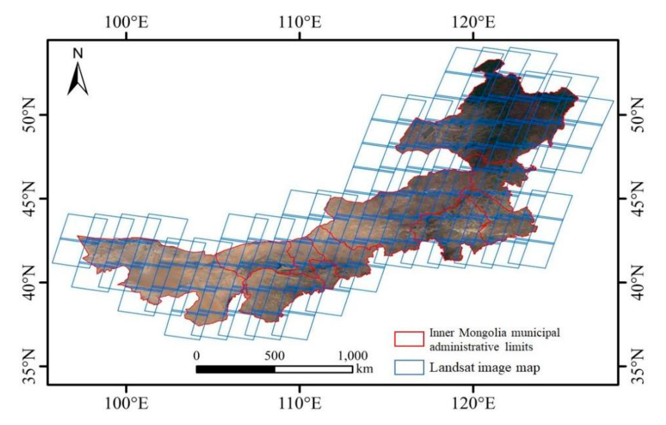
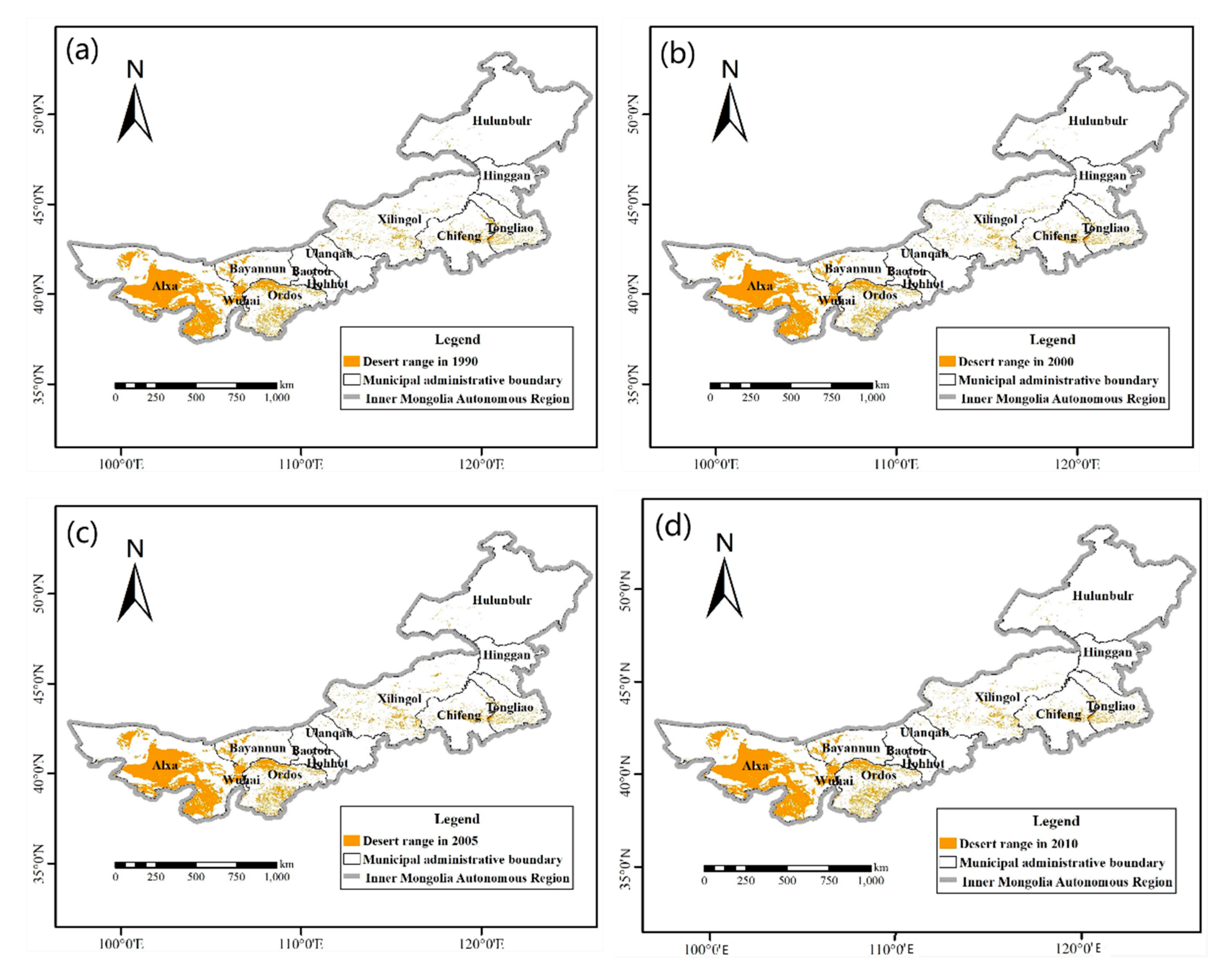
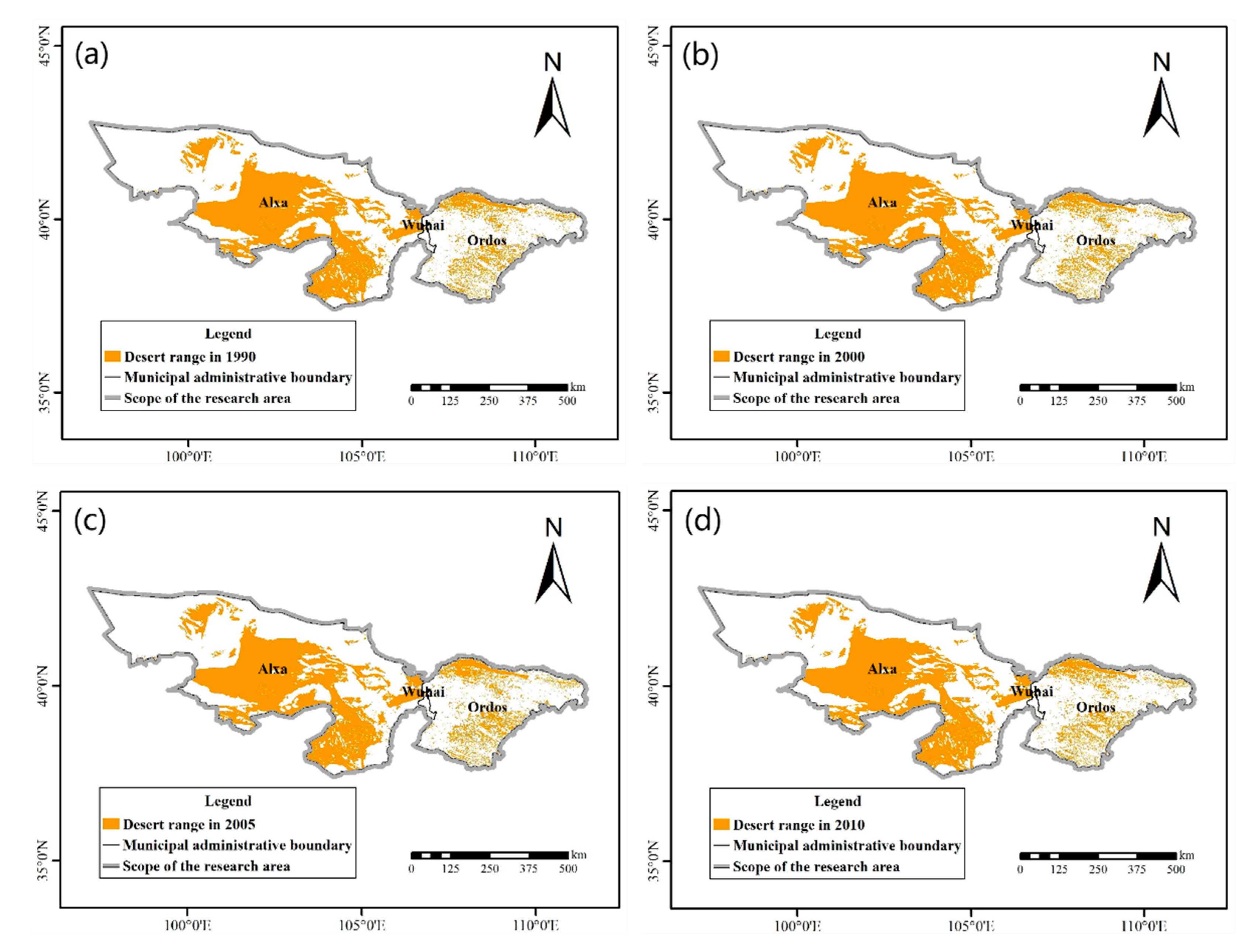
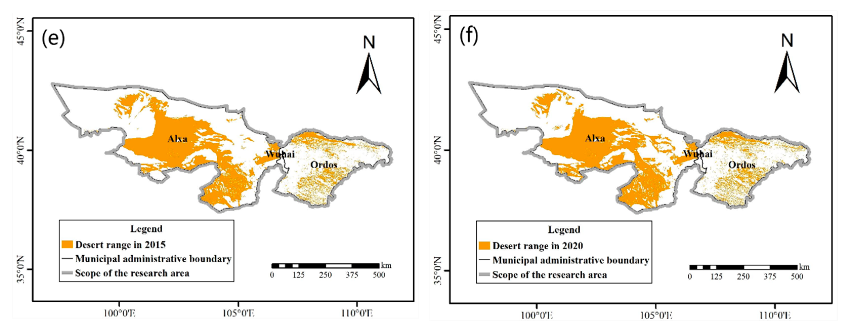
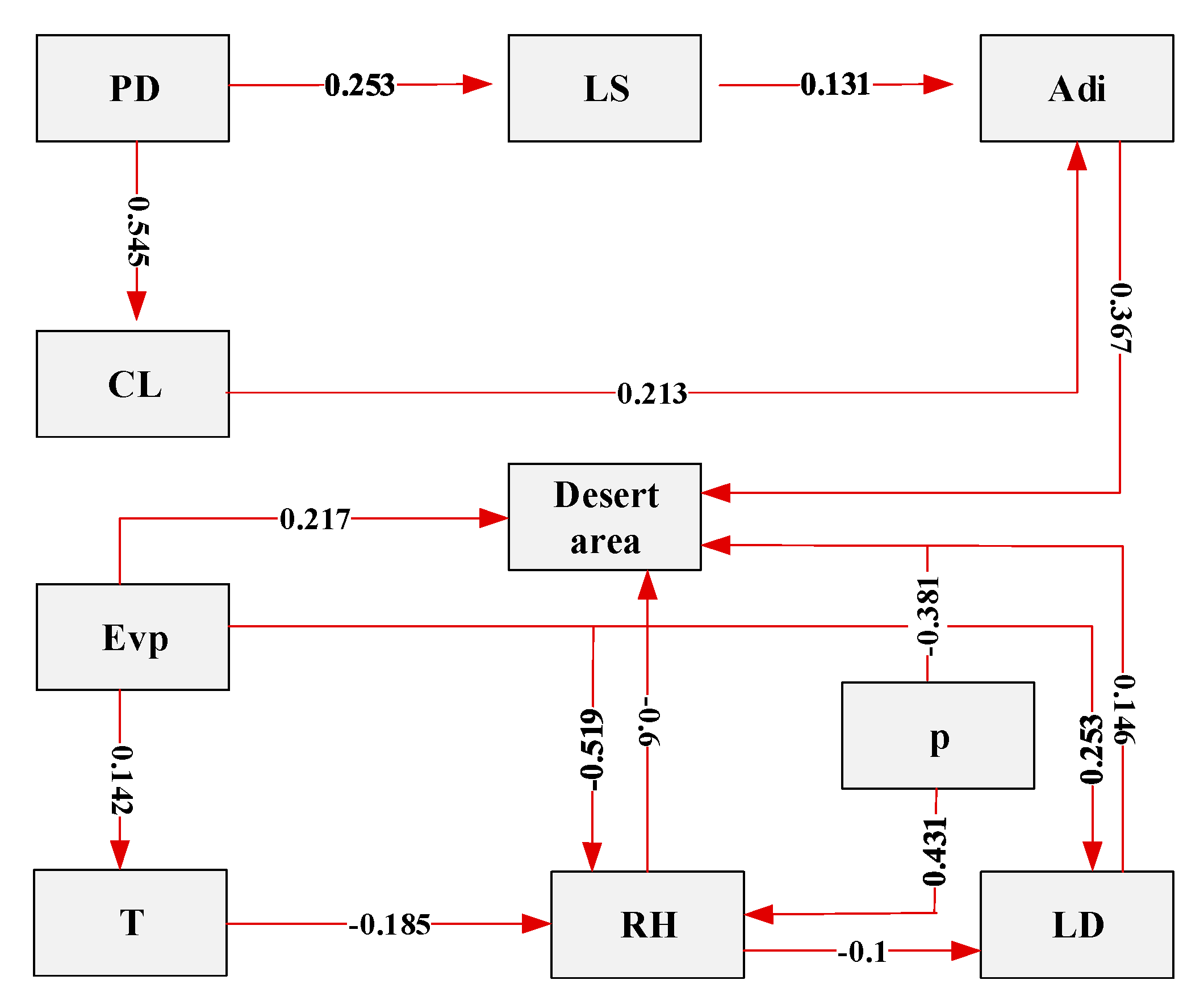
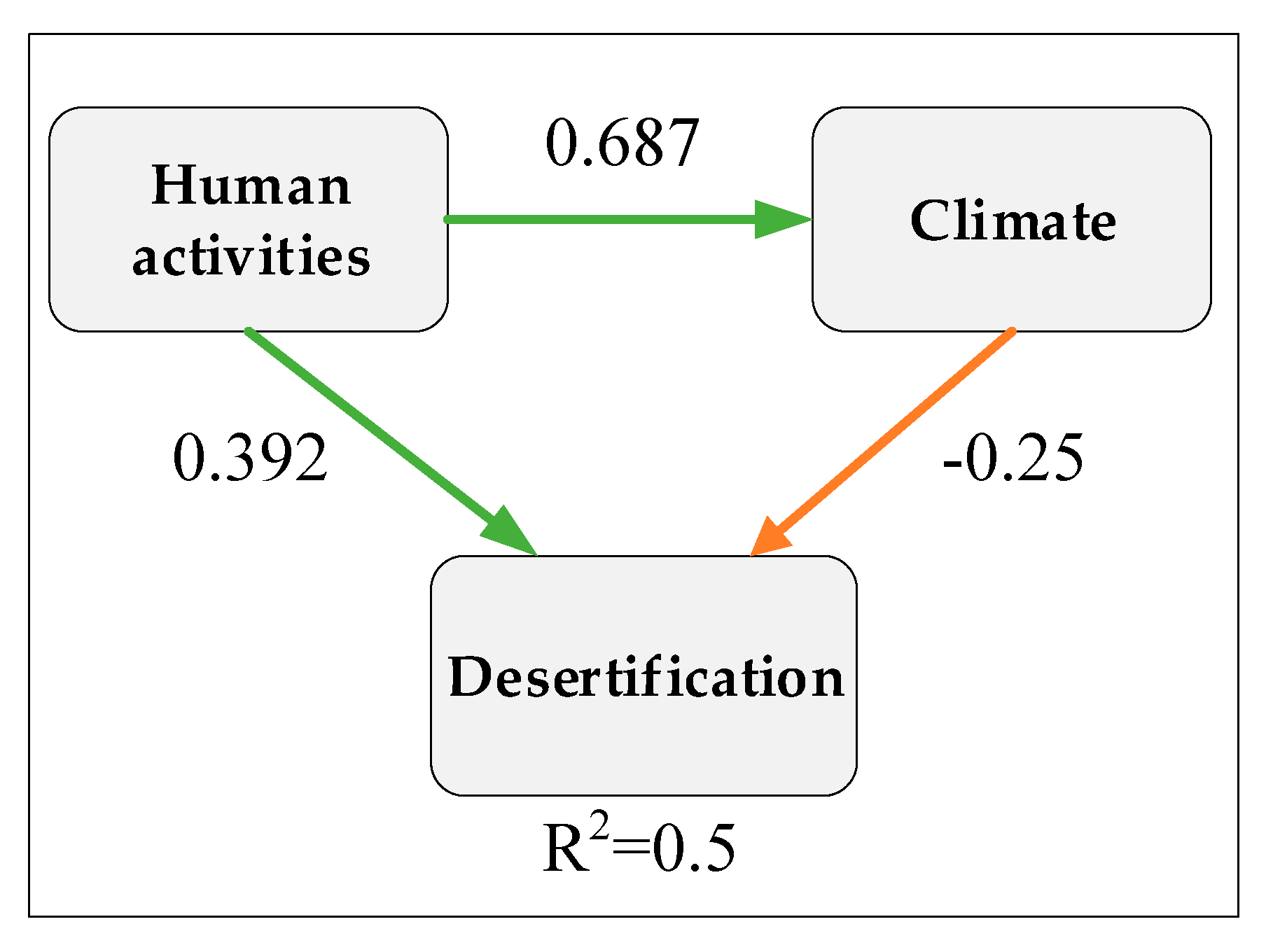
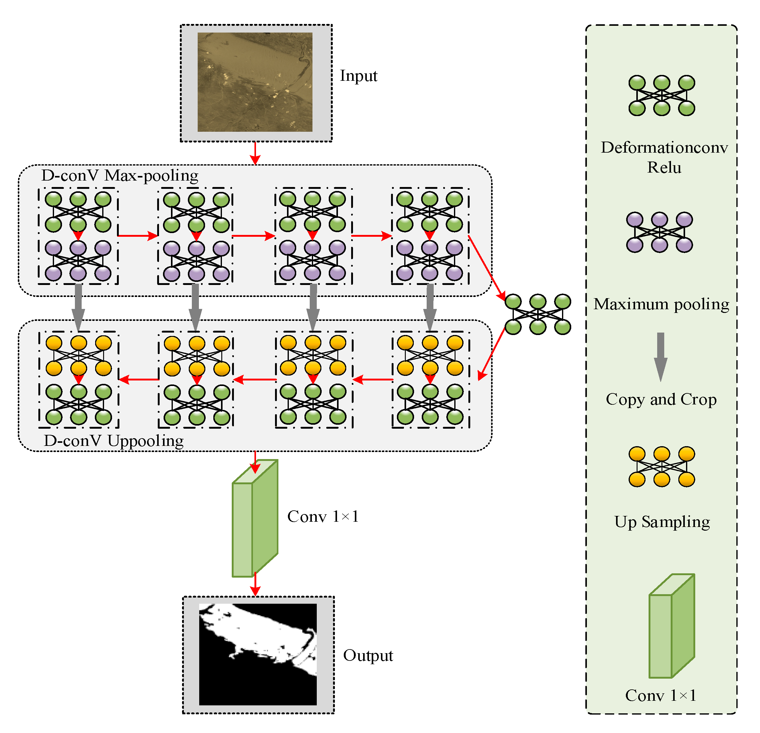
With the wide application of remote sensing technology, target detection based on deep learning has become a research hotspot in the field of remote sensing. In this paper, aimed at the problems of the existing deep-learning-based desert land intelligent extraction methods, such as the spectral similarity of features and unclear texture features, we propose a multispectral remote sensing image desert land intelligent extraction method that takes into account band information. Firstly, we built a desert land intelligent interpretation dataset based on band weighting to enhance the desert land foreground features of the images. On this basis, we introduced the deformable convolution adaptive feature extraction capability to U-Net and developed the Y-Net model to extract desert land from Landsat remote sensing images covering the Inner Mongolia Autonomous Region. Finally, in order to analyze the spatial and temporal trends of the desert land in the study area, we used a structural equation model (SEM) to evaluate the direct and indirect effects of natural conditions and human activities, i.e., population density (PD), livestock volume (LS), evaporation (Evp), temperature (T), days of sandy wind conditions (LD), humidity (RH), precipitation (P), anthropogenic disturbance index (Adi), and cultivated land (CL). The results show that the F1-score of the Y-Net model proposed in this paper is 95.6%, which is 11.5% more than that of U-Net. Based on the Landsat satellite images, the area of desert land in the study area for six periods from 1990 to 2020 was extracted. The results show that the area of desert land in the study area first increased and then decreased. The main influencing factors have been precipitation, humidity, and anthropogenic disturbance, for which the path coefficients are 0.646, 0.615, and 0.367, respectively. This study will be of great significance in obtaining large-scale and long-term time series of desert land cover and revealing the inner mechanism of desert land area change.
Keywords: desert land; Y-Net model; multispectral images; structural equation model; driving factors desert land; Y-Net model; multispectral images; structural equation model; driving factors