Article

Can GPM IMERG Capture Extreme Precipitation in North China Plain?
1
Hebei Institute of Water Resources, Shijiazhuang 050051, China
2
China Institute of Water Resources and Hydropower Research, Beijing 100038, China
3
School of Geographic and Environmental Sciences, Tianjin Normal University, Tianjin 300387, China
4
Tianjin Key Laboratory of Water Resources and Environment, Tianjin Normal University, Tianjin 300387, China
5
Center for Hydrology, University of Saskatchewan, Canmore, AB T1W 3G1, Canada
6
Institute of Remote Sensing and Geographic Information System, School of Earth and Space Sciences, Peking University, Beijing 100871, China
7
College of Architecture and Civil Engineering, Beijing University of Technology, Beijing 100124, China
*
Author to whom correspondence should be addressed.
Co-first author.
Remote Sens. 2022, 14(4), 928; https://doi.org/10.3390/rs14040928
Submission received: 27 December 2021 / Revised: 3 February 2022 / Accepted: 8 February 2022 / Published: 14 February 2022
(This article belongs to the Special Issue Remote Sensing Applications for Water Scarcity Assessment)

Abstract

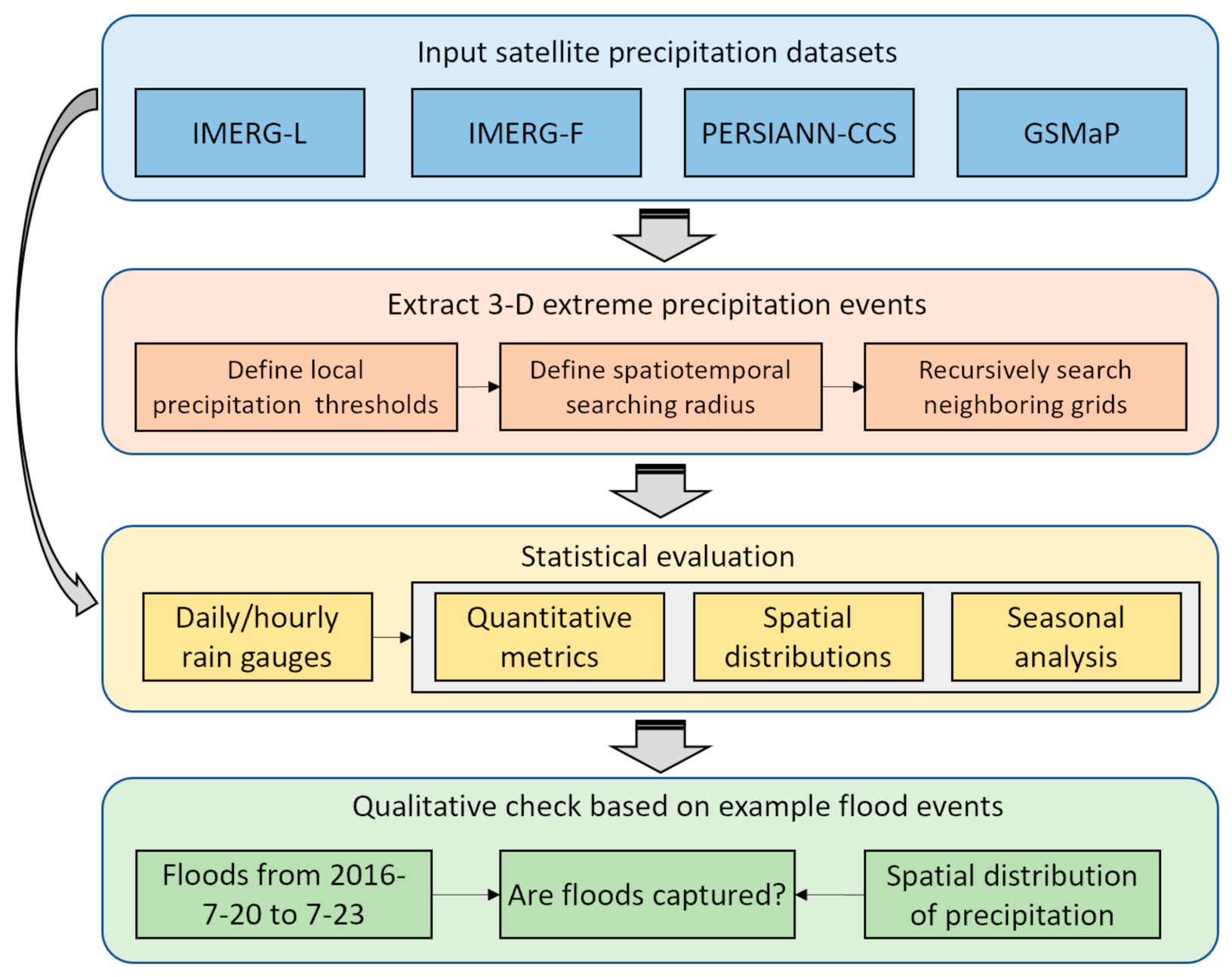
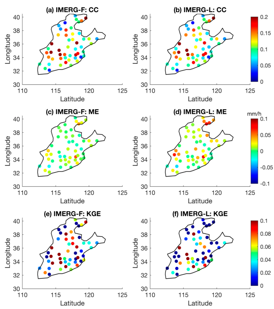
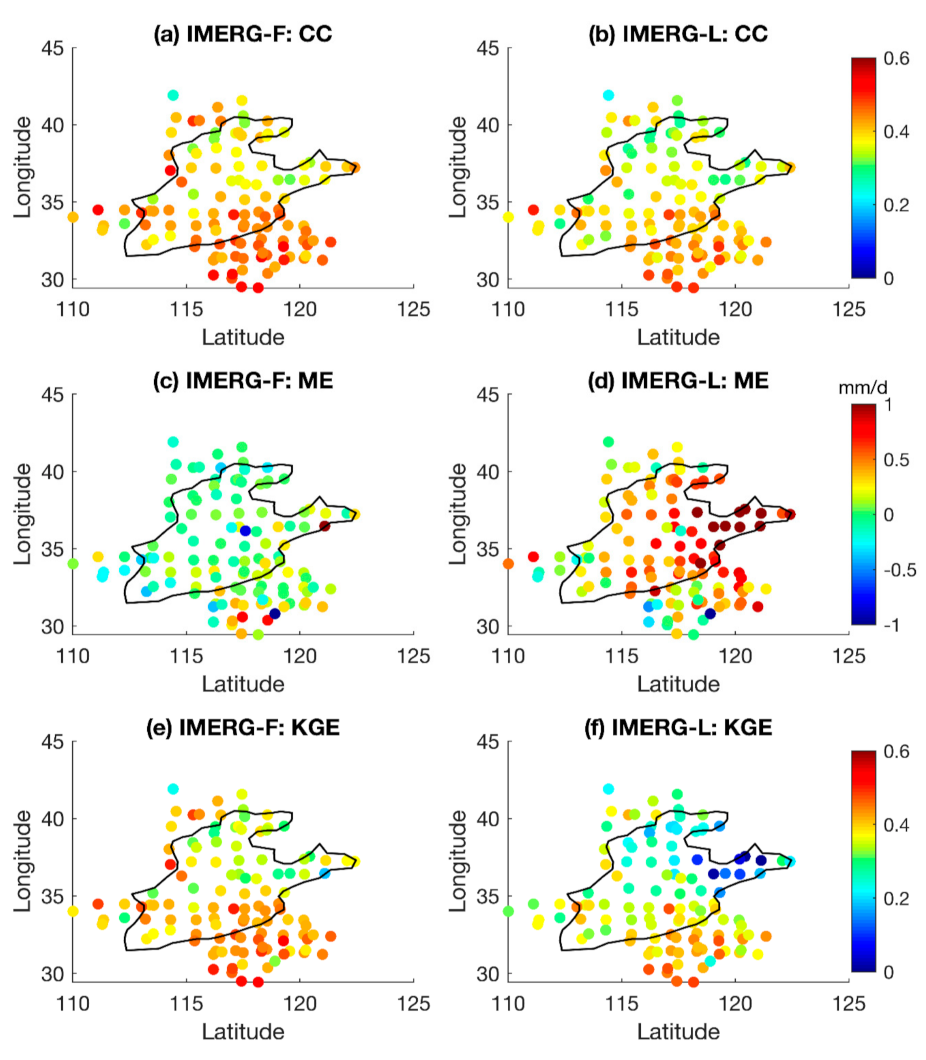
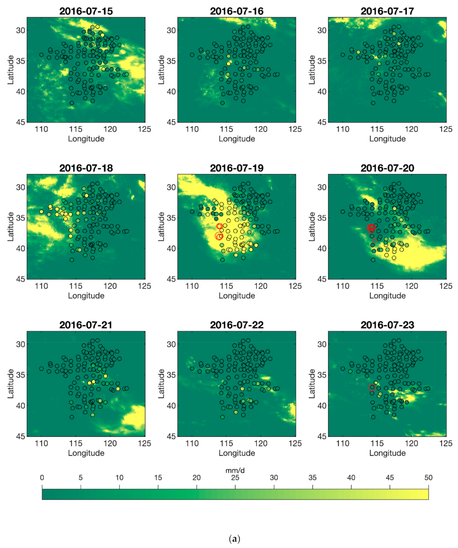
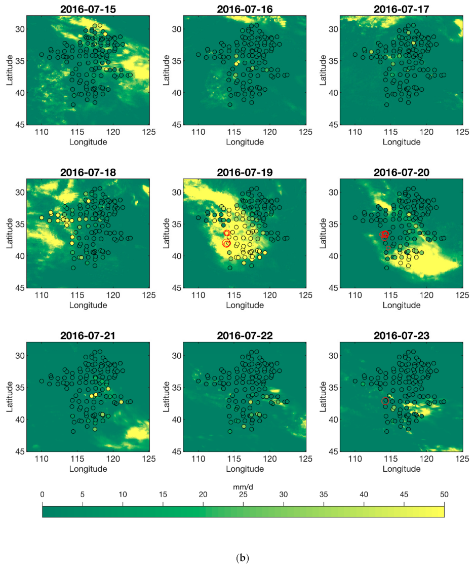
Extreme precipitation events (EPE) often cause catastrophic floods accompanied by serious economic losses and casualties. The latest version (V06) of the Integrated Multi-satellite Retrievals for Global Precipitation Measurement (GPM IMERG) provides global satellite precipitation data from 2000 at a higher spatiotemporal resolution with improved quality. It is scientifically and practically important to assess the accuracy of the IMERG V06 in capturing extreme precipitation. This study evaluates the two widely used products of IMERG during 2000–2018, i.e., IMERG late run (IMERG-L) and IMERG final run (IMERG-F), in the densely populated and flood-prone North China Plain. The accuracy of the IMERG V06 is evaluated with ground measurements from rain gauge stations at multiple scales (hourly, daily, and seasonally). A novel target tracking method is introduced to extract three-dimensional (3D) extreme precipitation events, and the near-real-time uncalibrated PERSIANN-CCS (Precipitation Estimation from Remotely Sensed Information using Artificial Neural Networks Cloud Classification System) and GSMAP (Global Satellite Mapping of Precipitation) satellite data are added to further evaluate IMERG’s performance during extreme precipitation. Finally, for flash flood events induced by extreme rainfall in the Hebei Province from 15 to 23 July 2016, the accuracy of capturing the event with IMERG-F and IMERG-L was verified. Results reveal that IMERG-F is better than IMERG-L at all investigated scales (hourly, daily, and seasonally), but the difference between the two products is less at higher time resolutions. Both products manifest decreased performance when capturing 3D extreme precipitation events, and comparatively, IMERG-F performs better than IMERG-L. IMERG-F exhibits a distinct discontinuity in extreme precipitation thresholds between land and ocean, which is a limitation of IMERG-F not documented in previous studies. Moreover, IMERG-L and IMERG-F are comparable at an hourly scale for some metrics, which is beyond the expectation that IMERG-F is notably better than IMERG-L. This study provides a scientific basis for the performance of satellite precipitation products and contributes to guiding users when applying global precipitation products.
Keywords: IMERG; object tracking; extreme precipitation; North China Plain IMERG; object tracking; extreme precipitation; North China Plain