Article

Integrating DMSP-OLS and NPP-VIIRS Nighttime Light Data to Evaluate Poverty in Southwestern China
1
School of Geoscience and Technology, Southwest Petroleum University, Chengdu 610500, China
2
PowerChina Sichuan Electric Power Engineering Co., Ltd., Chengdu 610041, China
3
School of Civil Engineering and Geomatics, Southwest Petroleum University, Chengdu 610500, China
4
State Key Laboratory of Resources and Environmental Information System, Institute of Geographic Sciences and Natural Resources Research, Chinese Academy of Sciences, Beijing 100101, China
5
School of Geography and Planning, Sun Yat-sen University, Guangzhou 510275, China
6
State Key Laboratory of Earth Surface Processes and Resource Ecology, Faculty of Geographical Science, Beijing Normal University, Beijing 100875, China
*
Author to whom correspondence should be addressed.
Remote Sens. 2022, 14(3), 600; https://doi.org/10.3390/rs14030600
Submission received: 27 December 2021 / Revised: 17 January 2022 / Accepted: 20 January 2022 / Published: 26 January 2022
(This article belongs to the Special Issue Remote Sensing Imagery for Mapping Economic Activities)

Abstract

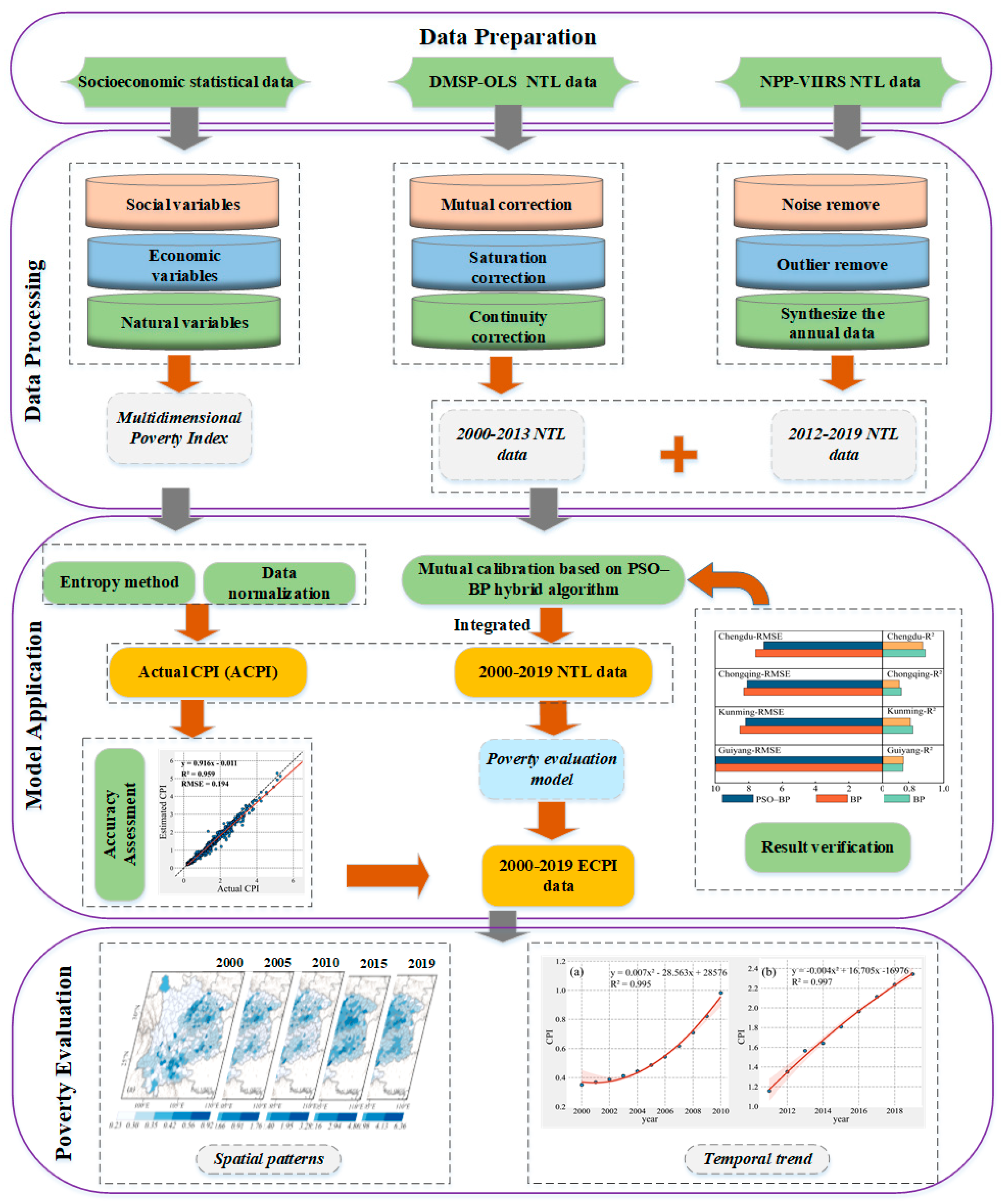
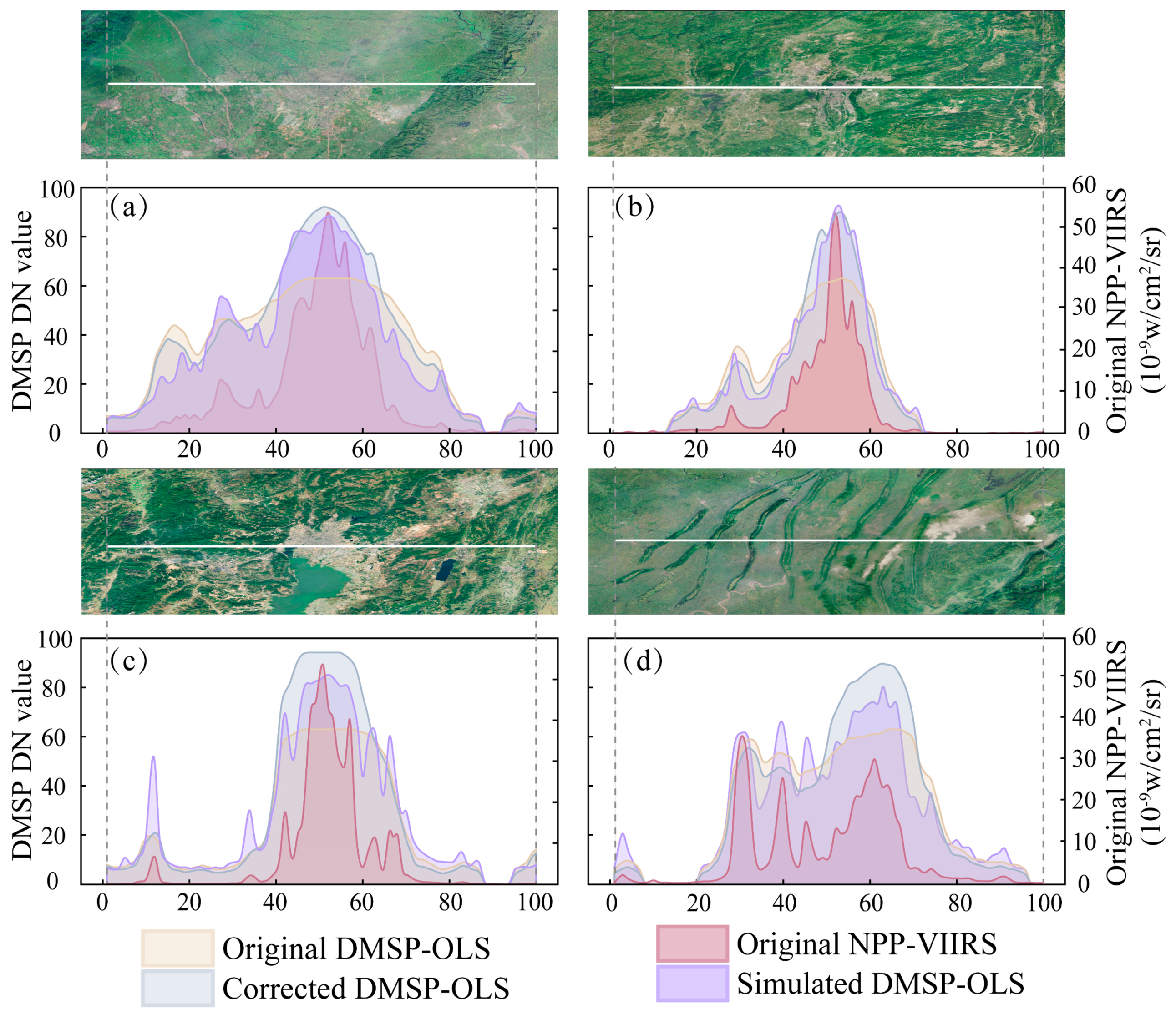
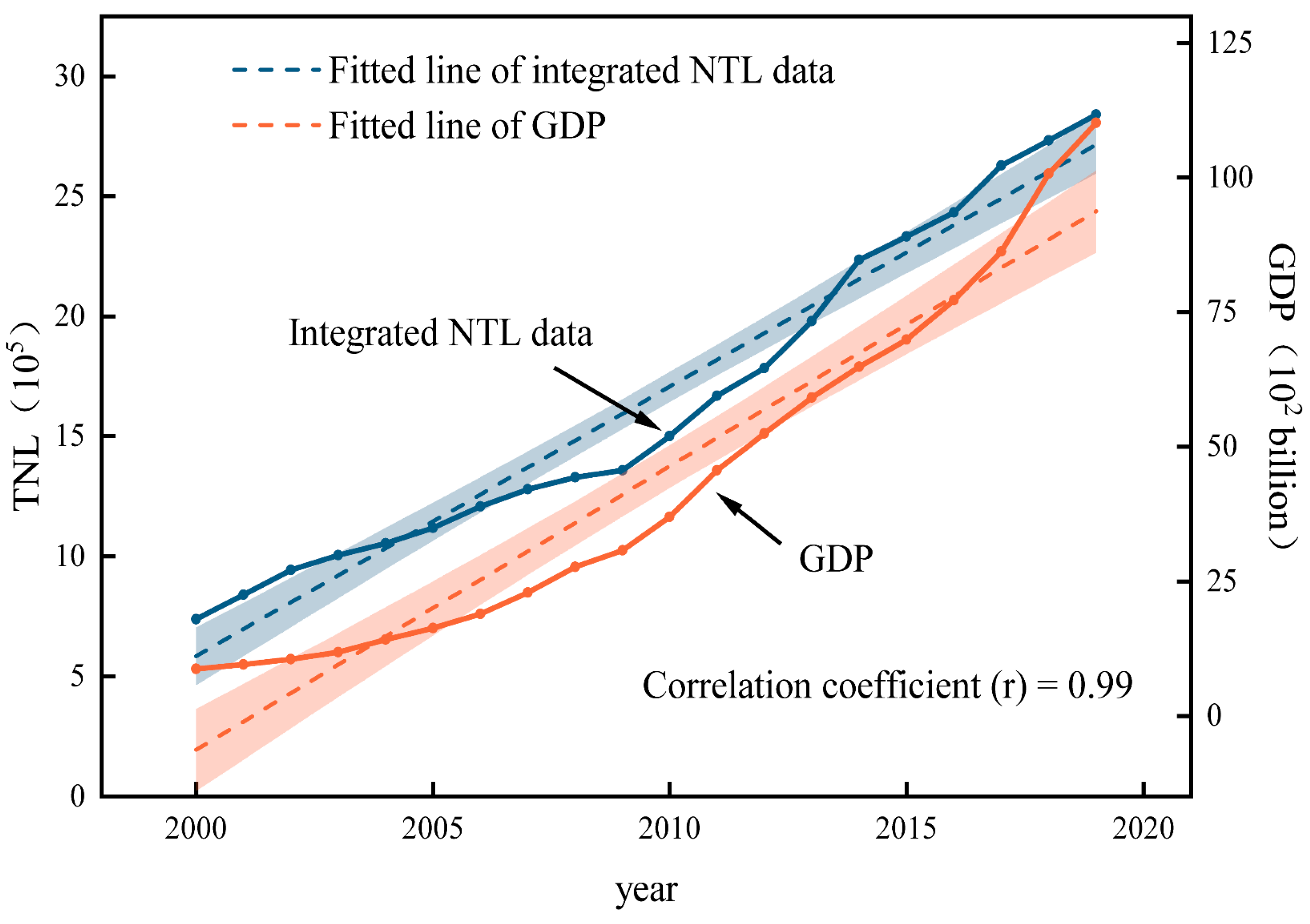
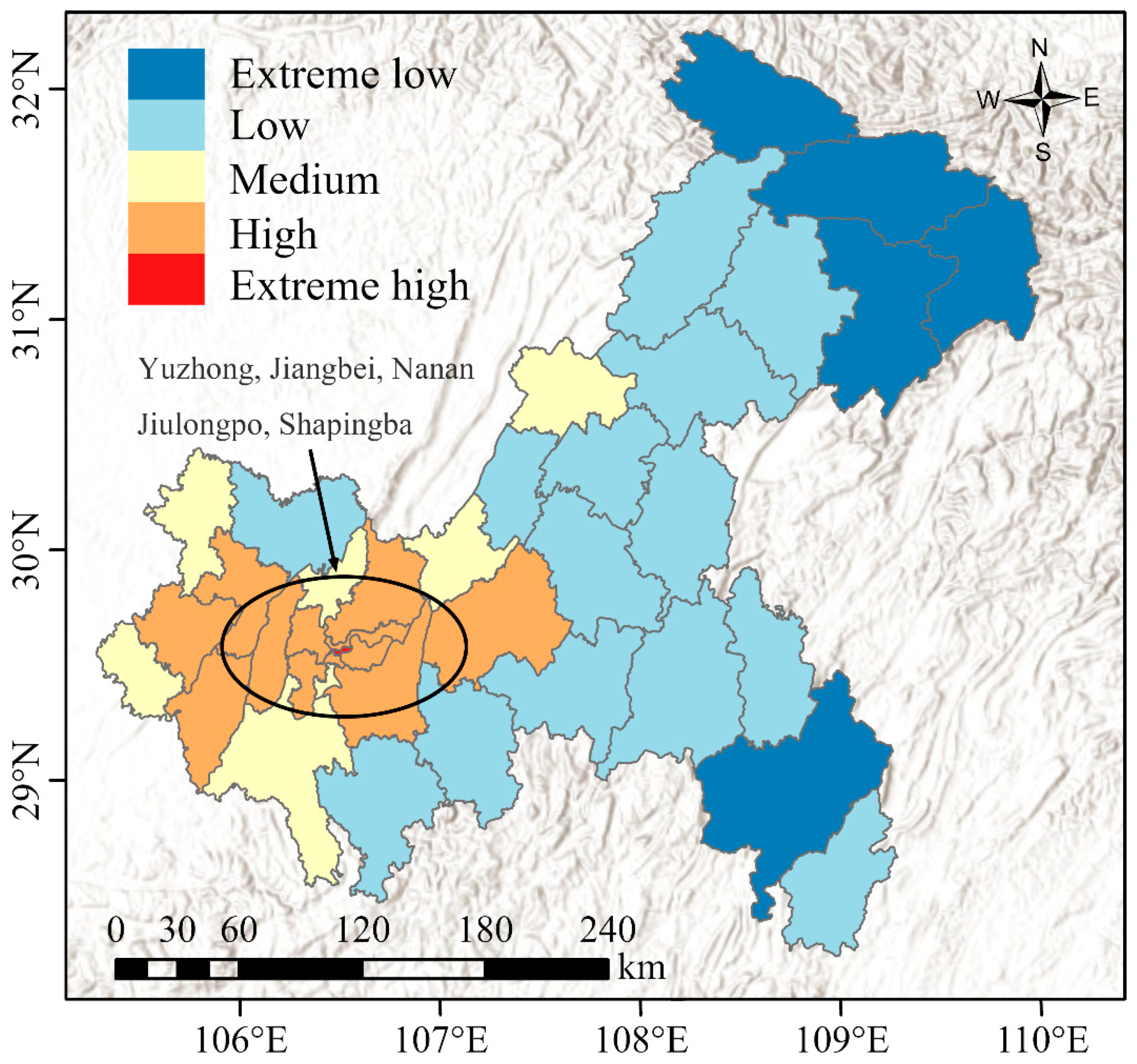
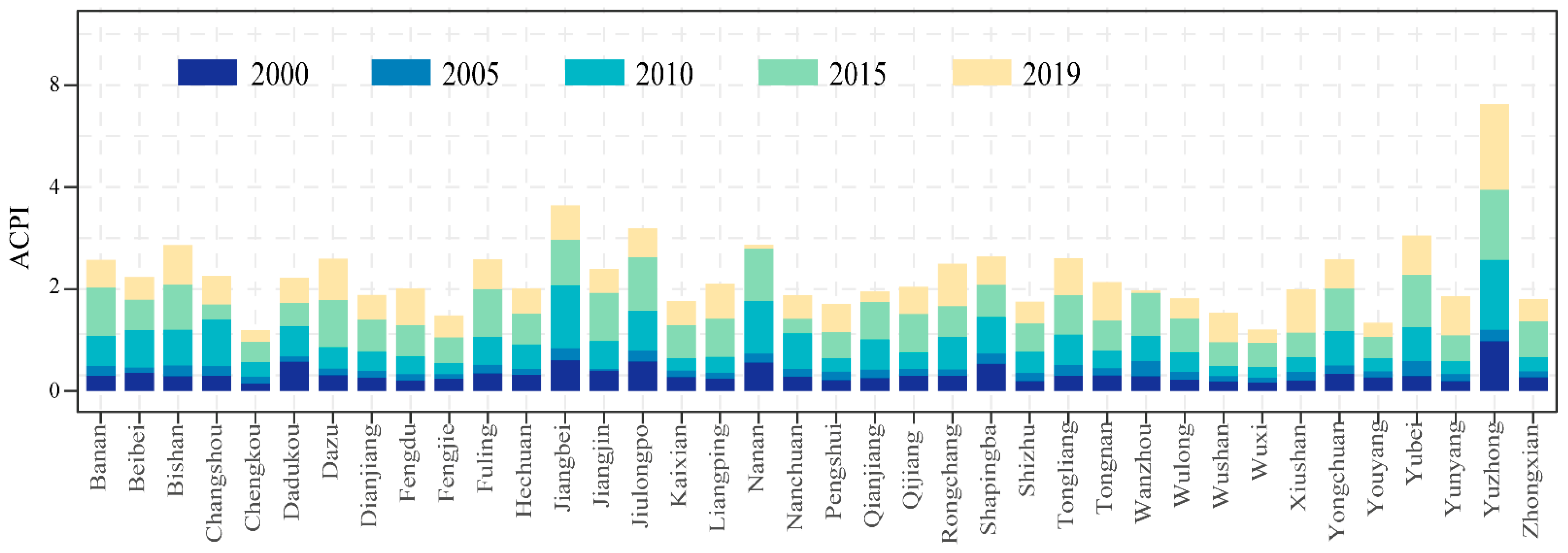
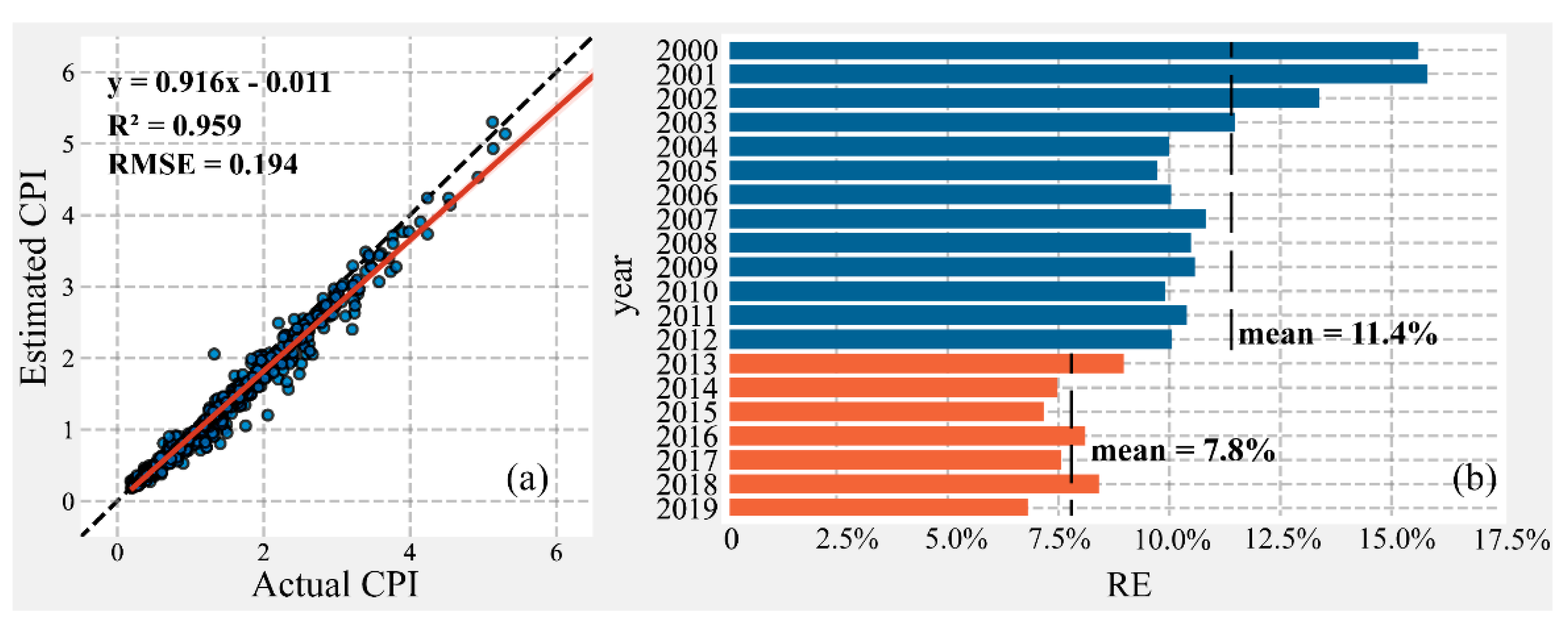
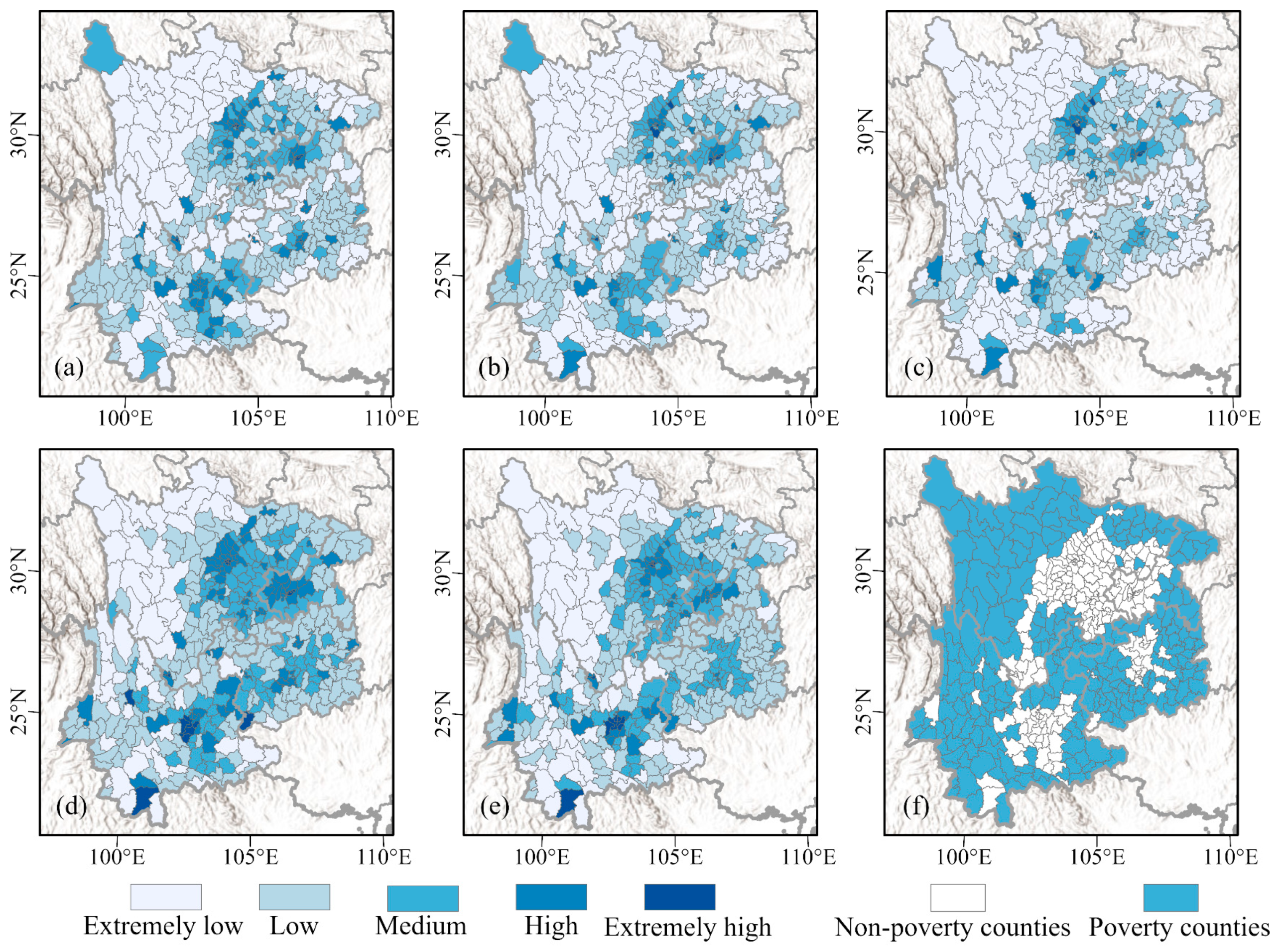
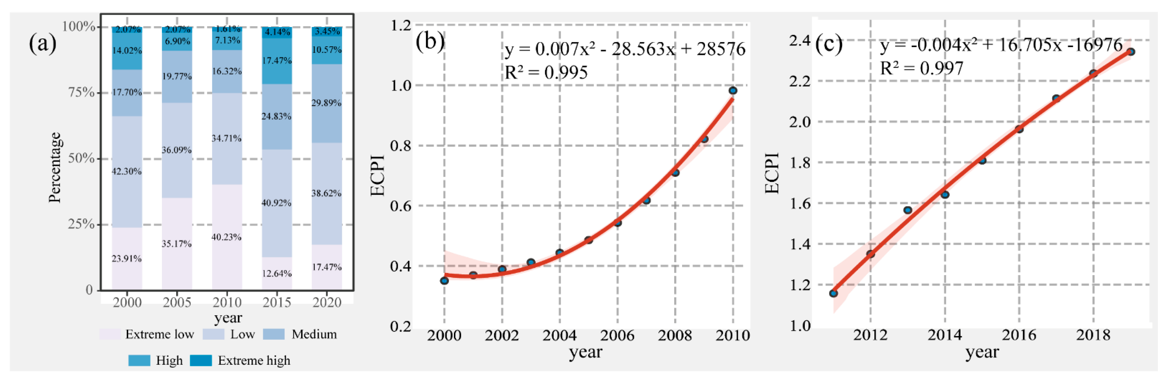
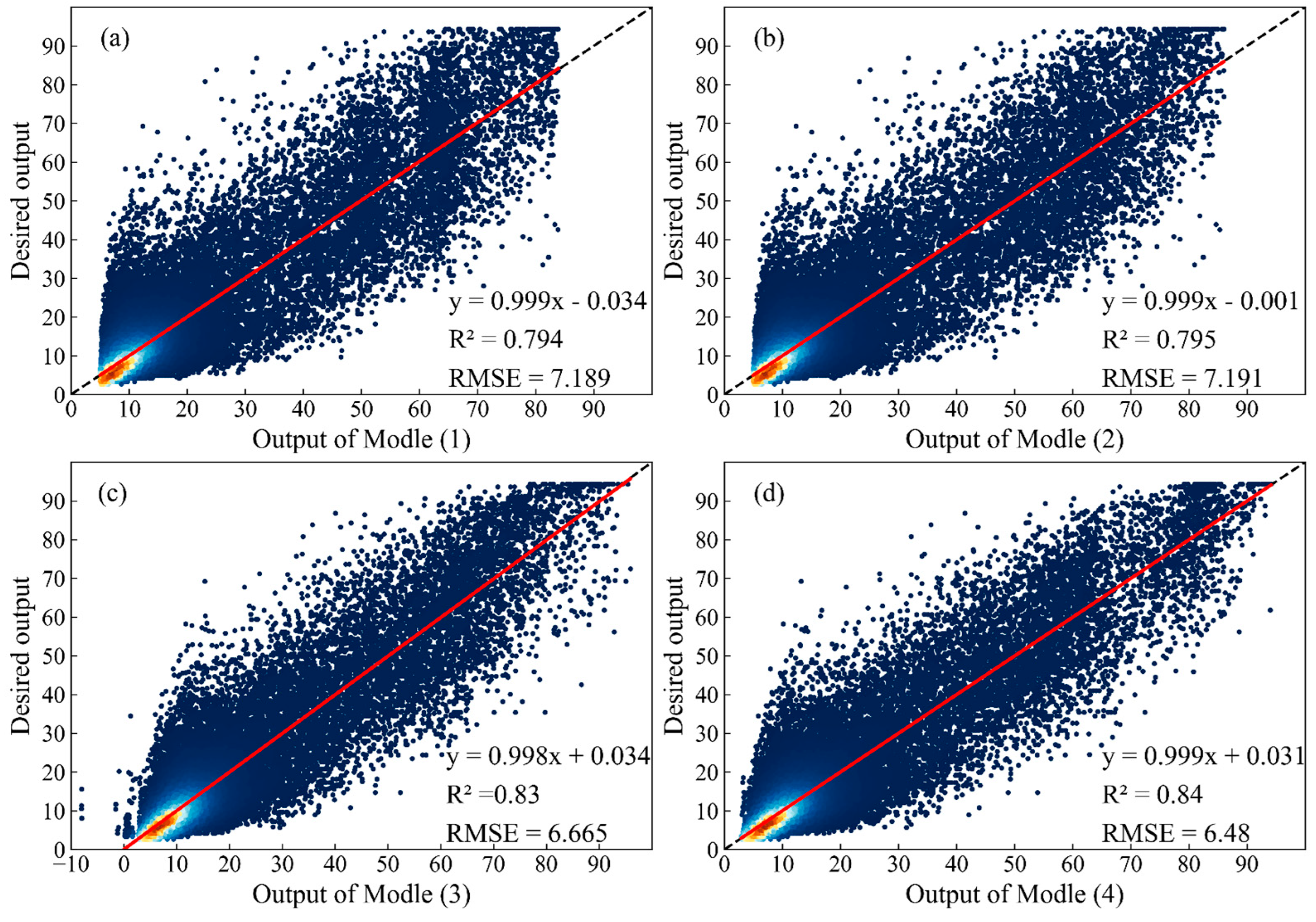
Poverty alleviation is one of the most important tasks facing human social development. It is necessary to make accurate monitoring and evaluations for areas with poverty to improve capability of implementing poverty alleviation policies. Here, this study introduced nighttime light (NTL) data to estimate county-level poverty in southwest China. First, this study used particle swarm optimization-back propagation hybrid algorithm to explore the potential relationship between two NTL data (the Defense Meteorological Satellite Program’s Operational Line Scan System data and the Suomi National Polar-orbiting Partnership Visible Infrared Imaging Radiometer Suite data). Then, we integrated two NTL data at the pixel level to establish a consistent time-series of NTL dataset from 2000 to 2019. Next, an actual comprehensive poverty index (ACPI) was employed as an indicator of multidimensional poverty at county level based on 11 socioeconomic and natural variables, and which could be the reference to explore the poverty evaluation using NTL data. Based on the correlation between the ACPI and NTL characteristic variables, a poverty evaluation model was developed to evaluate the poverty situation. The result showed the great matching relationship between DMSP-OLS and NPP-VIIRS data (R2 = 0.84). After calibration, the continuity and comparability of DMSP-OLS data were significantly improved. The integrated NTL data also reflected great consistency with socioeconomic development (r = 0.99). The RMSE between ACPI and the estimated comprehensive poverty index (ECPI) based on the integrated NTL data is approximately 0.19 (R2 = 0.96), which revealed the poverty evaluation model was feasible and reliable. According to the ECPI, we found that the magnitude of poverty eradication increased in southwest China until 2011, but slowed down from 2011 to 2019. Regarding the spatial scale, geographic barriers are a key factor for poverty, with high altitude and mountainous areas typically having a high incidence of poverty. Our approach offers an effective model for evaluation poverty based on the NTL data, which can contribute a more reliable and efficient monitoring of poverty dynamic and a better understanding of socioeconomic development.
Keywords: DMSP-OLS; NPP-VIIRS; nighttime light calibration; multi-dimensional poverty; poverty evaluation DMSP-OLS; NPP-VIIRS; nighttime light calibration; multi-dimensional poverty; poverty evaluation