Article

Integrated UAV-Based Multi-Source Data for Predicting Maize Grain Yield Using Machine Learning Approaches


1
College of Water Sciences, Beijing Normal University, Beijing 100875, China
2
Heilongjiang Province Key Laboratory of Geographical Environment Monitoring and Spatial Information Service in Cold Regions, Heilongjiang Province Collaborative Innovation Center of Cold Region Ecological Safety, Harbin Normal University, Harbin 150025, China
3
Institute for Infocomm Research, Agency for Science, Technology and Research (A*STAR), Singapore 138632, Singapore
4
Department of Agroecology, Aarhus University, iClimate, Cbio, 8800 Tjele, Denmark
*
Author to whom correspondence should be addressed.
Remote Sens. 2022, 14(24), 6290; https://doi.org/10.3390/rs14246290
Submission received: 18 October 2022 / Revised: 29 November 2022 / Accepted: 10 December 2022 / Published: 12 December 2022

Abstract

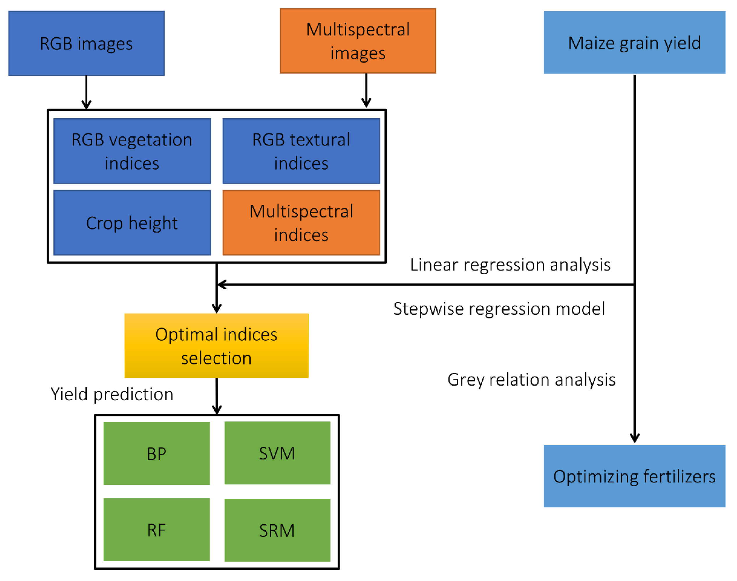
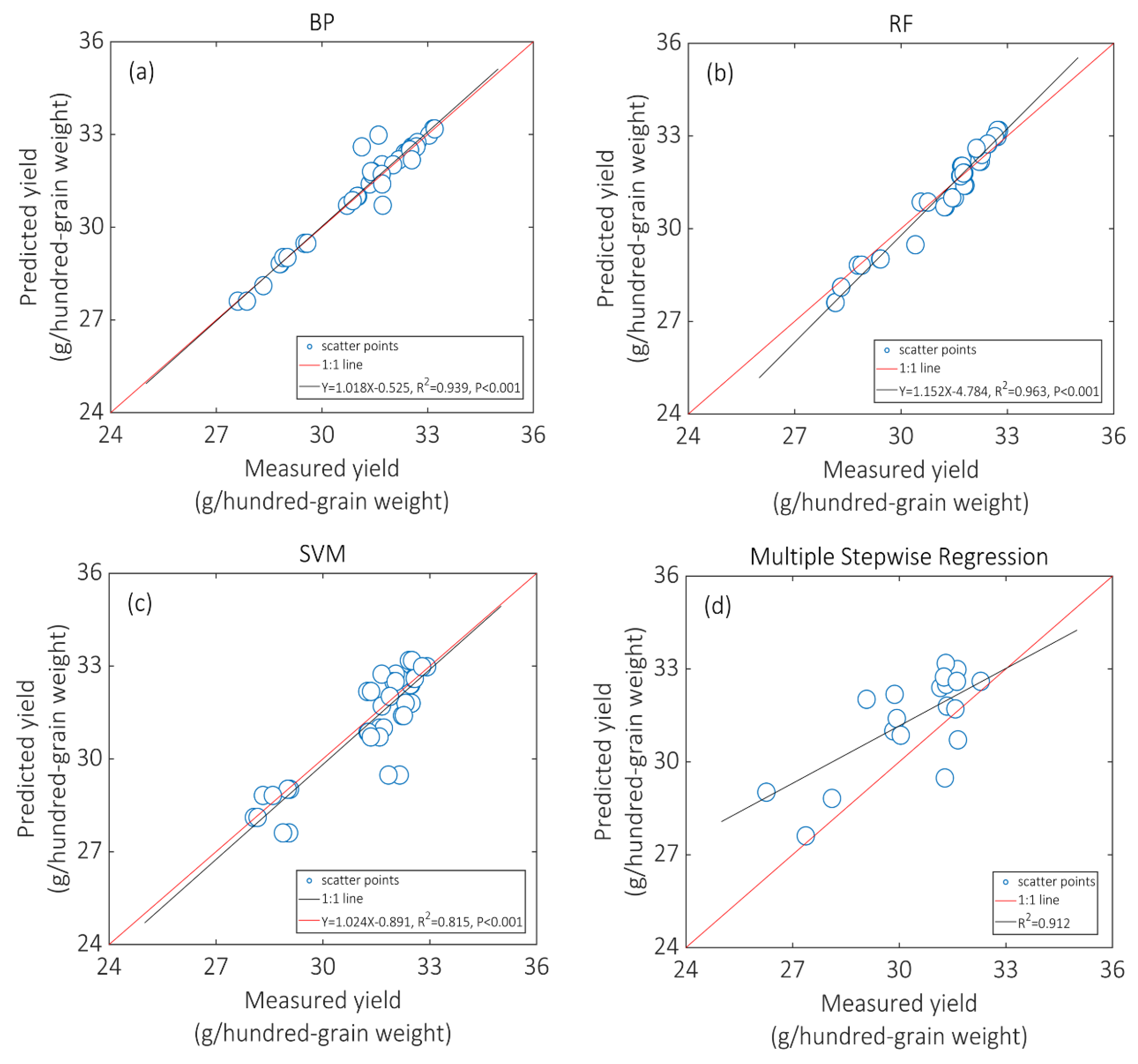
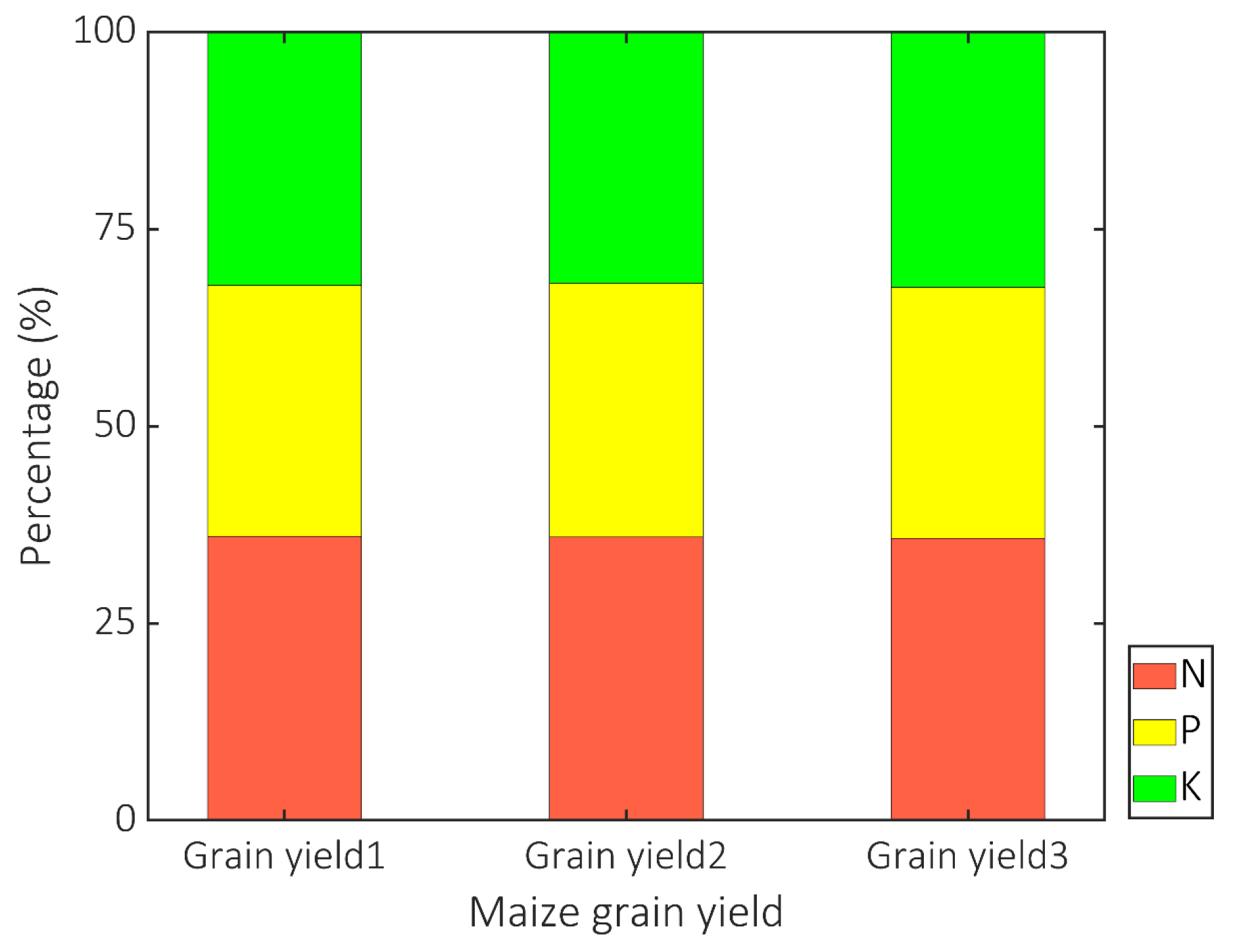
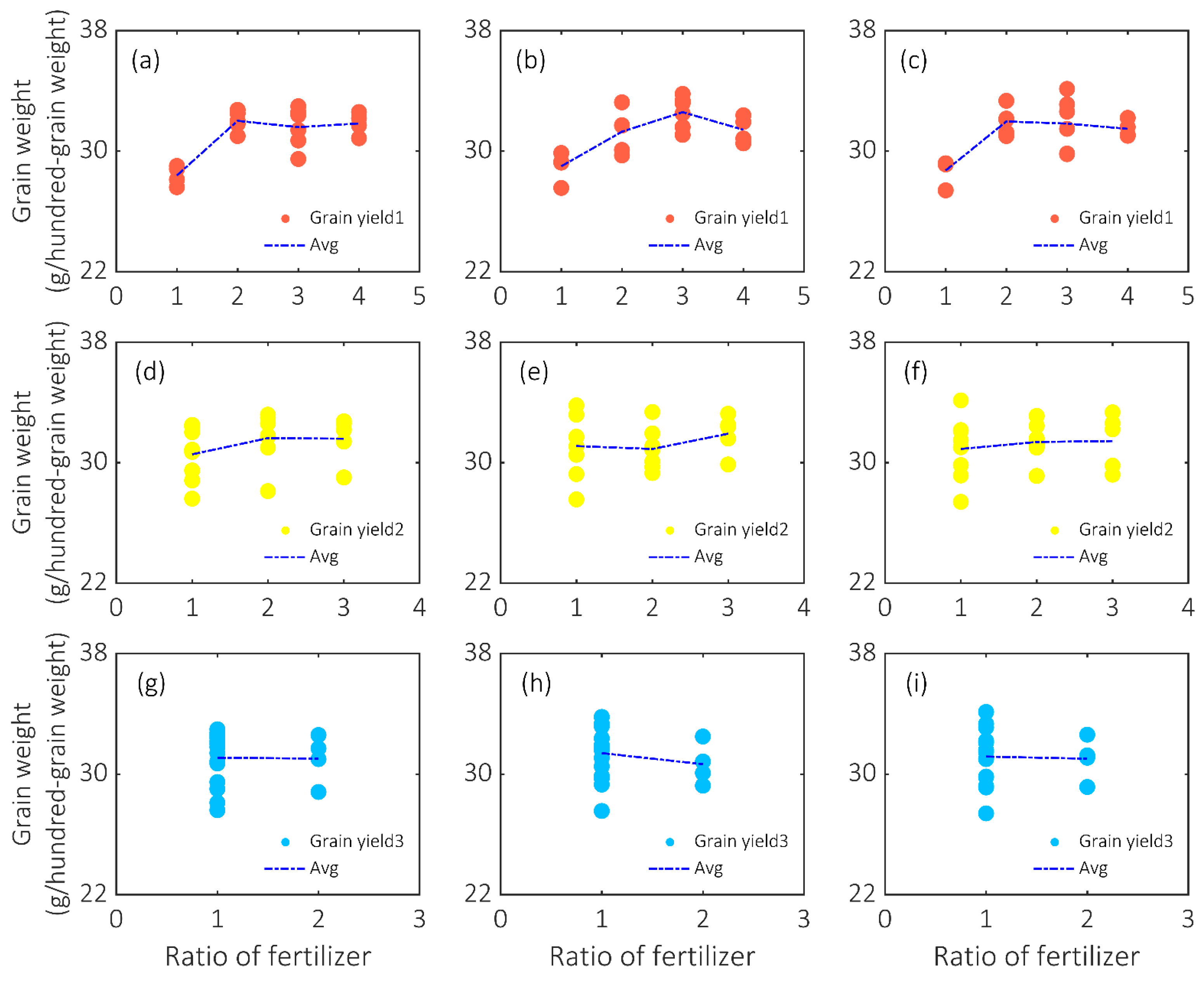
Increases in temperature have potentially influenced crop growth and reduced agricultural yields. Commonly, more fertilizers have been applied to improve grain yield. There is a need to optimize fertilizers, to reduce environmental pollution, and to increase agricultural production. Maize is the main crop in China, and its ample production is of vital importance to guarantee regional food security. In this study, the RGB and multispectral images, and maize grain yields were collected from an unmanned aerial vehicle (UAV) platform. To confirm the optimal indices, RGB-based vegetation indices and textural indices, multispectral-based vegetation indices, and crop height were independently applied to build linear regression relationships with maize grain yields. A stepwise regression model (SRM) was applied to select optimal indices. Three machine learning methods including: backpropagation network (BP), random forest (RF), and support vector machine (SVM) and the SRM were separately applied for predicting maize grain yields based on optimal indices. RF achieved the highest accuracy with a coefficient of determination of 0.963 and root mean square error of 0.489 (g/hundred-grain weight). Through the grey relation analysis, the N was the most correlated indicator, and the optimal ratio of fertilizers N/P/K was 2:1:1. Our research highlighted the integration of spectral, textural indices, and maize height for predicting maize grain yields.
Keywords: maize grain yield; unmanned aerial vehicle (UAV); vegetation indices and textural indices; machine learning maize grain yield; unmanned aerial vehicle (UAV); vegetation indices and textural indices; machine learning