Article

Absolute Accuracy Assessment of Lidar Point Cloud Using Amorphous Objects

1
KBR, Contractor to U.S. Geological Survey Earth Resources Observation and Science (EROS) Center, Sioux Falls, SD 57198, USA
2
U.S. Geological Survey, National Geospatial Program, Reston, VA 20192, USA
3
U.S. Geological Survey EROS Center, Sioux Falls, SD 57198, USA
4
USS, Contractor to U.S. Geological Survey EROS Center, Sioux Falls, SD 57198, USA
*
Author to whom correspondence should be addressed.
Remote Sens. 2022, 14(19), 4767; https://doi.org/10.3390/rs14194767
Submission received: 25 August 2022 / Revised: 21 September 2022 / Accepted: 22 September 2022 / Published: 23 September 2022
(This article belongs to the Special Issue Environmental Monitoring and Mapping Using 3D Elevation Program Data)

Abstract

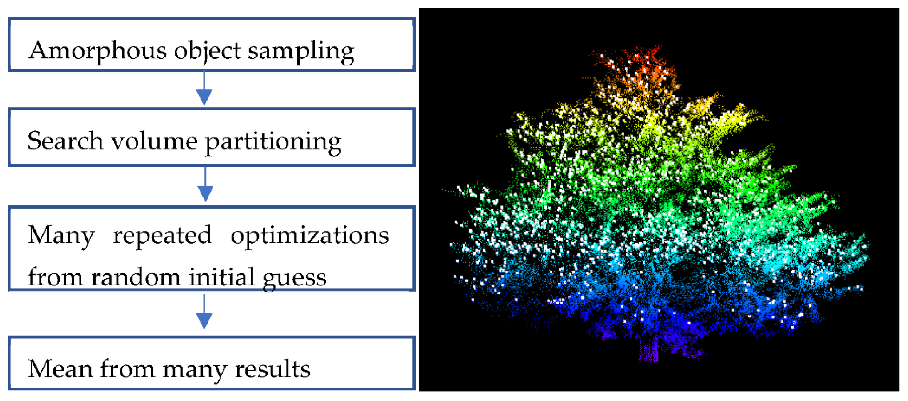
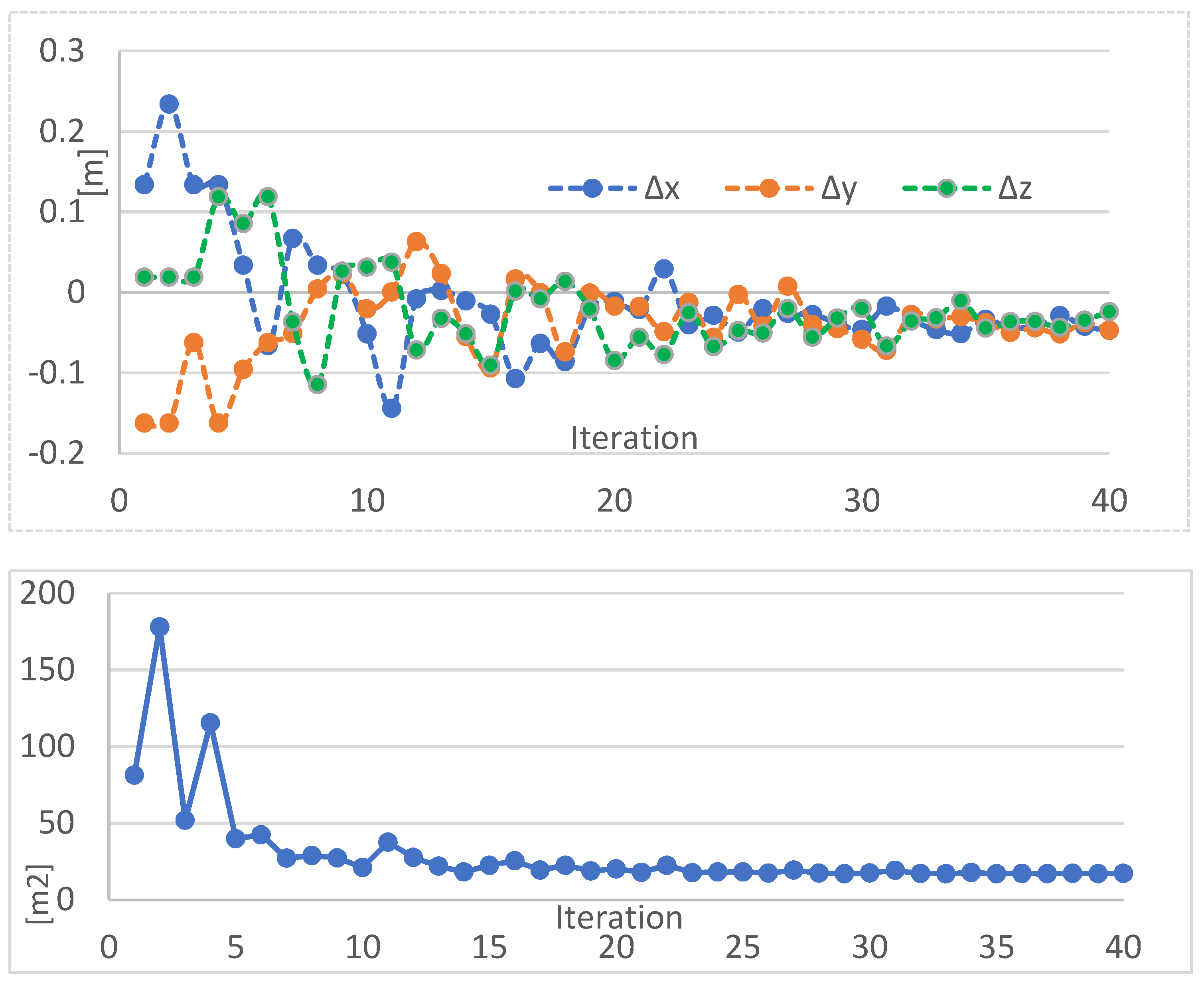
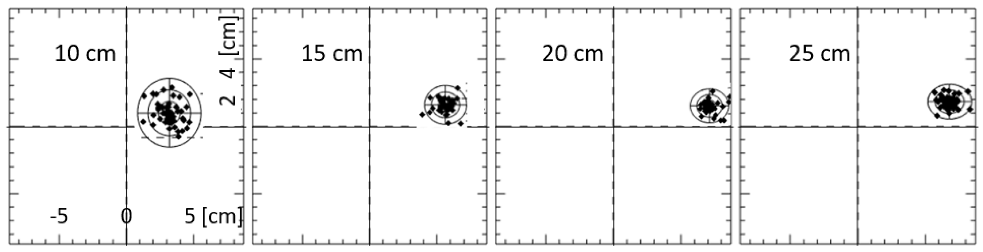
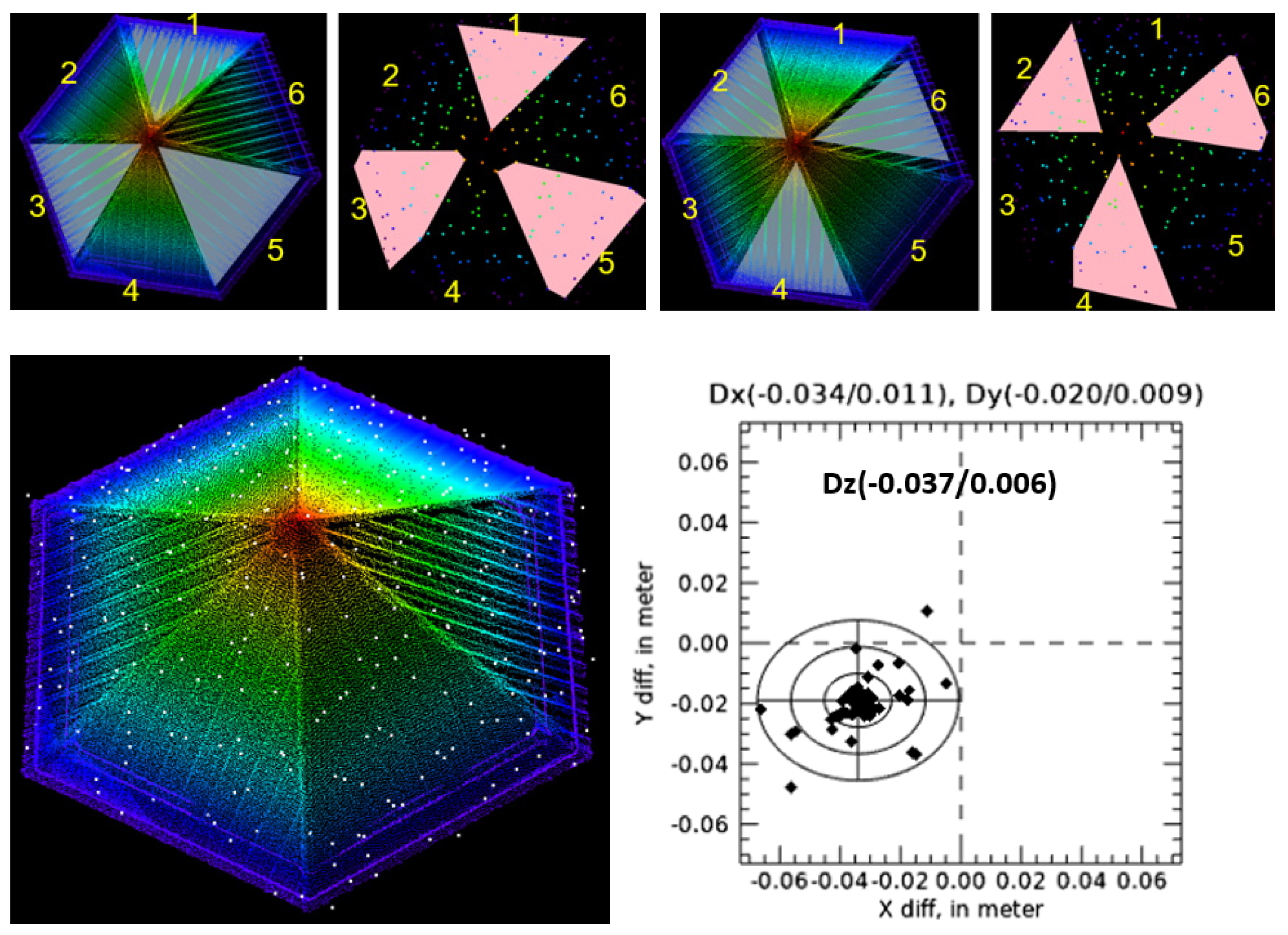
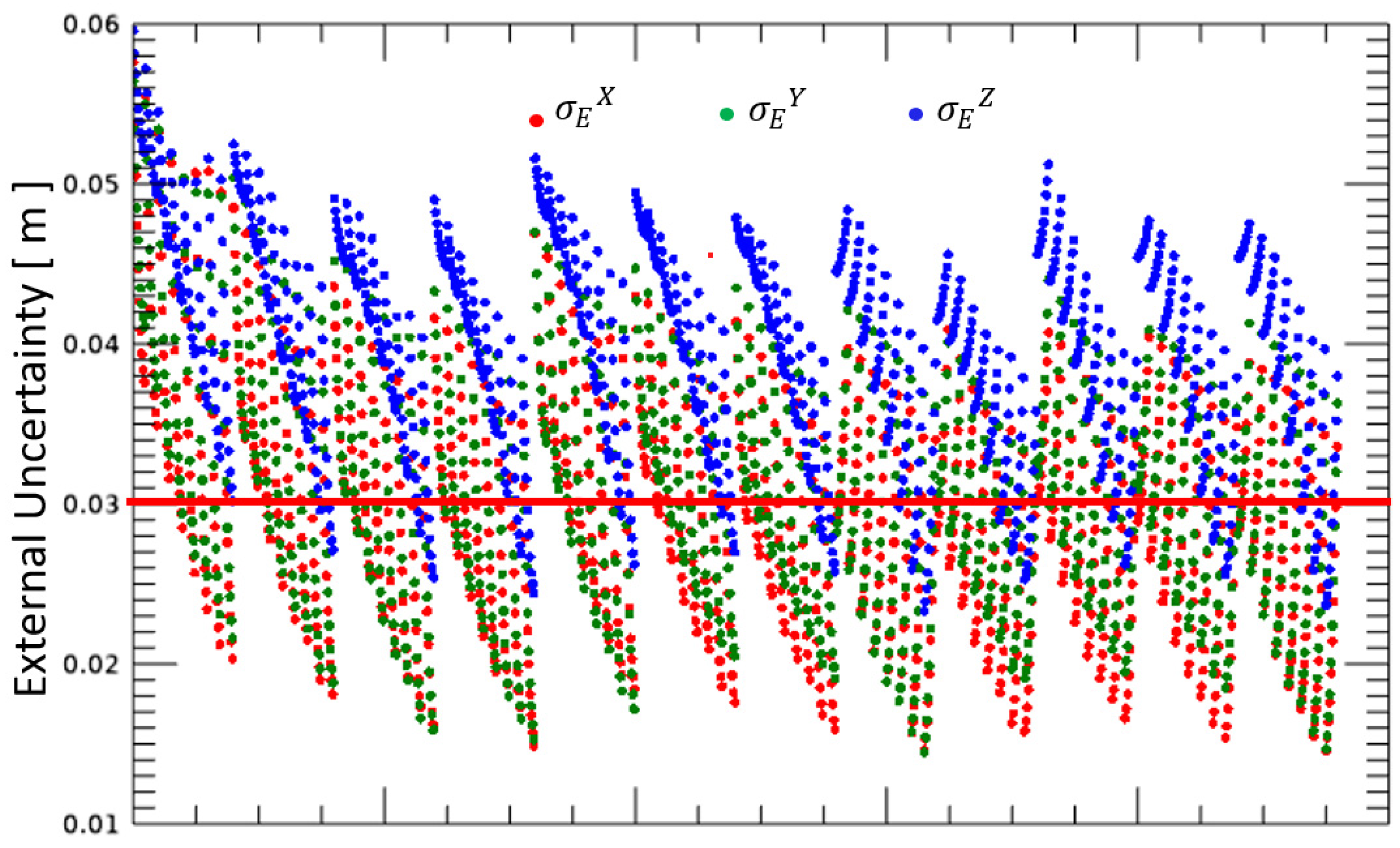
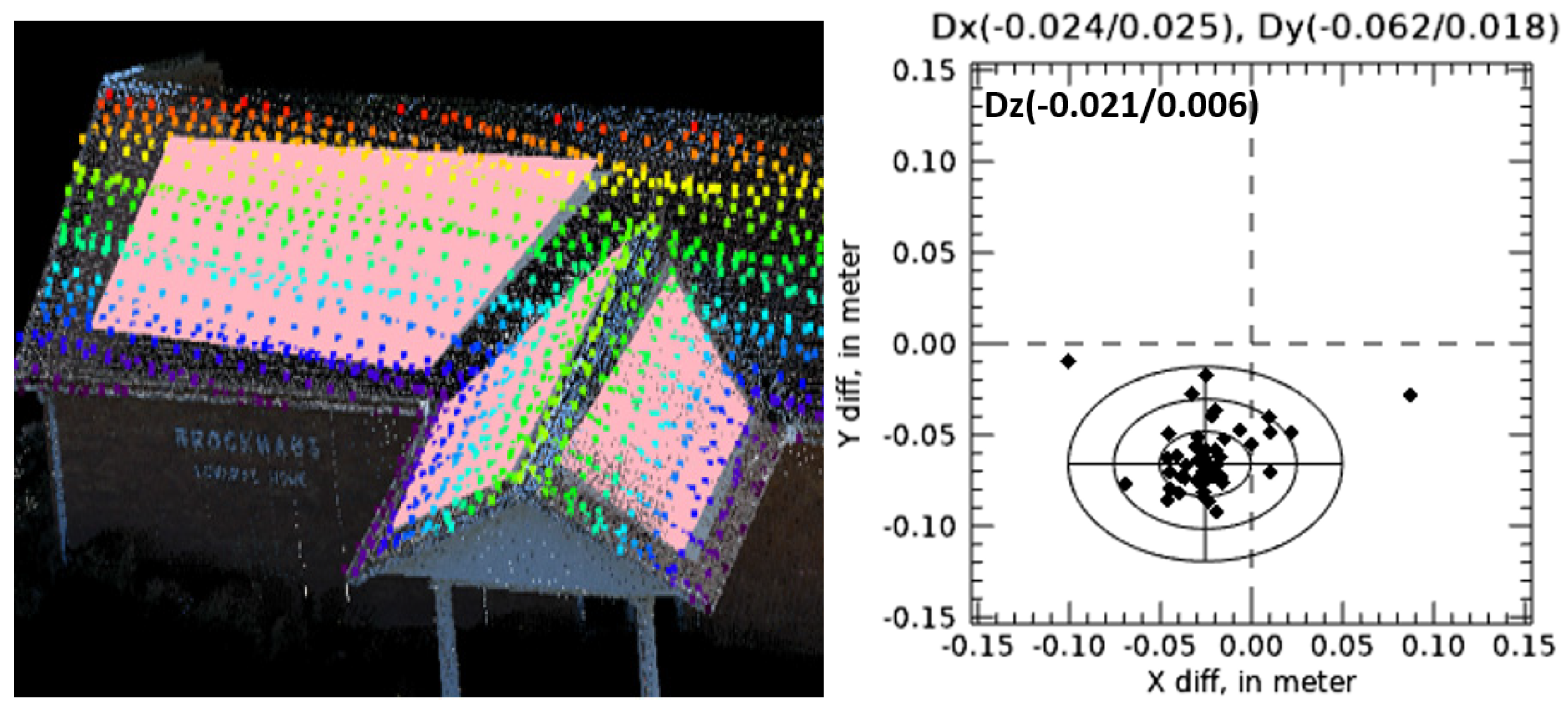
The accuracy assessment of airborne lidar point cloud typically estimates vertical accuracy by computing RMSEz (root mean square error of the z coordinate) from ground check points (GCPs). Due to the low point density of the airborne lidar point cloud, there is often not enough accurate semantic context to find an accurate conjugate point. To advance the accuracy assessment in full three-dimensional (3D) context, geometric features, such as the three-plane intersection point or two-line intersection point, are often used. Although the point density is still low, geometric features are mathematically modeled from many points. Thus, geometric features provide a robust determination of the intersection point, and the point is considered as a GCP. When no regular built objects are available, we describe the process of utilizing features of irregular shape called amorphous natural objects, such as a tree or a rock. When scanned to a high-density point cloud, an amorphous natural object can be used as ground truth reference data to estimate 3D georeferencing errors of the airborne lidar point cloud. The algorithm to estimate 3D accuracy is the optimization that minimizes the sum of the distance between the airborne lidar points to the ground scanned data. The search volume partitioning was the most important procedure to improve the computational efficiency. We also performed an extensive study to address the external uncertainty associated with the amorphous object method. We describe an accuracy assessment using amorphous objects (108 trees) spread over the project area. The accuracy results for ∆x, ∆y, and ∆z obtained using the amorphous object method were 3.1 cm, 3.6 cm, and 1.7 cm RMSE, along with a mean error of 0.1 cm, 0.1 cm, and 4.5 cm, respectively, satisfying the accuracy requirement of U.S. Geological Survey lidar base specification. This approach shows strong promise as an alternative to geometric feature methods when artificial targets are scarce. The relative convenience and advantages of using amorphous targets, along with its good performance shown here, make this amorphous object method a practical way to perform 3D accuracy assessment.
Keywords: lidar; accuracy assessment; uncertainty; amorphous object lidar; accuracy assessment; uncertainty; amorphous object