Article

Evaluating the Near and Mid Infrared Bi-Spectral Space for Assessing Fire Severity and Comparison with the Differenced Normalized Burn Ratio


by
Max J. van Gerrevink
* and
Sander Veraverbeke
Faculty of Science, Vrije Universiteit Amsterdam, de Boelelaan 1085, 1081 HV Amsterdam, The Netherlands
*
Author to whom correspondence should be addressed.
Remote Sens. 2021, 13(4), 695; https://doi.org/10.3390/rs13040695
Submission received: 26 January 2021 / Revised: 10 February 2021 / Accepted: 11 February 2021 / Published: 14 February 2021
(This article belongs to the Special Issue Remote Sensing of Burnt Area)

Abstract

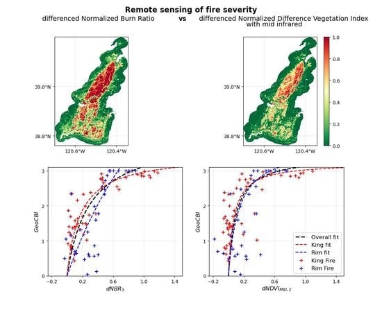
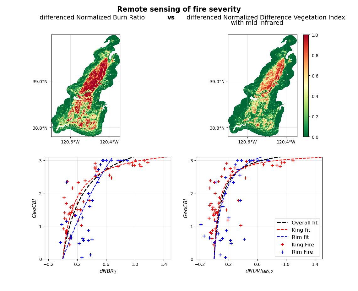
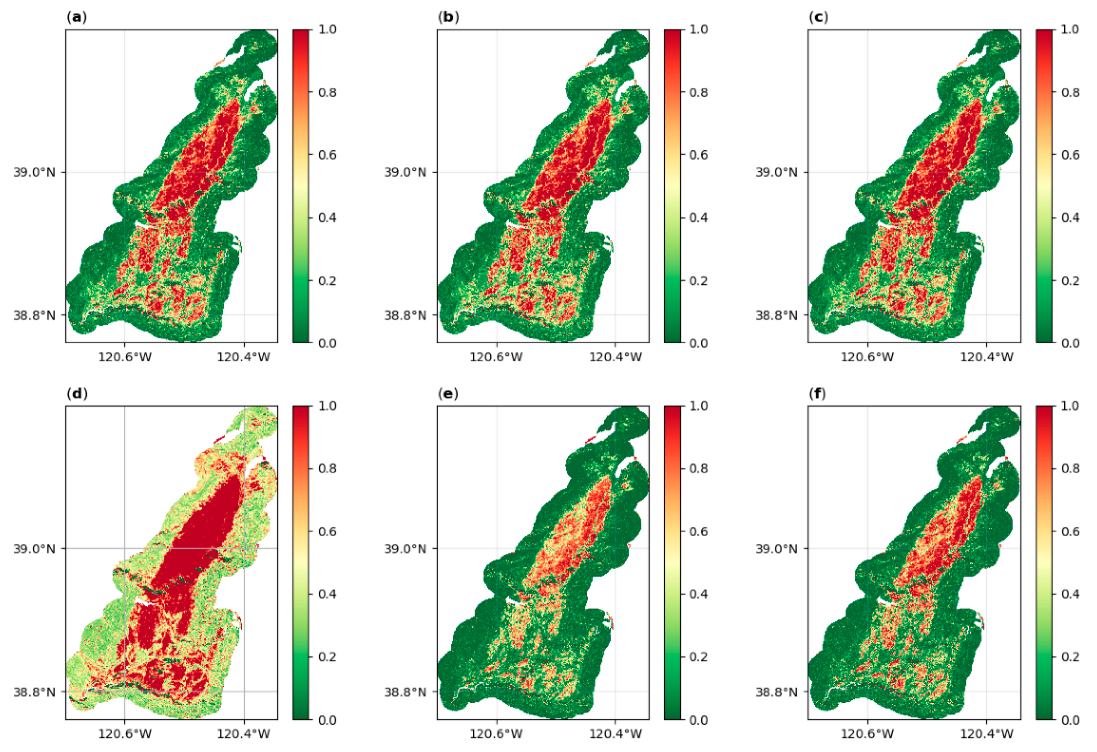
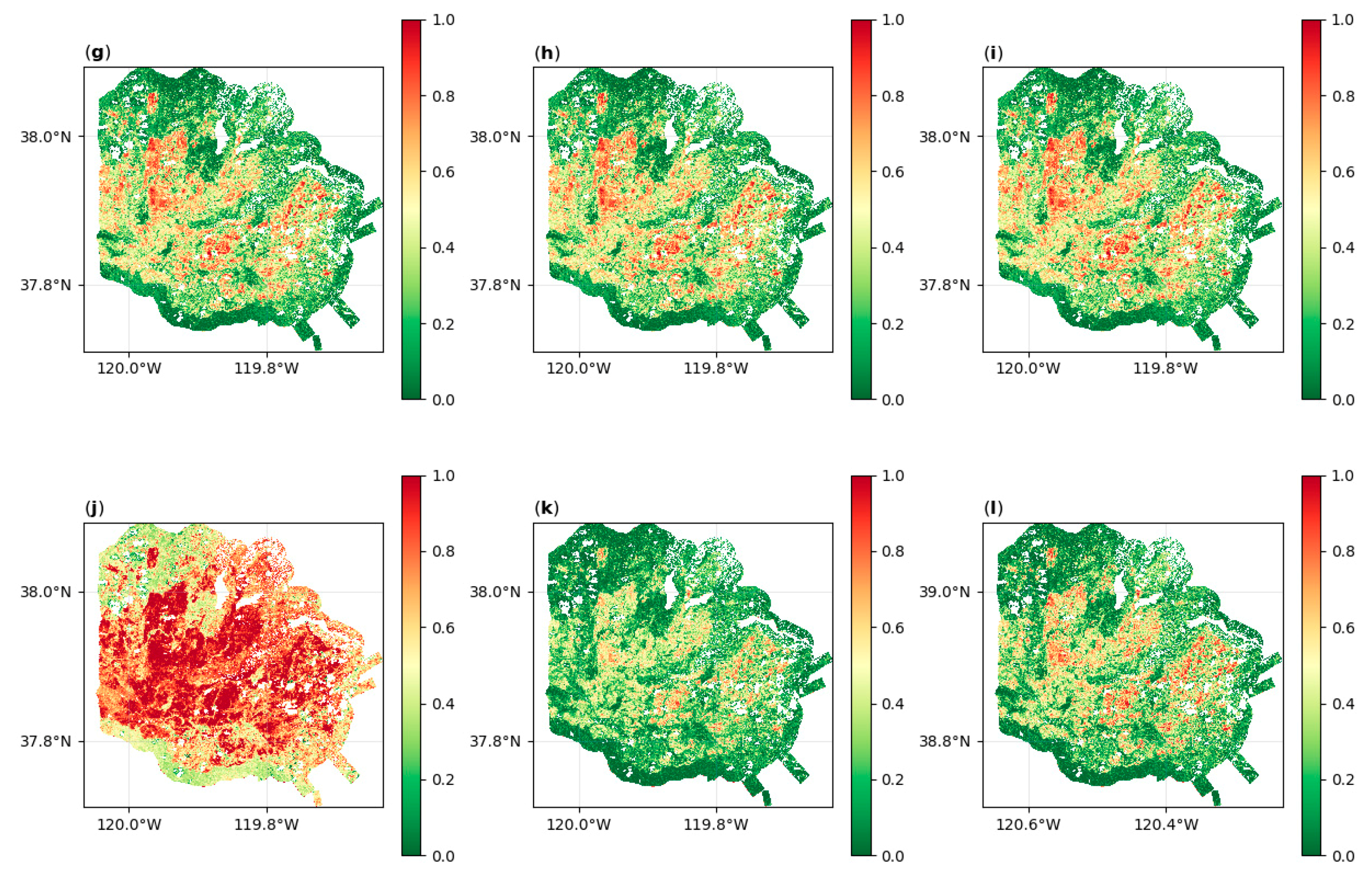
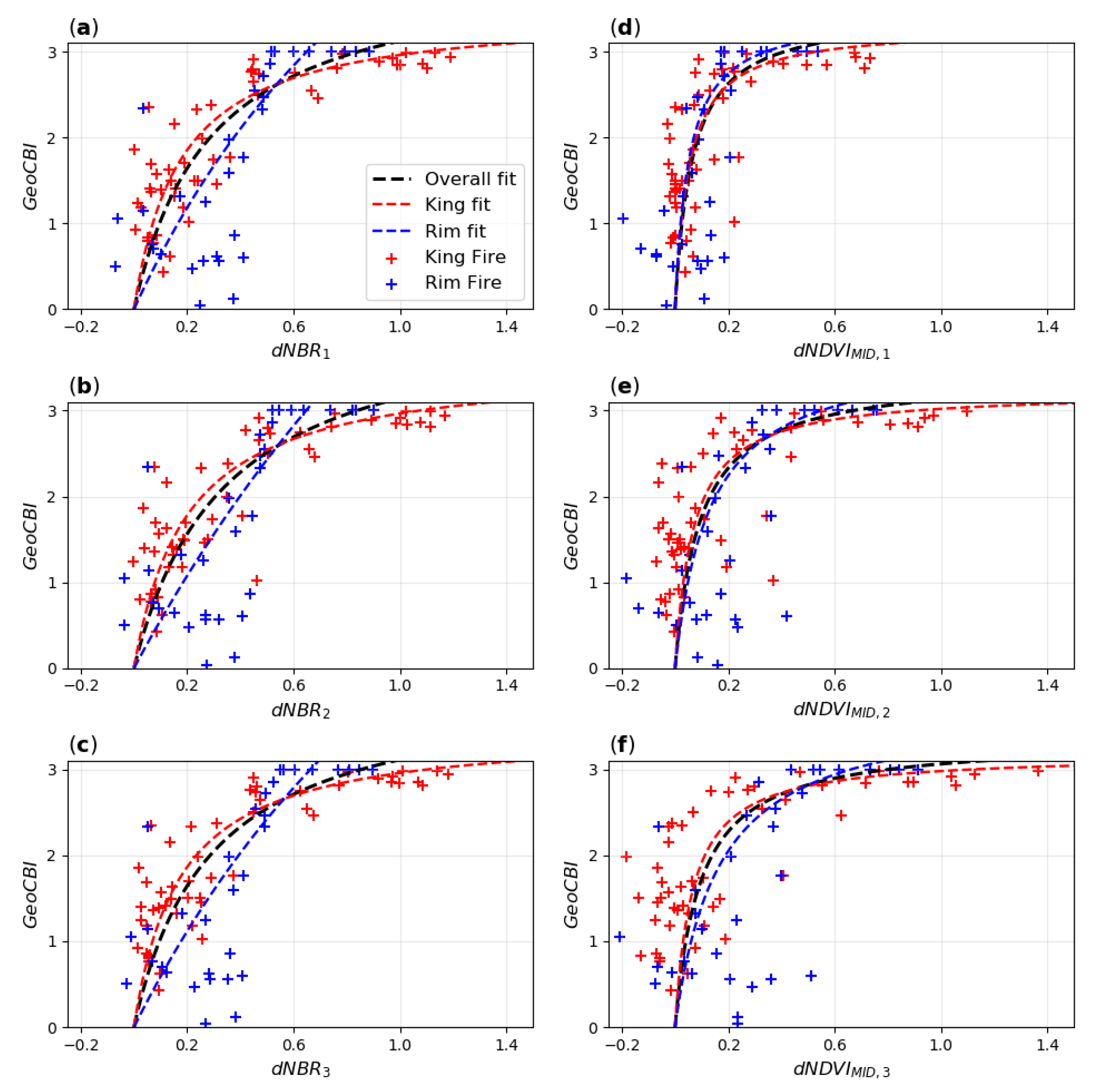
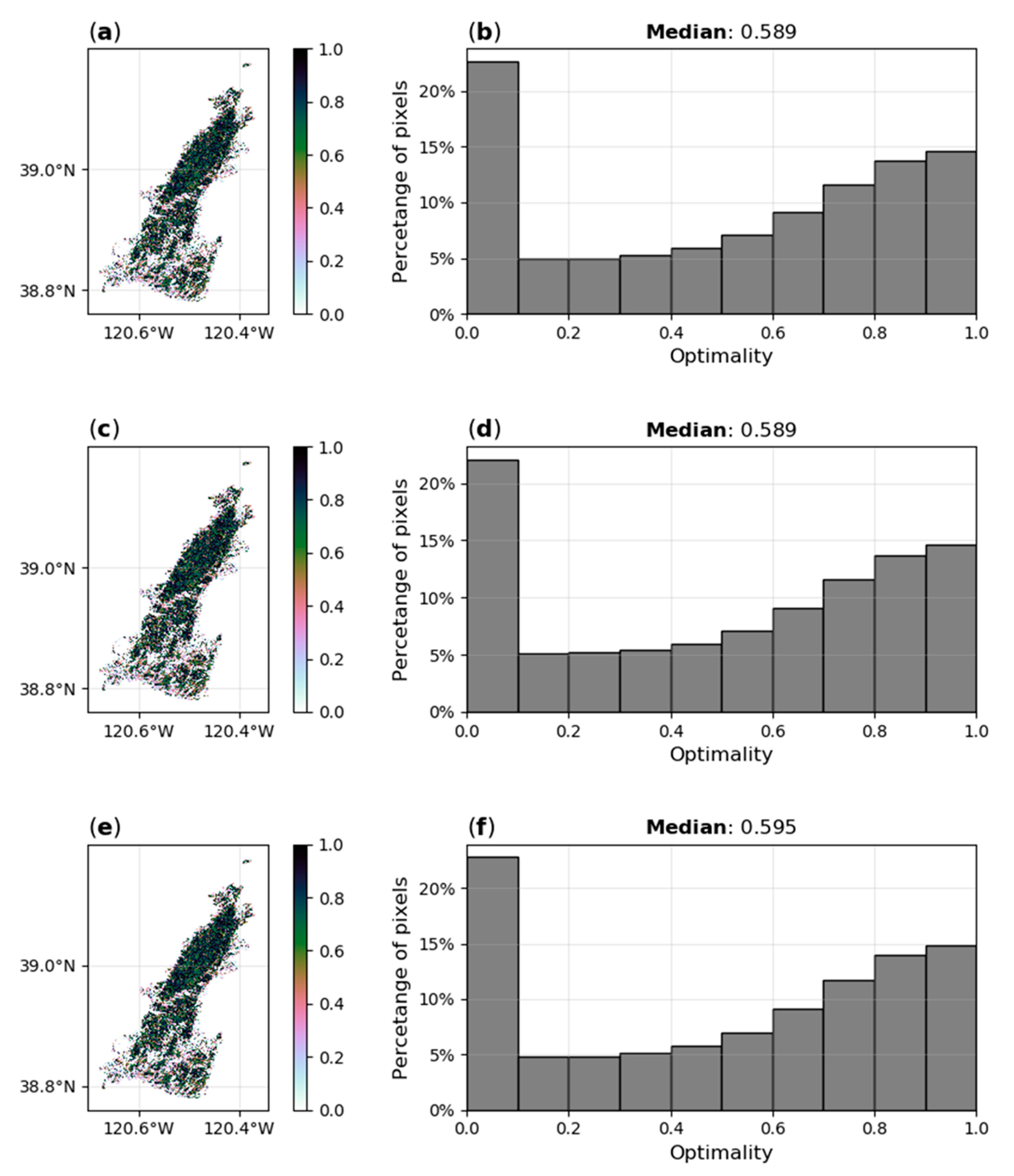
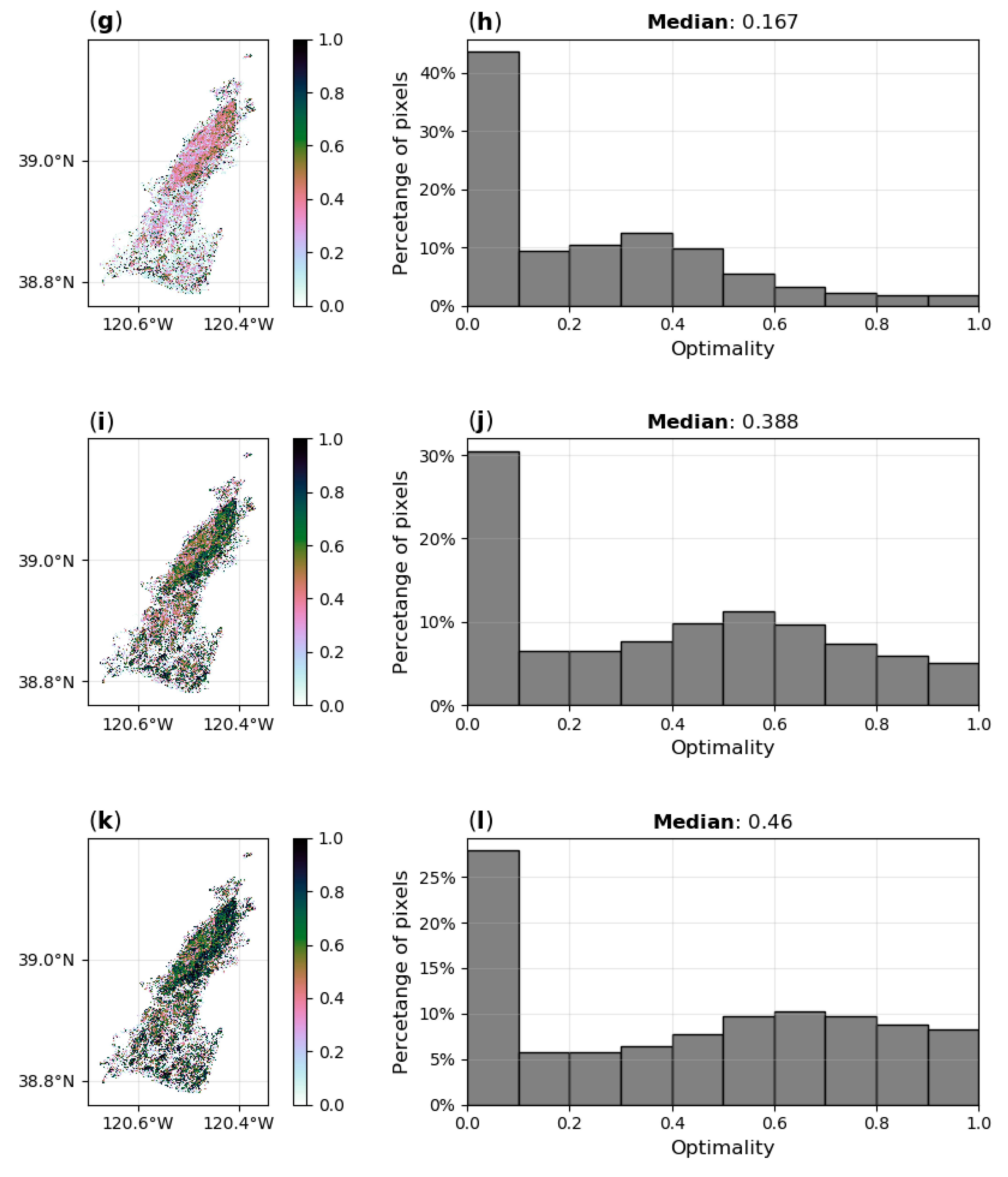
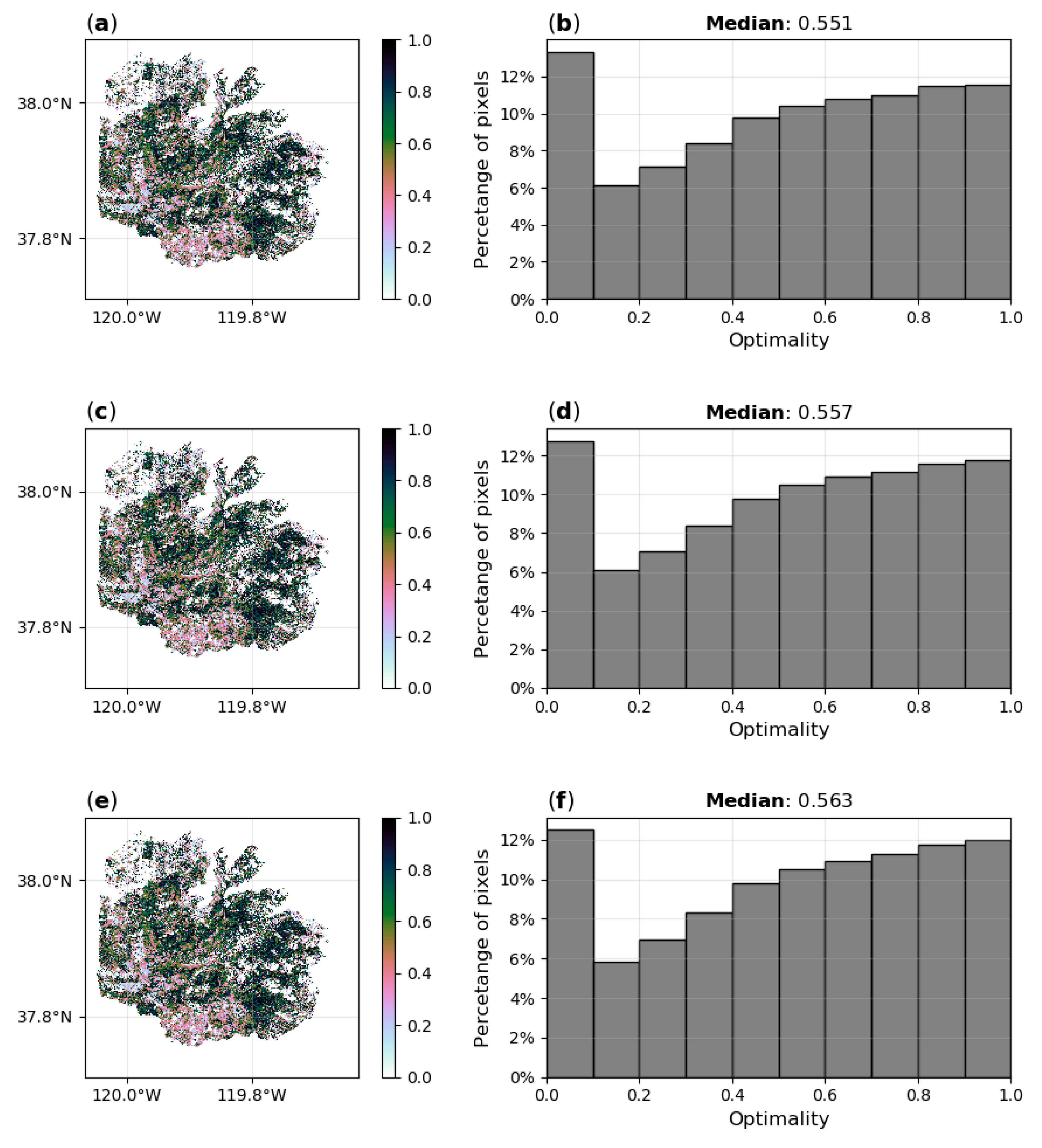
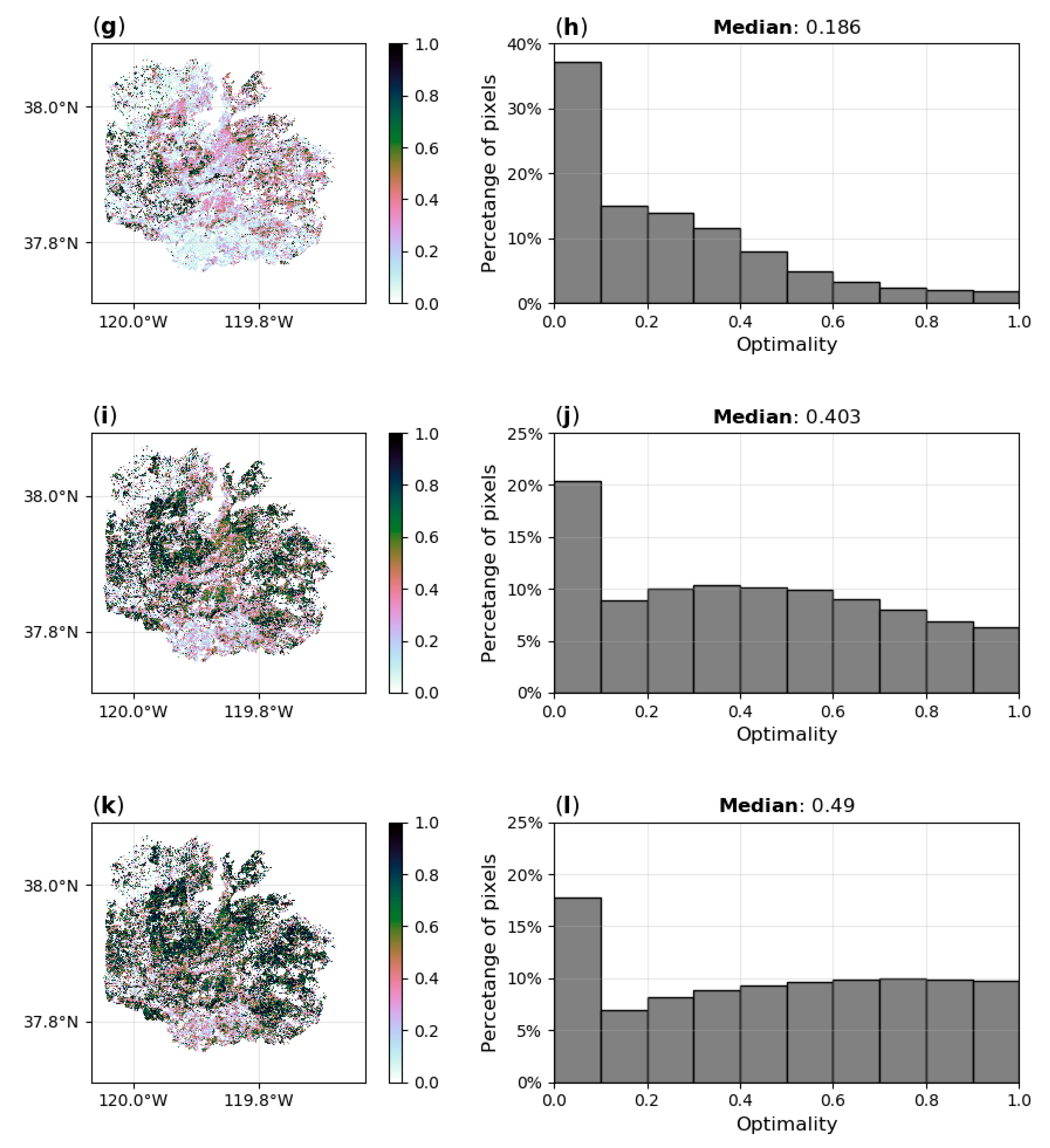
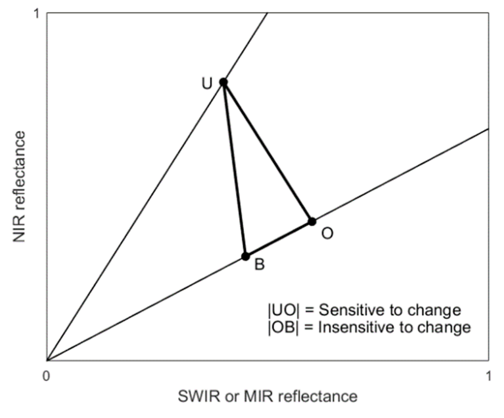
Fire severity, defined as the degree of environmental change caused by a fire, is a critical fire regime attribute of interest to fire emissions modelling and post-fire rehabilitation planning. Remotely sensed fire severity is traditionally assessed by the differenced normalized burn ratio (dNBR). This spectral index captures fire-induced reflectance changes in the near infrared (NIR) and short-wave infrared (SWIR) spectral regions. This study evaluates a spectral index based on a band combination including the NIR and mid infrared (MIR) spectral regions, the differenced normalized difference vegetation index with mid infrared (dNDVIMID), to assess fire severity. This evaluation capitalized upon the unique opportunity stemming from the pre- and post-fire airborne acquisitions over the Rim (2013) and King (2014) fires in California with the MODIS/ASTER Airborne Simulator (MASTER) instrument. The field data consist of 85 Geometrically structured Composite Burn Index (GeoCBI) plots. In addition, six different index combinations, respectively three with a NIR–SWIR combination and three with a NIR–MIR combination, were evaluated based on the optimality of fire-induced spectral displacements. The optimality statistic ranges between zero and one, with values of one representing pixel displacements that are unaffected by noise. The results show that the dNBR demonstrated a stronger relationship with GeoCBI field data when field measurements over the two fire scars were combined than the dNDVIMID approaches. The results yielded an R2 of 0.68 based on a saturated growth model for the best performing dNBR index, whereas the performance of the dNDVIMID indices was lower with an R2 = 0.61 for the best performing dNDVIMID index. The dNBR also outperformed the dNDVIMID in terms of spectral optimality across both fires. The best performing dNBR index yielded median optimality statistics of 0.56 over the Rim and 0.60 over the King fire. The best performing dNDVIMID index recorded optimality values of 0.49 over the Rim and 0.46 over the King fire. We also found that the dNBR approach led to considerable differences in the form of the relationship with the GeoCBI between the two fires, whereas the dNDVIMID approach yielded comparable relationships with the GeoCBI over the two fires. This suggests that the dNDVIMID approach, despite its slightly lower performance than the dNBR, may be a more robust method for estimating and comparing fire severity over large regions. This premise needs additional verification when more air- or spaceborne imagery with NIR and MIR bands will become available with a spatial resolution that allows ground truthing of fire severity.
Keywords: fire severity; differenced normalized burn ratio; composite burn index; optimality; wildfires; remote sensing fire severity; differenced normalized burn ratio; composite burn index; optimality; wildfires; remote sensing
Graphical Abstract