Article

Estimation of Vertical Fuel Layers in Tree Crowns Using High Density LiDAR Data
1
Integrated Remote Sensing Studio, Department of Forest Resources Management, University of British Columbia, Vancouver, BC V6T 1Z4, Canada
2
Tree Ring Lab, Department of Forest and Conservation Sciences, University of British Columbia, Vancouver, BC V6T 1Z4, Canada
3
FYBR Solutions Inc., 211 E Georgia St #305, Vancouver, BC V6A 1Z6, Canada
*
Author to whom correspondence should be addressed.
Remote Sens. 2021, 13(22), 4598; https://doi.org/10.3390/rs13224598
Submission received: 29 September 2021 / Revised: 8 November 2021 / Accepted: 11 November 2021 / Published: 16 November 2021
(This article belongs to the Special Issue Advances in Forest Fire Behaviour Modelling Using Remote Sensing)

Abstract

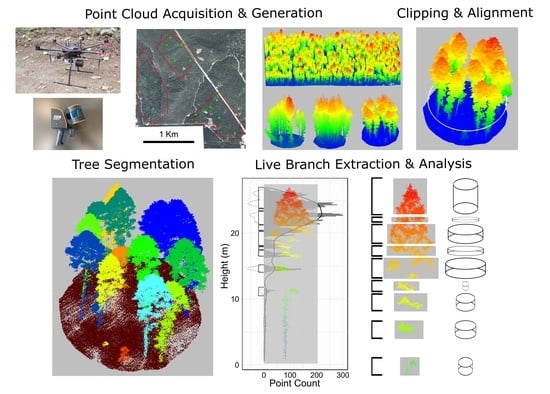
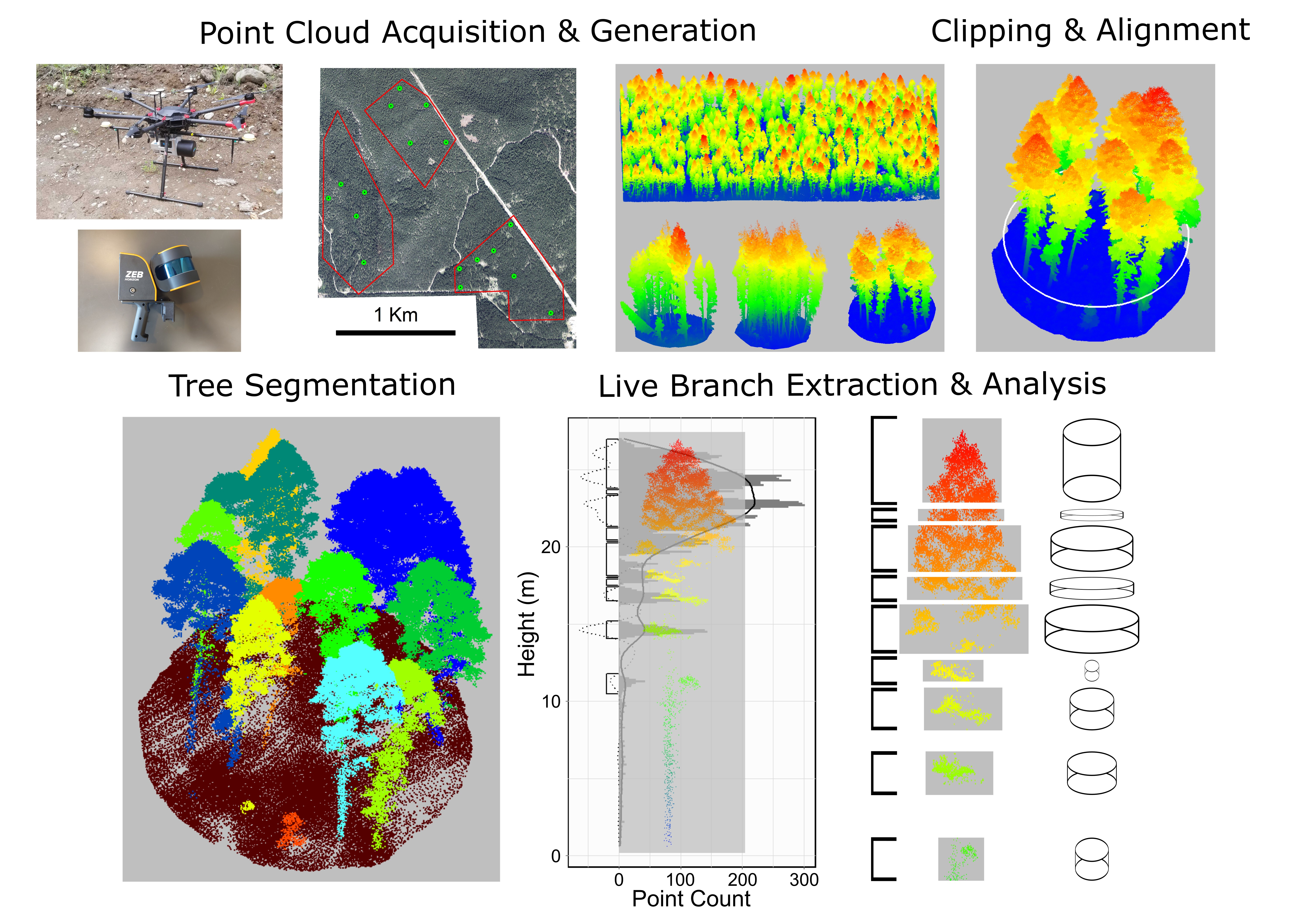
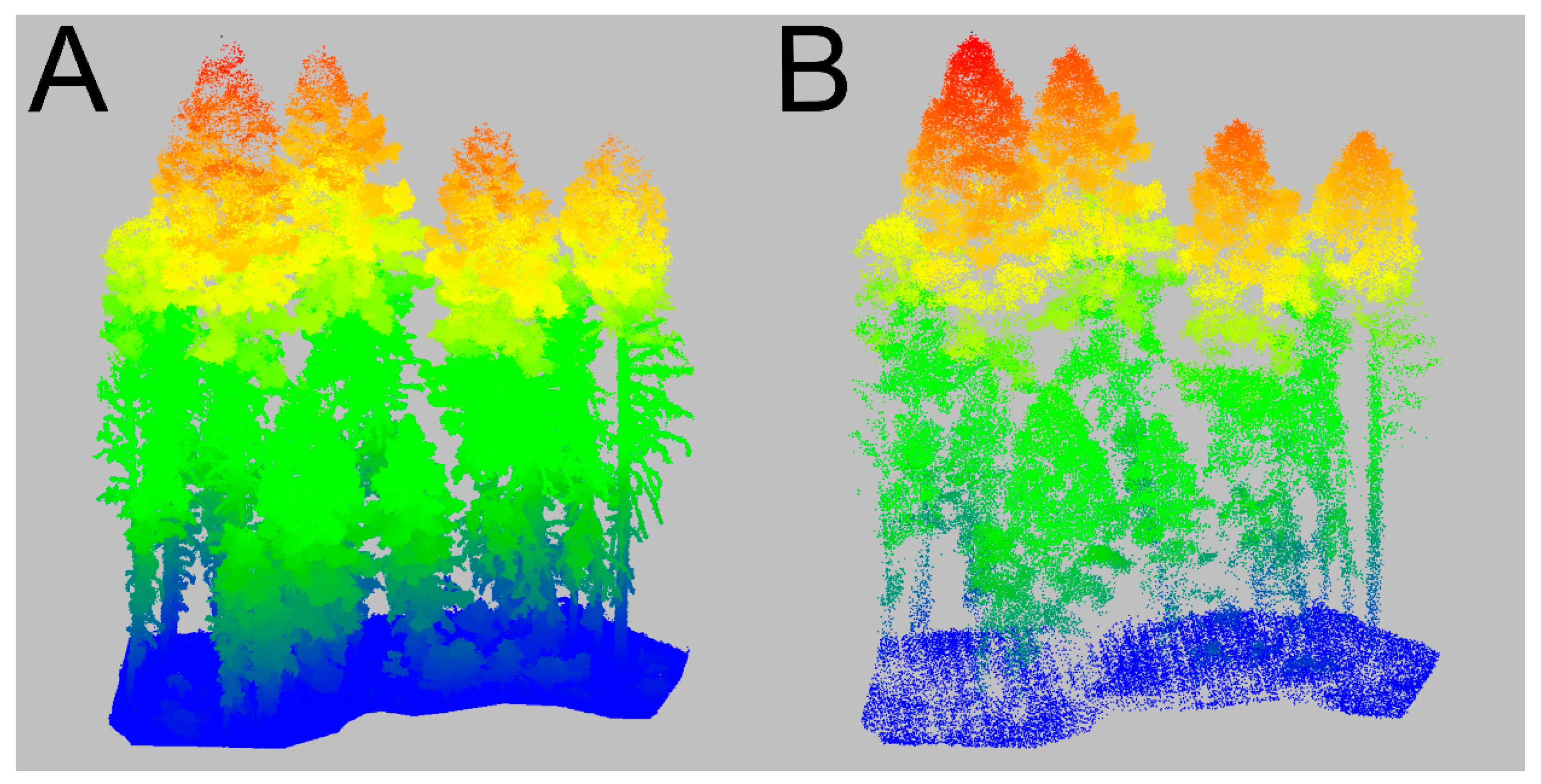
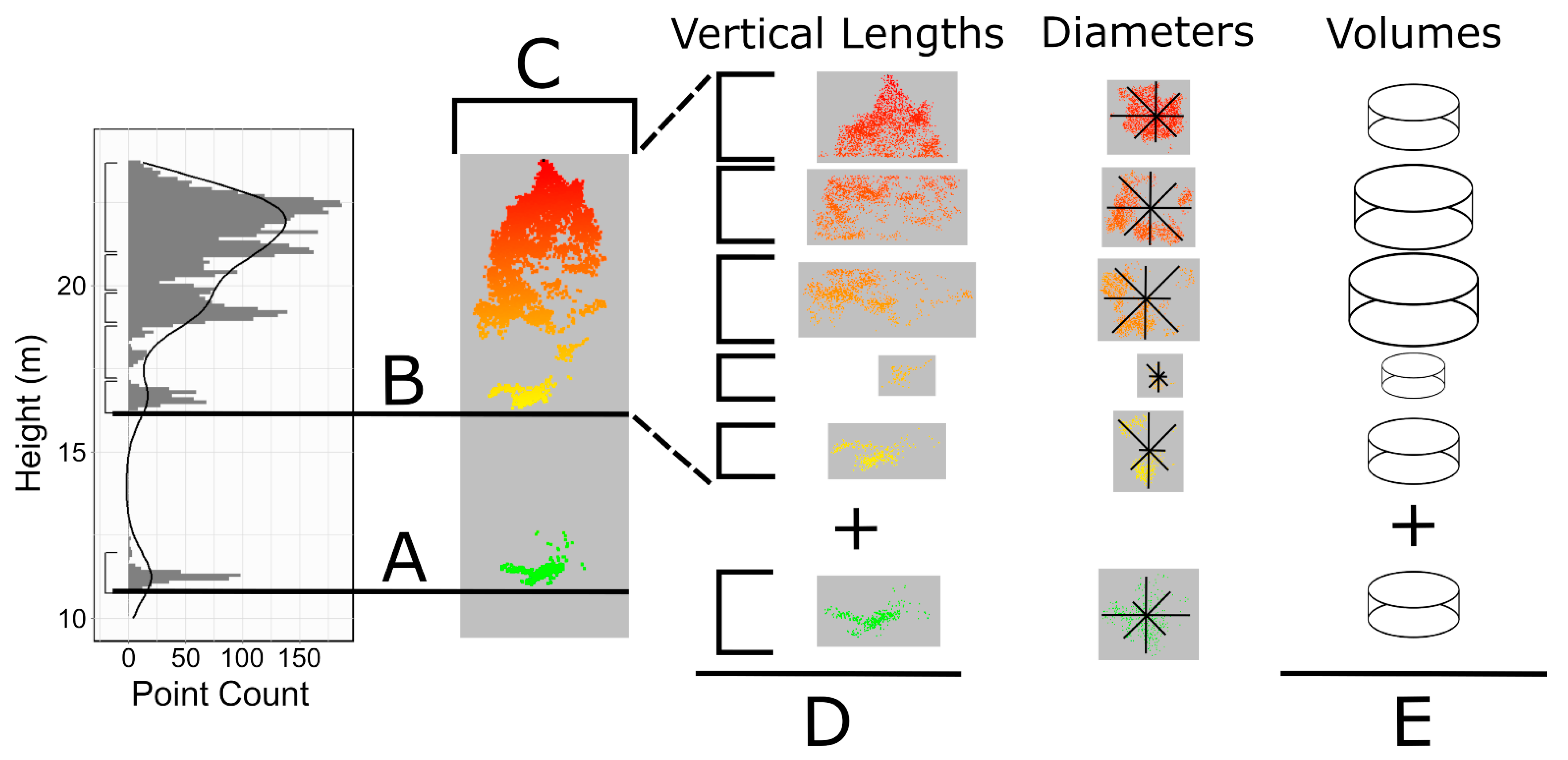
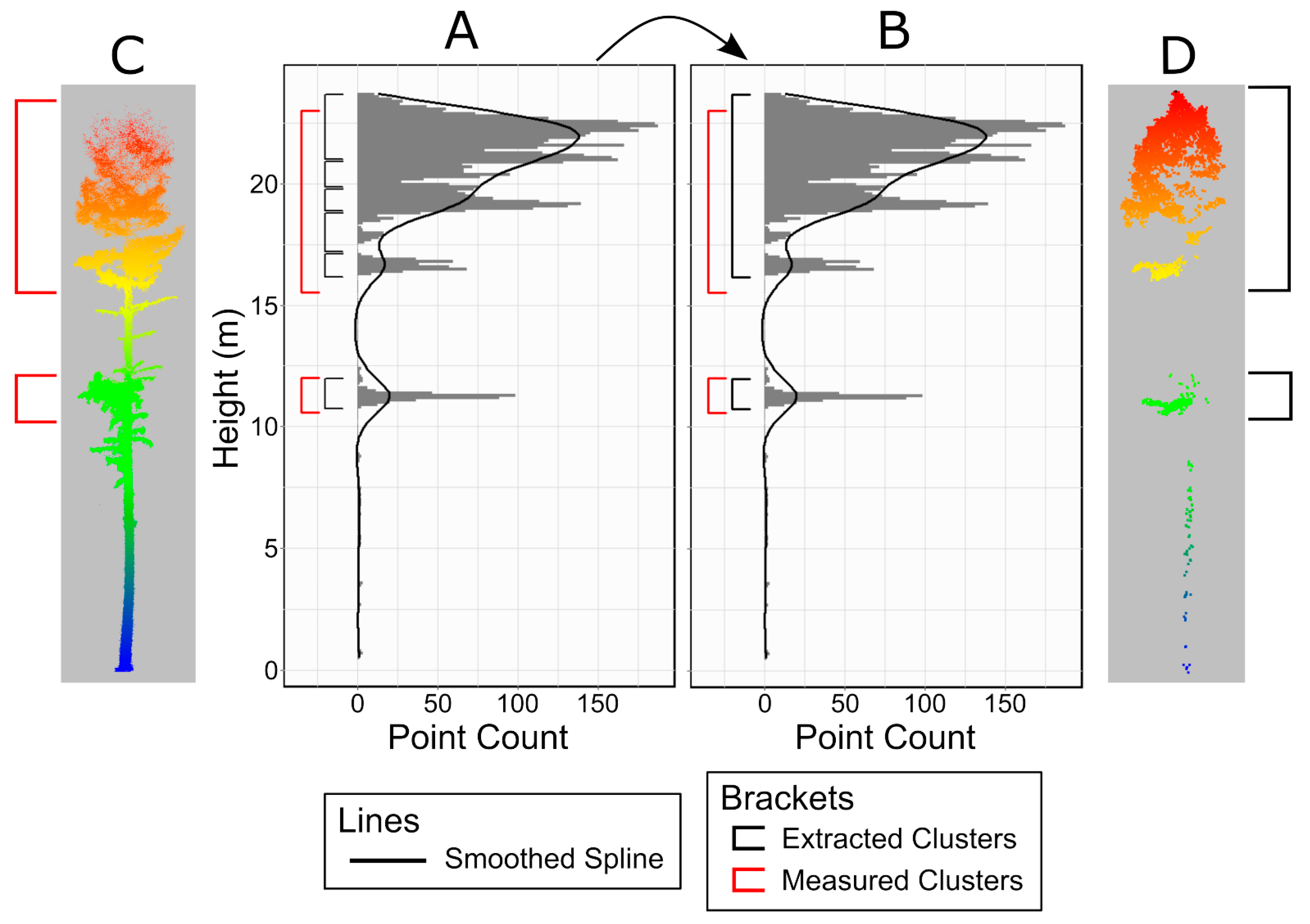
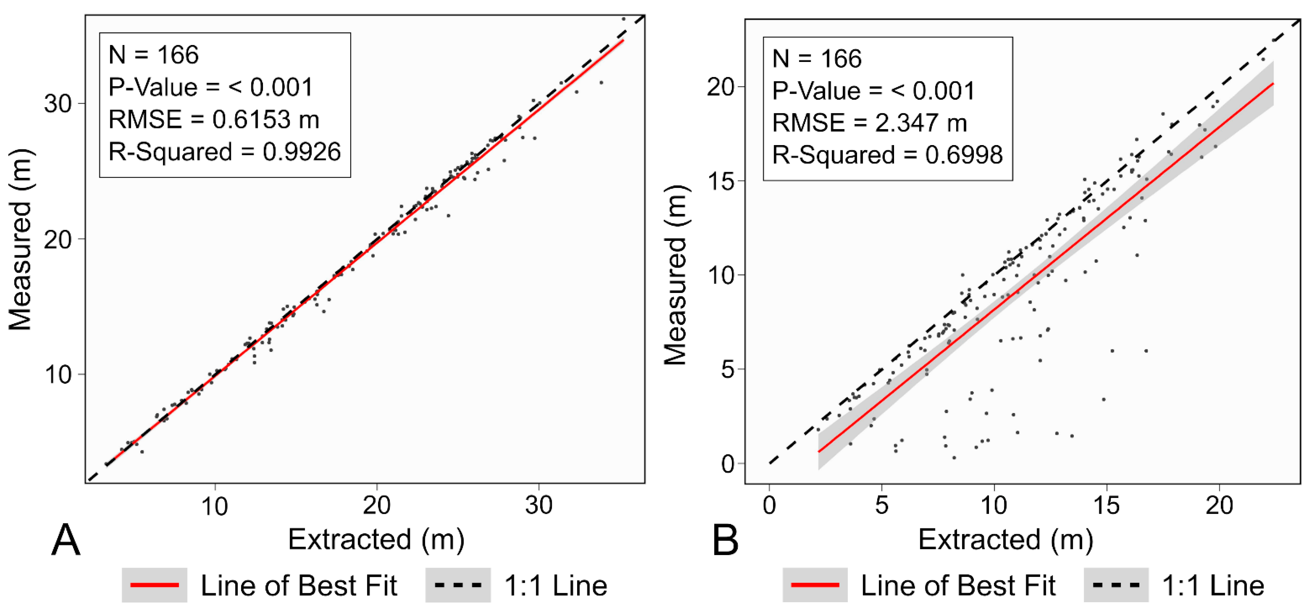
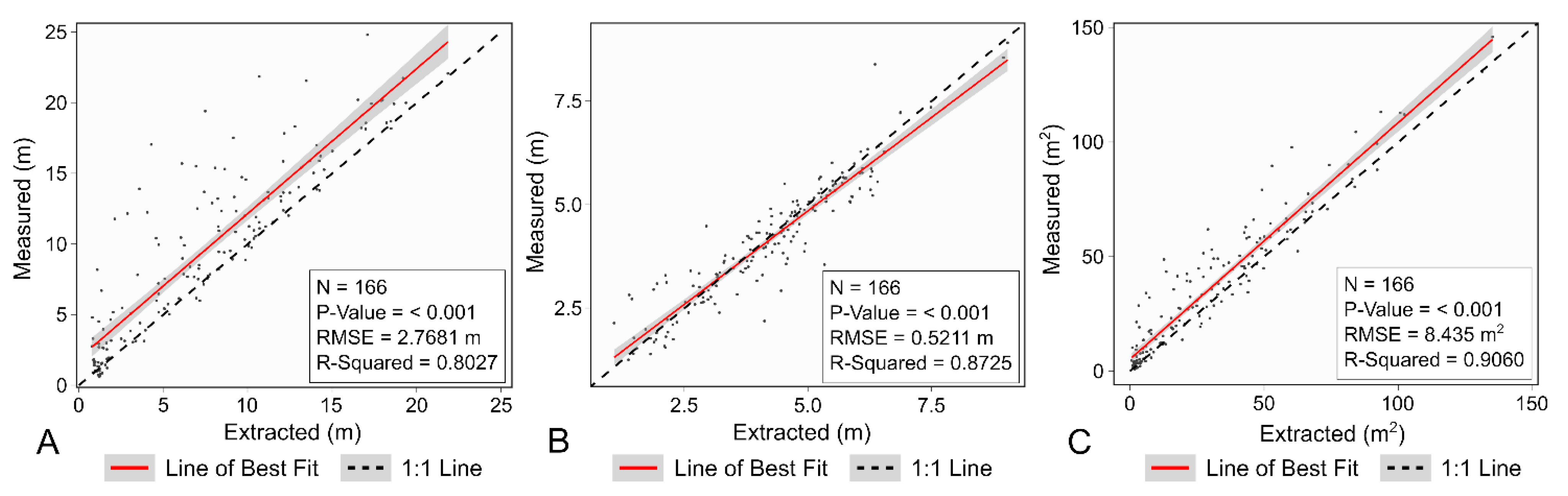
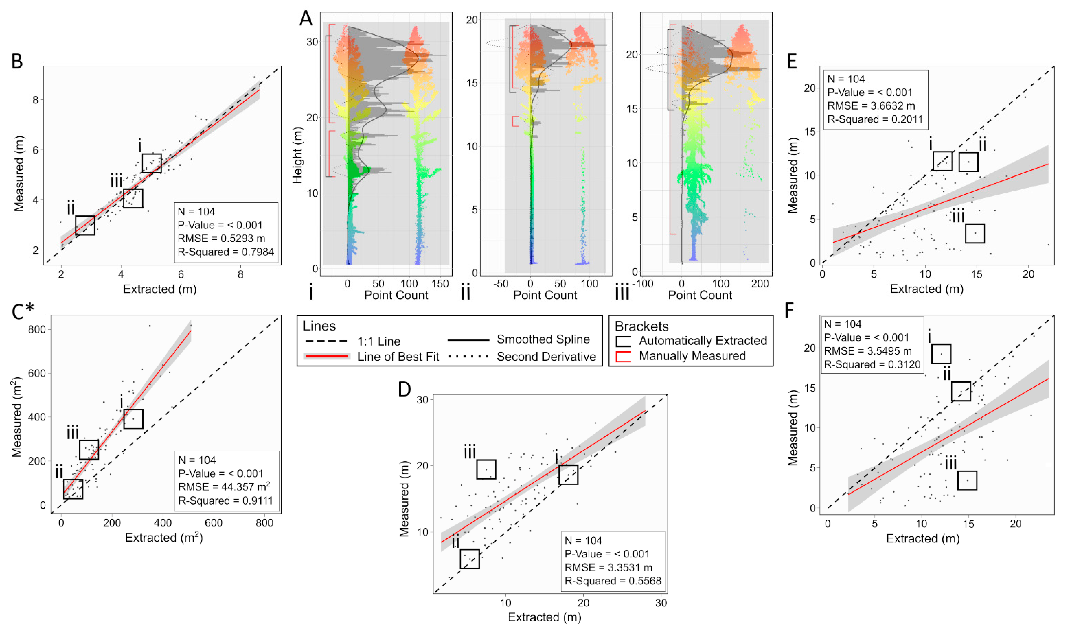
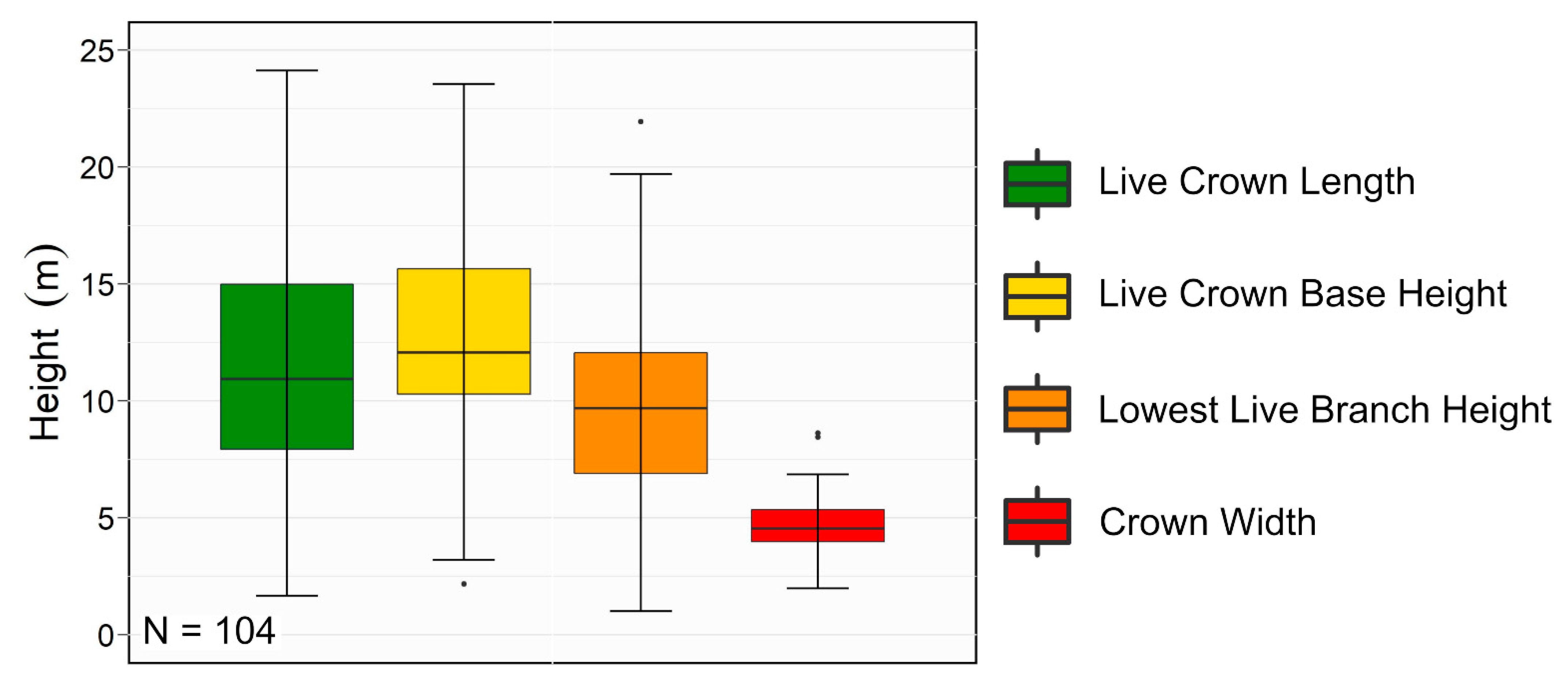
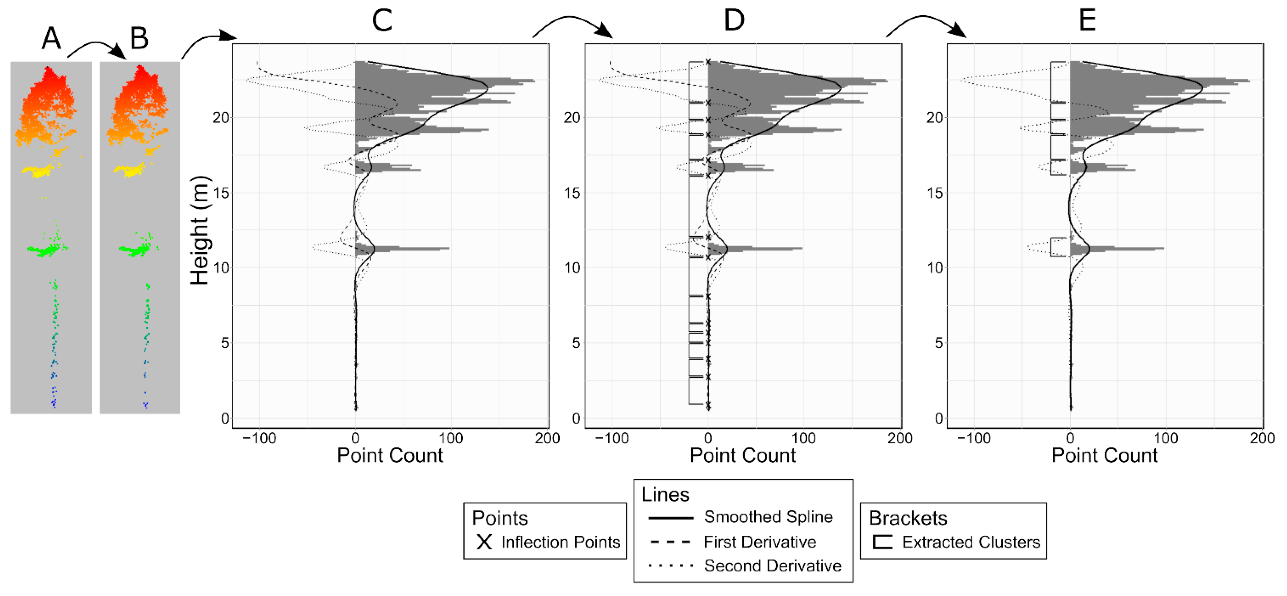
The accurate prediction and mitigation of wildfire behaviour relies on accurate estimations of forest canopy fuels. New techniques to collect LiDAR point clouds from remotely piloted aerial systems (RPAS) allow for the prediction of forest fuels at extremely fine scales. This study uses a new method to examine the ability of such point clouds to characterize the vertical arrangement and volume of crown fuels from within individual trees. This method uses the density and vertical arrangement of LiDAR points to automatically extract and measure the dimensions of each cluster of vertical fuel. The amount and dimensions of these extracted clusters were compared against manually measured clusters that were collected through the manual measurement of over 100 trees. This validation dataset was composed of manual point cloud measurements for all portions of living crown fuel for each tree. The point clouds used for this were ground-based LiDAR point clouds that were ~80 times denser than the RPAS LiDAR point clouds. Over 96% of the extracted clusters were successfully matched to a manually measured cluster, representing ~97% of the extracted volume. A smaller percentage of the manually measured clusters (~79%) were matched to an extracted cluster, although these represented ~99% of the total measured volume. The vertical arrangement and dimensions of the matched clusters corresponded strongly to one another, although the automated method generally overpredicted each cluster’s lower boundary. Tree-level volumes and crown width were, respectively, predicted with R-squared values of 0.9111 and 0.7984 and RMSE values of 44.36 m2 and 0.53 m. Weaker relationships were observed for tree-level metrics that relied on the extraction of lower crown features (live crown length, live crown base height, lowest live branch height). These metrics were predicted with R-squared values of 0.5568, 0.3120, and 0.2011 and RMSE values of 3.53 m, 3.55 m, and 3.66 m. Overall, this study highlights strengths and weaknesses of the developed method and the utility of RPAS LiDAR point clouds relative to ground-based point clouds.
Keywords: forest fire; fuels; LiDAR; RPAS; fire behaviour; individual tree forest fire; fuels; LiDAR; RPAS; fire behaviour; individual tree
Graphical Abstract