Article

Predicting the Impact of Future Land Use and Climate Change on Potential Soil Erosion Risk in an Urban District of the Harare Metropolitan Province, Zimbabwe

by
Andrew K. Marondedze
* and
Brigitta Schütt
Physical Geography, Institute of Geographical Sciences, Freie Universität Berlin, 12449 Berlin, Germany
*
Author to whom correspondence should be addressed.
Remote Sens. 2021, 13(21), 4360; https://doi.org/10.3390/rs13214360
Submission received: 17 September 2021 / Revised: 21 October 2021 / Accepted: 26 October 2021 / Published: 29 October 2021
(This article belongs to the Topic Climate Change and Environmental Sustainability)

Abstract

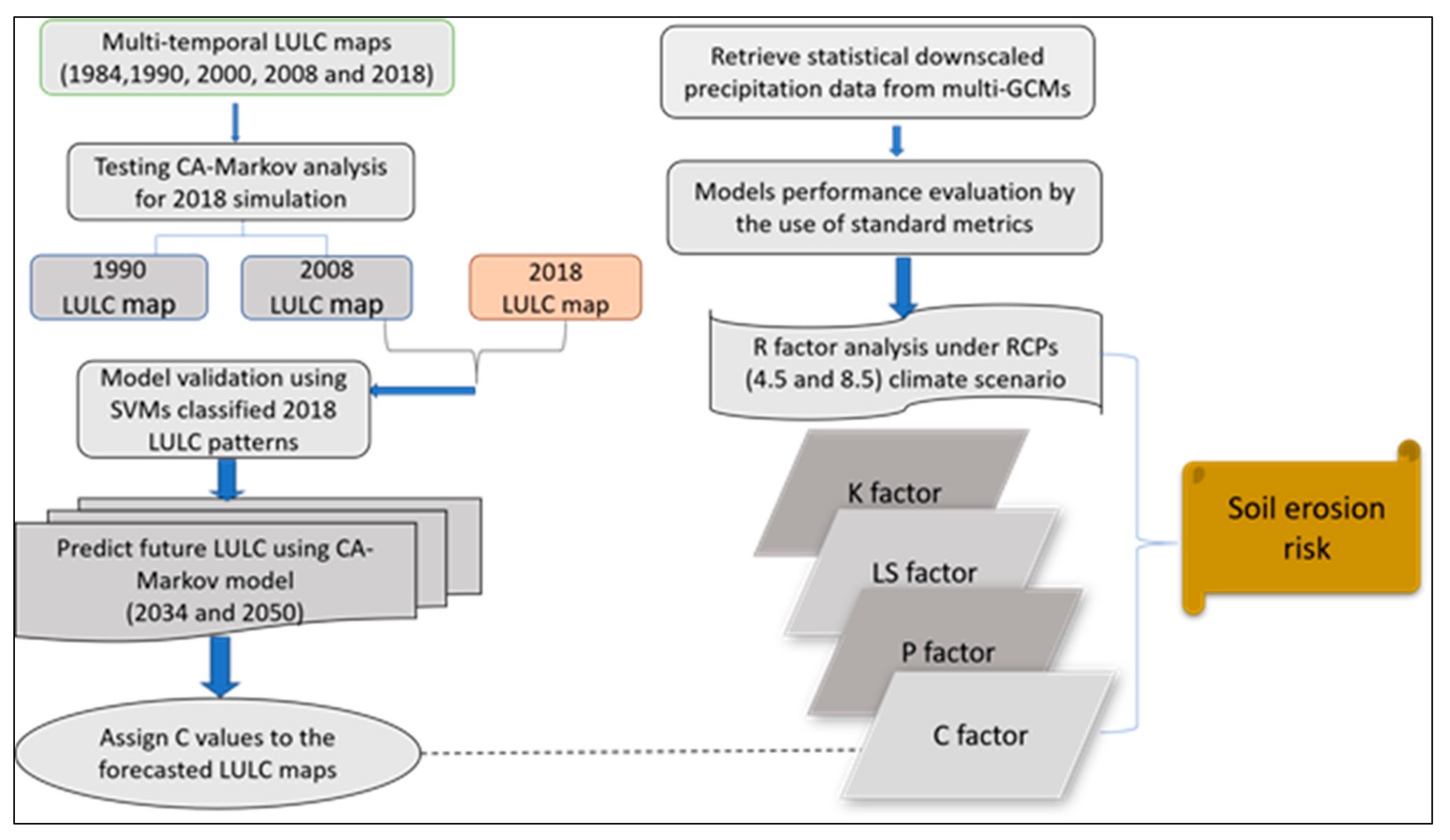
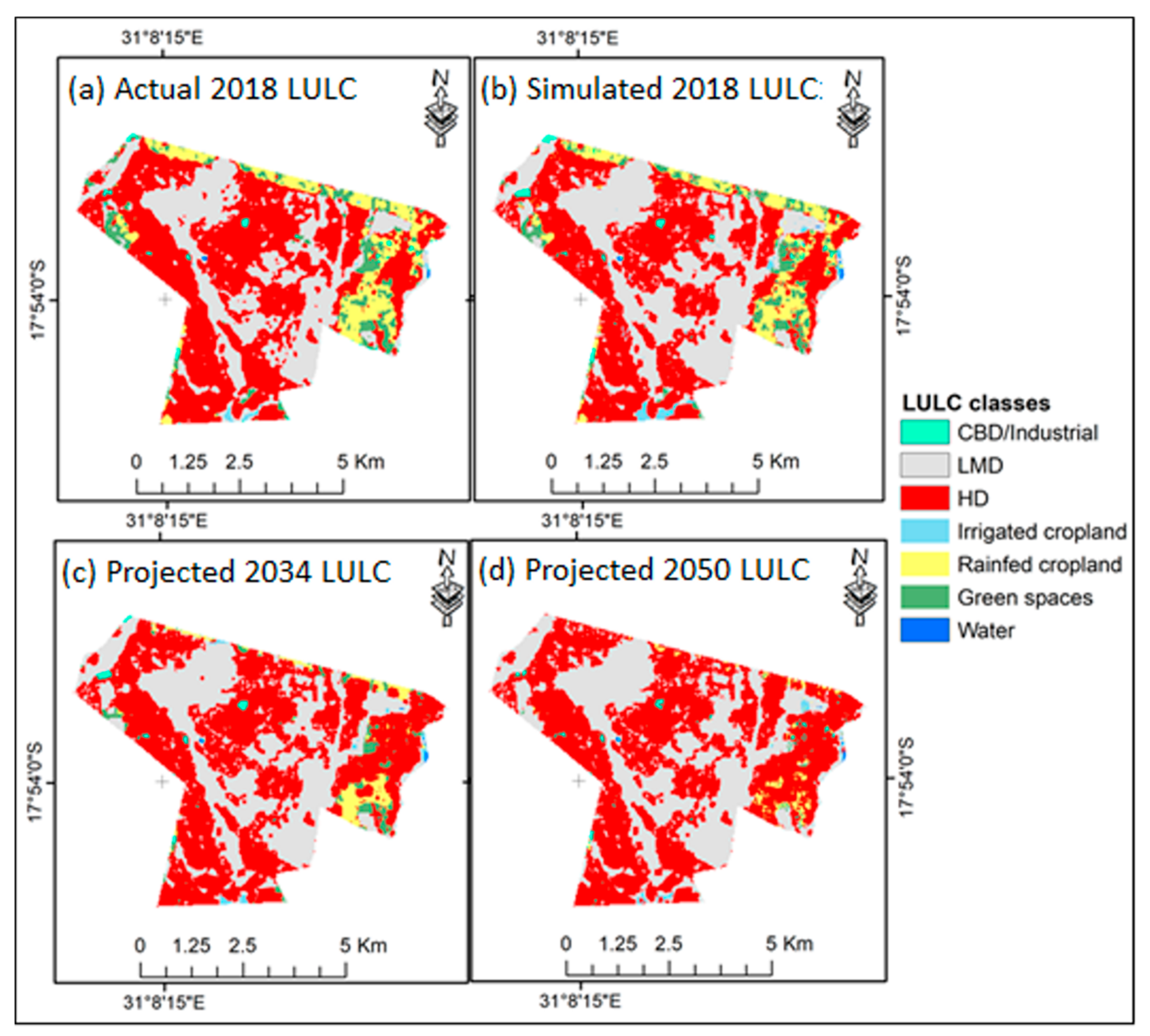
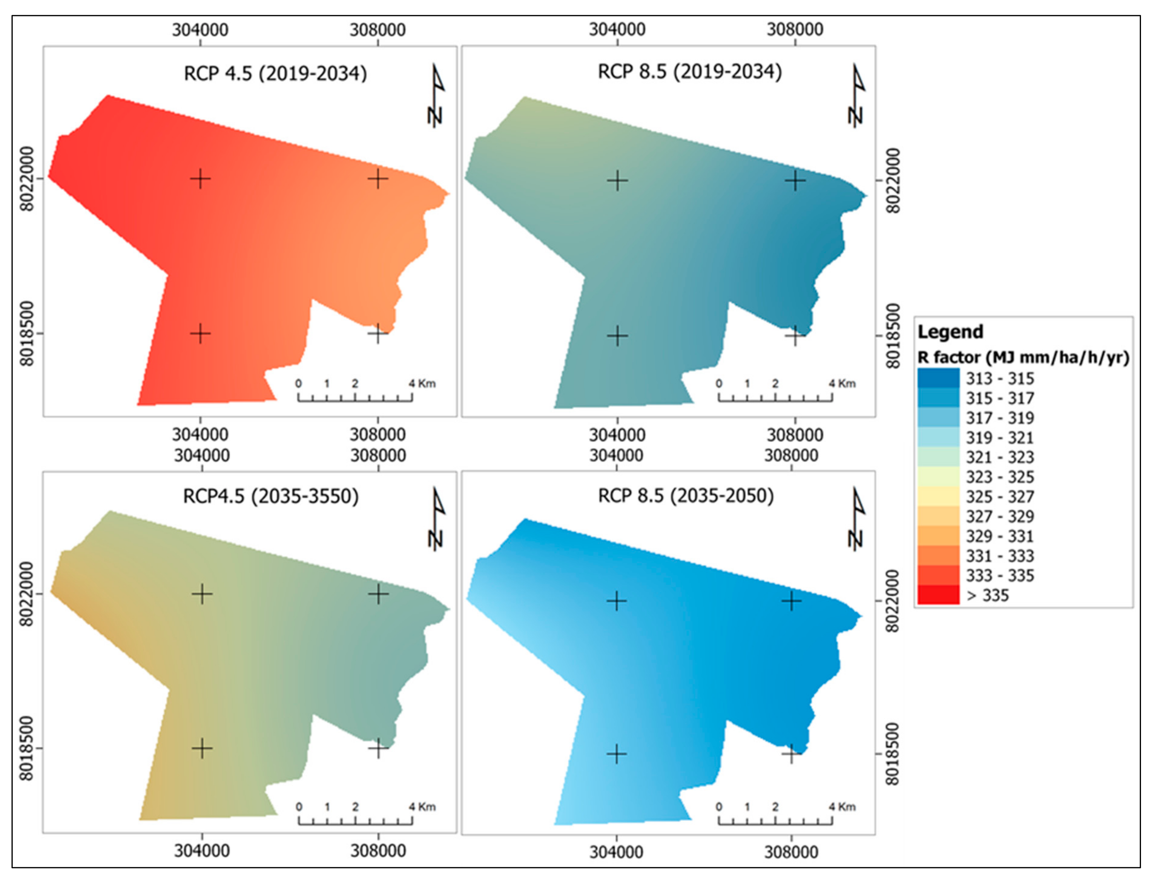
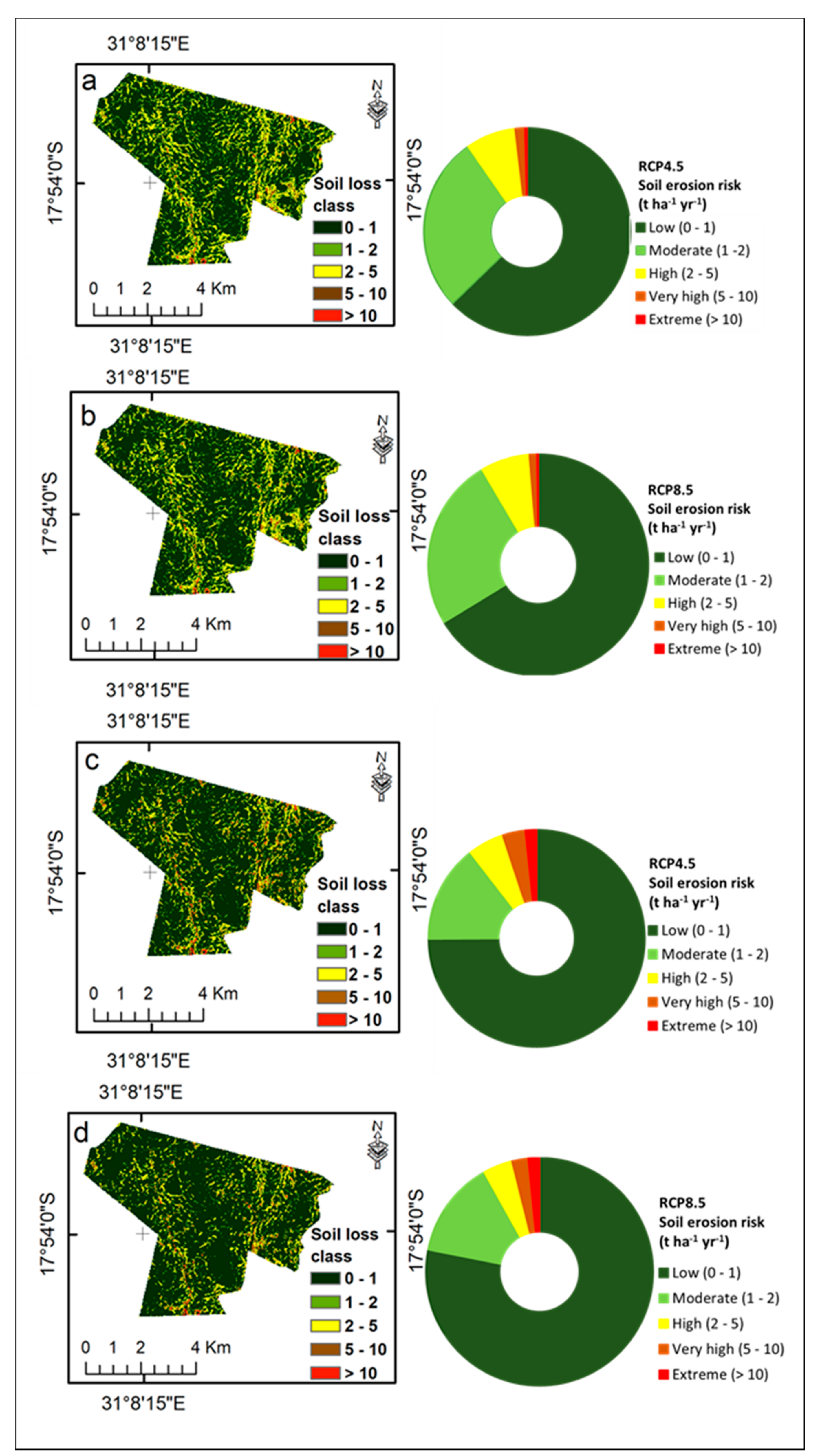
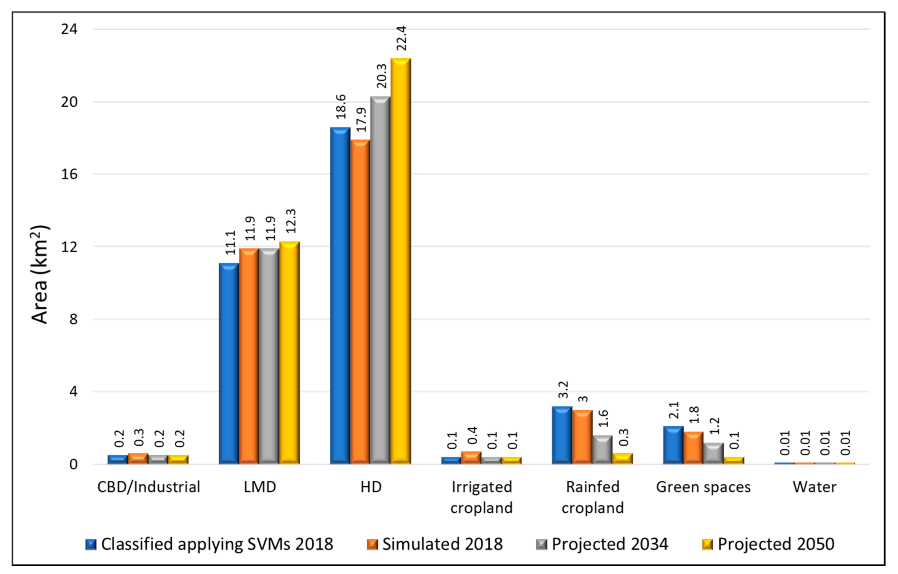
Monitoring urban area expansion through multispectral remotely sensed data and other geomatics techniques is fundamental for sustainable urban planning. Forecasting of future land use land cover (LULC) change for the years 2034 and 2050 was performed using the Cellular Automata Markov model for the current fast-growing Epworth district of the Harare Metropolitan Province, Zimbabwe. The stochastic CA–Markov modelling procedure validation yielded kappa statistics above 80%, ascertaining good agreement. The spatial distribution of the LULC classes CBD/Industrial area, water and irrigated croplands as projected for 2034 and 2050 show slight notable changes. For projected scenarios in 2034 and 2050, low–medium-density residential areas are predicted to increase from 11.1 km2 to 12.3 km2 between 2018 and 2050. Similarly, high-density residential areas are predicted to increase from 18.6 km2 to 22.4 km2 between 2018 and 2050. Assessment of the effects of future climate change on potential soil erosion risk for Epworth district were undertaken by applying the representative concentration pathways (RCP4.5 and RCP8.5) climate scenarios, and model ensemble averages from multiple general circulation models (GCMs) were used to derive the rainfall erosivity factor for the RUSLE model. Average soil loss rates for both climate scenarios, RCP4.5 and RCP8.5, were predicted to be high in 2034 due to the large spatial area extent of croplands and disturbed green spaces exposed to soil erosion processes, therefore increasing potential soil erosion risk, with RCP4.5 having more impact than RCP8.5 due to a higher applied rainfall erosivity. For 2050, the predicted wide area average soil loss rates declined for both climate scenarios RCP4.5 and RCP8.5, following the predicted decline in rainfall erosivity and vulnerable areas that are erodible. Overall, high potential soil erosion risk was predicted along the flanks of the drainage network for both RCP4.5 and RCP8.5 climate scenarios in 2050.
Keywords: land use land cover (LULC); Cellular Automata Markov model; representative concentration pathways; climate scenarios land use land cover (LULC); Cellular Automata Markov model; representative concentration pathways; climate scenarios