Article

Spatio-Temporal Simulation of Mangrove Forests under Different Scenarios: A Case Study of Mangrove Protected Areas, Hainan Island, China
1
International Research Center of Big Data for Sustainable Development Goals, Aerospace Information Research Institute, Chinese Academy of Sciences, Beijing 100094, China
2
University of Chinese Academy of Sciences, Beijing 100049, China
3
Key Laboratory of Earth Observation Hainan Province, Hainan 572029, China
*
Author to whom correspondence should be addressed.
Remote Sens. 2021, 13(20), 4059; https://doi.org/10.3390/rs13204059
Submission received: 1 September 2021 / Revised: 2 October 2021 / Accepted: 5 October 2021 / Published: 11 October 2021
(This article belongs to the Special Issue Remote Sensing in Mangroves II)

Abstract

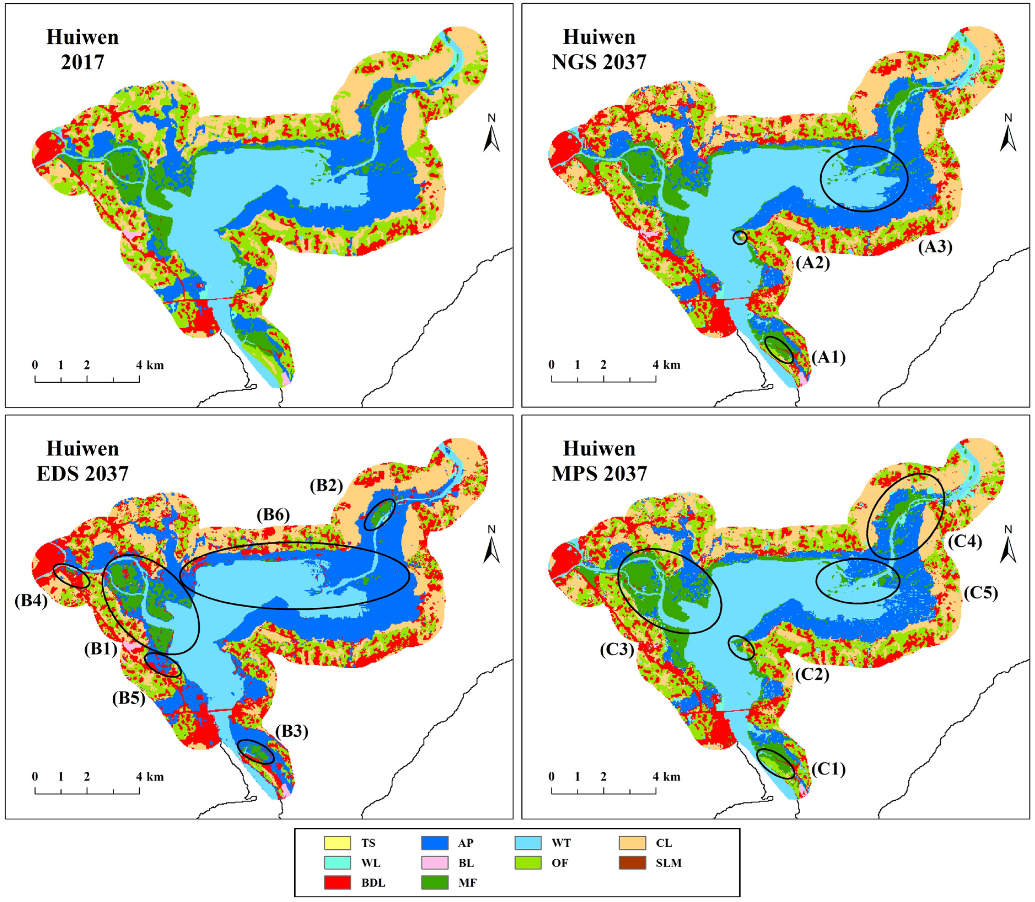
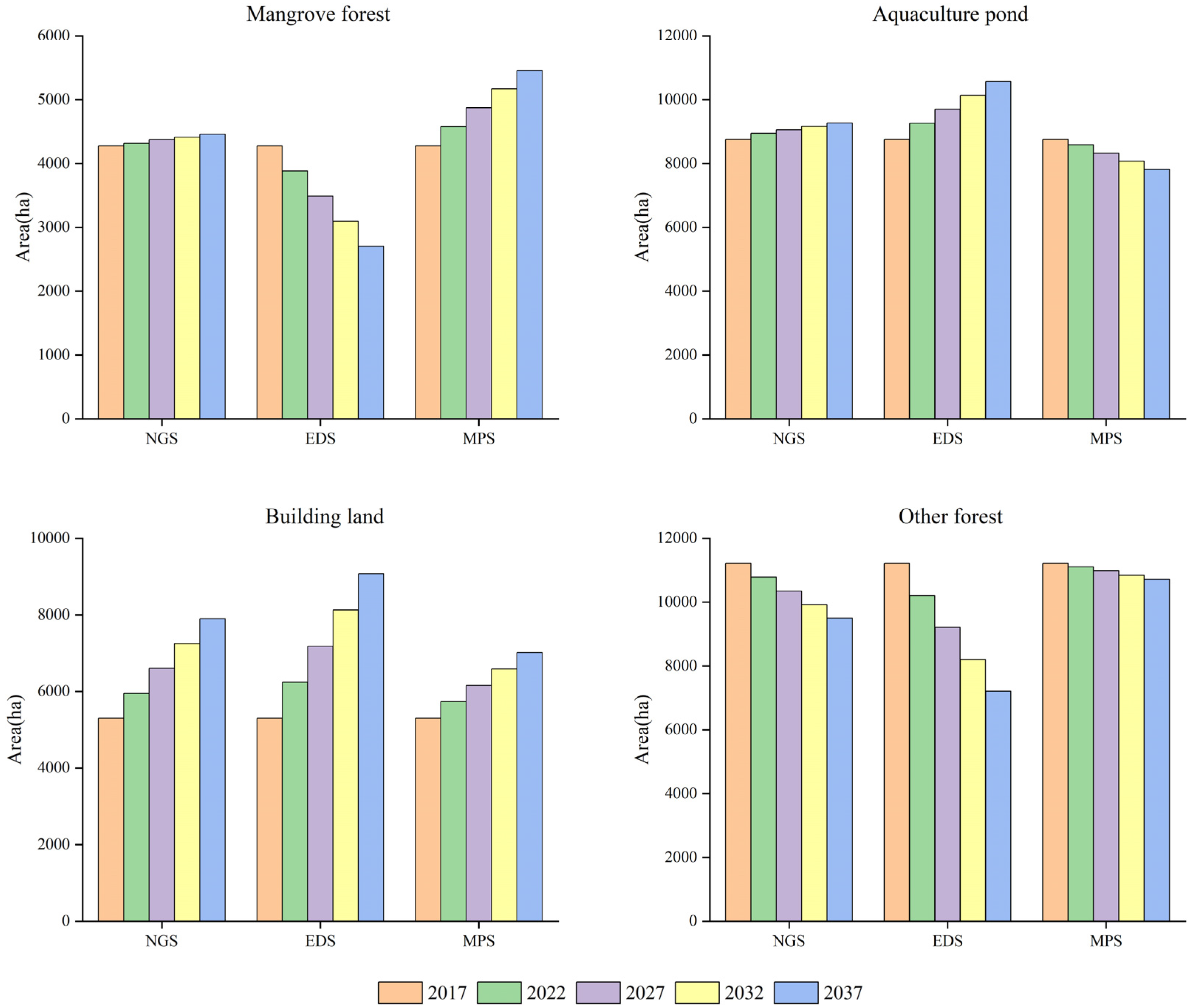
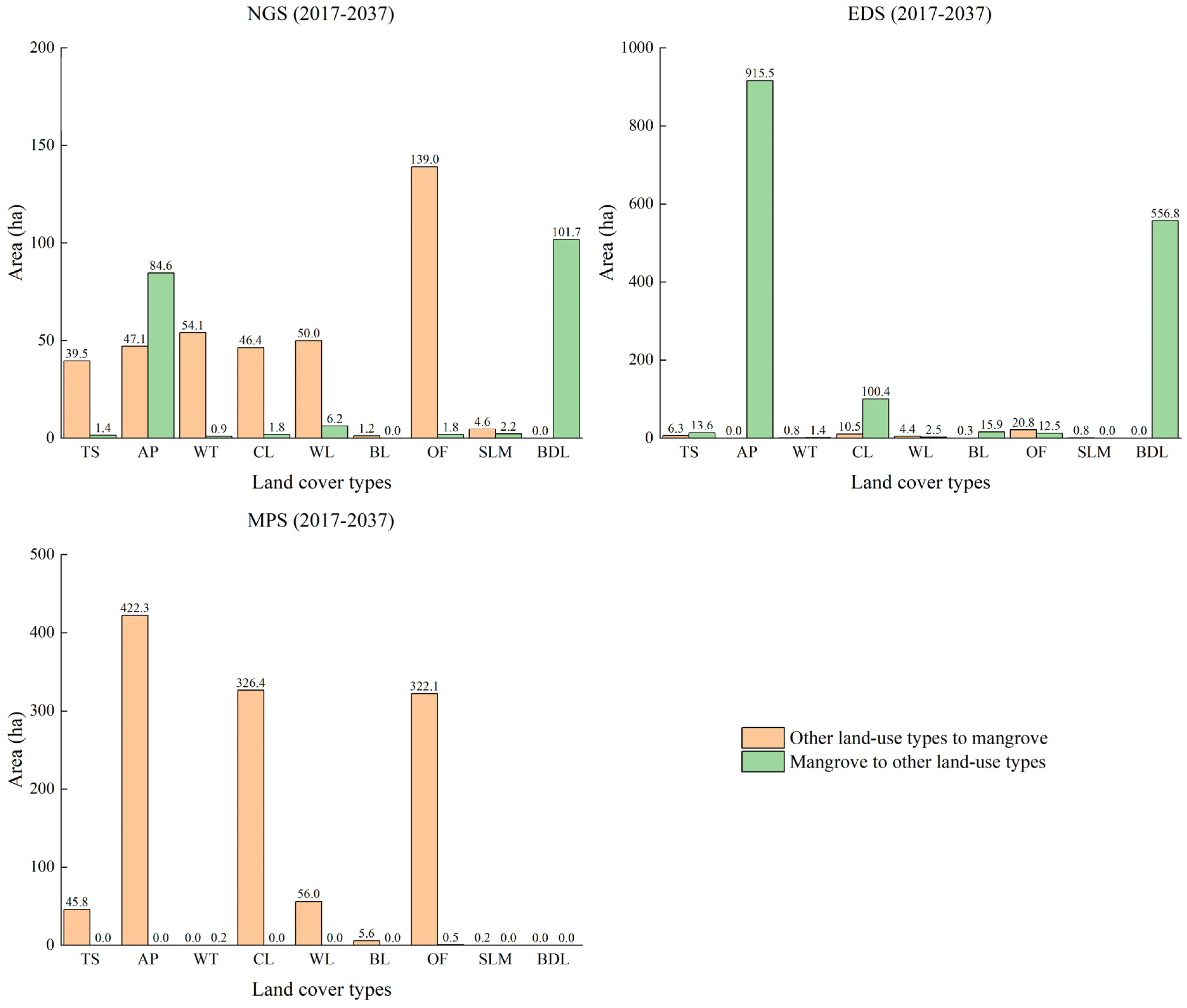
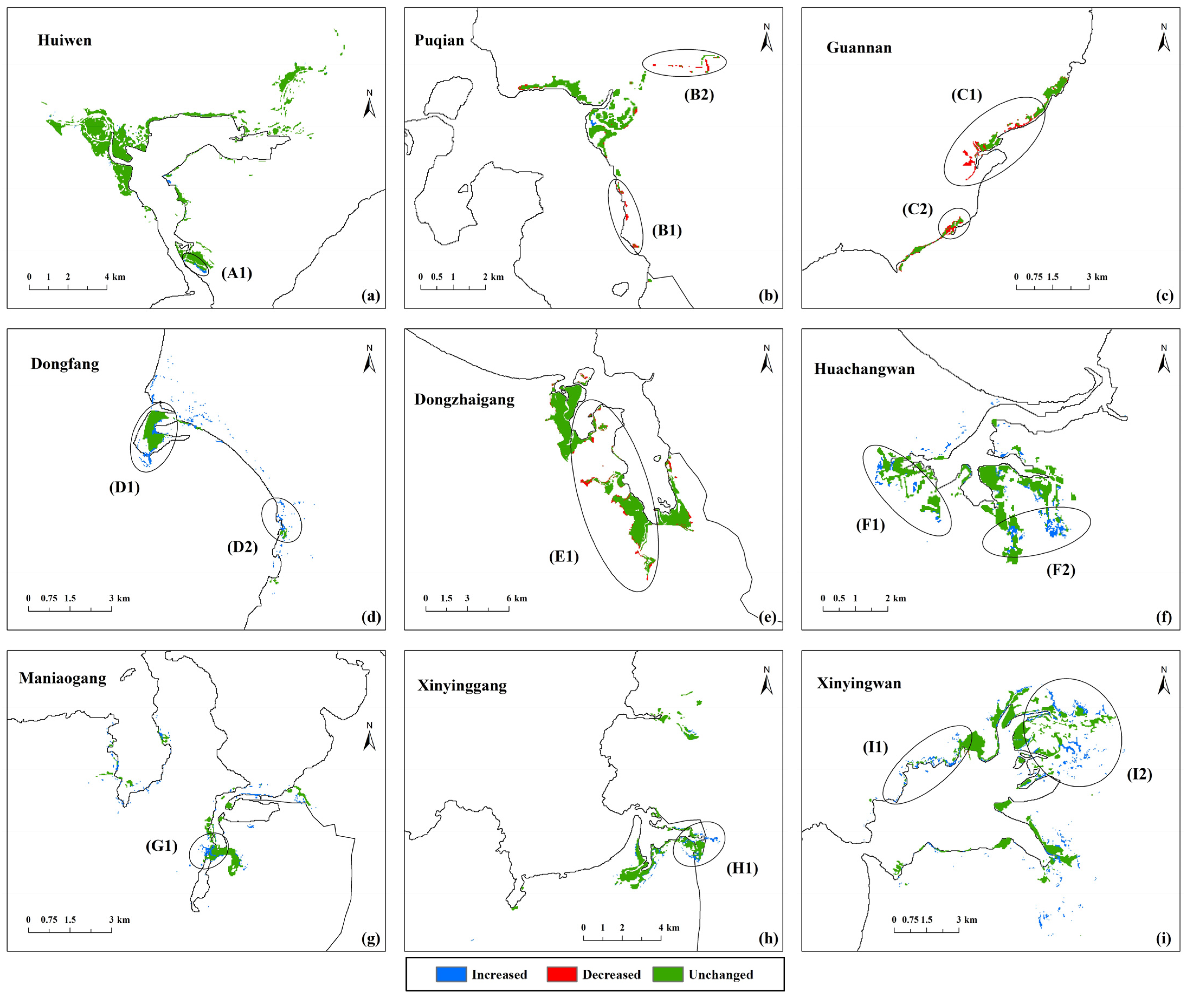
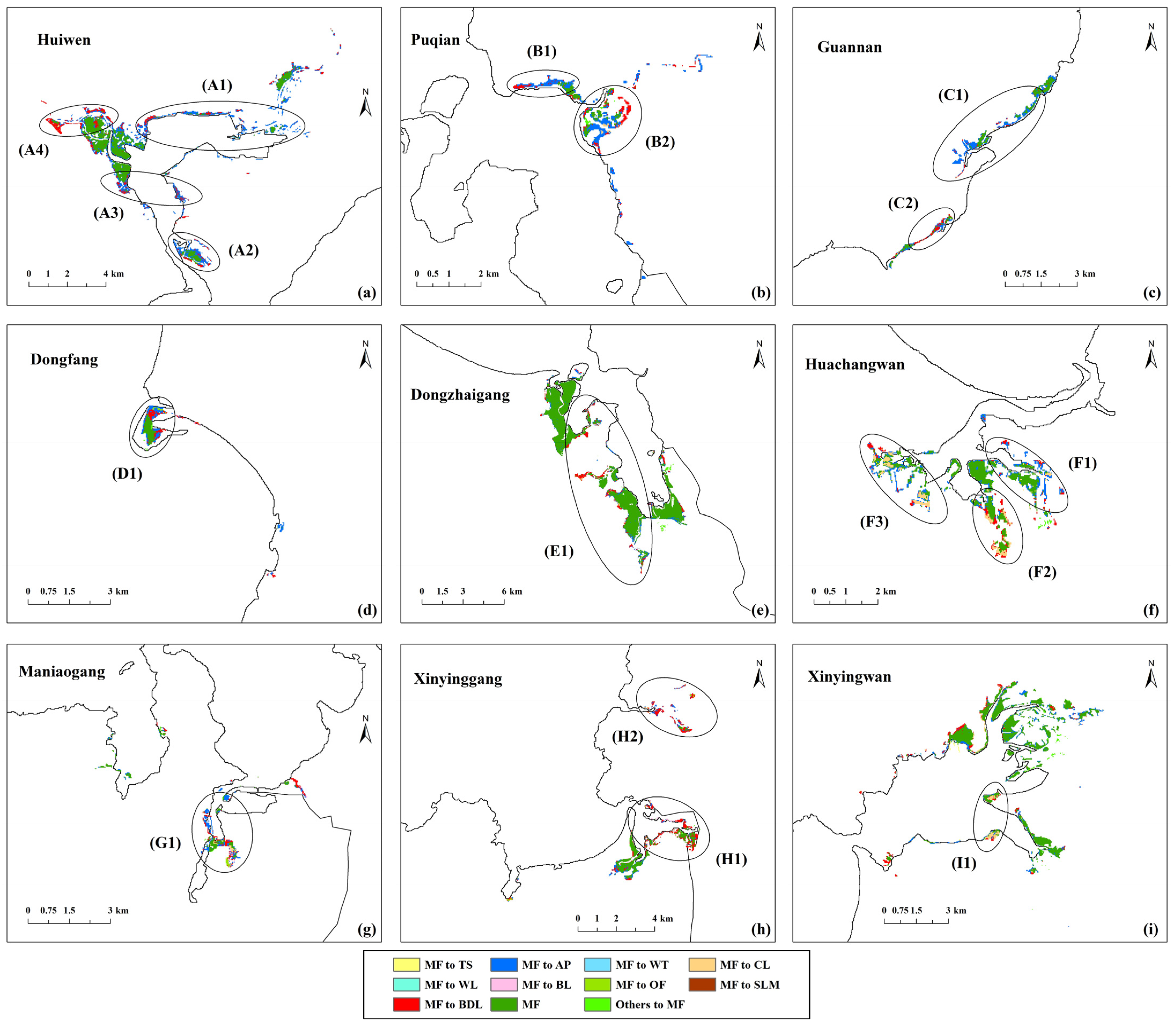
Mangrove forests are important woody plant communities that grow in the intertidal zone between land and sea. They provide important social, ecological and economic services to coastal areas. In recent years, the growth environment of mangrove forests has been threatened. Mangrove forests have become one of the most endangered ecosystems in the world. To better protect mangrove forests, effective monitoring methods are essential. In this study, a spatio-temporal simulation method for mangrove forests was proposed in the mangrove protected areas of Hainan Island, China. This method compared the simulation accuracy of different models in terms of spatial characteristics, evaluated the applicability of driving factors in mangrove simulation and predicted the future spatio-temporal distribution and change trends of mangrove forests under different scenarios. The simulation results of different models showed that AutoRF (random forest with spatial autocorrelation) performs best in spatial characteristic simulation. Driving factors such as the Enhanced Vegetation Index (EVI), various location indices and the spatial autocorrelation factor can significantly improve the accuracy of mangrove simulations. The prediction results for Hainan Island showed that the mangrove area increased slowly under a natural growth scenario (NGS), decreased significantly under an economic development scenario (EDS) and increased significantly under a mangrove protection scenario (MPS) with 4460, 2704 and 5456 ha respectively by 2037. The contraction of mangrove forests is closely related to the expansion of aquaculture ponds, building land and cultivated land. Mangrove contraction is more severe in marginal or fragmented areas. The expansion of mangrove forests is due to the contraction of aquaculture ponds, cultivated land and other forests. The areas around existing mangrove forests and on both sides of the riverbank are typical areas prone to mangrove expansion. The MPS should be the most suitable development direction for the future, as it can reasonably balance economic development with mangrove protection.
Keywords: mangrove forests; Hainan Island; CLUE-S; spatio-temporal simulation; future change trends mangrove forests; Hainan Island; CLUE-S; spatio-temporal simulation; future change trends