Article

Time Varying Spatial Downscaling of Satellite-Based Drought Index

by
Hone-Jay Chu
1,*,
Regita Faridatunisa Wijayanti
1,2,
Lalu Muhamad Jaelani
2 and
Hui-Ping Tsai
3
1
Department of Geomatics, National Cheng Kung University, Tainan 701, Taiwan
2
Department of Geomatics Engineering, Institut Teknologi Sepuluh Nopember, Surabaya 60111, Indonesia
3
Department of Civil Engineering, National Chung Hsing University, Taichung 402, Taiwan
*
Author to whom correspondence should be addressed.
Remote Sens. 2021, 13(18), 3693; https://doi.org/10.3390/rs13183693
Submission received: 16 August 2021 / Revised: 7 September 2021 / Accepted: 10 September 2021 / Published: 15 September 2021
(This article belongs to the Special Issue Drought Monitoring Using Satellite Remote Sensing)

Abstract

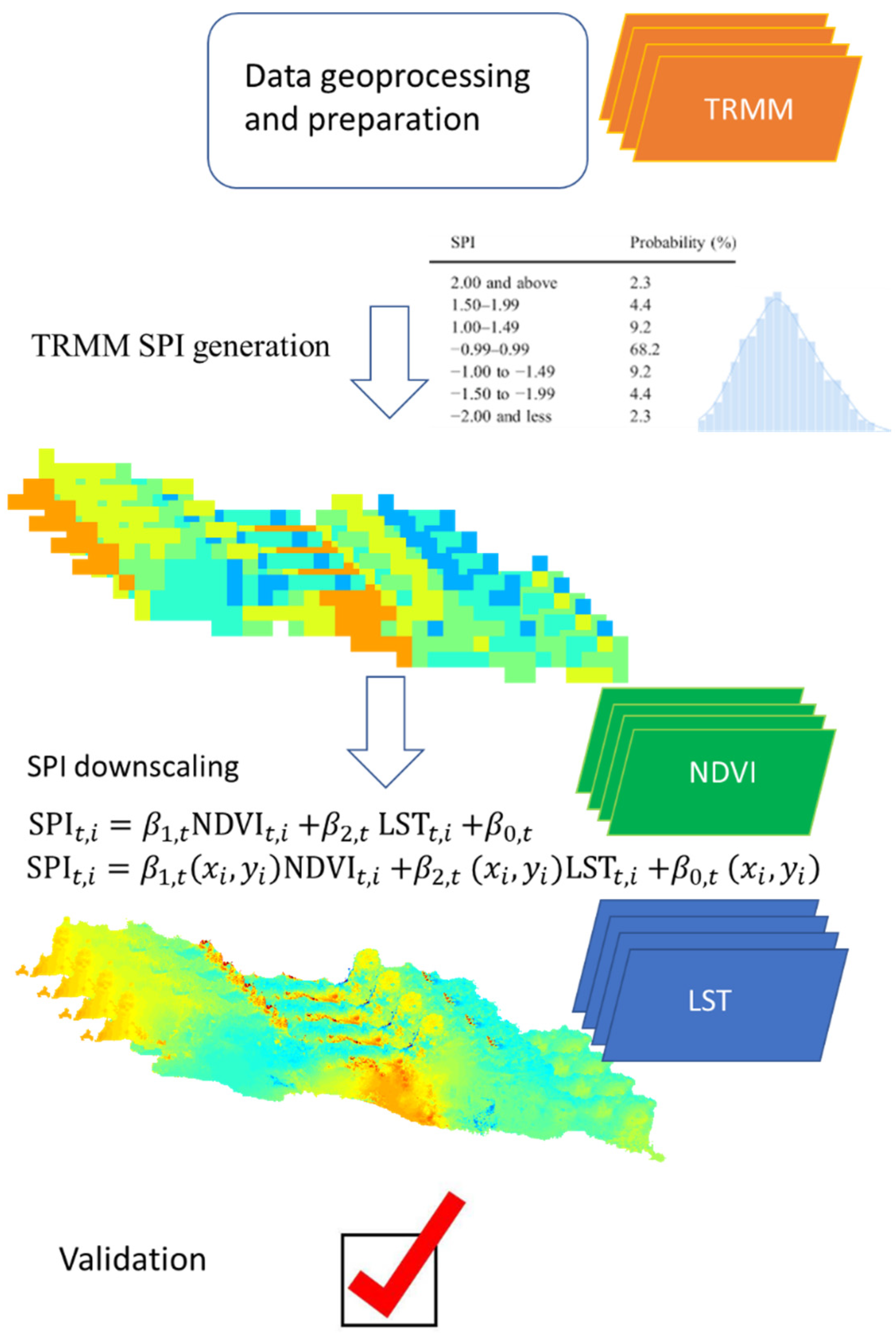
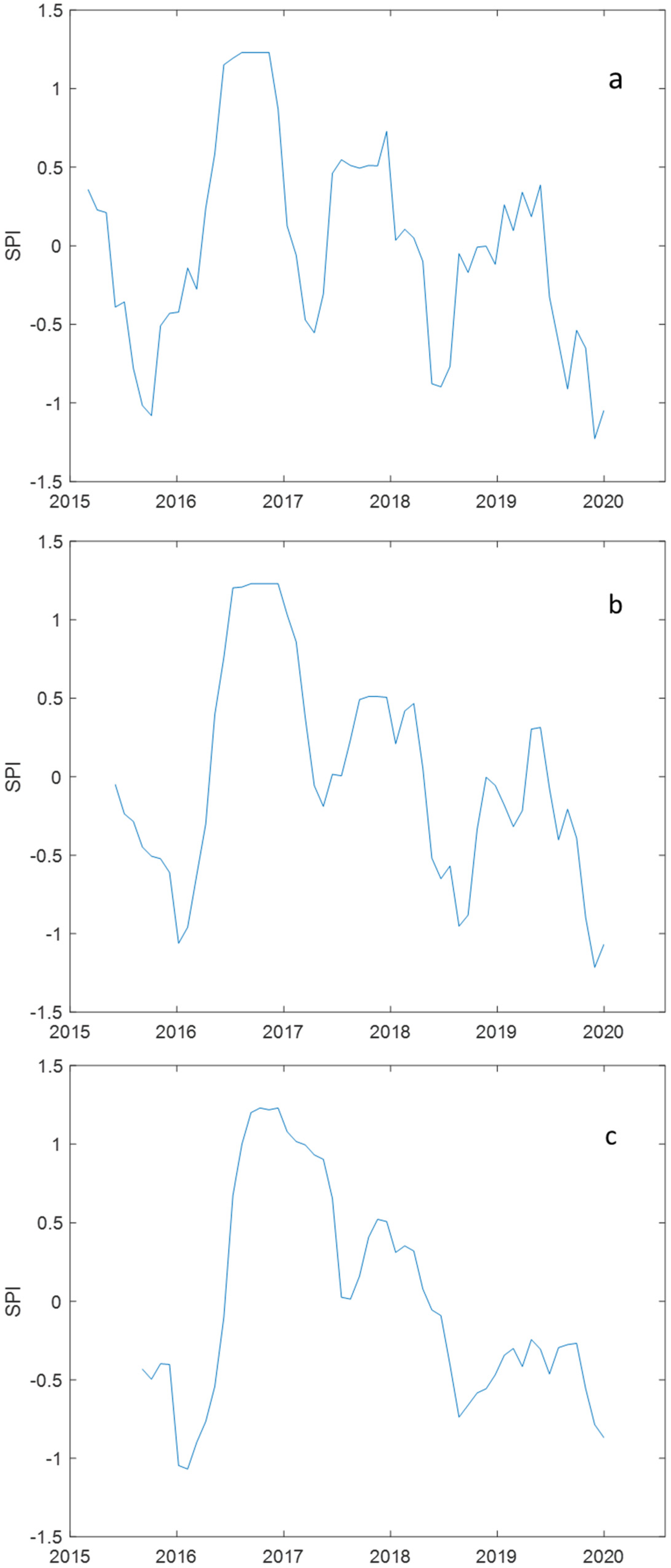
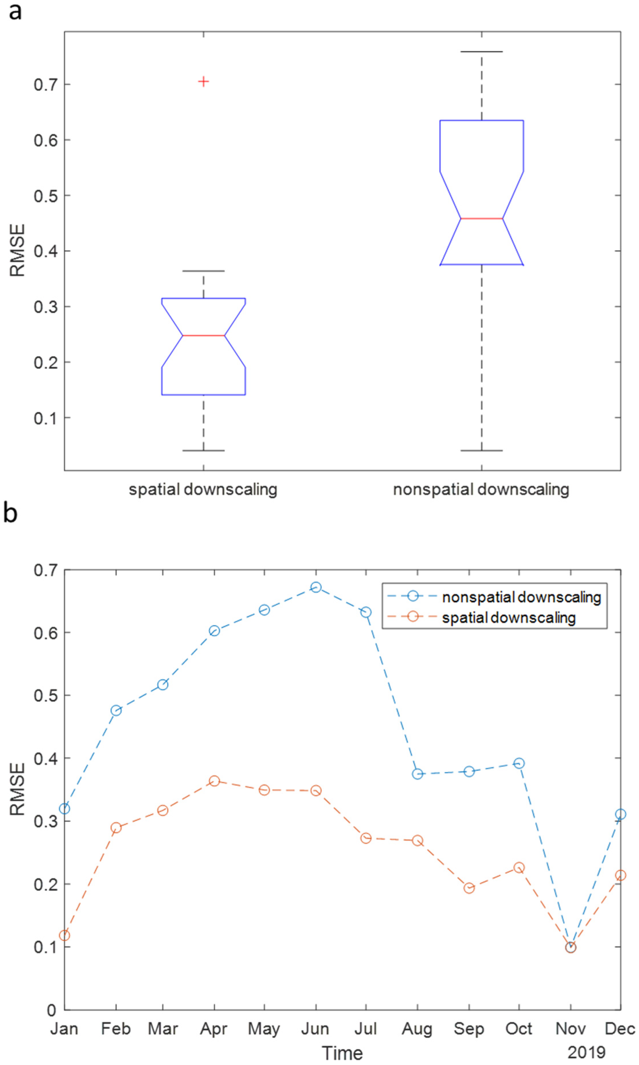
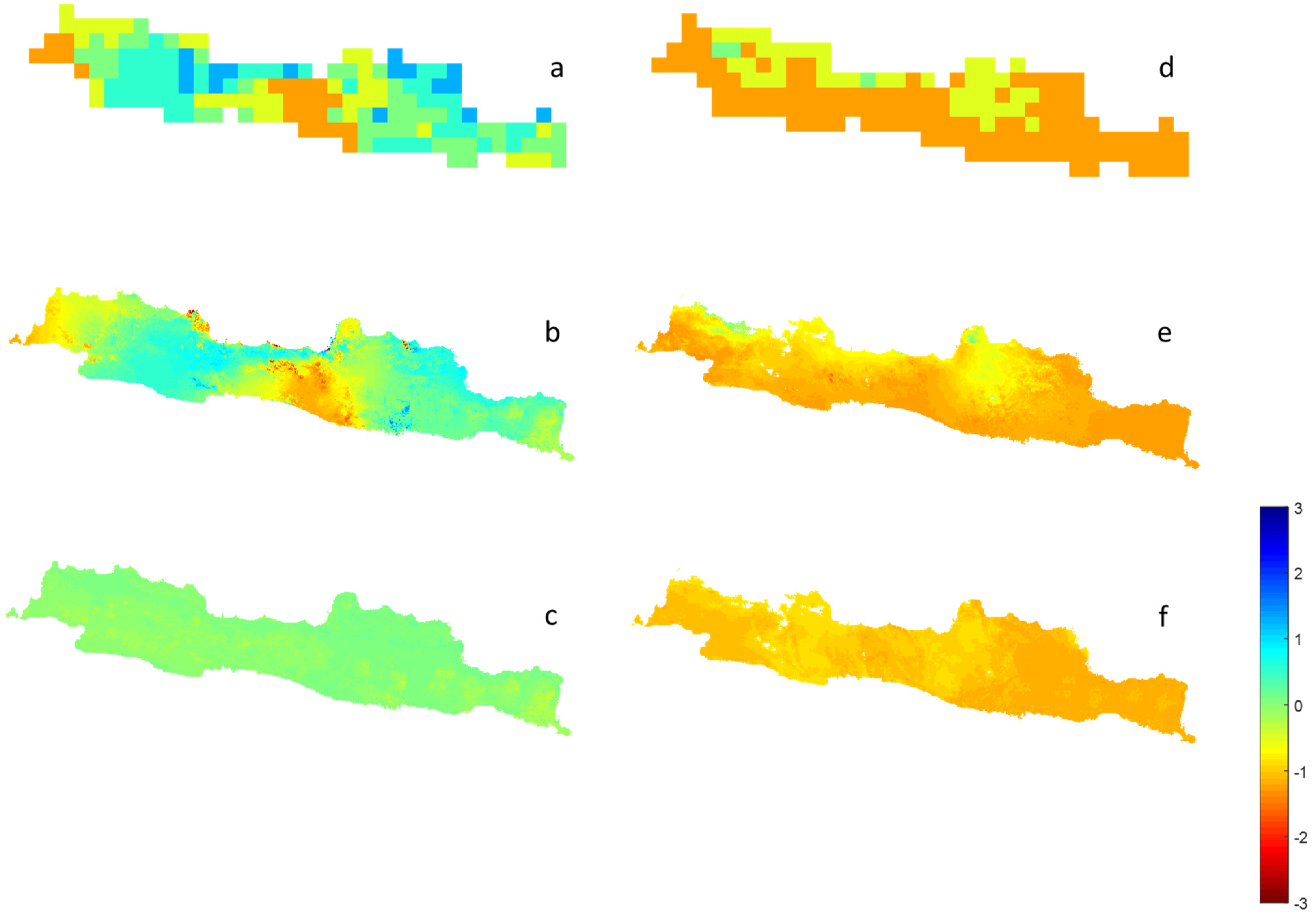
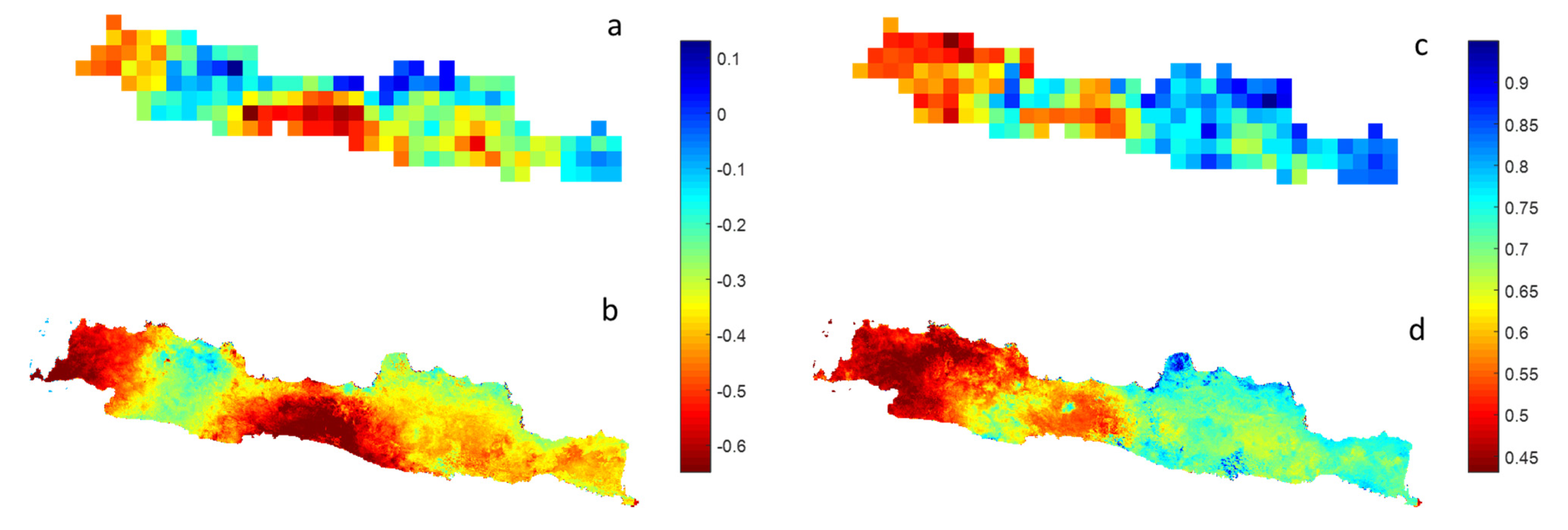
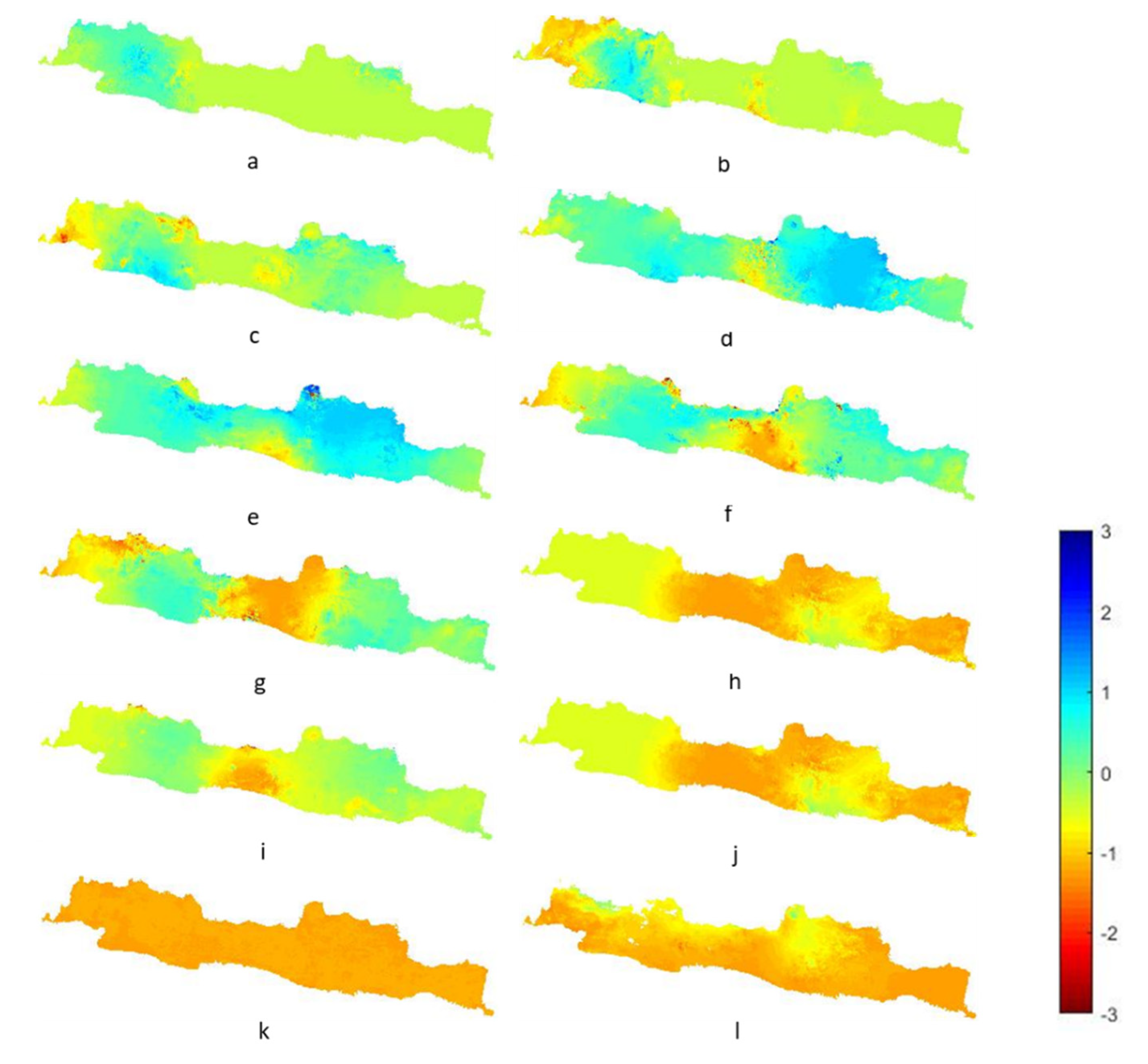
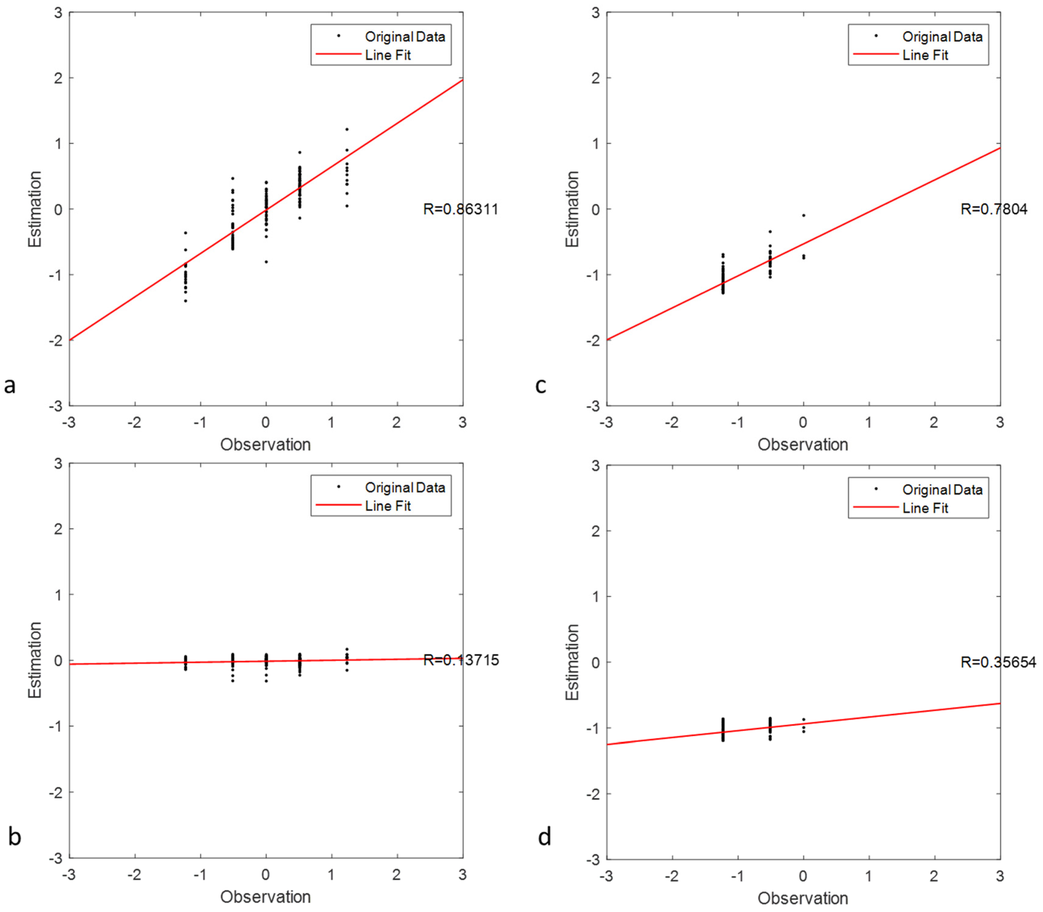
Drought monitoring is essential to detect the presence of drought, and the comprehensive change of drought conditions on a regional or global scale. This study used satellite precipitation data from the Tropical Rainfall Measuring Mission (TRMM), but refined the data for drought monitoring in Java, Indonesia. Firstly, drought analysis was conducted to establish the standardized precipitation index (SPI) of TRMM data for different durations. Time varying SPI spatial downscaling was conducted by selecting the environmental variables, normalized difference vegetation index (NDVI), and land surface temperature (LST) that were highly correlated with precipitation because meteorological drought was associated with vegetation and land drought. This study used time-dependent spatial regression to build the relation among original SPI, auxiliary variables, i.e., NDVI and LST. Results indicated that spatial downscaling was better than nonspatial downscaling (overall RMSEs: 0.25 and 0.46 in spatial and nonspatial downscaling). Spatial downscaling was more suitable for heterogeneous SPI, particularly in the transition time (R: 0.863 and 0.137 in June 2019 for spatial and nonspatial models). The fine resolution (1 km) SPI can be composed of the environmental data. The fine-resolution SPI captured a similar trend of the original SPI. Furthermore, the detailed SPI maps can be used to understand the spatio-temporal pattern of drought severity.
Keywords: drought analysis; LST; NDVI; SPI; time varying spatial downscaling drought analysis; LST; NDVI; SPI; time varying spatial downscaling