Article

Combination of Sentinel-2 and PALSAR-2 for Local Climate Zone Classification: A Case Study of Nanchang, China

1
School of Environmental and Geographical Sciences, Shanghai Normal University, Shanghai 200234, China
2
Center for Global Environmental Research, National Institute for Environmental Studies, Ibaraki 305-8506, Japan
3
Cryosphere Research Station on the Qinghai-Tibetan Plateau, State Key Laboratory of Cryospheric Science, Northwest Institute of Eco-Environment and Resource, Chinese Academy of Sciences, Lanzhou 730000, China
4
University of Chinese Academy Sciences, Beijing 100049, China
*
Author to whom correspondence should be addressed.
Remote Sens. 2021, 13(10), 1902; https://doi.org/10.3390/rs13101902
Submission received: 16 March 2021 / Revised: 20 April 2021 / Accepted: 5 May 2021 / Published: 13 May 2021
(This article belongs to the Special Issue ALOS-2/PALSAR-2 Calibration, Validation, Science and Applications)

Abstract

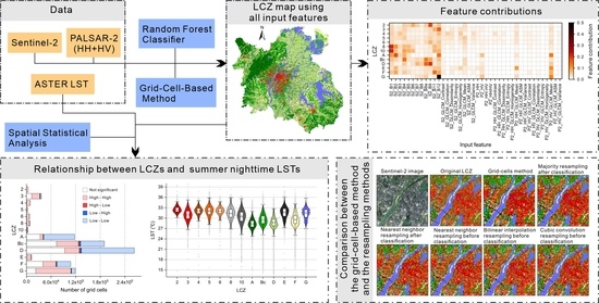
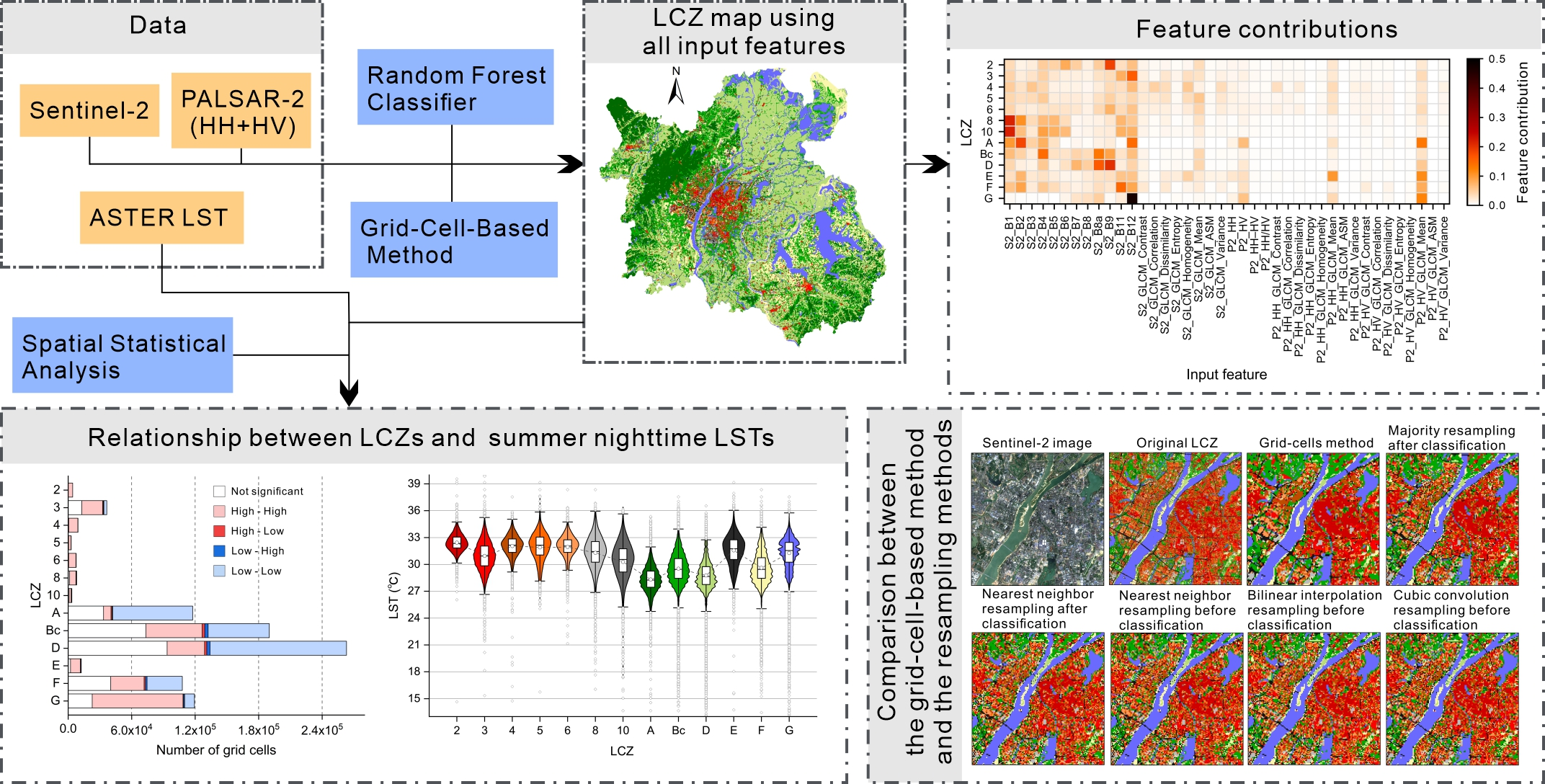
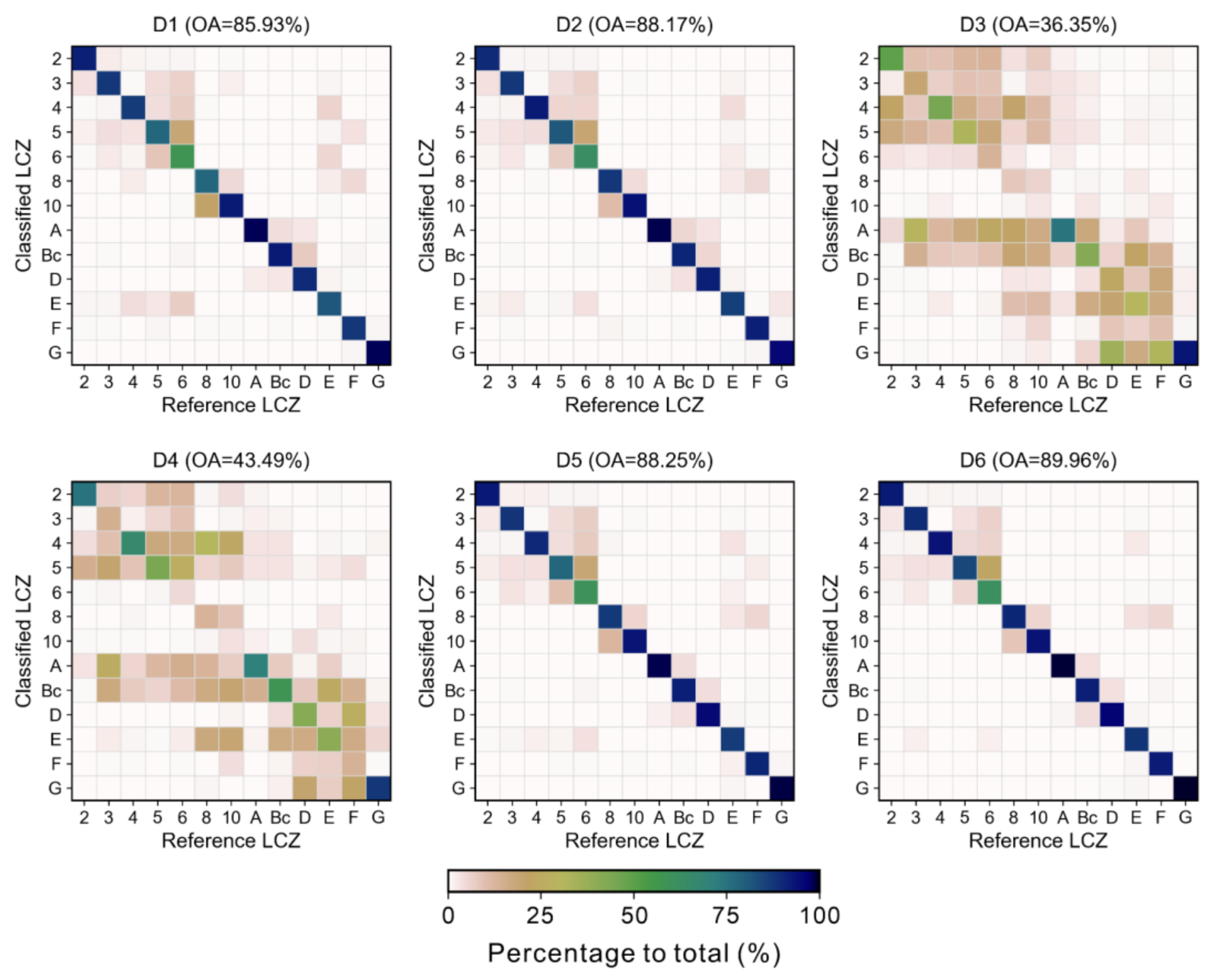
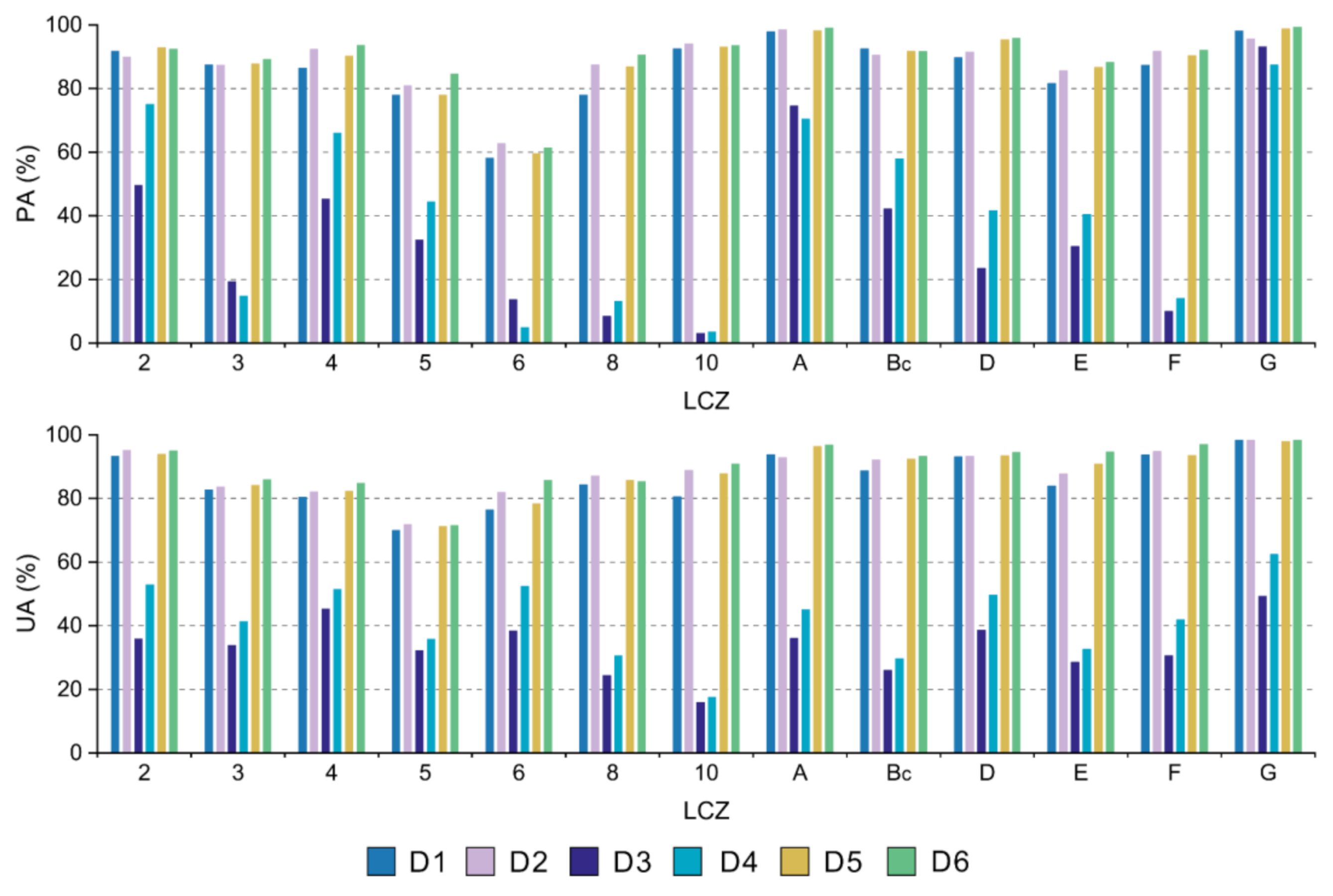
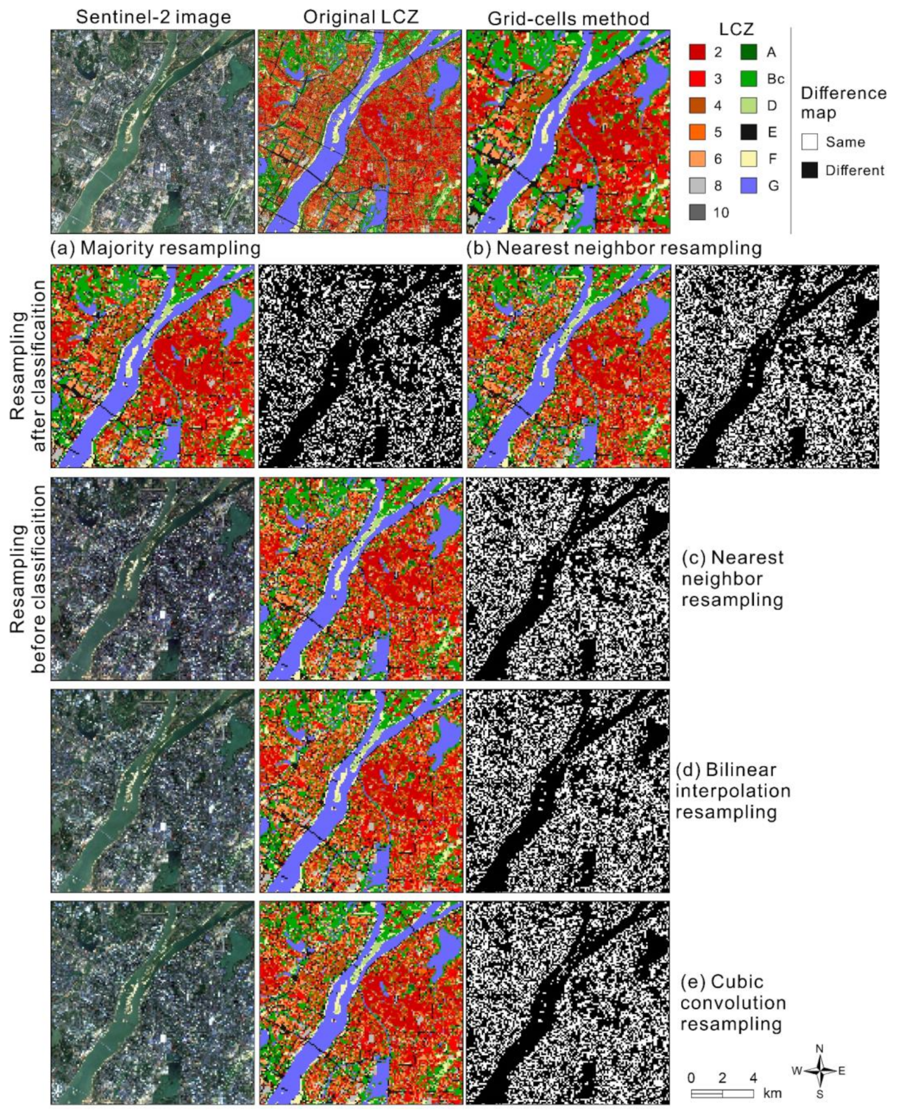
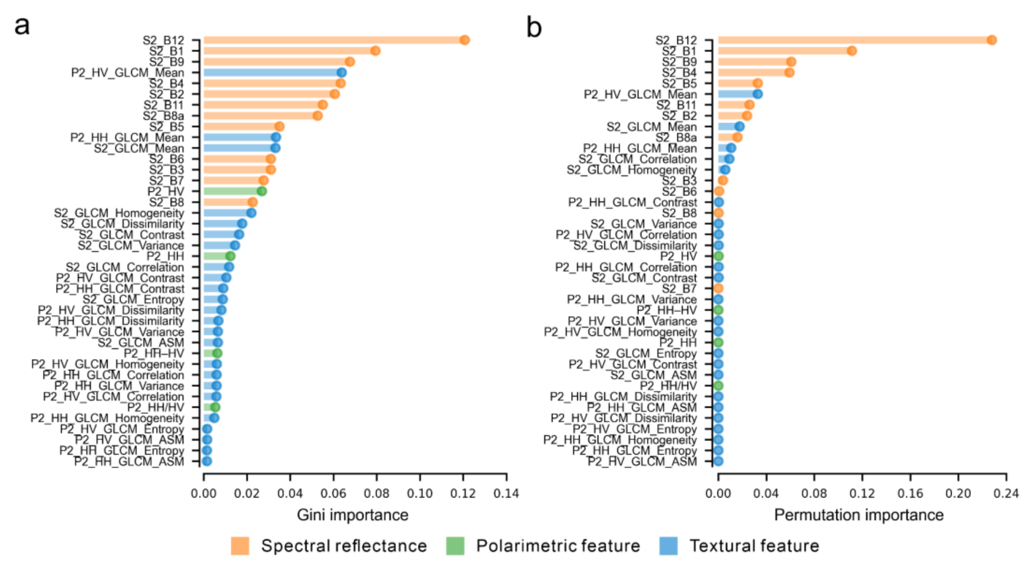
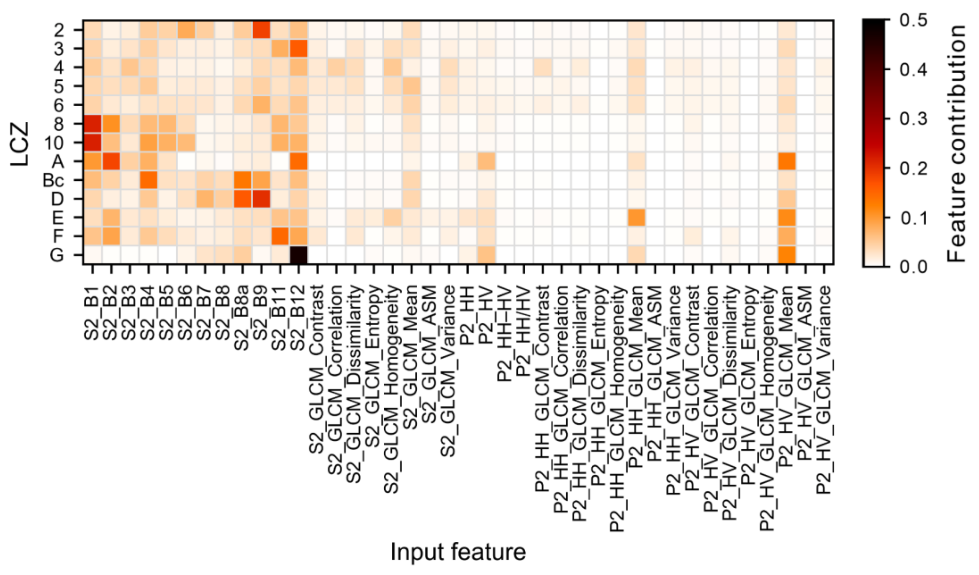
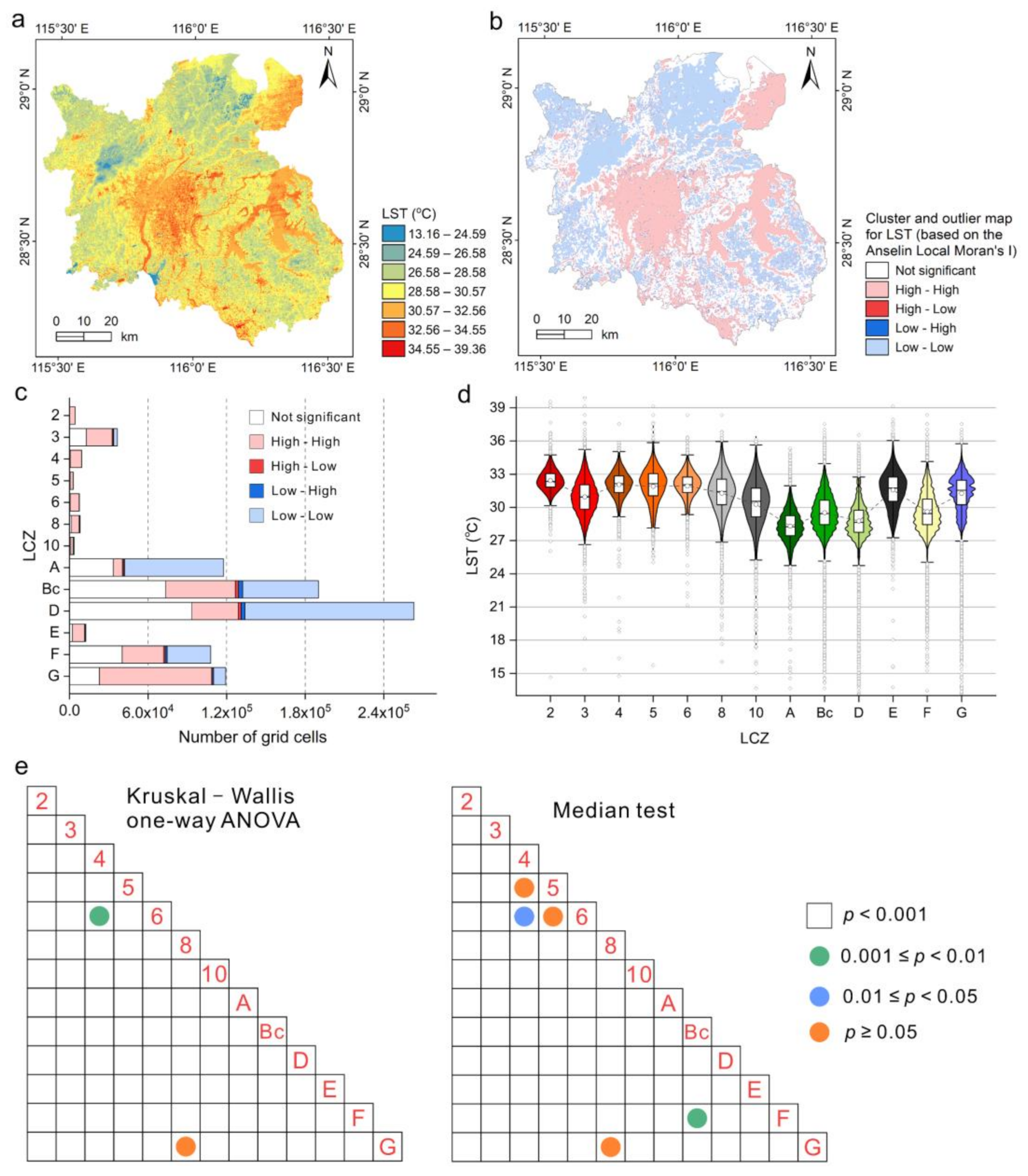
Local climate zone (LCZ) maps have been used widely to study urban structures and urban heat islands. Because remote sensing data enable automated LCZ mapping on a large scale, there is a need to evaluate how well remote sensing resources can produce fine LCZ maps to assess urban thermal environments. In this study, we combined Sentinel-2 multispectral imagery and dual-polarized (HH + HV) PALSAR-2 data to generate LCZ maps of Nanchang, China using a random forest classifier and a grid-cell-based method. We then used the classifier to evaluate the importance scores of different input features (Sentinel-2 bands, PALSAR-2 channels, and textural features) for the classification model and their contribution to each LCZ class. Finally, we investigated the relationship between LCZs and land surface temperatures (LSTs) derived from summer nighttime ASTER thermal imagery by spatial statistical analysis. The highest classification accuracy was 89.96% when all features were used, which highlighted the potential of Sentinel-2 and dual-polarized PALSAR-2 data. The most important input feature was the short-wave infrared-2 band of Sentinel-2. The spectral reflectance was more important than polarimetric and textural features in LCZ classification. PALSAR-2 data were beneficial for several land cover LCZ types when Sentinel-2 and PALSAR-2 were combined. Summer nighttime LSTs in most LCZs differed significantly from each other. Results also demonstrated that grid-cell processing provided more homogeneous LCZ maps than the usual resampling methods. This study provided a promising reference to further improve LCZ classification and quantitative analysis of local climate.
Keywords: local climate zone; random forest; feature importance; land surface temperature; grid cells; Sentinel-2; PALSAR-2; ASTER local climate zone; random forest; feature importance; land surface temperature; grid cells; Sentinel-2; PALSAR-2; ASTER
Graphical Abstract