Article

Tree Species Traits Determine the Success of LiDAR-Based Crown Mapping in a Mixed Temperate Forest


1
Department of Natural Resources and the Environment, University of New Hampshire, 56 College Rd, Durham, NH 03824, USA
2
Earth Systems Research Center, University of New Hampshire, 8 College Rd, Durham, NH 03824, USA
3
Department of Earth Sciences, University of New Hampshire, 56 College Rd, Durham, NH 03824, USA
4
Department of Organismic and Evolutionary Biology, Harvard University, 26 Oxford St, Cambridge, MA 02138, USA
5
Harvard Forest, Harvard University, 324 N. Main St, Petersham, MA 01366, USA
*
Author to whom correspondence should be addressed.
Remote Sens. 2020, 12(2), 309; https://doi.org/10.3390/rs12020309
Submission received: 27 November 2019 / Revised: 27 December 2019 / Accepted: 11 January 2020 / Published: 17 January 2020
(This article belongs to the Special Issue Remote Sensing to Assess Canopy Structure and Function)

Abstract

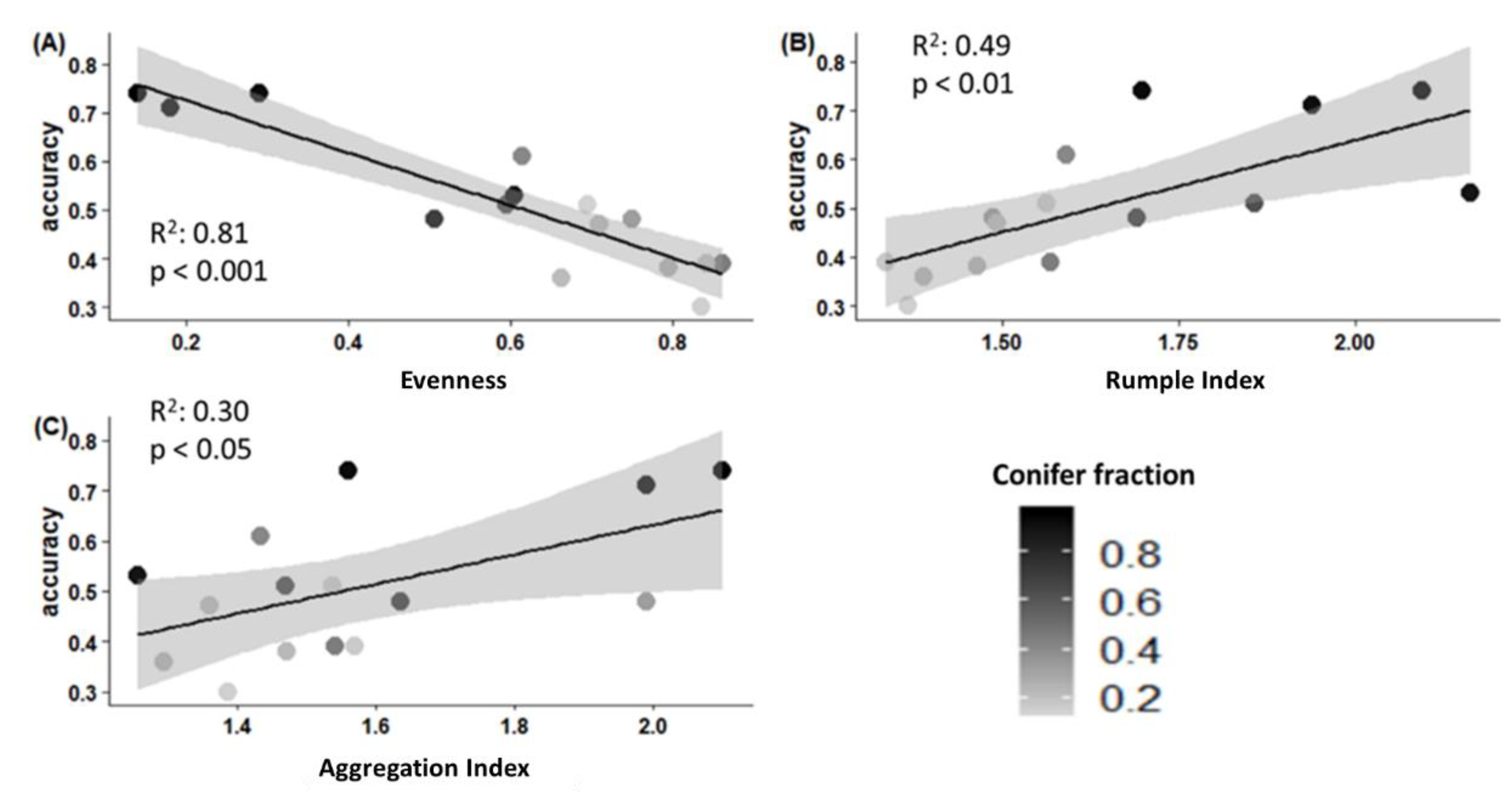
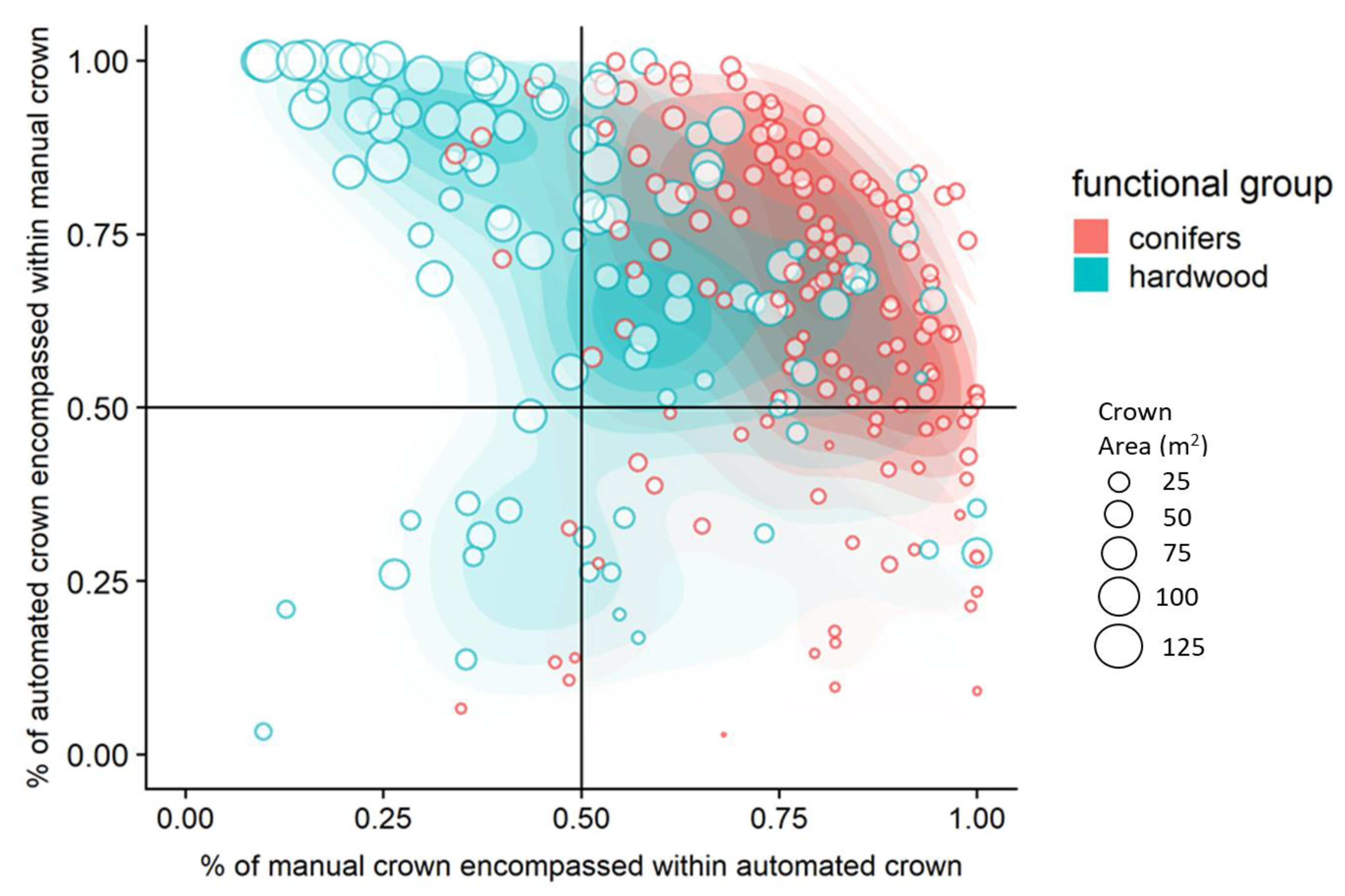
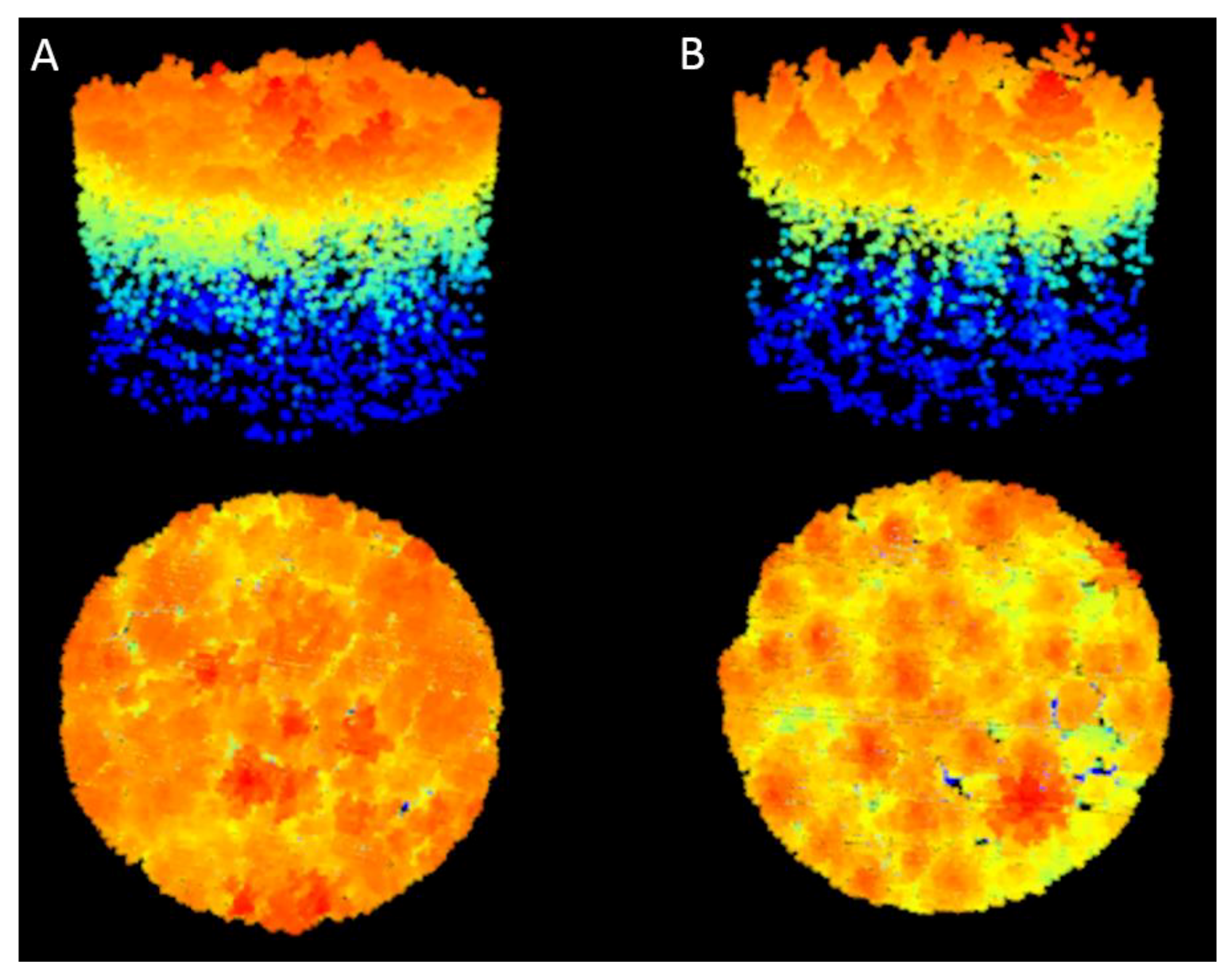
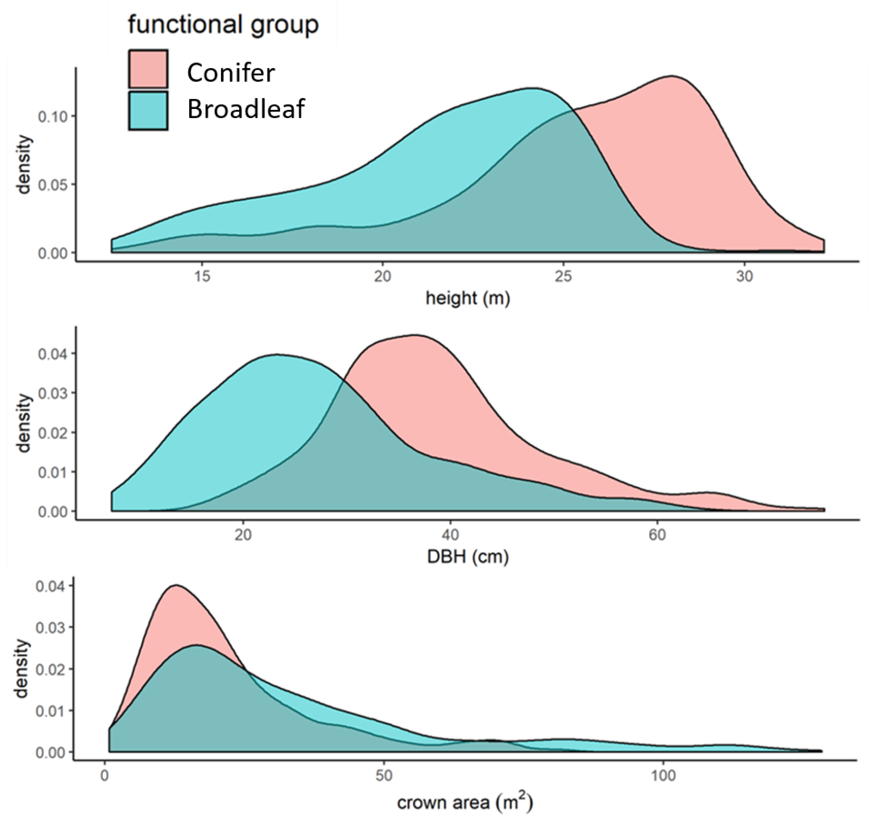
The ability to automatically delineate individual tree crowns using remote sensing data opens the possibility to collect detailed tree information over large geographic regions. While individual tree crown delineation (ITCD) methods have proven successful in conifer-dominated forests using Light Detection and Ranging (LiDAR) data, it remains unclear how well these methods can be applied in deciduous broadleaf-dominated forests. We applied five automated LiDAR-based ITCD methods across fifteen plots ranging from conifer- to broadleaf-dominated forest stands at Harvard Forest in Petersham, MA, USA, and assessed accuracy against manual delineation of crowns from unmanned aerial vehicle (UAV) imagery. We then identified tree- and plot-level factors influencing the success of automated delineation techniques. There was relatively little difference in accuracy between automated crown delineation methods (51–59% aggregated plot accuracy) and, despite parameter tuning, none of the methods produced high accuracy across all plots (27—90% range in plot-level accuracy). The accuracy of all methods was significantly higher with increased plot conifer fraction, and individual conifer trees were identified with higher accuracy (mean 64%) than broadleaf trees (42%) across methods. Further, while tree-level factors (e.g., diameter at breast height, height and crown area) strongly influenced the success of crown delineations, the influence of plot-level factors varied. The most important plot-level factor was species evenness, a metric of relative species abundance that is related to both conifer fraction and the degree to which trees can fill canopy space. As species evenness decreased (e.g., high conifer fraction and less efficient filling of canopy space), the probability of successful delineation increased. Overall, our work suggests that the tested LiDAR-based ITCD methods perform equally well in a mixed temperate forest, but that delineation success is driven by forest characteristics like functional group, tree size, diversity, and crown architecture. While LiDAR-based ITCD methods are well suited for stands with distinct canopy structure, we suggest that future work explore the integration of phenology and spectral characteristics with existing LiDAR as an approach to improve crown delineation in broadleaf-dominated stands.
Keywords: LiDAR; individual tree crown delineation (ITCD); temperate forest; tree architecture LiDAR; individual tree crown delineation (ITCD); temperate forest; tree architecture
Graphical Abstract