Article

Examining the Roles of Spectral, Spatial, and Topographic Features in Improving Land-Cover and Forest Classifications in a Subtropical Region


1
State Key Laboratory of Subtropical Silviculture, Zhejiang A&F University, Hangzhou 311300, China
2
School of Environmental & Resource Sciences, Zhejiang A&F University, Hangzhou 311300, China
3
State Key Laboratory for Subtropical Mountain Ecology of the Ministry of Science and Technology and Fujian Province, Fujian Normal University, Fuzhou 350007, China
4
School of Geographical Sciences, Fujian Normal University, Fuzhou 350007, China
5
Institute of Forest Resource Information Techniques, Chinese Academy of Forestry, Beijing 100091, China
*
Author to whom correspondence should be addressed.
Remote Sens. 2020, 12(18), 2907; https://doi.org/10.3390/rs12182907
Submission received: 8 August 2020 / Revised: 5 September 2020 / Accepted: 6 September 2020 / Published: 8 September 2020
(This article belongs to the Special Issue Multi-Modality Data Classification: Algorithms and Applications)

Abstract

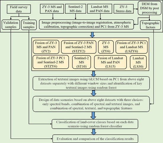
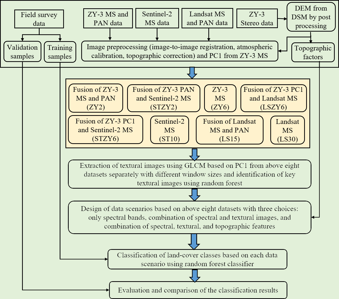
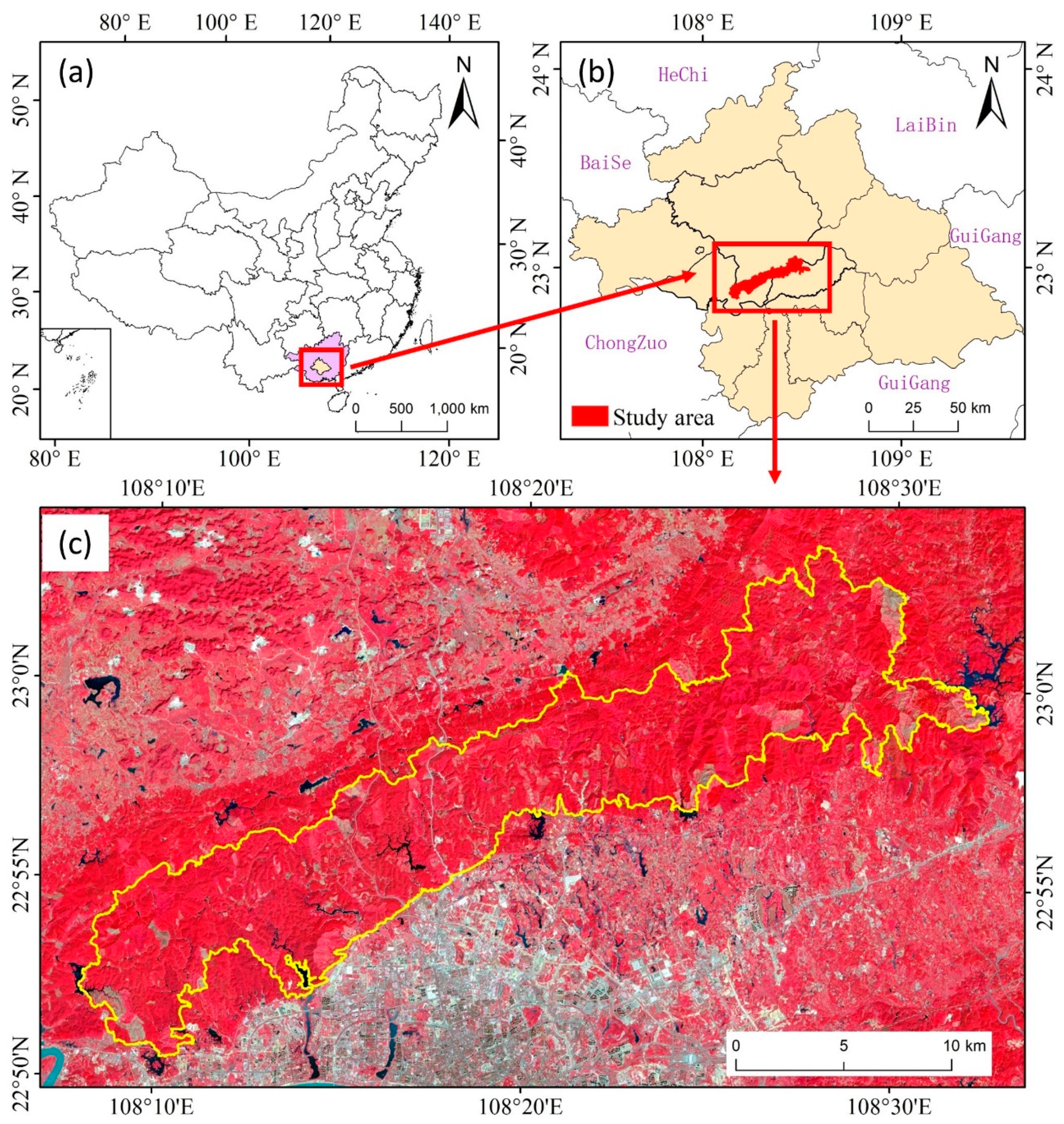
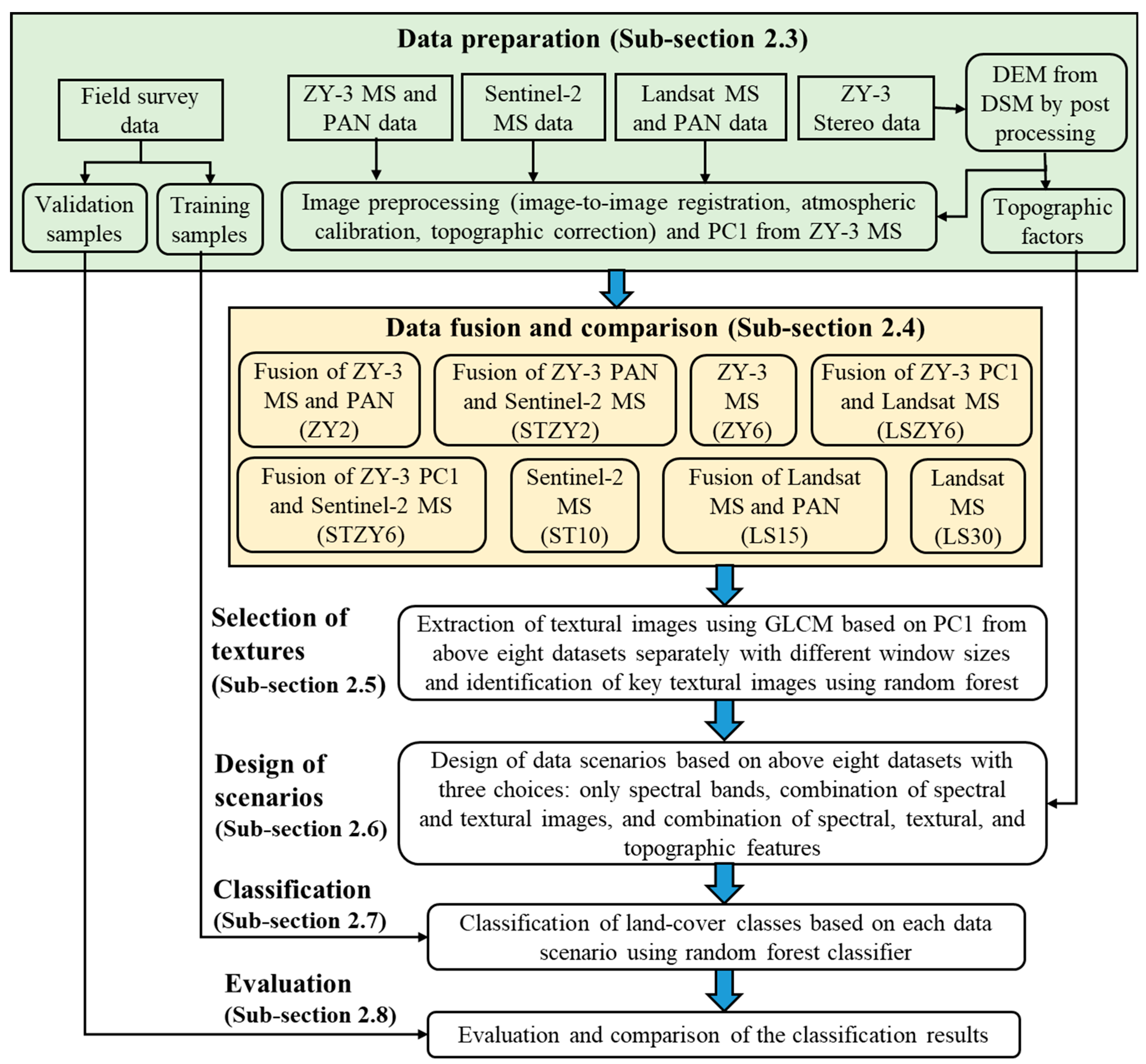
Many studies have investigated the effects of spectral and spatial features of remotely sensed data and topographic characteristics on land-cover and forest classification results, but they are mainly based on individual sensor data. How these features from different kinds of remotely sensed data with various spatial resolutions influence classification results is unclear. We conducted a comprehensively comparative analysis of spectral and spatial features from ZiYuan-3 (ZY-3), Sentinel-2, and Landsat and their fused datasets with spatial resolution ranges from 2 m, 6 m, 10 m, 15 m, and to 30 m, and topographic factors in influencing land-cover classification results in a subtropical forest ecosystem using random forest approach. The results indicated that the combined spectral (fused data based on ZY-3 and Sentinel-2), spatial, and topographical data with 2-m spatial resolution provided the highest overall classification accuracy of 83.5% for 11 land-cover classes, as well as the highest accuracies for almost all individual classes. The improvement of spectral bands from 4 to 10 through fusion of ZY-3 and Sentinel-2 data increased overall accuracy by 14.2% at 2-m spatial resolution, and by 11.1% at 6-m spatial resolution. Textures from high spatial resolution imagery play more important roles than textures from medium spatial resolution images. The incorporation of textural images into spectral data in the 2-m spatial resolution imagery improved overall accuracy by 6.0–7.7% compared to 1.1–1.7% in the 10-m to 30-m spatial resolution images. Incorporation of topographic factors into spectral and textural imagery further improved overall accuracy by 1.2–5.5%. The classification accuracies for coniferous forest, eucalyptus, other broadleaf forests, and bamboo forest can be 85.3–91.1%. This research provides new insights for using proper combinations of spectral bands and textures corresponding to specifically spatial resolution images in improving land-cover and forest classifications in subtropical regions.
Keywords: land-cover classification; subtropical ecosystem; random forest; multiple data sources; data fusion land-cover classification; subtropical ecosystem; random forest; multiple data sources; data fusion
Graphical Abstract