Article

Object-Based Analysis Using Unmanned Aerial Vehicles (UAVs) for Site-Specific Landslide Assessment


by
Efstratios Karantanellis
1,*,
Vassilis Marinos
1,
Emmanuel Vassilakis
2 and
Basile Christaras
1
1
Laboratory of Engineering Geology and Hydrogeology, Department of Geology, Aristotle University of Thessaloniki, 54124 Thessaloniki, Greece
2
Remote Sensing Laboratory, Department of Geology and Geoenvironment, National and Kapodistrian University of Athens, 15784 Zografou, Greece
*
Author to whom correspondence should be addressed.
Remote Sens. 2020, 12(11), 1711; https://doi.org/10.3390/rs12111711
Submission received: 23 April 2020 / Revised: 22 May 2020 / Accepted: 23 May 2020 / Published: 27 May 2020

Abstract

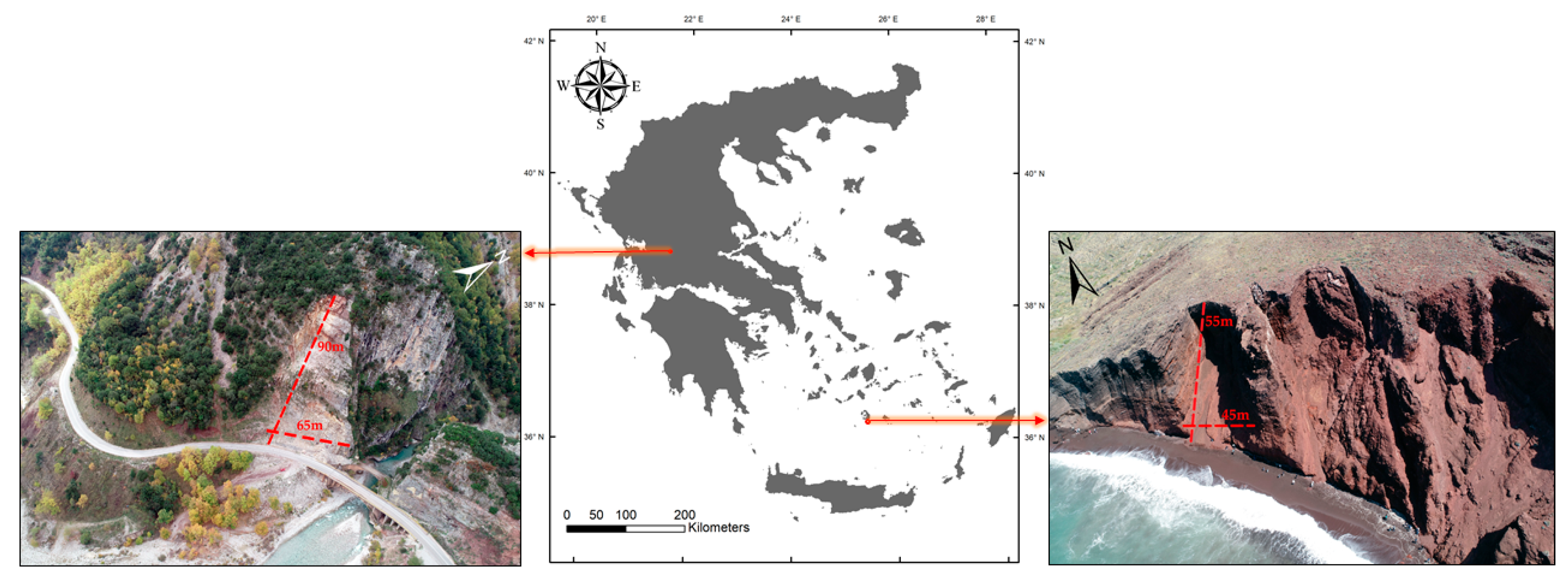
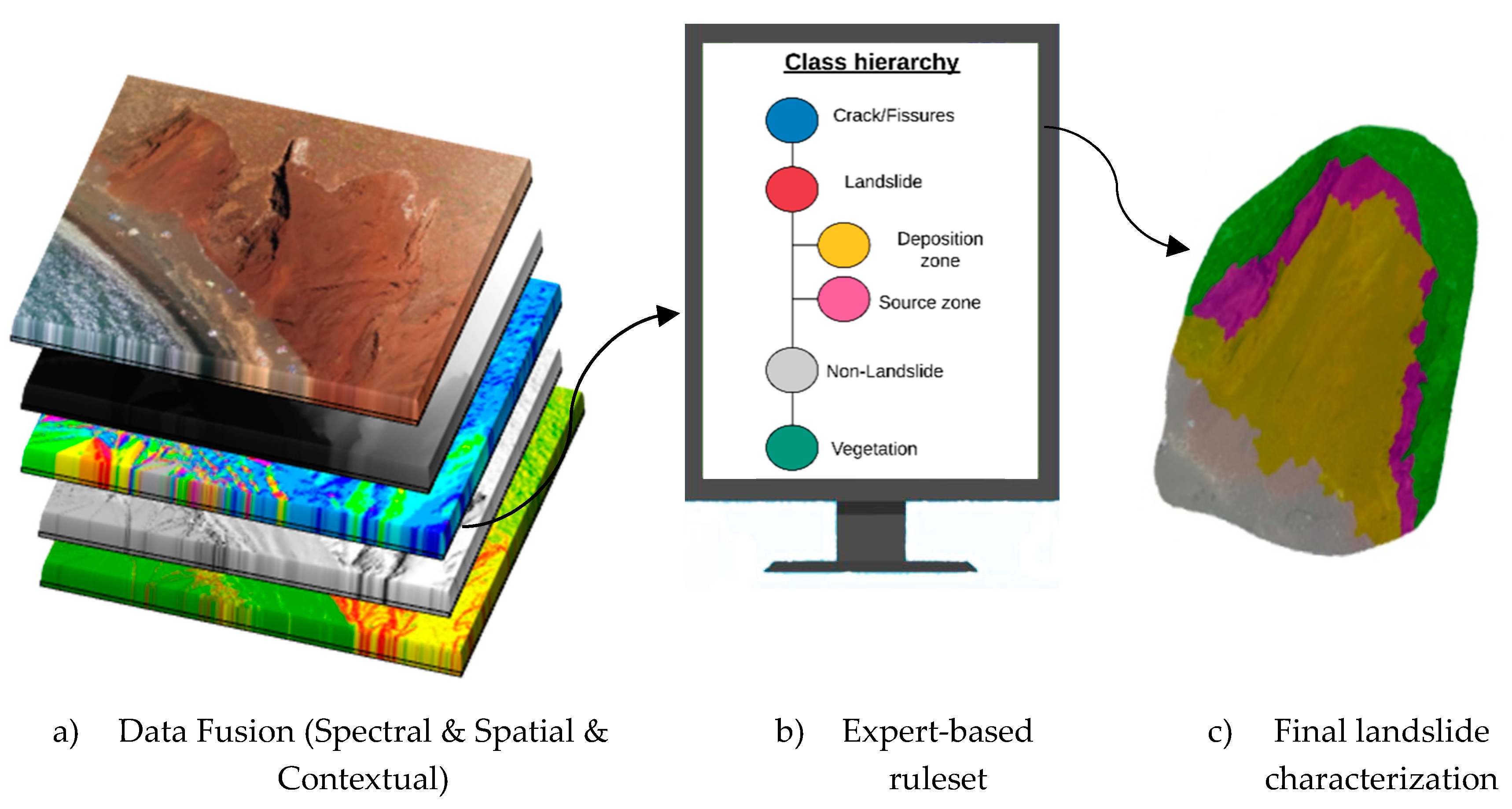
The increased development of computer vision technology combined with the increased availability of innovative platforms with ultra-high-resolution sensors, has generated new opportunities and fields for investigation in the engineering geology domain in general and landslide identification and characterization in particular. During the last decade, the so-called Unmanned Aerial Vehicles (UAVs) have been evaluated for diverse applications such as 3D terrain analysis, slope stability, mass movement hazard and risk management. Their advantages of detailed data acquisition at a low cost and effective performance identifies them as leading platforms for site-specific 3D modelling. In this study, the proposed methodology has been developed based on Object-Based Image Analysis (OBIA) and fusion of multivariate data resulted from UAV photogrammetry processing in order to take full advantage of the produced data. Two landslide case studies within the territory of Greece, with different geological and geomorphological characteristics, have been investigated in order to assess the developed landslide detection and characterization algorithm performance in distinct scenarios. The methodology outputs demonstrate the potential for an accurate characterization of individual landslide objects within this natural process based on ultra high-resolution data from close range photogrammetry and OBIA techniques for landslide conceptualization. This proposed study shows that UAV-based landslide modelling on the specific case sites provides a detailed characterization of local scale events in an automated sense with high adaptability on the specific case site.
Keywords: landslide assessment; UAV photogrammetry; remote sensing; object-based image analysis (OBIA); mass movements; surface deformation; SfM processing landslide assessment; UAV photogrammetry; remote sensing; object-based image analysis (OBIA); mass movements; surface deformation; SfM processing