Article

Extraction of High-Precision Urban Impervious Surfaces from Sentinel-2 Multispectral Imagery via Modified Linear Spectral Mixture Analysis


1
State Key Laboratory of Information Engineering in Surveying, Mapping, and Remote Sensing, Wuhan University, Wuhan 430079, China
2
Guangzhou Institute of Geography, Guangzhou 510070, China
3
Key Laboratory of Guangdong for Utilization of Remote Sensing and Geographical Information System, Guangzhou 510070, China
4
Guangdong Open Laboratory of Geospatial Information Technology and Application, Guangzhou 510070, China
*
Author to whom correspondence should be addressed.
Sensors 2018, 18(9), 2873; https://doi.org/10.3390/s18092873
Submission received: 24 July 2018 / Revised: 23 August 2018 / Accepted: 29 August 2018 / Published: 31 August 2018
(This article belongs to the Section Remote Sensors)

Abstract

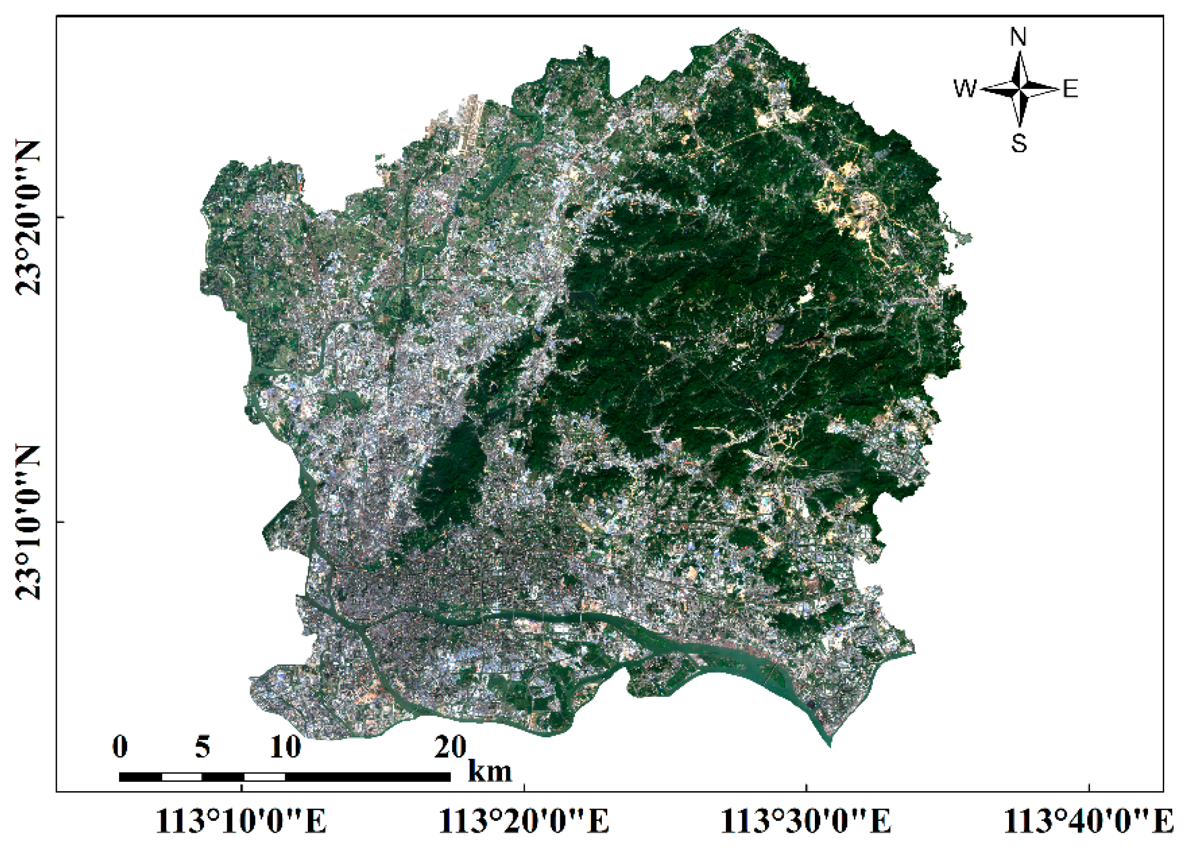
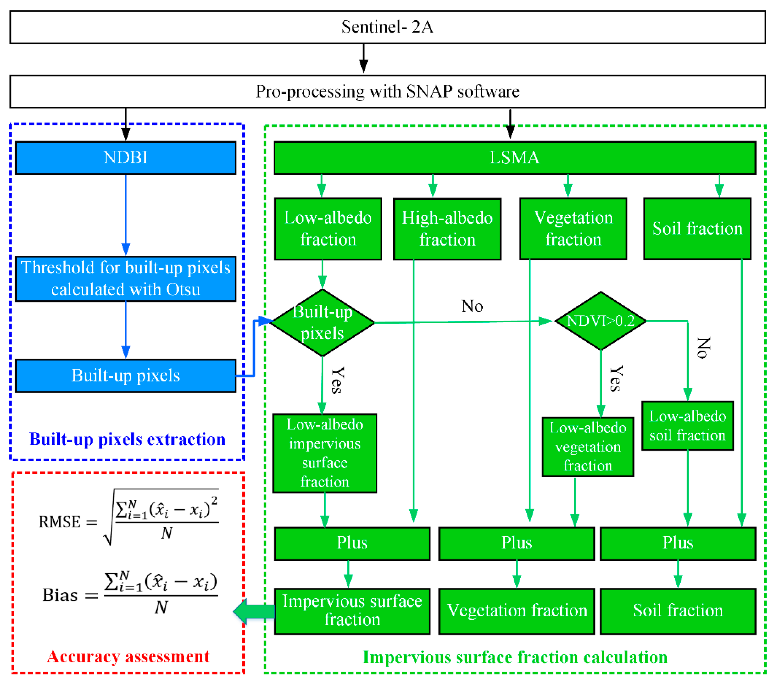
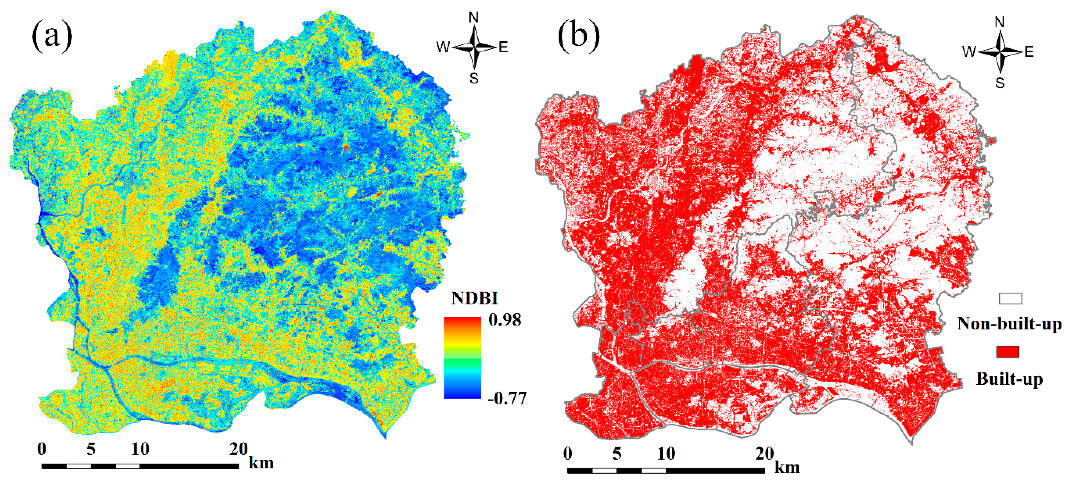
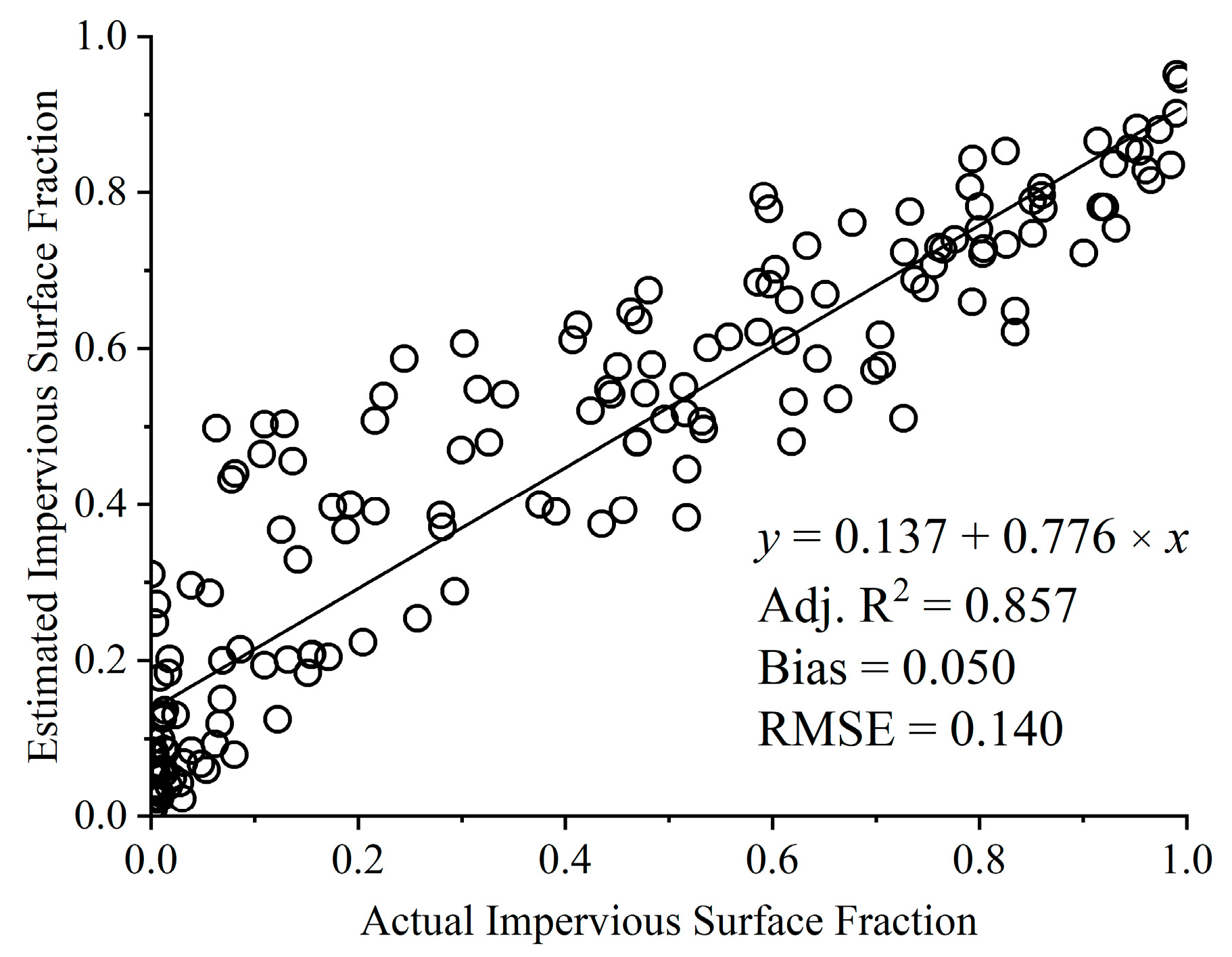
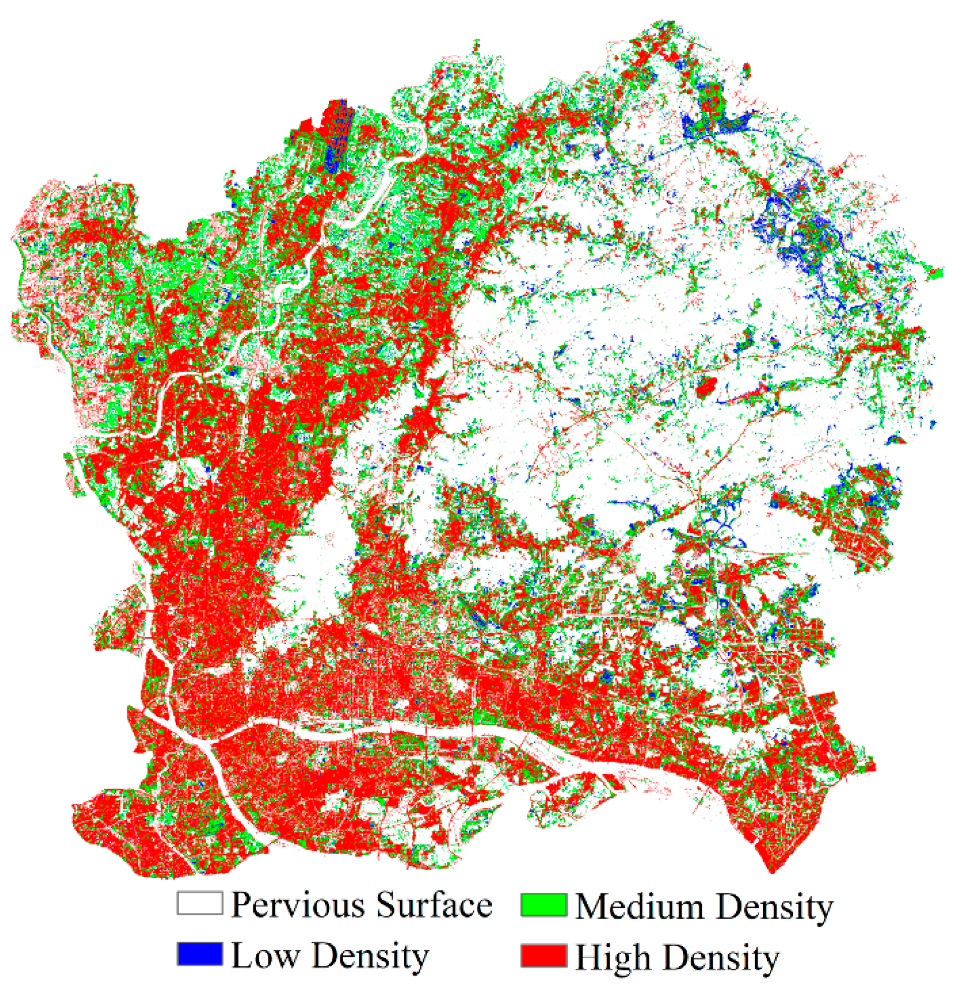
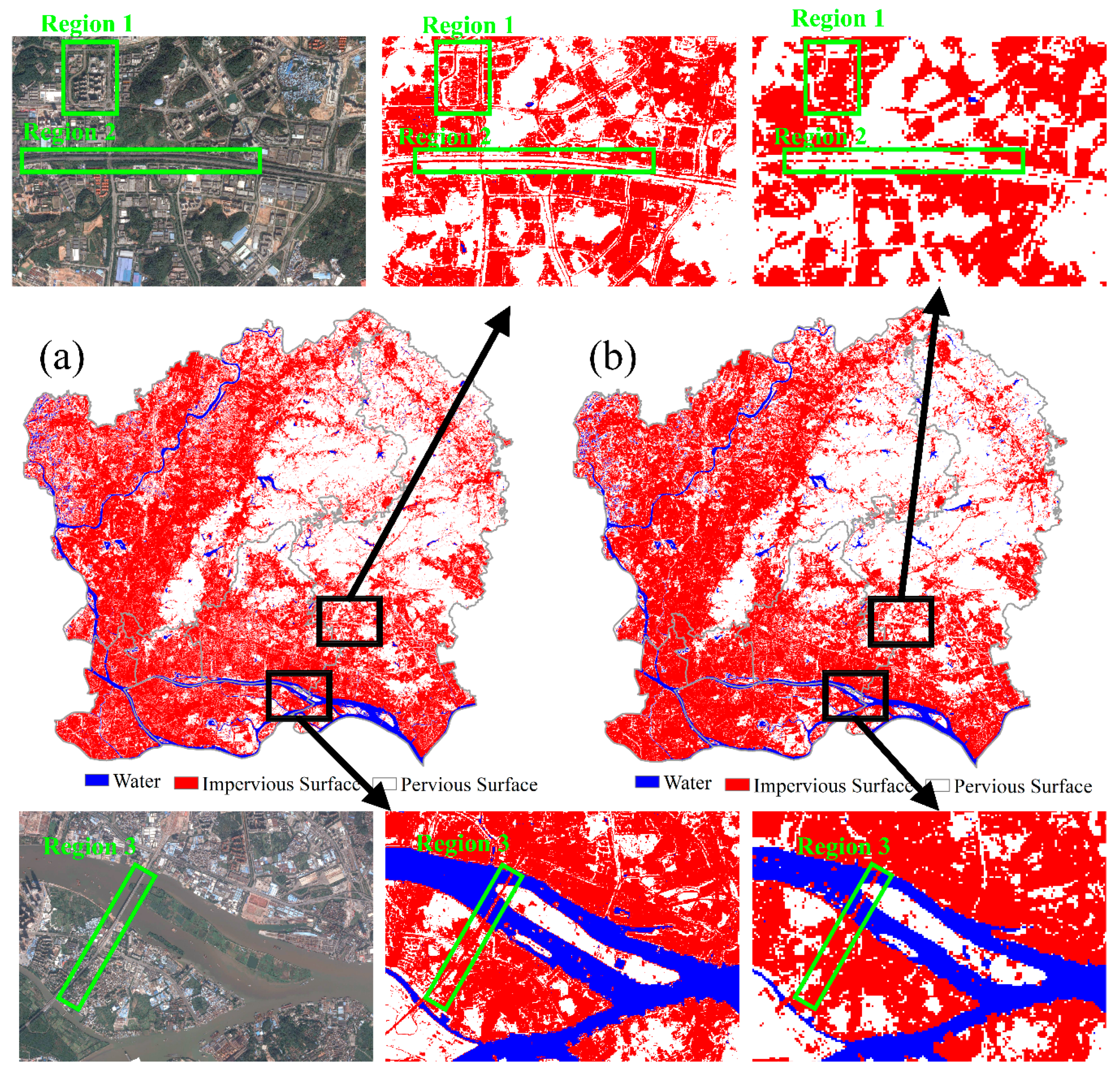
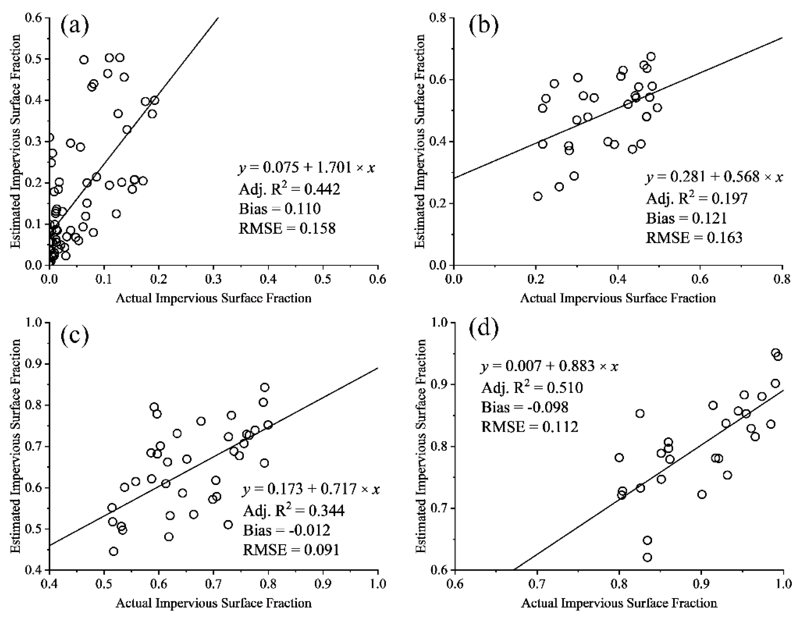
This study explores the performance of Sentinel-2A Multispectral Instrument (MSI) imagery for extracting urban impervious surface using a modified linear spectral mixture analysis (MLSMA) method. Sentinel-2A MSI provided 10 m red, green, blue, and near-infrared spectral bands, and 20 m shortwave infrared spectral bands, which were used to extract impervious surfaces. We aimed to extract urban impervious surfaces at a spatial resolution of 10 m in the main urban area of Guangzhou, China. In MLSMA, a built-up image was first extracted from the normalized difference built-up index (NDBI) using the Otsu’s method; the high-albedo, low-albedo, vegetation, and soil fractions were then estimated using conventional linear spectral mixture analysis (LSMA). The LSMA results were post-processed to extract high-precision impervious surface, vegetation, and soil fractions by integrating the built-up image and the normalized difference vegetation index (NDVI). The performance of MLSMA was evaluated using Landsat 8 Operational Land Imager (OLI) imagery. Experimental results revealed that MLSMA can extract the high-precision impervious surface fraction at 10 m with Sentinel-2A imagery. The 10 m impervious surface map of Sentinel-2A is capable of recovering more detail than the 30 m map of Landsat 8. In the Sentinel-2A impervious surface map, continuous roads and the boundaries of buildings in urban environments were clearly identified.
Keywords: Sentinel-2; modified linear spectral mixture analysis; normalized difference built-up index; normalized difference vegetation index; urban impervious surface Sentinel-2; modified linear spectral mixture analysis; normalized difference built-up index; normalized difference vegetation index; urban impervious surface