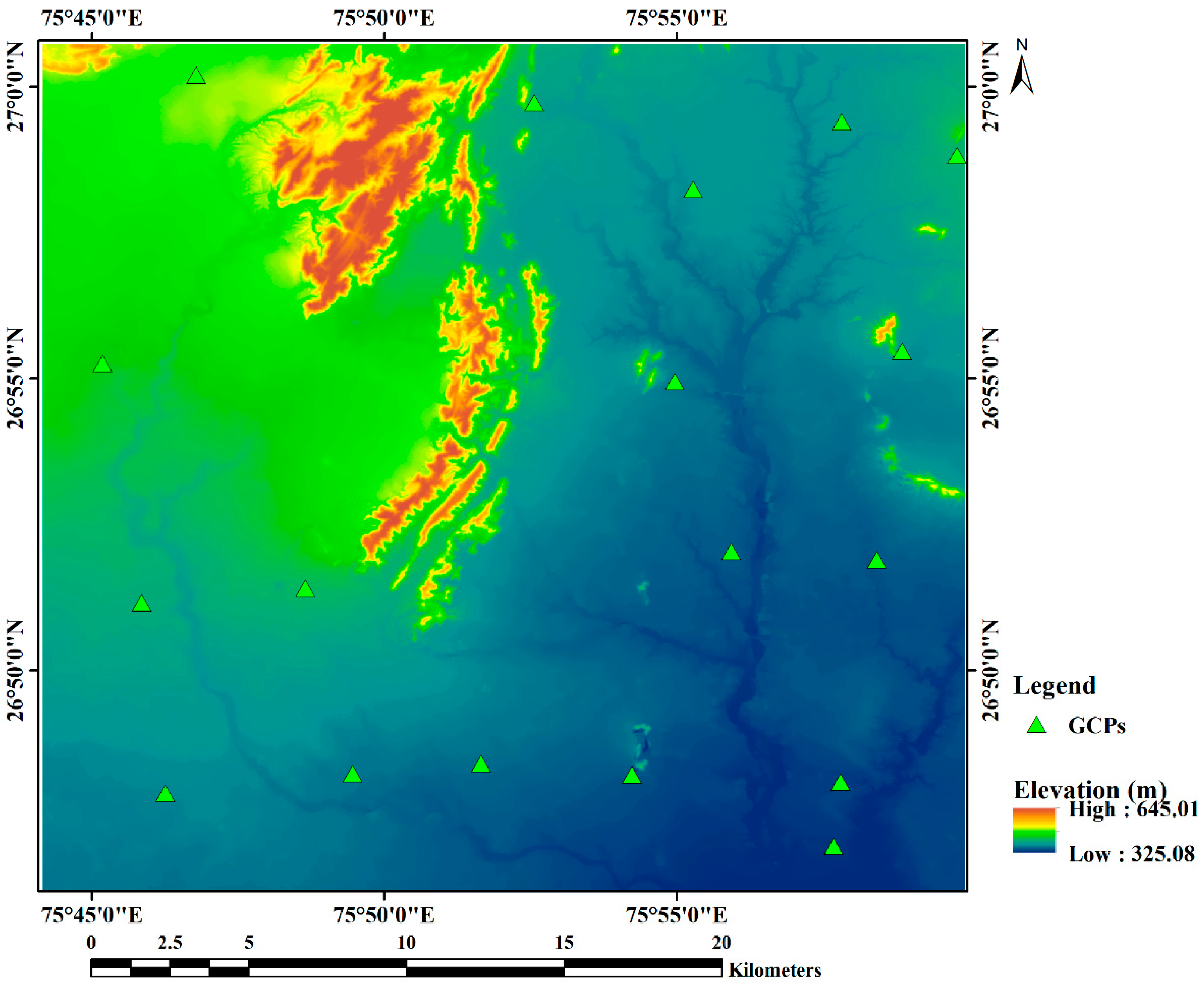
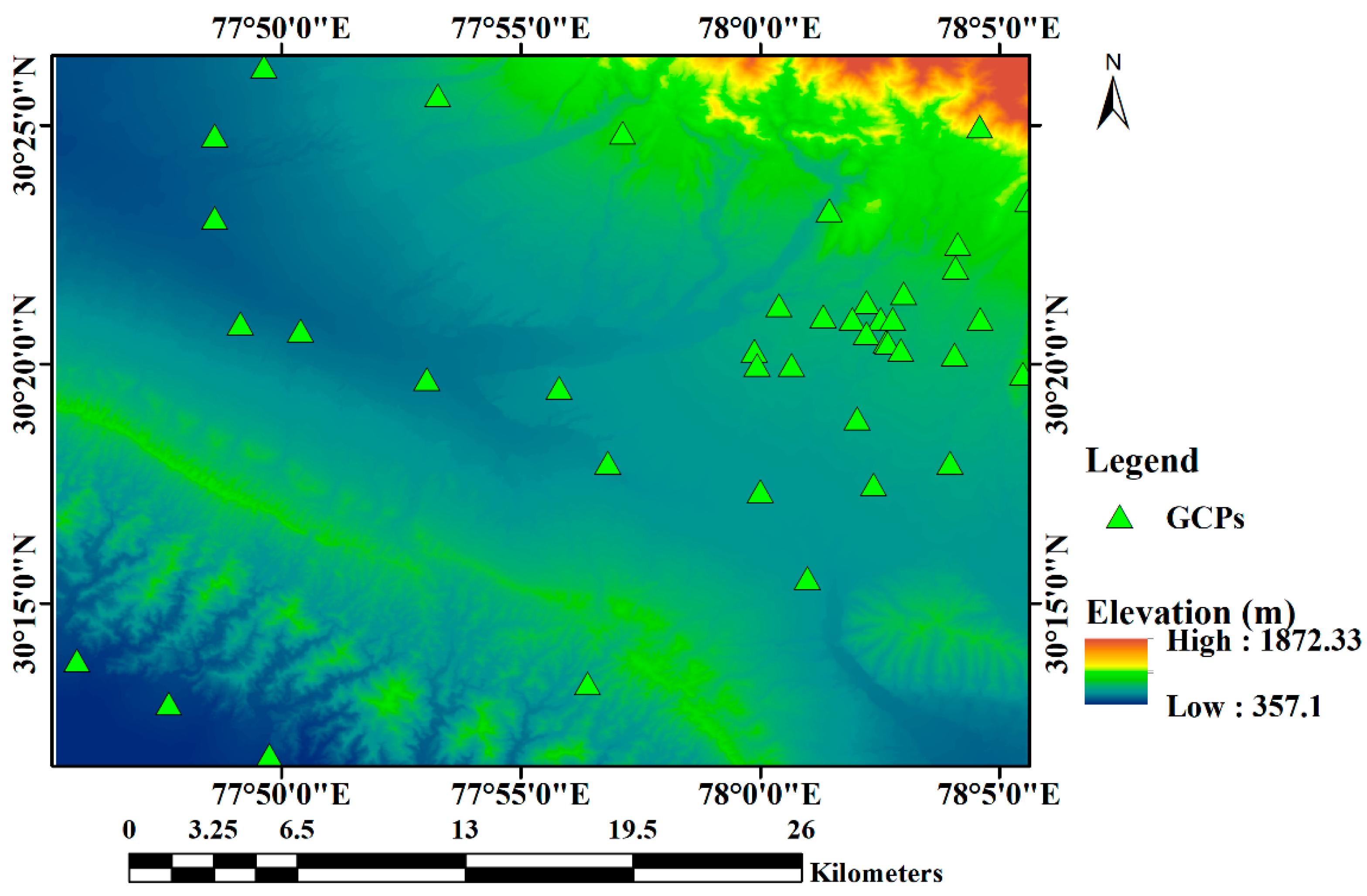
Assessment of FABDEM on the Different Types of Topographic Regions in India Using Differential GPS Data †
Abstract
1. Introduction
2. Experimental Sites
3. Materials and Method
4. Results and Discussion
5. Conclusions
Funding
Institutional Review Board Statement
Informed Consent Statement
Data Availability Statement
Acknowledgments
Conflicts of Interest
References
- Hawker, L.; Uhe, P.; Paulo, L.; Sosa, J.; Savage, J.; Sampson, C.; Neal, J. A 30 m global map of elevation with forests and buildings removed. Environ. Res. Lett. 2022, 17, 024016. [Google Scholar] [CrossRef]
- Girohi, P.; Bhardwaj, A. A Neural Network based Fusion Approach for Improvement of SAR Interferometry based Digital Elevation Models in Plain and hilly terrain of India. Eur. J. Environ. Earth Sci. 2022, 3, 79–89. [Google Scholar] [CrossRef]
- Bagheri, H.; Schmitt, M.; Zhu, X.X. Fusion of TanDEM-X and Cartosat-1 elevation data supported by neural network-predicted weight maps. ISPRS J. Photogramm. Remote Sens. 2018, 144, 285–297. [Google Scholar] [CrossRef]
- Suzuki, K. Overview of deep learning in medical imaging. Radiol. Phys. Technol. 2017, 10, 257–273. [Google Scholar] [CrossRef] [PubMed]
- Agarwal, R.; Sur, K.; Rajawat, A.S. Accuracy assessment of the CARTOSAT DEM using robust statistical measures. Model. Earth Syst. Environ. 2019, 6, 471–478. [Google Scholar] [CrossRef]
- Ahmed, N.; Mahtab, A.; Agrawal, R.; Jayaprasad, P.; Pathan, S.K.; Ajai; Singh, D.K.; Singh, A.K. Extraction and validation of cartosat-1 DEM. J. Indian Soc. Remote Sens. 2007, 35, 121–127. [Google Scholar] [CrossRef]
- Yadav, U.; Bhardwaj, A. Accuracy Assessment of TanDEM-X 90 and CartoDEM Using ICESat-2 Datasets for Plain Regions of Ratlam City and Surroundings. Eng. Proc. 2021, 10, 59. [Google Scholar] [CrossRef]
- Bhardwaj, A.; Chatterjee, R.S.; Jain, K. Evaluation of Cartosat-1 satellite triangulation & DSMs in varied terrain conditions. Sci. Res. 2013, 1, 19–24. [Google Scholar] [CrossRef]
- Bhardwaj, A. Quality Assessment of Openly Accessible Fused EarthEnv-DEM90 DEM and its comparison with MERIT DEM using Ground Control Points for Diverse Topographic Regions. In Proceedings of the MOL2NET’20, Conference on Molecular, Biomedical & Computational Sciences and Engineering, 6th ed., Duluth, MN, USA, 30 January 2020–30 January 2021; MDPI: Basel, Switzerland, 2020. [Google Scholar]
- Bhardwaj, A. Evaluation of openly Accessible MERIT DEM for vertical accuracy in different topographic regions of India. Indian Cartogr. J. Indian Natl. Cartogr. Assoc. 2021, 39, 239–245. [Google Scholar]
- Vaka, D.S.; Kumar, V.; Rao, Y.S.; Deo, R. Comparison of Various DEMs for Height Accuracy Assessment over Different Terrains of India. In Proceedings of the International Geoscience and Remote Sensing Symposium (IGARSS), Yokohama, Japan, 28 July–2 August 2019; pp. 1998–2001. [Google Scholar]
- Bhardwaj, A. Quality Assessment of merged NASADEM products for varied Topographies in India using Ground Control Points from GNSS. In Proceedings of the MOL2NET 2020, International Conference on Multidisciplinary Sciences, 6th ed.; Sciforum (MDPI): Basel, Switzerland, 2021; Available online: https://mol2net-06.sciforum.net/#section1478 (accessed on 24 August 2022).
- Airbus WorldDEMTM Technical Product Specification Digital Surface Model. Digital Terrain Model, Version 2.4; Airbus Defence and Space Intelligence. 2018. Available online: https://api.oneatlas.airbus.com/documents/2018-07_WorldDEM_TechnicalSpecs_Version2.4_I1.0.pdf (accessed on 23 August 2022).
- FABDEM. Datasets—Data.bris. Available online: https://data.bris.ac.uk/data/dataset/25wfy0f9ukoge2gs7a5mqpq2j7 (accessed on 23 August 2022).
- Bhardwaj, A. Assessment of Vertical Accuracy for TanDEM-X 90 m DEMs in Plain, Moderate, and Rugged Terrain. Proceedings 2019, 24, 8. [Google Scholar] [CrossRef]


| Specifications of TanDEM-X | FABDEM |
|---|---|
| Acquisition and Generation technique | RADAR (TanDEM-X/WorldDEM/COPDEM) processed with ML techniques for FABDEM generation |
| Data format | GeoTIFF |
| Vertical Datum | EGM2008 |
| Spatial resolution | 30 m |
| Projection system | Geographic |
| Absolute horizontal accuracy (CE90) | below 10 m, with further improvement over COPDEM |
| Absolute vertical accuracy (LE90) | below 10 m, with further improvement over COPDEM |
| S. No. | Parameter/Study Area | ME | MAE | RMSE | LE90 |
|---|---|---|---|---|---|
| 1. | Dehradun | −0.77 | 4.73 | 5.96 | 9.80 |
| 2. | Jaipur | −0.52 | 1.57 | 2.77 | 4.55 |
| 3. | Kendrapara | −3.93 | 3.93 | 4.29 | 7.05 |
Publisher’s Note: MDPI stays neutral with regard to jurisdictional claims in published maps and institutional affiliations. |
© 2022 by the author. Licensee MDPI, Basel, Switzerland. This article is an open access article distributed under the terms and conditions of the Creative Commons Attribution (CC BY) license (https://creativecommons.org/licenses/by/4.0/).
Share and Cite
Bhardwaj, A. Assessment of FABDEM on the Different Types of Topographic Regions in India Using Differential GPS Data. Eng. Proc. 2022, 27, 79. https://doi.org/10.3390/ecsa-9-13368
Bhardwaj A. Assessment of FABDEM on the Different Types of Topographic Regions in India Using Differential GPS Data. Engineering Proceedings. 2022; 27(1):79. https://doi.org/10.3390/ecsa-9-13368
Chicago/Turabian StyleBhardwaj, Ashutosh. 2022. "Assessment of FABDEM on the Different Types of Topographic Regions in India Using Differential GPS Data" Engineering Proceedings 27, no. 1: 79. https://doi.org/10.3390/ecsa-9-13368
APA StyleBhardwaj, A. (2022). Assessment of FABDEM on the Different Types of Topographic Regions in India Using Differential GPS Data. Engineering Proceedings, 27(1), 79. https://doi.org/10.3390/ecsa-9-13368


