Article

Proximal and Remote Sensing Data Integration to Assess Spatial Soil Heterogeneity in Wild Blueberry Fields


1
Quebec Research and Development Centre, Agriculture and Agri-Food Canada, 2560 Hochelaga, Québec City, QC G1V 2J3, Canada
2
Department of Bioresource Engineering, McGill University, 21111 Lakeshore Road, Ste-Anne-de-Bellevue, QC H9X 3V9, Canada
3
Normandin Research Farm, Agriculture and Agri-Food Canada, 1468 St-Cyrille Street, Normandin, QC G8M 4K3, Canada
4
School of Environmental Sciences, University of Guelph, 50 Stone Road East, Guelph, ON N1G 2W1, Canada
*
Author to whom correspondence should be addressed.
Soil Syst. 2022, 6(4), 89; https://doi.org/10.3390/soilsystems6040089

Submission received: 20 October 2022 / Revised: 21 November 2022 / Accepted: 23 November 2022 / Published: 29 November 2022
(This article belongs to the Special Issue Contemporary Applications of Geostatistics to Soil Studies)

Abstract

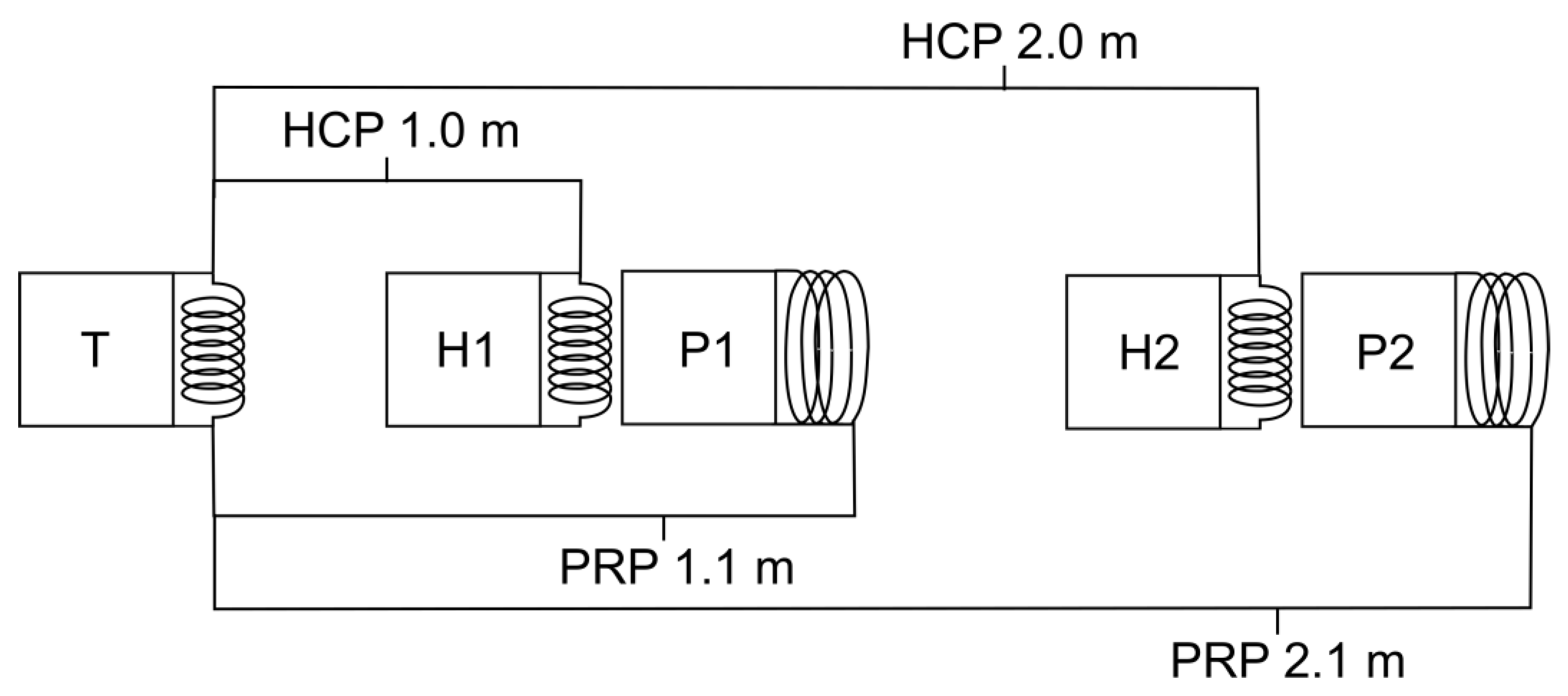
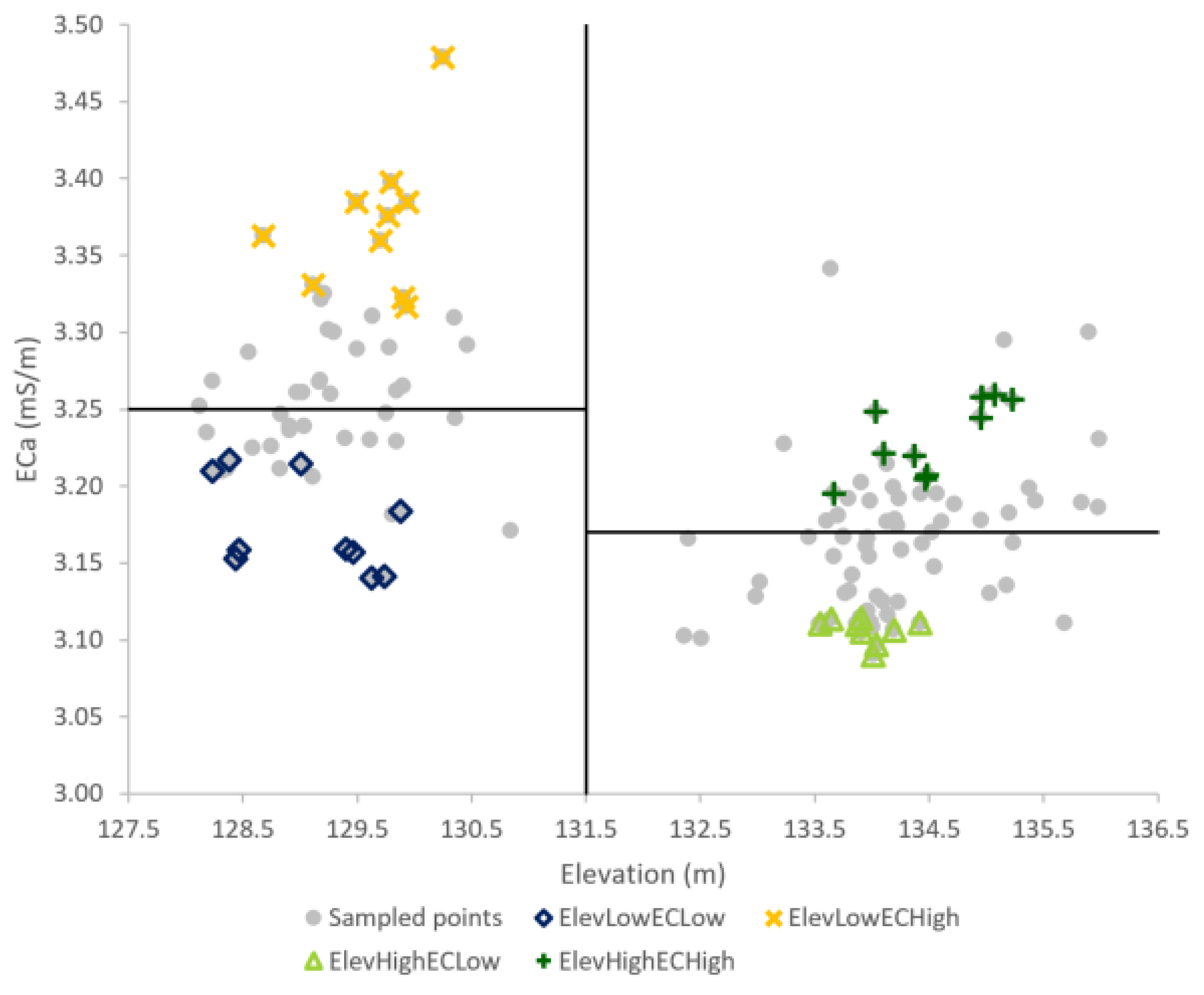
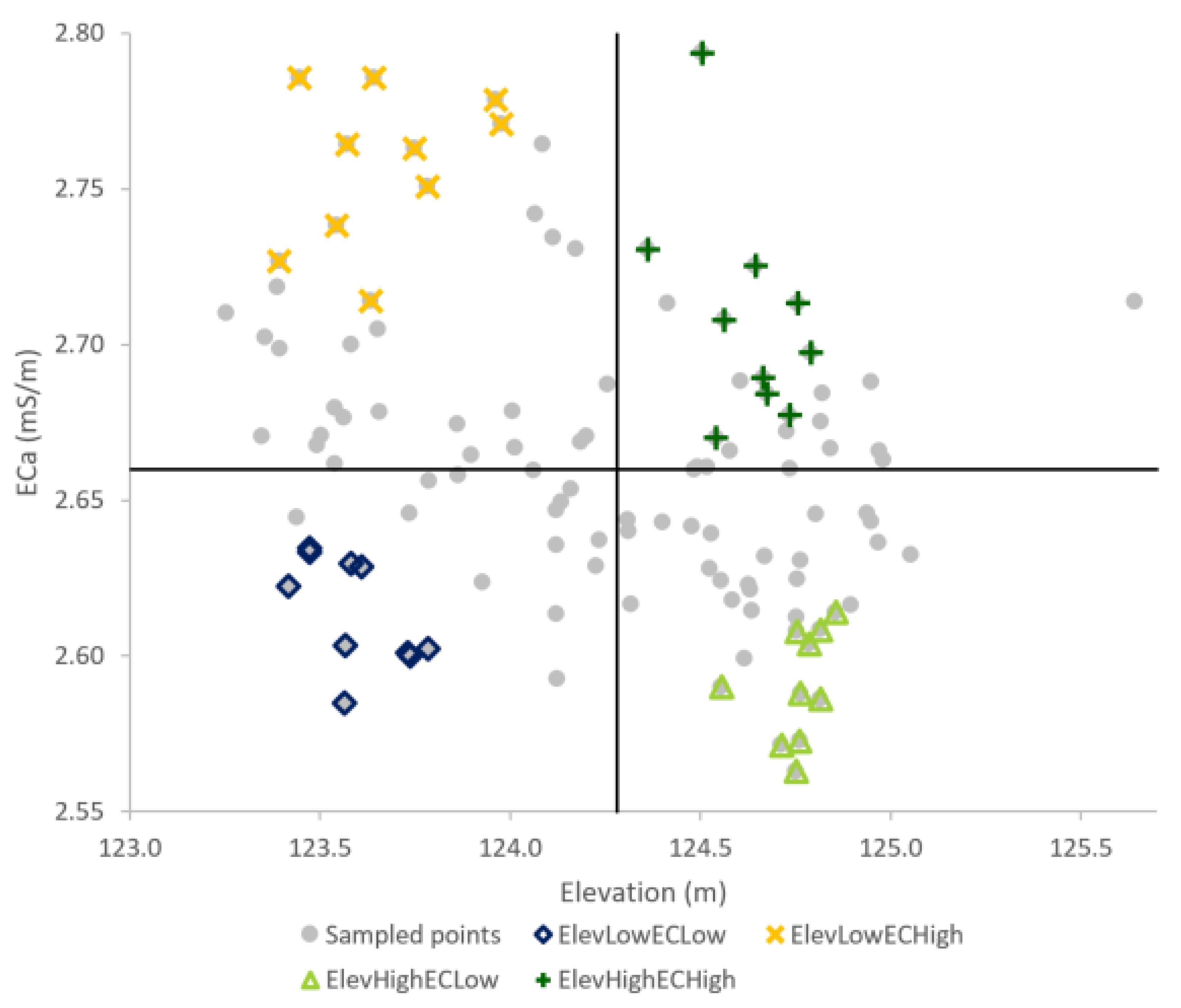
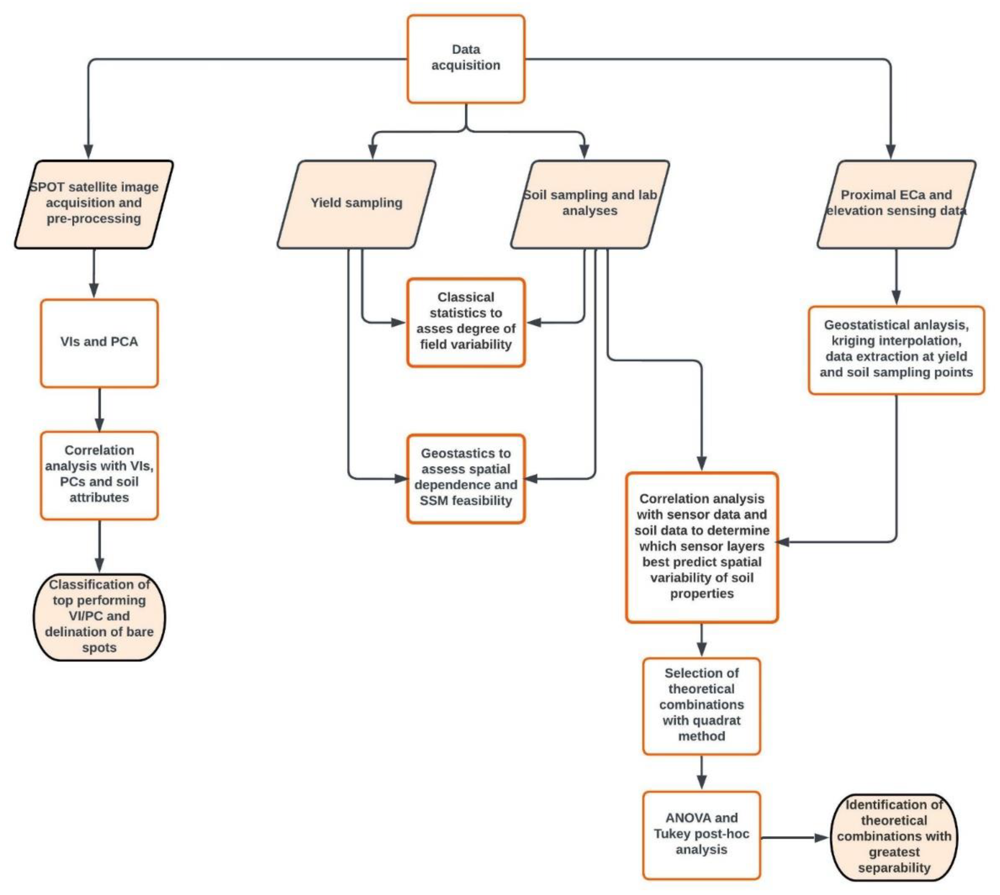
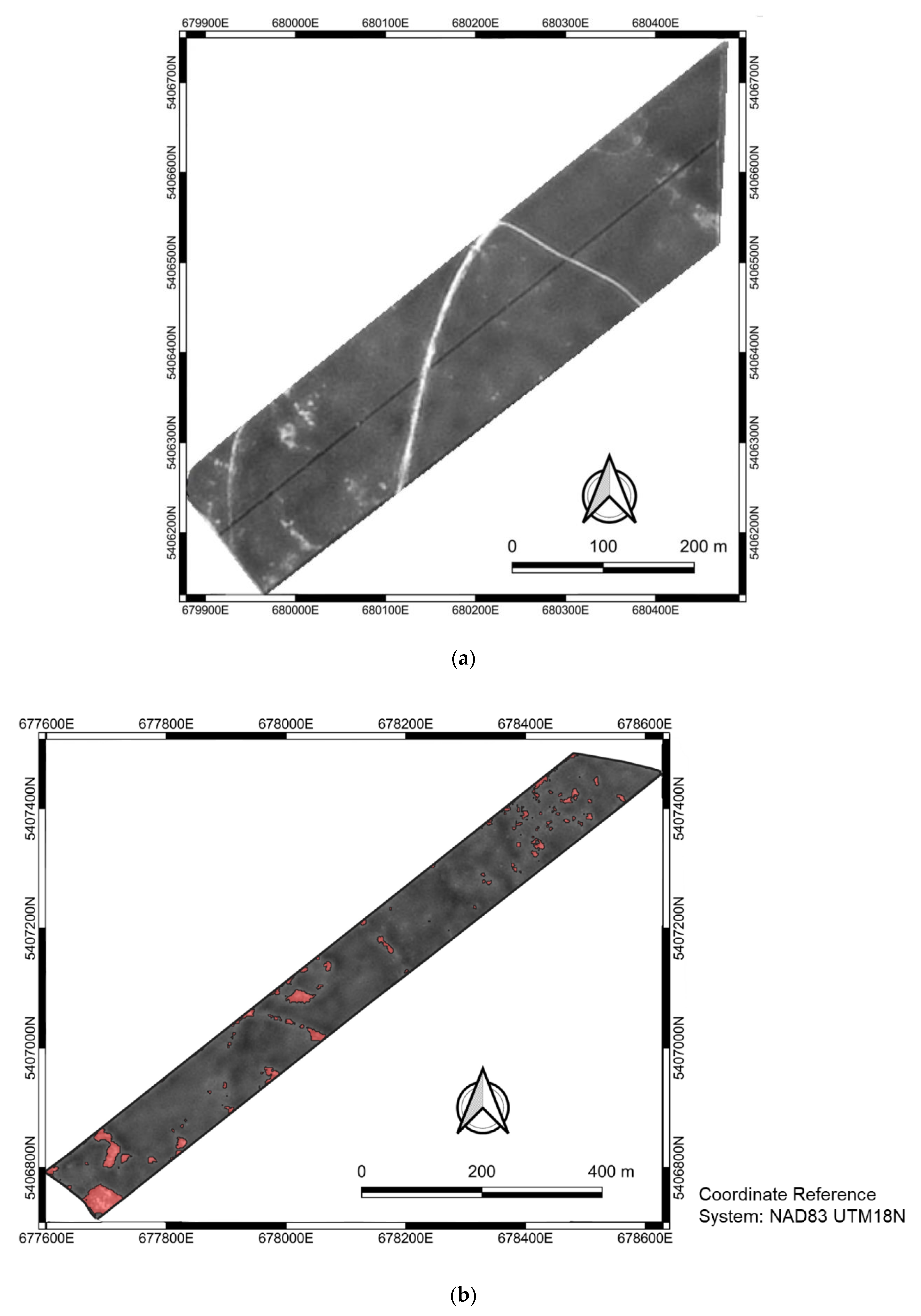
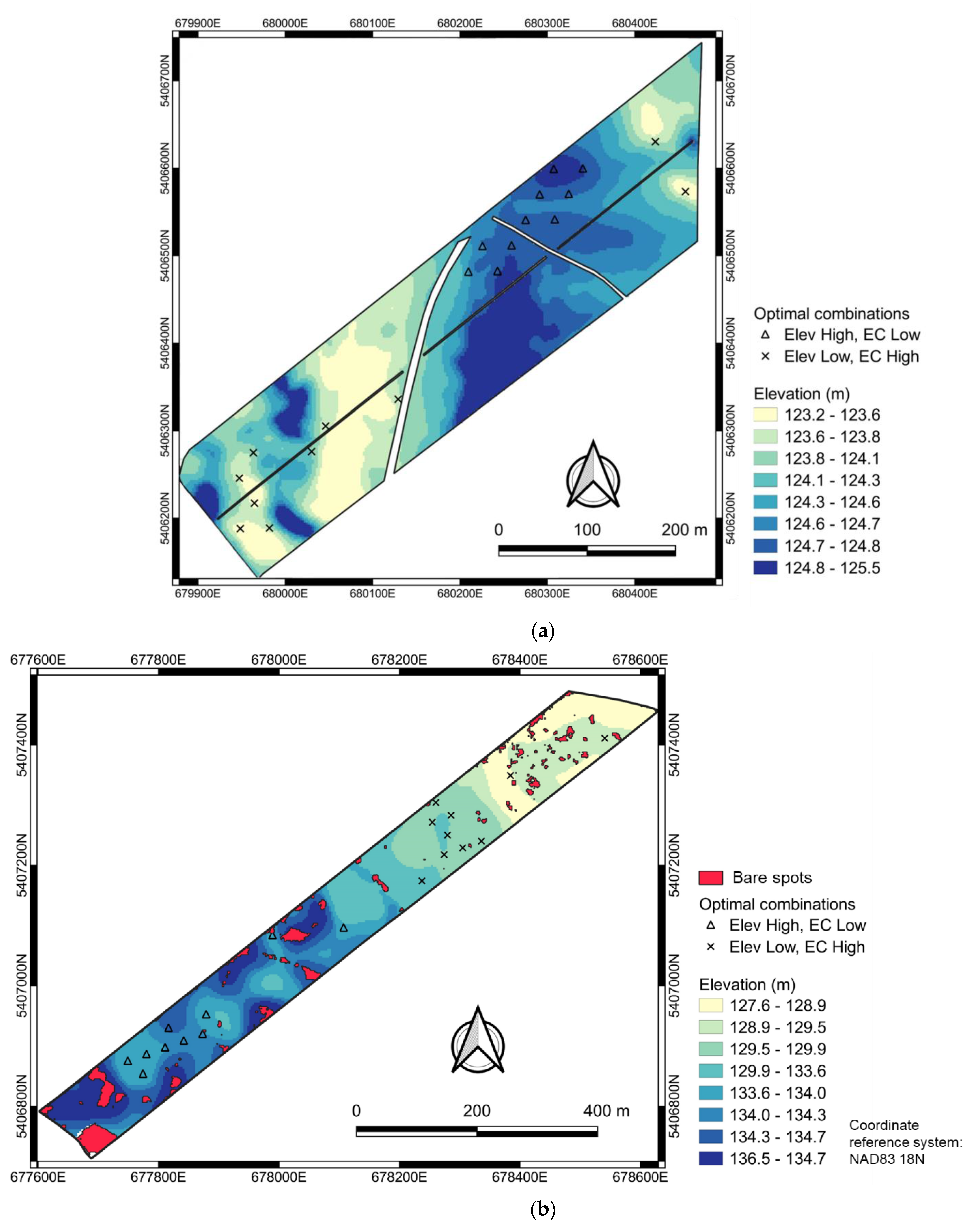
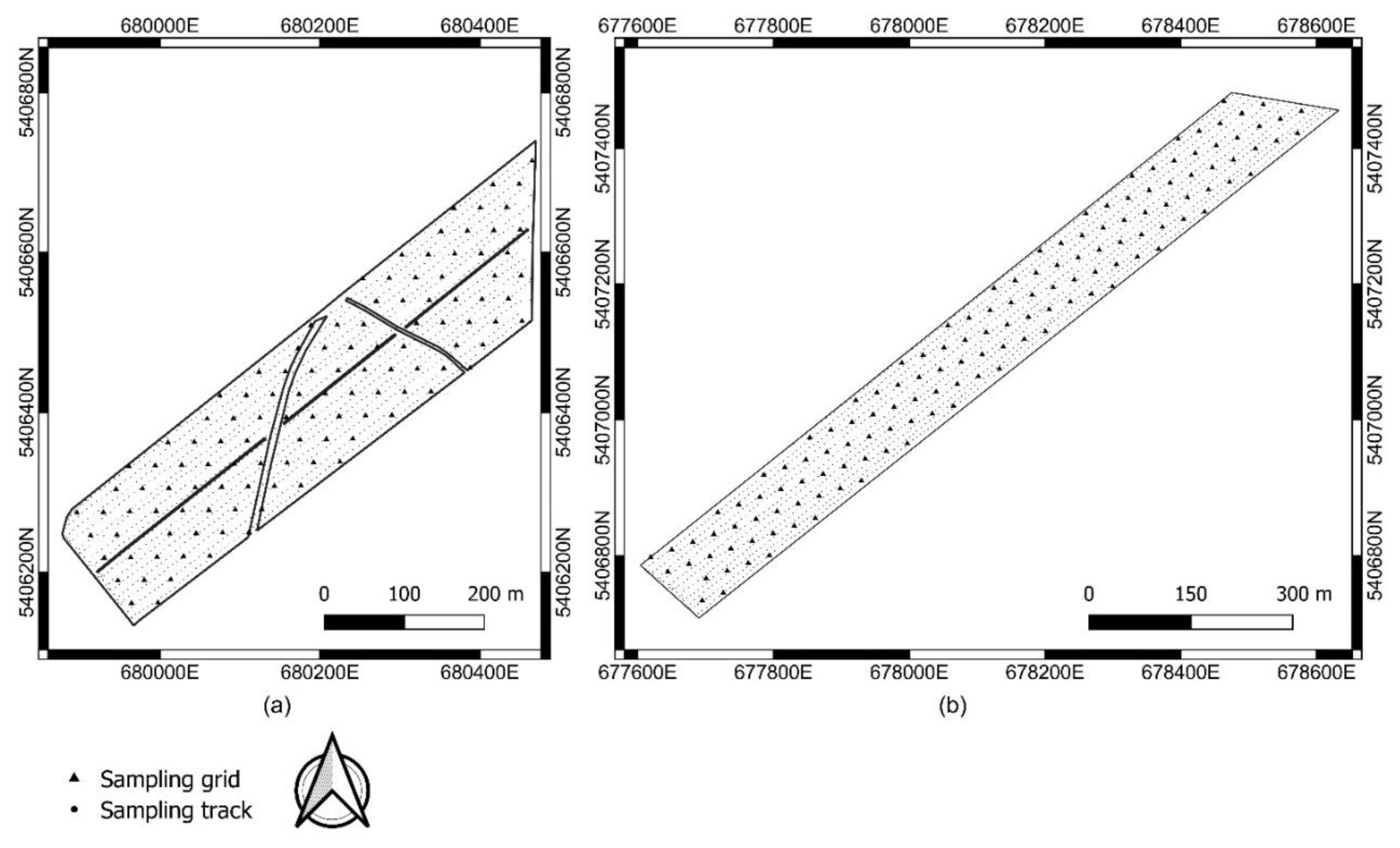
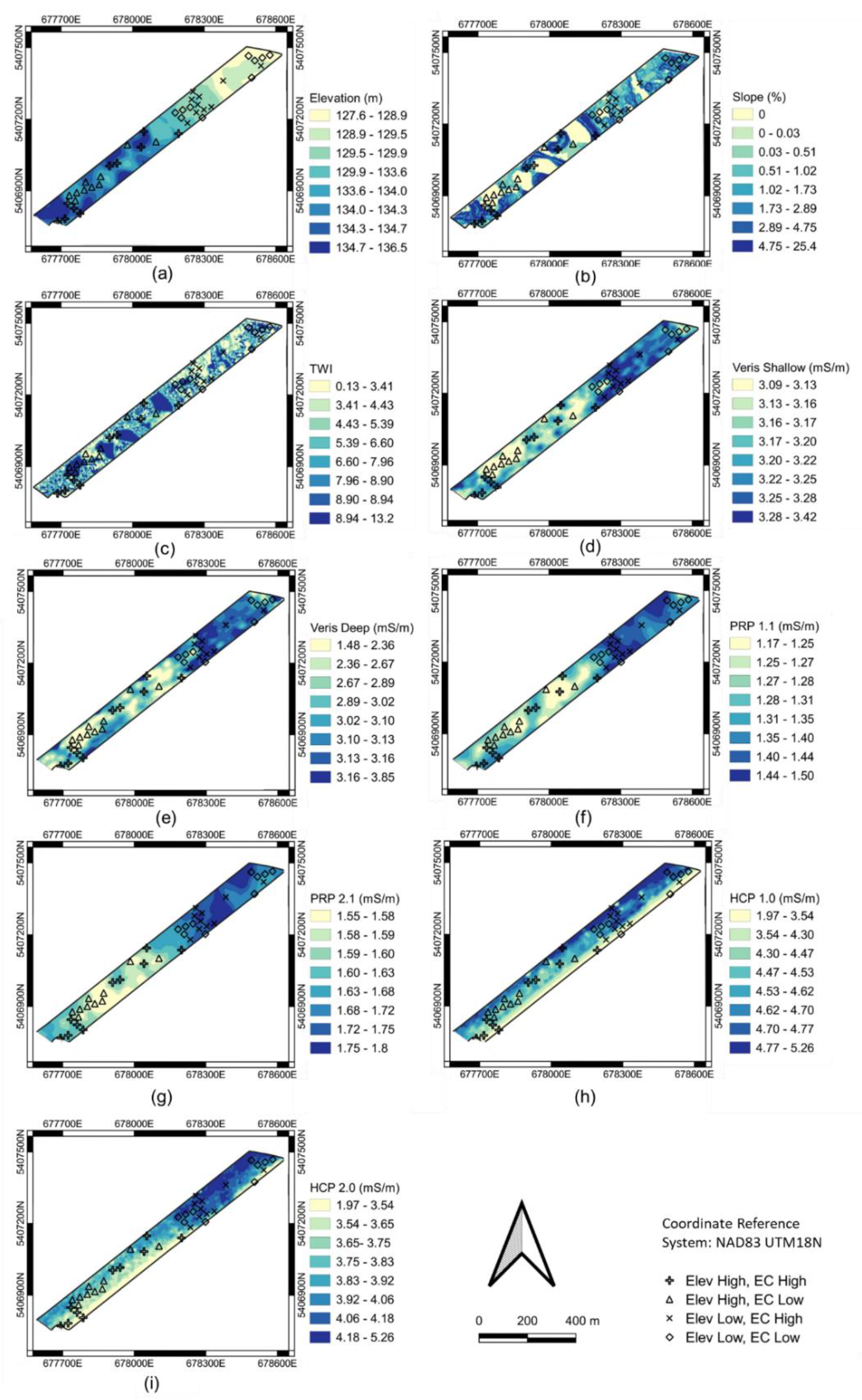
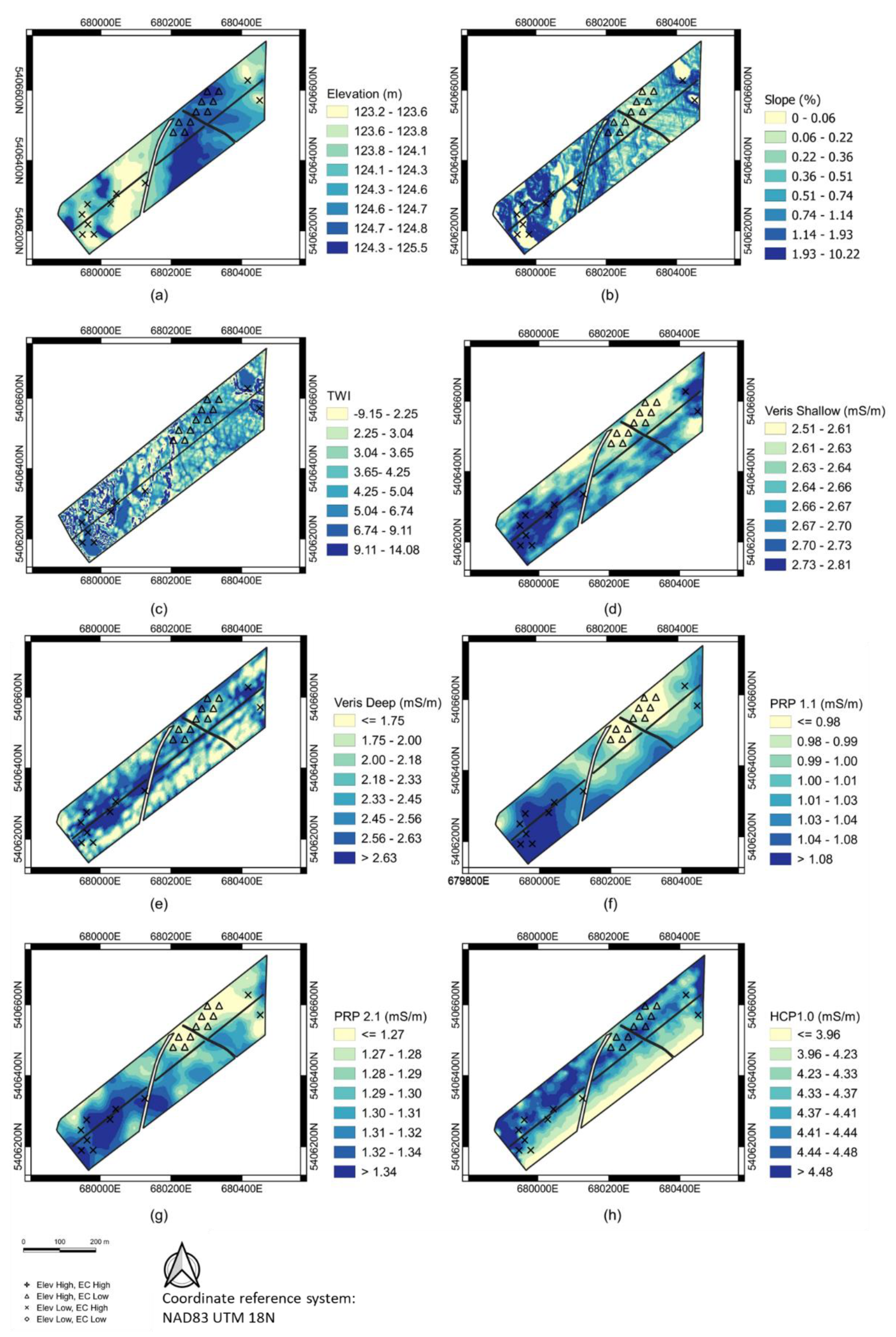
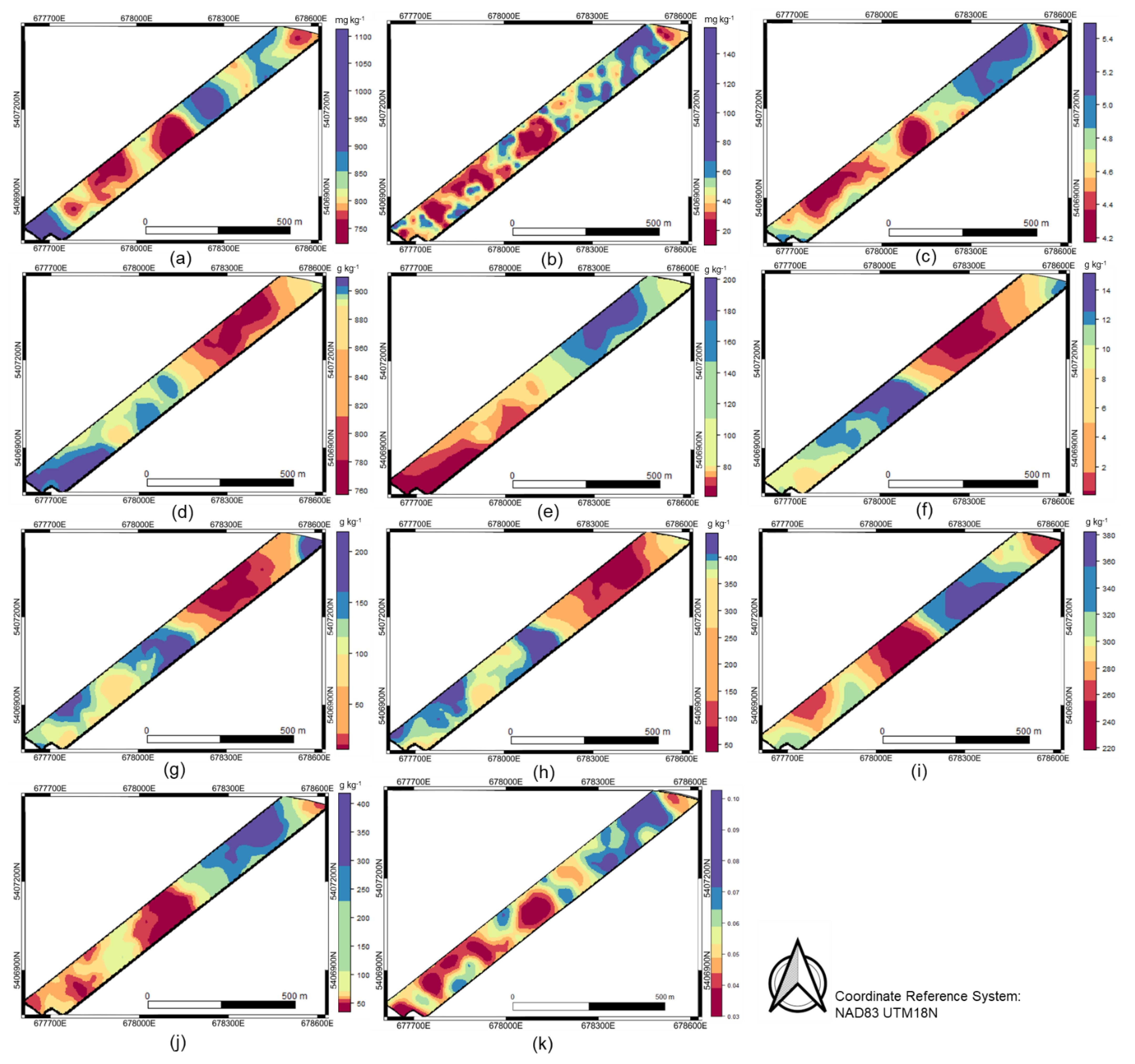
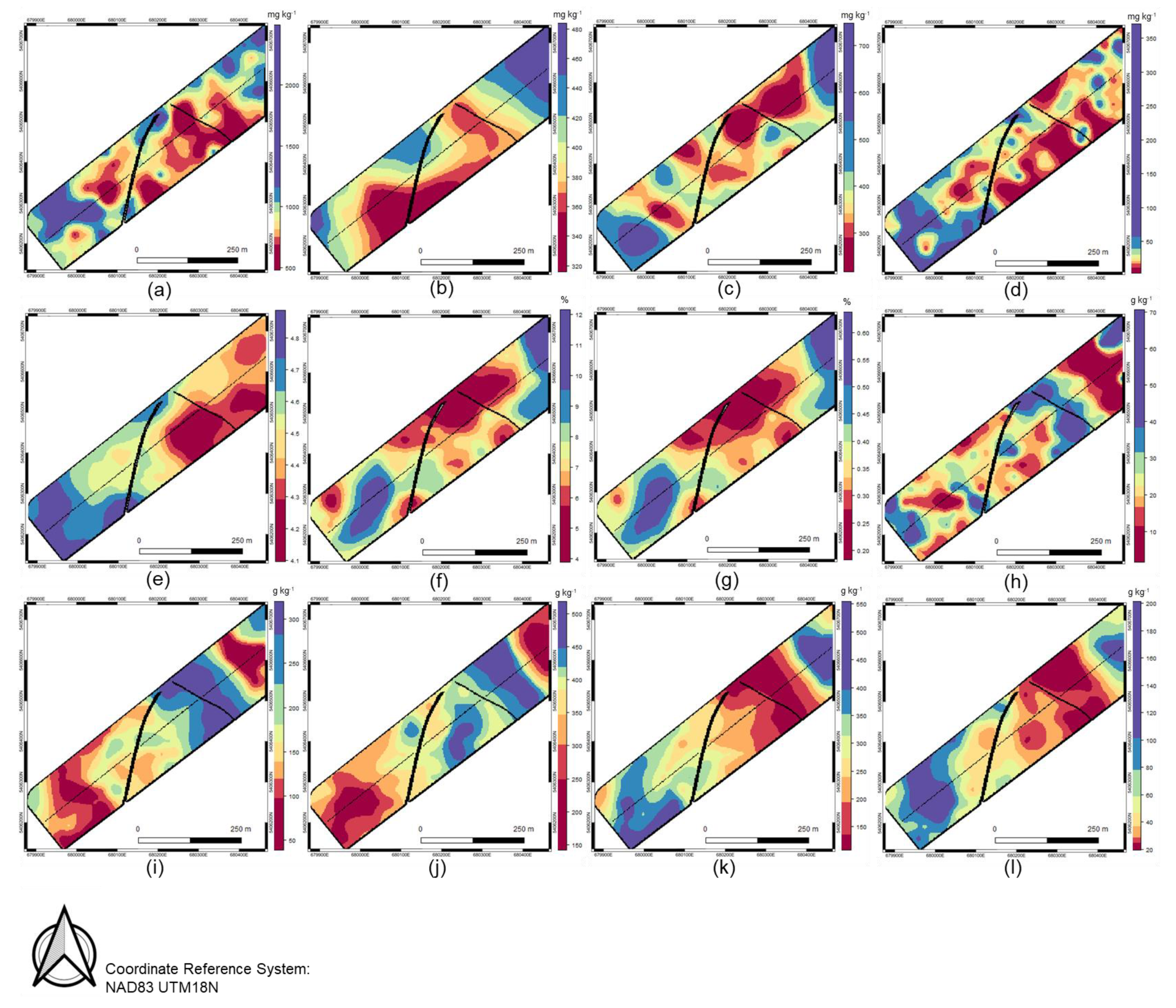
Wild blueberries (Vaccinium angustifolium Ait.) are often cultivated uniformly despite significant within-field variations in topography and crop density. This study was conducted to relate apparent soil electrical conductivity (ECa), topographic attributes, and multi-spectral satellite imagery to fruit yield and soil attributes and evaluate the potential of site-specific management (SSM) of nutrients. Elevation and ECa at multiple depths were collected from two experimental fields (referred as FieldUnd, FieldFlat) in Normandin, Quebec, Canada. Soil samples were collected at two depths (0–0.05 m and 0.05–0.15 m) and analyzed for a range of soil properties. Statistical analyses of fruit yield, soil, and sensor data were used to characterize within-field variability. Fruit yield showed large variability in both fields (CVUnd = 54.4%, CVFlat = 56.5%), but no spatial dependence. However, several soil attributes showed considerable variability and moderate to strong spatial dependence. Elevation and the shallowest depths of both the Veris (0.3 m) and DUALEM (0.54 m) ECa sensors showed moderate to strong spatial dependence and correlated significantly to most soil properties in both study sites, indicating the feasibility of SSM. In place of management zone delineation, a quadrant analysis of the shallowest ECa depth vs. elevation provided four sensor combinations (scenarios) for theoretical field conditions. ANOVA and Tukey–Kramer’s post hoc test showed that the greatest differentiation of soil properties in both fields occurred between the combinations of high ECa/low elevation versus low ECa/high elevation. Vegetation indices (VIs) obtained from satellite data showed promise as a biomass indicator, and bare spots classified with satellite imagery in FieldUnd revealed significantly distinct soil properties. Combining proximal and multispectral data predicted within-field variations of yield-determining soil properties and offered three theoretical scenarios (high ECa/low elevation; low ECa/high elevation; bare spots) on which to base SSM. Future studies should investigate crop response to fertilization between the identified scenarios.
Keywords: precision horticulture; proximal soil sensors; apparent soil electrical conductivity; SPOT satellite image; management zone; sensor combinations precision horticulture; proximal soil sensors; apparent soil electrical conductivity; SPOT satellite image; management zone; sensor combinations