Article

Ultra-High Resolution Large-Eddy Simulation of Typhoon Yagi (2024) over Urban Haikou


1
School of Ecology, Hainan University, Haikou 570228, China
2
Lanzhou Central Meteorological Observatory, Lanzhou 730020, China
3
School of Earth Science and Engineering, Hebei University of Engineering, Handan 056009, China
4
Hainan Province Meteorological Information Center, Haikou 570203, China
5
National Meteorological Information Center, Beijing 100081, China
*
Authors to whom correspondence should be addressed.
Urban Sci. 2026, 10(1), 42; https://doi.org/10.3390/urbansci10010042

Submission received: 15 November 2025 / Revised: 28 December 2025 / Accepted: 6 January 2026 / Published: 11 January 2026

Abstract

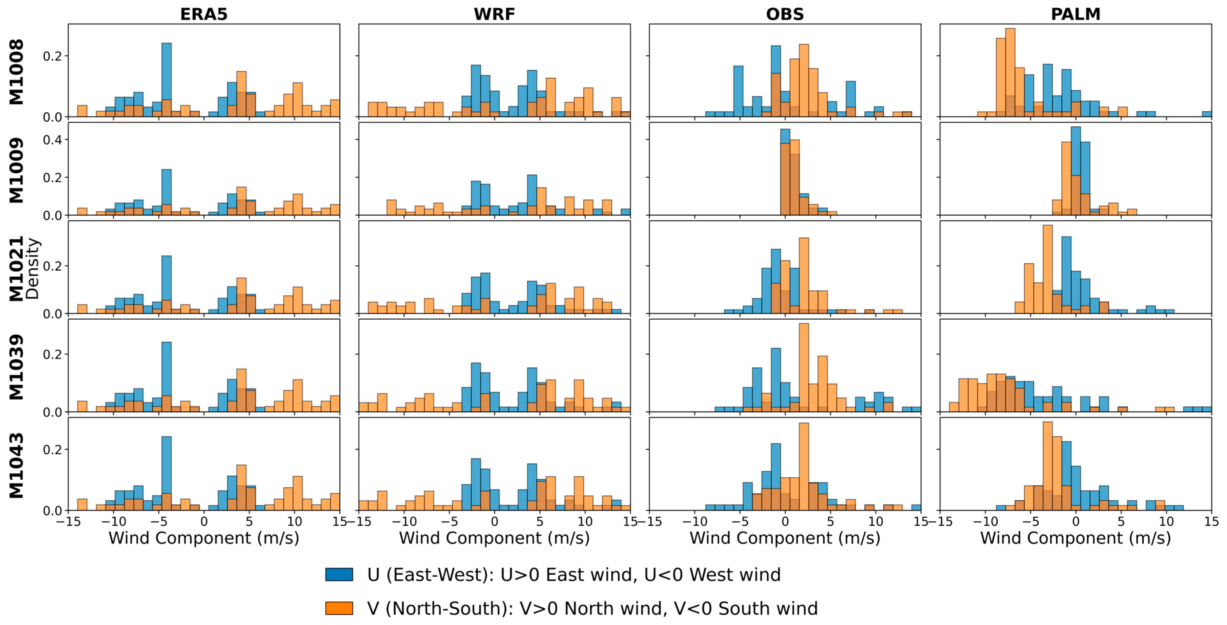
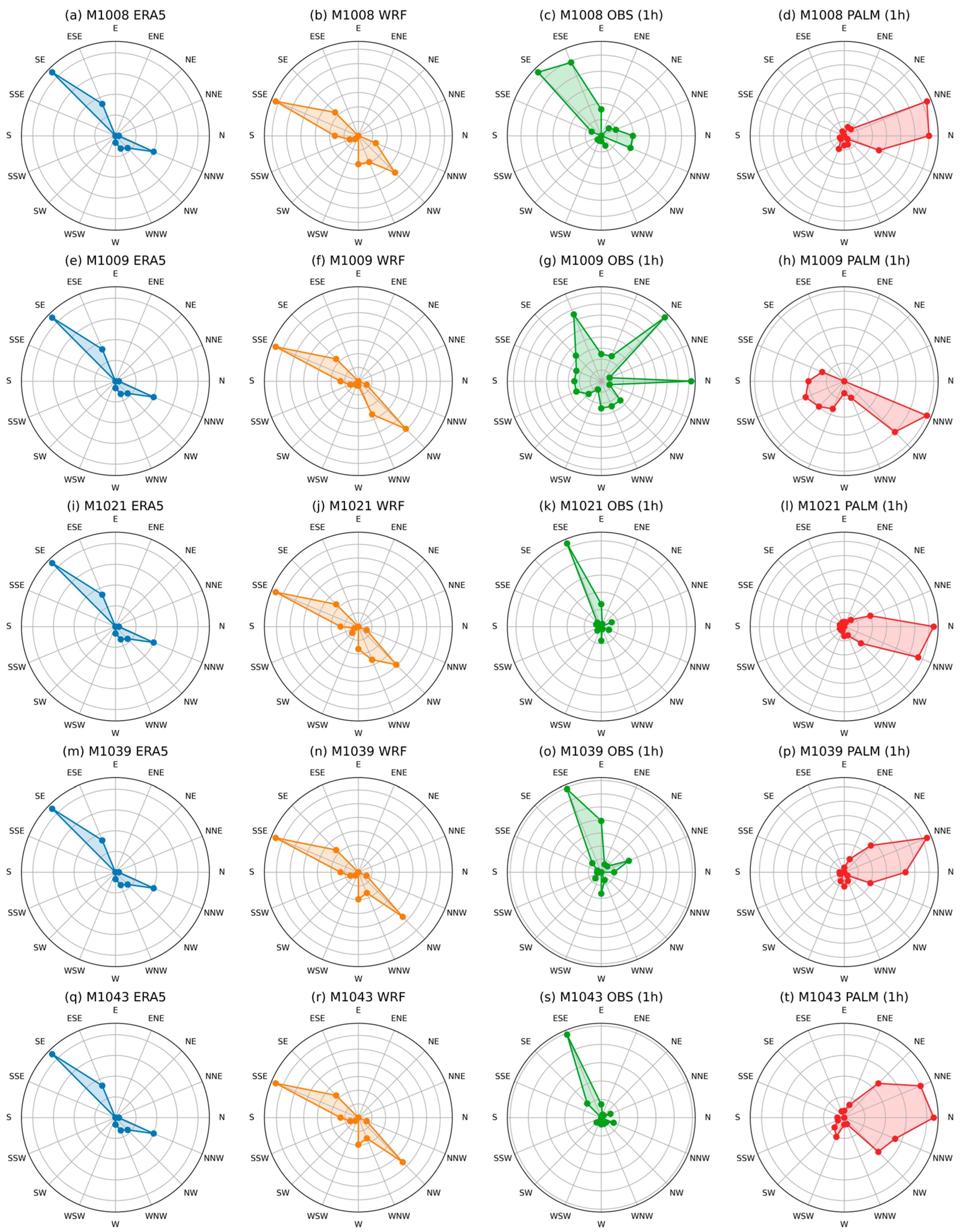
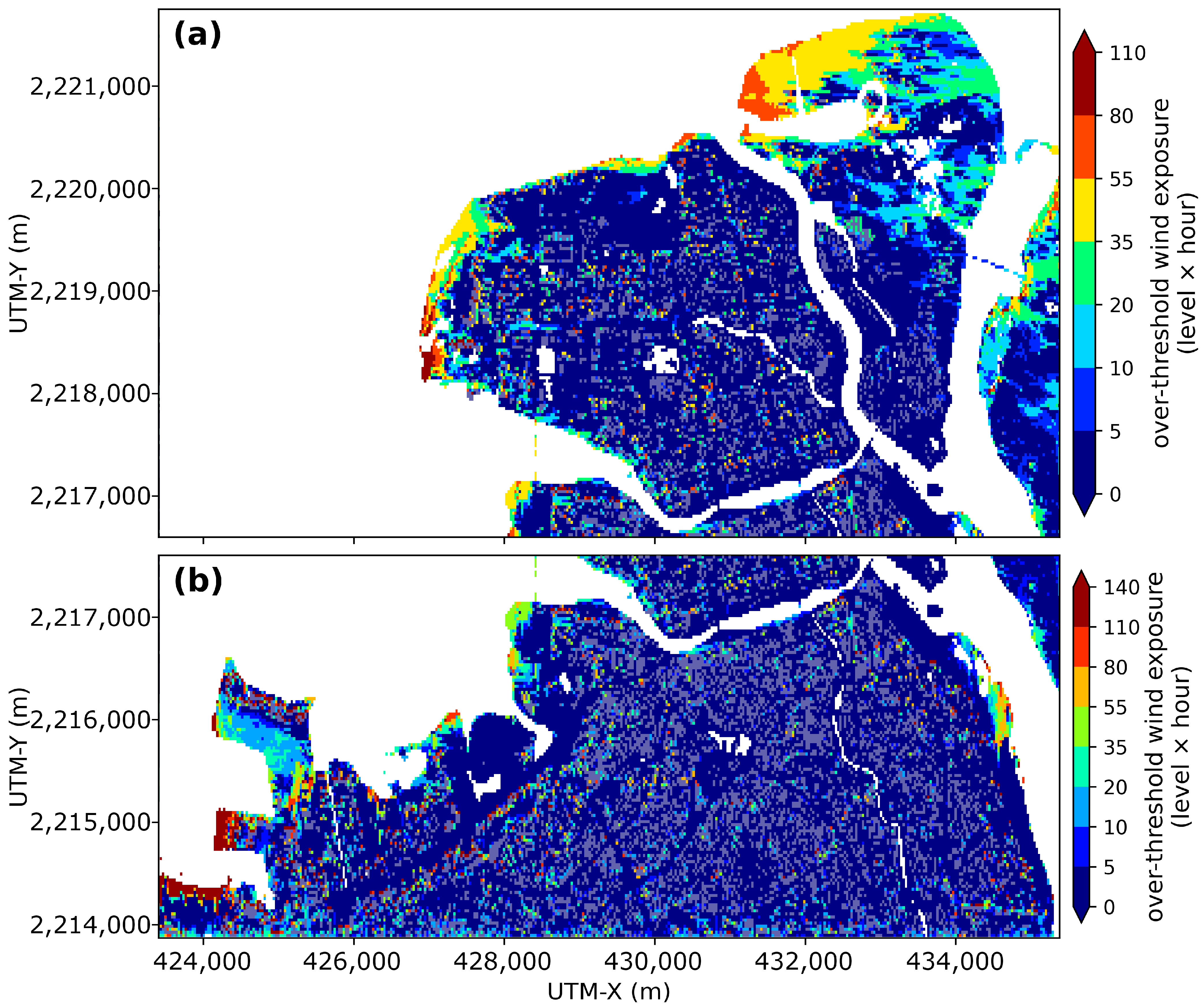
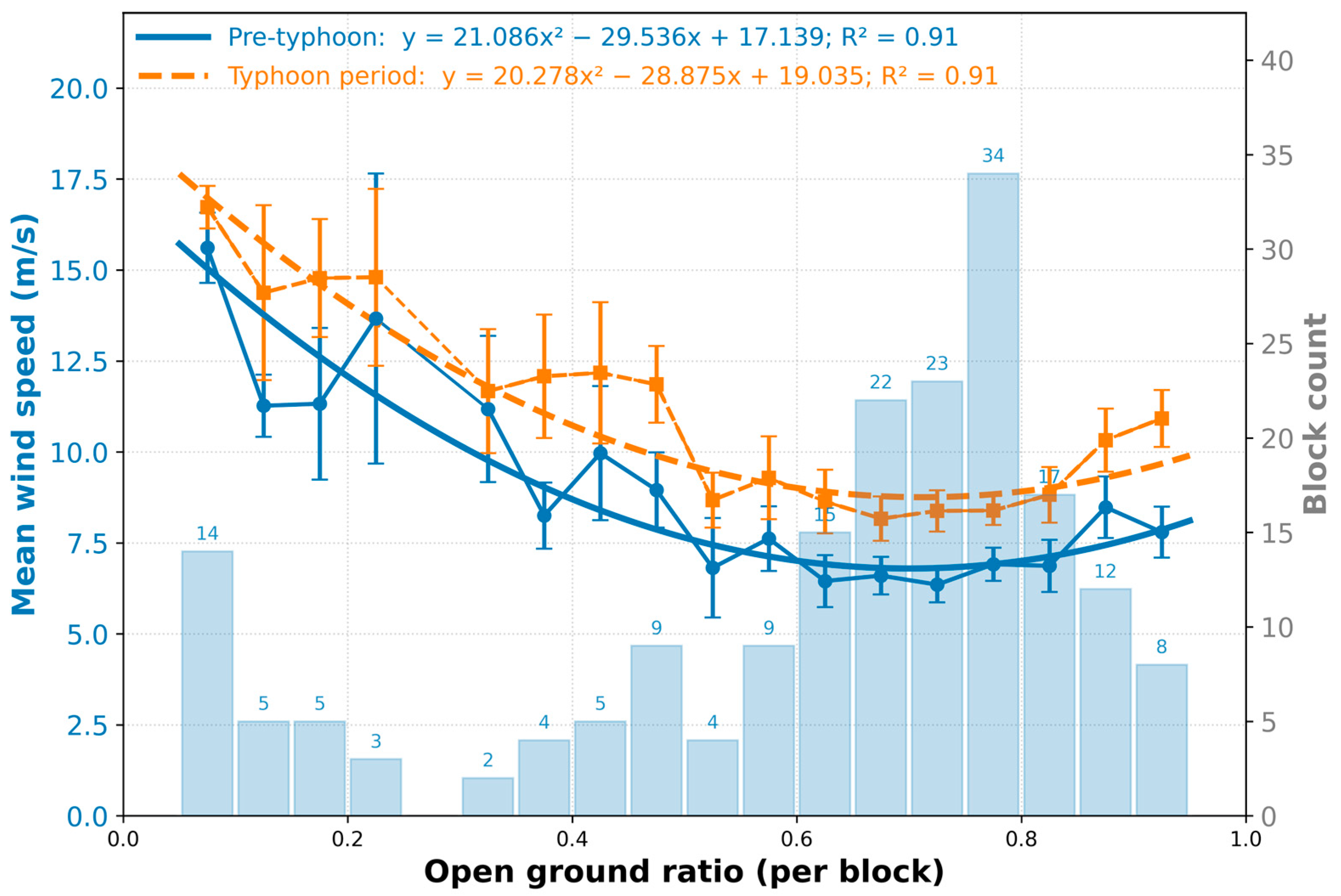
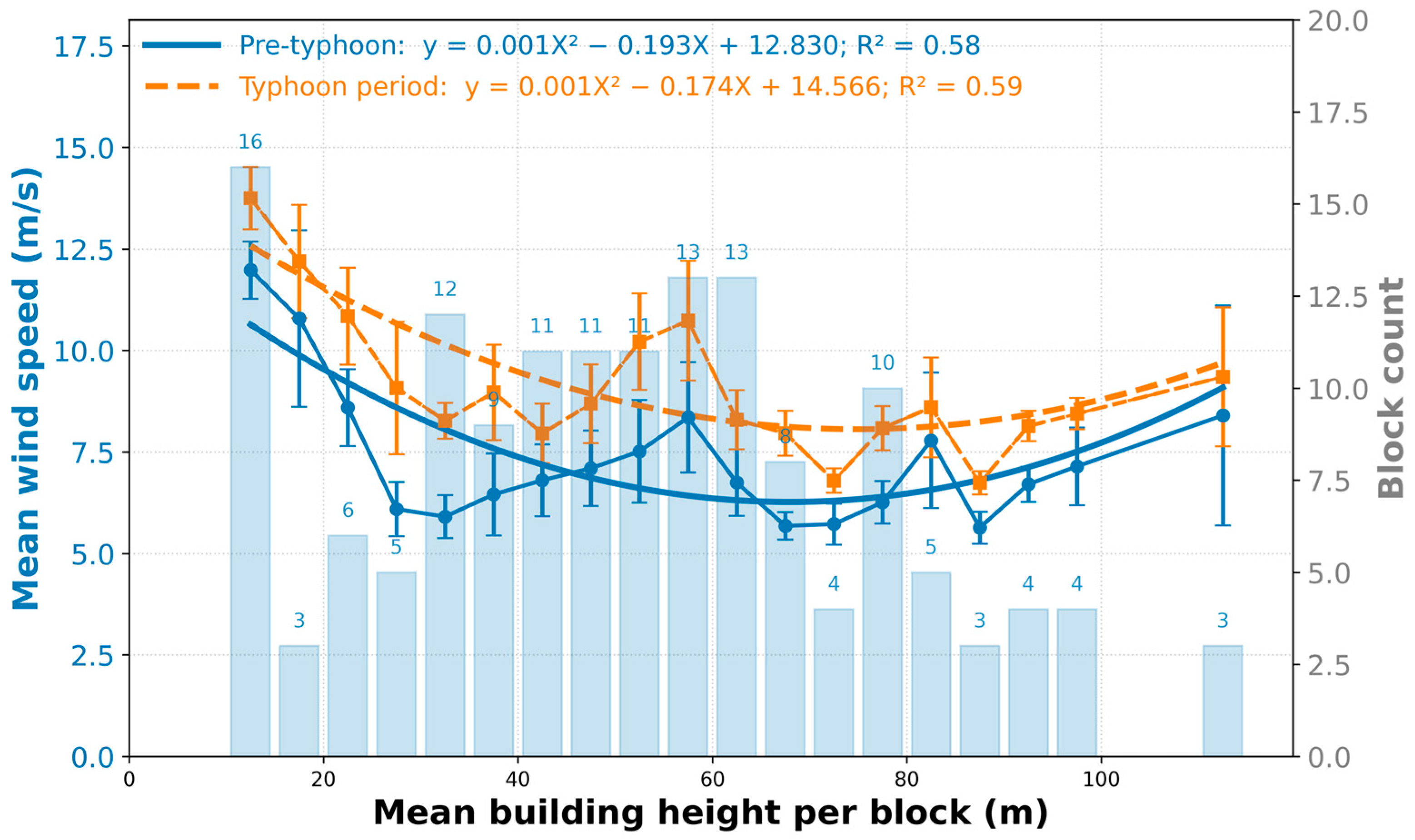
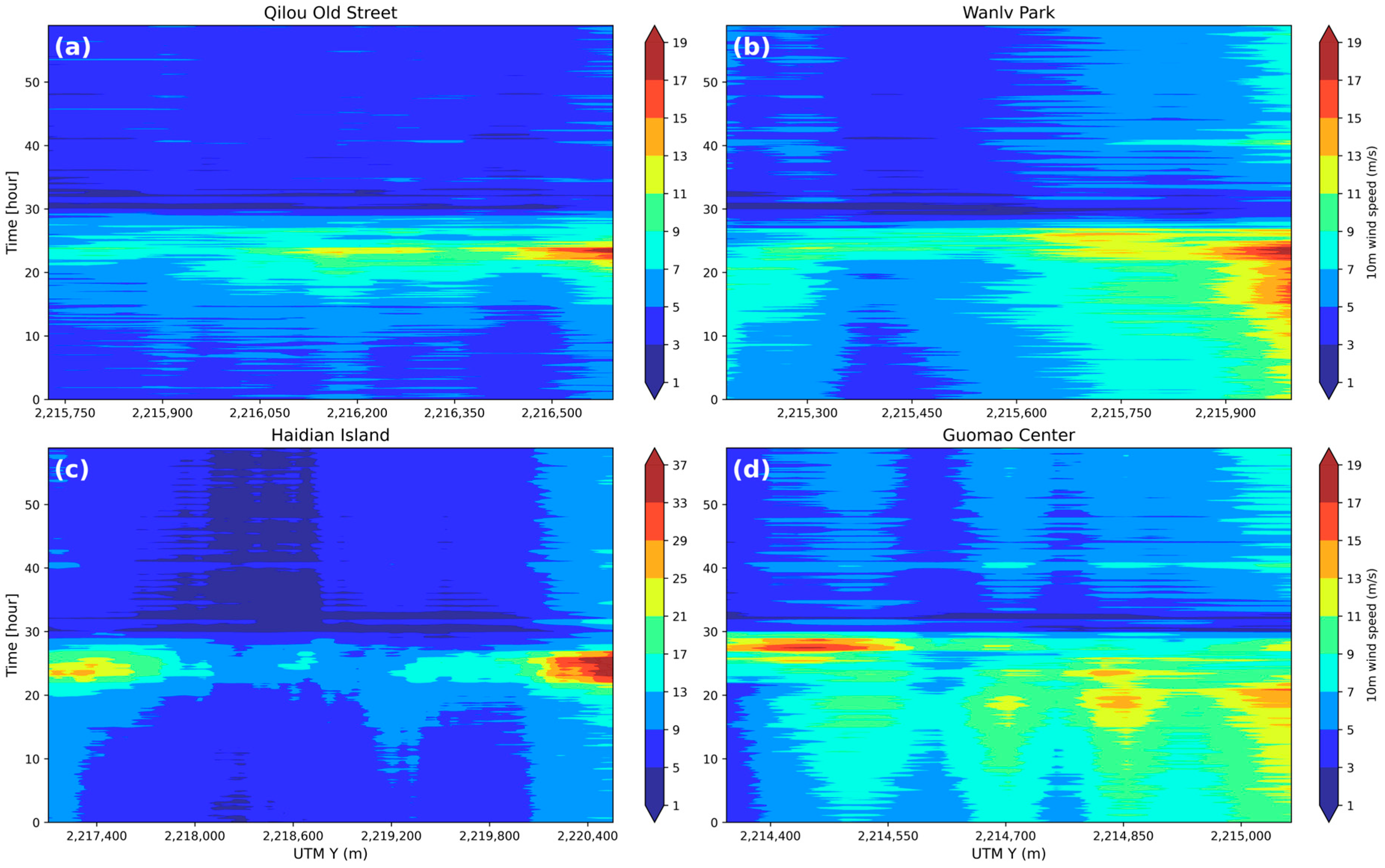
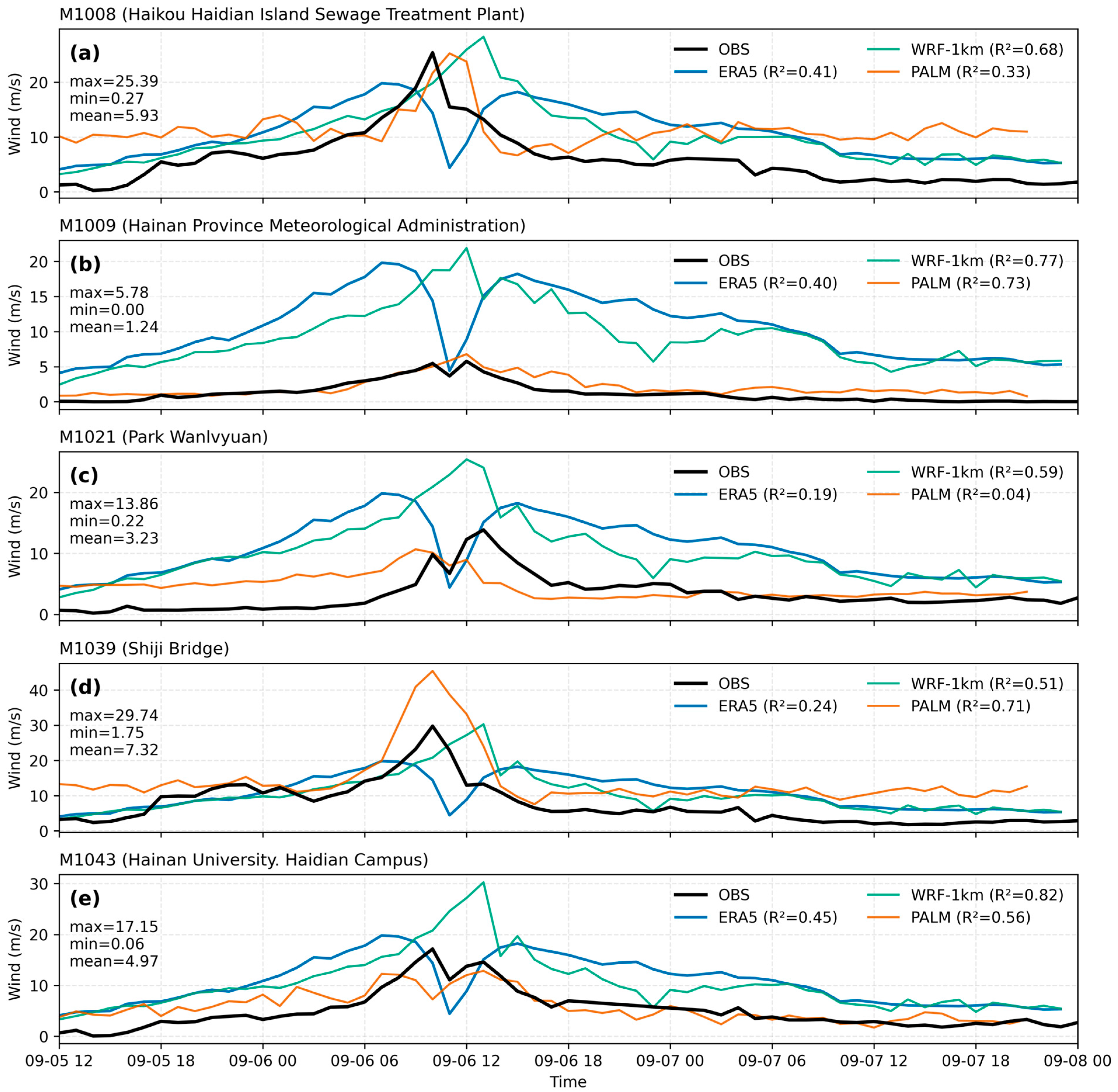
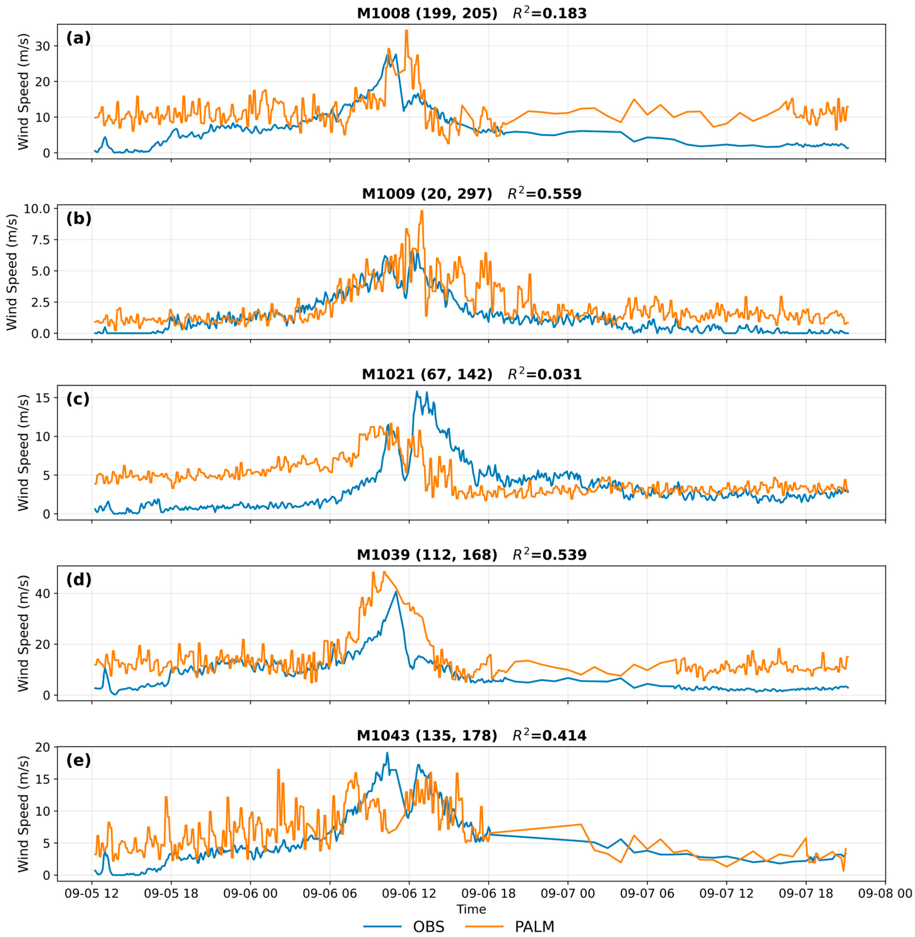
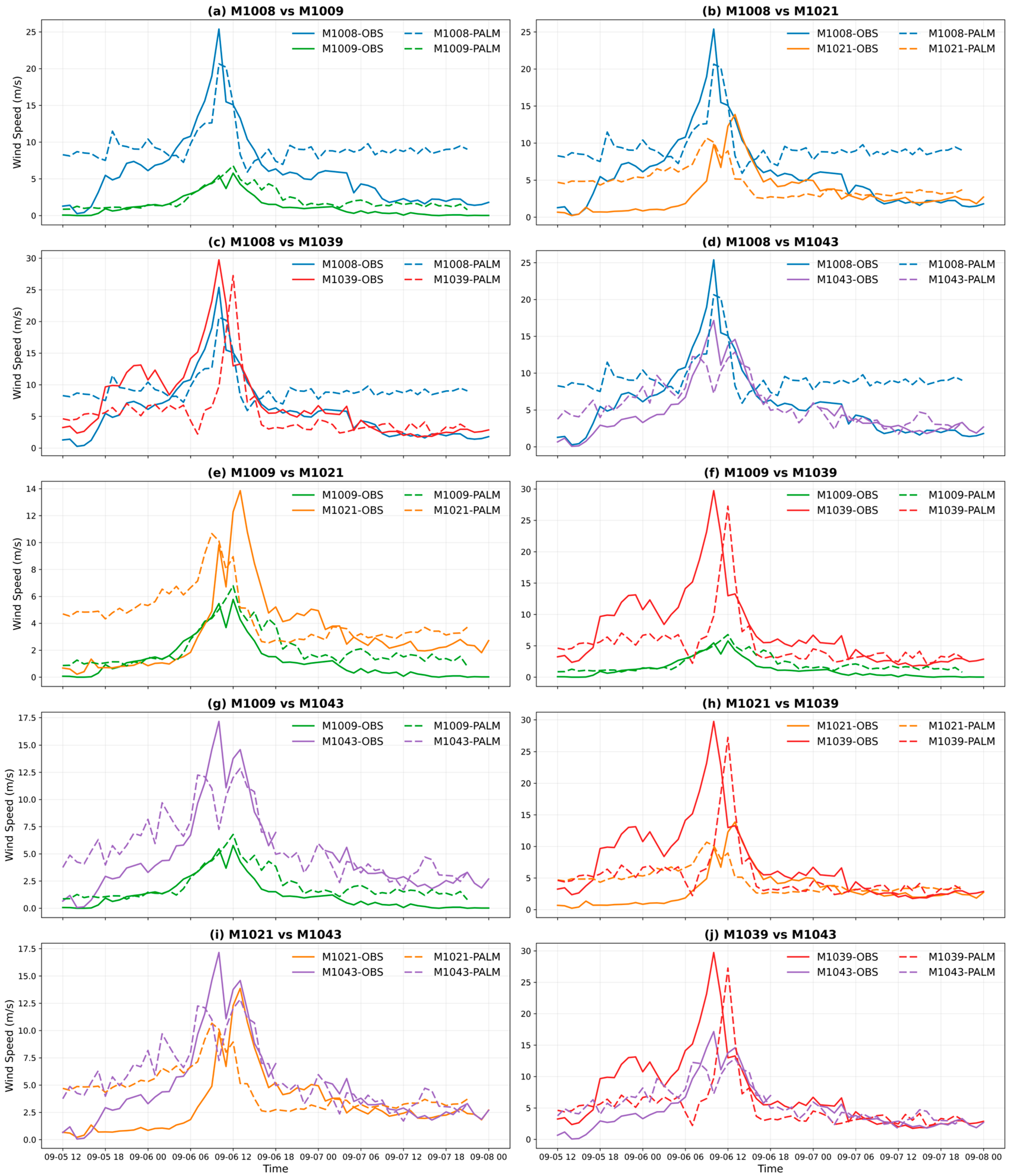
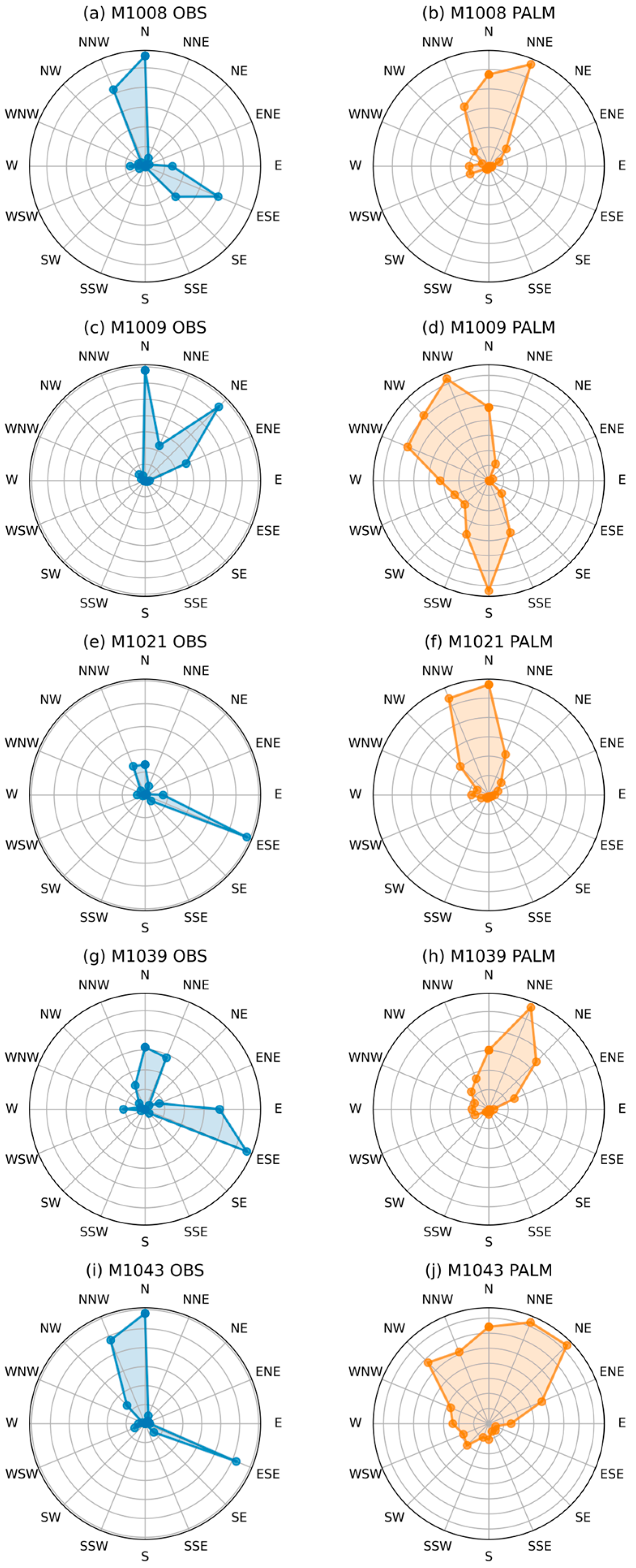
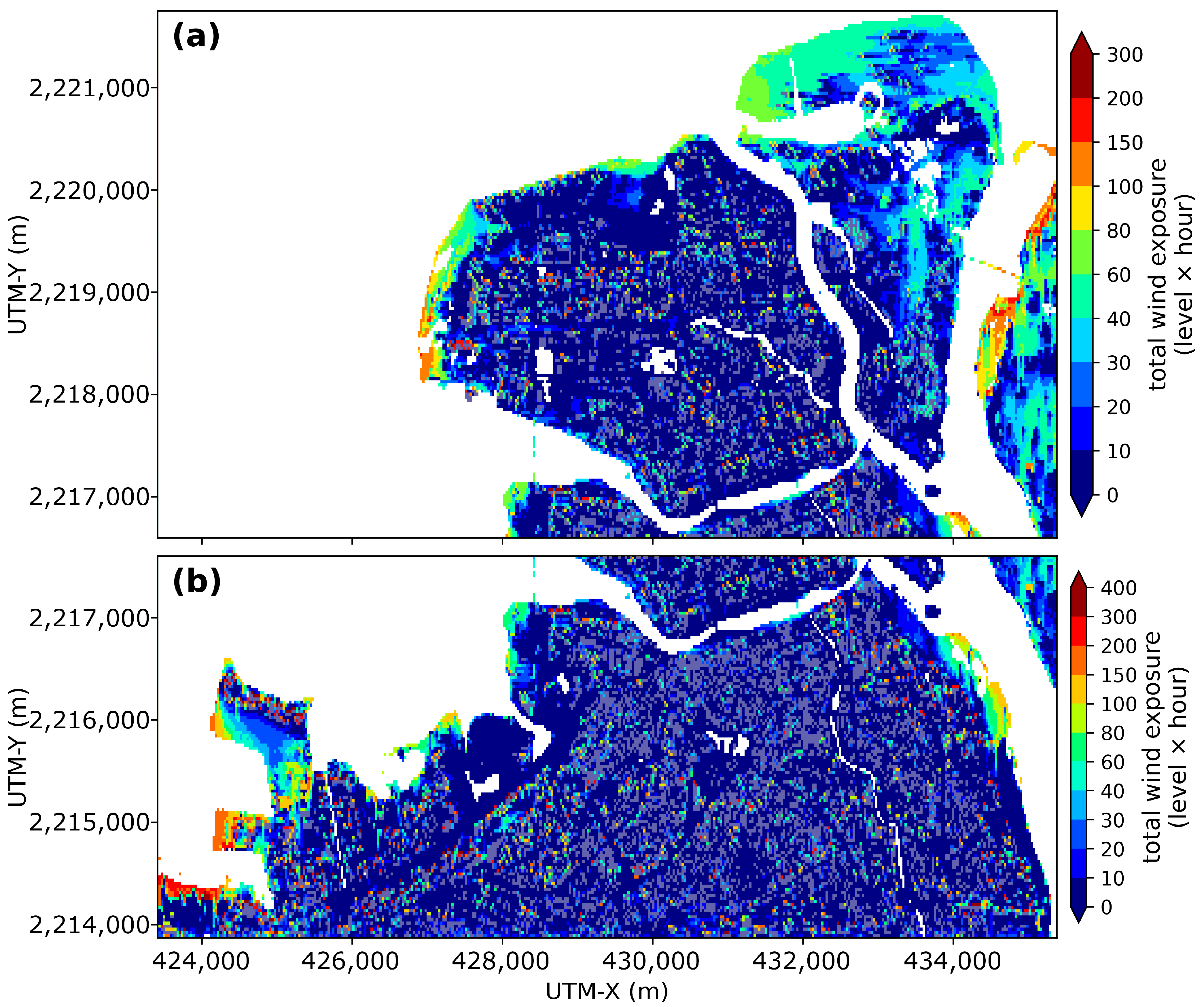
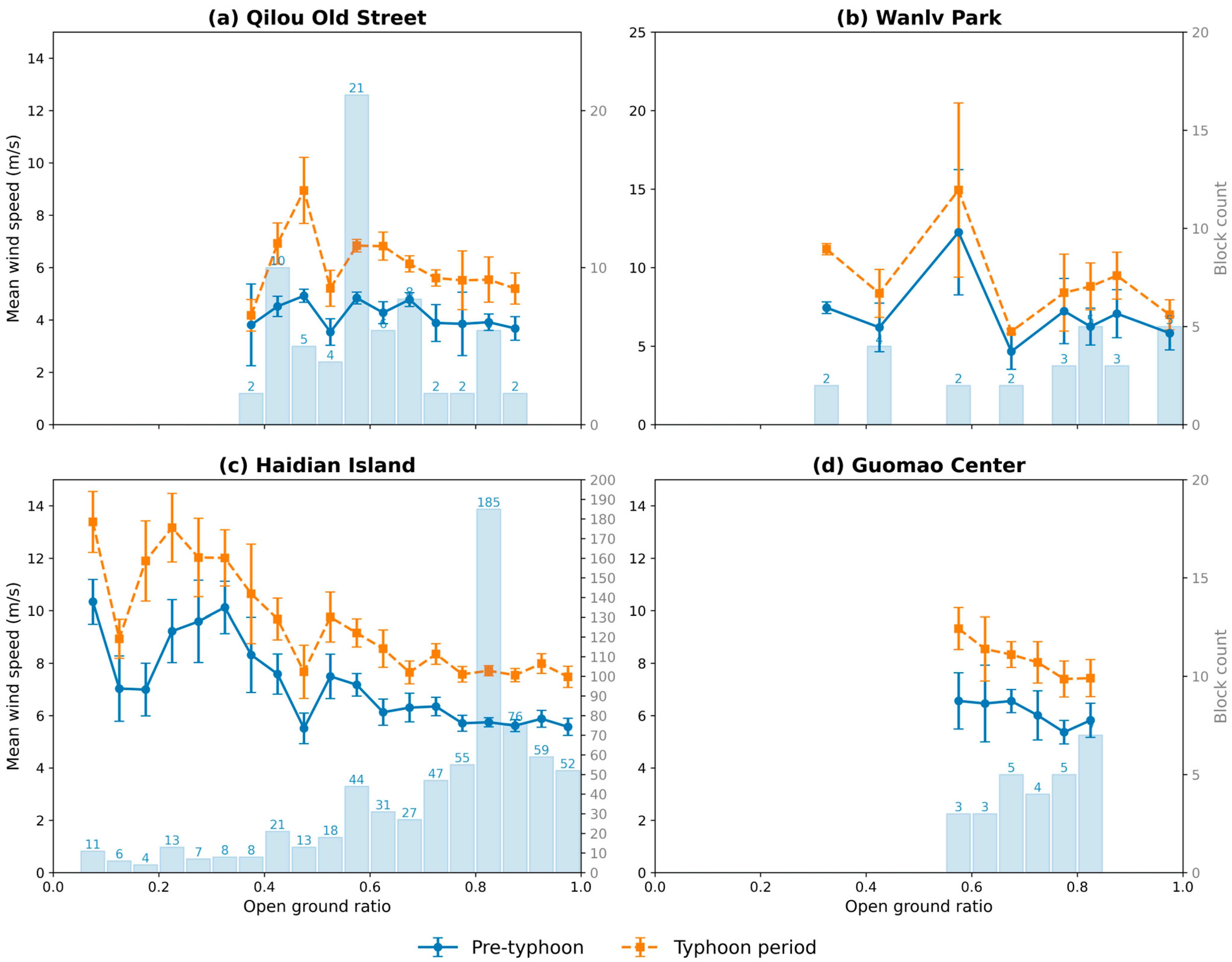
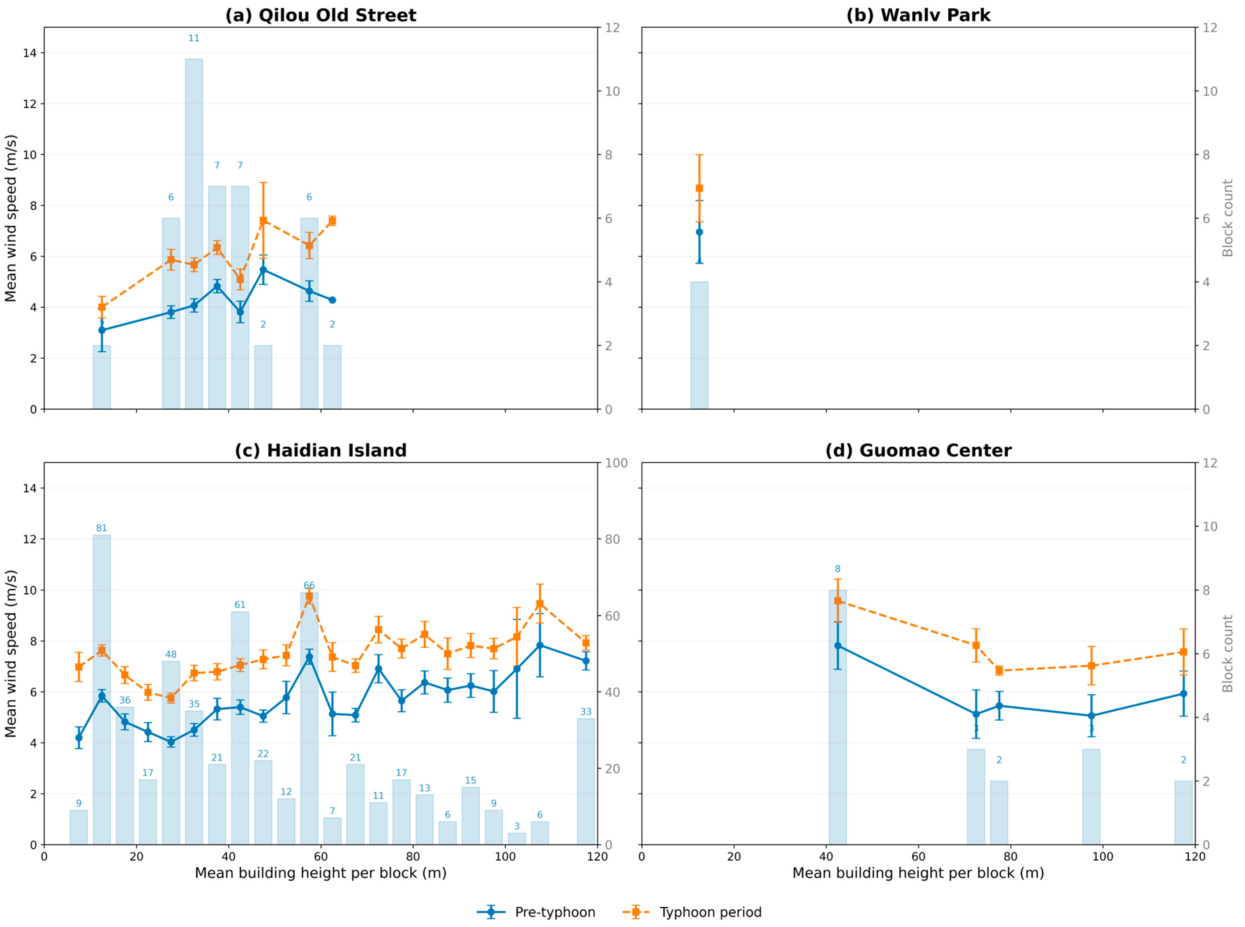
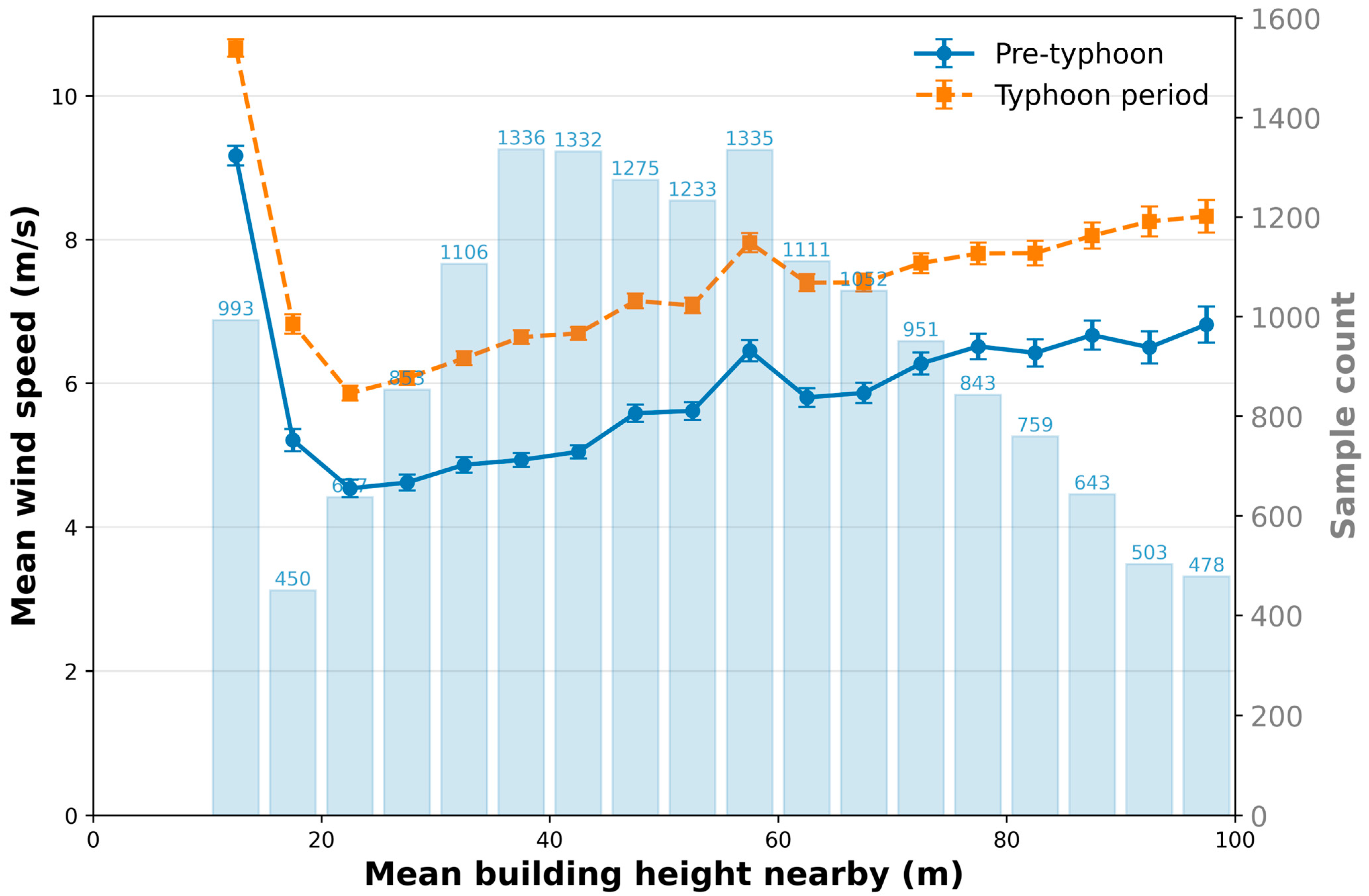
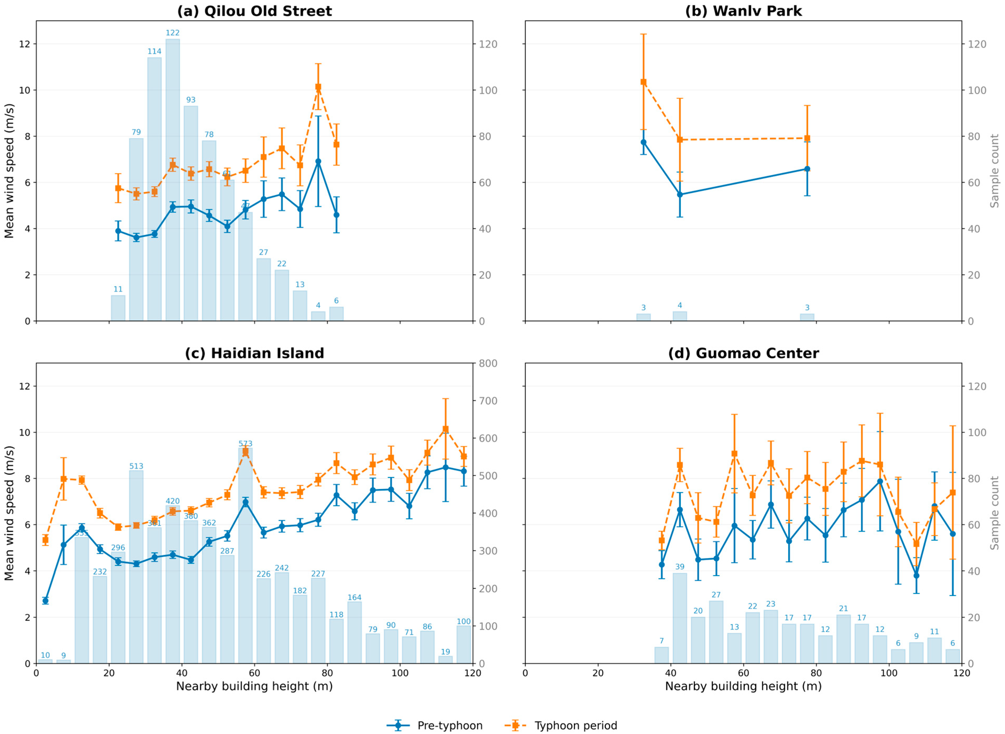
About 16% of typhoons making landfall in China strike Hainan Island, where near-surface extreme winds in dense urban areas exhibit a strong spatiotemporal heterogeneity that is difficult to capture with current observations and mesoscale models. Focusing on Haikou during Super Typhoon Yagi (2024)—the strongest autumn typhoon to hit China since 1949—we developed a multiscale ERA5–WRF–PALM framework to conduct 30 m resolution large-eddy simulations. PALM results are in reasonable agreement with most of the five automatic weather stations, while performance is weaker at the most sheltered park site. Mean near-surface wind speeds increased by 20–50% relative to normal conditions, showing a coastal–urban gradient: maps of weighted cumulative exposure to strong winds (≥Beaufort force 8) show much longer and more intense events along open coasts than within built-up urban cores. Urban morphology exerted nonlinear effects: wind speeds followed a U-shaped relation with both the open-space ratio and mean building height, with suppression zones at ~0.5–0.7 openness and ~20–40 m height, while clusters of super-tall buildings induced Venturi-like acceleration of 2–3 m s−1. Spatiotemporal analysis revealed banded swaths of high winds, with open areas and islands sustaining longer, broader extremes, and dense street grids experiencing shorter, localized events. Methodologically, this study provides a rare, systematically evaluated application of a multiscale ERA5–WRF–PALM framework to a real typhoon case at 30 m resolution in a tropical coastal city. These findings clarify typhoon–city interactions, quantify morphological regulation of extreme winds, and support risk assessment, urban planning, and wind-resilient design in coastal megacities.
Keywords: typhoon Yagi; large-eddy simulation; ultra-high resolution; urban scale; wind disaster risk typhoon Yagi; large-eddy simulation; ultra-high resolution; urban scale; wind disaster risk