Article

The Role of Spatial Context Information in the Generalization of Geographic Information: Using Reducts to Indicate Relevant Attributes

Faculty of Geodesy and Cartography, Warsaw University of Technology, 00-661 Warsaw, Poland
ISPRS Int. J. Geo-Inf. 2020, 9(1), 37; https://doi.org/10.3390/ijgi9010037
Submission received: 25 October 2019 / Revised: 29 December 2019 / Accepted: 4 January 2020 / Published: 10 January 2020
(This article belongs to the Special Issue Map Generalization)

Abstract

:
Generalization of geographic information enables cognition and understanding not only of objects and phenomena located in space but also the relations and processes between them. The automation of this process requires formalization of cartographic knowledge, including information on the spatial context of objects. However, the question remains which information is crucial to the decisions regarding the generalization (in this paper: selection) of objects. The article presents and compares the usability of three methods based on rough set theories (rough set theory, dominance-based rough set theory, fuzzy rough set theory) that facilitate the designation of the attributes relevant to a decision. The methods are using different types (levels of measurements) of attributes. The author determines reducts and their cores (common elements) that show the relevance of attributes stemming from the spatial context. The fuzzy rough set theory method proved the least useful, whereas the rough set theory and dominance-based rough set theory methods seem to be recommendable (depending on the governing level of measurement).

1. Introduction

1.1. Generalization of Geographic Information

Generalization is a process that relies on understanding the geographical space [1] and plays a vital role in ensuring that the content of a map or a spatial database serves its goal at specified levels of detail (LoD) [2]. Generalization purpose is the extraction of relevant information (by omitting information that would obscure the readability of trends and patterns in the data) [3,4]. Newer approaches (like [2]) often equate generalization with cartographic modeling, which is related to the map as a model of reality [5].
One of the fundamental challenges of modern cartography is the formalization of the principles of generalization, necessary for the (at least partial) automation of this process [6,7]. One of the approaches to the formalization of the generalization rules is the condition-action modeling (along with the interactive, that is human interaction modeling, and restrictive, namely constraint-based modeling, approaches) [1]. This process demands choosing of the attributes which are substantial for making generalization decisions.
The process of generalization of geographical information can be divided into a series of activities called generalization operators. The best-known classification of generalization operators is the one proposed by Shea and McMaster [8] that distinguishes 12 generalization operators, e.g., simplification, smoothing, aggregation, typification, and so on. The article does not mention the selection of objects among the generalization operators; instead, it was treated as the first step (pre-processing step) of generalization, performed before implementing the “proper” operators. In other classifications, a selection can be mentioned as a generalization operator, most often indirectly, e.g., as an elimination [9]. Nevertheless, the selection is not just the first stage of generalization of geographical information—it is also part of other operators; for example, simplifying the shape of a line relies on the selection of its proper nodes. Due to the vital role of selection, the research in this article concerns the proper selection of geographic objects.

1.2. Rough Logics

The classic logic, used on a daily basis, based on the binary Aristotle system 0–1 true–false [10], proves insufficient in some cases. It is especially true when dealing with inconsistent or intrinsically antithetical information, which often happens with real data. In response to the need for conducting formal logical operations on such data, numerous non-classical systems have been created, e.g., rough logic [11] or fuzzy logic [12]. In the further part of the article, the author uses rough logic and rough set theory, whose foundations were created by Zdzisław Pawlak [11].
Unlike the classical set theory, the rough sets theory assumes that there may be three (and not two as in the classical theory) states of an object—an object may: certainly belong to a set, certainly not belong to a set, may or may not belong to a set [11].
A table most often represents an information system in rough logic, where the rows correspond to individual objects, while columns correspond to attributes that describe objects [13]. One of the attributes can be singled out as a decision attribute. Depending on the type of rough logic, the attributes in the following levels of measurements may appear in the table of attributes:
Rough set theory [RST]: attributes are nominal—their values can differentiate objects, but there is no specific order between them. In particular, attributes can be of boolean type which can only take two values (usually 0 or 1) [11,13].
  • Dominance-based rough set theory [DRST]: attributes are expressed on an ordinal scale, which provides a specific order between the particular values of the attribute [14,15].
  • Fuzzy rough set theory [FRST]: attributes are expressed in numbers (integers or floating-point numbers). It is possible to specify not only the order but also the distance between the individual values of attributes [16,17].
The decision attribute is expressed on a nominal scale (RST and FRST) or an ordinal scale (DRST). A decision attribute is often binary which is also the case in this research: 1—an object is chosen during the selection, 0—a non-selected object.

1.3. Reducts

One of the more interesting features of rough sets is that they allow designating reducts. A decision reduct is a minimal subset of the P ⊆ C attributes that enables a division of objects into decision classes, not worse than the original (based on an entire set of C attributes). Thus, a decision reduct is a set of attributes P ⊆ C that [15]:
  • maintains the discernibility of the set C for decision dec, i.e., if dec(x) ≠ dec(y) and x, y are discernible by C, then they are also discernible by P;
  • is irreducible, i.e., no specific subset of the set P retains the characteristic above.
There may be many reducts for the same decision table; however, using any of them ensures maintaining the quality (or quality of classification, in the case of reducts that include the decision attribute) of the original, full set of attributes [15]. The set of attributes repeated in all reducts is called the core of the table [18]. Attributes appearing in the reducts but not belonging to the core are called exchangeable, while the attributes that do not appear in any reducts are called superfluous [15].
The designation of reducts may be useful when limiting the number of attributes required to make a decision. Nonetheless, the shortest reduct will not always be the best (the most useful from a practical point of view). The cost of acquiring the values of particular attributes (calculated in financial resources, time, health risk, and so on) is often not identical.
Many methods allow the designation of reducts exhaustively or using one of the heuristics. The determination of reducts in each of the rough logics is also different:
  • RST—on the basis of the indiscernibility relation: two objects are indiscernible if and only if their attributes are identical [13].
  • DRST—on the basis of the dominance relation: an object dominates over the second object if and only if the values of its attributes are greater than or equal to the second (however, at least one attribute must be greater) [14].
  • FRST—on the basis of the similarity relation: determined from the proximity of the values of particular attributes between objects (similarity may take values from 0—not similar, to 1—identical) [17].

1.4. Spatial Context Information

Pieces of information about the spatial context of objects are a source of valuable knowledge implicit in spatial data [4]. For centuries, this knowledge was read visually by the recipient of a map (often an experienced cartographer) and used in an intuitive and often unconscious manner. Additionally, the understanding of spatial concepts (e.g., near or far) may vary depending on the spatial location [19,20,21]. The purpose of reading map defines the type and scope of information used. Other pieces of information will draw the attention of a regular map user and other of a cartographer who wants to generalize data [22,23,24]
This article focuses on the use of spatial context as information essential for the process of selecting objects. The article presents examples of formalization of spatial context information, as well as the method of selecting necessary information, the acquisition of which is relevant from the perspective of the generalization of the base. In this article information about spatial context is formalized in a form of attributes assigned to the specific objects. There are also other ways of formalizing the spatial context [25] like:
  • Geostatistical analysis: krigining and cokriging [26], widely used for interpolation i.e., [27,28];
  • Spatial econometrics (spatial lag model, spatial error model, Moran’s I statistic etc., basing on autocorrelation) [29] with various definitions of neighborhood matrixes; sometimes criticized for arbitrariness and oversimplification of social, economic and other processes [30];
  • Processing algorithms locally via moving window [31];
  • Use of semiotic, semantic and ontology [32,33] to describe their relationships or to use the spatial context to influence semiotic triangle [21];
  • Graph analysis (especially for network data) [34,35];
  • Agent-modeling for representing relations and interactions between objects [36,37].
However the other methods will not be wider analyzed in this article.

1.5. Rough Sets Current Research and Applications

There is number of basic researches about rough sets theories being conducted, like relating rough sets with testors [38]. They are also very interesting approaches using bireducts based on fuzzy-rough sets which allow for a reduction of dimensionality and data size at the same time [39]. However those research have rather theoretical and mathematical character, there is a wide group of others which concern the implementations in various field of science, industry and business.
Implementations of rough sets among spatial data cover mainly classification purposes. One example can be knowledge discovery and land cover raster classification using reducts and rough rules [40]. Other authors use rough sets to classify satellite multispectral images using a feature selection method and showing the potential also for multi- and hyperspectral images [41]. RST can be applied not only for raster analysis—in [42] rough rules are used to improve decisions about location of restaurants in restaurants chain. On the other hand [43] uses RST to describe the spatiotemporal relations of eutrophication in an river basing on monitoring data.
Much less popular in spatial applications are the DRST and FRST theories for spatial data. DRST method was used for example for defining security level in regions of Brasilian city of Recife [44]. Another example is a use of DRST method for identifying which type of requalification to assign to certain traditional farm buildings in Italy [45]. Combination of fuzzy and rough sets are being successfully used for example in attribute reduction for web categorization [46], which however has no direct spatial reference.
There is limited literature describing usage of rough sets directly in cartographic generalization. One of the latest approaches presents a rough solution for the generation of initial scale in digital interactive maps basing on a road network distribution and historical users behaviors and operations in different locations [47]. An interesting approach on generalization in GIS is presented in [48]—authors are adding an unknown fuzzy decision attribute after discretizing existing ones with k-means clustering. Then authors use RST for attribute reduction, showing a potential of rough sets for spatial data analysis.
Last but not least there are also some new approaches which help in a practical application of rough set theories. One example can be a use of dynamic reducts with the FRST based attribute reduction which can be very useful for practical applications where data are gathered incrementally [49]. There are also some analyses of software used for rough sets problem processing and its functionalities. The most popular seem to be Rosetta, RSES, Rose2, WEKA, and RoughSets package in R [50]. Within this research the last one was used for RST and FRST methods and jMAF was used for DRST.

1.6. Article Main Objectives

The article proposes new approach which includes spatial context information into generalization (object selection) process. Firstly it deals with the formalization of information coming from objects geometry and neighborhood. Then it shows how the different rough set theories can be used for attribute selection for generalization purposes. It also provides the evaluation of each of the method used and compares them. The literature studies made by author show that those methods have not been used before in this context. According to the studies only RST method has been occasionally used in cartography before. Therefor the research goal was to examine if different rough methods (namely rough set theory, dominance-based rough set theory, fuzzy-rough set theory) can be successfully used in attributes selection for generalization (object selection) purposes of topographic database.

2. Materials and Methods
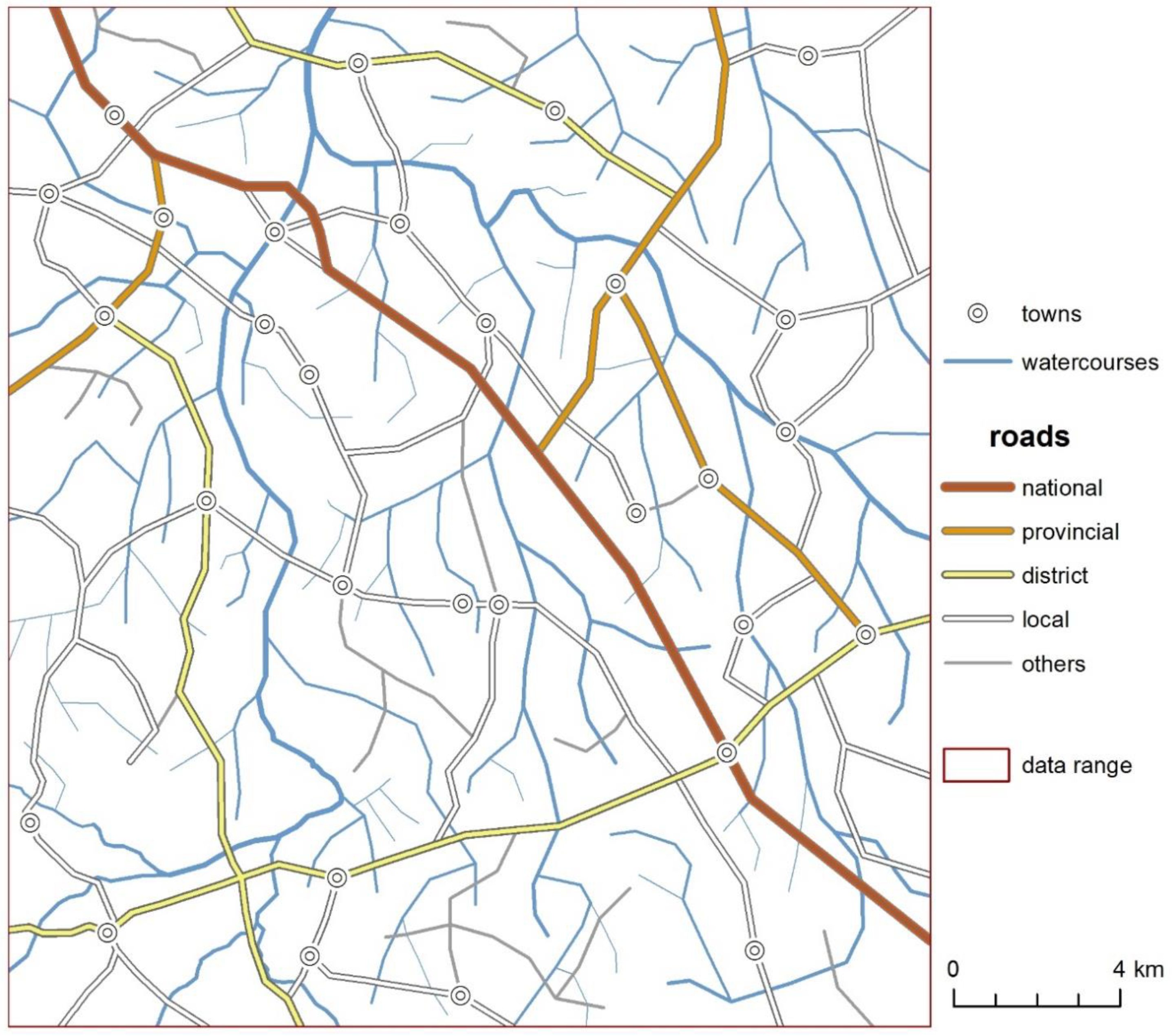
2.1. Data

The research was carried out on topographic data, created and modified for the needs of the present study in the image and likeness of official European topographic databases. However, in comparison to the real data, the structure of the model data is simplified (e.g., there is a smaller number of attributes), facilitating a qualitative analysis of the obtained results (particularly reducts).
Hence, the classes of objects created in the model data correspond to:
  • Buildings—anthropogenic objects, polygon objects.
  • Sections of roads—anthropogenic objects, linear objects.
  • Sections of watercourses—natural objects, linear objects.
Two test areas have been defined: a smaller one, Figure 1A (9.1 km by 6.4 km), generalized from the level of detail corresponding to 1:10,000 (LoD10k) to 1:50,000 (LoD50k) analog maps; and a larger one, Figure 1B (24.6 km by 22.2 km), generalized from the level of detail corresponding to 1:50,000 (LoD50k) to 1: 250,000 (LoD250k) maps, where the larger area contains the smaller area (Figure 1). Area A contains a representation of buildings, roads, and watercourses in LoD10k (Figure 2), area B the representation of roads and watercourses in LoD50k (Figure 3).

2.2. Attributes Included

For the research, three groups of attributes were assigned to objects:
  • Native—attributes that emerge from the structure of the database, e.g., the function of a building; initially assigned to the objects, at the stage of data collection.
  • Geometric—attributes that emerge from geometry, shape, density, or the mutual placement of objects in a given class of objects, e.g., the density of buildings within a 200-m radius from a given building; calculated using appropriate analytical tools.
  • Relational—attributes that describe the location of an object relative to the other classes’ objects, e.g., the distance of the building from the nearest road; calculated using appropriate analytical tools, using geometry and the attributes of other classes’ objects.
The spatial context is primarily described by geometric and relational attributes. It is possible to designate an infinite number of such attributes, although, naturally, not all of them will be relevant from the perspective of object selection.
Some of the proposed attributes could prove relevant from the perspective of expert cartographic knowledge and, thus, could formalize the expert cartographic knowledge about the relationships between objects, which so far has been recorded implicitly in the database. Among these attributes are: attributes concerning the densification of objects (with a different radius that defines the neighborhood), attributes describing the features of a larger structure (e.g., a river instead of a section of a river and a road route instead of a road), or the attributes describing the distances to other (defined) objects. The author has chosen to use quantitative scales primarily; however, it would also be possible to use qualitative scales to describe spatial relationships [51]. The results section includes a description of the set of the attributes used and their relevance for feature selection based on reducts approach.
Following the expert cartographic knowledge (author decision), each of the objects of the analyzed classes was also assigned the value of the decision attribute k50 and/or k250 that corresponds to the decision:
  • 1—an object selected for a given level of detail,
  • 0—an object not selected for a given level of detail.

2.3. Changing the Levels of Measurment

The first stage, necessary to designate the decision reducts, was the adjustment of the levels of measurement in which the attributes were expressed to the rough method used. The following operations were performed, as required, to achieve this (Figure 4):
  • Changing continuous data into ordinal classes—a “downgrade” of the level of measurement, performed following the Jenks natural breaks optimization method [52]. The number of classes was determined experimentally, e.g., the discretization of building areas in square meters (used in FRST method) to 5 ordinal classes (for DRST method).
  • Changing ordinal data into nominal data—a “downgrade” of the level of measurement. While this did not require any action, the analysis had not considered the order of classes, e.g., treating 5 classes that define increasing building areas (used in DRST method) as 5 different classes in the RST method, in which class 1 differs in the same way from class 2 as from class 5 (in RST method).
  • Changing nominal data into ordinal data—an artificial “upgrade” of the level of measurement. It was necessary to determine the monotonicity of classes, quite evident in some cases (e.g., the road management categories: from local to national), while subjective in others (e.g., the order of the buildings’ functions). Consequently, data suitable for the RST method were prepared for the DRST method.
  • Changing ordinal data into continuous data—an artificial “upgrade” of the level of measurement. While no action was necessary, it meant accepting an artificial distance between classes about which their monotonic nature was the only known aspect. Usually, the distances between classes were equal as the way they are adopted affects the result [53]; e.g., ordinal categories of road management. This method was used to prepare data specific to the DRST method for the FRST method.
One should note that the reduction (“downgrade”) or the artificial “upgrade” of the level of measurement has its consequences. Due to the downgrade of the level of measurement, some information is lost, such as the exact values of an attribute (e.g., area in square meters) or the order of classes. In the first case (discretization), there is a certain subjectivity of the division of continuous values into ordinal classes (concerning the number as well as the places of divisions). One of the known discretization algorithms based, for example, on data distribution (in this paper: the method of natural breaks) may limit the subjectivity. An even greater level of subjectivism appears in the artificial “upgrade” of the level of measurement. When the order of non-ordinal classes or distances between ordinal classes is assigned subjectively, additional information is added to the set, which stems from the researcher’s interpretation of reality and which—as a subjective element—affects the result of classification (selection). This is one of the instances, besides the selection of attributes to the model, where the subjective character of the generalization process transpires in the studied methodology. Naturally, one can restrict this element by solely using levels of measurement suitable for a given method, or by limiting oneself to the “downgrade” of the levels of measurement (and avoiding their “upgrade”). Such actions, however, reduce the possibility of using some attributes relevant in the process of generalization.
Creating the so-called inverted attributes was one of the elements of adapting attributes to the methods employed. This concerned the dominance-based rough set method (DRST), which assumes the monotonicity of conditional attributes on a decision. So that the opposite operation is also possible, i.e., selecting an object (dec ≥1) with the conditional attribute defined by the less-than sign, it was necessary to invert the monotonicity of the conditional attributes. Thus, in the DRST method, each attribute appears in two forms: direct and inverted (marked by adding “_i” to the attribute’s abbreviation). The interpretation of the rules created requires taking into account the direction of the attributes.

2.4. Designation of reducts

With the attributes adequately prepared, it was possible to determine all possible decision reducts using three rough methods (RST, DRST, FRST). jMAF software was used for DRST method with exhaustive reducts computation basing on dominance relation. For RST and FRST the RoughSets package of R language was used—particularly the FS.all.reducts.computation function. Most of the parameters were assigned default values. Only the discernibility function used differs for two methods:
  • for RST the attributes can be either identical or different (0 or 1)
  • for FRST the similarity/tolerance measure was used (according to the package Equation (1)):
R a ( x ,   y ) = 1   | a ( x ) a ( y ) | | a m a x     a m i n | .
From each of the sets in 4 iterations, stratified samples were randomly selected from which the reducts were designated. Then, the following was determined for each of them:
  • The number of designated reducts (more reducts—more options for selecting a subset of attributes affecting a decision);
  • The size of a reduct (larger reducts mean greater complexity of the decision system);
  • The size of the core (indicating the number of attributes necessary to make the right decision);
  • The attributes of the core (indicating the information crucial for making a decision, for a given class of objects, according to a given method).

3. Results

3.1. Buildings

3.1.1. Attributes

A set containing 476 buildings in area A was created; grouped in four towns and one smaller group representing a forester’s lodge (Figure 2). The attributes listed in Table 1 were designated to the buildings. Additionally, decision (k50) was established: an attribute that states whether a given building is 1—selected during the selection to the scale of 1:50,000, or 0—is not selected during the selection.
The attributes and levels of measurement considered in this methodology developed are diverse. Therefore, the levels of measurement were adjusted to the methods (according to the information in the section “Changing the levels of measurement”). In the DRST method, the order of classes was objective (e.g., regarding the attribute that describes the number of floors) or imposed in an artificial, subjective way:
  • Function (o it takes the value 1, out—2, res—3, c—4, i—5, p—6, rel—7).
  • Category (O takes the value 1, L—2, D—3).
  • A seat of government in the town (n takes the value 1, L—2).
For the FRST method, it was not possible to include classification attributes. Thus, taking into account the assumptions mentioned above, only the numerical attributes were included in further considerations.

3.1.2. Reducts

Reducts were designated on subsets of 300 buildings, determined four times by stratified random sampling. Table 2 shows the number and size of the reducts designated using the RST method. In all the iterations, the function of the building was in the core; in the middle of iteration—also the location in the built-up area. The area of the building also appeared frequently. Therefore, the native (function), relational (location in the built-up area), and geometric (area) attributes all proved relevant. The length of reducts ranged from 4 to 7 elements. The number of reducts was 8 to 9 (except for one iteration). It is worth noting that regardless of the length or number of designated reducts, their core was very repeatable.
Table 3 shows the number and size of reducts designated using the DRST method. When compared to the RST approach, the number of designated reducts is an order of magnitude higher. Undoubtedly, it is because the adopted method, but another reason may be that there were twice as many attributes (direct and “inverted” attributes). That may also cause an increase in the size of the reducts (from 4–7 in the RST method to 5–11 in the DRST method). What is fascinating is that the cores of reducts designated using both methods are the same (in all iterations). In the DRST, in addition to the function of a building (a more important function—a greater chance of selecting the object) in the core, there was an inverted attribute regarding the location of the building in the built-up area (i.e., the objects located outside this area have a better chance of being selected).
The reduct designated using the FRST method corresponded (in all iterations) to the full set of eight attributes; thus, it was not possible to limit this set.

3.2. Roads

3.2.1. Attributes

One hundred and sixty-six road sections constituting 76 routes in area A and 141 road sections constituting 49 routes in area B (Figure 2 and Figure 3) were created. The roads overlap in the common area (A), although for area B only some sections of roads are considered (after selection). The sections of road were assigned attributes listed in Table 4.
The “route” attribute is not directly used as a conditional attribute in generalization; it only helps in combining the sections of roads into road routes. Road routes are treated as a whole, as an object that connects points and ensures communication between them (road sections are separated when any of the attributes changes or when there is an intersection with another route). The “route” attribute also enables the designation of a more global feature of an object (e.g., the average width of the route) to a road section.
Additionally, the decisions (k50 and k250) were particularized, i.e., the attribute regarding whether a given road section: 1—is selected to the smaller scale during the selection, 0—is not selected.
Similarly to the previously discussed classes of objects, it was also necessary to adjust the levels of measurement to the methods used for the road sections.
For the RST method, attributes with continuous and integer values have been discretized. The DRST method utilized the same attributes, but those expressed in the classification scale had to be ordered (it is partly an artificial addition of the information value to the attributes; however, e.g., the road management category is hierarchical):
  • Management category (O takes the value of 1, L—2, D—3, P—4, N—5).
  • Class (O takes the value of 1, L—2, C—3, P—4, FT—5, E—6).
  • Pavement (D take the value of 1, P—2, GM—3, Ma—4).
The FRST method utilizes almost all the attributes in their original form, while attributes such as category, class, and area—as in the DRST method—are in an ordinal form.

3.2.2. Reducts LoD 1:10,000 to LoD 1:50,000

In each iteration, reducts were determined for a sample of 110 objects. Table 5 shows the number and size of reducts designated using the RST method. In all of the iterations, the same core was obtained: the attribute required in each reduct is the number of intersections of a given route with other routes. The number of designated reducts varies from 22 to 24, and their size—from 4 to 7 attributes (the shortest reducts are the majority).
Table 6 shows the number and size of reducts designated using the DRST method. The number of designated reducts is twice as large as in the RST approach, but their sizes are almost the same as in the previous method. The designated core is also identical in all the iterations for the RST and DRST methods and contains information on the number of intersections of the route.
One or two reducts of 5 to 7 element-length were designated using the FRST method in each iteration (Table 7). In the core, the following attributes repeated in all iterations: (category, pavement, the passage of the route through the town center, the density of roads in the vicinity of 500 m, the number of intersections of the route with other routes). Additionally, in two iterations, there was an information on the distance from a religious building in the core. However, in iterations in which two reducts were designated, the distance from a public building or the distance from a public or a religious building was, interchangeably, the additional attribute reaching to the core.

3.2.3. Reducts LoD 1:50,000 to LoD 1:250,000

Table 8 shows the number and size of the reducts designated using the RST method. In all iterations, the same eight reducts without a common core were designated. The following attributes constituted the shortest reduct: (the category of the road, the density of roads in the vicinity of 3000 m). However, in the three-element reducts, the attributes (the category of the road, the number of intersections of the route with other routes) appeared, and, alternatively, (the length of the route) or (the passage of the route through the town center) while the density of nearby roads was omitted. These designated reducts are relatively short, and there are few of them when compared to the other examples analyzed in the RST method.
For the DRST method, the same eight reducts with 2 to 5 elements were designated in all iterations, and there was no core. The shortest, two-element, reduct comprised the same attributes as RST method: (the category of the road, the density of roads in the vicinity of 3000 m). While the weight of the road category seems entirely justified, it is exciting that roads with a higher density of other roads in the vicinity of 3000 m have a better chance of being selected to a higher scale level.
As part of the FRST method, it was possible to determine two reducts of 4 or 5 elements in all the iterations (Table 9). The following were in the core of all iterations: (category, pavement, the passage of the route through the town center) and, in the last iteration additionally (the density of roads in the vicinity of 3000 m). Additionally, apart from the core, attributes describing the largest (area-wise) city or the most populated city in the vicinity appeared in the reducts.

3.3. Watercourses

3.3.1. Attributes

When developing model data, 51 sections of watercourses forming 26 rivers in area A and 175 sections of watercourses forming 83 rivers in area B were created. In the common area (A), the watercourses overlap, while for area B only some watercourses are taken into account (following the selection). Table 10 shows the attributes assigned to the watercourses.
The Horton–Strahler number [54] determined the stream order. Statistics on information about entire rivers are averaged (weighted by length) for sections of watercourses belonging to a given river; thus, they are not average lengths or widths of rivers, as the rivers themselves are not modeled directly.
The “river” attribute is not directly used as a conditional attribute in generalization. However, this attribute helps in combining the sections of watercourses into rivers, treated as a real object found in the area (the sections are separated when any of the attributes changes or when there are tributaries of rivers). The river attribute also enables assigning a more global feature of an object (e.g., the length of the entire river) to the section of the watercourse.
Additionally, the decisions (k50 and k250) were particularized, i.e., the attribute regarding whether a given watercourse section: 1—is selected to the smaller scale during the selection, 0—is not selected.
Similarly to the previously discussed classes of objects, it was also necessary to adjust the levels of measurement to the methods used for the watercourse sections.
For the RST method (as in the case of buildings), some attributes required discretization. The DRST method utilized the same attributes as the RST method, as the data were ordinal originally. However, in the FRST method, there was no need to discretize. Thus, the same attributes as in the two first methods were used—but in their original form described above.

3.3.2. Reducts LoD 1:10,000 to LoD 1:50,000

Reducts were designated in 4 iterations, each time for a subset of 35 objects. Table 11 shows the number and size of reducts obtained utilizing the RST method. The core was not obtained in any of the iterations. Still, the designated reducts showed some regularities. In all iterations, the two-element reduct repeated (the average width of the river, the number of river nodes). In all reducts longer than three elements (and in most three-element reducts), at least one attribute associated with watercourse density transpired.
Table 12 shows the number and size of reducts designated using the DRST method. When compared to the RST approach, the number of designated reducts was much higher (more than twice the number); however, their sizes did not differ significantly from those designated using the RST method. In this case, short, two-element reducts appeared once in each iteration. Moreover, it was a different reduct each time—successively: (the average width of the river, the inverted most populated city in the vicinity), (the length of the river, the number of crossings with – at least – district roads), (the length of the river, the watercourse order).
Depending on the iteration, 1 or 2 reducts were designated using the FRST method. Their length ranged from 3 to 4 attributes (Table 13). In all of the cases, the core included: (number of crossings of the watercourse section with roads, number of crossings of the river with (at least) district roads). Additionally, two iterations included (density of watercourses in the vicinity of 1500 m). In iterations with two reducts assigned to each, there was, interchangeably, the largest (area-wise) or the most populated city in the vicinity apart from the core.

3.3.3. Reducts LoD 1:50,000 to LoD 1:250,000

Reducts were designated on subsets of 110 sections of watercourses, determined four times using stratified random sampling.
Table 14 shows the number and size of reducts designated using the RST method. In all iterations, a non-empty core was designated, comprising 4 to 6 attributes. The only attribute in the core repeated in all iterations was the watercourse order. The number of crossings with other objects was also crucial for the selection: in three iterations, those were the crossings with the watercourse section and, in one, crossings with roads of (at least) district category with the river. The density of watercourses was also critical: the vicinity of 3000 m appeared in the core in three iterations, the vicinity of 1500 m—in two iterations. In 3 out of 4 iterations in the reduct core, the width and length of the river also appeared. There were not many reducts (depending on the iteration, 4 to 7), but they were quite long, varying from 6 to 8 elements.
Table 15 shows the number and size of reducts designated using the DRST method. When compared to the RST approach, the number of designated reducts was several times higher, while the designated cores remained similar. In this case, as well the only element of the core repeated throughout all iterations was the watercourse order. The length and width of the watercourse section also appeared three times, as well as the inverted number of the watercourse crossings with roads (i.e., a more significant number of crossings with roads is not conducive to the selection of the watercourse section). The designated reducts were very long (from 8 to 16 elements).
In each of the iterations, just one reduct was designated using the FRST method; it comprised 8 to 10 elements. That reduct at the same time constituted the core of each iteration. The core attributes included in all of the iterations are: (the average width of the river, the length of the river, the watercourse order, the number of river nodes, the largest (area-wise) city in the vicinity, the number of crossings with the roads, the number of crossings with roads of (at least) district category, the density of watercourses in the vicinity of 1500 m, and the density of watercourses in the vicinity of 3000 m).

4. Discussion

Table 16 shows the summary of the obtained results. One may observe several regularities regarding both the methods employed and the attributes selected in reducts.
What is indeed worth noting is that usually more reducts were obtained using the DRST method than with the RST method. The reason might be that the DRST method uses the “inverted” attributes, so the number of analyzed attributes was twice as large. Therefore, the number of possible and valuable combinations of them increased as well. It should be emphasized, however, that in both of these methods the same attributes were most often indicated (reducts’ cores were repeated); differing only in the variant “inverted” or not in the DRST method.
With the FRST method, the number of reducts found was always very small (1 or 2), while their length—quite significant (in one variant of the experiment, the number of attributes used was not reduced at all).
In most variants of the experiment, it was possible to designate the reduct cores, which enables the analysis of critical features that influence the decision to select objects of a given type. Wherever it was impossible to designate the cores, often (but not always) the attributes in reducts were analyzed.
Below are the “crucial” attributes; in parentheses, the number of occurrences in reducts in each method is given, in sequence: RST + DRST + FRST. In a few cases, attributes are noted as crucial (repeated), even though they were outside the core and did not appear in all the reducts (marked as “outside”). The following information proved most relevant for the selection of objects:
  • For buildings (10 k > 50 k): building function (4 + 4 + 4), location in the built-up area (2 + 2 + 4).
  • For roads (10 k > 50 k): the number of intersections with other roads (4 + 4 + 4), the category of management, pavement, the passage through the town (0 + 0 + 4).
  • For roads (50 k > 250 k): road category (outside + outside + 3), the density of roads in the vicinity of 3000 m (outside + outside + 1), pavement, the passage through the town (0 + 0 + 3).
  • For watercourses (10 k > 50 k): crossings with roads (0 + 0 + 4), crossings with roads of (at least) district category (0 + outside + 4), the attribute related to the density of watercourses (except + 0 + 2), the average width of the river (outside + outside + 0).
  • For watercourses (50 k > 250 k): order (4 + 4 + 4), width, length, crossings with roads (3 + 3 + 4), the density of watercourses in the vicinity of 3000 m (3 + 2 + 4), the density of watercourses in the vicinity of 1500 m (2 + 2 + 4).
It is worth noting that a significant part of the attributes indicated in reducts, in all the classes of objects and regardless of the scale level, are not attributes available by default in the database structure. Instead, they stem from the recognition and analysis of the spatial context (geometric and relational attributes). The vital example is the number of intersections with other roads for roads generalization 10 k > 50 k. Figure 5 visually shows the crucial meaning of the attribute which was also discovered within reducts. It shows the meaning of knowledge discovery by rough sets—the cartographers may know that they are choosing “main” roads but they may not be conscious that the information about the road being “more or less main” can be formalized by the number of intersections with other road segments. Similarly for the 50 k > 250 k generalization the example of watercourse order was presented (Figure 6). In this case it is known that this particular information can be used for generalization purposes [55] however it is properly discovered by rough rules confirming the knowledge in a data-driven way. This examples show how rough sets and reducts are useful to discover cartographic knowledge hidden in the data and expert decisions—in both cases: when the knowledge is unknown or when it only needs the confirmation and proper formalization.

5. Conclusions

It is possible to designate reducts using each of the three methods presented; however, the reducts differ in number and cardinality of designated reducts or cores. The FRST method proved the least useful as it very often enabled finding only one or two reducts with a significant number of attributes, whereas the RST and DRST methods seem to be recommendable (depending on the governing level of measurement).
One should also remember to adjust the attributes to the levels of measurement used in each method. Thus, the predominant levels of measurement are worth considering in the analyzed data to avoid the error-laden upgrading or downgrading of the levels of measurement.
As the analysis has indicated, using a method of designating reducts may lead to the most relevant features of objects for generalization (in this instance: selection). Regardless of the method used, the features describing the spatial context of the generalized objects are essential. The formalization of these features to the attributes and the subsequent selection of attributes are both relevant elements of cognition of a spatial database described through a model.
The formalization of features representing the spatial context requires properly designed analyses (carried out in the geographic information systems) that attempt at replacing the classical cognition—experienced by the cartographer with the proper knowledge and experience—to become some tools for automatic cognition.
The awareness of which information is crucial for the generalization process often exceeds the capabilities of expert cartographers who make their decisions intuitively (even though they base them on cartographic knowledge and years of experience). In this instance, reducts have proven useful: capable of selecting subsets from an extensive set of attributes, or even an entire set, to arrive at the right decision. Moreover, their cores signal particularly relevant information necessary so as not to compromise the quality of decisions.
It is worth noting that this methodology can be generalized to geographic information generalization operators other than the selection of objects, as well as to other aspects of spatial data analysis. It is crucial to formalize the spatial context information on objects not only for the generalization of geographic information but also for cognitive and analytical purposes. However, the tools facilitating the selection of relevant (from a particular point of view) information are precious—since nowadays excess causes more problems than the lack of data. It is possible to use such solutions in the data analysis and processing (including spatial data) as well as in expert systems that support decision making.

Funding

This research received no external funding.

Acknowledgments

I want to thank Robert Olszewski for supporting this research.

Conflicts of Interest

The authors declare no conflict of interest.

References

  1. Harrie, L.; Weibel, R. Modelling the overall process of generalisation. In Generalisation of Geographic Information; Elsevier Science BV: Amsterdam, The Netherlands, 2007; pp. 67–87. [Google Scholar]
  2. Mackaness, W. Understanding geographic space. In Generalisation of Geographic Information: Cartographic Modelling and Application; Mackaness, W., Ruas, A., Sarjakoski, T., Eds.; Elsevier Science BV: Amsterdam, The Netherlands, 2007. [Google Scholar]
  3. Weibel, R. Generalization of spatial data: Principles and selected algorithms. In Algorithmic Foundations of Geographic Information Systems; Springer: Berlin/Heidelberg, Germany, 1997; pp. 99–152. [Google Scholar]
  4. Mackaness, W.; Burghardt, D.; Duchêne, C. Map generalisation: Fundamental to the modelling and understanding of geographic space. In Abstracting Geographic Information in a Data Rich World; Springer: Cham, Switzerland, 2014; pp. 1–15. [Google Scholar]
  5. Baranowski, M.; Gotlib, D.; Olszewski, R. Search of the Essence of Cartography. Advances in Cartography and GIScience; Peterson, W.M.P., Peterson, M.P., Eds.; Springer International Publishing: Cham, Switzerland, 2017; pp. 525–536. [Google Scholar] [CrossRef]
  6. Regnauld, N.; Touya, G.; Gould, N.; Foerster, T. Process Modelling, Web Services and Geoprocessing. In Abstracting Geographic Information in a Data Rich World; Burghardt, D., Duchêne, C., Mackaness, W., Eds.; Lecture Notes in Geoinformation and Cartography; Springer: Cham, Switzerland, 2014. [Google Scholar]
  7. Grünreich, D. Development of Computer-Assisted Generalization on the Basis of Cartographic Model Theory. Gis and Generalization: Methodology and Practice; Taylor and Francis: London, UK, 1995; pp. 47–55. [Google Scholar]
  8. Shea, K.S.; McMaster, R.B. Cartographic generalization in a digital environment: When and how to generalize. In Proceedings of the Auto-Carto, Baltimore, MD, USA, 2–7 April 1989; Volume 9, pp. 56–67. [Google Scholar]
  9. Roth, R.E.; Brewer, C.A.; Stryker, M.S. A typology of operators for maintaining legible map designs at multiple scales. Cartogr. Perspect. 2011, 68, 29–64. [Google Scholar] [CrossRef] [Green Version]
  10. Degnan, M. Aristotle’s Logic. Philosophical Books. 1994, Volume 35, pp. 81–89. Available online: https://onlinelibrary.wiley.com/doi/abs/10.1111/j.1468-0149.1994.tb02858.x (accessed on 20 October 2019). [CrossRef]
  11. Pawlak, Z. Rough sets. Int. J. Comput. Inf. Sci. 1982, 11, 341–356. [Google Scholar] [CrossRef]
  12. Zadeh, L.A. Fuzzy logic. Computer 1988, 21, 83–93. [Google Scholar] [CrossRef]
  13. Pawlak, Z.; Grzymala-Busse, J.; Słowiński, R.; Ziarko, W. Rough sets. Commun. ACM 1995, 38, 88–95. [Google Scholar] [CrossRef]
  14. Greco, S.; Matarazzo, B.; Słowiński, R. Rough sets theory for multicriteria decision analysis. Eur. J. Oper. Res. 2001, 129, 1–47. [Google Scholar] [CrossRef]
  15. Słowiński, R.; Greco, S.; Matarazzo, B. Rough-set-based decision support. In Search Methodologies; Springer: Boston, MA, USA, 2014; pp. 557–609. [Google Scholar]
  16. Dubois, D.; Prade, H. Rough fuzzy sets and fuzzy rough sets. Int. J. Gen. Syst. 1990, 17, 191–209. [Google Scholar] [CrossRef]
  17. Cornelis, C.; Martín, G.H.; Jensen, R.; Ślȩzak, D. Feature selection with fuzzy decision reducts. In Proceedings of the International Conference on Rough Sets and Knowledge Technology, Chengdu, China, 17–18 May 2008; Springer: Berlin/Heidelberg, Germany, 2008; pp. 284–291. [Google Scholar]
  18. Pawlak, Z. Rough Sets: Theoretical Aspects of Reasoning About Data; Kluwer Academic Publishing: Dordrecht, The Netherlands, 1991. [Google Scholar]
  19. Burigo, M.; Coventry, K. Context affects scale selection for proximity terms. Spat. Cogn. Comput. 2010, 10, 292–312. [Google Scholar] [CrossRef]
  20. Freundschuh, S.; Blades, M. The cognitive development of the spatial concepts NEXT, NEAR, AWAY and FAR. In Cognitive and Linguistic Aspects of Geographic Space; Springer: Berlin/Heidelberg, Germany, 2013; pp. 43–62. [Google Scholar]
  21. Hahn, J.; Fogliaroni, P.; Frank, A.U.; Navratil, G. A computational model for context and spatial concepts. In Geospatial Data in a Changing World; Springer: Cham, Switzerland, 2016; pp. 3–19. [Google Scholar]
  22. Touya, G.; Bucher, B.; Falquet, G.; Jaara, K.; Steiniger, S. Modelling Geographic Relationships in Automated Environments. In Abstracting Geographic Information in a Data Rich World; Burghardt, D., Duchêne, C., Mackaness, W., Eds.; Lecture Notes in Geoinformation and Cartography; Springer: Cham, Switzerland, 2014. [Google Scholar]
  23. Mustière, S.; Moulin, B. What is spatial context in cartographic generalization? Int. Arch. Photogramm. Remote Sens. Spat. Inf. Sci. 2002, 34, 274–278. [Google Scholar]
  24. Steiniger, S.; Weibel, R. Relations among map objects in cartographic generalization. Cartogr. Geogr. Inf. Sci. 2007, 34, 175–197. [Google Scholar] [CrossRef]
  25. Varanka, D.E.; Caro, H.K. Spatial relation predicates in topographic feature semantics. In Cognitive and Linguistic Aspects of Geographic Space; Springer: Berlin/Heidelberg, Germany, 2013; pp. 175–193. [Google Scholar]
  26. Stein, A.; Corsten, L.C.A. Universal kriging and cokriging as a regression procedure. Biometrics 1991, 47, 575–587. [Google Scholar] [CrossRef]
  27. Kumari, M.; Basistha, A.; Bakimchandra, O.; Singh, C.K. Comparison of spatial interpolation methods for mapping rainfall in Indian Himalayas of Uttarakhand region. In Geostatistical and Geospatial Approaches for the Characterization of Natural Resources in the Environment; Springer: Cham, Switzerland, 2016; pp. 159–168. [Google Scholar]
  28. Bockelmann, F.D.; Puls, W.; Kleeberg, U.; Müller, D.; Emeis, K.C. Mapping mud content and median grain-size of North Sea sediments–A geostatistical approach. Mar. Geol. 2018, 397, 60–71. [Google Scholar] [CrossRef]
  29. Anselin, L. Spatial Econometrics. A Companion to Theoretical Econometrics. 2001, pp. 310–330. Available online: http://citeseerx.ist.psu.edu/viewdoc/download?doi=10.1.1.141.1868&rep=rep1&type=pdf (accessed on 4 December 2019).
  30. Petrovic, A.; Manley, D.J.; Van Ham, M. Freedom from the Tyranny of Neighbourhood: Rethinking Socio-Spatial Context Effects. 2018. Available online: https://www.econstor.eu/bitstream/10419/180434/1/dp11416.pdf (accessed on 5 December 2019).
  31. Haas, T. Lognormal and Moving Window Methods of Estimating Acid Deposition. J. Am. Stat. Assoc. 1990, 85, 950–963. [Google Scholar] [CrossRef]
  32. Fu, G.; Jones, C.B.; Abdelmoty, A.I. Ontology-based spatial query expansion in information retrieval. In Proceedings of the OTM Confederated International Conferences “On the Move to Meaningful Internet Systems”, Agia Napa, Cyprus, 31 October–4 November 2005; Springer: Berlin/Heidelberg, Germany, 2005; pp. 1466–1482. [Google Scholar]
  33. Wannous, R.; Malki, J.; Bouju, A.; Vincent, C. Modelling mobile object activities based on trajectory ontology rules considering spatial relationship rules. In Modeling Approaches and Algorithms for Advanced Computer Applications; Springer: Cham, Switzerland, 2013; pp. 249–258. [Google Scholar]
  34. Thomson, R.C.; Richardson, D.E. A graph theory approach to road network generalisation. In Proceedings of the 17th International Cartographic Conference, Barcelona, Spain, 3–9 September 1995; pp. 1871–1880. [Google Scholar]
  35. Curtin, K.M. Network analysis in geographic information science: Review, assessment, and projections. Cartogr. Geogr. Inf. Sci. 2007, 34, 103–111. [Google Scholar] [CrossRef] [Green Version]
  36. Touya, G.; Duchêne, C.; Taillandier, P.; Gaffuri, J.; Ruas, A.; Renard, J. Multi-Agents Systems for Cartographic Generalization: Feedback from Past and On-going Research. ResearchReport; IGN (Institut National de l’Information Géographique et Forestière); LaSTIG, équipe COGIT. hal-01682131. 2018. Available online: https://hal.archives-ouvertes.fr/hal-01682131/document (accessed on 4 December 2019).
  37. Galanda, M.; Weibel, R. An agent-based framework for polygonal subdivision generalisation. In Advances in Spatial Data Handling; Springer: Berlin/Heidelberg, Germany, 2002; pp. 121–135. [Google Scholar]
  38. Lazo-Cortés, M.S.; Martínez-Trinidad, J.F.; Carrasco-Ochoa, J.A.; Sanchez-Diaz, G. On the relation between rough set reducts and typical testors. Inf. Sci. 2015, 294, 152–163. [Google Scholar] [CrossRef]
  39. Mac Parthalain, N.; Jensen, R.; Diao, R. Fuzzy-rough set bireducts for data reduction. IEEE Trans. Fuzzy Syst. 2019. [Google Scholar] [CrossRef] [Green Version]
  40. Sikder, I.U. A variable precision rough set approach to knowledge discovery in land cover classification. Int. J. Digit. Earth 2016, 9, 1206–1223. [Google Scholar] [CrossRef]
  41. Pessoa, A.S.A.; Stephany, S.; Fonseca, L.M.G. Feature selection and image classification using rough sets theory. In Proceedings of the 2011 IEEE International Geoscience and Remote Sensing Symposium, Vancouver, BC, Canada, 24–29 July 2011; pp. 2904–2907. [Google Scholar]
  42. Chen, L.; Tsai, C. Data mining framework based on rough set theory to improve location selection decisions: A case study of a restaurant chain. Tour. Manag. 2016, 53, 197–206. [Google Scholar] [CrossRef]
  43. Yan, H.Y.; Zhang, X.R.; Dong, J.H.; Shang, M.S.; Shan, K.; Wu, D.; Yuan, Y.; Wang, X.; Meng, H.; Huang, Y.; et al. Spatial and temporal relation rule acquisition of eutrophication in Da’ning River based on rough set theory. Ecol. Indic. 2016, 66, 180–189. [Google Scholar] [CrossRef]
  44. Figueiredo, C.; Mota, C. A Classification Model to Evaluate the Security Level in a City Based on GIS-MCDA. Math. Probl. Eng. 2016, 2016, 3534824. [Google Scholar] [CrossRef] [Green Version]
  45. Ottomano Palmisano, G.; Loisi, R.; Ruggiero, G.; Rocchi, L.; Boggia, A.; Roma, R.; Dal Sasso, P. Using Analytic Network Process and Dominance-based Rough Set Approach for sustainable requalification of traditional farm buildings in Southern Italy. Land Use Policy 2016, 59, 95–110. [Google Scholar] [CrossRef]
  46. Jensen, R.; Shen, Q. Fuzzy–rough attribute reduction with application to web categorization. Fuzzy Sets Syst. 2004, 141, 469–485. [Google Scholar] [CrossRef] [Green Version]
  47. Yan, C.; Yang, L.; Gartner, G.; Zhu, Q.; Liu, X. Intelligent initial map scale generation based on rough-set rules. Arab. J. Geosci. 2019, 12, 109. [Google Scholar] [CrossRef]
  48. Li, W.; Qiu, J.; Wu, Z.; Lin, Z.; Li, S. Application of rough sets in GIS generalization. In Proceedings of the International Conference on Rough Sets and Knowledge Technology, Banff, AB, Canada, 9–12 October 2011; Springer: Berlin/Heidelberg, Germany, 2011; pp. 347–353. [Google Scholar]
  49. Yang, Y.; Chen, D.; Wang, H.; Tsang, E.; Zhang, D. Fuzzy rough set based incremental attribute reduction from dynamic data with sample arriving. Fuzzy Sets Syst. 2017, 312, 66–86. [Google Scholar] [CrossRef]
  50. Abbas, Z.; Burney, A. A survey of software packages used for Rough Set Analysis. J. Comput. Commun. 2016, 4, 10–18. [Google Scholar] [CrossRef] [Green Version]
  51. Fogliaroni, P.; Weiser, P.; Hobel, H. Qualitative spatial configuration search. Spat. Cogn. Comput. 2016, 16, 272–300. [Google Scholar] [CrossRef]
  52. Jenks, G.F. Optimal Data Classification for Choropleth Maps; Department of Geography, University of Kansas Occasional Paper No. 2; Department of Geography, University of Kansas: Lawrence, KS, USA, 1977. [Google Scholar]
  53. Fiedukowicz, A. Construction of fuzzy interference system for generalization of geographic information–selection of road segments. Geoinformat. Pol. 2013, 12, 53–62. [Google Scholar] [CrossRef]
  54. Strahler, A.N. Quantitative analysis of watershed geomorphology. Eos Trans. Am. Geophys. Union 1957, 38, 913–920. [Google Scholar] [CrossRef] [Green Version]
  55. Mackaness, W.A.; Beard, K.M. Use of graph theory to support map generalization. Cartogr. Geogr. Inf. Syst. 1993, 20, 210–221. [Google Scholar] [CrossRef]
Figure 1. Dimensions and mutual position of model data areas: (A) 1:10 000 data area, (B) 1:50 000 data area.
Ijgi 09 00037 g001
Figure 2. Model data in the area A shown in Figure 1 (viewed in ArcMap ESRI); source: own work.
Ijgi 09 00037 g002
Figure 3. Model data in the area B shown in Figure 1 (viewed in ArcMap ESRI); source: own work.
Ijgi 09 00037 g003
Figure 4. Changing the levels of measurement: arrows to the left mean a “downgrade” of the level of measurement, arrows to the right mean an “upgrade” (often artificial) of the level of measurement.
Ijgi 09 00037 g004
Figure 5. The expert selection of roads 10 k > 50 k (solid lines) juxtaposed with the roads attribute describing the number of intersections with other road segments (geometric atribute), visually showing the importance of the attribute discovered also within reducts.
Ijgi 09 00037 g005
Figure 6. The expert selection of watercourses 50 k > 250 k (solid lines) juxtaposed with the watercourse order (geometric atribute), visually showing the importance of the attribute discovered also within reducts.
Ijgi 09 00037 g006
Table 1. The attributes of the buildings in model data with the indication of the types of attributes and their values; source: own work.
NoNameTypeValues
1functionnative(out—outbuilding, c—commercial/services, o—other, res—residential, i—industrial, rel—religious, p—public)
2historical monumentnative(0—no, 1—yes)
3floorsnativeintegers
4area [square meters]geometriccontinuous
5the density within 100 mgeometricintegers
6the density within 300 mgeometricintegers
7the distance from the nearest road [m]relationalcontinuous
8the category of the nearest roadrelational(L—local, D—district, O—other)
9the distance from the nearest district road [m]relationalcontinuous
10the distance from the center [m] (the point of the nearest town)relationalcontinuous
11the number of inhabitants in the nearest townrelationalintegers
12a seat of government in the nearest townrelational(n—none, L—local)
13the location in the built-up arearelational(0—no, 1—yes)
Table 2. Number, size, and cores of reducts designated by the RST method for the selection of buildings in four iterations.
RSTi1i2i3i4
Number of reducts98932
7 elements---2
6 elements-4-5
5 elements7-321
4 elements2464
Corefunction
built-up-built-up-
Table 3. Number, size, and cores of reducts designated by the DRST method for the selection of buildings.
DRSTi1i2i3i4
Number of reducts147154434739
Length5–85–116–96–11
Corefunction,
built-up_i
functionfunction,
built-up_i
function
Table 4. Attributes of sections of roads in model data along with the indication of the types of attributes and their values; source: own work.
NoNameTypeValues
1width [m]nativecontinuous
2management categorynative(O—other, L—local, D—district, P—provincial, N—national)
3classnative(O—other, L—local, C—collector, P—principal, FT—fast traffic trunk road, E—expressway)
4pavementnative(D—dirt road, P—paver, Ma—mastic asphalt, GM—gravel or macadam)
5route 1 -ID
6the density within 500 m
(only LoD10k)
geometricintegers
7the density within 1500 mgeometricintegers
8the density within 3000 m
(only LoD50k)
geometricintegers
9the length of the route [m] 1geometriccontinuous
10the number of intersections with other routes 1geometricintegers
11the most populated town in the vicinity (1500 m) of the route 1relationalintegers
12the biggest (area-wise) town in the vicinity (1500 m) of the route 1relationalintegers
13the route goes through the town center 1relational(1—yes, 0—no)
14the distance from a religious building (only LoD10k) [m] 1relationalcontinuous
15the distance from a public building (only LoD10k) [m] 1relationalcontinuous
16the distance from a religious or public building (only LoD10k) [m] 1relationalcontinuous
1 the attributes regarding the routes.
Table 5. Number, size, and cores of reducts designated using the RST method for the selection of road sections to the scale of 1:50,000.
RSTi1i2i3i4
Number of reducts24222423
7 elements222 -
6 elements7377
5 elements6867
4 elements9999
Coreintersections
Table 6. Number, size, and cores of reducts designated using the DRST method for the selection of road sections to the scale of 1:50,000.
DRSTi1i2i3i4
Number of reducts44465252
Length4–74–74–74–7
Coreintersections
Table 7. Number, size, and cores of reducts designated using the FRST method for the selection of road sections to the scale of 1:50,000.
FRSTi1i2i3i4
Number of reducts1222
Length5677
Core--distance from a religious buildingdistance from a religious building
category, pavement, the passage of the route through the town center, the density of roads in the vicinity of 500 m, the number of intersections of the route with other routes
Table 8. Number, size, and cores of reducts designated using the RST method for the selection of road sections to the scale of 1:250,000.
RSTi1i2i3i4
Number of reducts8888
4 elements4444
3 elements3333
2 elements1111
Core-
Table 9. Number, size, and cores of reducts designated using the FRST method for the selection of road sections to the scale of 1:50,000.
FRSTi1i2i3i4
Number of reducts2222
Length4445
Core---the density of roads in the vicinity of 3000 m
category, pavement, the passage of the route through the town center
Table 10. Attributes of sections of watercourses in model data along with the indication of the types of attributes and their values; source: own work.
NoNameTypeValues
1width [m]nativecontinuous
2ordergeometricintegers
3river 1-ID
4the density in the vicinity of 500 m (only LoD10k)geometricintegers
5the density in the vicinity of 1500 mgeometricintegers
6the density in the vicinity of 3000 m (only LoD50k)geometricintegers
7the length of the entire river [m] 1geometriccontinuous
8the average width of the river 1geometriccontinuous
9the number of river nodes 1geometricintegers
10the most populated city in the vicinity (1500 m) of the river 1relationalintegers
11the largest (area-wise) city in the vicinity (1500 m) of the river 1relationalintegers
12the number of crossings of the watercourse section with roadsrelationalintegers
13the number of river crossings with roads 1relationalintegers
14the number of river crossings with roads of district category or higher 1relationalintegers
1 the attributes regarding an entire river.
Table 11. Number, size, and cores of designated reducts designated using the RST method for the selection of sections of watercourses to the scale of 1:50,000.
RSTi1i2i3i4
Number of reducts31554534
6 elements6310 -
5 elements77710
4 elements8391918
3 elements8475
2 elements2221
Core-
Table 12. Number, size, and cores of designated reducts designated using the DRST method for the selection of sections of watercourses to the scale of 1:50,000.
DRSTi1i2i3i4
Number of reducts119162145108
Length2–82–72–93–8
Core-
Table 13. Number, size, and cores of designated reducts designated using the FRST method for the selection of sections of watercourses to the scale of 1:50,000.
FRSTi1i2i3i4
Number of reducts2122
Length4333
Coredensity of watercourses in the vicinity of 1500 m-
number of crossings of the watercourse section with roads, number of crossings of the river with (at least) district roads
Table 14. Number, size, and cores of designated reducts designated using the RST method for the selection of sections of watercourses to the scale of 1:250,000.
RSTi1i2i3i4
Number of reducts5747
8 elements55-7
7 elements-21-
6 elements--3-
Corewatercourse order
river length, density in 1500 m, density in 3000 m, crossings with at least district roads, watercourse widthriver length, crossings with roads, watercourse width river length, density in 1500 m, density in 3000 m, crossings with roadsdensity in 3000 m, crossings with roads, watercourse width
Table 15. Number, size, and cores of designated reducts designated using the DRST method for the selection of sections of watercourses to the scale of 1:250,000.
DRSTi1i2i3i4
Number of reducts19633186
Length9–1210–128–1210–16
Corewatercourse order
river width, river length, density in 1500 m_i, density in 3000 m river width, river length, crossings with roads_iriver length, crossings with roads_i, density in 1500 m_i river width, density in 3000 m, crossings with roads_i
Table 16. The summary of results in different variants of the experiment.
Experiment VariantNumber of ReductsAttributes in ReductAttributes in Core
ScaleSetMethodMin.Med.Max.Min.Max.Min.Max.
10->50buildingsRST89324712
10->50buildingsDRST14715073951112
10->50buildingsFRST1118888
10->50roadsRST2223244711
10->50roadsDRST4449524711
10->50roadsFRST1225756
50->250roadsRST8882400
50->250roadsDRST8882500
50->250roadsFRST2224534
10->50watercoursesRST3140552600
10->50watercoursesDRST1191541622900
10->50watercoursesFRST1223423
50->250watercoursesRST4676846
50->250watercoursesDRST19478681645
50->250watercoursesFRST111810810

