Article

Integrating Geospatial Technique, Machine Learning Algorithm, and Public Perceptions for Advancing Urban Heat Island Dynamics Assessment


1
Department of Urban and Regional Planning, Chittagong University of Engineering and Technology, Chattogram 4349, Bangladesh
2
Department of Geomatics Engineering, University of Calgary, Calgary, AB T2N 1N4, Canada
*
Author to whom correspondence should be addressed.
ISPRS Int. J. Geo-Inf. 2026, 15(5), 192; https://doi.org/10.3390/ijgi15050192
Submission received: 16 February 2026 / Revised: 25 April 2026 / Accepted: 27 April 2026 / Published: 1 May 2026

Abstract

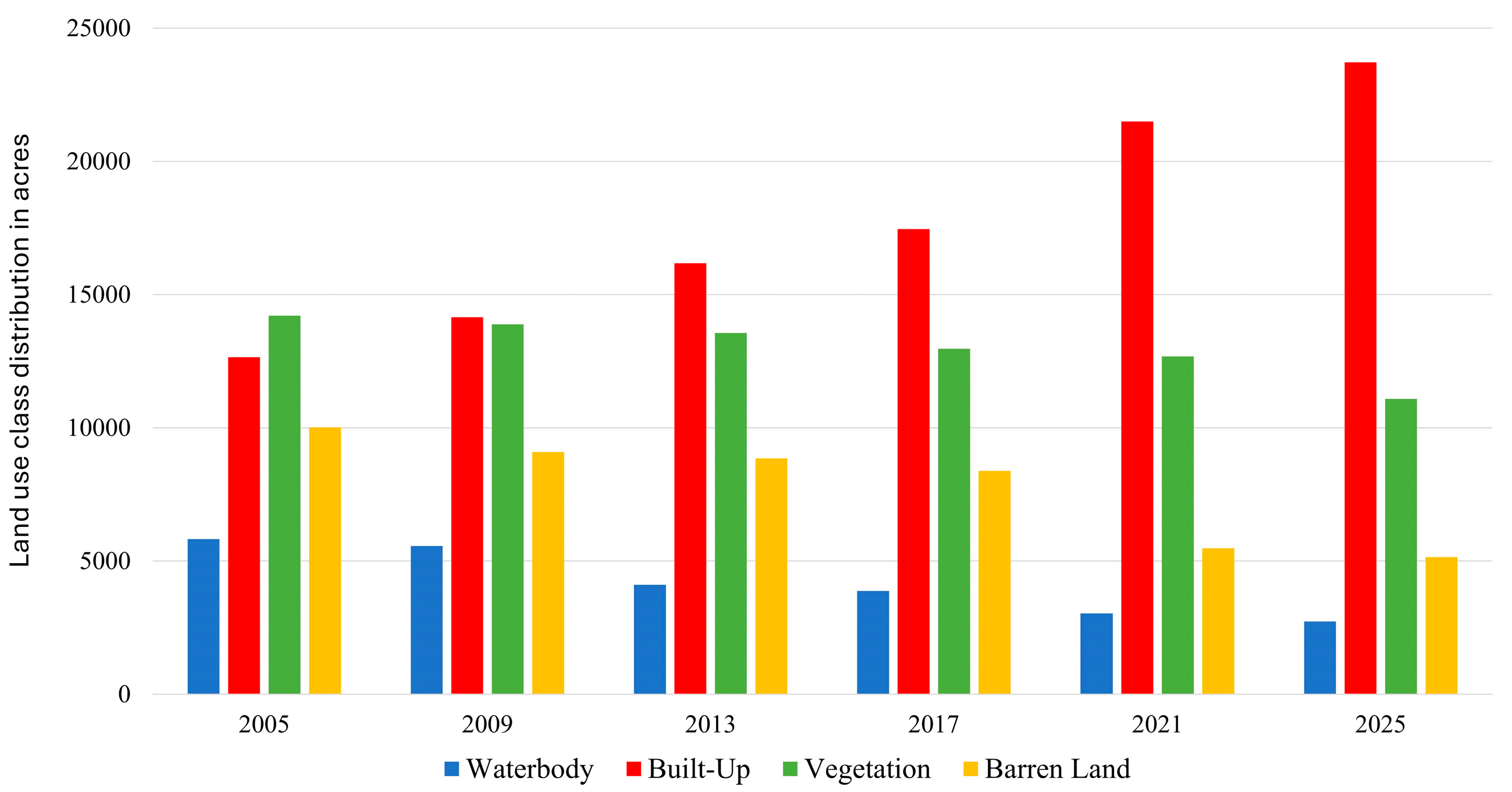
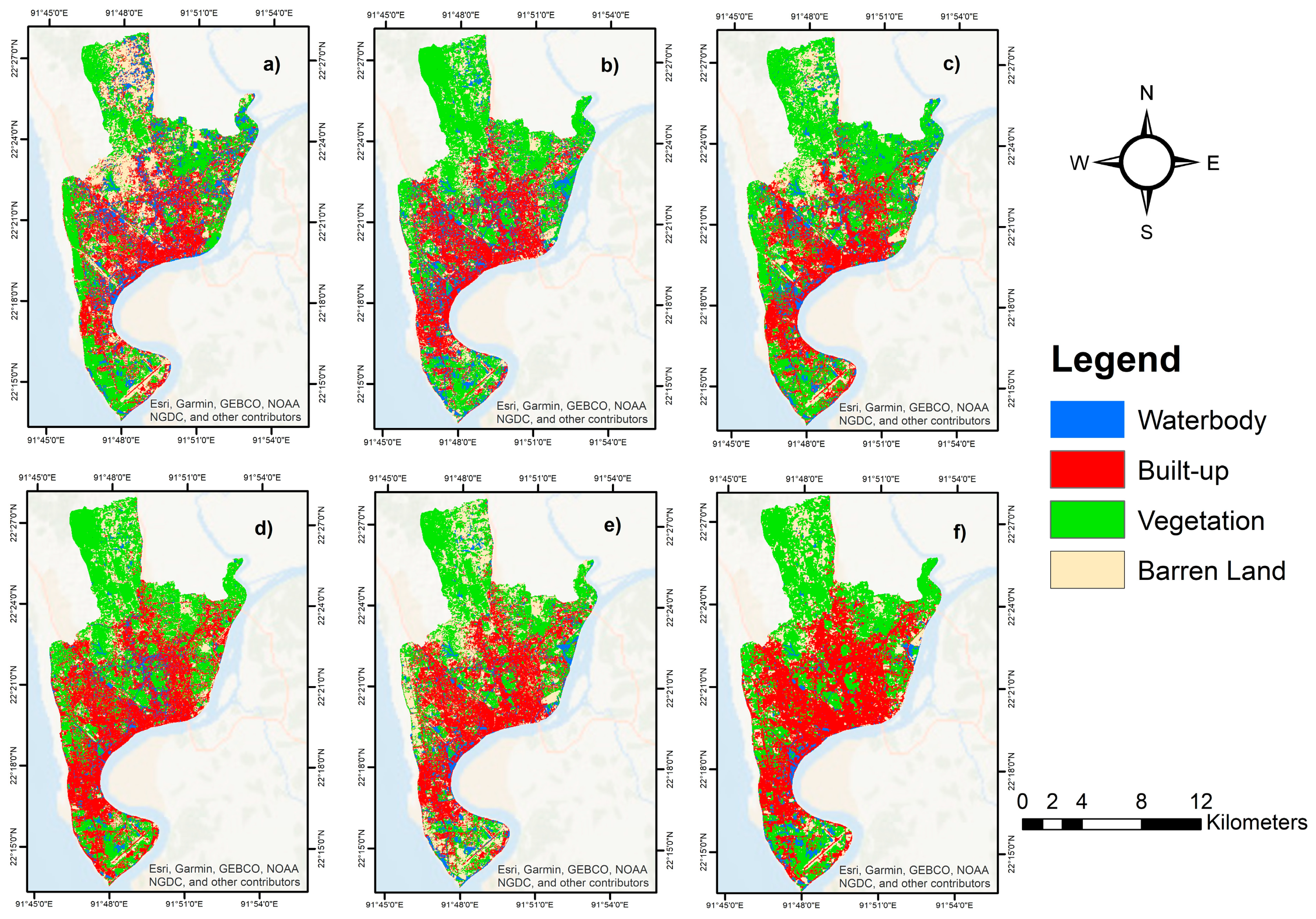
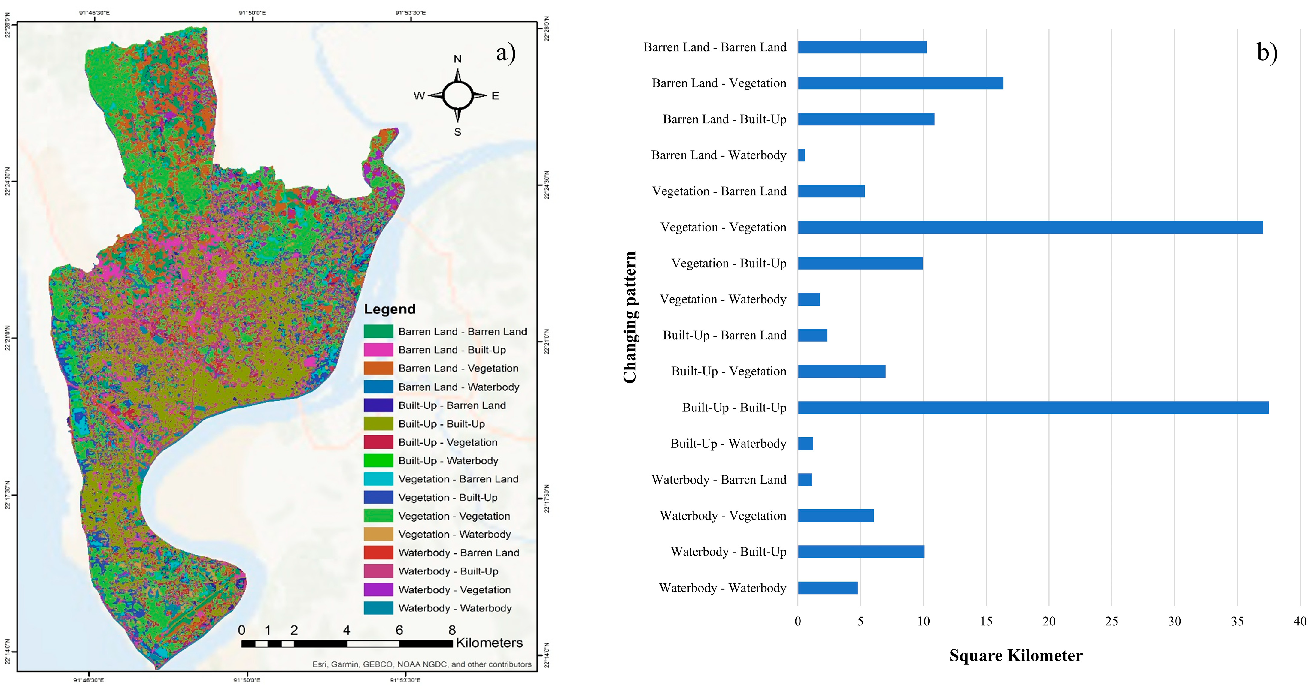
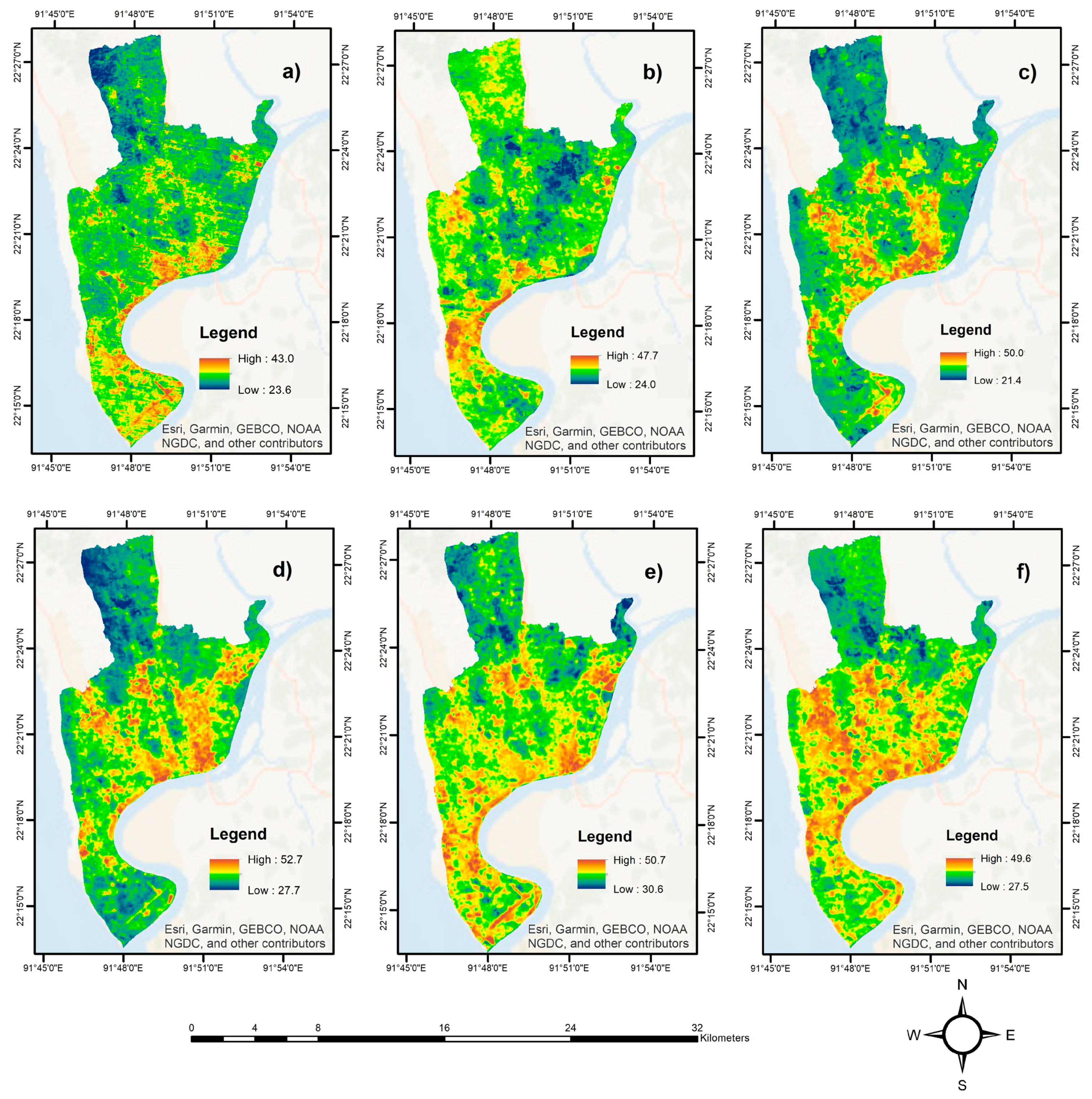
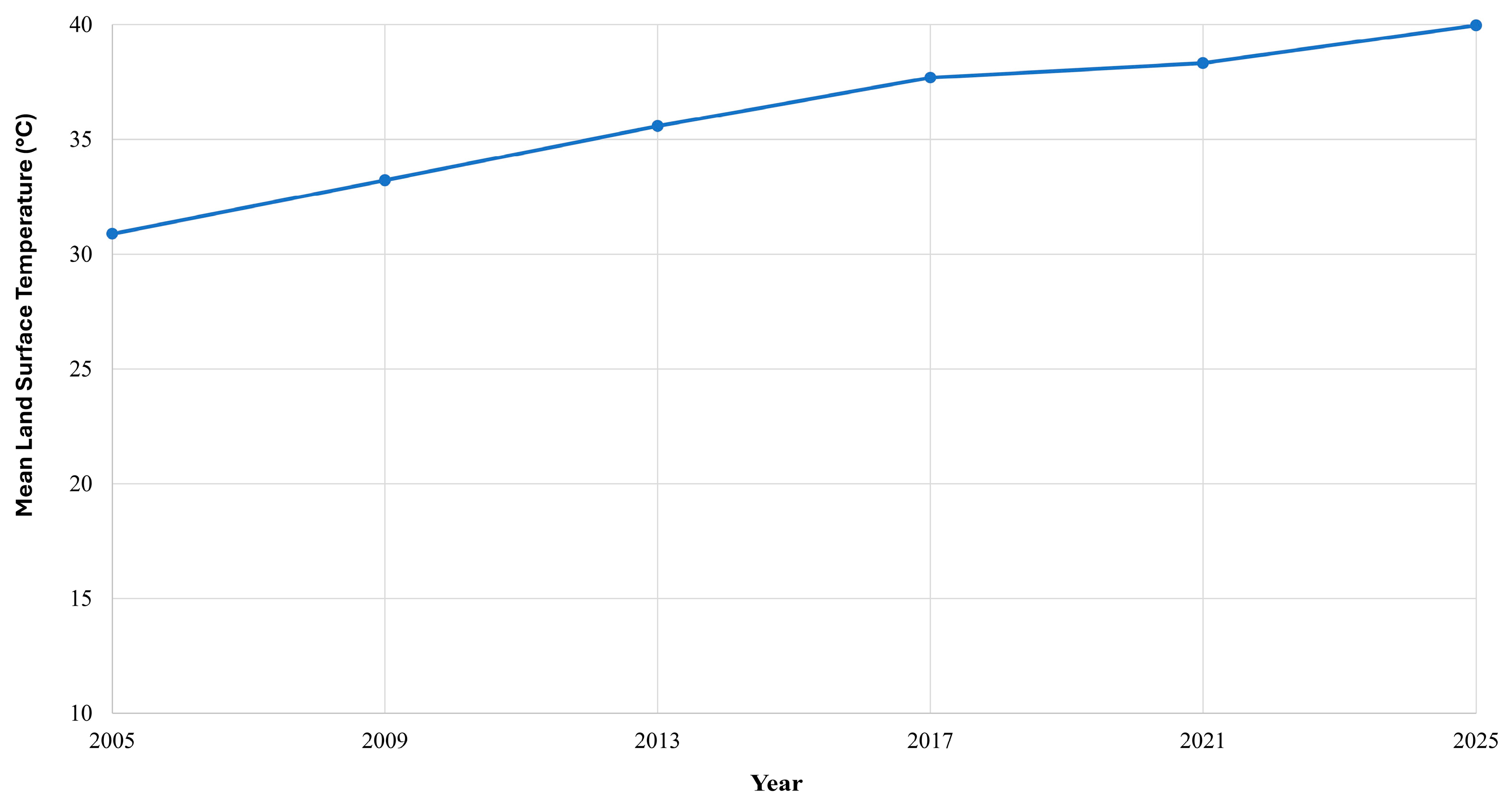
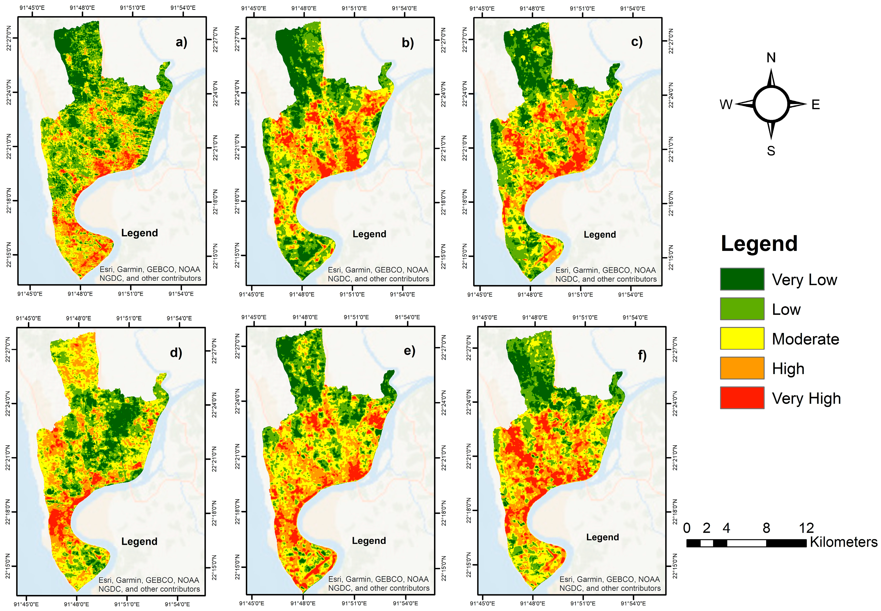
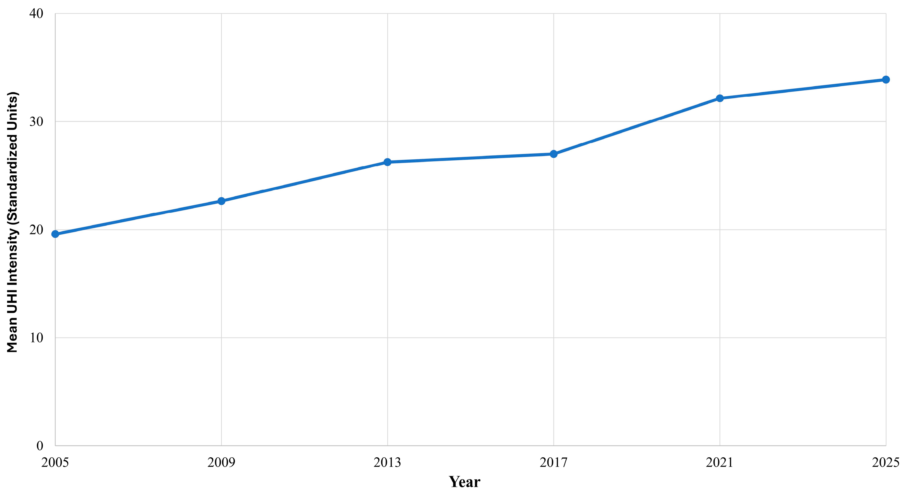
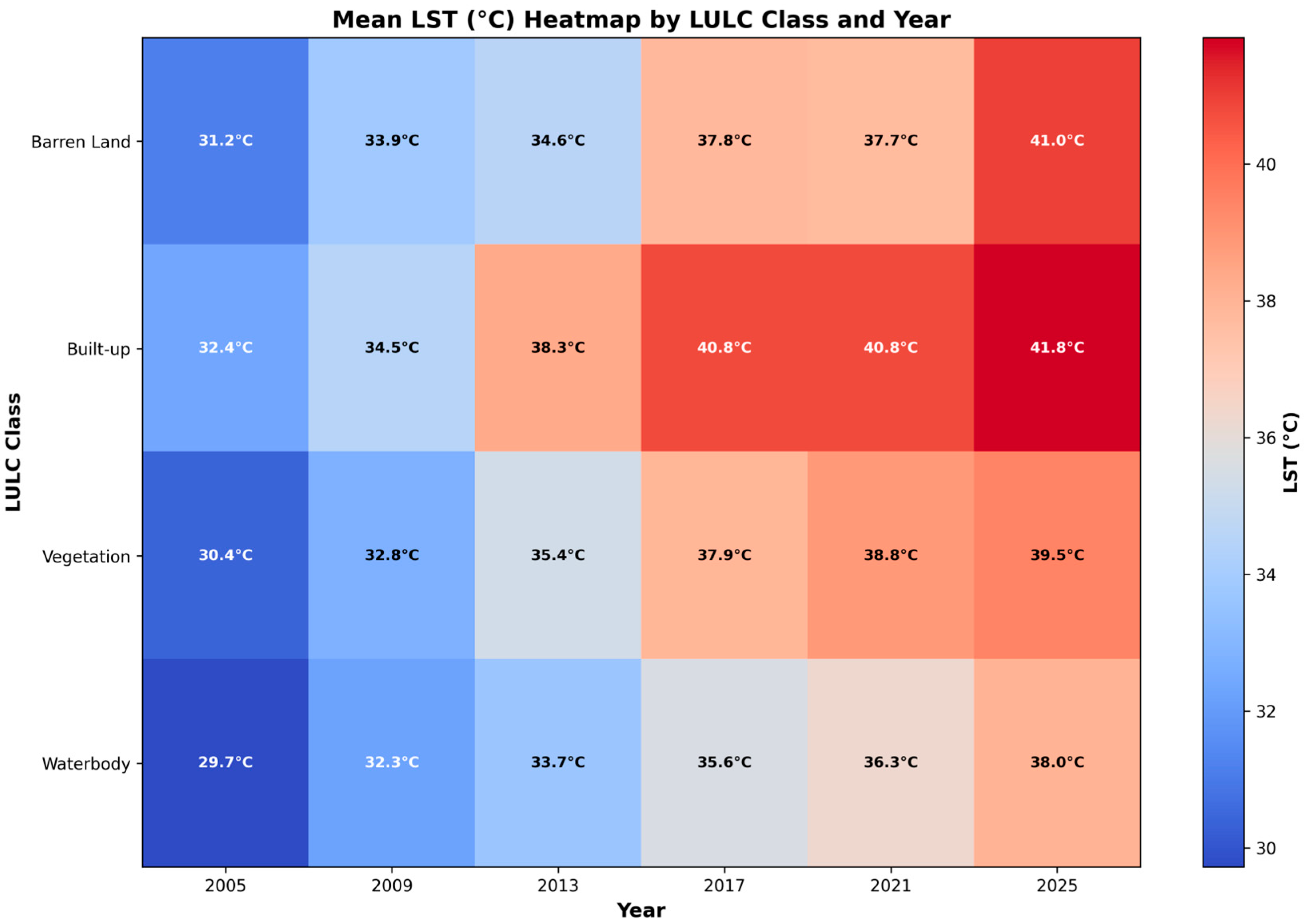
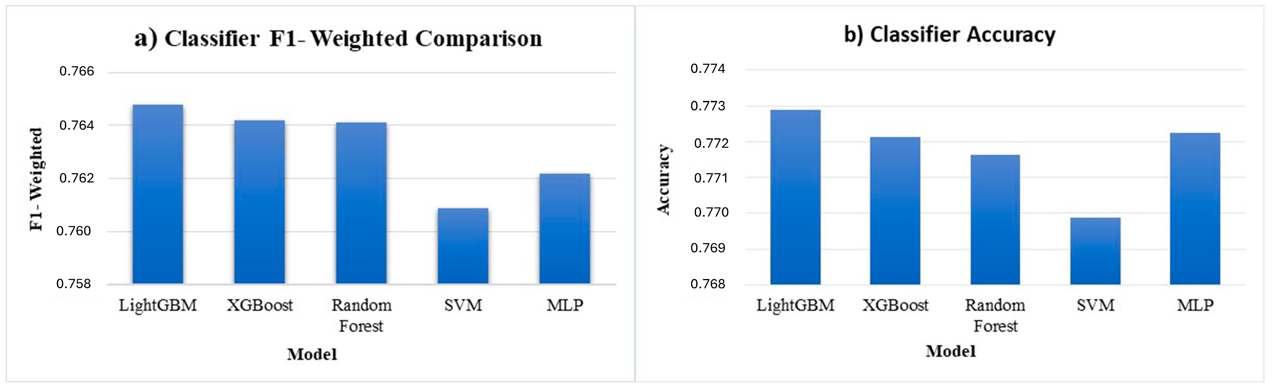
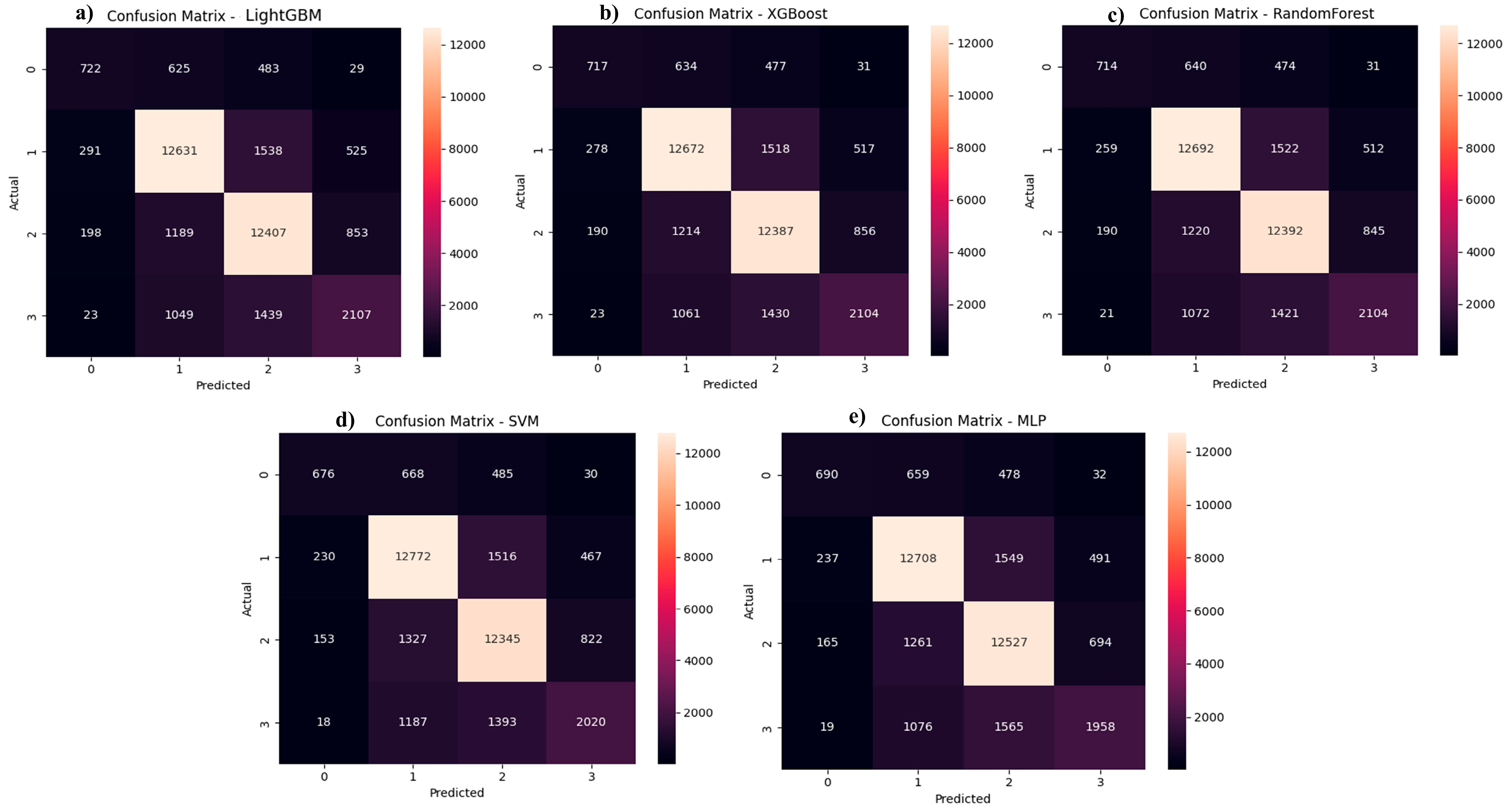
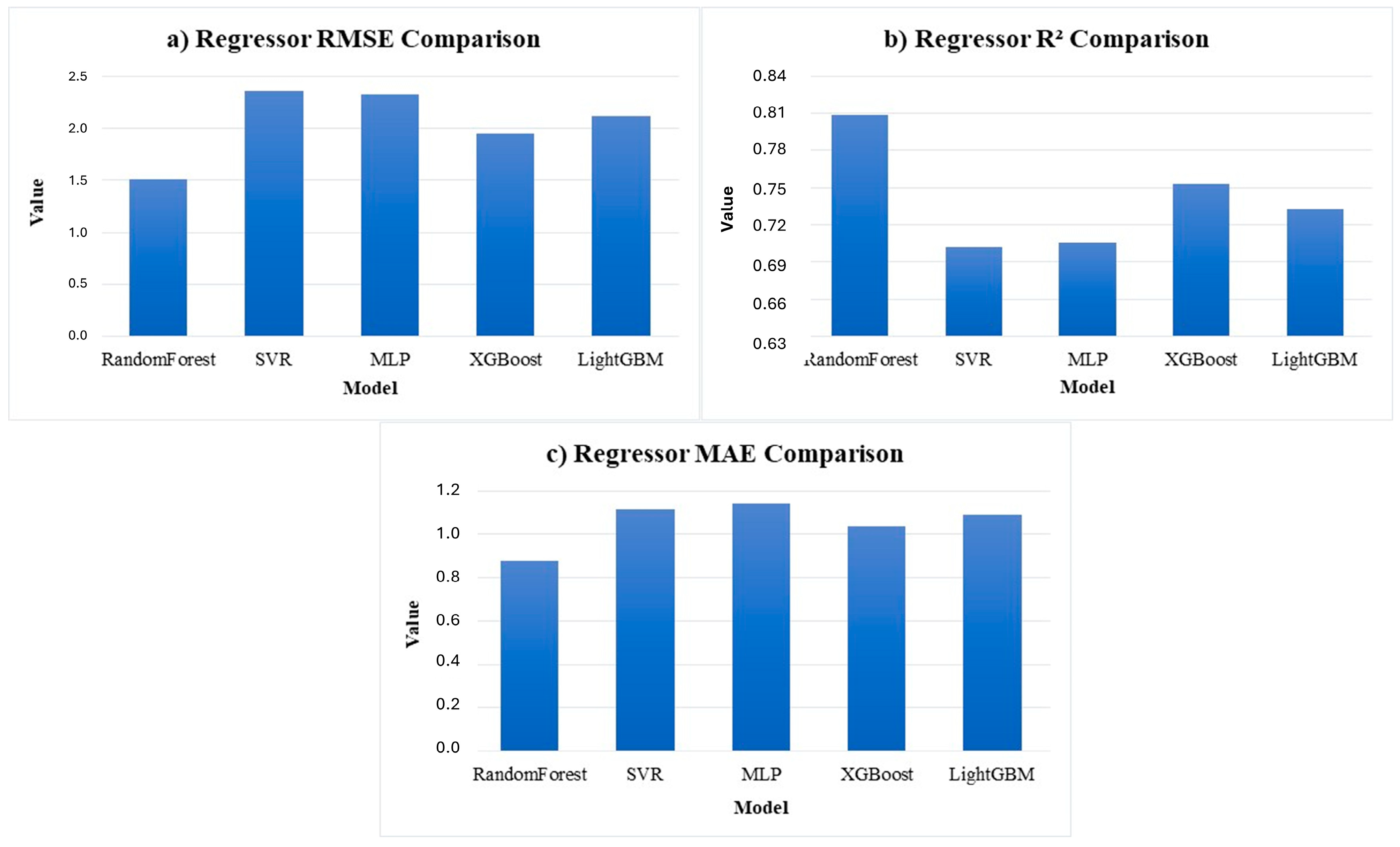
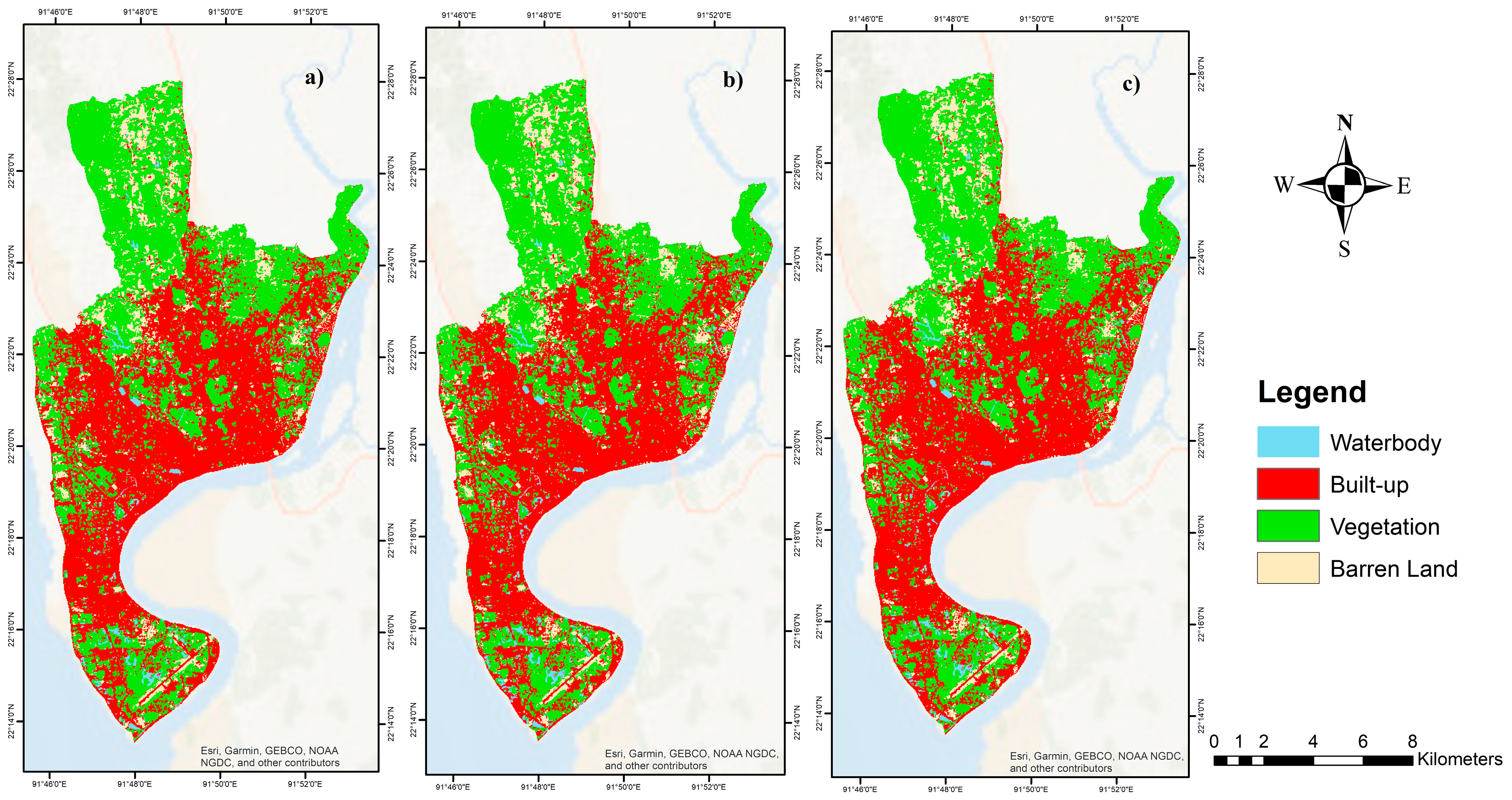
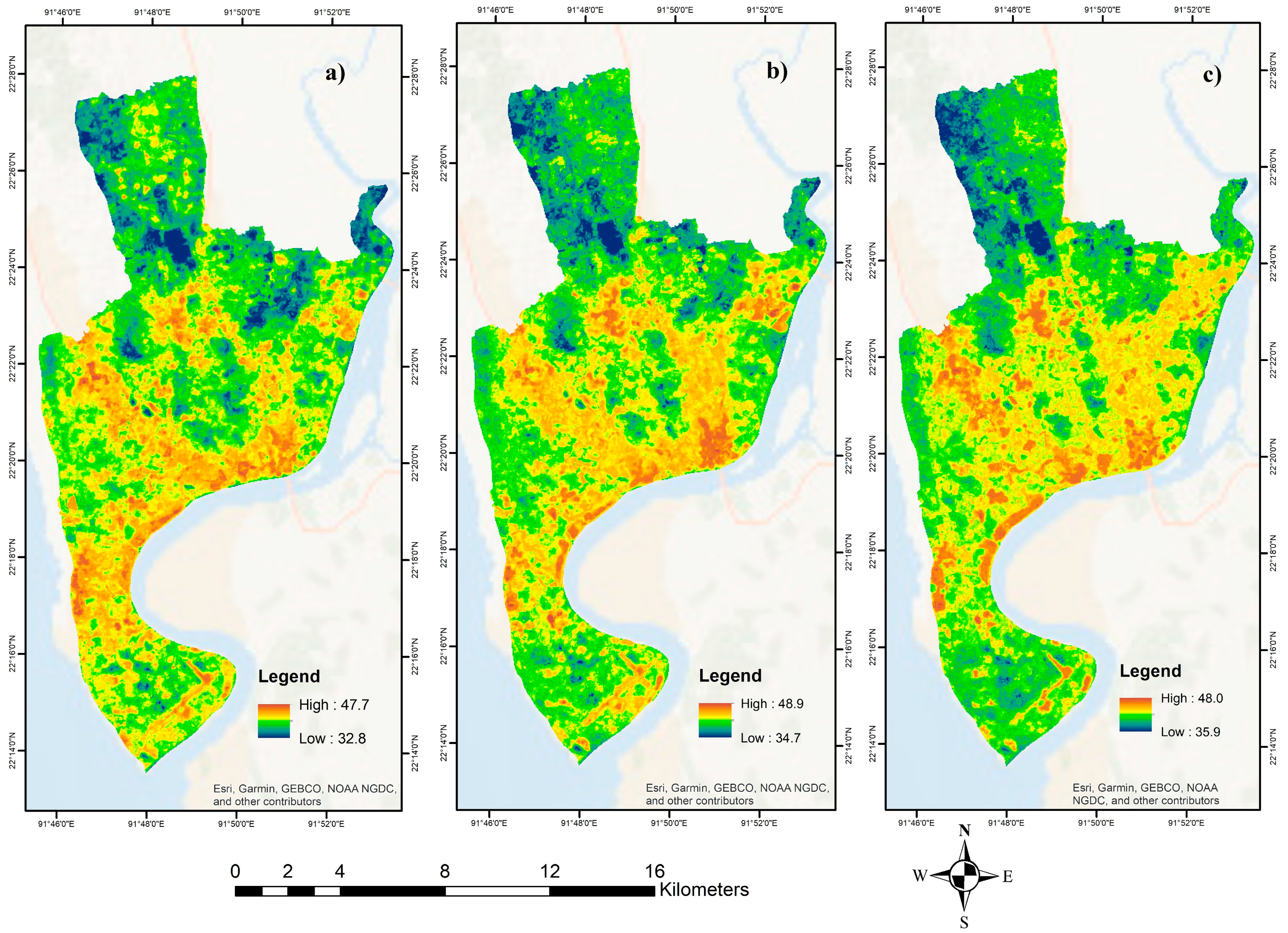
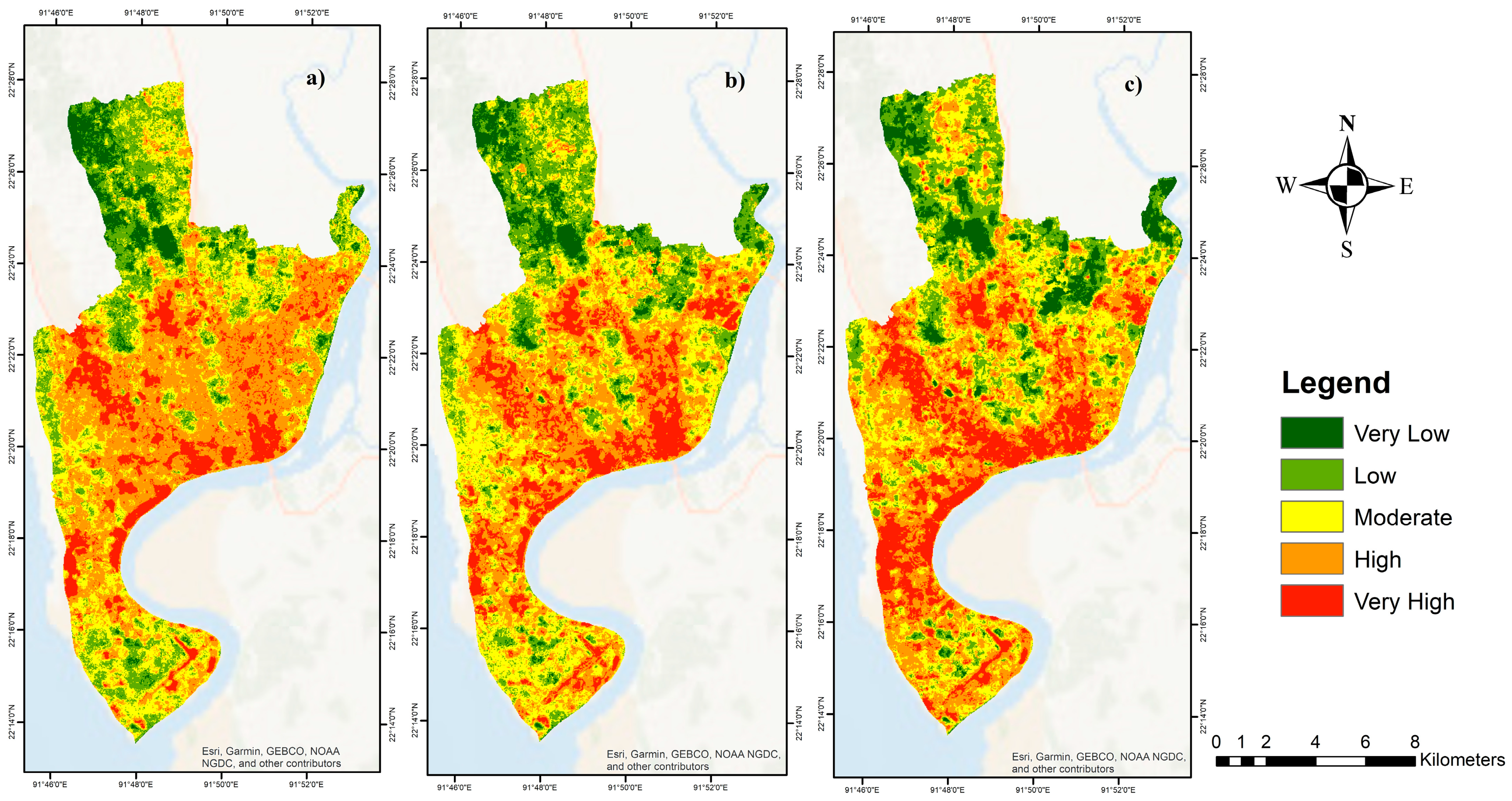
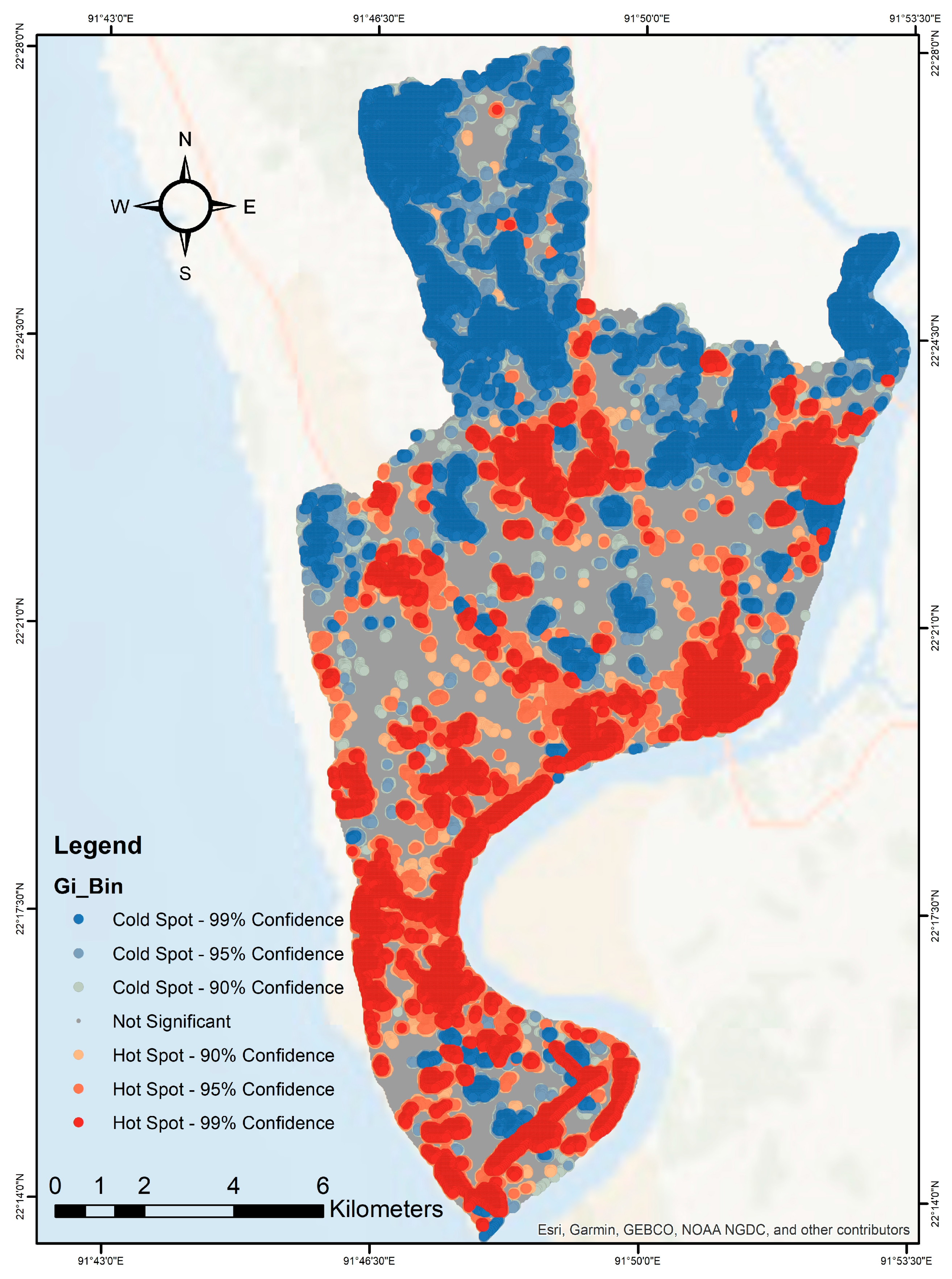
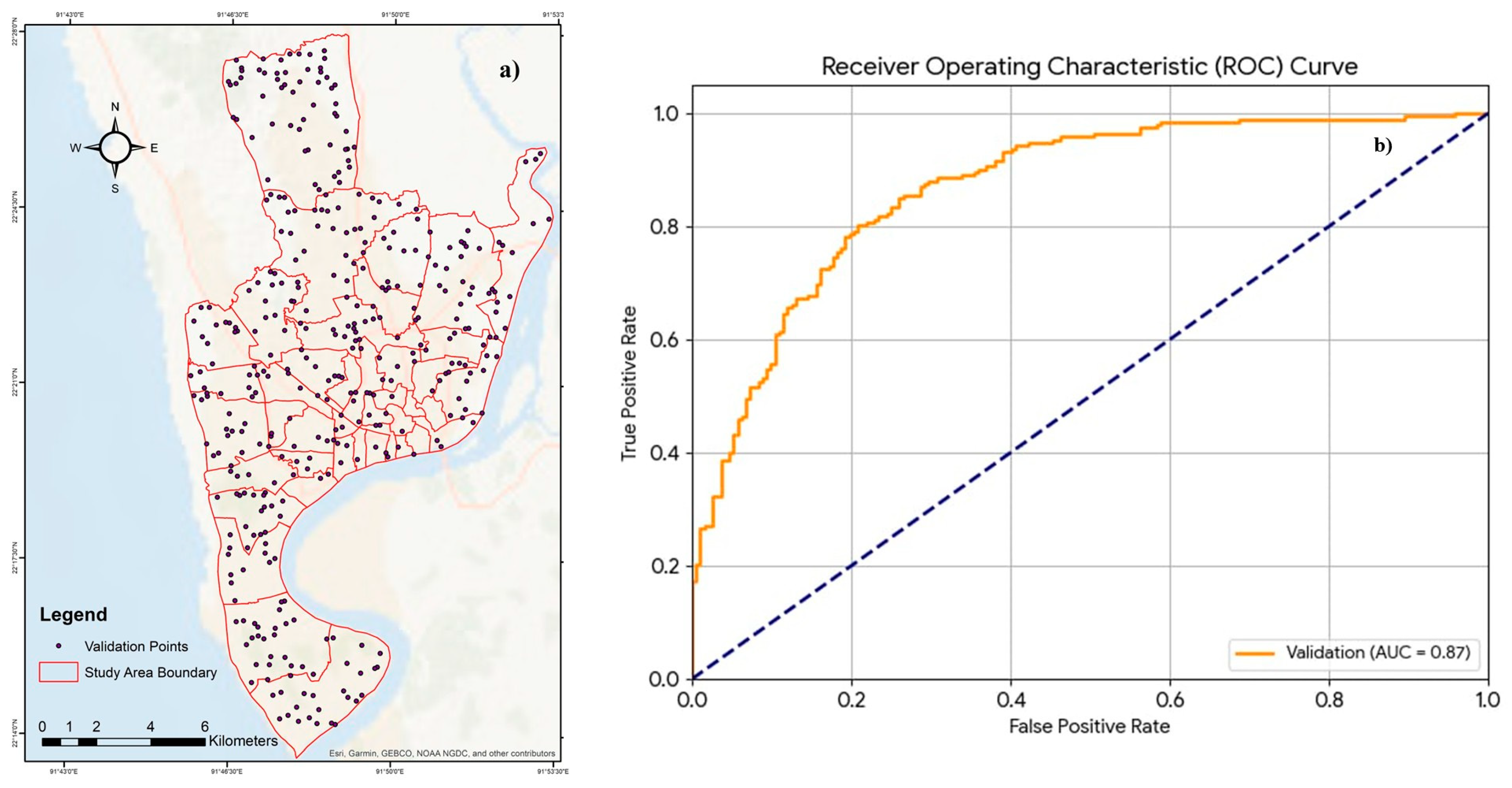
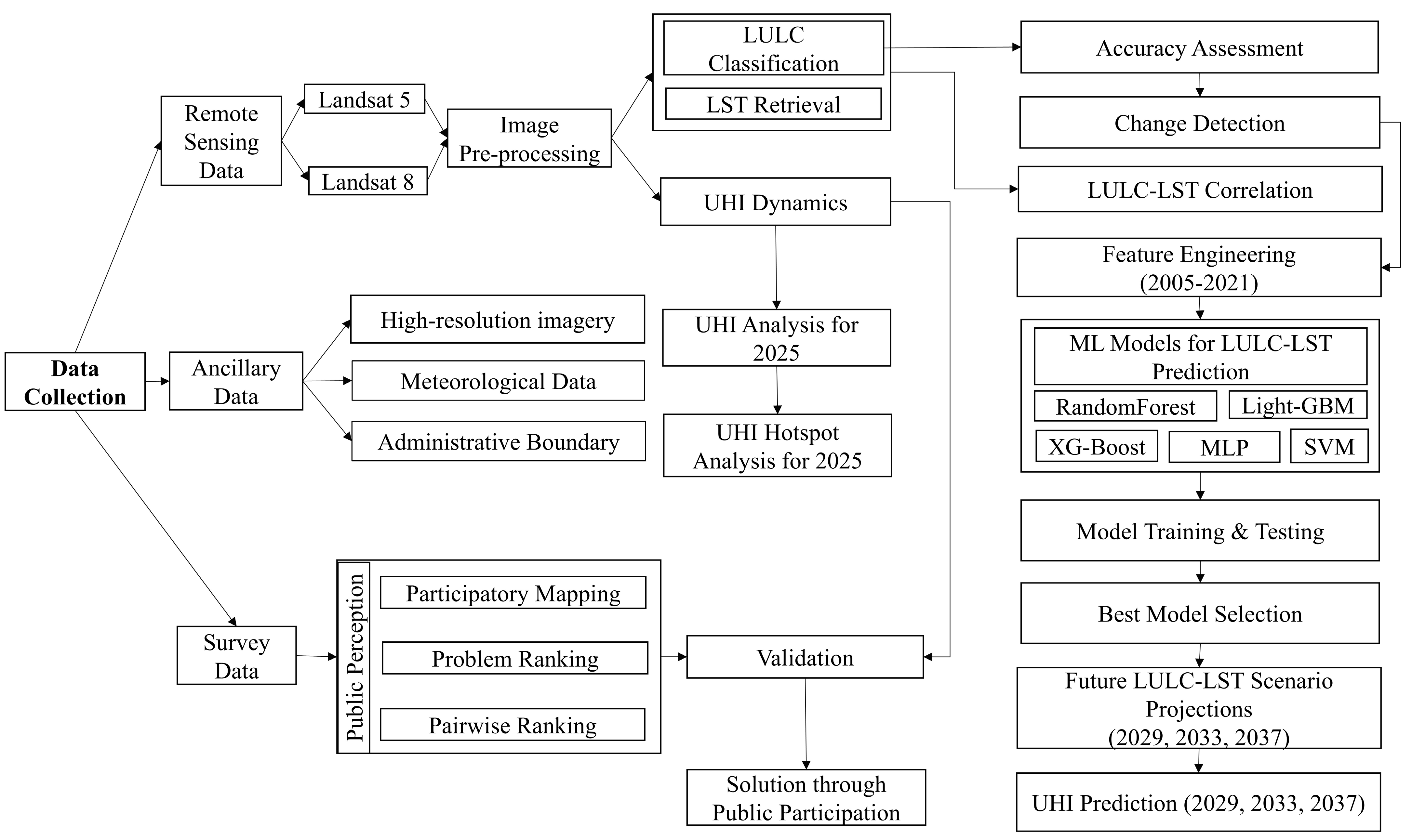
Rapid urbanization in South Asian coastal cities is systematically dismantling natural cooling infrastructure, driving unprecedented urban heat island (UHI) intensification with severe consequences for human health, energy systems, and urban livability. Despite growing research attention, comprehensive frameworks that simultaneously capture temporal UHI dynamics, machine learning-based thermal projections, and community-grounded validation remain scarce, particularly for secondary coastal cities in tropical developing regions. This study addresses these gaps by investigating UHI dynamics in Chattogram City Corporation (CCC), Bangladesh, through three integrated methodological pillars: (1) multi-temporal remote sensing analysis using Landsat 5 and 8 imagery spanning 2005–2025; (2) comparative evaluation of five machine learning algorithms (LightGBM, Random Forest, XGBoost, SVM, and MLP) for land use/land cover (LULC) classification and land surface temperature (LST) regression, with iterative scenario projections for 2029, 2033, and 2037; and (3) a structured public perception survey of 384 residents validated through participatory mapping and focus group discussions. Landsat analysis revealed dramatic LULC transformations: built-up areas expanded 88% (12,649 to 23,719 acres), while waterbodies declined 53.1% and vegetation decreased 21.9%. Mean LST increased by 9.09 °C (from 30.94 °C to 40.03 °C), with mean UHI intensity rising from 19.59 to 33.88 standardized units over two decades. LightGBM achieved optimal LULC classification (F1-weighted: 0.765) while Random Forest best predicted LST (RMSE: 1.51, R2: 0.809). Projections indicate continued thermal escalation, with mean LST reaching 43.64 °C and UHI intensity exceeding 37.41 standardized units by 2037. Persistent thermal hotspots were identified in the southwestern coastal corridor, western industrial belt, and central business district. Community survey data corroborated satellite-derived patterns, with 73.44% of respondents observing environmental degradation, yet only 22% aware of formal heat mitigation policies, and 87% supporting vegetation-based cooling interventions. This integrated framework advances urban thermal monitoring in tropical coastal cities and provides spatially targeted, community-endorsed evidence for climate-responsive urban planning.
Keywords: urban heat island; land surface temperature; machine learning prediction; remote sensing analysis; public perception urban heat island; land surface temperature; machine learning prediction; remote sensing analysis; public perception