Next Article in Journal
Geographical Entity Management Model Based on Multi-Classification
Next Article in Special Issue
Urban–Rural Exposure to Flood Hazard and Social Vulnerability in the Conterminous United States
Previous Article in Journal
Potentials in Using VR for Facilitating Geography Teaching in Classrooms: A Systematic Review
Previous Article in Special Issue
Universal Snow Avalanche Modeling Index Based on SAFI–Flow-R Approach in Poorly-Gauged Regions
 
 
Correction published on 23 December 2024, see ISPRS Int. J. Geo-Inf. 2024, 13(12), 466.
Article

Geometric Characterization of the Mateur Plain in Northern Tunisia Using Vertical Electrical Sounding and Remote Sensing Techniques


1
Department of Earth Sciences, Faculty of Sciences of Bizerte 7021, University of Carthage Tunisia, Carthage 1054, Tunisia
2
URGAMM-Faculty of Sciences of Tunis, University of Tunis El Manar 2092, Tunis 1938 , Tunisia
3
National Center of Mapping and Remote Sensing, El Aouina 1080, Tunis 1938, Tunisia
4
Institute for Mediterranean Studies, Foundation for Research and Technology Hellas, 70013 Iraklio, Greece
5
Institute of Geophysics and Meteorology, University of Cologne, 50923 Cologne, Germany
*
Author to whom correspondence should be addressed.
ISPRS Int. J. Geo-Inf. 2024, 13(9), 333; https://doi.org/10.3390/ijgi13090333
Submission received: 17 July 2024 / Revised: 6 September 2024 / Accepted: 11 September 2024 / Published: 18 September 2024 / Corrected: 23 December 2024

Abstract

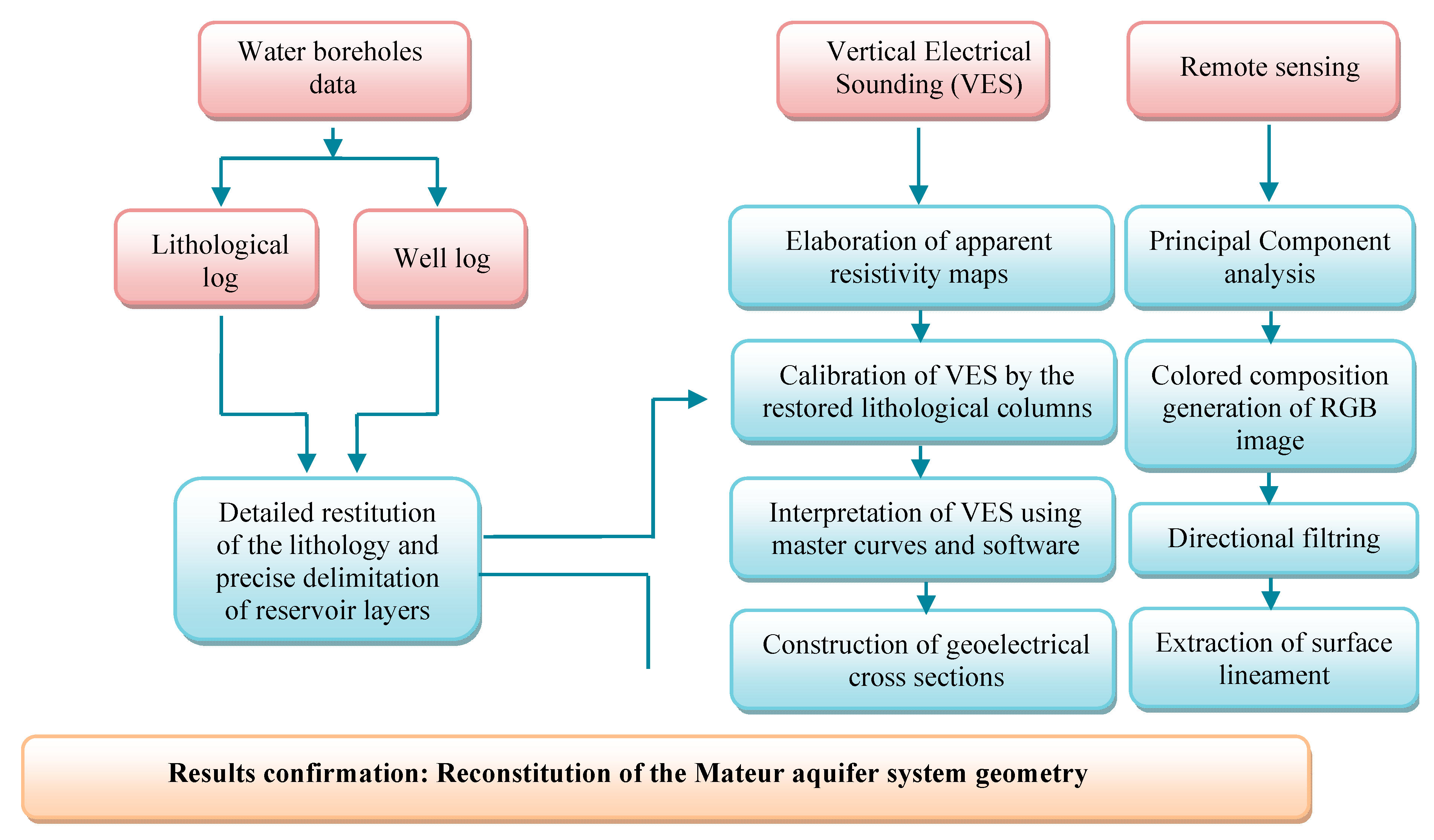
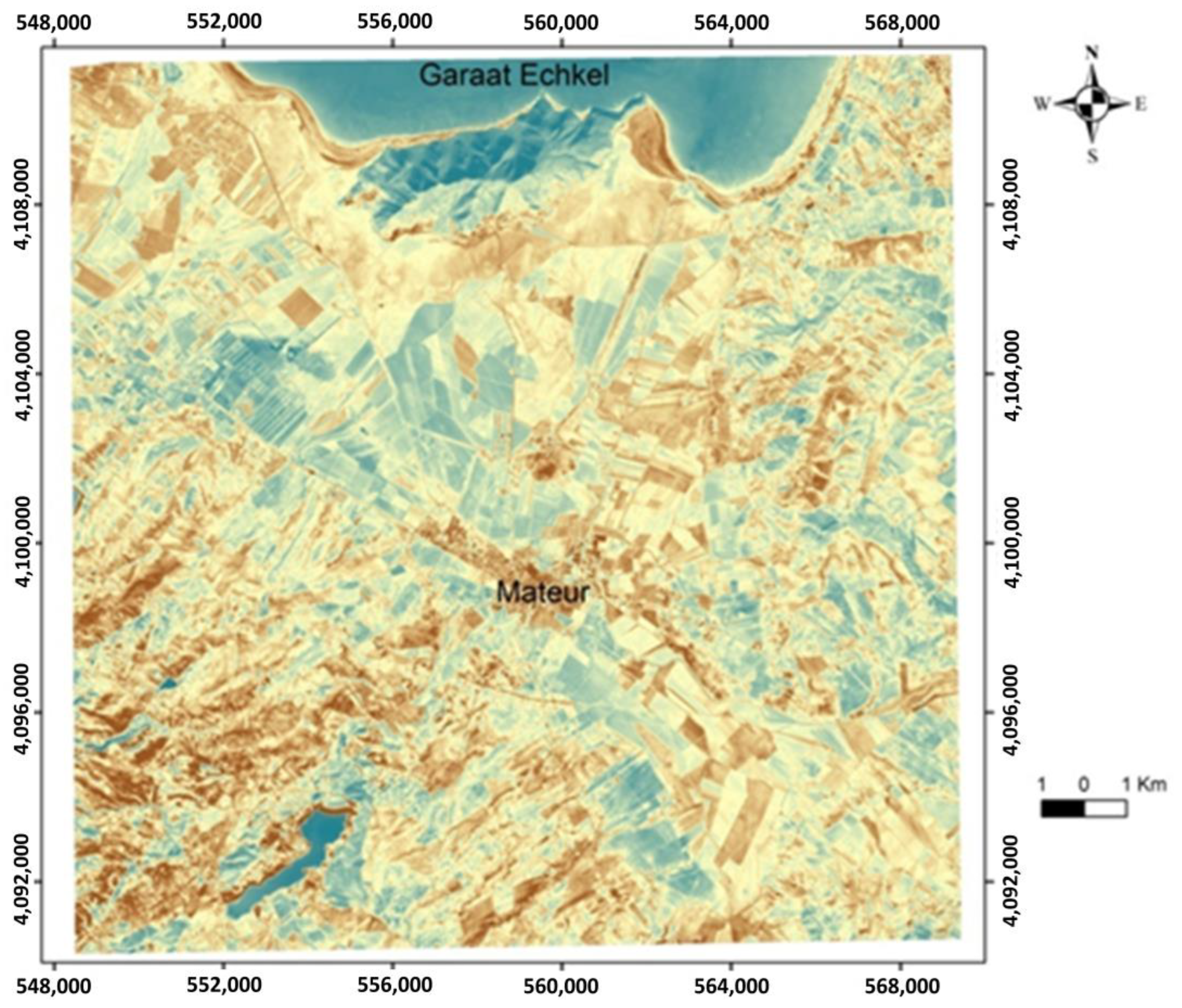
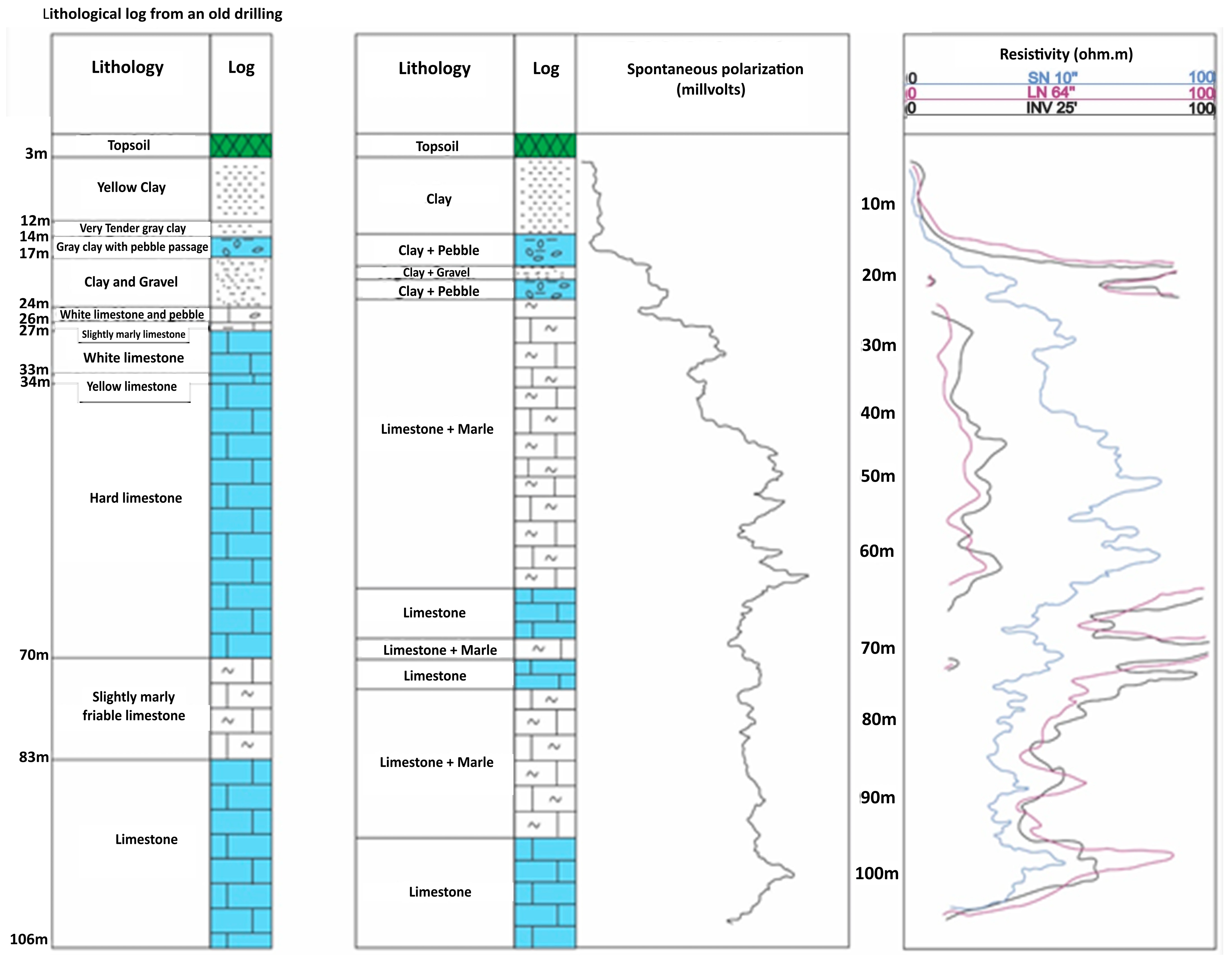
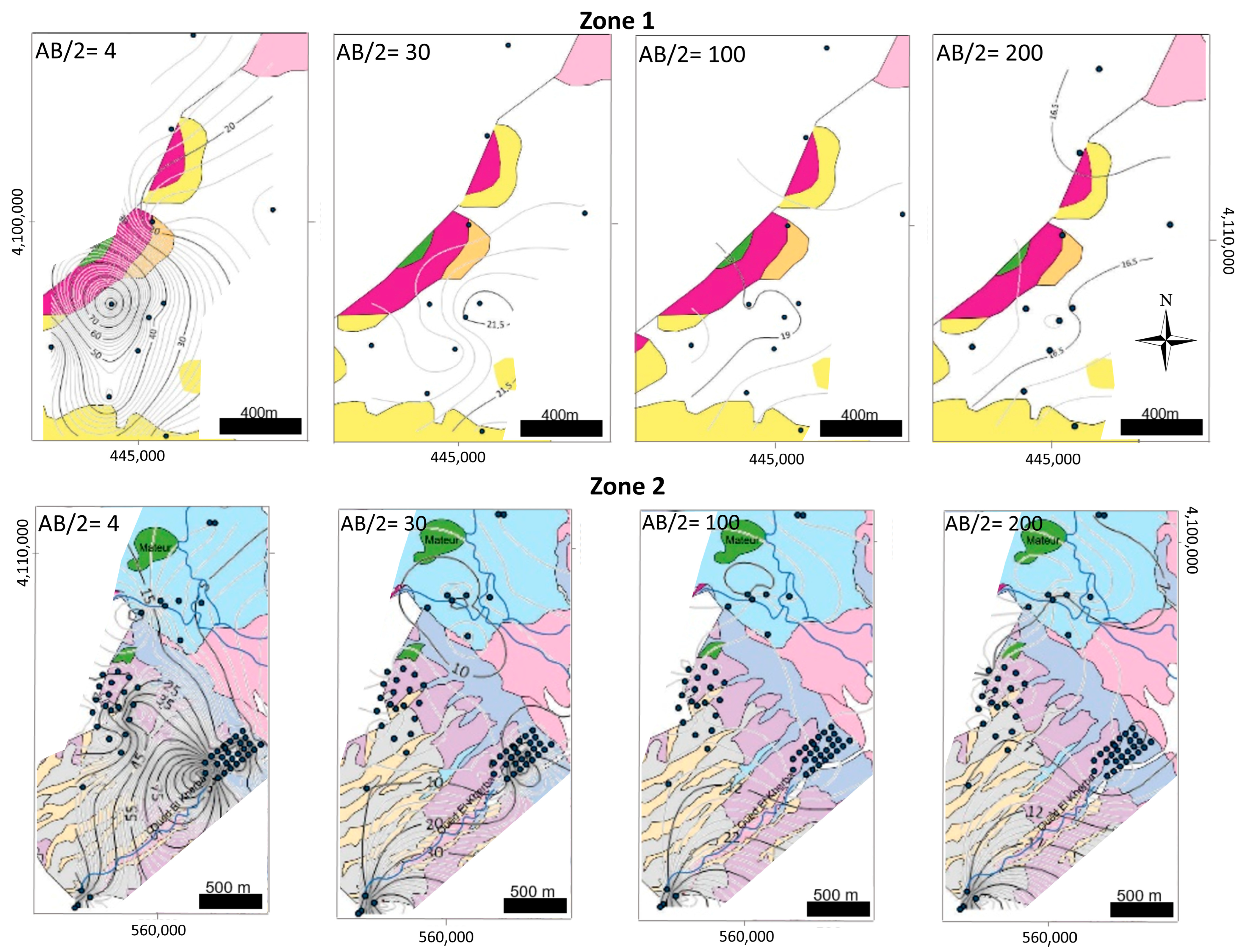
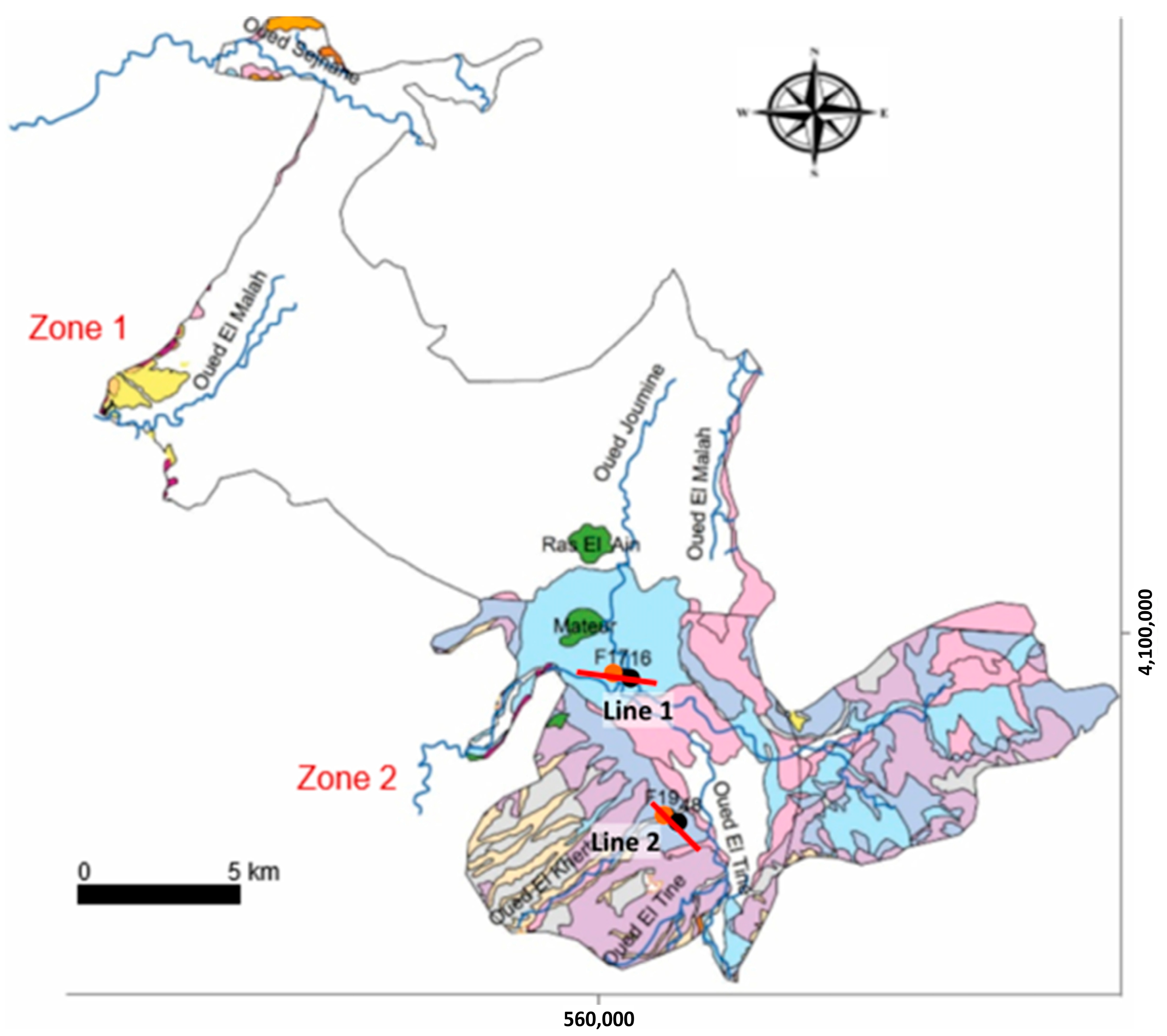
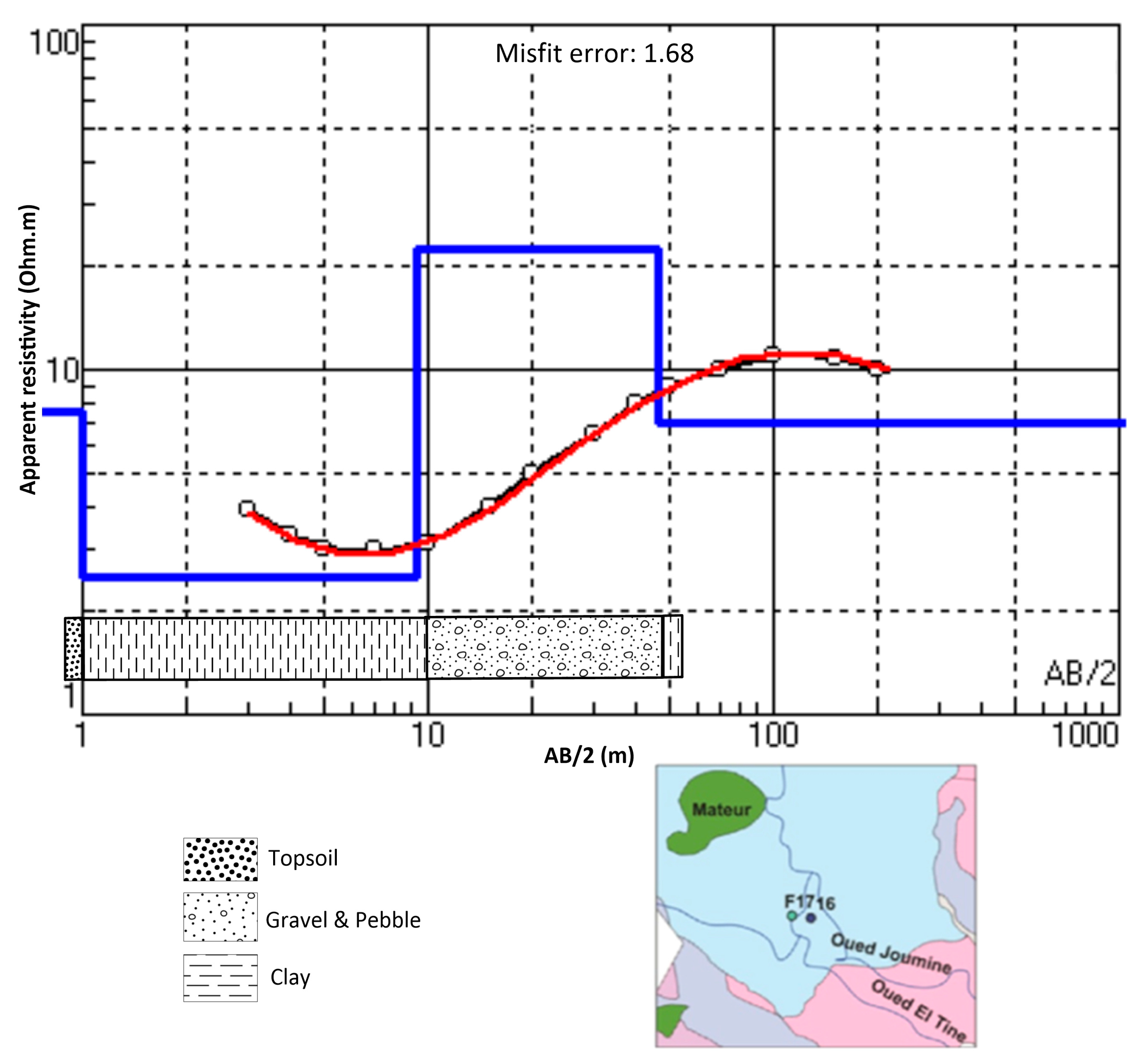
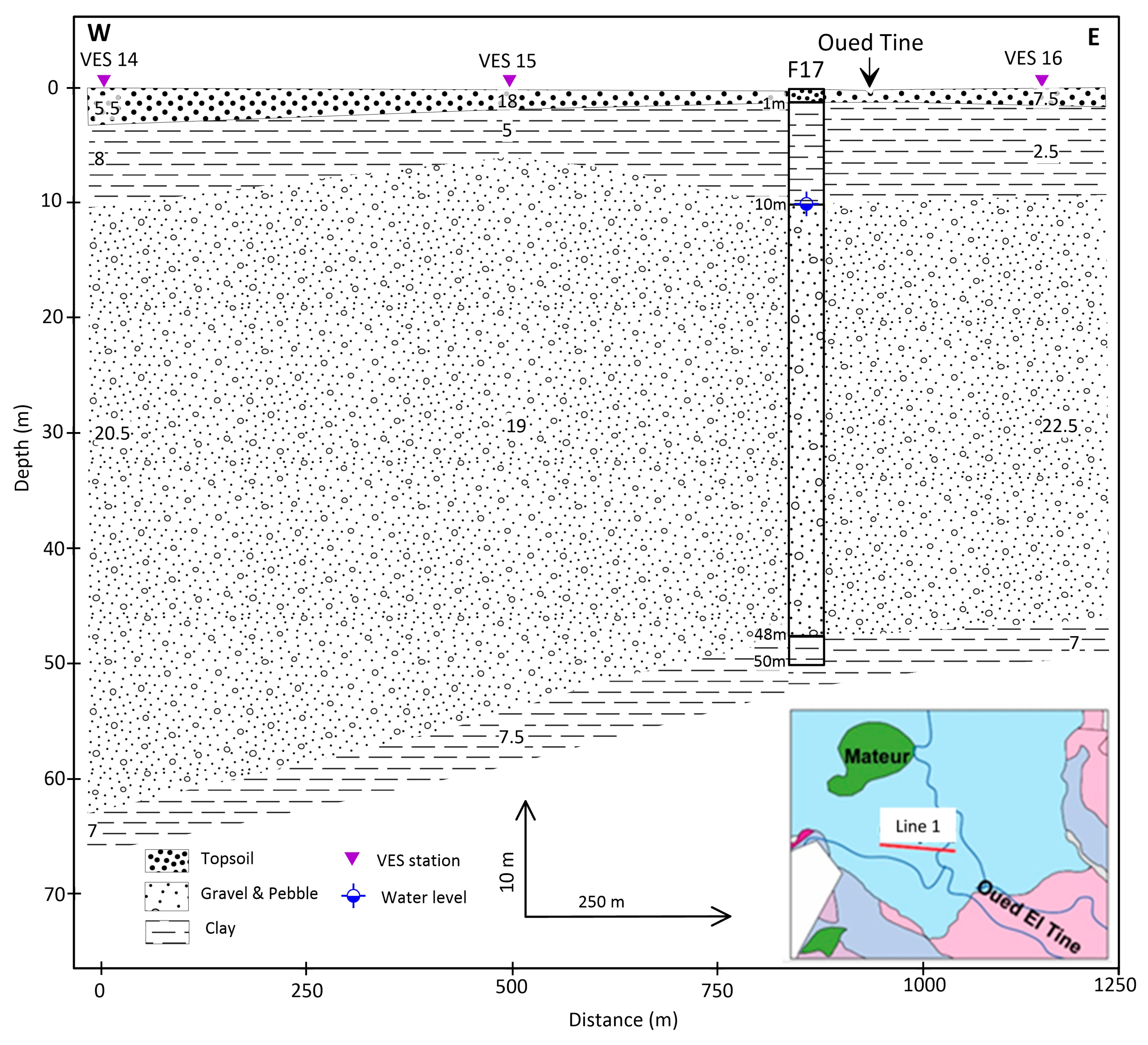
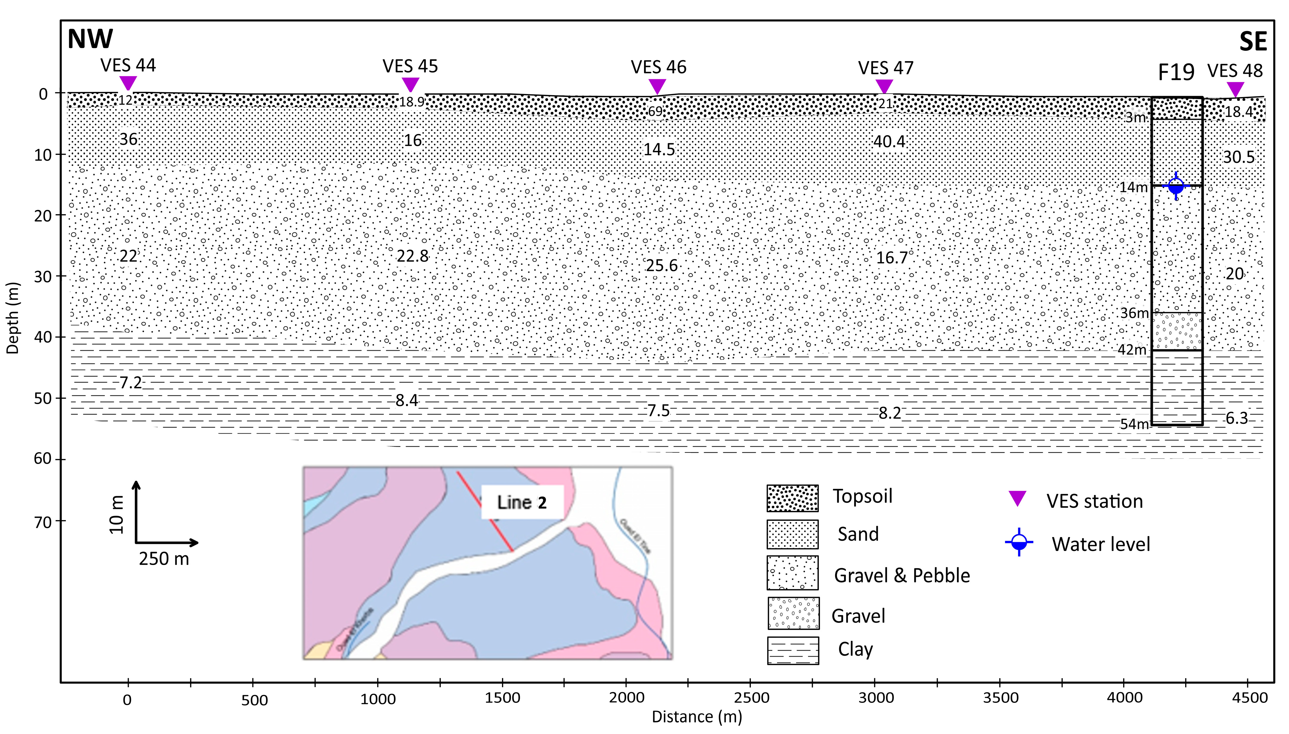
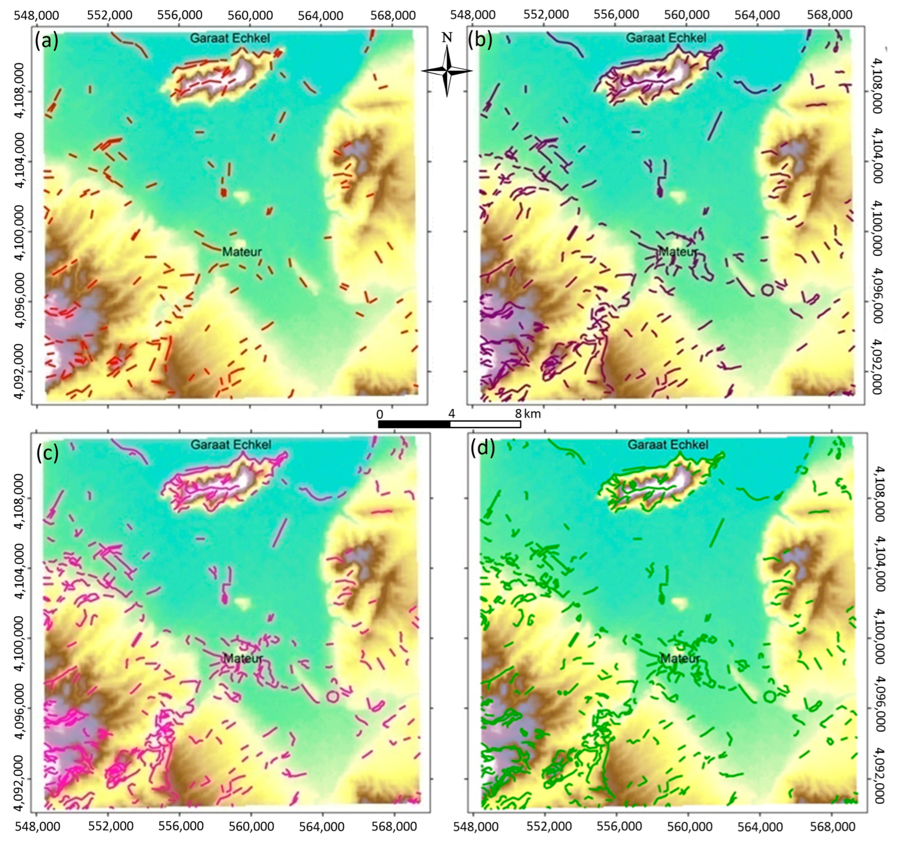
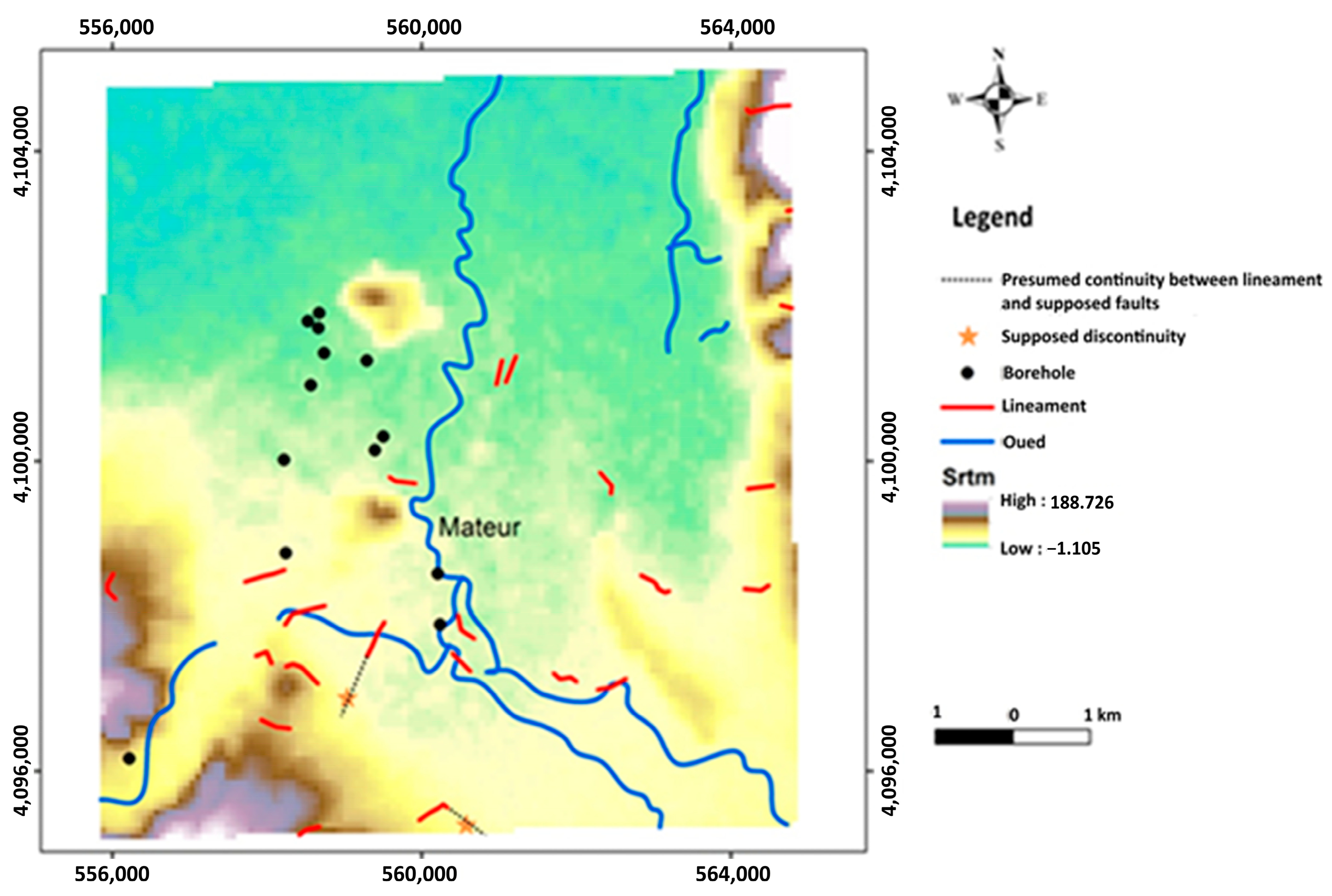
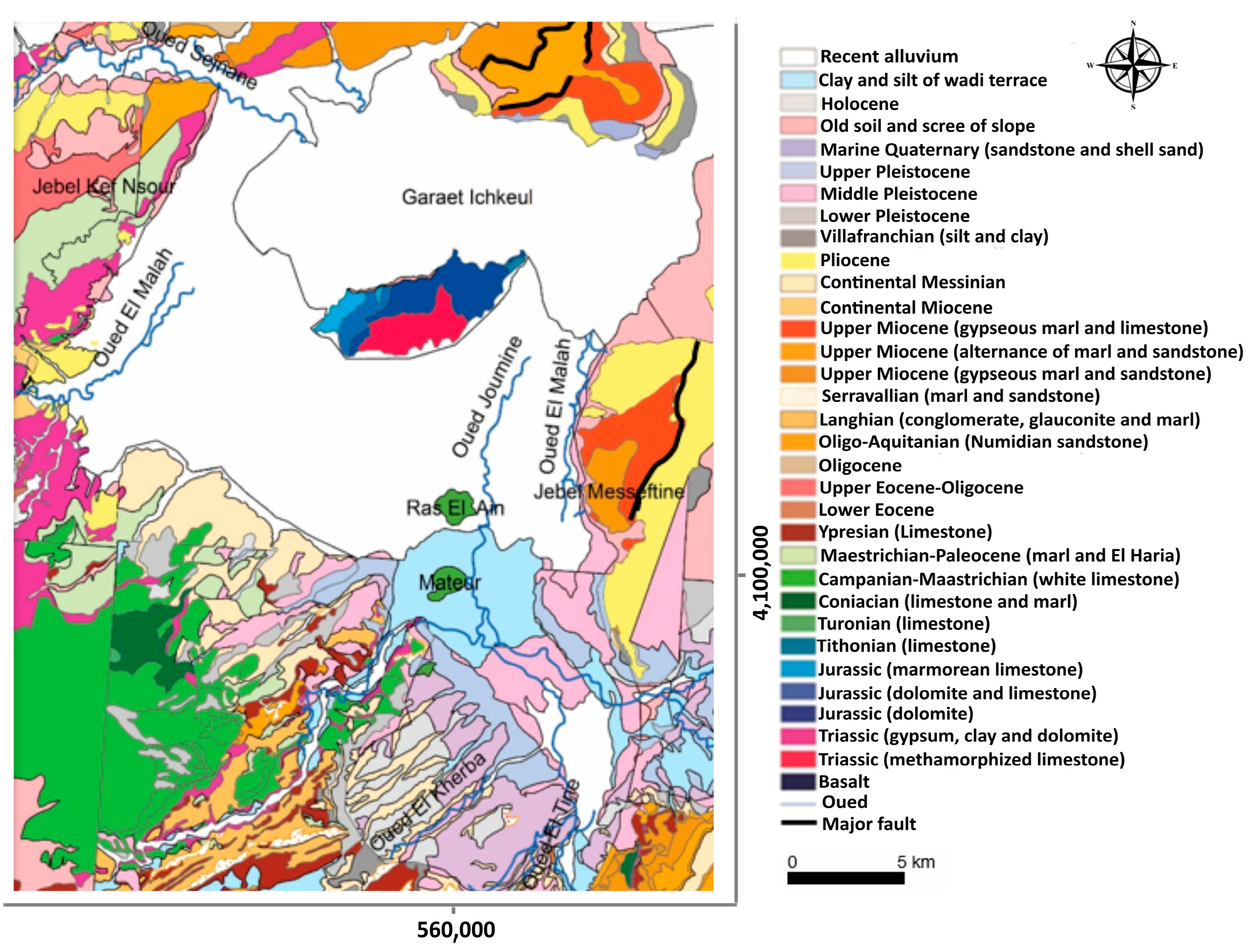
The Mateur aquifer system in Northern Tunisia was examined using data from 19 water boreholes, 69 vertical electrical sounding (VES) stations, and a Sentinel-2 satellite image. Available boreholes and their corresponding logs were compared to define precisely the multi-layer aquifer system, including the Quaternary and Campanian aquifers of the Mateur plain. Quantitative interpretation and qualitative evaluation of VES data were conducted to define the geometry of these reservoirs. These interpretations were enhanced by remote sensing imagery processing, which enabled the identification of the Mateur plain’s superficial lineaments. Based on well log information, the lithological columns show that the Quaternary series in the Ras El Ain region contains a layer of clayey, pebbly, and gravelly limestone. Additionally, in the Oued El Tine area, a clayey lithological unit has been identified as a multi-layer aquifer. The study area, exhibiting apparent resistivity values ranging between 20 and 170 Ohm·m, appears to be rich in groundwater resources. The correlation between the lithological columns and the interpreted VES data, presented as geoelectrical cross-sections, revealed variations in depth (8–106 m), thickness (10 to 55 m), and resistivity (20–98 Ohm·m) of a coarse unit corresponding to the Mateur aquifer. Twenty-three superficial lineaments were extracted from the Sentinel-2 image. Their common superposition indicated that both of them are in a good coincidence; these could be the result of normal faults, creating an aquifer system divided into raised and sunken blocks.
Keywords: Tunisia; Mateur plain; groundwater aquifer; vertical electrical sounding (VES); remote sensing; satellite image Tunisia; Mateur plain; groundwater aquifer; vertical electrical sounding (VES); remote sensing; satellite image