Article

A Localized Evaluation of Surface Water Quality Using GIS-Based Water Quality Index along Satpara Watershed Skardu Baltistan, Pakistan


by
Ali Muhammad
1,2,3,
Donghui Shangguan
1,2,3,*,
Ghulam Rasool
4,
Amjad Ali Khan
1,2,3,
Asim Qayyum Butt
1,2,3,
Ayesha Hussain
5 and
Muhammad Ahsan Mukhtar
1,2,3
1
Northwest Institute of Eco-Environment and Resources (NIEER), Chinese Academy of Sciences, Lanzhou 730000, China
2
University of Chinese Academy of Sciences, Beijing 100049, China
3
China-Pakistan Joint Research Center on Earth Sciences, CAS-HEC, Islamabad 45320, Pakistan
4
Department of Chemistry, Quaid-i-Azam University Islamabad, Islamabad 15320, Pakistan
5
Department of Economics, Government College Women University, Faisalabad 38000, Pakistan
*
Author to whom correspondence should be addressed.
ISPRS Int. J. Geo-Inf. 2024, 13(11), 393; https://doi.org/10.3390/ijgi13110393
Submission received: 25 August 2024 / Revised: 27 October 2024 / Accepted: 30 October 2024 / Published: 2 November 2024

Abstract

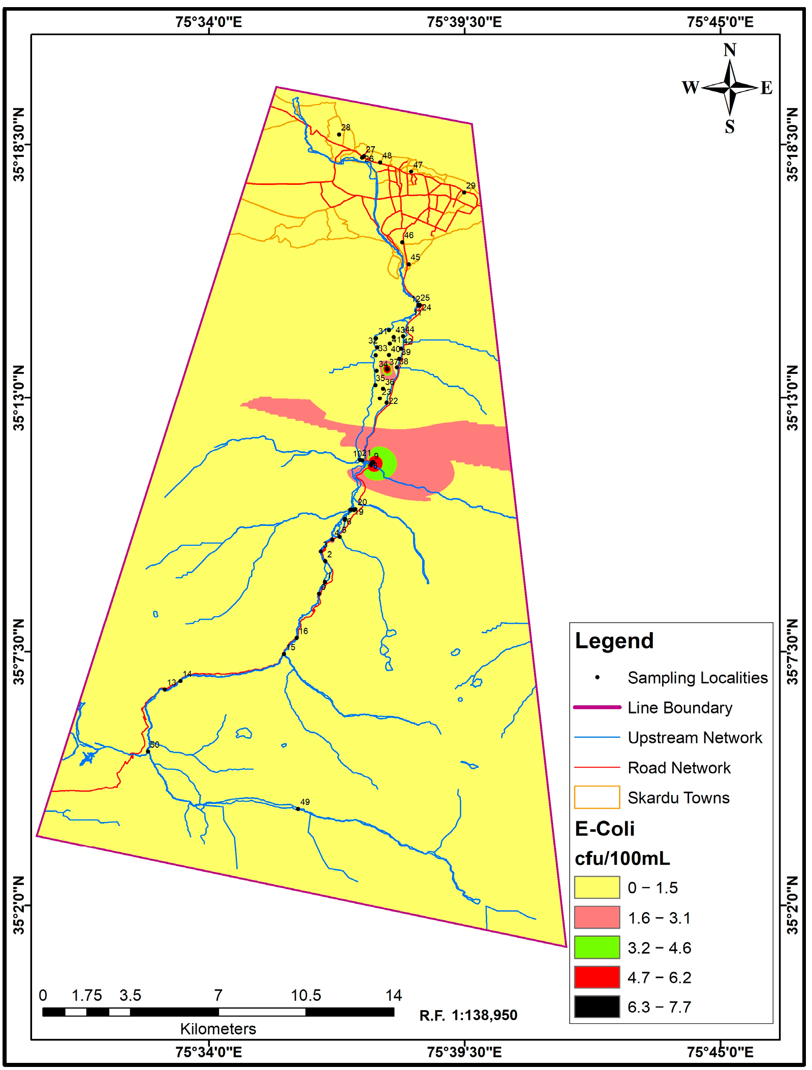
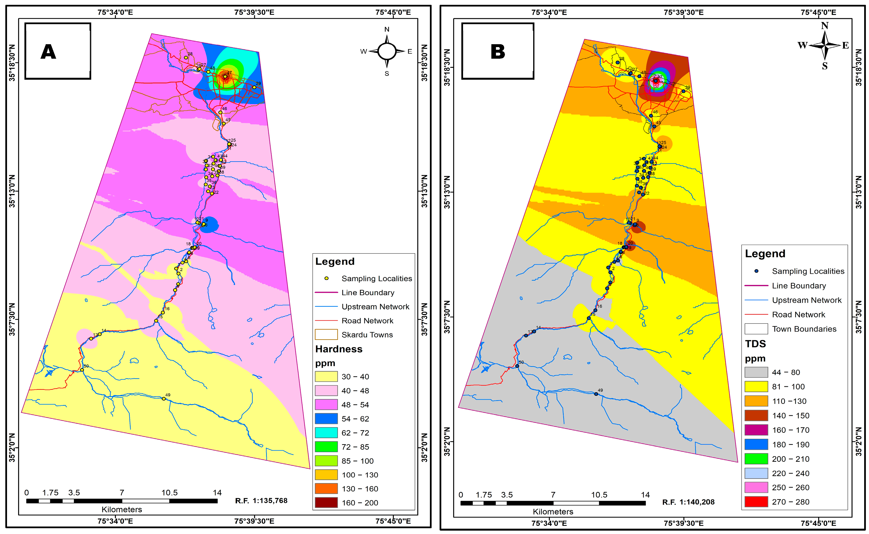
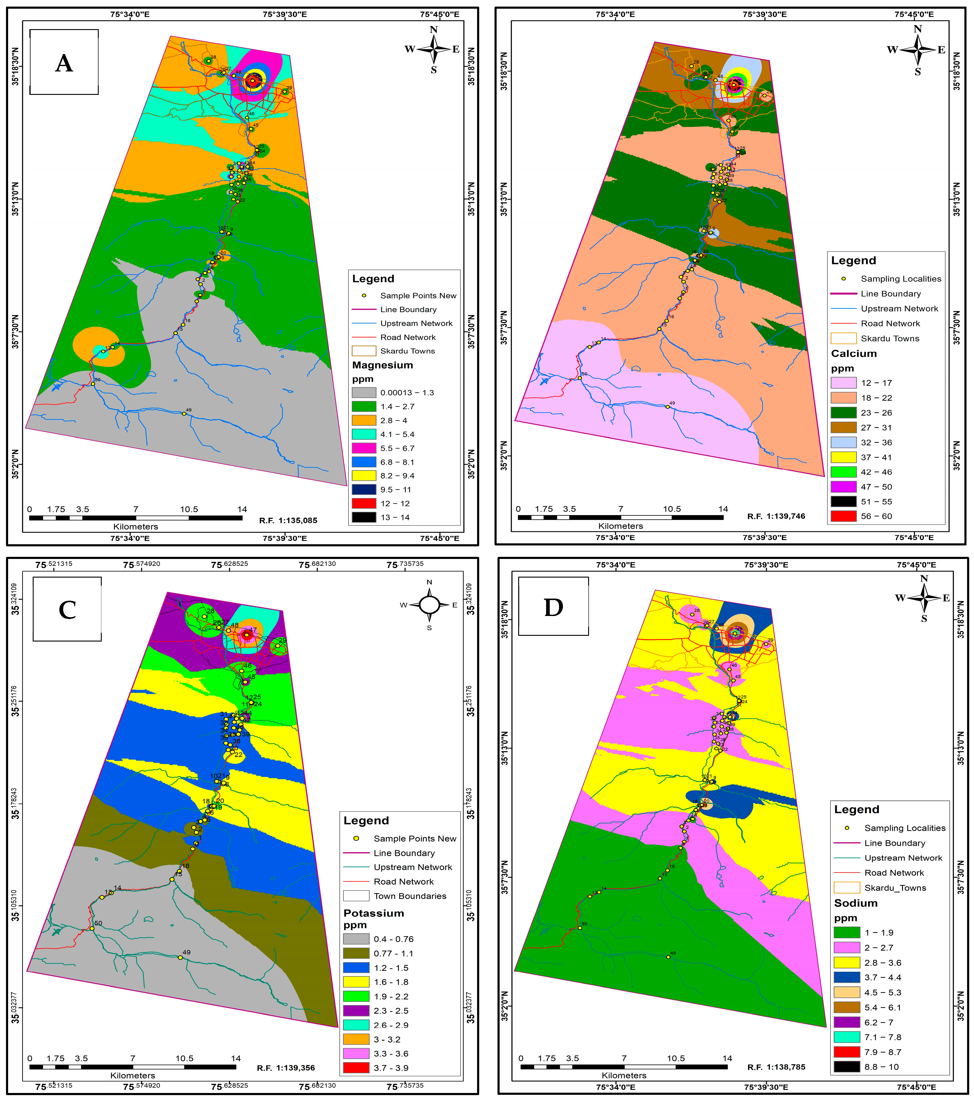
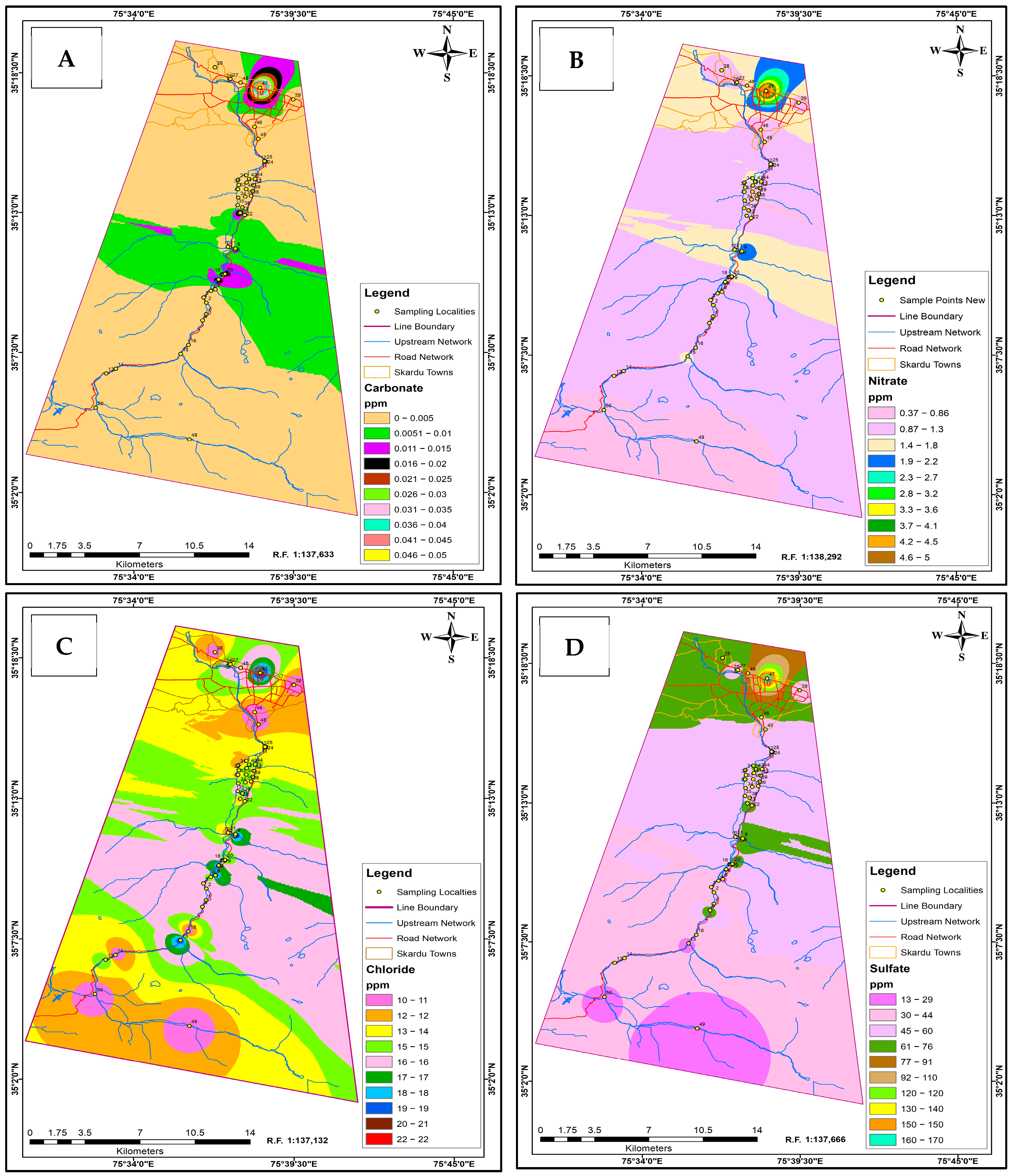
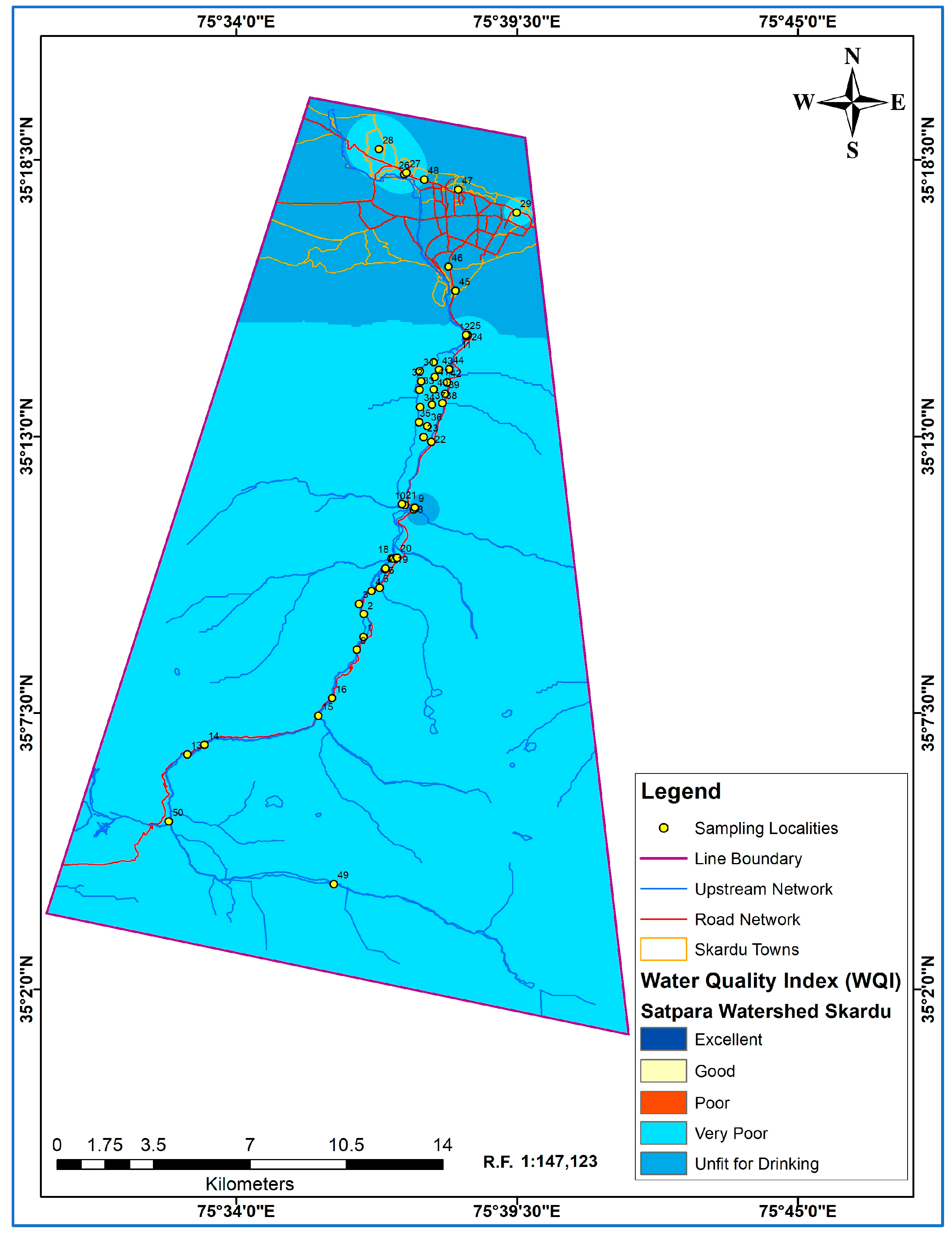
Surface water quality in Skardu, Gilgit-Baltistan, Pakistan, is of immense importance because of the city’s dependence on these resources for domestic uses, agriculture, and drinking water. The water quality index (WQI) was integrated with the Geographic Information System (GIS) to spatially envision and examine water quality data to facilitate the identification of pollution hotspots, trend analysis, and knowledge-based decision-making for effective water resource management. This study aims to evaluate the physiochemical and bacteriological parameters of the Satpara watershed and to provide the spatial distribution of these parameters. This study endeavors to achieve Sustainable Development Goal 6 (SDG 6) by identifying localities with excellent and unfit water for drinking, sanitation, and hygiene. A total of fifty-one surface water samples were collected from various parts of the Satpara watershed during the fall season of 2023. Well-established laboratory techniques were used to investigate water for parameters like Electrical Conductivity (EC), pH, turbidity, total dissolved solids (TDSs), major cations (K+, Na+, Mg2+, Ca2+), major anions (Cl, SO42, NO3, HCO3), and bacteriological contaminants (E. coli). Spatial distribution maps of all these parameters were created using the Inverse Distance Weighted (IDW) technique in a GIS environment. A significant variation in the quality of water was observed along the study area. The level of Escherichia coli (E. coli) contamination is above the permissible limit at various locations along the watershed, making water unsafe for direct human consumption in these areas. Some regions showed low TDS values, which could adversely affect human health and agricultural yield. From the WQI valuation, 58.82% of the collected samples were “Poor”, 31.8% were “Very poor” and 9.8% were found to be “Unfit for drinking”. The research findings emphasize the pressing need for consistent monitoring and adoption of water management strategies in Skardu City to warrant sustainable soil and water use. The spatial maps generated for various parameters and the water quality index WQI offer critical insights for targeted intercessions.
Keywords: water quality index; ArcGIS; interpolation; physio-chemical; bacteriological water quality index; ArcGIS; interpolation; physio-chemical; bacteriological