
Article

Crustal Deformation Across and beyond Central Europe and Its Impact on Land Boundaries
1
Department of Integrated Geodesy and Cartography, AGH University of Science and Technology, 30-059 Krakow, Poland
2
School of Earth and Planetary Sciences, Curtin University, Perth 6102, Australia
3
Department of Geotechnical Engineering, Faculty of Civil Engineering and Architecture, Lublin University of Technology, 20-618 Lublin, Poland
4
Department of Tourism and Regional Studies, Institute of Geography, Pedagogical University of Cracow, 30-084 Kraków, Poland
*
Author to whom correspondence should be addressed.
Resources 2021, 10(2), 15; https://doi.org/10.3390/resources10020015

Submission received: 7 January 2021 / Revised: 28 January 2021 / Accepted: 10 February 2021 / Published: 12 February 2021

Abstract

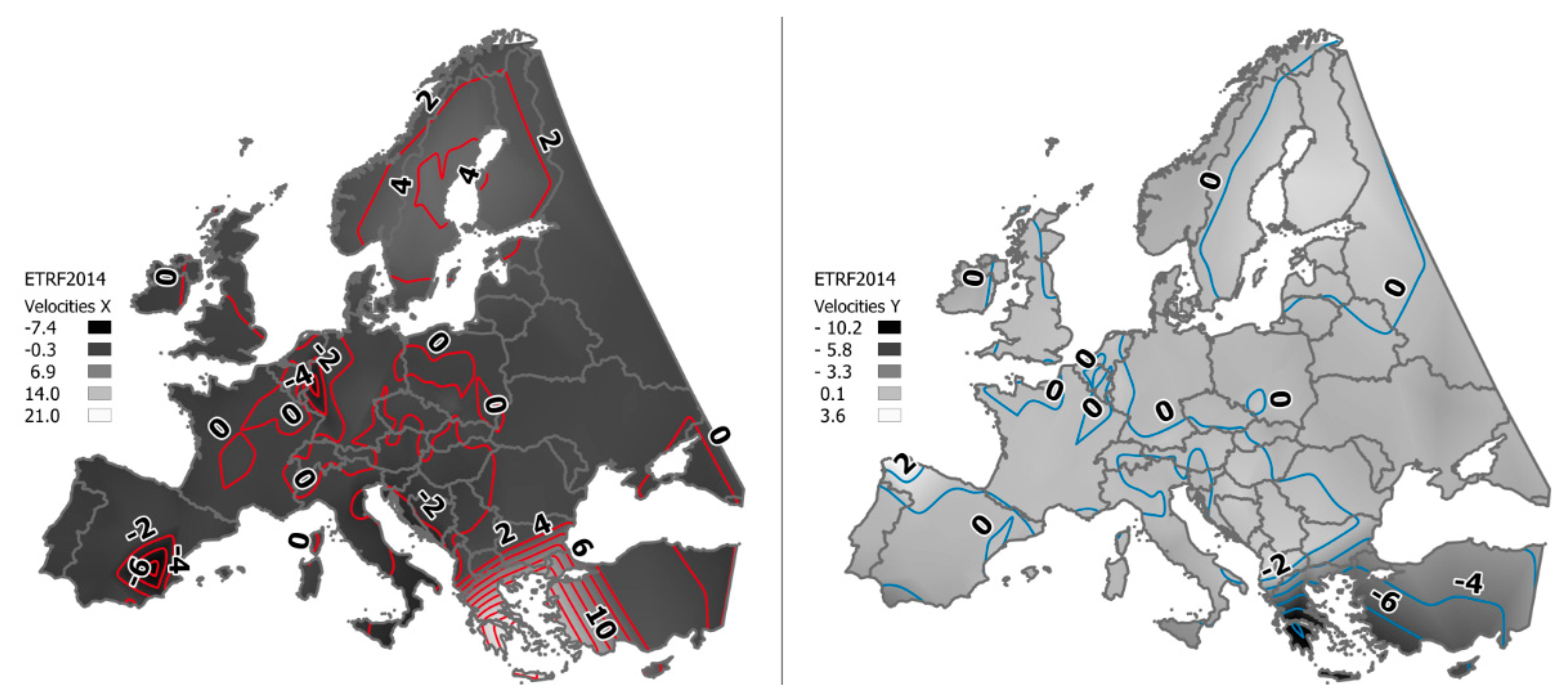
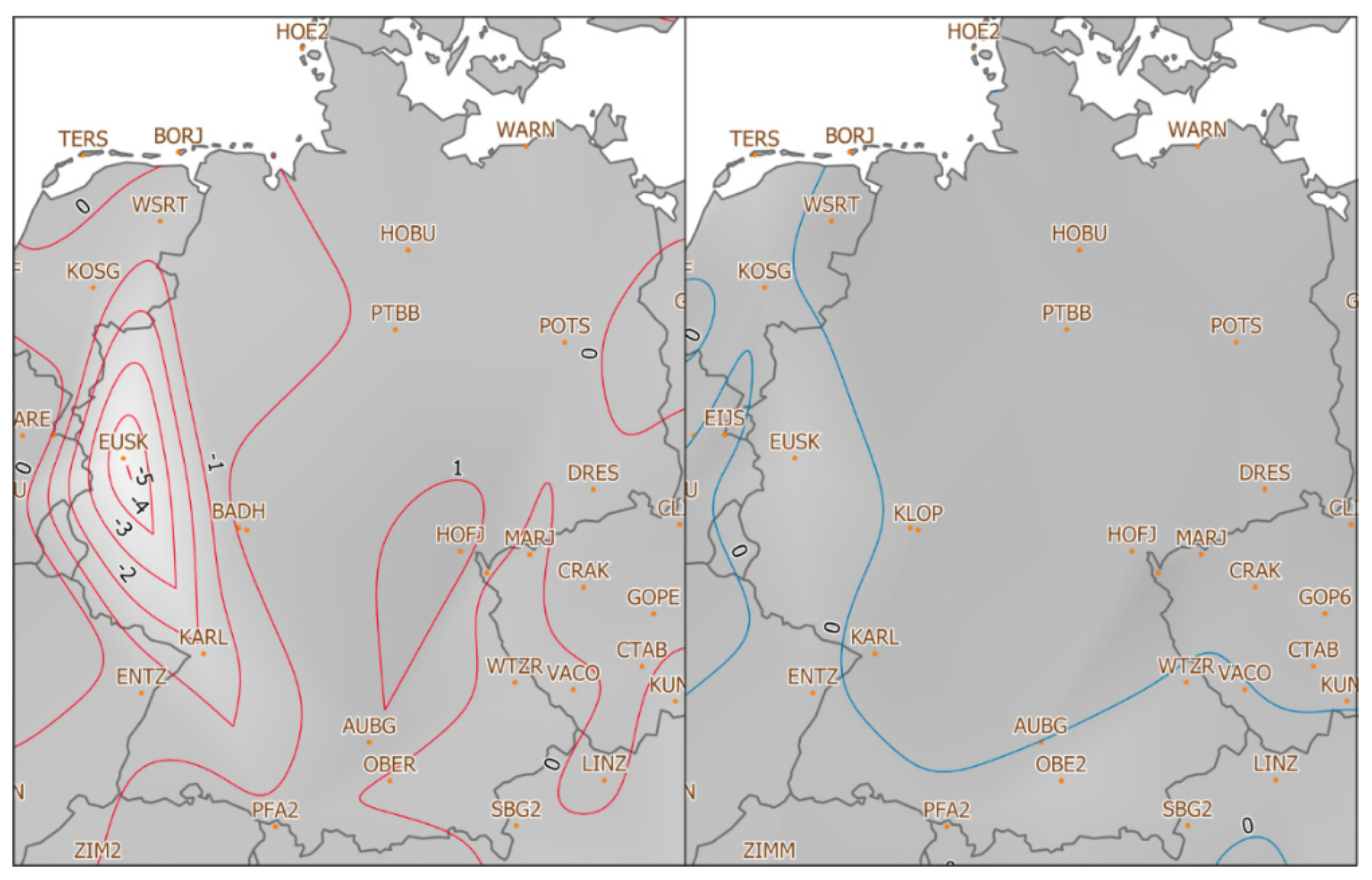
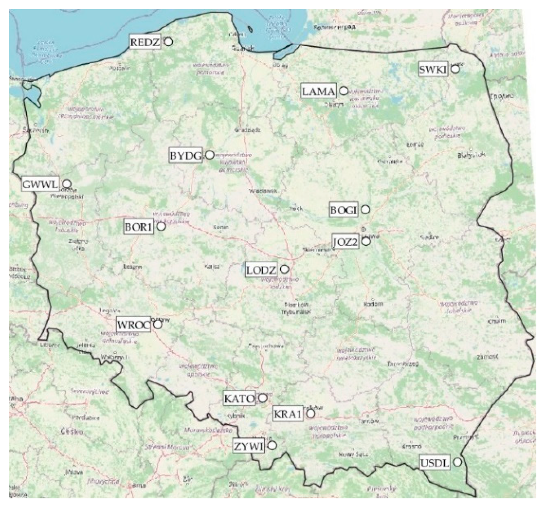
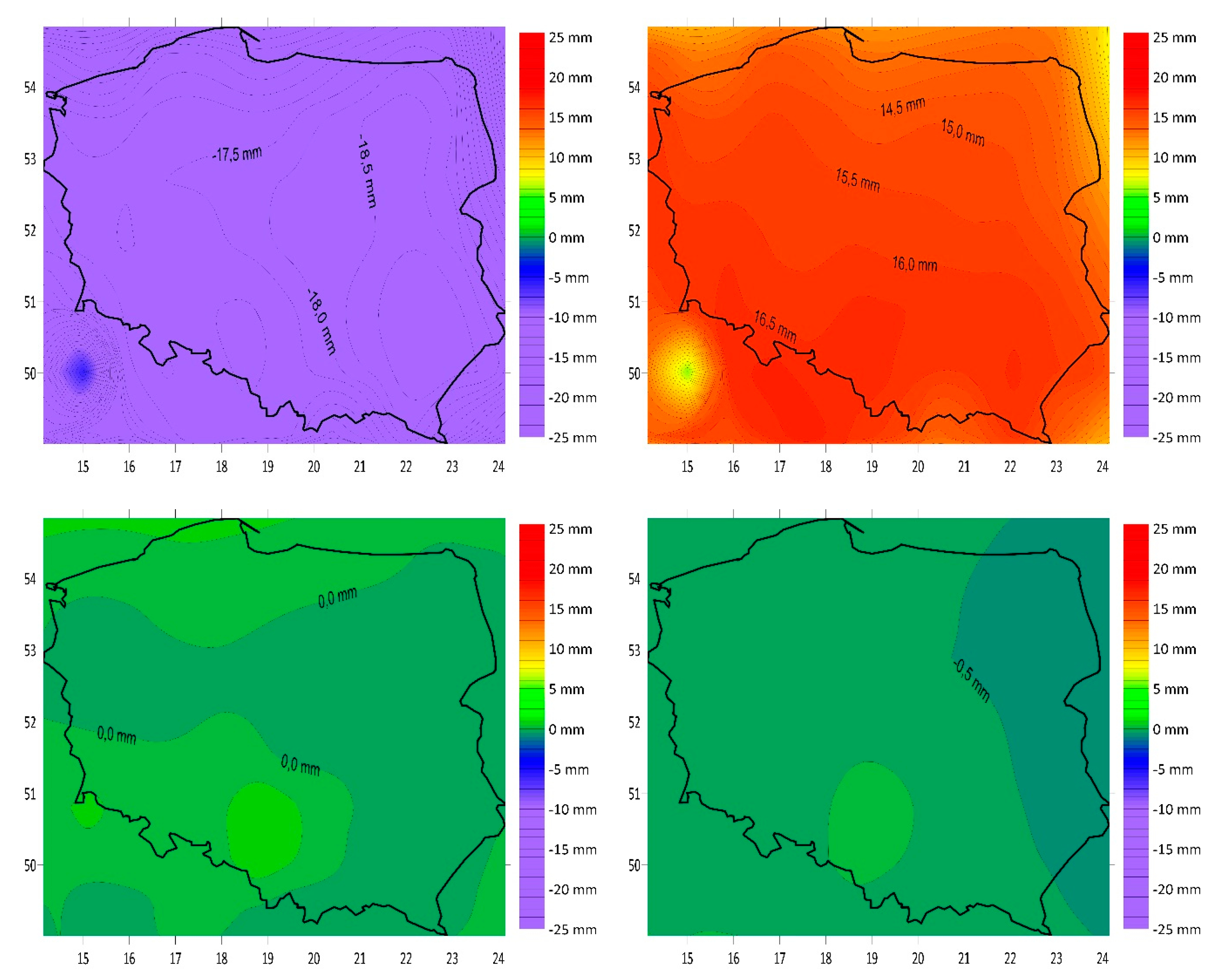
Land is a critical and limited natural resource. The Land Administration System (LAS) has been developed to resolve and adjudicate over any disputes that might arise concerning the rights and boundaries of land. Land registration and cadastre are types of land recording that need to be established. To secure the property rights, we must be sure of accuracy of the boundary points determining the size of the property. However, in addition to typical factors considered when determining the boundary point positions, such as accuracy of geodetic networks and measurement errors, the global and local crustal deformation, resulting, e.g., from the movement of tectonic plates, should be considered. In this work, the focus is on the movement of points inside the European plate due to tectonic movement, without taking into account local events caused by erosion, landslides, etc. The study area is Europe, and particular attention was paid to Poland, which is located in the centre of the European continent and does not have significant anomalous sub-areas, making it an authoritative research object. In this study, we analysed the velocity of point displacements and the boundary deformation, using GPS observations. For this reason, we used both global (IGS) and regional (ETRF) reference frames, to show differences in point velocities for the studied areas. Overall, for the needs of the real estate cadastre in Poland, information about parcel boundary points must be obtained with an accuracy better than 0.30 m. Within 25 years, the border mark may be shifted by 0.13 m due to tectonic plate movement, which is within the required accuracy. Pursuant to the current legal regulations, the measurements of the boundary points can be performed with any method, ensuring the required accuracy (0.30 m). The most commonly used are direct measurements (GNSS and tacheometry) and photogrammetric measurements. It is recommended that periodic verifications and update of the cadastre data in Poland be carried out at least once every 15 years. In the case of such relatively frequent verification and possible modernisation of data, the potential impact of tectonic plate movement on the relative boundary point displacement can be ignored, particularly in the short term. However, for a long time period it has an influence. We suggest “relatively frequent” cadastral boundary verification to be able to ignore such influence.
Keywords: boundaries; deformation; GNSS; parcels; tectonic plate movement boundaries; deformation; GNSS; parcels; tectonic plate movement