Article

Spatiotemporal Distribution of Soil Thermal Conductivity in Chinese Loess Plateau

State Key Laboratory of Eco-Hydraulics in Northwest Arid Region, Xi’an University of Technology, Xi’an 710048, China
*
Author to whom correspondence should be addressed.
These authors contributed equally to this work.
Agriculture 2024, 14(12), 2190; https://doi.org/10.3390/agriculture14122190

Submission received: 1 August 2024 / Revised: 22 November 2024 / Accepted: 26 November 2024 / Published: 30 November 2024
(This article belongs to the Section Agricultural Soils)

Abstract

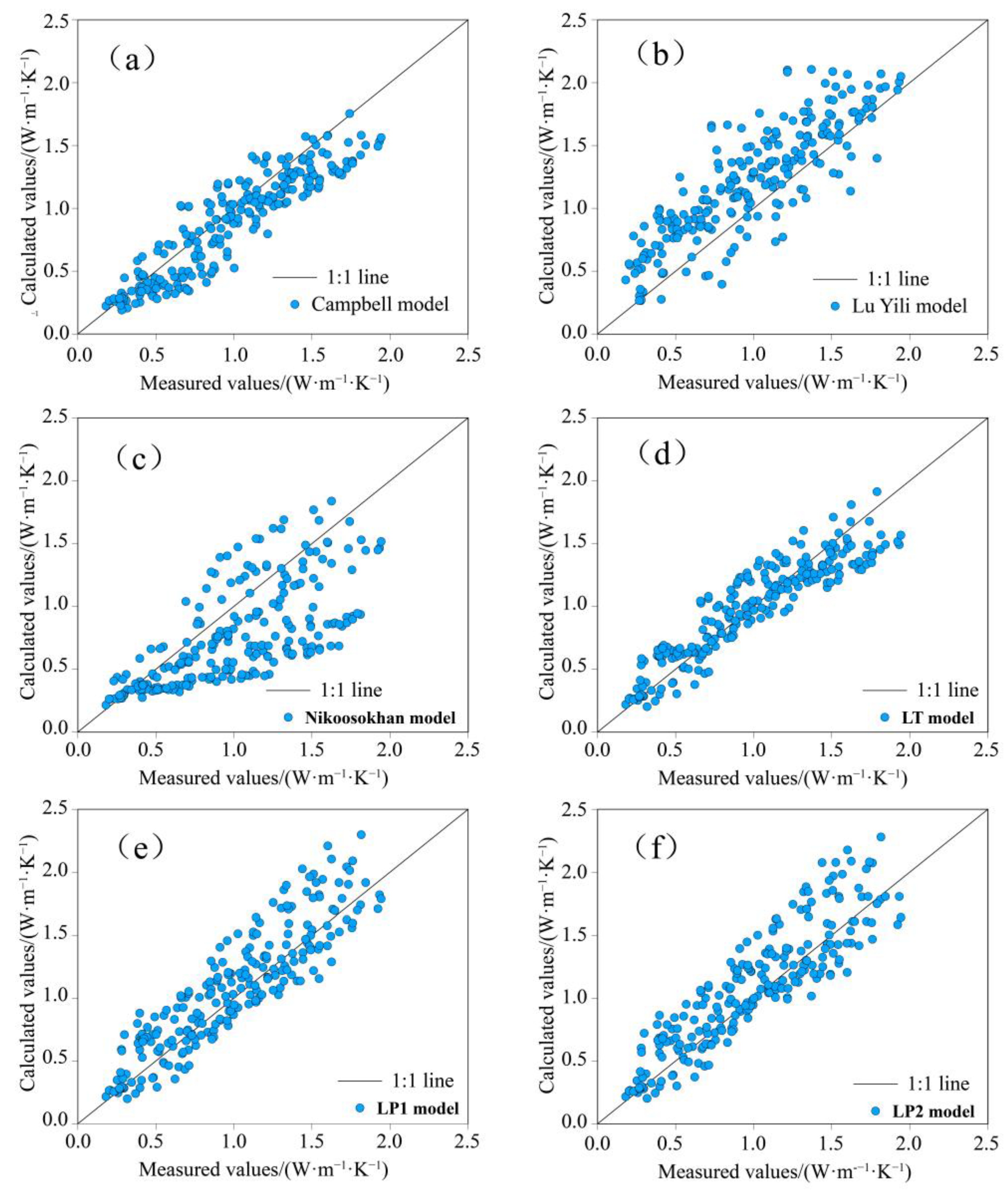
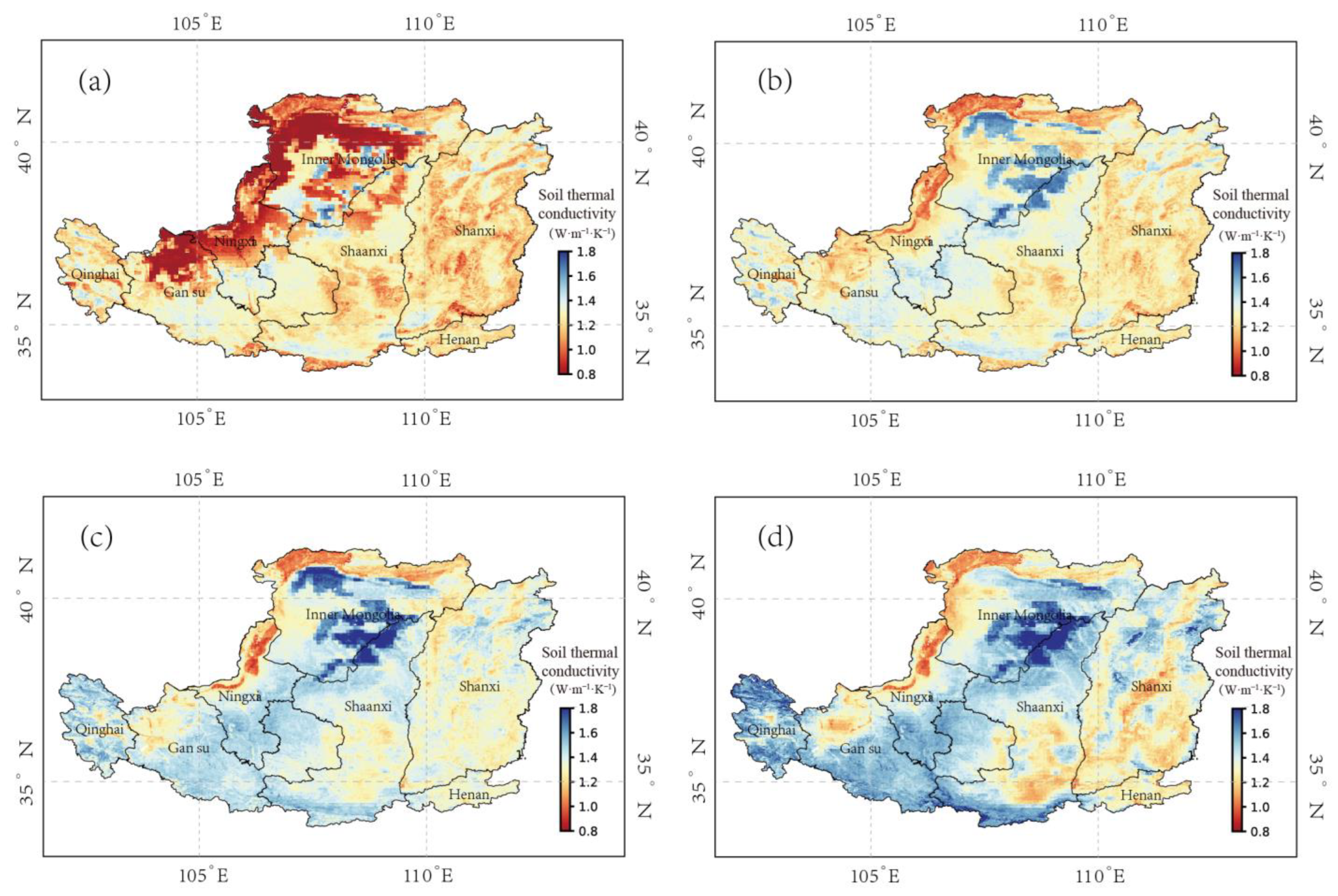
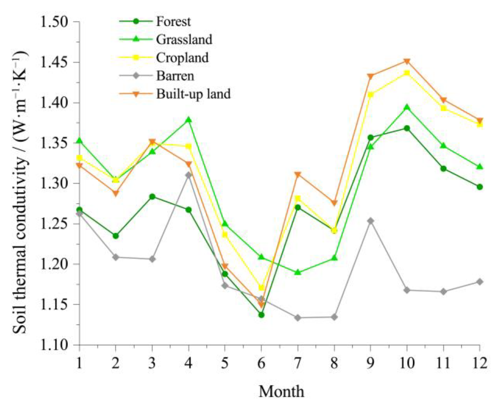
The Chinese Loess Plateau (CLP) is ecologically fragile, and water resources are extremely scarce. Soil thermal conductivity (λ) is a vital parameter for controlling surface heat transfer and is the key to studying the energy exchange and water balance of the soil surface. The objective of this study is to investigate the spatial distribution characteristics of soil thermal conductivity on the Loess Plateau. The research primarily employed soil heat transfer models and the Google Earth Engine (GEE) platform for remote sensing cloud computing, compares and analyzed the suitability of six models (Cambell model, Lu Yili model, Nikoosokhan model, LT model, LP1 model, and LP2 model), and utilized the selected improved model (LT model) to analyze the spatiotemporal characteristics of thermal conductivity on the CLP, examining the impacts of soil particle composition, bulk density, elevation, moisture content, and land use on thermal conductivity. The results show that the LT model is the best in the relevant evaluation indices, with a determination coefficient (R2) of 0.84, root mean square error (RMSE) of 0.18, and relative error (RE) of 0.16. Furthermore, the λ on the CLP shows an overall trend of increasing from northwest to southeast, with a lower λ between May and August and a higher one between September and October. The λ of different land use types is as follows: built-up land > cropland > grassland > forest land > barren. The bulk density (ρb) and altitude mainly influence λ in the CLP. The results of this study can provide a theoretical basis for studying hydrothermal variation in the CLP, model application, energy development, and land resource use.
Keywords: soil physics; soil thermal conductivity; spatiotemporal distribution; land use soil physics; soil thermal conductivity; spatiotemporal distribution; land use