Article

Regional Baseline Estimation in Campania, Southern Italy: Incorporating Spatial Autocorrelation via Hotspot Analysis


1
Department of Earth Sciences, Environment and Resources (DiSTAR), University of Naples Federico II, 80126 Naples, Italy
2
International Network for Environment and Health (INEH), School of Geography, Archaeology & Irish Studies, University of Galway, H91 CF50 Galway, Ireland
*
Authors to whom correspondence should be addressed.
Environments 2026, 13(2), 98; https://doi.org/10.3390/environments13020098

Submission received: 16 December 2025 / Revised: 4 February 2026 / Accepted: 7 February 2026 / Published: 11 February 2026

Abstract

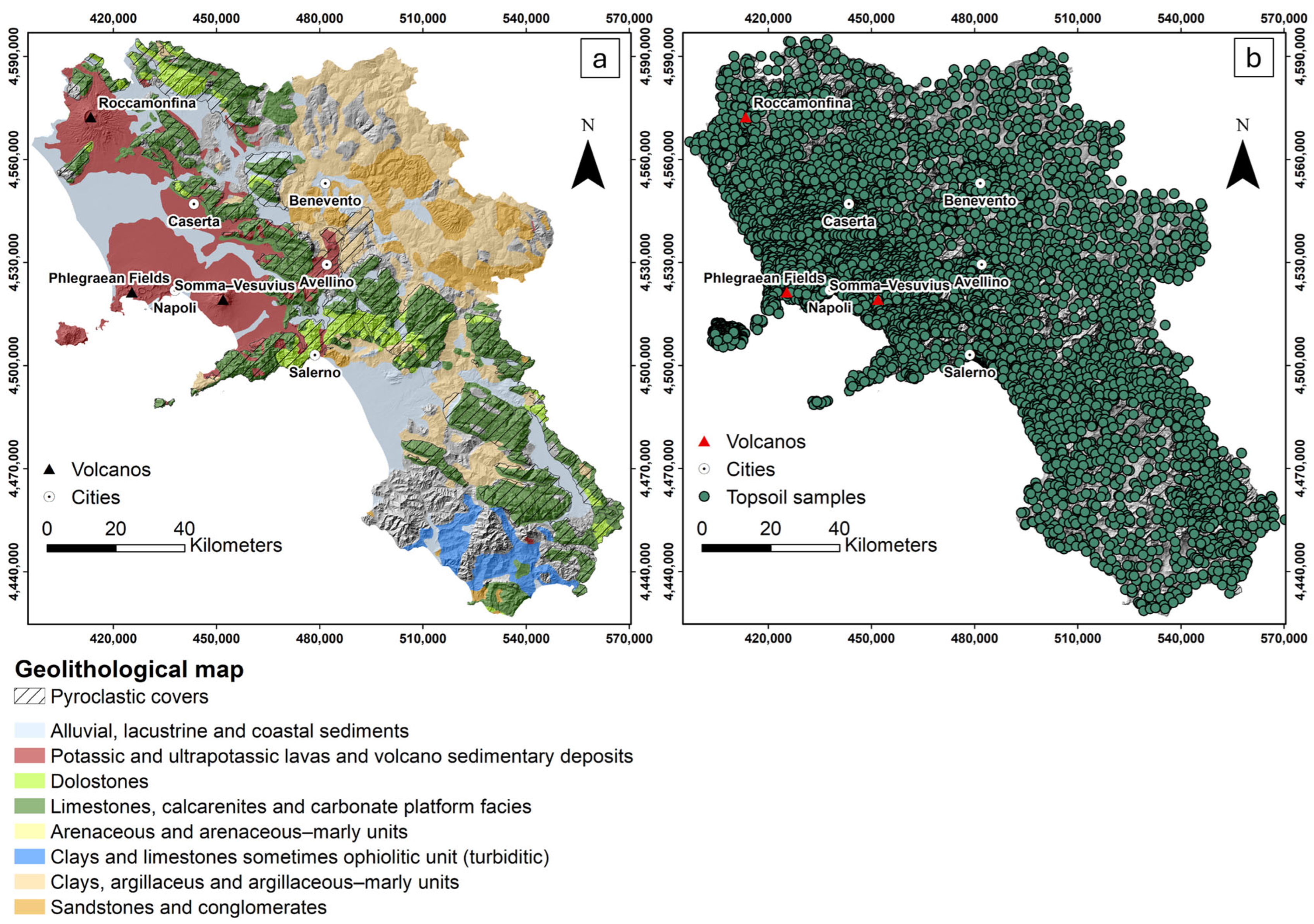
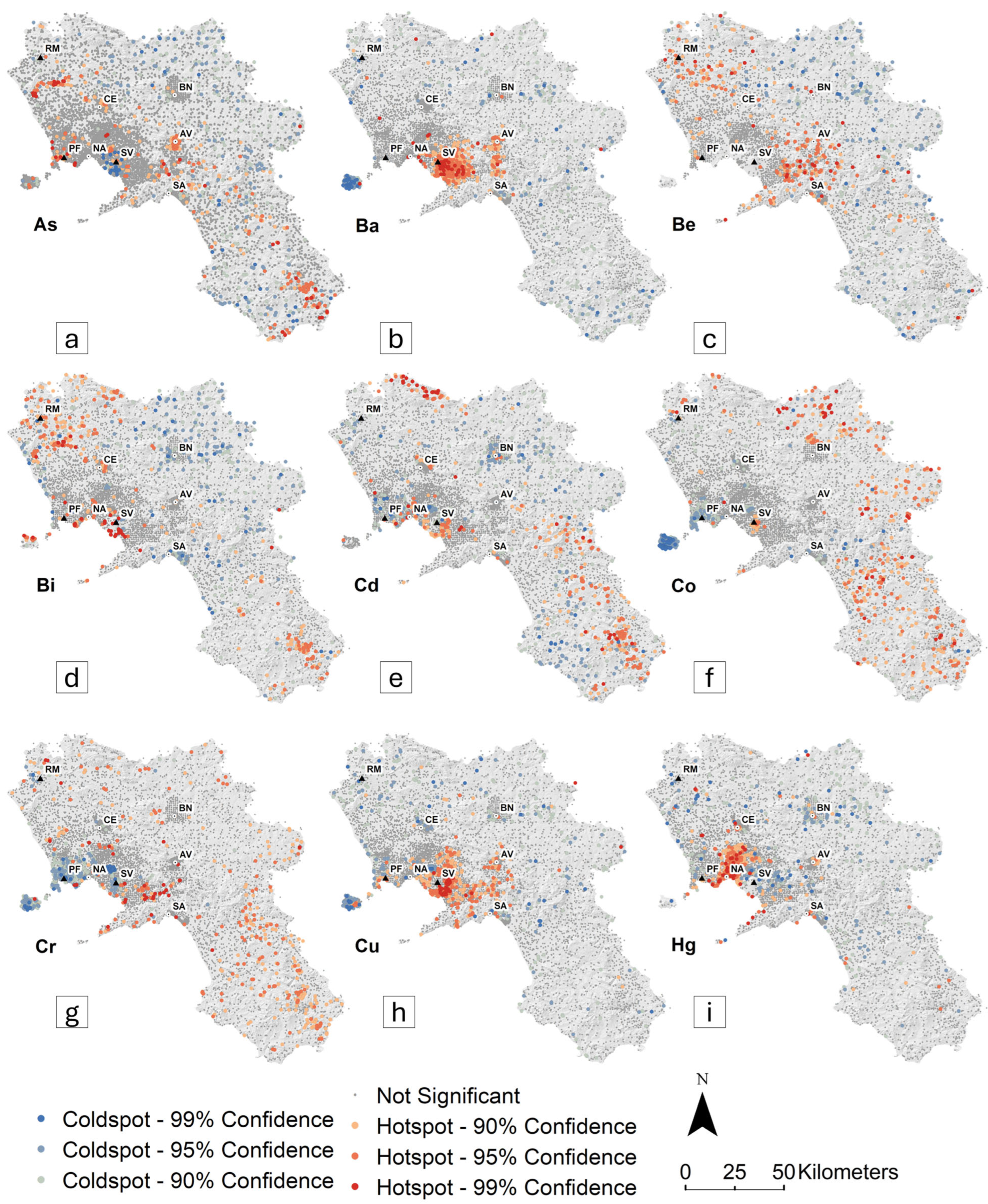
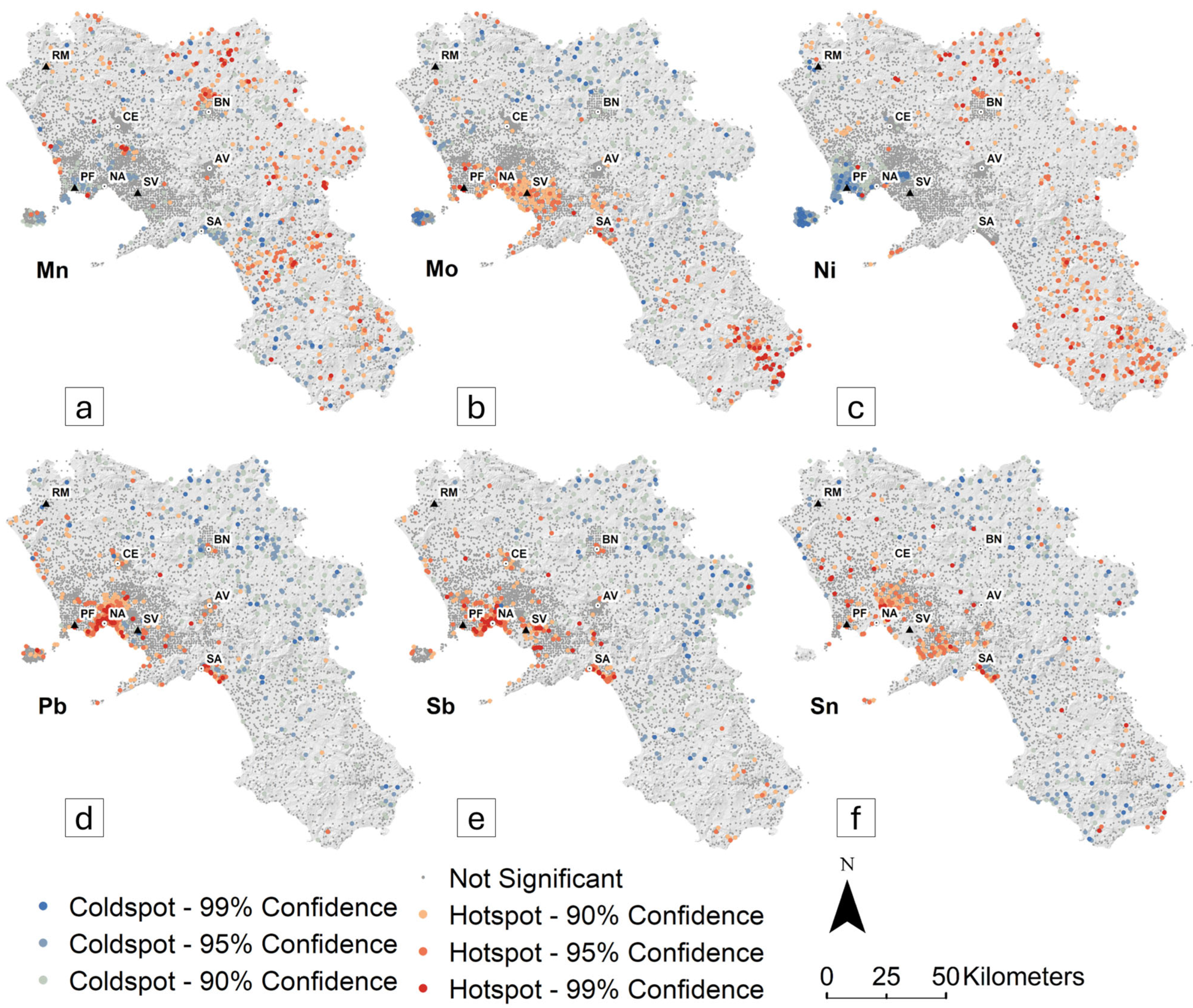
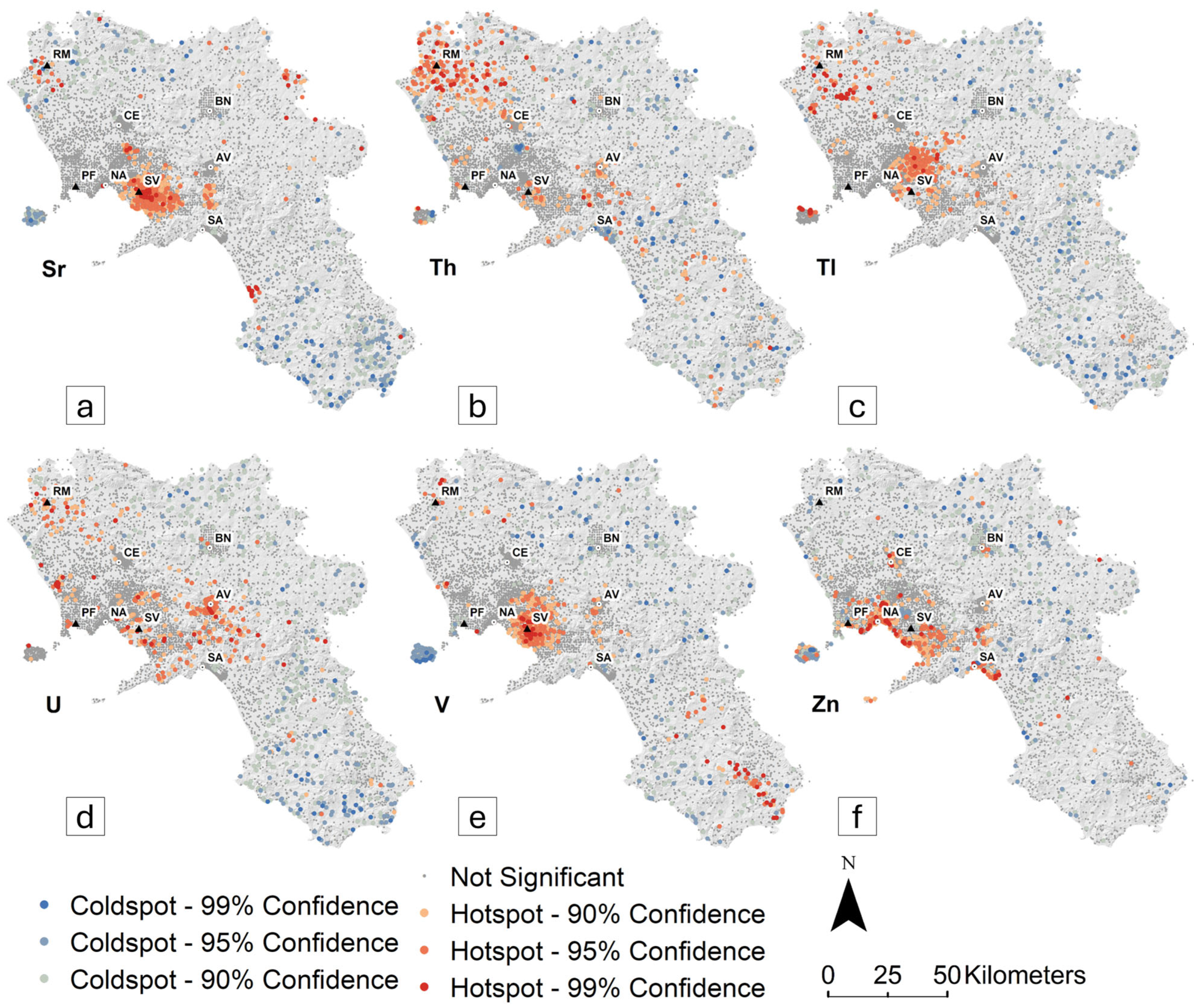
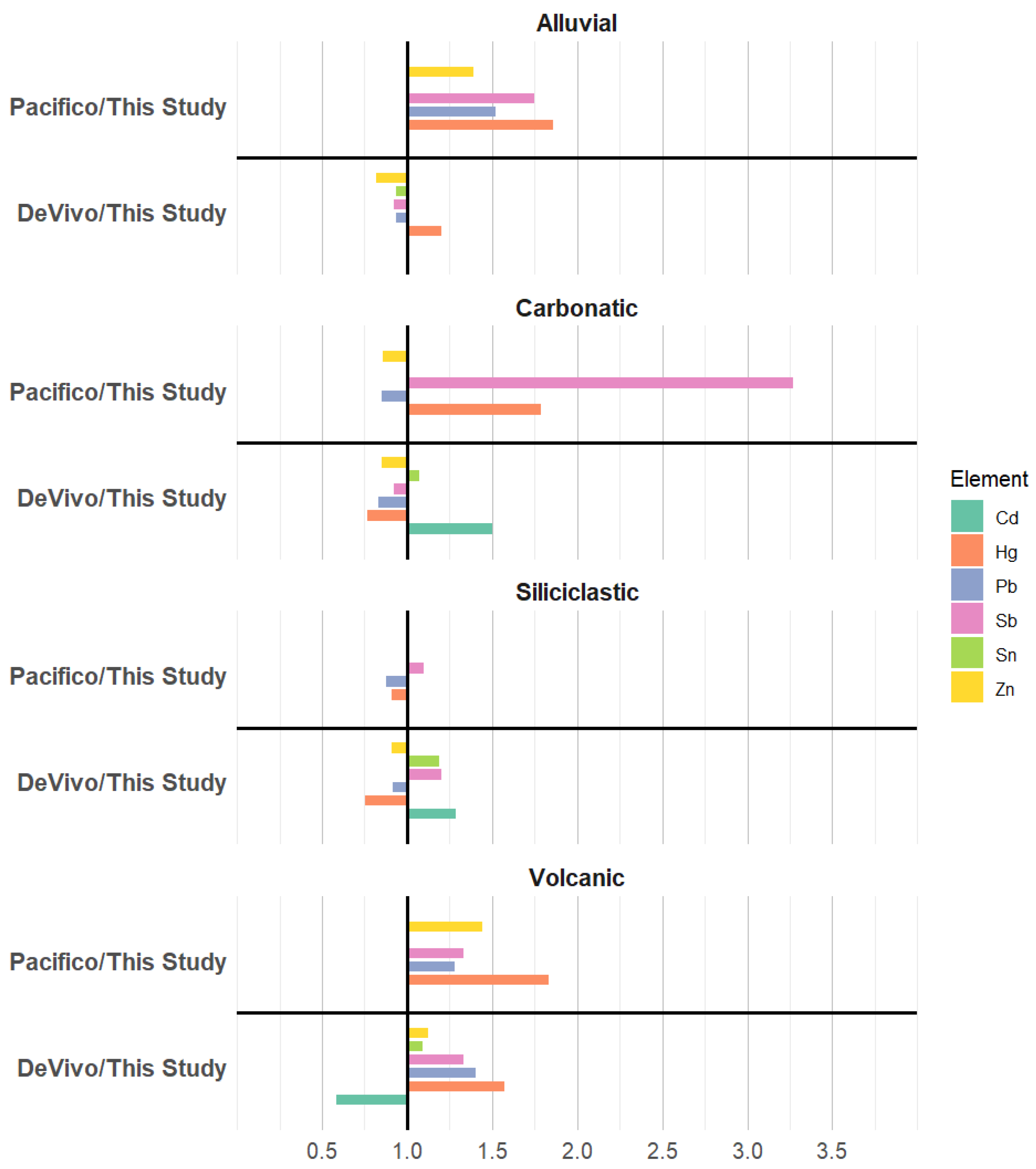
This study applies a hotspot-based spatial statistical approach to investigate the spatial distribution of chemical elements and to improve regional geochemical baseline estimation in topsoils affected by widespread anthropogenic influence. Specifically, this study applied the Getis–Ord Gi* Hotspot analysis on over 7000 topsoil samples from the Campania region (southern Italy), focusing on 21 variables. The analysis revealed statistically significant clusters of high and low concentrations, closely aligned with regional geological features. Elevated levels of As, Ba, Be, Bi, Cu, Sr, Th, Tl, U, and V were mainly observed in soils developed on volcanoclastic deposits, whereas Co, Cr, Ni, and Mn were more common in soils on siliciclastic units. Cd, Hg, Pb, Sb, Sn, and Zn exhibited clustered anomalies in major urban and industrial areas, indicating anthropogenic sources. For these elements, baseline values were estimated. Traditional statistical methods, which primarily rely on data distribution, often overlook spatial autocorrelation, leading to biased thresholds, particularly in areas with widespread contamination. The hotspot-based approach addresses this limitation by excluding hotspot clusters from the calculation of the 95% Upper Tolerance Limit (UTL95-95), thereby providing baseline thresholds uninfluenced by human activity. Comparison with other data-driven methods showed consistent trends across lithologies, although the hotspot-based approach tended to yield slightly lower thresholds, reflecting its responsiveness to spatial patterns.
Keywords: soil geochemistry; spatial clustering; geogenic controls; anthropogenic impacts; environmental thresholds soil geochemistry; spatial clustering; geogenic controls; anthropogenic impacts; environmental thresholds