Earth Observation, Remote Sensing, and Geoscientific Ground Investigations for Archaeological and Heritage Research


Abstract
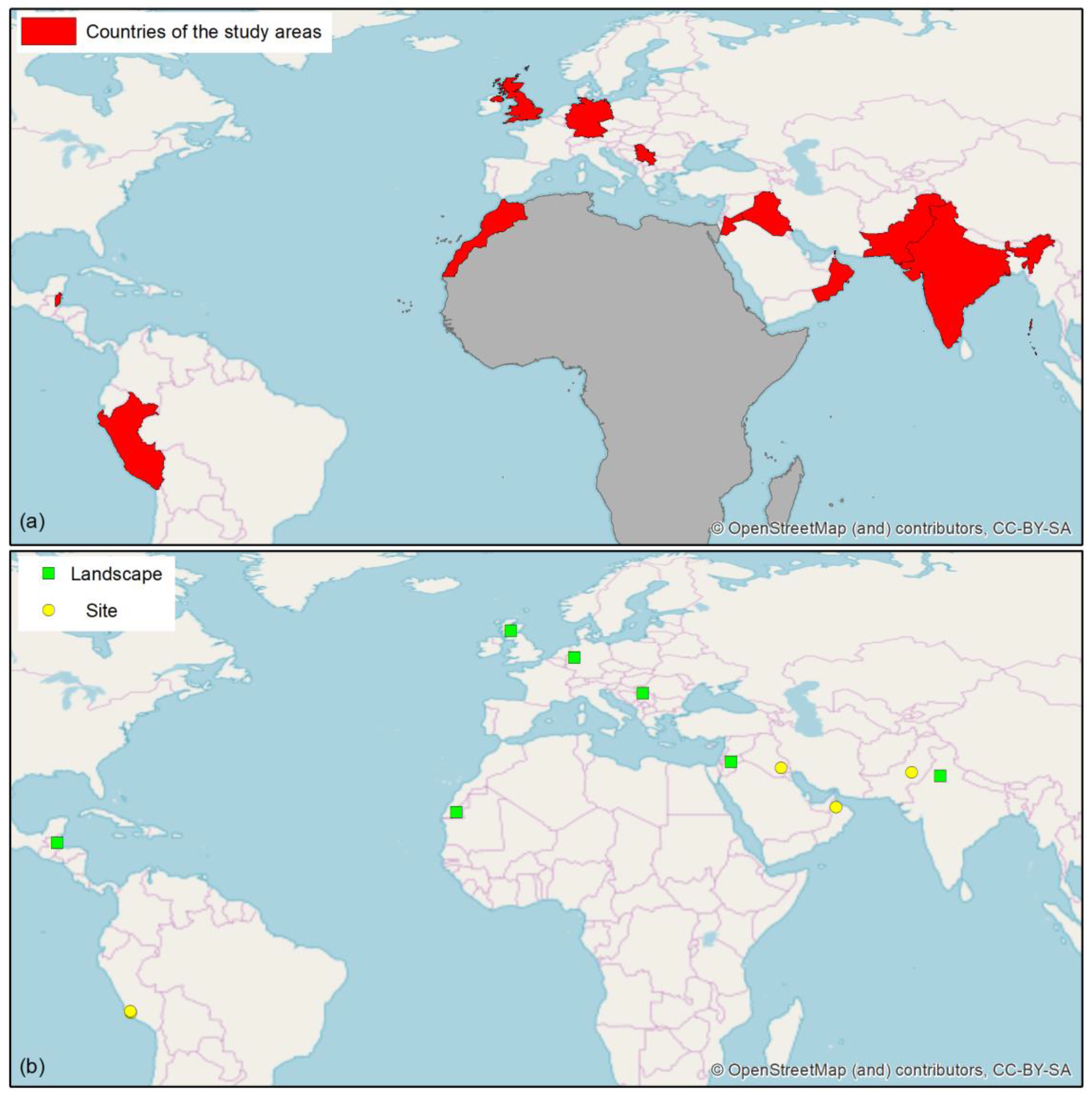
:1. Introduction
- archaeological prospection
- digital archaeological fieldwork
- condition assessment of heritage assets
- GIS analysis of spatial settlement patterns in modern landscapes
- assessment of natural or human-induced threats to conservation
- education and capacity building in EO and RS for archaeology
2. Facts and Figures of the Special Issue
3. Overview of the Published Papers
3.1. Archaeological Prospection with High Resolution Satellite SAR and Optical Imagery
3.2. High Resolution Documentation of Archaeological Features with Drones
3.3. Archaeological Mapping with LiDAR towards Automation
3.4. Digital Fieldwork and Reflections on Challenges of Archaeological Mapping with Old and Modern Data
3.5. Field and Archaeometric Investigations to Corroborate Archaeological Hypotheses
3.6. New Frontiers in Archaeological Research from Space in Contemporary Africa
3.7. Education and Capacity Building in EO and RS for Cultural Heritage
Funding
Acknowledgments
Conflicts of Interest
References
- Tapete, D. Remote sensing and geosciences for archaeology. Geosciences 2018, 8, 41. [Google Scholar] [CrossRef]
- Traviglia, A.; Torsello, A. Landscape pattern detection in archaeological remote sensing. Geosciences 2017, 7, 128. [Google Scholar] [CrossRef]
- Agapiou, A.; Lysandrou, V.; Hadjimitsis, D. Optical remote sensing potentials for looting detection. Geosciences 2017, 7, 98. [Google Scholar] [CrossRef]
- Rutishauser, S.; Erasmi, S.; Rosenbauer, R.; Buchbach, R. SARchaeology—Detecting palaeochannels based on high resolution radar data and their impact of changes in the settlement pattern in Cilicia (Turkey). Geosciences 2017, 7, 109. [Google Scholar] [CrossRef]
- Comer, D.; Chapman, B.; Comer, J. Detecting landscape disturbance at the Nasca Lines using SAR data collected from airborne and satellite platforms. Geosciences 2017, 7, 106. [Google Scholar] [CrossRef]
- Gade, M.; Kohlus, J.; Kost, C. SAR imaging of archaeological sites on Intertidal Flats in the German Wadden Sea. Geosciences 2017, 7, 105. [Google Scholar] [CrossRef]
- Rayne, L.; Bradbury, J.; Mattingly, D.; Philip, G.; Bewley, R.; Wilson, A. From above and on the ground: Geospatial methods for recording endangered archaeology in the Middle East and North Africa. Geosciences 2017, 7, 100. [Google Scholar] [CrossRef]
- Agapiou, A.; Lysandrou, V.; Sarris, A.; Papadopoulos, N.; Hadjimitsis, D. Fusion of satellite multispectral images based on Ground-Penetrating Radar (GPR) data for the investigation of buried concealed archaeological remains. Geosciences 2017, 7, 40. [Google Scholar] [CrossRef]
- Chyla, J. How can remote sensing help in detecting the threats to archaeological sites in Upper Egypt? Geosciences 2017, 7, 97. [Google Scholar] [CrossRef]
- Danti, M.; Branting, S.; Penacho, S. The American schools of oriental research cultural heritage initiatives: Monitoring cultural heritage in Syria and Northern Iraq by geospatial imagery. Geosciences 2017, 7, 95. [Google Scholar] [CrossRef]
- Parcak, S.; Mumford, G.; Childs, C. Using open access satellite data alongside ground based remote sensing: An assessment, with case studies from Egypt’s delta. Geosciences 2017, 7, 94. [Google Scholar] [CrossRef]
- Corso, J.; Roca, J.; Buill, F. Geometric analysis on stone façades with terrestrial laser scanner technology. Geosciences 2017, 7, 103. [Google Scholar] [CrossRef]
- Drap, P.; Papini, O.; Pruno, E.; Nucciotti, M.; Vannini, G. Ontology-Based photogrammetry survey for medieval archaeology: Toward a 3D geographic information system (GIS). Geosciences 2017, 7, 93. [Google Scholar] [CrossRef]
- Garcia-Garcia, E.; Andrews, J.; Iriarte, E.; Sala, R.; Aranburu, A.; Hill, J.; Agirre-Mauleon, J. Geoarchaeological core prospection as a tool to validate archaeological interpretation based on geophysical data at the Roman Settlement of Auritz/Burguete and Aurizberri/Espinal (Navarre) †. Geosciences 2017, 7, 104. [Google Scholar] [CrossRef]
- Guidi, G.; Gonizzi Barsanti, S.; Micoli, L.; Malik, U. Accurate reconstruction of the Roman circus in Milan by georeferencing heterogeneous data sources with GIS. Geosciences 2017, 7, 91. [Google Scholar] [CrossRef]
- Kalayci, T.; Simon, F.-X.; Sarris, A. A manifold approach for the investigation of early and middle Neolithic settlements in Thessaly, Greece. Geosciences 2017, 7, 79. [Google Scholar] [CrossRef]
- Křivánek, R. Comparison study to the use of geophysical methods at archaeological sites observed by various remote sensing techniques in the Czech Republic. Geosciences 2017, 7, 81. [Google Scholar] [CrossRef]
- Malinverni, E.; Pierdicca, R.; Bozzi, C.; Colosi, F.; Orazi, R. Analysis and processing of Nadir and Stereo VHR Pleiadés images for 3d mapping and planning the land of Nineveh, Iraqi Kurdistan. Geosciences 2017, 7, 80. [Google Scholar] [CrossRef]
- Poux, F.; Neuville, R.; Van Wersch, L.; Nys, G.-A.; Billen, R. 3D point clouds in archaeology: Advances in acquisition, processing and knowledge integration applied to quasi-planar objects. Geosciences 2017, 7, 96. [Google Scholar] [CrossRef]
- Sonnemann, T.; Comer, D.; Patsolic, J.; Megarry, W.; Herrera Malatesta, E.; Hofman, C. Semi-Automatic detection of indigenous settlement features on Hispaniola through remote sensing data. Geosciences 2017, 7, 127. [Google Scholar] [CrossRef]
- Verhoeven, G. Are We There Yet? A Review and assessment of archaeological passive airborne optical imaging approaches in the light of landscape archaeology. Geosciences 2017, 7, 86. [Google Scholar] [CrossRef]
- Oduntan, G. Geospatial sciences and space law: Legal aspects of earth observation, remote sensing and geoscientific ground investigations in Africa. Geosciences 2019, 9, 149. [Google Scholar] [CrossRef]
- Tapete, D.; Cigna, F. Appraisal of opportunities and perspectives for the systematic condition assessment of heritage sites with copernicus sentinel-2 high-resolution multispectral imagery. Remote Sens. 2018, 10, 561. [Google Scholar] [CrossRef]
- Casana, J.; Laugier, E.J. Satellite imagery-based monitoring of archaeological site damage in the Syrian civil war. PLoS ONE 2017, 12, e0188589. [Google Scholar] [CrossRef]
- Wiig, F.; Harrower, M.J.; Braun, A.; Nathan, S.; Lehner, J.W.; Simon, K.M.; Sturm, J.O.; Trinder, J.; Dumitru, I.A.; Hensley, S.; et al. Mapping a subsurface water channel with x-band and c-band synthetic aperture radar at the Iron Age archaeological site of ‘Uqdat al-Bakrah (Safah), Oman. Geosciences 2018, 8, 334. [Google Scholar] [CrossRef]
- Zanni, S.; De Rosa, A. remote sensing analyses on sentinel-2 images: Looking for Roman roads in Srem region (Serbia). Geosciences 2019, 9, 25. [Google Scholar] [CrossRef]
- Tapete, D.; Cigna, F. Trends and perspectives of space-borne SAR remote sensing for archaeological landscape and cultural heritage applications. J. Archaeol. Sci. Reports 2016, 14, 716–726. [Google Scholar] [CrossRef]
- Pavelka, K.; Šedina, J.; Matoušková, E. High resolution drone surveying of the Pista Geoglyph in Palpa, Peru. Geosciences 2018, 8, 479. [Google Scholar] [CrossRef]
- Chase, A.S.Z.; Chase, D.Z.; Chase, A.F. LiDAR for archaeological research and the study of historical landscapes. In Sensing the Past: From Artifact to Historical Site; Masini, N., Soldovieri, F., Eds.; Springer International Publishing: Cham, Switzerland, 2017; pp. 89–100. [Google Scholar]
- Moyes, H.; Montgomery, S. Locating cave entrances using lidar-derived local relief modeling. Geosciences 2019, 9, 98. [Google Scholar] [CrossRef]
- Opitz, R.; Herrmann, J. Recent trends and long-standing problems in archaeological remote sensing. J. Comput. Appl. Archaeol. 2018, 1, 19–41. [Google Scholar] [CrossRef]
- Meyer, M.F.; Pfeffer, I.; Jürgens, C. Automated detection of field monuments in digital terrain models of Westphalia using OBIA. Geosciences 2019, 9, 109. [Google Scholar] [CrossRef]
- Nsanziyera, A.F.; Rhinane, H.; Oujaa, A.; Mubea, K. GIS and remote-sensing application in archaeological site mapping in the Awsard Area (Morocco). Geosciences 2018, 8, 207. [Google Scholar] [CrossRef]
- Smith, S.L.; Chambrade, M.-L. The application of freely-available satellite imagery for informing and complementing archaeological fieldwork in the “Black Desert” of North-Eastern Jordan. Geosciences 2018, 8, 491. [Google Scholar] [CrossRef]
- Petrie, C.A.; Orengo, H.A.; Green, A.S.; Walker, J.R.; Garcia, A.; Conesa, F.; Knox, J.R.; Singh, R.N. Mapping archaeology while mapping an empire: Using historical maps to reconstruct ancient settlement landscapes in modern India and Pakistan. Geosciences 2018, 9, 11. [Google Scholar] [CrossRef]
- Garcia, A.; Orengo, H.A.; Conesa, F.C.; Green, A.S.; Petrie, C.A. Remote sensing and historical morphodynamics of alluvial plains. The 1909 Indus flood and the city of Dera Ghazi Khan (province of Punjab, Pakistan). Geosciences 2018, 9, 21. [Google Scholar] [CrossRef]
- Banaszek, Ł.; Cowley, D.C.; Middleton, M. Towards national archaeological mapping. Assessing source data and methodology—A case study from Scotland. Geosciences 2018, 8, 272. [Google Scholar] [CrossRef]
- Festa, G.; Andreani, C.; D’Agostino, F.; Forte, V.; Nardini, M.; Scherillo, A.; Scatigno, C.; Senesi, R.; Romano, L. Sumerian pottery technology studied through neutron diffraction and chemometrics at Abu Tbeirah (Iraq). Geosciences 2019, 9, 74. [Google Scholar] [CrossRef]
- Delle Rose, M.; Mattioli, M.; Capuano, N.; Renzulli, A. Stratigraphy, petrography and grain-size distribution of sedimentary lithologies at Cahuachi (South Peru): ENSO-Related deposits or a common regional succession? Geosciences 2019, 9, 80. [Google Scholar] [CrossRef]
- Matusch, T.; Schneibel, A.; Dannwolf, L.; Siegmund, A. Implementing a modern e-learning strategy in an interdisciplinary environment—Empowering UNESCO stakeholders to use earth observation. Geosciences 2018, 8, 432. [Google Scholar] [CrossRef]


| Authors | Views | Downloads | Citations |
|---|---|---|---|
| Agapiou et al. [8] | 3278 | 1904 | 5 |
| Agapiou et al. [3] | 1708 | 970 | 8 |
| Chyla [9] | 1429 | 827 | 1 |
| Comer et al. [5] | 1570 | 1102 | 3 |
| Corso et al. [12] | 1753 | 1215 | 2 |
| Danti et al. [10] | 1943 | 1740 | 7 |
| Drap et al. [13] | 1571 | 1565 | 2 |
| Gade et al. [6] | 1751 | 1210 | 4 |
| Garcia-Garcia et al. [14] | 1282 | 995 | 1 |
| Guidi et al. [15] | 1719 | 976 | 3 |
| Kalayci et al. [16] | 1218 | 968 | 2 |
| Křivánek [17] | 1420 | 1174 | 2 |
| Malinverni et al. [18] | 1445 | 1345 | 1 |
| Parcak et al. [11] | 1486 | 1374 | 3 |
| Poux et al. [19] | 2306 | 2249 | 7 |
| Rayne et al. [7] | 1750 | 1500 | 5 |
| Rutishauser et al. [4] | 1784 | 1345 | 2 |
| Sonnemann et al. [20] | 1582 | 1046 | 2 |
| Tapete [1] | 1256 | 2313 | 3 |
| Traviglia & Torsello [2] | 1680 | 1311 | 9 |
| Verhoeven [21] | 1573 | 1399 | 6 |
© 2019 by the author. Licensee MDPI, Basel, Switzerland. This article is an open access article distributed under the terms and conditions of the Creative Commons Attribution (CC BY) license (http://creativecommons.org/licenses/by/4.0/).
Share and Cite
Tapete, D. Earth Observation, Remote Sensing, and Geoscientific Ground Investigations for Archaeological and Heritage Research. Geosciences 2019, 9, 161. https://doi.org/10.3390/geosciences9040161
Tapete D. Earth Observation, Remote Sensing, and Geoscientific Ground Investigations for Archaeological and Heritage Research. Geosciences. 2019; 9(4):161. https://doi.org/10.3390/geosciences9040161
Chicago/Turabian StyleTapete, Deodato. 2019. "Earth Observation, Remote Sensing, and Geoscientific Ground Investigations for Archaeological and Heritage Research" Geosciences 9, no. 4: 161. https://doi.org/10.3390/geosciences9040161
APA StyleTapete, D. (2019). Earth Observation, Remote Sensing, and Geoscientific Ground Investigations for Archaeological and Heritage Research. Geosciences, 9(4), 161. https://doi.org/10.3390/geosciences9040161