Article

Interpretation of the Jiangnan Landscape and Countryside (Shan-Shui) Pattern: Evidence from the Classification and Spatial Form of Traditional Settlements in the Nanxi River Basin

1
Faculty of Innovation and Design, City University of Macau, Avenida Padre Tomás Pereira, Taipa, Macau 999078, China
2
School of Media & Art Design, Wenzhou Business College, Wenzhou Chashan Higher Education Park, Wenzhou 325035, China
3
Faculty of Humanities and Arts, Macau University of Science and Technology, Avenida Wai Long, Taipa, Macau 999078, China
4
Heritage Conservation Laboratory, Macau University of Science and Technology, Avenida Wai Long, Taipa, Macau 999078, China
*
Authors to whom correspondence should be addressed.
Buildings 2025, 15(3), 413; https://doi.org/10.3390/buildings15030413
Submission received: 12 November 2024 / Revised: 25 January 2025 / Accepted: 28 January 2025 / Published: 28 January 2025
(This article belongs to the Special Issue Advanced Technologies for Urban and Architectural Design)

Abstract

Against the backdrop of accelerated globalization and urbanization, traditional settlements in the Jiangnan waterside areas of China face challenges such as morphological distortion and a simplified spatial structure. The ecological adaptability and cultural value of settlements urgently need scientific protection. There has not been enough research on how to better classify settlements, how to conduct systematic morphological analysis, or how to use dynamic protection methods. This makes it hard to fully show the variety of settlement types and how they differ in different areas. To this end, this study uses a combination of GIS spatial analysis, type classification, and case study methods to classify and morphologically analyze 159 traditional settlement patches in the Nanxi River Basin. We construct a settlement type map from quantitative research on topographical, water system, and spatial morphological characteristics, and extract a spatial organization model of mountains and water. The results show the following: (1) The main morphological types, such as the plain–waterfront–strip-shaped and cluster-shaped/finger-shaped types, are typical patterns of traditional settlements in the basin. This indicates how well settlements can adapt to their natural surroundings. (2) This study summarizes six typical settlement sample spaces. (3) The settlement digital protection strategy suggested in this paper uses GIS and 3D modeling technology to make it easier to record, show, and manage information about settlement spaces. This offers a new way to protect traditional settlements scientifically. The study not only enriches the theoretical understanding of the settlement morphology of Jiangnan landscape pastoral areas but also provides an important reference for the protection and sustainable development of settlements in similar basins around the world.

1. Introduction

1.1. Research Background

Rural settlement morphology, as an important manifestation of rural spatial structure and cultural landscape, reflects the interactive process between specific geographical environments and human social activities [1] (Ji et al., 2022). With the acceleration of globalization and urbanization, the modernization of rural areas has attracted increasing attention, especially in China, where the implementation of the rural revitalization strategy has provided new opportunities and challenges for the protection and development of traditional villages [2,3]. As a region rich in Chinese culture and natural resources, the Jiangnan region has attracted more and more attention for its unique landscape and traditional settlements in the wave of modernization [4]. At present, traditional settlements in the Jiangnan water town area are facing two big problems. The first is how to keep their unique spatial morphology and cultural traits while modernizing [5]. The second is how to work out the best way to protect and develop settlements through scientific classification and morphological analysis [6,7]. Many current rural planning practices focus on keeping rural areas safe, but there are still problems with how settlements are scientifically categorized and how they are developed. These issues mean that they do not fully show the variety and complexity of settlements [8,9,10]. Therefore, studying the classification and spatial morphology of settlements in the Nanxi River Basin not only reveals the morphological evolution of traditional settlements in the Jiangnan water town area but also fills a gap in the study of the morphological classification and spatial characteristics of traditional settlements in the Nanxi River Basin. Furthermore, it provides theoretical support for rural protection and land use development in similar environments.

1.2. Problem Statement and Objectives

This study analyzed the information provided by GIS geographic data on traditional settlements in the Nanxi River Basin, clustered settlement morphological types, and identified specific settlement structures. The following scientific questions were investigated: (1) Can we classify the traditional villages in the Nanxi River Basin into different types of settlements? (2) What are the representative settlement morphological structures of different types? (3) In the context of modern society, how can we effectively protect and maintain the traditional villages in the Nanxi River Basin while also preserving their spatial characteristics? This study theoretically expands the depth of the study of Jiangnan water village settlements, innovates the technical path of settlement morphology classification and analysis in terms of methods, and provides direct application value for regional rural protection and development.
This study introduces several innovations. First, through quantitative analysis, the researchers constructed a traditional settlement classification system that adapts to the actual situation in the Nanxi River Basin, filling the gaps in previous studies where the classification standards were vague and the classification methods were insufficient. Second, the classification of settlement types reveals the adaptive relationship between the spatial form of settlements and the natural environment. Third, the study enriches the theoretical basis for the protection of traditional settlements. From the perspective of spatial form (morphology) and classification (typology), the study proposes a theoretical basis for the protection of traditional settlements in the Nanxi River Basin. At the same time, this study innovatively introduces quantitative methods such as multivariate statistical analysis, GIS spatial analysis, and space syntax, advancing the spatial form research of traditional settlements from qualitative description to quantitative analysis. Finally, it provides empirical support for regional planning under the Jiangnan landscape and countryside (Shan-Shui) pattern.

2. Literature Review

2.1. Research Progress in Rural Geography

Rural geography is a branch of geography that studies rural spatial patterns, ecological environments, and socioeconomic interactions. It aims to reveal land use, human–land relations, and sustainable development models in rural areas [11]. The core goal of this theory is to support the sustainable development of rural regional systems, optimal resource allocation, spatial science control, and social comprehensive governance [12]. The early 20th century French human geographer Paul Vidal de la Blache and his students Albert Demangeon and Jean Brunhes used historical methods to study the origin, type, distribution, and evolution of rural settlements, giving rise to the study of rural settlement geography [13]. In the 1950s and 1960s, post-World War II urban reconstruction and economic growth drove the global wave of urbanization and modernization. Regional geography, especially urban geography, developed rapidly. As one of the research objects of regional geography, rural areas have also attracted the attention of scholars [14]. German scholar Walter Christaller further explained the spatial organization and hierarchical system of rural settlements through the central place theory, which became an important theoretical basis for settlement research [15,16]. In the 1970s and 1980s, with the introduction of the concept of sustainable development, rural environment and development issues increasingly attracted the attention of geographers from all over the world. While retaining traditional agricultural geography and rural settlement research, rural geography has greatly expanded as a research field and entered a remarkable “regeneration” development stage [17]. John Fraser Hart and other scholars have revealed the impact of agricultural decline and industrialization on settlement structure in their empirical research in rural areas of the United States, which promoted the research and policy formulation of rural revitalization [18]. The “cultural turn” in the 1990s further promoted the development of rural geography theory, introduced poststructuralist theory, and triggered research on the diversity of rural life among different social groups in rural areas [19]. In the 21st century, scholars have integrated the concepts of sustainable development and ecological protection into rural geography and widely used geographic information systems (GISs) and remote sensing technology for digital analysis, revealing the impact of globalization and urbanization on rural ecology and social structure.
Digital technology has vigorously developed rural geography in recent years, but this research also faces some controversy. Some scholars argue that the current research overly relies on technical tools such as remote sensing and GISs, neglecting the intricate social relationships and spatial morphological variations among village settlements, leading to a uniform approach in policy formulation and landscape heritage conservation [20]. In the future, while continuing to deepen the application of technology, the study of rural geography should pay more attention to the global ecological turn (rural geography focuses on the theoretical construction of human–nature interaction) [21] and the differentiation and reconstruction of the regional system of the rural human–land relationship [22]. Specifically, we should enhance the inheritance of and differences in settlement morphology and culture in the context of globalization to improve our ability to comprehensively interpret rural geographical issues, thereby addressing the multiple challenges of global rural development.

2.2. Focus on Rural Settlement Forms

Rural settlement morphology classification is an important research area in rural geography. Long, Liu, Wu, and Dong (2009) revealed the organizational law of rural space by analyzing the spatial pattern, morphological characteristics, and relationship between rural settlements and the natural environment and social economy [23]. There are three different focuses in the development of rural settlement morphology classification research. First, the study of rural settlement morphology classification originated from a discussion of the relationship between human living space and the natural environment [24]. In the early 20th century, geographical determinism emphasized the decisive role of natural conditions (such as topography, climate, and water sources) in settlement layout [25,26]. This theory provided the basis for the early classification of rural settlement morphology [27,28]. Second, as the social sciences have grown, research has gradually turned to the relevant theories of cultural ecology. These theories focus on how the interaction between human culture, social organization, and the natural environment shapes the form of settlements [29,30]. The spatial structure theory also looks at settlement morphology from the point of view of function and structure. It says that settlement morphology is the result of how social functional needs, the economic model, and the cultural background interact with each other [31,32]. As a result, the study of settlement morphology types overlaps and intersects with “physical geography, ecological culture, and spatial structure” and generates new theoretical research, which means that the micro-classification of settlement morphology and the research on the underlying structural causal relationship are becoming more and more complex.

2.3. Analysis Techniques for Rural Settlement Classification

Since the 20th century, many scholars around the world have studied settlement classification and proposed various classification methods. This study roughly divides settlement classification methods into two categories: traditional empirical classification models and modern technical classification models. Traditional rural settlement classification methods include empirical induction, geographical classification, and functional classification (Table 1). First, the early classification of rural settlement morphology was based on empirical induction, which looks at the terrain, architecture, and settlement morphology of a settlement to divide it into a few standard types [33]. Although this method relies on the regional environment and emphasizes intuitive spatial morphological characteristics, it is susceptible to subjective judgment and the classification criteria remain ambiguous. Second, scholars classify settlements according to their relationship with the natural environment. For instance, scholars divide settlements into mountain type, plain type, and river valley type based on the terrain characteristics, river distribution, and climatic conditions of the settlement. This classification method exhibits strong environmental adaptability and effectively reveals the constraints of the natural environment on the settlement morphology. However, its limitation lies in its failure to fully consider social, cultural, and other human factors. Third, classification according to the functional characteristics of rural settlements is a classic method. Although this type of method can more intuitively reflect the socioeconomic functions of settlements, it ignores their spatial form and historical and cultural background.
With the development of geographic information science and technology, and the improvement in satellite remote sensing recognition accuracy, settlement classification under the influence of modern technology has further technical means, including geographic information systems (GISs) and spatial analysis methods, remote sensing image classification, principal component analysis, and structural equation modeling (SEM) (Table 2).
First, the application of GIS technology has greatly promoted the scientific and refined classification of rural settlement morphology. Through the collection and analysis of spatial data, researchers can quantify the spatial characteristics of settlements, such as the area, road network, building density, and land use, and then classify settlements. Scholars Ioannis Vardopoulos et al. studied the expansion of urban settlements in Paphos, Cyprus, from 1993 to 2021, and quantified the impact of urban expansion changes through indicators such as the average population, population density, land density, fragmentation, multi-center distance, dispersed population ratio, and population density change [34]. Chinese scholars Yuyuan An et al. used the “SPSS + GIS” comprehensive analysis technology to describe the spatial morphology of 177 traditional villages in Linxia Hui Autonomous Prefecture, Gansu Province. They used a combination of five quantitative measurement indices (ratio, boundary, saturation, building density, and dispersion coefficient) to describe these characteristics [35]. This method has high accuracy and can process large data samples in batches, but its classification results depend on the accuracy of the data and the rationality of the analysis model.
Second, remote sensing images provide a new source of data for the classification of rural settlement morphology. Through processing satellite images or images taken by drones, researchers can quickly obtain the spatial morphological information of settlements and then classify them according to land use, building layout, natural environment, and other characteristics. Using high-resolution images (HRI), points of interest (POI), OpenStreetMap (OSM), and digital surface model (DSM) data, Chinese researchers Shan Hu et al. created a way to find out which 338 villages in Yunyang County, Hubei Province, central China, are poor using satellite images and geospatial data [36]. Remote sensing technology has the advantage of processing data in large-scale areas with high timeliness, but it may lack the authenticity and variability of field surveys and detailed mapping.
Third, principal component analysis simplifies the multidimensional data structure and reduces the original spatial feature data to a few principal components, thereby classifying settlements. Aleksandra Gajić et al. chose multivariate indicators to show the main demographic, economic, and natural geographical features of rural areas in Serbia. They also found the main factors used to separate and classify rural and urban areas, and came up with six regional types [37]. This type of method can reveal the complex mechanisms that affect settlement morphology and decompose them into several dominant dimensions, thereby providing a more accurate basis for classification. Chinese researchers Hui Xu et al. used fractal geometry and computer programming to write down quantitative information about 28 settlements in the agricultural and pastoral areas of eastern Inner Mongolia, China. They also found quantitative indicators that can sum up the settlement morphology in these areas, such as the relationship between boundary morphology, spatial structure, and architectural order. Xu, Guo, Siqin, Li, and Gao (2023) statistically analyzed the characteristic types of clustered settlements using SPSS software [38]. However, these methods are usually more complex, have strict requirements on the source and descriptive analysis of indicators, and require higher data quality.
In general, the research methods used for rural settlement morphology classification are evolving from traditional empirical classification to multidimensional data-driven fine classification. The introduction of modern technologies such as GISs, remote sensing, and machine learning has greatly improved the scientificity and accuracy of traditional settlement classification, but has also raised the challenge of interdisciplinary integration. Although modern technologies and methods have made significant progress in the classification of rural settlement morphology, each method still has its limitations. Existing research primarily overlooks the diversification and flexibility of classification methods, which are crucial for adapting to the complex morphology of rural settlements and their diverse social and cultural backgrounds. Macro-surveying and remote sensing data retrieval provide a significant amount of data, but they do not fully understand the morphological structure of micro-settlements and the construction of differences in geographical environments.

2.4. Research Gaps

Despite numerous preliminary studies on settlement classification, previous research has revealed issues such as inconsistent settlement classification standards, inadequate consideration of terrain issues, and a lack of a scientific quantitative system. These issues have led to a research gap in the overall local morphological classification of settlements, particularly in distinguishing between individual settlements and representative morphological structures. Particularly in the Jiangnan region of China, as the need for urban and rural development and ecological protection intensifies, the focus of current academic attention has shifted to the scientific classification and protection of these unique landscapes and pastoral settlement forms. At present, the classification of villages primarily uses administrative villages or higher as evaluation units. Compared with the overall description and macrodata of administrative villages, natural villages, as the smallest unit of residential settlements, can truly and intuitively reflect the current situation of the settlement. Therefore, we need to look into the division method at the natural settlement scale as a way to classify settlements, such that the supply policy for rural revitalization can be made more scientific and correct.

3. Research Methods and Data Sources

3.1. Study Area

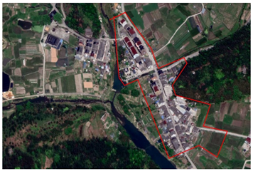
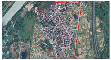
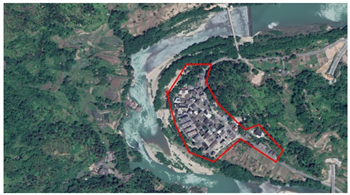
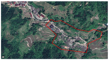
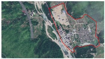
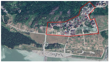
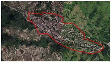
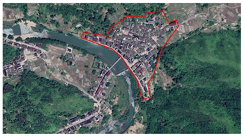
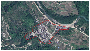
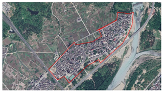
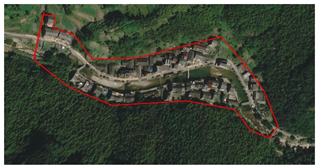
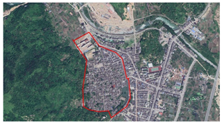
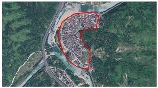
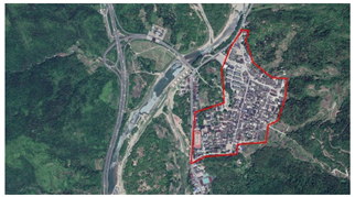
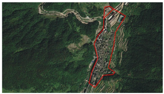
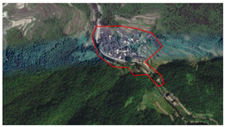
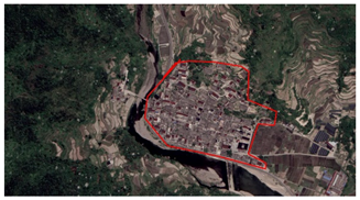
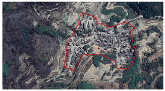
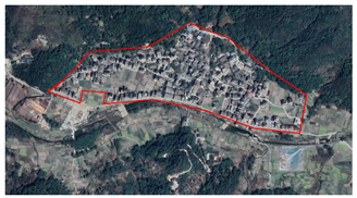
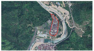
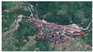
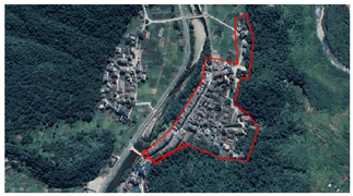
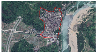
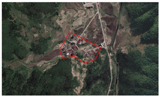
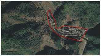
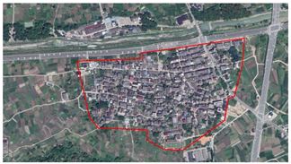
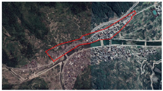
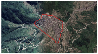
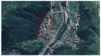
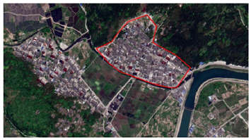
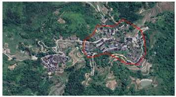
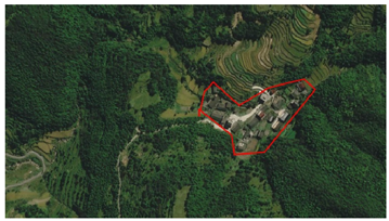
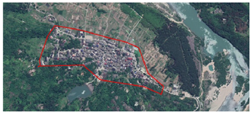
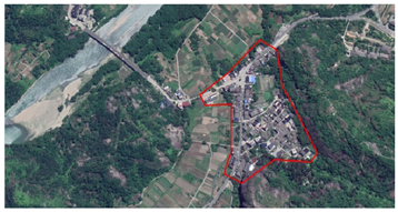
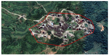
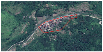
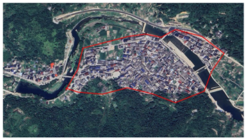
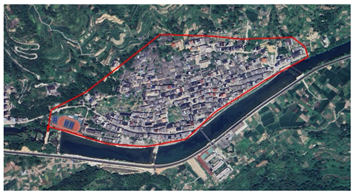
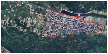
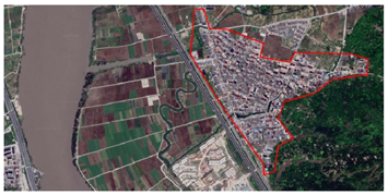
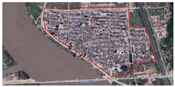
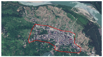
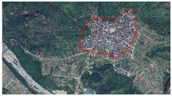
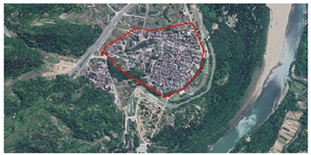
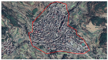
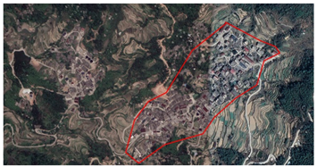
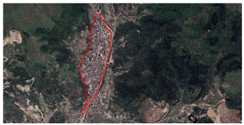
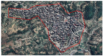
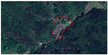
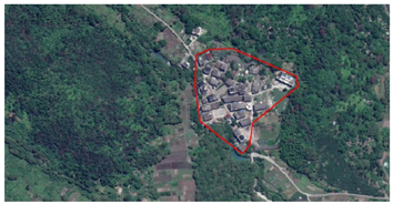
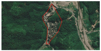
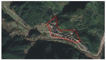
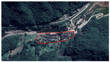
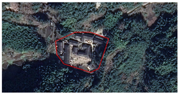
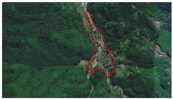
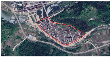
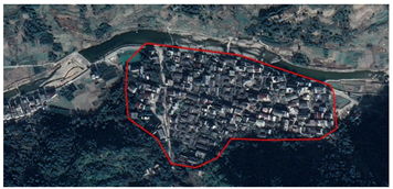
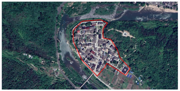
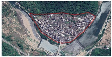
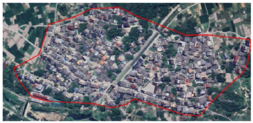
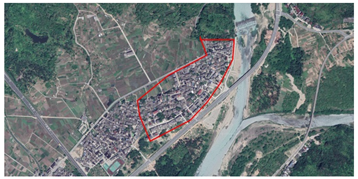
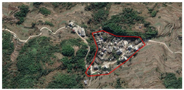
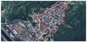
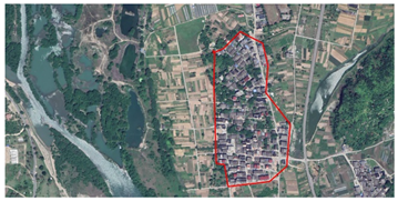
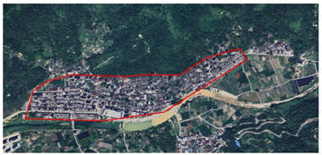
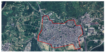
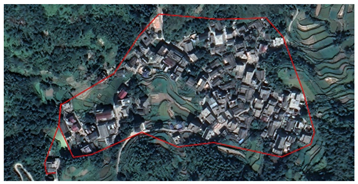
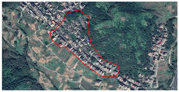
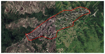
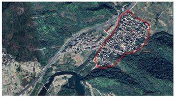
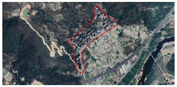
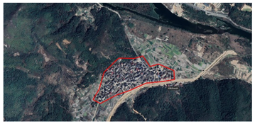
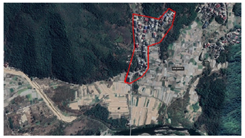
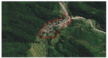
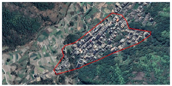
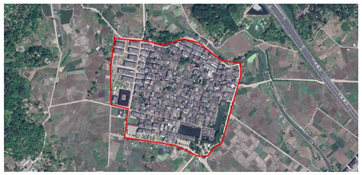
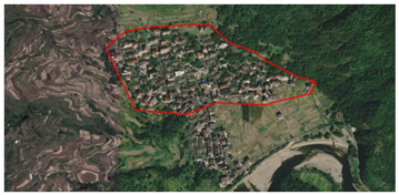
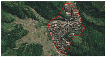
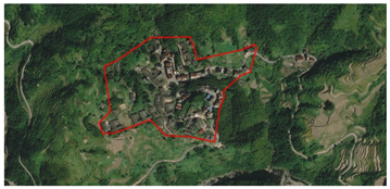
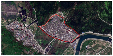
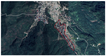
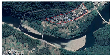
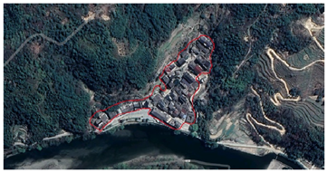
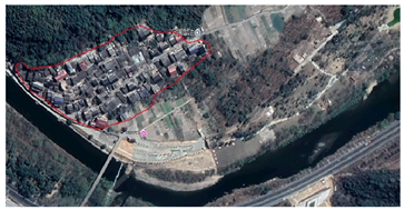
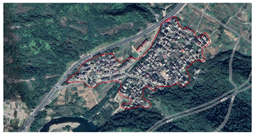
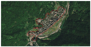
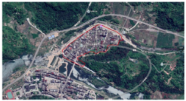
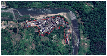
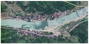
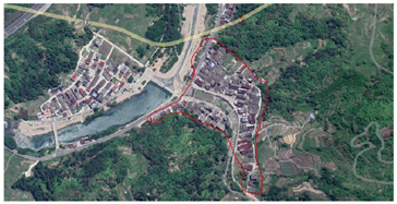
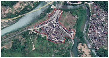
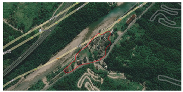
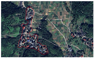
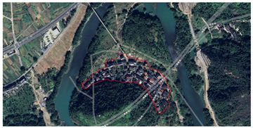
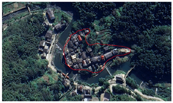
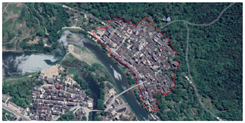
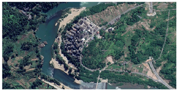
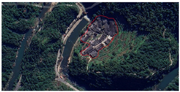
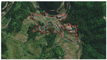
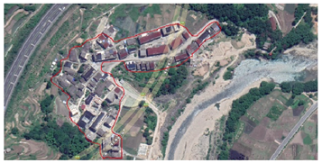
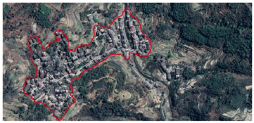
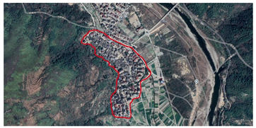
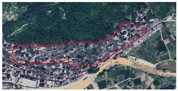
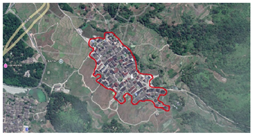
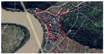
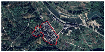
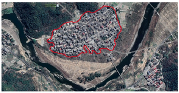
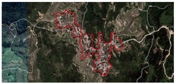
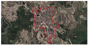
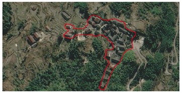
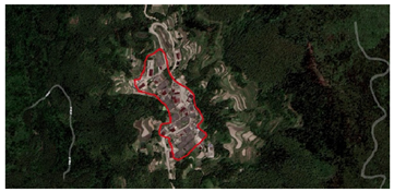
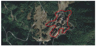
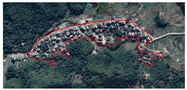
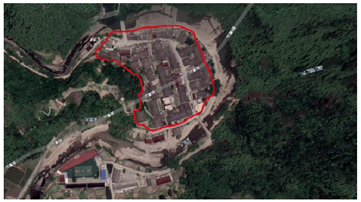
This study focuses on the Nanxi River Basin in Yongjia County, Wenzhou City, Zhejiang Province, on the southeast coast of China (see Figure 1a). It is adjacent to Yueqing and Huangyan in the east, Qingtian and Jinyun in the west, Xianju in the north, and Wenzhou across the river in the south. The geographical coordinates are 120°15′ to 121°03′ east longitude and 28°04′ to 28°33′ north latitude (see Figure 1b). The Nanxi River is an important tributary of the Oujiang River, with a total length of about 141 km and a basin area of about 2674 km2. The landforms in this area are mainly hilly and mountainous. The terrain features of high northwest and low southeast and the developed river network system together shape the typical distribution pattern of Jiangnan water town settlements (see Figure 1c). As the last tributary of the Ou River flowing into the East China Sea, the Nanxi River Basin has rich natural, economic, and cultural resources. Such a basin spatial pattern has a profound impact on the site selection, development, and layout of settlements. Please refer to Appendix A for satellite images and boundaries of some settlements.
As a typical representative of the landscape and pastoral pattern in the Jiangnan region, the Nanxi River Basin has a unique natural environment and historical culture. Natural elements such as rivers and mountains closely connect its traditional settlements, creating a rich settlement form and spatial structure. The settlements in the Nanxi River Basin not only carry the wisdom of ancient ancestors in adapting to nature but also reflect the long-term social evolution and cultural heritage.
The study of traditional settlements in the Nanxi River Basin typically takes into account the following four aspects. (1) The Nanxi River Basin is situated in a linguistically closed area, creating a distinct and autonomous cultural circle. In the conventional sense, the basin covers the entire county and borders the surrounding counties and cities. The basin maintains a relatively independent geographical position and features somewhat closed cultural exchanges. This unique language and cultural environment have facilitated the development of settlements in the Nanxi River Basin, preserving their strong regional identity and uniqueness, and adding significant research value. (2) The Nanxi River Basin has a typical Jiangnan “waterside mountain dwelling” pattern. The settlements are interdependent with rivers, mountains, and farmlands, reflecting the traditional natural and cultural relationship in the Jiangnan region. These settlements not only show a high degree of ecological adaptability in spatial layout but also carry the cultural spirit of “farming and reading to pass on the family”, reflecting the traditional Jiangnan people’s pursuit of lifestyle and values. (3) The settlements in the upper and middle reaches of the Nanxi River Basin are relatively well protected, with 159 traditional settlements and fairly complete historical features. The World Heritage Preliminary List lists these areas as important landscape areas, recognizing their high cultural and natural heritage value. This provides a powerful inspiration for the protection of related heritage and can help explore how to achieve the effective protection and sustainable development of traditional settlements in the process of modernization. (4) The settlement classification in the Nanxi River Basin is typical, especially under the influence of the spatiotemporal environment and geomorphological characteristics; the settlement morphology and distribution show significant regional differences. The settlement morphology of the upper, middle, and lower reaches has formed a unique spatial pattern under the joint action of the natural environment, terrain conditions, and human activities, demonstrating the adaptability of the human settlement environment in the basin under different geographical conditions. Therefore, studying the settlement classification and spatial morphology of the Nanxi River Basin can not only reveal the morphological evolution law of traditional settlements in the Jiangnan water town area but also provide theoretical support for the protection and development of villages in similar environments.

3.2. Research Methods

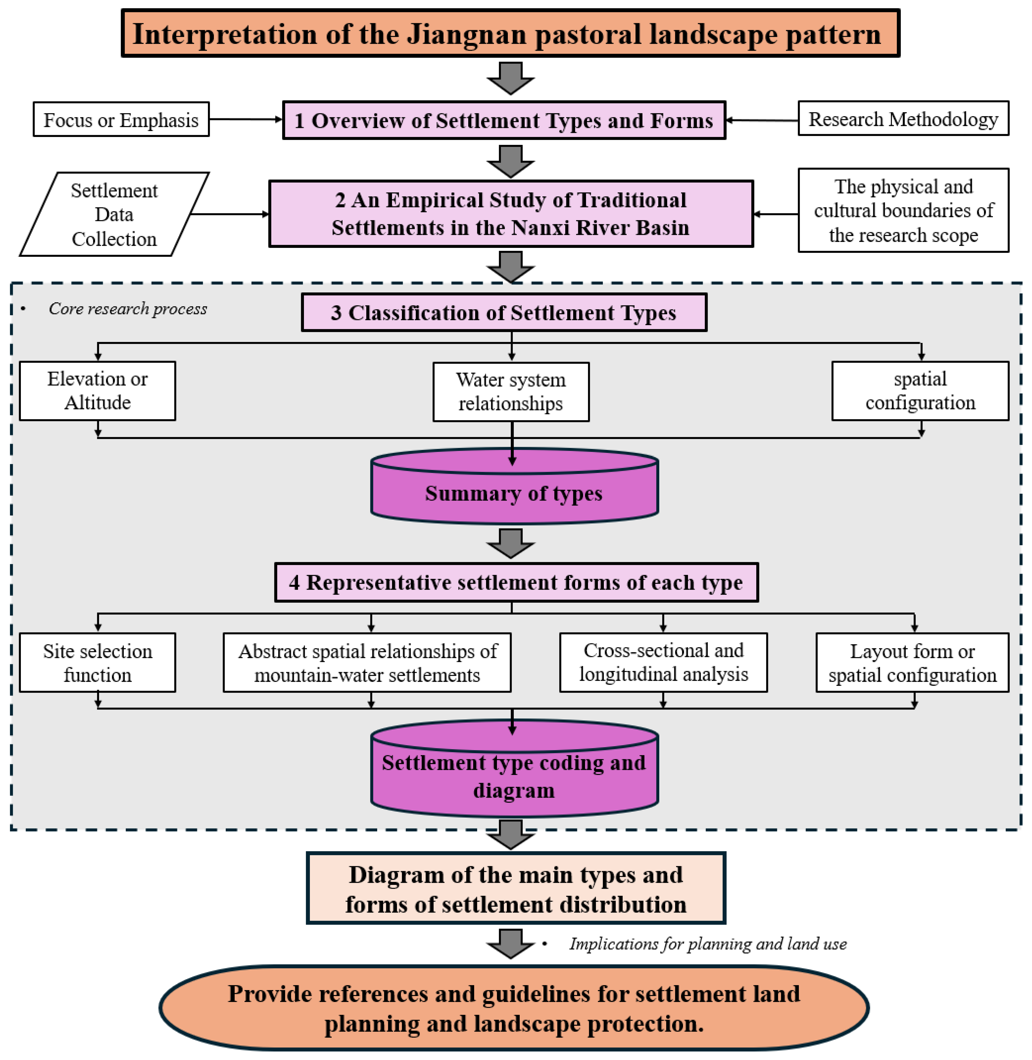
This study used a combination of empirical research and data analysis to systematically classify and morphologically analyze traditional settlements in the Nanxi River Basin (Figure 2). First, the researchers collected core data related to the spatial morphology of settlements, including topography, water system relationships, and spatial morphology, to construct a classification framework for settlement types. Therefore, the study looked closely at how different types of settlements choose their sites, how mountain and water settlements relate to each other in space, how cross-sectional and longitudinal structures work, and how layout forms and space arrangements are different. Subsequently, we demonstrated the spatial distribution characteristics and representative morphologies of various types of settlements by coding and graphically processing them. Ultimately, the research results provide a scientific basis for the classification, protection, and planning of traditional settlements and provide a reference and guidance for land use and landscape protection in planning practice.

3.2.1. Quantitative Classification and Characteristic Summary of Settlements

This study uses a systematic quantitative classification method to cluster the spatial morphology of traditional settlements in the Nanxi River Basin (Table 3). The study primarily divides the settlement classification into major categories and subcategories. First, the major category classification subdivides the settlements based on the topographic characteristics of their location, such as mountains, hills, and plains, revealing the influence of topography on their morphology and spatial layout. Secondly, by analyzing the distance between the settlements and the river system, the study classifies the settlements based on their spatial relationship with the river system. Waterfront settlements and inland settlements that are at least 1 km away from the water system are identified, thereby allowing for analysis of the influence of the water system on the spatial structure of the settlements. We calculate the aspect ratio and morphological index in the subcategory classification using the long and short axes, perimeters, and area sizes of the settlement patches. In the subclassification, the aspect ratio and morphological index are calculated through the long and short axes, perimeter, and area size of the settlement patches. The overall shapes of the settlements are categorized into six groups (Table 3) by using statistical analysis to look at the morphological index (S1) and aspect ratio (λ). We quantify their morphological characteristics to further reveal the geometric characteristics of the settlement morphology and its relationship with the natural environment. This method organizes traditional settlements in the Nanxi River Basin into groups based on their natural environment characteristics using multi-level quantitative methods. This gives us a scientific way to look at how settlements have changed over time and space in the Jiangnan landscape and countryside (Shan-Shui) pattern.

3.2.2. Analysis of Representative Types and Forms of Traditional Settlements

This research carefully categorizes the main types and subtypes of traditional settlements in the Nanxi River Basin. It uses a variety of analysis methods, including site selection characteristics, distribution location, abstract map, profile pattern, plane layout, and type coding, to have a detailed discussion on the typical types and spatial forms of traditional settlements (Table 4). Firstly, we classify the major categories and subcategories based on macro-environmental factors such as the settlements’ topography and landforms, their relationship with the water system, and their size. We then analyze the site selection characteristics and functions in detail to uncover the interactive relationship between the settlements and the natural environment. Subsequently, we construct an abstract map of the settlements, simplifying and extracting the core spatial structural characteristics of different types of settlements. Supplemented by the analysis of profile patterns and plane layouts, we present the organizational form of the settlements in vertical and horizontal space, particularly the relationship of building height, road height difference, and building layout with the natural landscape. The satellite image analysis examines the overall spatial relationship between the settlements and the surrounding natural environment on a macroscale, further confirming the results of the ground survey. Finally, we select representative settlements for in-depth analysis, highlighting their typical morphological characteristics and ecological adaptability.

3.2.3. Map Expression and Coding of Settlement Morphology Types

This study applied the principles of typology, drew on the N-level coding theory, and followed the coding rule of “uppercase letters—numbers—N-level naming” for generative superposition. We carried out a standardized map expression of the traditional settlements in the Nanxi River Basin, using a systematic settlement morphology classification and coding method (refer to Table 5 for specific coding classification instructions).
We first classified the settlements based on the natural environmental factors of landform (M/H/P) and water system distance (W/H), and then further refined the classification based on the village’s spatial morphology (Table 5). This basis, along with the abbreviations of the settlement names (e.g., “Yb” for Yubei Village), led to the formation of a comprehensive coding system for settlements. For example, the code for Yubei Village is “H-W-1-Yb”, where “H” represents mountainous terrain, “W” represents a waterfront settlement, “1” represents a finger-shaped settlement with a clustering tendency, and the abbreviation “Yb” identifies the name of the settlement (Figure 3). This coding system achieves the systematic classification and identification of different settlement types through multidimensional settlement feature expression. Finally, we constructed a map expression system of settlement types from the coding results, which intuitively presents the spatial distribution characteristics of traditional settlements in the Nanxi River Basin and their interactive relationship with the natural environment. This study provides a scientific tool for the classification and analysis of settlement morphology, and also provides important theoretical support and data reference for regional planning and heritage protection practice.

3.3. Data Sources and Processing

3.3.1. Data Sources

The data sources for this study are of four types: (1) Distribution and patch data of traditional rural settlements in the Nanxi River Basin. The Zhejiang Provincial Department of Agriculture and Rural Affairs (https://nynct.zj.gov.cn/) and the Yongjia County Natural Resources and Planning Bureau (www.yj.gov.cn) jointly applied for and provided the traditional rural settlement list and distribution coordinate point data. The settlement patch data were based on the Google 10 m precision satellite base map in August 2024 and combined with drone aerial photography data. The settlement patches were drawn in the GIS software according to the settlement distribution points and settlement jurisdiction range, and the Wenzhou Natural Resources and Planning Bureau (https://zrzyj.wenzhou.gov.cn/) was visited and consulted to determine and verify the relevant patch data. (2) Administrative division data. The Yongjia County Natural Resources and Planning Bureau disclosed the information data on the area of the relevant counties and villages and confirmed the data with the relevant land department personnel of the bureau. (3) Natural environment data. The data include information on altitude, topography, and the water system, as presented in Table 6. (4) Data on representative settlement space. The Zhejiang Provincial Department of Agriculture and Rural Affairs published the “National Traditional Village List”, “Zhejiang Provincial Traditional Village List”, “Historical and Cultural Village Protection and Utilization Key and General Protection Village List”, and other lists for cross-comparison, and selected representative settlements with provincial and above protection levels for field exploration and drone data mapping. The relevant streets in the area provided 1:2000 topographic data maps and related settlement space data.

3.3.2. Data Preprocessing

This step used the 10 m precision map of Google satellite data in 2024 as the base map to draw the data on traditional settlement patches. Firstly, the study screened the settlements for the presence of ancient settlement heritage buildings. This was performed by comparing the list of traditional national villages, the list of Zhejiang provincial traditional villages, the key protection and utilization of historical and cultural villages, and the list of general protection villages (which the Yongjia County Natural Planning Bureau applied for public data coordinates). Based on these criteria, the study statistically identified 204 relevant traditional settlements in the basin. In addition, through two rounds of field surveys of traditional settlements in the Nanxi River Basin and comparison of drone aerial photography data, the settlements with well-preserved styles were selected (the selected settlements should be one of the above four categories, with good landscape spatial pattern, street texture, architectural style, and other preservation status). This study survey covers the entire basin, and there are rural settlements with few morphological changes and more than 80% of intact preservation that were selected for research. According to the statistics, there are 159. As some settlements were merged into administrative villages or their reconstruction styles no longer existed, which made them incompatible with the purpose of this study, the remaining 45 traditional settlements were not considered and were eliminated.

4. Results

4.1. Classification of Settlement Distribution Based on Topography

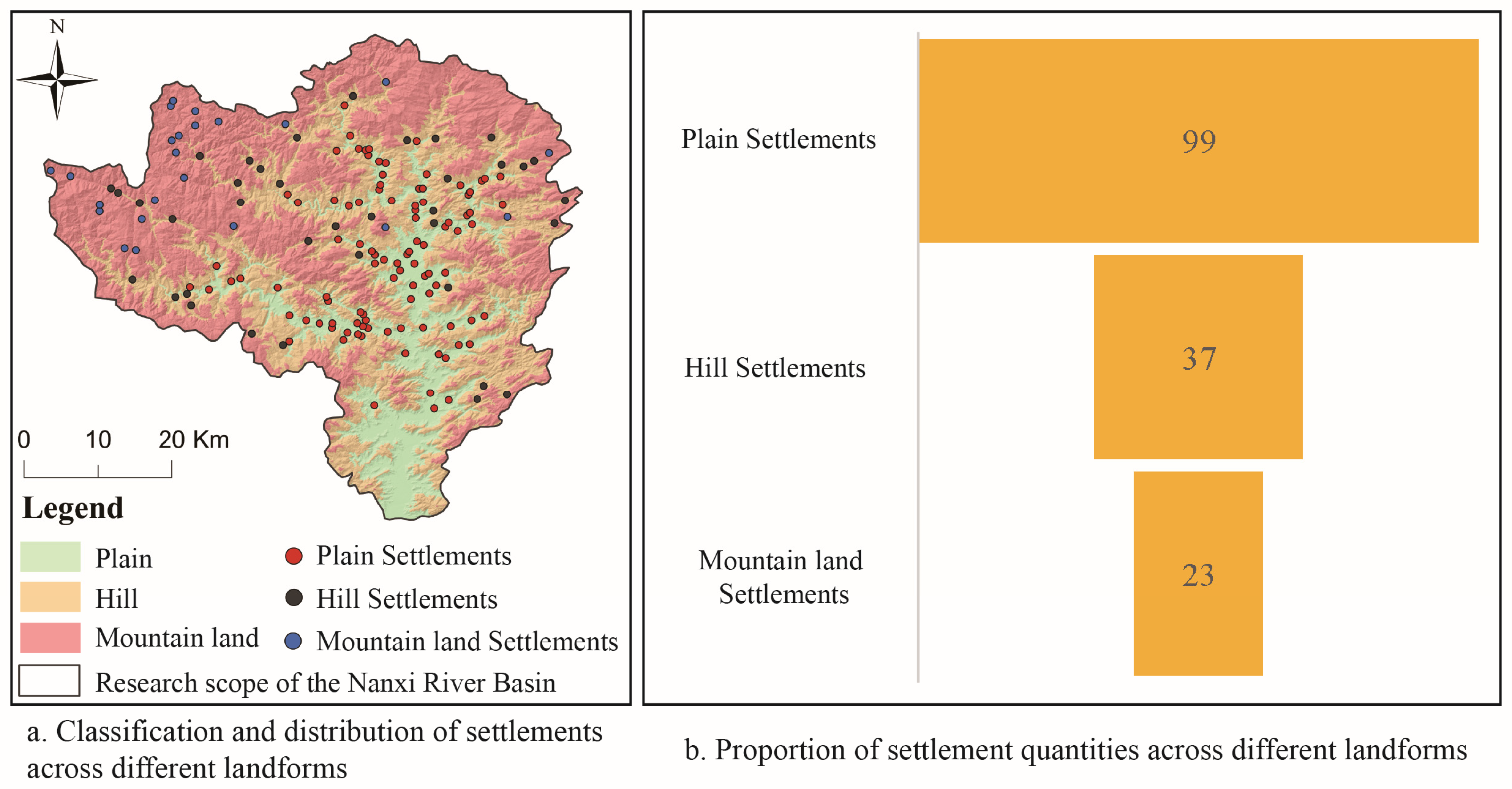
According to further research, plains and hilly terrains primarily host traditional rural settlements in the Nanxi River Basin (Figure 4a). Among them, plain settlements are the main ones, accounting for 62.26% (99) of the total number of settlements, followed by hills 23.27% (37) and mountains 14.47% (23); see Figure 4b. This distribution feature demonstrates that Jiangnan water towns’ plain terrain, with its flat land, abundant water resources, and superior agricultural production conditions, is more conducive to the development of river basin-type settlements. There are large areas of water and traditional villages in the plains of the middle reaches of the Nanxi River Basin. Therefore, the ancients selected living activities based on the advantages of river valleys and terrains. Furthermore, the distribution of settlements exhibits distinct morphological characteristics across various terrains, demonstrating the adaptability of rural settlements within their geographical environment.

4.2. Classification of Settlement Distribution Based on Water System Relationships

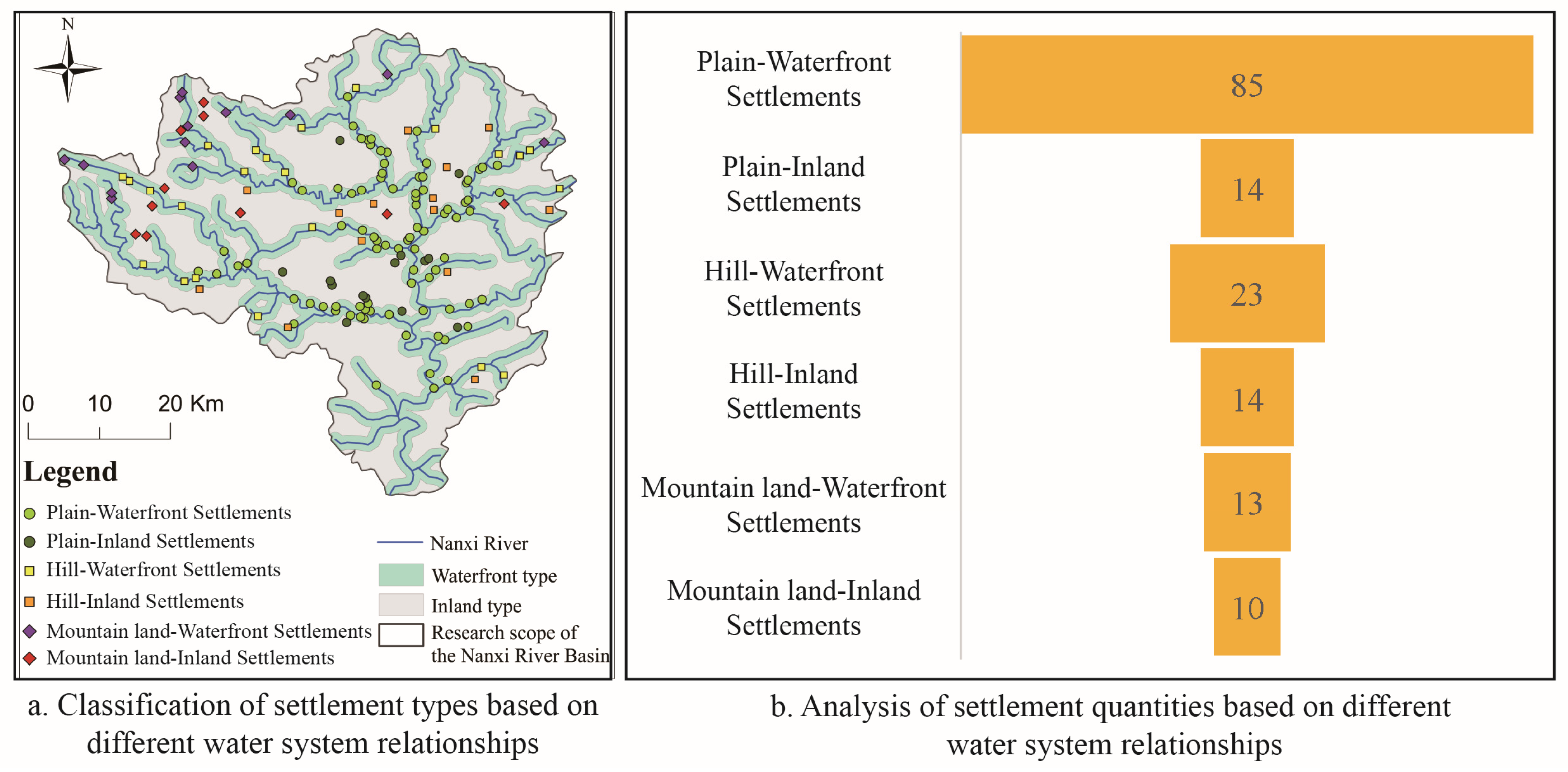
The relationship with the water system significantly influences the morphology of traditional rural settlements in the Nanxi River Basin. The Nanxi River Basin contains most of the settlements within a 1 km radius (Figure 5a). Specifically, waterfront settlements account for 76.11% (121) of the total, and inland settlements account for 23.89% (38). The two have obvious differences in settlement morphology. Among the waterfront settlements, plain waterfront settlements account for 53.46% (85), hilly waterfront settlements account for 14.47% (23), and mountain waterfront settlements account for 8.18% (13), as shown in Figure 5b. The number of waterfront settlements decreases as the terrain rises and falls, and there is no significant difference in the number of waterfront and inland settlements in mountainous landforms.
Therefore, the water system plays an important role in shaping the settlement morphology of the Nanxi River Basin. The settlement morphology of the waterfront area is more concentrated and extensible, adapting to the environmental characteristics of convenient water sources and transportation. These settlements tend to be compact in spatial organization, and their morphology tends to be clustered or strip-shaped, which is convenient for obtaining water resources and using water transportation. The settlement morphology of non-waterfront areas is more dispersed and freer, mainly meeting living needs by adapting to terrain and artificial water sources, and showing greater flexibility and adaptability in morphology.

4.3. Classification of Settlement Morphology

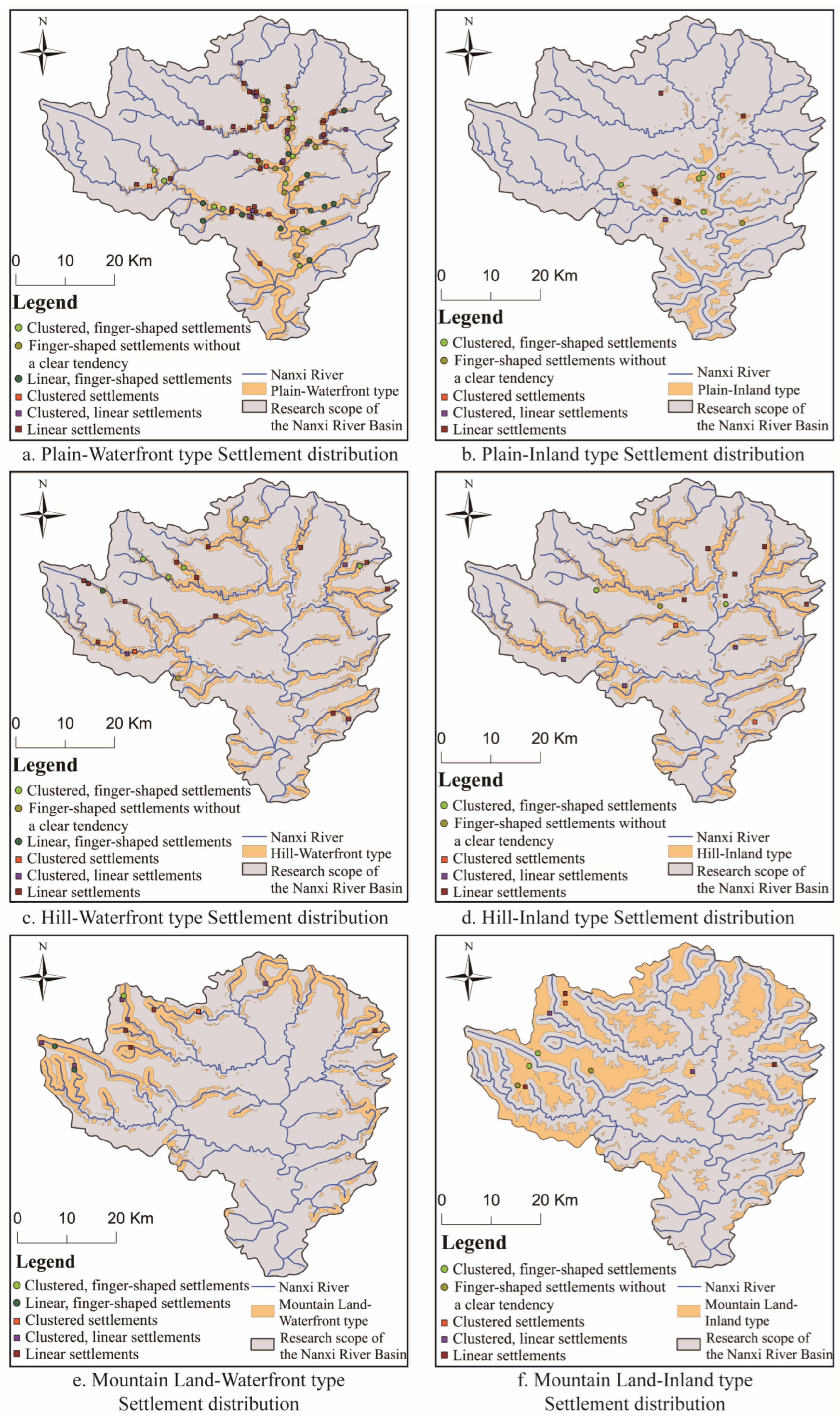
This study divided the traditional rural settlements in the Nanxi River Basin into 36 typological categories according to “three types of terrain, two types of water system relationships, and six types of settlement forms” and obtained the analysis results (Table 7).
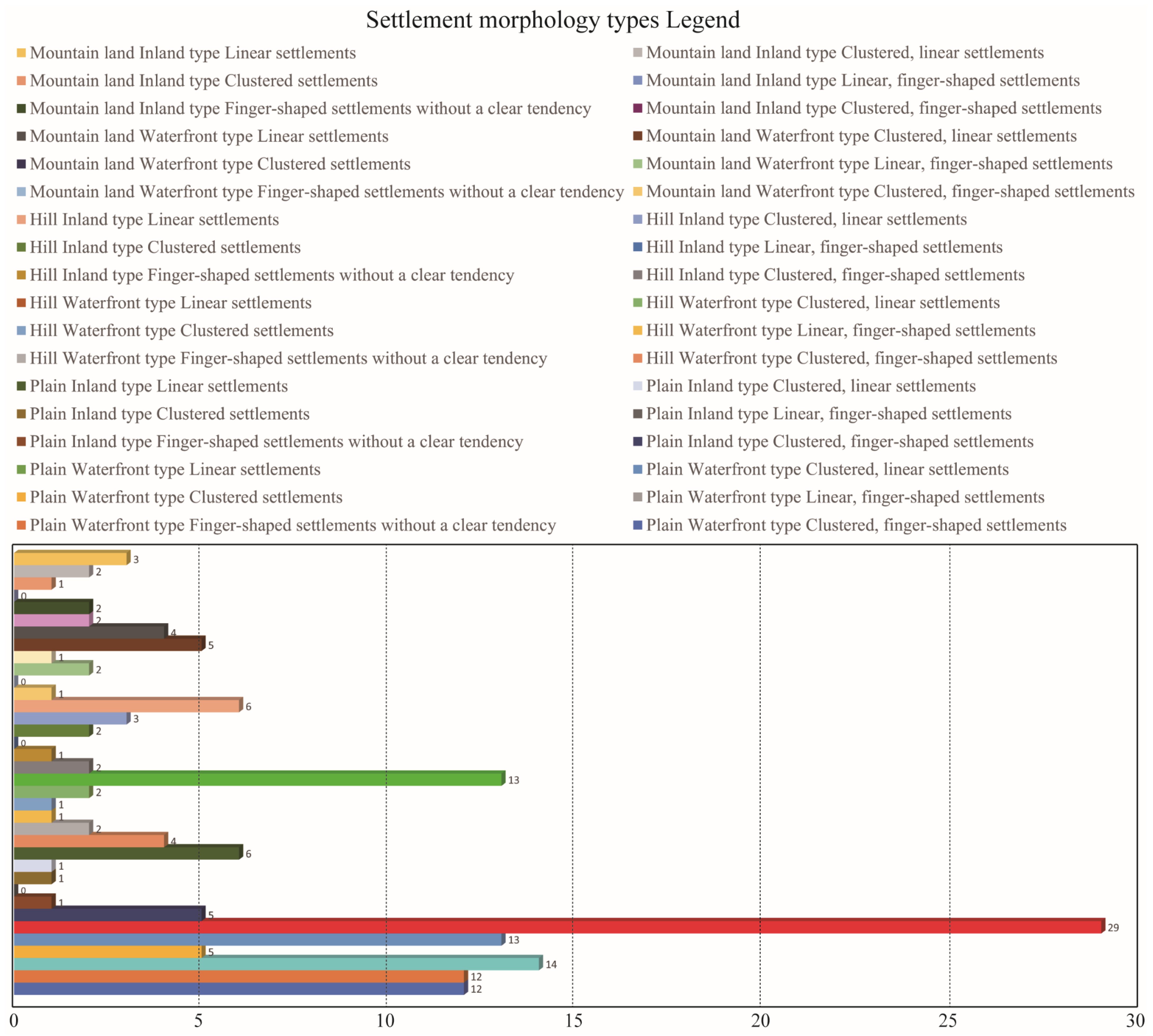
Overall, among the 159 traditional settlement forms in the Nanxi River Basin, the strip settlement (38.36%) is the dominant settlement form type, and the strip-shaped cluster settlement (16.35%) and the cluster-like finger settlement (16.35%) are the secondary important settlement forms. The strip settlement—the dominant type of settlement form—primarily occupies plains, river valleys, and locations near the Nanxi River Basin, creating a favorable terrain feature with its surrounding mountains and water. This distribution shows that the water system is dominant in the distribution of settlements in the Nanxi River Basin. Its linear layout enables the settlement to maximize the use of water sources, with strong adaptability and convenient transportation (Figure 6). The strip-shaped cluster settlement and the cluster-like finger settlement, as important secondary types, provide a more flexible spatial organization that can achieve a balance between water source acquisition and internal social connections. The secondary importance of these two types shows that, in areas with rich water resources, settlements often have both agglomeration and extension characteristics that adapt to diverse terrain and resource needs.
Specifically, this study classified the top six important settlement morphological types in the Nanxi River Basin according to different topographic and geomorphic attributes, ensuring that each topographic and geomorphic type has at least one representative settlement. The results show that (1) plain waterfront strip settlements account for 18.24%, (2) plain waterfront finger-shaped settlements with a strip tendency 8.80%, (3) plain waterfront cluster settlements with a strip tendency 8.18%, (4) plain inland strip settlements with a strip tendency 3.77%, (5) hilly waterfront strip settlements with a strip tendency 8.18%, and (6) mountainous waterfront cluster settlements with a strip tendency 3.14% (Table 7 and Figure 7). The plain waterfront area primarily concentrates the morphological types of traditional rural settlements in the Nanxi River Basin. The predominant types are the strip, strip-like, and cluster-like settlement morphologies, while hilly and mountainous waterfront settlements also form part of the multi-type. From the perspective of the main types of settlement forms, the main types are strip-shaped, strip-shaped/cluster-shaped, and finger-shaped settlements. This type of settlement form takes advantage of the linear distribution characteristics of water sources and enhances the irrigation and traffic accessibility of settlements by extending along the water. The cluster-shaped form shows the compactness of the settlement and the need for spatial agglomeration, which is convenient for strengthening social connections within it. The water system plays a key role in the layout of settlements, especially in plain areas. The convenience of water sources has significantly promoted the development of strip-shaped and finger-shaped layouts, fully reflecting the adaptability and utilization strategies of rural settlements in the natural environment.

4.4. Representative Settlement Morphological Types

The first six types of traditional rural settlements in the Nanxi River Basin were looked at from the point of view of site selection characteristics, distribution areas, abstract maps, 3D spatial composition, plane morphology, and representative settlements (Figure 8).

4.4.1. Plain–Waterfront–Strip Settlement

The plain–waterfront–strip settlements in the Nanxi River Basin show a high degree of adaptability to the water system and terrain. Typically, this type of settlement is situated in coastal areas near rivers or streams in plain areas, leveraging the convenience of water sources to support agricultural irrigation and enhance the quality of life for residents. The distribution area primarily focuses on the upper reaches of the Nanxi River and its tributaries, including riverside areas with flat terrain and stable water systems, which offer favorable natural conditions for agricultural activities.
The abstract atlas shows that the plain–waterfront–belt settlement extends linearly along the river, close to the water source, forming a belt layout. The settlement buildings line up along the river bank in a three-dimensional spatial composition, with houses arranged in turn near the river, surrounded by large tracts of farmland, ensuring a reasonable separation between the living and production areas. In terms of plan form, the settlement is shaped like a narrow strip that spreads along the river bank, maintaining a close connection with the water source and enhancing the efficiency of space utilization.
Representative settlements such as Zhangxi Village (P-W-6-Zx) embody the typical “plain–waterfront–strip” settlement morphological characteristics. The settlement buildings in Zhangxi Village, distributed in a belt along the river direction, exhibit a highly intensive spatial organization feature. This layout form not only meets the residents’ demand for water sources but also optimizes farmland irrigation and space utilization. This layout form, typical of plain waterfront settlements, fully reflects the adaptability and utilization strategy of settlements in the Jiangnan water town area to natural resources.

4.4.2. Plain–Waterfront–Strip-Oriented Finger-Shaped Settlements

The plain–waterfront–strip-oriented finger-shaped settlements in the Nanxi River Basin have significant regional characteristics and ecological adaptability. This type of settlement is typically located in the plain’s waterfront area, built on rivers or streams to ensure access to water resources and facilitate agricultural irrigation. The distribution area primarily focuses on the tributaries of the Nanxi River Basin, including the banks of the Hesheng River, Huatan River, and Xiaonan River. These areas have obvious river sedimentation, forming fertile farmland and providing good environmental conditions for agricultural production.
The abstract atlas demonstrates a linear distribution of this type of settlement, characterized by finger shapes that naturally extend along the river, and a layout that is highly consistent with the river’s curved shape. The settlements extend along both sides of the water system in three-dimensional space, and the distribution of surrounding farmland between the river and the settlement creates a natural transition between living space and agricultural space. The planar form takes the shape of a finger, exhibiting a strip-shaped tendency. The finger-shaped structure not only enables the settlement to extend to the vicinity of the water source but also facilitates expansion and connection under the constraints of the terrain and the river, ensuring the connection between residents and the water source and farmland.
Representative settlements, such as Langxia Village (P-W-3-Lx), embody the typical finger-shaped settlement characteristics of the plain–waterfront–strip tendency. The settlement maintains agglomeration in spatial layout and extends in a finger-shaped manner along the river, showing the high adaptability of the settlements in the Nanxi River Basin to water resources and terrain conditions. It exemplifies the traditional settlement form of Jiangnan’s water towns. This structure not only meets the living and production needs of residents but also provides ecological and spatial support for the sustainable development of the settlement.

4.4.3. Plain–Waterfront–Cluster-Oriented Finger-Shaped Settlements

The plain–waterfront–cluster-oriented finger-shaped settlements in the Nanxi River Basin have significant regional adaptability and spatial organization characteristics. This type of settlement is typically located in the waterfront area of the plain, relying on the gentle river system to facilitate the acquisition of water resources and agricultural irrigation. The distribution area primarily concentrates along the mainstream and tributaries of the Nanxi River, including the Xiaonan River. The river flow in these areas is slow and the land around it is fertile, providing favorable natural conditions for the stable development of the settlement.
The abstract atlas demonstrates that this type of settlement is based on clustering at the core, extending out in a finger-shaped distribution and spreading along the river. This layout features both the agglomeration of the core area and the finger-shaped extension towards the water system, providing a convenient direct connection to the water source. In terms of three-dimensional spatial composition, the settlement is densely distributed in clusters in the core area, and the buildings are arranged along the river bank, forming a centralized residential area around the core. The settlement distributes the surrounding farmland between it and the river, ensuring farming convenience. In terms of plane morphology, the settlement extends in a finger-shaped manner along the river bank, with the dual characteristics of clustering and finger-shaped dispersion adapting to the layout requirements of the terrain and water system.
Representative settlements such as Yubei Village (P-W-1-Yb) typically show the “plain–waterfront–cluster-oriented finger-shaped” settlement morphological structure. The spatial layout of Yubei Village emphasizes the core agglomeration of clusters and achieves a close connection with water sources through finger-shaped extension. This morphological structure not only meets the needs of residents’ lives and agricultural production but also shows the ecological adaptability of settlements in waterfront environments.

4.4.4. Plain–Inland–Strip Settlements

The plain–inland–strip settlements in the Nanxi River Basin show typical regional adaptability characteristics, especially the linear layout formed under the conditions of transportation networks and terrain constraints. This type of settlement is usually located in the plain inland area, close to convenient transportation routes or main channels connecting towns to meet the needs of human and logistics flows, while avoiding the direct dependence of waterfront settlements on water sources. The distribution area is mainly concentrated along the plain transportation arteries in the Nanxi River Basin, or the transition zone between hills and plains. The terrain is relatively flat, which is suitable for the strip-shaped layout extending along the line.
The abstract atlas demonstrates the linear distribution of plain–inland–strip settlements, which extend in a belt along traffic lines or natural terrain, mirroring the direction of the terrain. The three-dimensional spatial composition of the settlements distributes them along traffic lines or rivers (such as streams), flanked by residential areas and agricultural land, creating a continuous belt structure that facilitates internal connections and external passage. In terms of plane morphology, the settlements are narrow and long belts with a compact and orderly layout. Each building unit is arranged in sequence along the traffic line to reduce the land occupation and maintain the continuity of the settlement.
Representative settlements such as Li Dawu Village (P-I-3-Ldw) embody the typical “plain–inland–strip” settlement morphological structure. Li Dawu Village is strategically located along the main traffic routes, forming a belt along the road, demonstrating high land use efficiency and spatial extensibility. This structure adapts to the characteristics of convenient transportation and the flat terrain of the inland plain, provides a reasonable spatial organization form for the sustainable development of settlements in non-waterfront areas, and is typical of inland settlements in Jiangnan water towns.

4.4.5. Hills–Waterfront–Strip Settlement

The hills–waterfront–strip settlements in the Nanxi River Basin show unique layout characteristics in terms of adaptability to terrain and water systems. In hilly areas, this type of settlement is typically located along the banks of rivers or streams, dispersing along river valleys or streams in a strip-shaped pattern to optimize water resource utilization and adjust to the undulating terrain. The hilly areas of the Nanxi River Basin, such as valleys where streams converge or the terminal areas of tributaries, primarily concentrate the distribution area. The terrain is narrow and long and has natural channels formed by river erosion, which is conducive to agricultural irrigation and convenient transportation.
The abstract atlas shows that the hills–waterfront–strip settlement extends linearly along the river direction, and the settlement layout stretches there naturally. The three-dimensional spatial composition of the settlement distributes the buildings step by step along the river bank, arranging the houses on gentle slopes or flat land on both sides of the river according to the height difference of the terrain. This arrangement not only ensures the settlement’s flood control safety but also facilitates the convenient acquisition of water sources. The settlement extends in a strip-shaped manner, with buildings distributed along the river, creating a narrow and long strip-shaped form. Simultaneously, the settlement reserves farmland between rivers for agricultural activities.
Representative settlements such as Zhongyuan Village (H-W-6-Zy) typically show the characteristics of the “hills–waterfront–strip” settlement morphology. Zhongyuan Village is distributed in a strip-shaped manner along the river valley to fully adapt to the hilly terrain and water source conditions, and achieve a high degree of integration between the settlement layout and the natural environment. This structure not only meets the needs of residents’ lives and agricultural production but also shows the ecological adaptability of the settlement in the hilly waterfront environment, providing an important reference for the study of the settlement morphology of the Jiangnan hilly water town.

4.4.6. Clustered Settlements with Mountain–Waterfront–Strip Tendency

The mountain–waterfront–strip-oriented agglomeration settlements in the Nanxi River Basin show the typical adaptability characteristics of mountains and water systems. This type of settlement is usually located on gentle slopes or valleys along mountain rivers or streams. It is typically situated near water sources and built atop mountains, providing convenient access for water resource acquisition, agricultural irrigation, and the formation of defensive terrain. The distribution area primarily focuses on the tributary basins of the Nanxi River Basin, including the mountain valleys of the Jin Stream and Dayuan Stream, characterized by relatively open riverbanks and slope spaces.
The abstract atlas reveals that the settlements clustered with a mountain–waterfront–strip tendency form a core and extend in a strip-shaped manner along the water system. In terms of three-dimensional spatial composition, the settlement buildings follow the mountain’s terrain, forming a core area of clustered concentration, while also forming a specific linear extension towards the river bank. To ensure the safety and production functions of the settlement, the building complex arranges itself around farmland and water sources. In terms of plane morphology, the core of the settlement is clustered, and the extended part forms a strip-shaped tendency along the water system to adapt to the terrain restrictions and enhance the accessibility of water sources.
Representative settlements such as Ma Village (M-H-5-Ma) typically embody the settlement morphological characteristics of a “mountain–waterfront–strip-tendency cluster”. The layout of Ma Village not only maintains the tight agglomeration of the cluster but also extends in a belt-like manner along the river to adapt to the mountainous terrain and water system environment, showing the efficient spatial organization of the settlement in the mountainous waterfront environment. This morphological structure provides a typical reference model for studying the rural settlement morphology in mountainous river valley areas, reflecting the high adaptability of settlements to mountain water sources and terrain conditions.

5. Discussion

5.1. The Universality of the Research Path of Settlement Morphology

To classify traditional settlements in the Nanxi River Basin scientifically, this study used the “topography–water system relationship–spatial form” method. It shows how the traditional settlements are grouped and what the results are. This result is based on the previous complex settlement classification [39,40] and incorporates the influence of mountain and water environments on basin settlements in settlement geography theory, the morphological deduction relationship between settlement boundaries and space, and the verification of results by individual cases, which is more systematic in quantitative logic. Therefore, the typological research path of settlement morphology provides a methodological reference for the study of global basin settlement morphology and has broad universality and promotion significance for exploring the relationship between the human settlement environment and the basin ecology.
We looked at the layouts of settlements in the watersheds of the Lijiang River Basin in Guangxi, China, the traditional fishing villages in the Lake Biwa Basin in Shiga Prefecture, Japan, the traditional villages in the Kathmandu Valley in Nepal, and the snow-capped mountain settlements in the Jinsha River Basin in Yunnan, China (Figure 9). All of these settlements were very good at adapting to the hydrological ecosystem of the basin, which shows how settlement forms and the natural environment are connected. The typological analysis of settlements in the Nanxi River Basin not only reveals the spatial structural characteristics under a specific geographical background but also provides a reference for the classification of settlement forms in similar basins. Furthermore, this method is applicable to basins with different geographical and cultural backgrounds and helps summarize the commonalities of and differences in settlements across regions.

5.2. Settlement Spatial Morphology Reveals the Characteristics of the Landscape and Countryside (Shan-Shui) Pattern in the Jiangnan Region

The settlement morphology in the Jiangnan region shows obvious characteristics of being close to mountains and rivers, and harmoniously integrating natural landscapes and human activities. This study discovered that the Nanxi River Basin in the Jiangnan water town region primarily features three types of settlements: strip-shaped, cluster-shaped with strip-shaped tendencies, and finger-shaped with cluster-like tendencies. The settlement layout in the Nanxi River Basin is deeply influenced by the water system, topography, and climate, reflecting the spatial organization model with water as the link. Especially in the transition zone between mountains and waters, the settlement morphology presents an organic distribution of “aggregation–dispersion”, which not only meets the needs of ecological protection but also reflects the production and living functions of traditional villages. Through the analysis of different types of settlements, we can see the common characteristics of the Jiangnan landscape and countryside (Shan-Shui) pattern in spatial morphology. This pattern not only reflects the rational use of natural resources by humans, but also reveals the deep-seated concept of harmony between man and land in Jiangnan culture.
Based on the influencing factors of settlement distribution and environmental factors from the past [41,42], this study further explored the micro-level of settlement geography. It summarized 159 settlement forms by long and short axis, area, and perimeter, classified these forms, and considered the relationship between topography, landforms, water systems, and forms. Furthermore, the researchers discovered that the geographical pattern of numerous mountains and hills often results in strong environmental adaptability among the settlements in the waterside basins of the town. The researchers coordinate the relationship between settlement form, mountains, and rivers through site selection and layout, creating an environmental pattern where people are situated on the mountain and face the water. The irrigation problems and water source needs solved by the river are flexibly used and combined with the vegetation of the mountains to achieve the Jiangnan mountain and water human settlement pattern of sheltering from the wind, growing trees, raising fields, and farming and reading.

5.3. The Relationship Between the Population Size of River Settlements and the Distance to Rivers

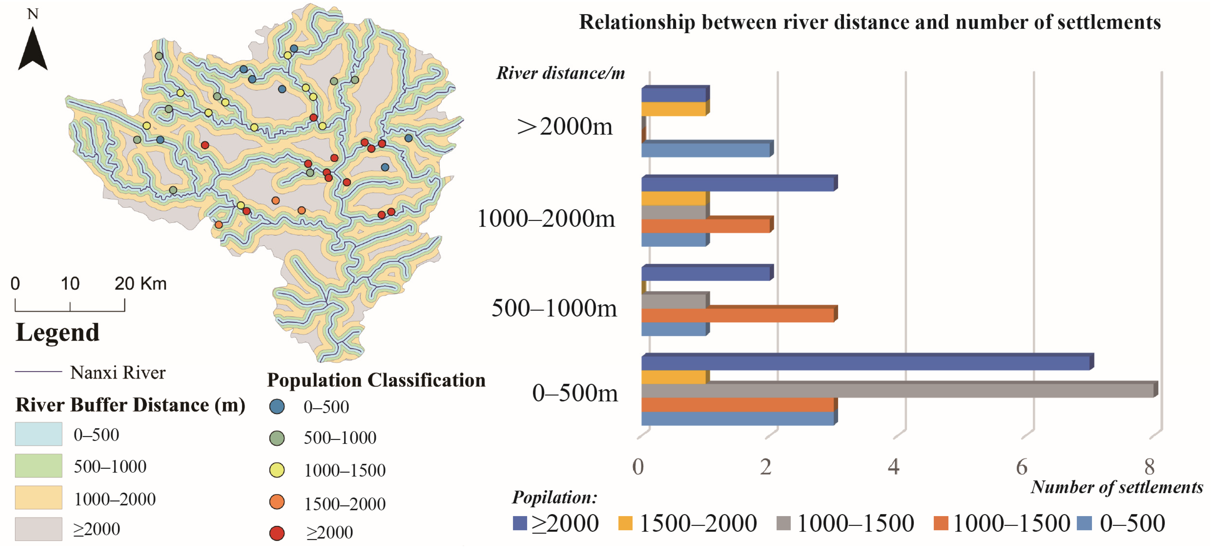
The relationship between the population size of river settlements and the distance to rivers is a complex and multidimensional research topic, involving interactions at multiple levels, such as geography, ecology, and socioeconomics. In the past, studies on settlement morphology paid little attention to the relationship between the village population and the distance to rivers. On the one hand, they only focused on the material mathematical quantification of settlement space [43], and on the other hand, they paid too much attention to the dynamic and balanced relationship between population migration and urbanization [44], while ignoring the understanding of the attributes of settlement morphology itself. This study used 41 typical settlement samples and the statistical population data of settlements to analyze the relationship between settlement population size and river distance to river settlements. As shown in Figure 10, the study found that there were 22 settlements with a river distance of 0–500 m, accounting for 53.66% of the total; 7 settlements with a river distance of 500–1000 m, accounting for 17.07%; 8 settlements with a river distance of 1000–2000 m, accounting for 19.51%; and 4 settlements with a river distance of more than 2000 m, accounting for 9.76%. In general, settlements closer to rivers promote agricultural and economic development due to convenient water sources and transportation, thereby attracting more people. Medium-sized (population base 500 < 2000 people) and large-scale (population base ≥ 2000 people) settlements are mainly distributed in short-distance river distances, and small-scale settlements (population base < 500 people) are mainly distributed in long-distance river distances. As an important water source, rivers play a vital role in the survival and development of settlements. Settlements closer to rivers can more conveniently obtain water resources, which is particularly critical in agricultural societies, as sufficient water sources directly affect the growth and yield of crops, thereby promoting the settlement of residents and population growth. In addition, the accessibility of water resources will also affect the quality of life of residents and the diversity of economic activities, further promoting the expansion of settlements.
However, this relationship is nonlinear. When the distance from the river reaches a certain threshold, the population growth may slow down or even disappear. It is worth mentioning that this nonlinear relationship also reflects the differences in the development stages of the settlements. In the early stages, the settlements are more dependent on water sources and transportation. After they mature, the improvement in infrastructure and the diversification of economic activities mean the survival and development of the settlements no longer rely solely on the river.

5.4. Sustainability and Protection Strategy of Settlement Spatial Form: Settlement Type Atlas and Digital Protection Development

This study uses satellite images, three-dimensional modeling, and GIS technology to digitally record the traditional settlements in the Nanxi River Basin, which not only can fully preserve the spatial characteristics of the settlements but also allow their historical features and cultural values to be displayed through virtual reality. This digital protection method offers a novel approach to safeguarding the global settlement heritage, while also effectively addressing the issue of regional heritage protection. There is a deficiency in timeliness, rescue, fieldwork, and regional focus.
The traditional rural settlements along the Nanxi River serve as typical examples of the settlement forms found in Jiangnan’s water towns. The valuable spatial forms, classification characteristics, and urban and rural spatial planning of these settlements have significantly contributed to the preservation of vernacular architectural heritage, as well as the sustainable development and inheritance of Jiangnan’s traditional settlements. Among them, the researchers also used the settlement type atlas data and built a digital settlement library for 159 traditional settlements in the Nanxi River Basin based on a GIS. We uploaded and recorded the distribution coordinates, plane topography, abstract atlas, facade composition, drone images from 2012 to 2024, specific settlement space values, and multi-period field survey images of the settlements (Figure 11). We also coded and sorted the 159 settlements by type coding to simplify management and retrieval, safeguard the settlement landscape genes, and offer sustainable support for settlement renewal and development.

6. Conclusions

This study systematically studied the classification and spatial morphology of traditional settlements in the Nanxi River Basin, revealing the adaptability of the settlements’ morphology to the geographical environment and their diversified characteristics. The study determined that the predominant forms of rural settlements in the Nanxi River Basin are “belt-shaped, cluster-shaped with a tendency to be belt-shaped, and finger-shaped with a tendency to be cluster-shaped.” The Jiangnan landscape and countryside (Shan-Shui pattern), the natural environment, and the pastoral pattern closely influence the form of settlements in the Nanxi River Basin. Different settlement types have formed diverse spatial layouts under the influence of natural factors such as terrain and water systems.
This study proposed a settlement type atlas that offers a scientific foundation for safeguarding and managing traditional settlements, particularly with regard to digital protection. We recorded and displayed the settlements in a sophisticated manner using a GIS, three-dimensional modeling, and other technical means, offering an innovative path for future sustainable protection and development. However, this study also has limitations, primarily due to the absence of long-term monitoring of the dynamic changes in settlements. In the future, researchers may be able to use big data and artificial intelligence together to better manage and keep an eye on the physical features of settlements. This will help to protect and use traditional settlements in the long-term.

Author Contributions

Conceptualization, Y.H. (Yuhao Huang); methodology, Y.H. (Yuhao Huang) and Y.C.; software, Y.H. (Yuhao Huang); validation, Y.H. (Yuhao Huang), Y.H. (Yingying Huang) and Y.C.; formal analysis, Y.H. (Yuhao Huang), Y.H. (Yingying Huang) and Y.C.; investigation, Y.H. (Yuhao Huang) and Y.H. (Yingying Huang); resources, Y.H. (Yuhao Huang); data curation, Y.H. (Yuhao Huang); writing—original draft preparation, Y.H. (Yuhao Huang) and Y.C; writing—review and editing, Y.H. (Yuhao Huang), Y.H. (Yingying Huang), Y.C. and Y.Y ; visualization, Y.H. (Yuhao Huang), Y.H. (Yingying Huang), L.Z. and Z.Y.; supervision, Y.Y. and Y.C.; project administration, Y.H. (Yuhao Huang) and Y.C.; funding acquisition, Y.H. (Yingying Huang). All authors have read and agreed to the published version of the manuscript.

Funding

The following funding supports this research: (1) the General Research Project of the Zhejiang Provincial Department of Education: “The Impact of Local Identity on Rural Settlements in the Middle Reaches of the Nanxi River and Optimization Strategies” (grant number: Y202353008); (2) the 2024 Zhejiang Provincial Philosophy and Social Science Planning “Provincial-City Cooperation” Project: “The Distribution Characteristics, Spatiotemporal Evolution, and Influencing Factors of Rural Settlements in the Nanxi River Basin from 1990 to 2020” (grant number: 24SSHZ085YB). The funders had no role in the study conceptualization, data curation, formal analysis, methodology, software, decision to publish, or preparation of the manuscript. There was no additional external funding received for this study.

Data Availability Statement

The datasets used and analyzed during the current study are available from the first author Yuhao Huang (u24092120176@cityu.edu.mo) on reasonable request.

Conflicts of Interest

The authors declare no conflicts of interest.

Appendix A. Boundaries and Satellite Images of Traditional Settlements in the Nanxi River Basin (154 Partial Excerpts)

The appendix below shows the boundaries and satellite images of traditional settlements in the Nanxi River Basin (154 partial excerpts) in this study.
Table A1. Boundaries and satellite images of traditional settlements in the Nanxi River Basin (154 partial excerpts).
No.Traditional SettlementsSatellite Image
1Ma’ao Village, Zhutu Township, Yongjia County, Wenzhou City, Zhejiang ProvinceBuildings 15 00413 i001
2Meizhong Village, Yongjia County, Wenzhou City, Zhejiang ProvinceBuildings 15 00413 i002
3Shengukeng Village, Zhangxi Township, Yongjia County, Wenzhou City, Zhejiang ProvinceBuildings 15 00413 i003
4Zhangxi Linkeng, Yongjia County, Wenzhou City, Zhejiang ProvinceBuildings 15 00413 i004
5Yubei Village, Yongjia County, Wenzhou City, Zhejiang ProvinceBuildings 15 00413 i005
6Yutian Village, Yongjia County, Wenzhou City, Zhejiang ProvinceBuildings 15 00413 i006
7Yingjiekeng Village, Yongjia County, Yongjia County, Wenzhou City, Zhejiang ProvinceBuildings 15 00413 i007
8Zhouzhai Village, Yantou Town, Yongjia County, Wenzhou City, Zhejiang ProvinceBuildings 15 00413 i008
9Xing’ao Village, Yantou Town, Yongjia County, Wenzhou City, Zhejiang ProvinceBuildings 15 00413 i009
10Wanli Village, Yantou Town, Yongjia County, Wenzhou City, Zhejiang ProvinceBuildings 15 00413 i010
11Nan’an Village, Yantou Town, Yongjia County, Wenzhou City, Zhejiang ProvinceBuildings 15 00413 i011
12Fangxiang Village, Yantou Town, Yongjia County, Wenzhou City, Zhejiang ProvinceBuildings 15 00413 i012
13Dutou Village, Yantou Town, Yongjia County, Wenzhou City, Zhejiang ProvinceBuildings 15 00413 i013
14Shixia Village, Biaoshan Community, Yantou Town, Yongjia County, Wenzhou City, Zhejiang ProvinceBuildings 15 00413 i014
15Yantou Village, Yongjia County, Wenzhou City, Zhejiang ProvinceBuildings 15 00413 i015
16Xiyi Village, Xikou Community, Yantan Town, Yongjia County, Wenzhou City, Zhejiang ProvinceBuildings 15 00413 i016
17Tanyi Village, Yantan Town, Yongjia County, Wenzhou City, Zhejiang ProvinceBuildings 15 00413 i017
18Pankeng Village, Pankeng Community, Yantan Town, Yongjia County, Wenzhou City, Zhejiang ProvinceBuildings 15 00413 i018
19Daxie Village, Yantan Town, Yongjia County, Wenzhou City, Zhejiang ProvinceBuildings 15 00413 i019
20Yanlong Village, Yongjia County, Wenzhou City, Zhejiang ProvinceBuildings 15 00413 i020
21Xiaer Village, Xunzhai Town, Yongjia County, Wenzhou City, Zhejiang ProvinceBuildings 15 00413 i021
22Xiaoxi Village, Xunzhai Township, Yongjia County, Wenzhou City, Zhejiang ProvinceBuildings 15 00413 i022
23Zhukeng Village, Xu’ao Township, Yongjia County, Wenzhou City, Zhejiang ProvinceBuildings 15 00413 i023
24Zhang’ao Village, Xu’ao Township, Yongjia County, Wenzhou City, Zhejiang ProvinceBuildings 15 00413 i024
25Xiaozhou Village, Yongjia County, Wenzhou City, Zhejiang ProvinceBuildings 15 00413 i025
26Xiaochangkeng Village, Yongjia County, Wenzhou City, Zhejiang ProvinceBuildings 15 00413 i026
27Xiazhai Village, Yongjia County, Wenzhou City, Zhejiang ProvinceBuildings 15 00413 i027
28Xia Richuan, Yongjia County, Wenzhou City, Zhejiang ProvinceBuildings 15 00413 i028
29Huangyi Village, Xixia Township, Yongjia County, Wenzhou City, Zhejiang ProvinceBuildings 15 00413 i029
30Chenkeng Village, Xixia Township, Yongjia County, Wenzhou City, Zhejiang ProvinceBuildings 15 00413 i030
31Xinan Village, Yongjia County, Wenzhou City, Zhejiang ProvinceBuildings 15 00413 i031
32Panzhai Village, Xixi Township, Yongjia County, Wenzhou City, Zhejiang ProvinceBuildings 15 00413 i032
33Ouqu Village, Xixi Township, Yongjia County, Wenzhou City, Zhejiang ProvinceBuildings 15 00413 i033
34Weizhi Village, Xixi Township, Yongjia County, Wenzhou City, Zhejiang ProvinceBuildings 15 00413 i034
35Wuchi Village, Yongjia County, Wenzhou City, Zhejiang ProvinceBuildings 15 00413 i035
36Shuiyun Village, Yongjia County, Wenzhou City, Zhejiang ProvinceBuildings 15 00413 i036
37Shenlong Village, Yongjia County, Wenzhou City, Zhejiang ProvinceBuildings 15 00413 i037
38Zhikou Village, Shangtang Town, Yongjia County, Wenzhou City, Zhejiang ProvinceBuildings 15 00413 i038
39Keshiwan Village, Shangtang Town, Yongjia County, Wenzhou City, Zhejiang ProvinceBuildings 15 00413 i039
40Shangfan Village, Yongjia County, Wenzhou City, Zhejiang ProvinceBuildings 15 00413 i040
41Yuzhang Village, Shatou Town, Yongjia County, Wenzhou City, Zhejiang ProvinceBuildings 15 00413 i041
42Yingao Village, Shatou Town, Yongjia County, Wenzhou City, Zhejiang ProvinceBuildings 15 00413 i042
43Tangwan Village, Shatou Town, Yongjia County, Wenzhou City, Zhejiang ProvinceBuildings 15 00413 i043
44Taishi Village, Shatou Town, Yongjia County, Wenzhou City, Zhejiang ProvinceBuildings 15 00413 i044
45Shangfang Village, Shatou Town, Yongjia County, Wenzhou City, Zhejiang ProvinceBuildings 15 00413 i045
46Luochuan Village, Shatou Town, Yongjia County, Wenzhou City, Zhejiang ProvinceBuildings 15 00413 i046
47Longtanxia Village, Shatou Town, Yongjia County, Wenzhou City, Zhejiang ProvinceBuildings 15 00413 i047
48Langsan Village, Shatou Town, Yongjia County, Wenzhou City, Zhejiang ProvinceBuildings 15 00413 i048
49Huatan Village, Shatou Town, Yongjia County, Wenzhou City, Zhejiang ProvinceBuildings 15 00413 i049
50Guer Village, Shatou Town, Yongjia County, Wenzhou City, Zhejiang ProvinceBuildings 15 00413 i050
51Dongchuan Village, Shatou Town, Yongjia County, Wenzhou City, Zhejiang ProvinceBuildings 15 00413 i051
52Ruolong Village, Sanjiang Business District (Street), Yongjia County, Wenzhou City, Zhejiang ProvinceBuildings 15 00413 i052
53Lutian Village, Sanjiang Street, Yongjia County, Wenzhou City, Zhejiang ProvinceBuildings 15 00413 i053
54Taishi Village, Qukou Township, Yongjia County, Wenzhou City, Zhejiang ProvinceBuildings 15 00413 i054
55Qukou Village, Qukou Township, Yongjia County, Wenzhou City, Zhejiang ProvinceBuildings 15 00413 i055
56Zhukeng Village, Qiaoxia Town, Yongjia County, Wenzhou City, Zhejiang ProvinceBuildings 15 00413 i056
57Xushan Village, Qiaoxia Town, Yongjia County, Wenzhou City, Zhejiang ProvinceBuildings 15 00413 i057
58Xi’an Village, Qiaoxia Town, Yongjia County, Wenzhou City, Zhejiang ProvinceBuildings 15 00413 i058
59Kunyang Village, Qiaoxia Town, Yongjia County, Wenzhou City, Zhejiang ProvinceBuildings 15 00413 i059
60Zhan’ao Village, Qiaotou Town, Yongjia County, Wenzhou City, Zhejiang ProvinceBuildings 15 00413 i060
61Xixin Village, Qiaotou Town, Yongjia County, Wenzhou City, Zhejiang ProvinceBuildings 15 00413 i061
62Pankeng Village, Pankeng Township, Yongjia County, Wenzhou City, Zhejiang ProvinceBuildings 15 00413 i062
63Mingao Village, Yongjia County, Wenzhou City, Zhejiang ProvinceBuildings 15 00413 i063
64Lilong Village, Yongjia County, Wenzhou City, Zhejiang ProvinceBuildings 15 00413 i064
65Liaoyan Village, Yongjia County, Wenzhou City, Zhejiang ProvinceBuildings 15 00413 i065
66Lizhuang Village, Yongjia County, Wenzhou City, Zhejiang ProvinceBuildings 15 00413 i066
67Meiao Village, Jiekeng Township, Yongjia County, Wenzhou City, Zhejiang ProvinceBuildings 15 00413 i067
68Kengkou Village, Jiekeng Township, Yongjia County, Wenzhou City, Zhejiang ProvinceBuildings 15 00413 i068
69Jiaxi Village, Yongjia County, Wenzhou City, Zhejiang ProvinceBuildings 15 00413 i069
70Jijiazhai, Yongjia County, Wenzhou City, Zhejiang ProvinceBuildings 15 00413 i070
71Huangnan Linkeng, Yongjia County, Wenzhou City, Zhejiang ProvinceBuildings 15 00413 i071
72Zhengyuan Village, Hesheng Town, Yongjia County, Wenzhou City, Zhejiang ProvinceBuildings 15 00413 i072
73Village, Hesheng Town, Yongjia County, Wenzhou City, Zhejiang ProvinceBuildings 15 00413 i073
74Pengxi Village, Hesheng Town, Yongjia County, Wenzhou City, Zhejiang ProvinceBuildings 15 00413 i074
75Meitan Village, Hesheng Town, Yongjia County, Wenzhou City, Zhejiang ProvinceBuildings 15 00413 i075
76Heyang Village, Hesheng Town, Yongjia County, Wenzhou City, Zhejiang ProvinceBuildings 15 00413 i076
77Donggao Village, Hesheng Town, Yongjia County, Wenzhou City, Zhejiang ProvinceBuildings 15 00413 i077
78Shangguang Village, Hesheng Town, Yongjia County, Wenzhou City, Zhejiang ProvinceBuildings 15 00413 i078
79Gangtou Village, Yongjia County, Wenzhou City, Zhejiang ProvinceBuildings 15 00413 i079
80Furong Village, Yongjia County, Wenzhou City, Zhejiang ProvinceBuildings 15 00413 i080
81Yangshan Village, Fenglin Town, Yongjia County, Wenzhou City, Zhejiang ProvinceBuildings 15 00413 i081
82Tangao Village, Fenglin Town, Yongjia County, Wenzhou City, Zhejiang ProvinceBuildings 15 00413 i082
83Huolu Village, Fenglin Town, Yongjia County, Wenzhou City, Zhejiang ProvinceBuildings 15 00413 i083
84Gushan Village, Fenglin Town, Yongjia County, Wenzhou City, Zhejiang ProvinceBuildings 15 00413 i084
85Fenglin Ancient Town, Yongjia County, Wenzhou City, Zhejiang ProvinceBuildings 15 00413 i085
86Fenshui Village, Yongjia County, Wenzhou City, Zhejiang ProvinceBuildings 15 00413 i086
87Daitou Village, Yongjia County, Wenzhou City, Zhejiang ProvinceBuildings 15 00413 i087
88Zhouao Village, Daluoyan Town, Yongjia County, Wenzhou City, Zhejiang ProvinceBuildings 15 00413 i088
89Yingkeng Village, Daluoyan Town, Yongjia County, Wenzhou City, Zhejiang ProvinceBuildings 15 00413 i089
90Xiaoruokou Village, Daluoyan Town, Yongjia County, Wenzhou City, Zhejiang ProvinceBuildings 15 00413 i090
91Tongzhou Village, Daluoyan Town, Yongjia County, Wenzhou City, Zhejiang ProvinceBuildings 15 00413 i091
92Tian’an Village, Daluoyan Town, Yongjia County, Wenzhou City, Zhejiang ProvinceBuildings 15 00413 i092
93Siqian Village, Daluoyan Town, Yongjia County, Wenzhou City, Zhejiang ProvinceBuildings 15 00413 i093
94Shuangao Village, Daluoyan Town, Yongjia County, Wenzhou City, Zhejiang ProvinceBuildings 15 00413 i094
95Dankeng Village, Yongjia County, Wenzhou City, Zhejiang ProvinceBuildings 15 00413 i095
96Lidayu Village, Daluoyan Town, Yongjia County, Wenzhou City, Zhejiang ProvinceBuildings 15 00413 i096
97Cangpo Village, Yongjia County, Wenzhou City, Zhejiang ProvinceBuildings 15 00413 i097
98Xinzhai Village, Bilian Town, Yongjia County, Wenzhou City, Zhejiang ProvinceBuildings 15 00413 i098
99Xiaoju Village, Bilian Town, Yongjia County, Wenzhou City, Zhejiang ProvinceBuildings 15 00413 i099
100South of Chengtian Village, Bilian Town, Yongjia County, Wenzhou City, Zhejiang ProvinceBuildings 15 00413 i100
101Beixi Village, Bilian Town, Yongjia County, Wenzhou City, Zhejiang ProvinceBuildings 15 00413 i101
102Keshi Village, Beicheng Street, Yongjia County, Wenzhou City, Zhejiang ProvinceBuildings 15 00413 i102
103Dankeng Village, Yongjia County, Wenzhou City, Zhejiang ProvinceBuildings 15 00413 i103
104Duxi Village, Yongjia County, Wenzhou City, Zhejiang ProvinceBuildings 15 00413 i104
105Liuwan Village, Yongjia County, Wenzhou City, Zhejiang ProvinceBuildings 15 00413 i105
106Shizhu Village, Yongjia County, Wenzhou City, Zhejiang ProvinceBuildings 15 00413 i106
107Daruo Village, Yongjia County, Wenzhou City, Zhejiang ProvinceBuildings 15 00413 i107
108Xiaoruokou Village, Yongjia County, Wenzhou City, Zhejiang ProvinceBuildings 15 00413 i108
109Mazhuang Village, Yongjia County, Wenzhou City, Zhejiang ProvinceBuildings 15 00413 i109
110Shankeng Village, Yongjia County, Wenzhou City, Zhejiang ProvinceBuildings 15 00413 i110
111Xiamei Village, Yongjia County, Wenzhou City, Zhejiang ProvinceBuildings 15 00413 i111
112Hesheng Village, Yongjia County, Wenzhou City, Zhejiang ProvinceBuildings 15 00413 i112
113Hewan Village, Yongjia County, Wenzhou City, Zhejiang ProvinceBuildings 15 00413 i113
114Yongtan Village, Yongjia County, Wenzhou City, Zhejiang ProvinceBuildings 15 00413 i114
115Dangtou Village, Yongjia County, Wenzhou City, Zhejiang ProvinceBuildings 15 00413 i115
116Baiyan Village, Yongjia County, Wenzhou City, Zhejiang ProvinceBuildings 15 00413 i116
117Nan’an Village, Yongjia County, Wenzhou City, Zhejiang ProvinceBuildings 15 00413 i117
118Qianxi Village, Yongjia County, Wenzhou City, Zhejiang ProvinceBuildings 15 00413 i118
119Xiakeng Village, Yongjia County, Wenzhou City, Zhejiang ProvinceBuildings 15 00413 i119
120Xiyuan Village, Yongjia County, Wenzhou City, Zhejiang ProvinceBuildings 15 00413 i120
121Shankeng Village, Yongjia County, Wenzhou City, Zhejiang ProvinceBuildings 15 00413 i121
122Fuyou Village, Yongjia County, Wenzhou City, Zhejiang ProvinceBuildings 15 00413 i122
123Dangjing Village, Yongjia County, Wenzhou City, Zhejiang ProvinceBuildings 15 00413 i123
124Zhangxi Village, Yongjia County, Wenzhou City, Zhejiang ProvinceBuildings 15 00413 i124
125University Village, Yongjia County, Wenzhou City, Zhejiang ProvinceBuildings 15 00413 i125
126Siqian Village, Yongjia County, Wenzhou City, Zhejiang ProvinceBuildings 15 00413 i126
127Xia’an Village, Yongjia County, Wenzhou City, Zhejiang ProvinceBuildings 15 00413 i127
128Lingli Village, Yongjia County, Wenzhou City, Zhejiang ProvinceBuildings 15 00413 i128
129Filling Village, Yongjia County, Wenzhou City, Zhejiang ProvinceBuildings 15 00413 i129
130Shen’ao Village, Yongjia County, Wenzhou City, Zhejiang ProvinceBuildings 15 00413 i130
131Lingshang Village, Yongjia County, Wenzhou City, Zhejiang ProvinceBuildings 15 00413 i131
132Pan Er Village, Yongjia County, Wenzhou City, Zhejiang ProvinceBuildings 15 00413 i132
133Yanmen Village, Yongjia County, Wenzhou City, Zhejiang ProvinceBuildings 15 00413 i133
134Yuantou Village, Yongjia County, Wenzhou City, Zhejiang ProvinceBuildings 15 00413 i134
135Changyuan Village, Yongjia County, Wenzhou City, Zhejiang ProvinceBuildings 15 00413 i135
136Meikeng Village, Yongjia County, Wenzhou City, Zhejiang ProvinceBuildings 15 00413 i136
137Shaoyuan Village, Yongjia County, Wenzhou City, Zhejiang ProvinceBuildings 15 00413 i137
138Gushan Village, Yongjia County, Wenzhou City, Zhejiang ProvinceBuildings 15 00413 i138
139Dongao Village, Yongjia County, Wenzhou City, Zhejiang ProvinceBuildings 15 00413 i139
140Dong’an Village, Yongjia County, Wenzhou City, Zhejiang ProvinceBuildings 15 00413 i140
141Wanli Village, Yongjia County, Wenzhou City, Zhejiang ProvinceBuildings 15 00413 i141
142Xiazhuang Village, Yongjia County, Wenzhou City, Zhejiang ProvinceBuildings 15 00413 i142
143Jingzhou Village, Yongjia County, Wenzhou City, Zhejiang ProvinceBuildings 15 00413 i143
144Yingyi Village, Yongjia County, Wenzhou City, Zhejiang ProvinceBuildings 15 00413 i144
145Chaipi Village, Yongjia County, Wenzhou City, Zhejiang ProvinceBuildings 15 00413 i145
146Shengshan Village, Yongjia County, Wenzhou City, Zhejiang ProvinceBuildings 15 00413 i146
147Nikeng Village, Yongjia County, Wenzhou City, Zhejiang ProvinceBuildings 15 00413 i147
148Mashang Village, Yongjia County, Wenzhou City, Zhejiang ProvinceBuildings 15 00413 i148
149Shaokeng Village, Yongjia County, Wenzhou City, Zhejiang ProvinceBuildings 15 00413 i149
150Baishini Village, Yongjia County, Wenzhou City, Zhejiang ProvinceBuildings 15 00413 i150
151Ma Village, Yongjia County, Wenzhou City, Zhejiang ProvinceBuildings 15 00413 i151
152Fuyuan Village, Yongjia County, Wenzhou City, Zhejiang ProvinceBuildings 15 00413 i152
153Biaoshan Village, Yongjia County, Wenzhou City, Zhejiang ProvinceBuildings 15 00413 i153
154Xixia Village, Yongjia County, Wenzhou City, Zhejiang ProvinceBuildings 15 00413 i154

References

  1. Ji, Z.; Xu, Y.; Sun, M.; Liu, C.; Lu, L.; Huang, A.; Duan, Y.; Liu, L. Spatiotemporal characteristics and dynamic mechanism of rural settlements based on typical transects: A case study of Zhangjiakou City, China. Habitat Int. 2022, 123, 102545. [Google Scholar] [CrossRef]
  2. Long, H.; Liu, Y.; Li, X.; Chen, Y. Building new countryside in China: A geographical perspective. Land Use Policy 2010, 27, 457–470. [Google Scholar] [CrossRef]
  3. Yin, X.; Chen, J.; Li, J. Rural innovation system: Revitalize the countryside for a sustainable development. J. Rural Stud. 2022, 93, 471–478. [Google Scholar] [CrossRef]
  4. Zuo, Y.; Zhang, L. Research on Local Ecosystem Cultural Services in the Jiangnan Water Network Rural Areas: A Case Study of the Ecological Green Integration Demonstration Zone in the Yangtze River Delta, China. Land 2023, 12, 1373. [Google Scholar] [CrossRef]
  5. Buzan, B.; Lawson, G. China through the lens of modernity. Chin. J. Int. Politics 2020, 13, 187–217. [Google Scholar] [CrossRef]
  6. Ge, H.; Wang, Z.; Bao, Y.; Huang, Z.; Chen, X.; Wu, B.; Qiao, Y. Study on space diversity and influencing factors of Tunpu settlement in central Guizhou Province of China. Herit. Sci. 2022, 10, 85. [Google Scholar] [CrossRef]
  7. Śleszyński, P.; Gibas, P.; Sudra, P. The problem of mismatch between the CORINE Land Cover data classification and the development of settlement in Poland. Remote Sens. 2020, 12, 2253. [Google Scholar] [CrossRef]
  8. Carta, M.; Gisotti, M.R.; Lucchesi, F. Settlements and urban morphological quality in landscape planning–analytical models and regulating tools in the landscape plan of regione toscana. Sustainability 2022, 14, 1851. [Google Scholar] [CrossRef]
  9. Gkartzios, M.; Gallent, N.; Scott, M. A capitals framework for rural areas: ‘Place-planning’ the global countryside. Habitat Int. 2022, 127, 102625. [Google Scholar] [CrossRef]
  10. Hu, Z.; Josef, S.; Min, Q.; Tan, M.; Cheng, F. Visualizing the cultural landscape gene of traditional settlements in China: A semiotic perspective. Herit. Sci. 2021, 9, 115. [Google Scholar] [CrossRef]
  11. McCarthy, J. Rural geography: Globalizing the countryside. Prog. Hum. Geogr. 2008, 32, 129–137. [Google Scholar] [CrossRef]
  12. Roche, M. Rural geography: Searching rural geographies. Prog. Hum. Geogr. 2002, 26, 823–829. [Google Scholar] [CrossRef]
  13. Baker, S. Paul Vidal de la Blache. Geogr. Biobibliograph. Stud. 2015, 12, 189. Available online: https://www.torrossa.com/en/resources/an/5205428#page=203 (accessed on 9 November 2024).
  14. Nelson, L. Geographical perspectives on development studies. In Oxford Research Encyclopedia of International Studies; Oxford University Press (OUP): Oxford, UK, 2010. [Google Scholar] [CrossRef]
  15. Preston, R.E. Christaller’s research on the geography of administrative areas. Prog. Hum. Geogr. 1992, 16, 523–539. [Google Scholar] [CrossRef]
  16. Rösslør, M. Applied geography and area research in Nazi Society; central place theory and planning, 1933 to 1945. Environ. Plan. D Soc. Space 1989, 7, 419–431. [Google Scholar] [CrossRef]
  17. Irwin, E.G.; Isserman, A.M.; Kilkenny, M.; Partridge, M.D. A century of research on rural development and regional issues. Am. J. Agric. Econ. 2010, 92, 522–553. [Google Scholar] [CrossRef]
  18. Woods, M. Rural geography: Processes, responses and experiences in rural restructuring. Rural. Geogr. 2004, 1–352. Available online: https://www.torrossa.com/en/resources/an/5019319 (accessed on 5 November 2024).
  19. Mackay, M.D.; Perkins, H.C.; Espiner, S.R. The Study of Rural Change from a Social Scientific Perspective: A Literature Review and Annotated Bibliography. 2009. Available online: https://hdl.handle.net/10182/1132 (accessed on 2 November 2024).
  20. Kosiba, S.; Bauer, A.M. Mapping the political landscape: Toward a GIS analysis of environmental and social difference. J. Archaeol. Method Theory 2013, 20, 61–101. [Google Scholar] [CrossRef]
  21. Lorimer, J. Multinatural geographies for the Anthropocene. Prog. Hum. Geogr. 2012, 36, 593–612. [Google Scholar] [CrossRef]
  22. Fu, B.; Tian, T.; Liu, Y.; Zhao, W. New developments and perspectives in physical geography in China. Chin. Geogr. Sci. 2019, 29, 363–371. [Google Scholar] [CrossRef]
  23. Long, H.; Liu, Y.; Wu, X.; Dong, G. Spatio-temporal dynamic patterns of farmland and rural settlements in Su–Xi–Chang region: Implications for building a new countryside in coastal China. Land Use Policy 2009, 26, 322–333. [Google Scholar] [CrossRef]
  24. Antrop, M. Landscape change and the urbanization process in Europe. Landsc. Urban Plan. 2004, 67, 9–26. [Google Scholar] [CrossRef]
  25. De Block, G. Ecological infrastructure in a critical-historical perspective: From engineering ‘social’ territory to encoding ‘natural’ topography. Environ. Plan. A 2016, 48, 367–390. [Google Scholar] [CrossRef]
  26. Yavan, N.; Anli, C.K. (un) making human geography in Turkey under the dominance of environmental determinism. Posseible 2018, 13, 77–98. [Google Scholar] [CrossRef]
  27. Bassin, M. Geographical determinism in Fin-de-siècle Marxism: Georgii Plekhanov and the environmental basis of Russian history. Ann. Assoc. Am. Geogr. 1992, 82, 3–22. [Google Scholar] [CrossRef]
  28. Williamson, T. Environment, Society and Landscape in Early Medieval England: Time and Topography; Boydell & Brewer, 2015; Volume 19, Available online: https://boydellandbrewer.com/ (accessed on 2 November 2024).
  29. Crane, T.A. Of models and meanings: Cultural resilience in social–ecological. Ecol. Soc. 2010, 15. Available online: https://www.jstor.org/stable/26268225 (accessed on 7 November 2024). [CrossRef]
  30. Wang, R.; Li, F.; Hu, D.; Li, B.L. Understanding eco-complexity: Social-economic-natural complex ecosystem approach. Ecol. Complex. 2011, 8, 15–29. [Google Scholar] [CrossRef]
  31. Anas, A.; Arnott, R.; Small, K.A. Urban spatial structure. J. Econ. Lit. 1998, 36, 1426–1464. Available online: https://www.jstor.org/stable/2564805 (accessed on 2 November 2024).
  32. Lawrence, D.L.; Low, S.M. The built environment and spatial form. Annu. Rev. Anthropol. 1990, 453–505. Available online: https://www.jstor.org/stable/2155973 (accessed on 9 November 2024). [CrossRef]
  33. Nguluma, H. Housing Themselves: Transformations, Modernisation and Spatial Qualities in Informal Settlements in Dar es Salaam, Tanzania. Infrastruktur. 2003. Available online: https://www.diva-portal.org/smash/record.jsf?pid=diva2%3A9299&dswid=-6443 (accessed on 4 November 2024).
  34. Vardopoulos, I.; Ioannides, S.; Georgiou, M.; Voukkali, I.; Salvati, L.; Doukas, Y.E. Shaping sustainable cities: A long-term GIS-emanated spatial analysis of settlement growth and planning in a coastal Mediterranean European city. Sustainability 2023, 15, 11202. [Google Scholar] [CrossRef]
  35. An, Y.; Wu, X.; Liu, R.; Liu, L.; Liu, P. Quantitative Analysis Village Spatial Morphology Using “SPSS+ GIS” Approach: A Case Study of Linxia Hui Autonomous Prefecture. Sustainability 2023, 15, 16828. [Google Scholar] [CrossRef]
  36. Hu, S.; Ge, Y.; Liu, M.; Ren, Z.; Zhang, X. Village-level poverty identification using machine learning, high-resolution images, and geospatial data. Int. J. Appl. Earth Obs. Geoinf. 2022, 107, 102694. [Google Scholar] [CrossRef]
  37. Gajić, A.; Krunić, N.; Protić, B. Classification of rural areas in Serbia: Framework and implications for spatial planning. Sustainability 2021, 13, 1596. [Google Scholar] [CrossRef]
  38. Xu, H.; Guo, Q.; Siqin, C.; Li, Y.; Gao, F. Study of Settlement Patterns in Farming–Pastoral Zones in Eastern Inner Mongolia Using Planar Quantization and Cluster Analysis. Sustainability 2023, 15, 15077. [Google Scholar] [CrossRef]
  39. Bai, R.; Shi, Y.; Pan, Y. Land-use classifying and identification of the production-living-ecological space of island villages—A case study of islands in the western sea area of Guangdong province. Land 2022, 11, 705. [Google Scholar] [CrossRef]
  40. Chen, L.; Yingmei, W.; Binpin, G.; Yan, W.; Kejun, Z.; Chan, L. Spatial differentiation and driving factors of rural settlement in plateau lake: A case study of the area around the Erhai. Econ. Geogr. 2022, 42, 220–229. [Google Scholar] [CrossRef]
  41. Fu, J.; Zhou, J.; Deng, Y. Heritage values of ancient vernacular residences in traditional villages in Western Hunan, China: Spatial patterns and influencing factors. Build. Environ. 2021, 188, 107473. [Google Scholar] [CrossRef]
  42. Rodwin, L. Shelter, Settlement & Development; Taylor & Francis: London, UK, 2022. [Google Scholar] [CrossRef]
  43. Griffiths, S.; Vaughan, L. Mapping spatial cultures: Contributions of space syntax to research in the urban history of the nineteenth-century city. Urban Hist. 2020, 47, 488–511. [Google Scholar] [CrossRef]
  44. Parcero-Oubiña, C.; Nión-Álvarez, S. Forms of settlement inequality over space. A GIS-based method for measuring differences among settlements. J. Archaeol. Sci. Rep. 2021, 35, 102739. [Google Scholar] [CrossRef]
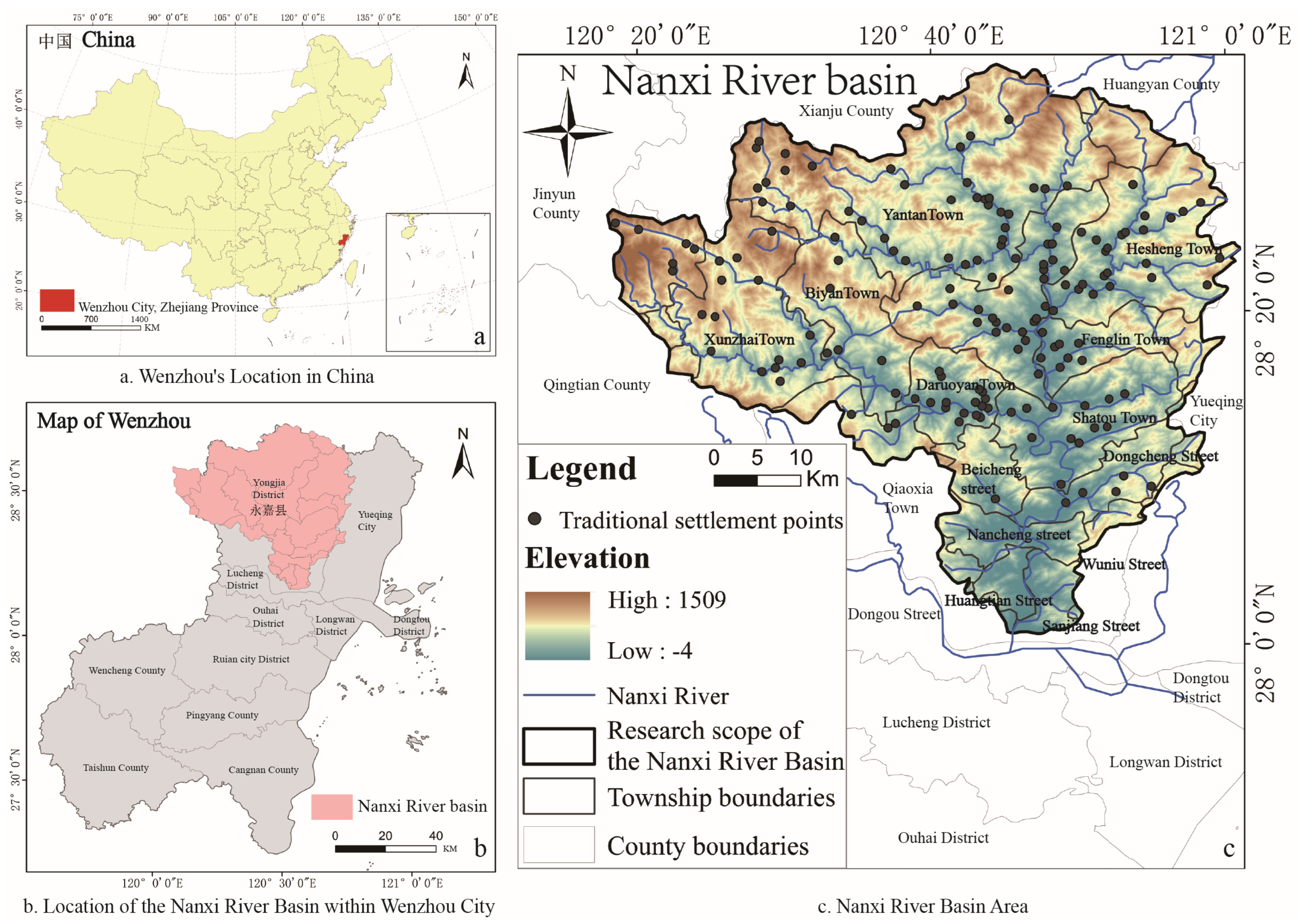
Figure 1. Study area (image source: drawn by the authors).
Buildings 15 00413 g001
Figure 2. Research path and framework (image source: drawn by the authors).
Buildings 15 00413 g002
Figure 3. Coding method description (image source: drawn by the authors).
Buildings 15 00413 g003
Figure 4. Classification and analysis of settlements in different topographies and landforms (image source: drawn by the authors).
Buildings 15 00413 g004
Figure 5. Classification analysis of settlements related to water systems (image source: drawn by the authors).
Buildings 15 00413 g005
Figure 6. Classification of settlement forms under different landforms and water systems (image source: drawn by the authors).
Buildings 15 00413 g006
Figure 7. Quantitative statistics of settlement classifications of different forms (image source: drawn by the authors).
Buildings 15 00413 g007
Figure 8. Analysis of the representative traditional settlement types and morphology in the Nanxi River Basin (image source: drawn by the authors).
Buildings 15 00413 g008
Figure 9. Research objects of similar watershed settlements (image source: drawn by the authors).
Buildings 15 00413 g009
Figure 10. Data analysis of river distance and settlement population (image source: drawn by the authors).
Buildings 15 00413 g010
Figure 11. This study has developed a GIS software platform that classifies settlement morphology. The non-English words in the picture are mainly the plaques at the entrance, which mean: Nanxi villagers celebrate the New Year; Xi men Cang slope (village entrance) (image source: drawn by the authors).
Buildings 15 00413 g011
Table 1. Methods of classifying traditional rural settlements.
Research MethodsYearResearch ObjectClassification Method or BasisLimitation
Empirical induction method2009Sernikaki, a vernacular settlement in GreeceThe use of vernacular building materials and construction techniques, and climate impacts on settlement space.It is highly regional and lacks universal theoretical application. It focuses on intuitive spatial morphological characteristics, but is easily affected by subjective judgment and has vague classification standards.
2019Manla, Manbie, and Manting villages in Xishuangbanna, Yunnan, ChinaNatural environment settlement form-building structure.
2021Vernacular architecture in CyprusMethods to enrich the protection of vernacular housing and settlement form in terms of sustainability.
2023Ancient settlements in Xiangxi, ChinaGenetic analysis methods to identify the impact of the environment on traditional Chinese natural living patterns and decode their environmental significance and cultural connotations.
2022Informal settlements in Manshiet Nasser, Cairo, EgyptEvaluation indices of building density, diversity, and accessibility.
2022The development of Hui-Chou Prefecture 800 to 1800Regional case studies over a long period of time, in-depth analysis of the complex causal relationship between settlement development and historical social culture.
Geographical classification method2016The forms of different contemporary urban spacesDifferences in the morphology of streets, urban blocks, plots, and buildings in the different historical periods of ancient settlements, modern settlements, and contemporary settlements.Failure to fully consider social, cultural, and other humanistic factors.
2023Rural settlements in Yunnan ProvinceSix terrain factors, namely elevation, slope, slope aspect, landform amplitude, incision depth, and surface roughness combined with distribution index method.
2022Tianshui City, Longzhong Loess Hilly Region, ChinaA new method for terrain gradient analysis of micro-geomorphic units.
2022Traditional rural settlement landscape in Xinjiang, ChinaAnalysis of the overall pattern of the village, street network, central landmarks, and special public spaces.
Functional classification method2017804 typical villages in Shandong Province, ChinaThe structure and spatial differentiation of multifunctional settlements reveal their formation mechanism in rural areas.It can reflect the social and economic functions of the settlements, but it often ignores the spatial form and historical and cultural background of the settlements.
2020Fengzhou Town, a typical coastal rural area in southeastern ChinaBased on the recognized “ecological production life” function in sustainable development, a unified land use classification and value evaluation system for rural land use planning and management in China was established.
20223042 administrative villages in Tai’an City, Shandong ProvinceA land use type and rural regional sub-function mapping system was established and its multifunctional type was identified through cluster analysis. Its influencing factors were quantitatively analyzed by multivariate logistic regression and its spatial structural characteristics were summarized.
2022289 villages in Datong County, Shanxi Province, ChinaThe settlement development index of population, land, economy, agricultural development, and living environment was used to divide the settlement natural living space into five settlement types.
2020Taizhou City has three county-level cities, namely Jingjiang, Taixing, and Xinghua, and three districts, namely Hailing, Gaogang, and Jiangyan, with a total of 75 towns and 17 streetsAn analytical framework was proposed to understand the impact of rural production function on the spatial distribution of rural settlements, and the binary Moran’s I method was used for quantitative analysis at the township level.
Source: statistics and compilation by the authors.
Table 2. Rural settlement classification methods using emerging analytical techniques.
Research MethodsYearResearch ObjectClassification Method or BasisLimitation
Geographic information system (GIS) and spatial analysis methods2023Urban expansion in Paphos, Cyprus, between 1993 and 2021Average population, population density, land density, fragmentation, polycentric distance, dispersed population ratio, change in population density.Depends on the accuracy of data and the rationality of the analysis model.
May lack the authenticity and variability of field surveys and mapping in detail identification.
2023177 traditional villages in Linxia Hui Autonomous Prefecture, Gansu ProvinceRatio, boundary, saturation, building density, and dispersion coefficient of settlement space form.
Remote sensing image classification method2022338 villages in Yunyang County, Hubei Province, Central ChinaIdentify and classify poor settlements using high-resolution imagery (HRI), points of interest (POI), OpenStreetMap (OSM), and digital surface model (DSM) data.The method is relatively complex, the source and descriptive analysis of indicators are relatively strict, and high data quality is required.
Principal component analysis and structural equation model2021Rural areas in SerbiaMultivariate indicators reflect the main demographic, economic, and physical geographical characteristics of rural areas in Serbia, identify the main factors for the demarcation and classification of rural and urban areas, and identify six regional types.Depends on the selected feature variables and the settings of the clustering algorithm, and has weak explanatory power.
202328 settlements in the agricultural and pastoral areas of eastern Inner Mongolia, ChinaQuantitative indicators of settlement boundary form, spatial structure, and architectural order.Depends on the accuracy of data and the rationality of the analysis model.
Source: statistics and compilation by the authors.
Table 3. Identification steps and classification standards for traditional settlements in the Nanxi River Basin.
Natural Environment Characteristics
(Only Considering Space Without Adding Functional Factors)
StepIdentification ContentCategoryDescription
Step 1Topography and landforms
(1)
Plains;
(2)
Hills;
(3)
Mountains.
(1)
Plains: 0–200 m above sea level;
(2)
Hills: 0–500 m above sea level, with a relative height (undulation) not exceeding 200 m;
(3)
Mountains: above 500 m above sea level, with a relative height (undulation) not exceeding 200 m.
Step 2Distance between settlements and water systems
(1)
Waterfront settlements;
(2)
Inland settlements (1 km and above).
The relationship between the watershed system and the daily 1 km travel distance of the settlements.
Step 3Overall form
(1)
Finger-shaped settlements with cluster-like tendencies;
(2)
Finger-shaped settlements with no clear tendency;
(3)
Finger-shaped settlements with strip-like tendencies;
(4)
Cluster-shaped settlements;
(5)
Cluster-shaped settlements with strip-like tendencies;
(6)
Strip-shaped settlements.
(1)
Aspect Ratio (λ)= L   L e n g t h L   W i d t h   ( L is the major and minor axes of the circumscribed ellipse);
(2)
Morphological Index S = P P 0 = P 1.5 λ λ + 1.5 λ A π (P is the perimeter, A is the area, λ is the aspect ratio);
(3)
Aspect ratio is λ, morphological index is S1. Boundary morphology determination: when S1 ≥ 2, λ < 1.5 denotes a finger-like settlement with clustering tendency, 1.5 ≤ λ < 2 denotes a finger-like settlement with no clear tendency, and λ ≥2 denotes a finger-like settlement with strip-like tendency; when S1 < 2, λ < 1.5 denotes a cluster-like settlement, 1.5 ≤ λ < 2 denotes a cluster-like settlement with strip-like tendency, and λ ≥ 2 denotes a strip-like settlement.
Source: statistics calculated by the authors.
Table 4. Explanation of representative analysis contents of settlement types.
No.ContentDescription
1Major categoriesAccording to the macro-geographical environment where the settlement is located, a preliminary classification is carried out to divide the overall types of settlements, laying the foundation for subsequent sub-class analysis.
2SubcategoriesCombined with the micro-features of the settlement, a detailed classification is carried out to highlight the individual differences and spatial organization characteristics of each type.
3Site selection characteristicsThe location characteristics of the settlement in the natural geographical environment are analyzed, including geographical location methods such as being close to mountains and rivers, and being close to fields and forests. At the same time, its functional characteristics are examined, such as defense, transportation, production, etc., and the interactive relationship between settlements and the environment is explored.
4Distribution locationThe relationship between settlement distribution and the spatial pattern of the Nanxi River Basin.
5Abstract mapBy refining the core spatial structure and morphological characteristics of the settlement, a simplified abstract diagram is constructed to compare the spatial patterns and common characteristics of different types of settlements.
6Sectional patternFrom the perspective of vertical space, the internal structure and hierarchical relationship of the settlement are analyzed, including the height of buildings, the height difference of roads, etc., to show the spatial organization of the settlement and its adaptability to the terrain.
7Village layoutTypical settlements are selected as the analysis object, their representative morphological characteristics are displayed, and the classification results of major categories and subcategories are combined to conduct in-depth individual analysis as an example support for type analysis.
8Representative settlement codeThe coding method is X (topography) − X (water system relationship) − X (settlement form) − Xx (settlement name).
Source: statistics calculated by the authors.
Table 5. Settlement morphology classification coding content and specific divisions.
Coding ObjectCoding Content and Specific Division
Landforms and topography
(1)
Plains;
(2)
Hills;
(3)
Mountains.
The codes are divided into (M/H/P).
Relationship with water systems
(1)
Waterfront settlements;
(2)
Inland settlements.
The codes are divided into (W/H).
Morphology (P)
(1)
Finger-shaped settlements with cluster-like tendencies;
(2)
Finger-shaped settlements with no clear tendency;
(3)
Finger-shaped settlements with strip-like tendencies;
(4)
Cluster-shaped settlements;
(5)
Cluster-shaped settlements with strip-like tendencies;
(6)
Strip-shaped settlements.
The codes are divided into (1/2/3/4/5/6).
Settlement nameThis is composed of the initials of the settlement; for example, Yubei Village is “Yb”.
Source: statistics calculated by the authors.
Table 6. Detailed description of data sources in this study.
No.ContentYearData SourcesDescription
1Rural settlement list data2023
(1)
The first to sixth batches of the “National Traditional Village List” (Ministry of Housing and Urban-Rural Development of China);
(2)
The first batch of the “Zhejiang Provincial Traditional Village List” (Zhejiang Provincial Department of Housing and Urban–Rural Development);
(3)
The first to eleventh batches of the “List of Key and General Protected Villages for the Protection and Utilization of Historical and Cultural Villages” (Zhejiang Provincial Department of Agriculture and Rural Affairs), settlements that appeared in combination with ancient settlement heritage buildings.
Overlay screening, eliminating non-compliant lists through field research
2Rural settlement preliminary list data2023The first to fourth batches of the “Yongjia County Historical Building List” (Yongjia County Natural Resources and Planning Bureau).Overlay of settlement data
3Settlement patch data20242024 Google satellite data 10 m precision satellite map combined with drone aerial photography data.Boundary morphology screening
4Administrative division data2020Administrative division vector data-administrative division (Baidu electronic map crawling).Zoning definition
5Altitude data2024DEM elevation data ASTER GDEM 30M (Geospatial Data Cloud).Altitude division and statistics
6Topography data2024Japan’s ALOS satellite data (12.5 m accuracy).Topography and geomorphology determination
7Water system data2024Provided by Yongjia County Water Conservancy Bureau.Watershed calculation
8Area data statistics2024Statistics by GIS unit area grid.Area calculation
9Representative settlement space data2024UAV aerial photography, Yongjia County Natural Resources and Planning Bureau 1:2000 topographic map data, field surveying, and exploration.Settlement surveying and mapping data
Source: statistics calculated by the authors.
Table 7. Classification results of settlement types.
Landforms and TopographyWater System RelationshipSettlement FormNumberProportion (%)SubtotalProportion (%)
PlainsWaterfront
(1)
Finger-shaped settlements with cluster-like tendencies;
127.548553.46
(2)
Finger-shaped settlements with no clear tendency;
127.54
(3)
Finger-shaped settlements with strip-like tendencies;
148.80
(4)
Cluster-shaped settlements;
53.14
(5)
Cluster-shaped settlements with strip-like tendencies;
138.18
(6)
Strip-shaped settlements.
2918.24
Inland
(1)
Finger-shaped settlements with cluster-like tendencies;
53.14148.80
(2)
Finger-shaped settlements with no clear tendency;
10.63
(3)
Finger-shaped settlements with strip-like tendencies;
00
(4)
Cluster-shaped settlements;
10.63
(5)
Cluster-shaped settlements with strip-like tendencies;
10.63
(6)
Strip-shaped settlements.
63.77
HillsWaterfront
(1)
Finger-shaped settlements with cluster-like tendencies;
42.522314.47
(2)
Finger-shaped settlements with no clear tendency;
21.26
(3)
Finger-shaped settlements with strip-like tendencies;
10.63
(4)
Cluster-shaped settlements;
10.63
(5)
Cluster-shaped settlements with strip-like tendencies;
21.26
(6)
Strip-shaped settlements.
138.18
Inland
(1)
Finger-shaped settlements with cluster-like tendencies;
21.26148.80
(2)
Finger-shaped settlements with no clear tendency;
10.63
(3)
Finger-shaped settlements with strip-like tendencies;
00
(4)
Cluster-shaped settlements;
21.26
(5)
Cluster-shaped settlements with strip-like tendencies;
31.89
(6)
Strip-shaped settlements.
63.77
MountainsWaterfront
(1)
Finger-shaped settlements with cluster-like tendencies;
10.63138.18
(2)
Finger-shaped settlements with no clear tendency;
00
(3)
Finger-shaped settlements with strip-like tendencies;
21.26
(4)
Cluster-shaped settlements;
10.63
(5)
Cluster-shaped settlements with strip-like tendencies;
53.14
(6)
Strip-shaped settlements.
42.52
Inland
(1)
Finger-shaped settlements with cluster-like tendencies;
21.26106.29
(2)
Finger-shaped settlements with no clear tendency;
21.26
(3)
Finger-shaped settlements with strip-like tendencies;
00
(4)
Cluster-shaped settlements;
10.63
(5)
Cluster-shaped settlements with strip-like tendencies;
21.26
(6)
Strip-shaped settlements.
31.89
Total159
Source: statistics calculated by the authors.
Disclaimer/Publisher’s Note: The statements, opinions and data contained in all publications are solely those of the individual author(s) and contributor(s) and not of MDPI and/or the editor(s). MDPI and/or the editor(s) disclaim responsibility for any injury to people or property resulting from any ideas, methods, instructions or products referred to in the content.