
Interpretation of the Jiangnan Landscape and Countryside (Shan-Shui) Pattern: Evidence from the Classification and Spatial Form of Traditional Settlements in the Nanxi River Basin


Abstract
1. Introduction
1.1. Research Background
1.2. Problem Statement and Objectives
2. Literature Review
2.1. Research Progress in Rural Geography
2.2. Focus on Rural Settlement Forms
2.3. Analysis Techniques for Rural Settlement Classification
2.4. Research Gaps
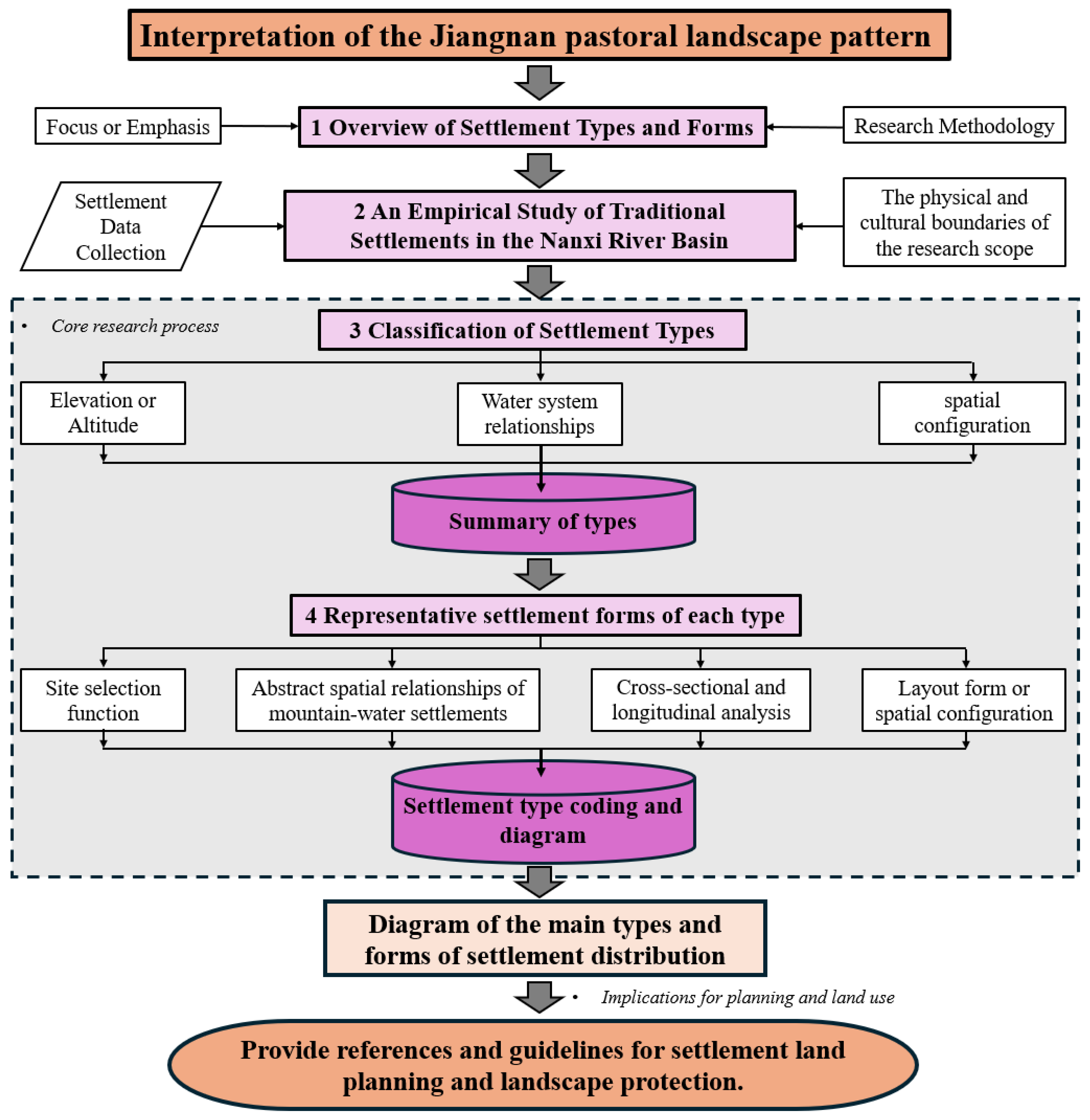
3. Research Methods and Data Sources
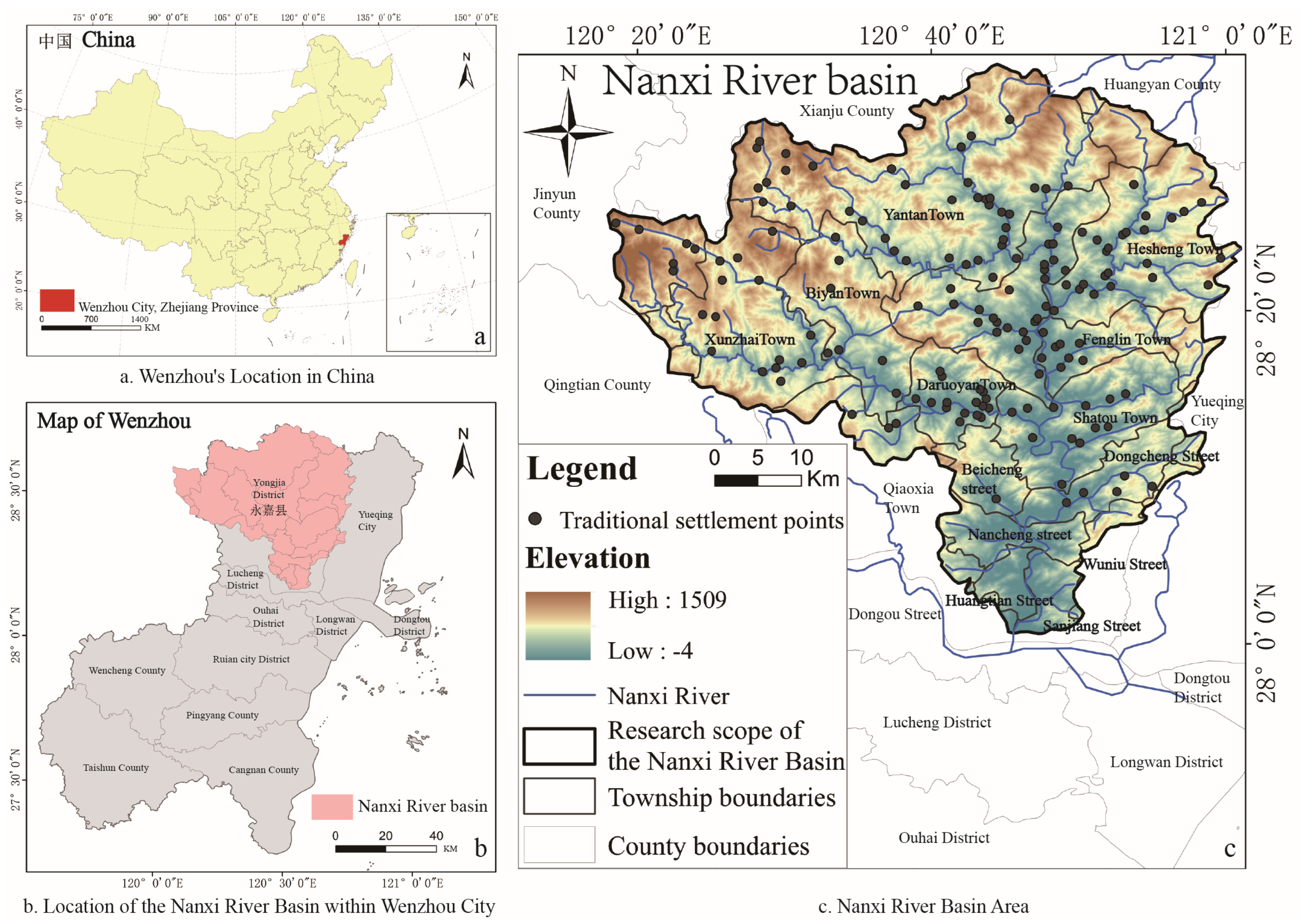
3.1. Study Area
3.2. Research Methods
3.2.1. Quantitative Classification and Characteristic Summary of Settlements
3.2.2. Analysis of Representative Types and Forms of Traditional Settlements
3.2.3. Map Expression and Coding of Settlement Morphology Types
3.3. Data Sources and Processing
3.3.1. Data Sources
3.3.2. Data Preprocessing
4. Results
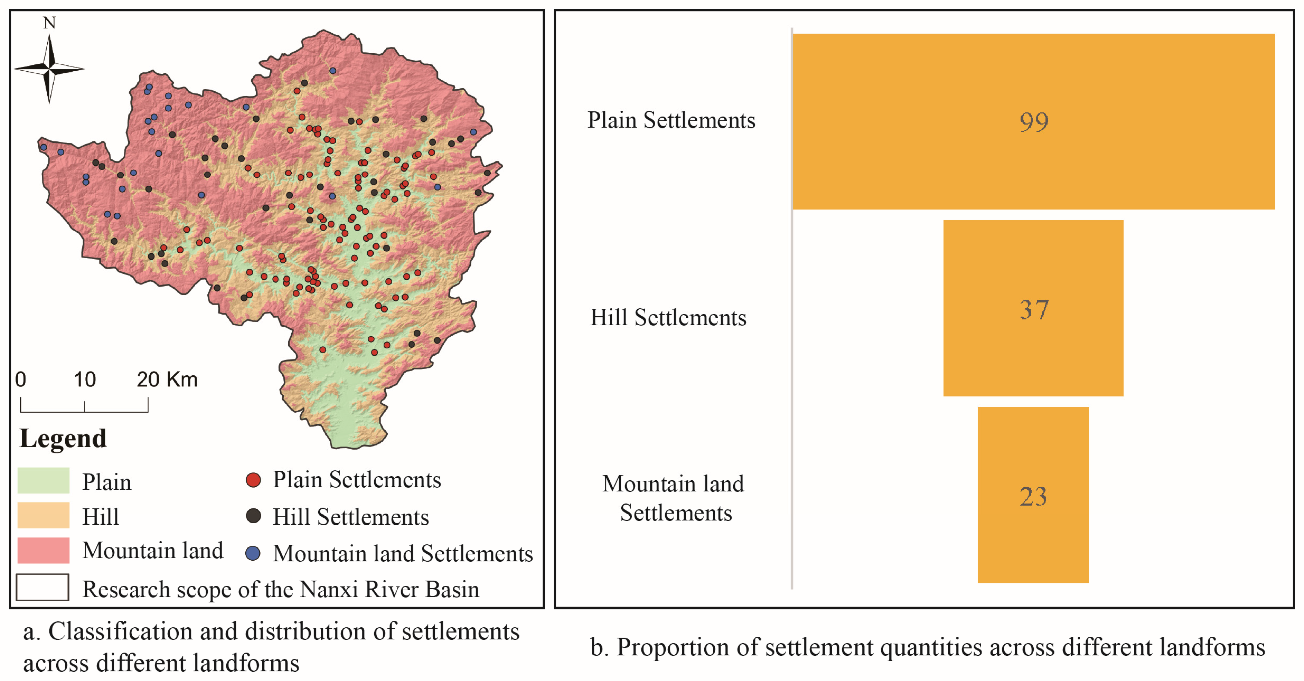
4.1. Classification of Settlement Distribution Based on Topography
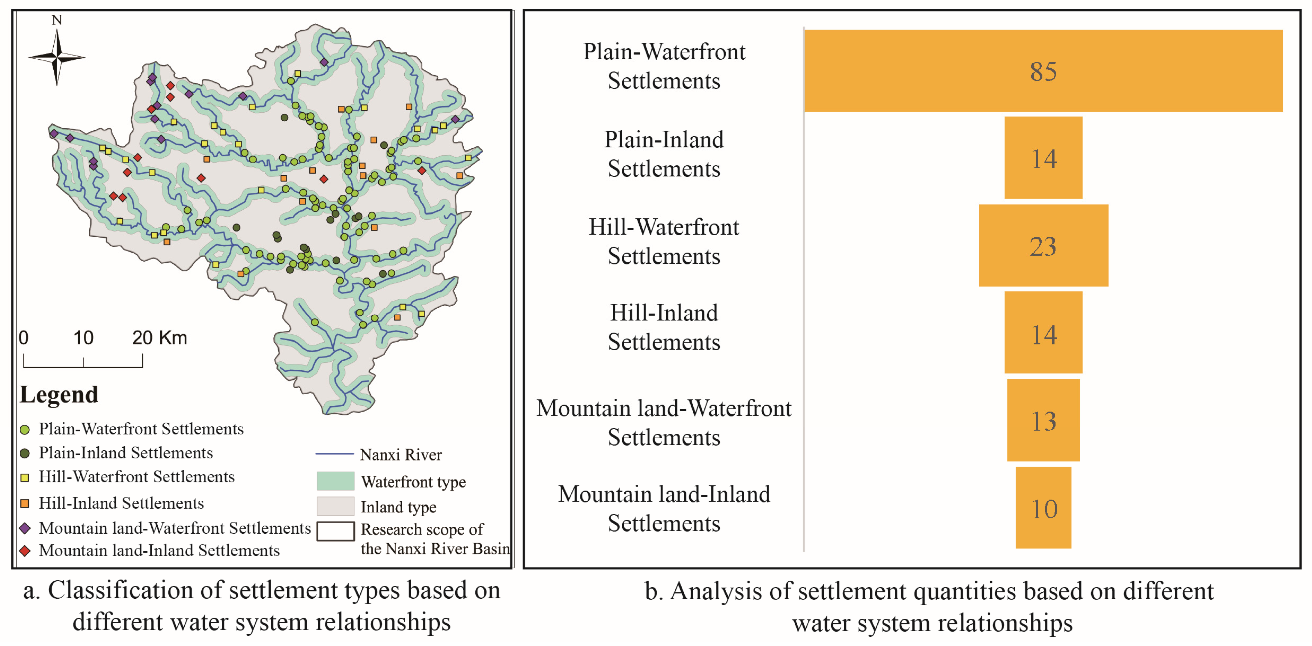
4.2. Classification of Settlement Distribution Based on Water System Relationships
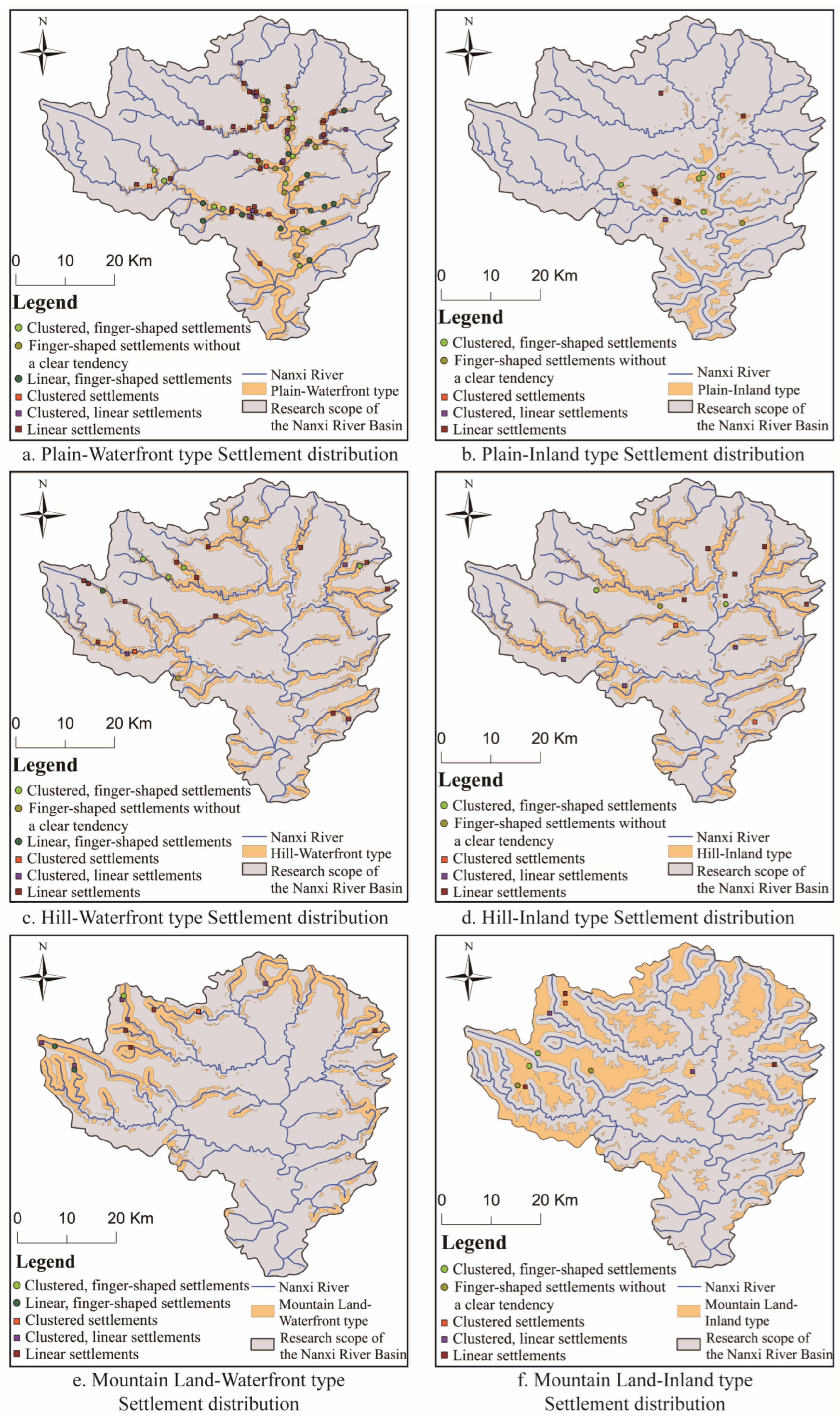
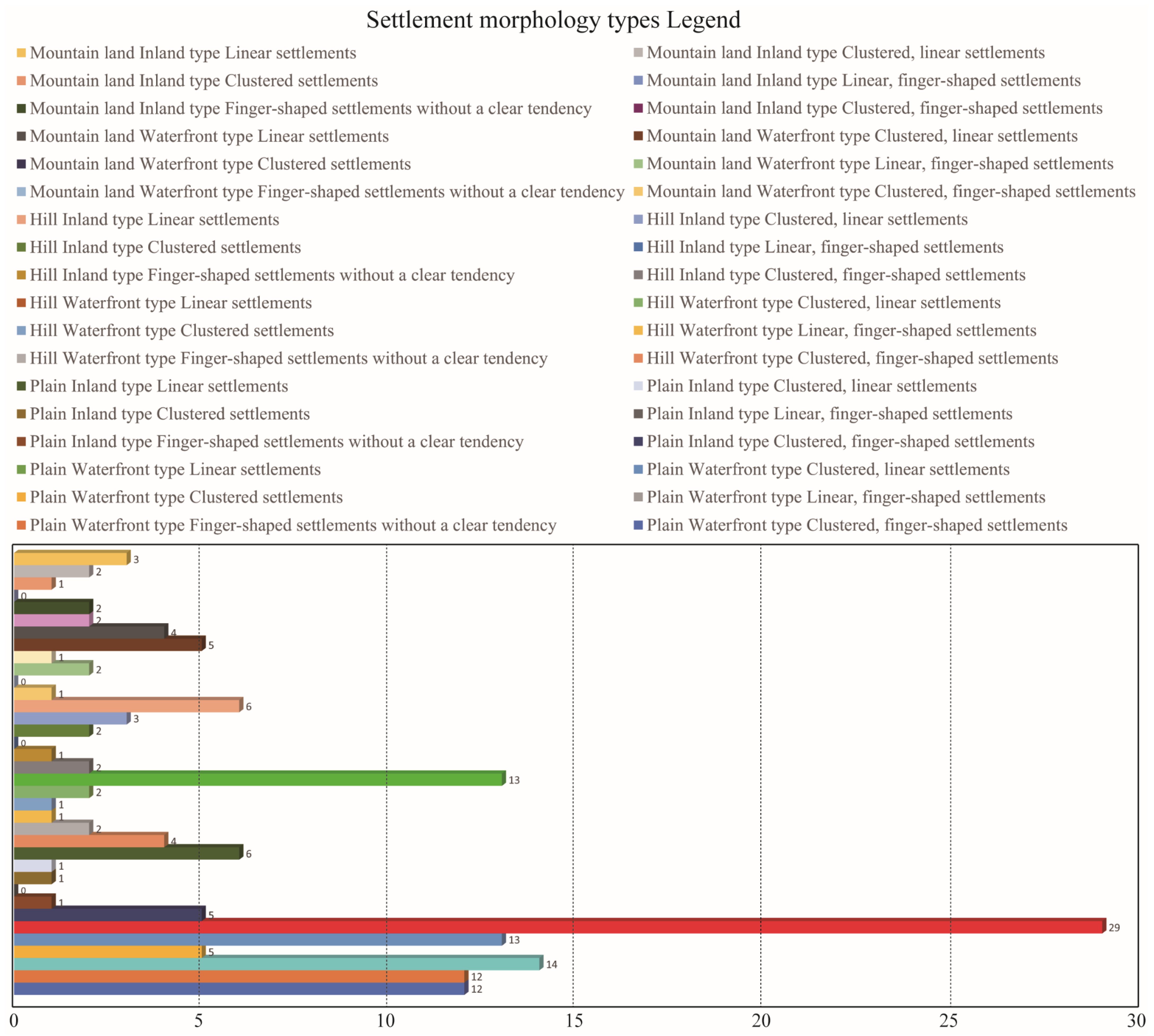
4.3. Classification of Settlement Morphology
4.4. Representative Settlement Morphological Types
4.4.1. Plain–Waterfront–Strip Settlement
4.4.2. Plain–Waterfront–Strip-Oriented Finger-Shaped Settlements
4.4.3. Plain–Waterfront–Cluster-Oriented Finger-Shaped Settlements
4.4.4. Plain–Inland–Strip Settlements
4.4.5. Hills–Waterfront–Strip Settlement
4.4.6. Clustered Settlements with Mountain–Waterfront–Strip Tendency
5. Discussion
5.1. The Universality of the Research Path of Settlement Morphology
5.2. Settlement Spatial Morphology Reveals the Characteristics of the Landscape and Countryside (Shan-Shui) Pattern in the Jiangnan Region
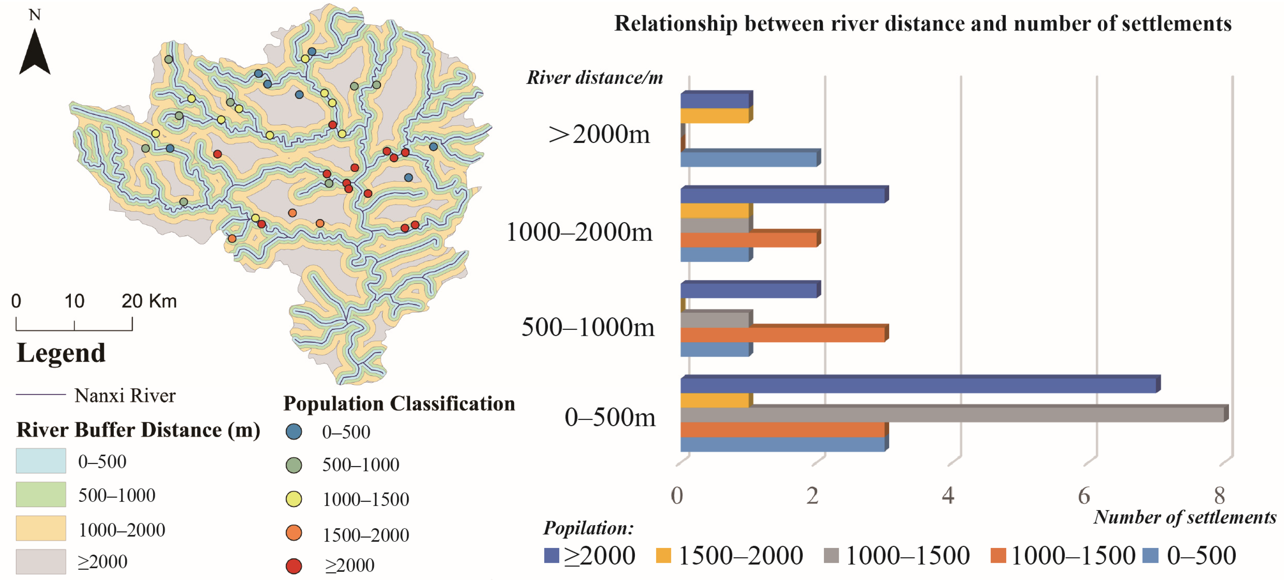
5.3. The Relationship Between the Population Size of River Settlements and the Distance to Rivers
5.4. Sustainability and Protection Strategy of Settlement Spatial Form: Settlement Type Atlas and Digital Protection Development
6. Conclusions
Author Contributions
Funding
Data Availability Statement
Conflicts of Interest
Appendix A. Boundaries and Satellite Images of Traditional Settlements in the Nanxi River Basin (154 Partial Excerpts)

| No. | Traditional Settlements | Satellite Image |
|---|---|---|
| 1 | Ma’ao Village, Zhutu Township, Yongjia County, Wenzhou City, Zhejiang Province | 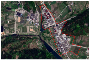 |
| 2 | Meizhong Village, Yongjia County, Wenzhou City, Zhejiang Province | 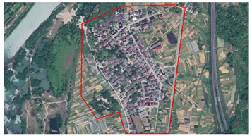 |
| 3 | Shengukeng Village, Zhangxi Township, Yongjia County, Wenzhou City, Zhejiang Province | 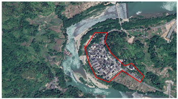 |
| 4 | Zhangxi Linkeng, Yongjia County, Wenzhou City, Zhejiang Province | 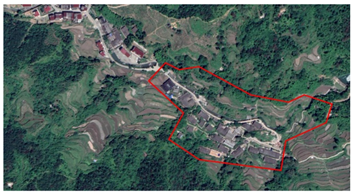 |
| 5 | Yubei Village, Yongjia County, Wenzhou City, Zhejiang Province | 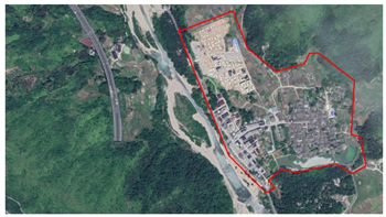 |
| 6 | Yutian Village, Yongjia County, Wenzhou City, Zhejiang Province | 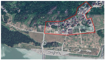 |
| 7 | Yingjiekeng Village, Yongjia County, Yongjia County, Wenzhou City, Zhejiang Province | 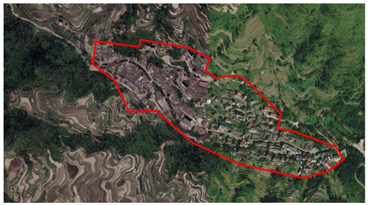 |
| 8 | Zhouzhai Village, Yantou Town, Yongjia County, Wenzhou City, Zhejiang Province |  |
| 9 | Xing’ao Village, Yantou Town, Yongjia County, Wenzhou City, Zhejiang Province | 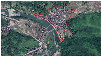 |
| 10 | Wanli Village, Yantou Town, Yongjia County, Wenzhou City, Zhejiang Province | 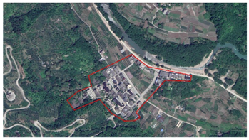 |
| 11 | Nan’an Village, Yantou Town, Yongjia County, Wenzhou City, Zhejiang Province |  |
| 12 | Fangxiang Village, Yantou Town, Yongjia County, Wenzhou City, Zhejiang Province |  |
| 13 | Dutou Village, Yantou Town, Yongjia County, Wenzhou City, Zhejiang Province | 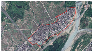 |
| 14 | Shixia Village, Biaoshan Community, Yantou Town, Yongjia County, Wenzhou City, Zhejiang Province | 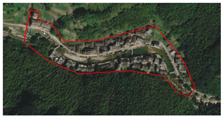 |
| 15 | Yantou Village, Yongjia County, Wenzhou City, Zhejiang Province | 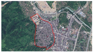 |
| 16 | Xiyi Village, Xikou Community, Yantan Town, Yongjia County, Wenzhou City, Zhejiang Province | 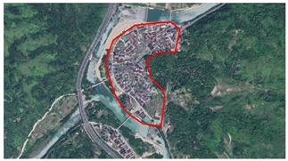 |
| 17 | Tanyi Village, Yantan Town, Yongjia County, Wenzhou City, Zhejiang Province | 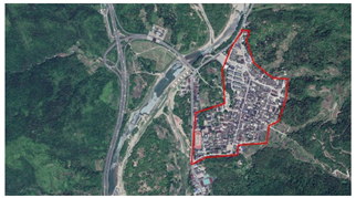 |
| 18 | Pankeng Village, Pankeng Community, Yantan Town, Yongjia County, Wenzhou City, Zhejiang Province | 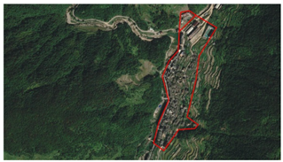 |
| 19 | Daxie Village, Yantan Town, Yongjia County, Wenzhou City, Zhejiang Province |  |
| 20 | Yanlong Village, Yongjia County, Wenzhou City, Zhejiang Province | 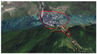 |
| 21 | Xiaer Village, Xunzhai Town, Yongjia County, Wenzhou City, Zhejiang Province |  |
| 22 | Xiaoxi Village, Xunzhai Township, Yongjia County, Wenzhou City, Zhejiang Province | 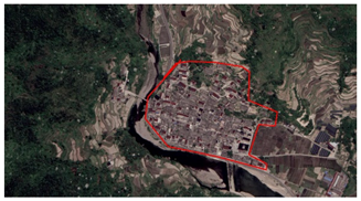 |
| 23 | Zhukeng Village, Xu’ao Township, Yongjia County, Wenzhou City, Zhejiang Province | 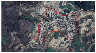 |
| 24 | Zhang’ao Village, Xu’ao Township, Yongjia County, Wenzhou City, Zhejiang Province | 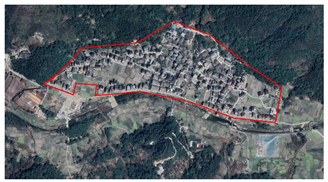 |
| 25 | Xiaozhou Village, Yongjia County, Wenzhou City, Zhejiang Province | 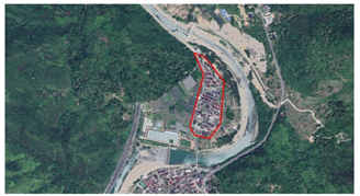 |
| 26 | Xiaochangkeng Village, Yongjia County, Wenzhou City, Zhejiang Province | 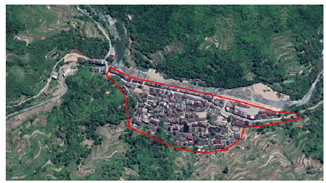 |
| 27 | Xiazhai Village, Yongjia County, Wenzhou City, Zhejiang Province | 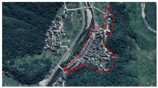 |
| 28 | Xia Richuan, Yongjia County, Wenzhou City, Zhejiang Province | 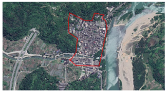 |
| 29 | Huangyi Village, Xixia Township, Yongjia County, Wenzhou City, Zhejiang Province | 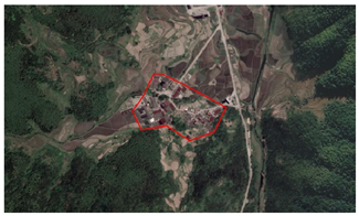 |
| 30 | Chenkeng Village, Xixia Township, Yongjia County, Wenzhou City, Zhejiang Province | 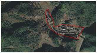 |
| 31 | Xinan Village, Yongjia County, Wenzhou City, Zhejiang Province | 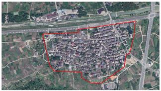 |
| 32 | Panzhai Village, Xixi Township, Yongjia County, Wenzhou City, Zhejiang Province | 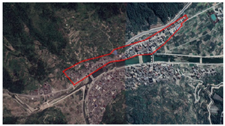 |
| 33 | Ouqu Village, Xixi Township, Yongjia County, Wenzhou City, Zhejiang Province |  |
| 34 | Weizhi Village, Xixi Township, Yongjia County, Wenzhou City, Zhejiang Province | 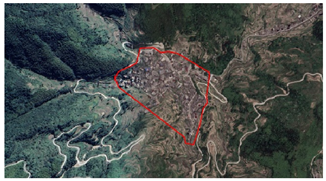 |
| 35 | Wuchi Village, Yongjia County, Wenzhou City, Zhejiang Province | 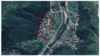 |
| 36 | Shuiyun Village, Yongjia County, Wenzhou City, Zhejiang Province |  |
| 37 | Shenlong Village, Yongjia County, Wenzhou City, Zhejiang Province |  |
| 38 | Zhikou Village, Shangtang Town, Yongjia County, Wenzhou City, Zhejiang Province |  |
| 39 | Keshiwan Village, Shangtang Town, Yongjia County, Wenzhou City, Zhejiang Province | 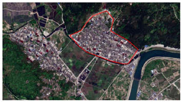 |
| 40 | Shangfan Village, Yongjia County, Wenzhou City, Zhejiang Province | 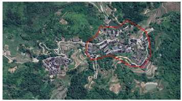 |
| 41 | Yuzhang Village, Shatou Town, Yongjia County, Wenzhou City, Zhejiang Province |  |
| 42 | Yingao Village, Shatou Town, Yongjia County, Wenzhou City, Zhejiang Province | 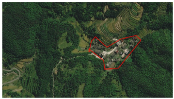 |
| 43 | Tangwan Village, Shatou Town, Yongjia County, Wenzhou City, Zhejiang Province |  |
| 44 | Taishi Village, Shatou Town, Yongjia County, Wenzhou City, Zhejiang Province | 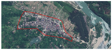 |
| 45 | Shangfang Village, Shatou Town, Yongjia County, Wenzhou City, Zhejiang Province | 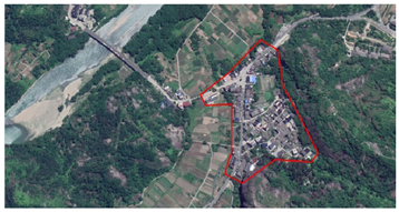 |
| 46 | Luochuan Village, Shatou Town, Yongjia County, Wenzhou City, Zhejiang Province | 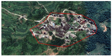 |
| 47 | Longtanxia Village, Shatou Town, Yongjia County, Wenzhou City, Zhejiang Province | 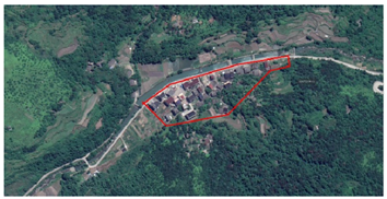 |
| 48 | Langsan Village, Shatou Town, Yongjia County, Wenzhou City, Zhejiang Province | 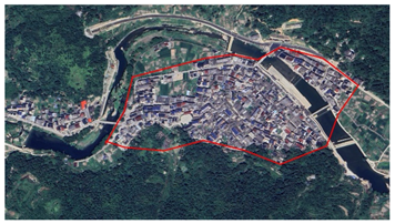 |
| 49 | Huatan Village, Shatou Town, Yongjia County, Wenzhou City, Zhejiang Province | 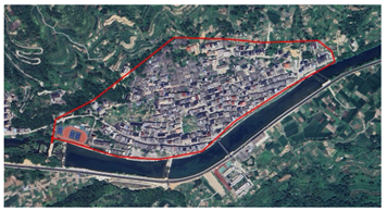 |
| 50 | Guer Village, Shatou Town, Yongjia County, Wenzhou City, Zhejiang Province | 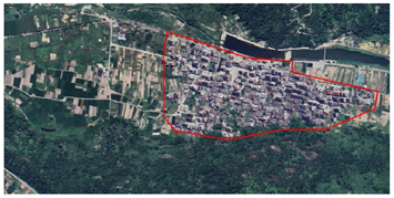 |
| 51 | Dongchuan Village, Shatou Town, Yongjia County, Wenzhou City, Zhejiang Province |  |
| 52 | Ruolong Village, Sanjiang Business District (Street), Yongjia County, Wenzhou City, Zhejiang Province | 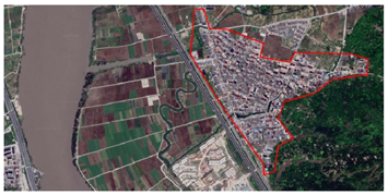 |
| 53 | Lutian Village, Sanjiang Street, Yongjia County, Wenzhou City, Zhejiang Province | 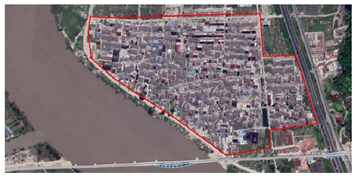 |
| 54 | Taishi Village, Qukou Township, Yongjia County, Wenzhou City, Zhejiang Province | 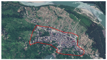 |
| 55 | Qukou Village, Qukou Township, Yongjia County, Wenzhou City, Zhejiang Province | 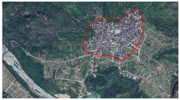 |
| 56 | Zhukeng Village, Qiaoxia Town, Yongjia County, Wenzhou City, Zhejiang Province |  |
| 57 | Xushan Village, Qiaoxia Town, Yongjia County, Wenzhou City, Zhejiang Province |  |
| 58 | Xi’an Village, Qiaoxia Town, Yongjia County, Wenzhou City, Zhejiang Province | 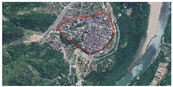 |
| 59 | Kunyang Village, Qiaoxia Town, Yongjia County, Wenzhou City, Zhejiang Province | 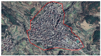 |
| 60 | Zhan’ao Village, Qiaotou Town, Yongjia County, Wenzhou City, Zhejiang Province | 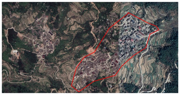 |
| 61 | Xixin Village, Qiaotou Town, Yongjia County, Wenzhou City, Zhejiang Province | 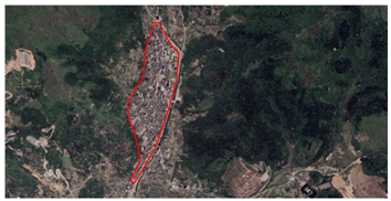 |
| 62 | Pankeng Village, Pankeng Township, Yongjia County, Wenzhou City, Zhejiang Province |  |
| 63 | Mingao Village, Yongjia County, Wenzhou City, Zhejiang Province | 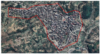 |
| 64 | Lilong Village, Yongjia County, Wenzhou City, Zhejiang Province | 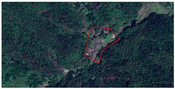 |
| 65 | Liaoyan Village, Yongjia County, Wenzhou City, Zhejiang Province | 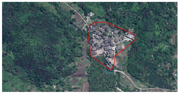 |
| 66 | Lizhuang Village, Yongjia County, Wenzhou City, Zhejiang Province | 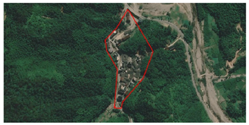 |
| 67 | Meiao Village, Jiekeng Township, Yongjia County, Wenzhou City, Zhejiang Province | 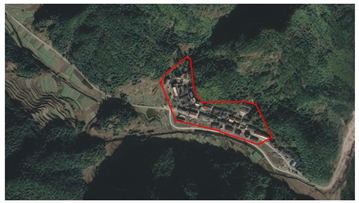 |
| 68 | Kengkou Village, Jiekeng Township, Yongjia County, Wenzhou City, Zhejiang Province | 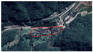 |
| 69 | Jiaxi Village, Yongjia County, Wenzhou City, Zhejiang Province |  |
| 70 | Jijiazhai, Yongjia County, Wenzhou City, Zhejiang Province | 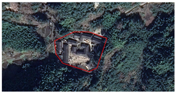 |
| 71 | Huangnan Linkeng, Yongjia County, Wenzhou City, Zhejiang Province | 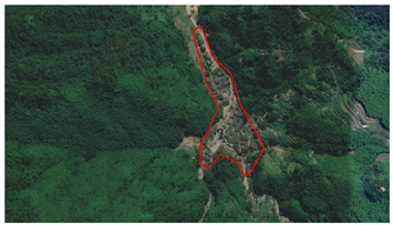 |
| 72 | Zhengyuan Village, Hesheng Town, Yongjia County, Wenzhou City, Zhejiang Province |  |
| 73 | Village, Hesheng Town, Yongjia County, Wenzhou City, Zhejiang Province | 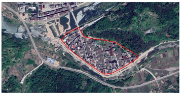 |
| 74 | Pengxi Village, Hesheng Town, Yongjia County, Wenzhou City, Zhejiang Province |  |
| 75 | Meitan Village, Hesheng Town, Yongjia County, Wenzhou City, Zhejiang Province | 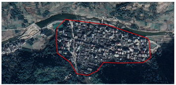 |
| 76 | Heyang Village, Hesheng Town, Yongjia County, Wenzhou City, Zhejiang Province | 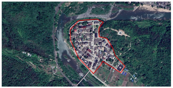 |
| 77 | Donggao Village, Hesheng Town, Yongjia County, Wenzhou City, Zhejiang Province | 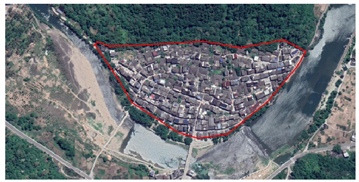 |
| 78 | Shangguang Village, Hesheng Town, Yongjia County, Wenzhou City, Zhejiang Province | 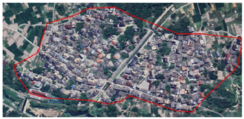 |
| 79 | Gangtou Village, Yongjia County, Wenzhou City, Zhejiang Province | 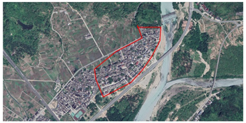 |
| 80 | Furong Village, Yongjia County, Wenzhou City, Zhejiang Province |  |
| 81 | Yangshan Village, Fenglin Town, Yongjia County, Wenzhou City, Zhejiang Province | 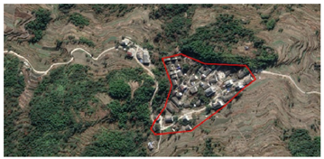 |
| 82 | Tangao Village, Fenglin Town, Yongjia County, Wenzhou City, Zhejiang Province | 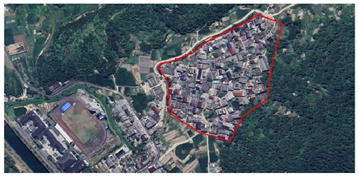 |
| 83 | Huolu Village, Fenglin Town, Yongjia County, Wenzhou City, Zhejiang Province | 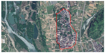 |
| 84 | Gushan Village, Fenglin Town, Yongjia County, Wenzhou City, Zhejiang Province | 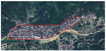 |
| 85 | Fenglin Ancient Town, Yongjia County, Wenzhou City, Zhejiang Province | 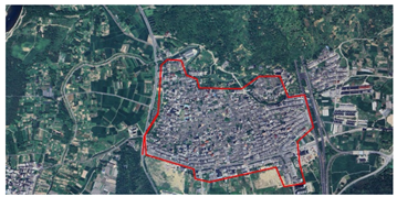 |
| 86 | Fenshui Village, Yongjia County, Wenzhou City, Zhejiang Province | 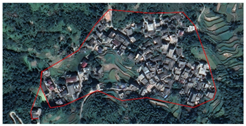 |
| 87 | Daitou Village, Yongjia County, Wenzhou City, Zhejiang Province | 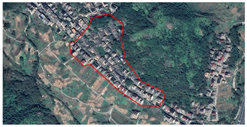 |
| 88 | Zhouao Village, Daluoyan Town, Yongjia County, Wenzhou City, Zhejiang Province |  |
| 89 | Yingkeng Village, Daluoyan Town, Yongjia County, Wenzhou City, Zhejiang Province | 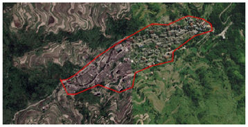 |
| 90 | Xiaoruokou Village, Daluoyan Town, Yongjia County, Wenzhou City, Zhejiang Province | 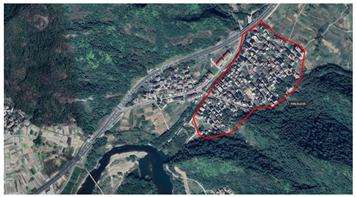 |
| 91 | Tongzhou Village, Daluoyan Town, Yongjia County, Wenzhou City, Zhejiang Province | 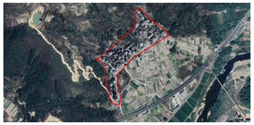 |
| 92 | Tian’an Village, Daluoyan Town, Yongjia County, Wenzhou City, Zhejiang Province | 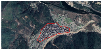 |
| 93 | Siqian Village, Daluoyan Town, Yongjia County, Wenzhou City, Zhejiang Province | 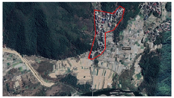 |
| 94 | Shuangao Village, Daluoyan Town, Yongjia County, Wenzhou City, Zhejiang Province | 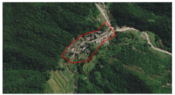 |
| 95 | Dankeng Village, Yongjia County, Wenzhou City, Zhejiang Province |  |
| 96 | Lidayu Village, Daluoyan Town, Yongjia County, Wenzhou City, Zhejiang Province | 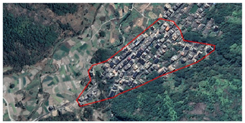 |
| 97 | Cangpo Village, Yongjia County, Wenzhou City, Zhejiang Province | 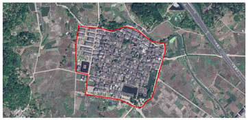 |
| 98 | Xinzhai Village, Bilian Town, Yongjia County, Wenzhou City, Zhejiang Province |  |
| 99 | Xiaoju Village, Bilian Town, Yongjia County, Wenzhou City, Zhejiang Province | 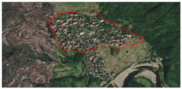 |
| 100 | South of Chengtian Village, Bilian Town, Yongjia County, Wenzhou City, Zhejiang Province | 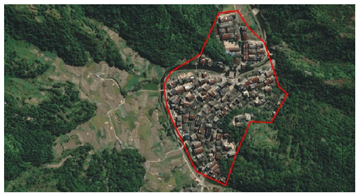 |
| 101 | Beixi Village, Bilian Town, Yongjia County, Wenzhou City, Zhejiang Province | 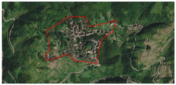 |
| 102 | Keshi Village, Beicheng Street, Yongjia County, Wenzhou City, Zhejiang Province | 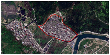 |
| 103 | Dankeng Village, Yongjia County, Wenzhou City, Zhejiang Province | 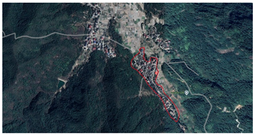 |
| 104 | Duxi Village, Yongjia County, Wenzhou City, Zhejiang Province | 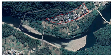 |
| 105 | Liuwan Village, Yongjia County, Wenzhou City, Zhejiang Province | 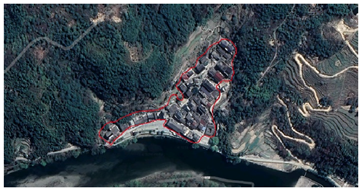 |
| 106 | Shizhu Village, Yongjia County, Wenzhou City, Zhejiang Province |  |
| 107 | Daruo Village, Yongjia County, Wenzhou City, Zhejiang Province | 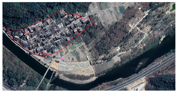 |
| 108 | Xiaoruokou Village, Yongjia County, Wenzhou City, Zhejiang Province | 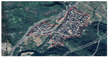 |
| 109 | Mazhuang Village, Yongjia County, Wenzhou City, Zhejiang Province |  |
| 110 | Shankeng Village, Yongjia County, Wenzhou City, Zhejiang Province | 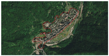 |
| 111 | Xiamei Village, Yongjia County, Wenzhou City, Zhejiang Province |  |
| 112 | Hesheng Village, Yongjia County, Wenzhou City, Zhejiang Province | 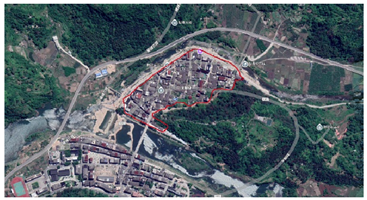 |
| 113 | Hewan Village, Yongjia County, Wenzhou City, Zhejiang Province | 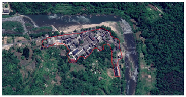 |
| 114 | Yongtan Village, Yongjia County, Wenzhou City, Zhejiang Province | 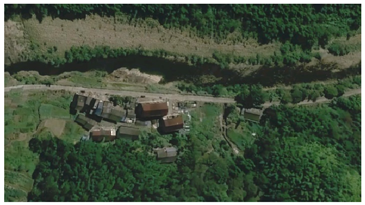 |
| 115 | Dangtou Village, Yongjia County, Wenzhou City, Zhejiang Province | 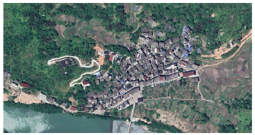 |
| 116 | Baiyan Village, Yongjia County, Wenzhou City, Zhejiang Province | 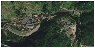 |
| 117 | Nan’an Village, Yongjia County, Wenzhou City, Zhejiang Province | 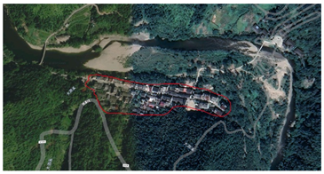 |
| 118 | Qianxi Village, Yongjia County, Wenzhou City, Zhejiang Province | 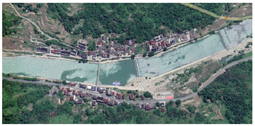 |
| 119 | Xiakeng Village, Yongjia County, Wenzhou City, Zhejiang Province |  |
| 120 | Xiyuan Village, Yongjia County, Wenzhou City, Zhejiang Province |  |
| 121 | Shankeng Village, Yongjia County, Wenzhou City, Zhejiang Province | 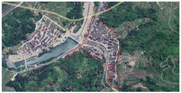 |
| 122 | Fuyou Village, Yongjia County, Wenzhou City, Zhejiang Province | 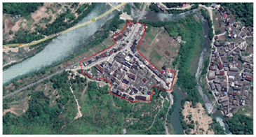 |
| 123 | Dangjing Village, Yongjia County, Wenzhou City, Zhejiang Province |  |
| 124 | Zhangxi Village, Yongjia County, Wenzhou City, Zhejiang Province |  |
| 125 | University Village, Yongjia County, Wenzhou City, Zhejiang Province | 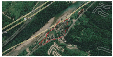 |
| 126 | Siqian Village, Yongjia County, Wenzhou City, Zhejiang Province | 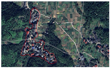 |
| 127 | Xia’an Village, Yongjia County, Wenzhou City, Zhejiang Province | 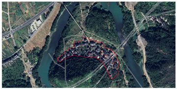 |
| 128 | Lingli Village, Yongjia County, Wenzhou City, Zhejiang Province | 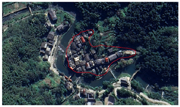 |
| 129 | Filling Village, Yongjia County, Wenzhou City, Zhejiang Province | 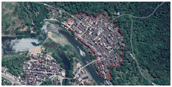 |
| 130 | Shen’ao Village, Yongjia County, Wenzhou City, Zhejiang Province | 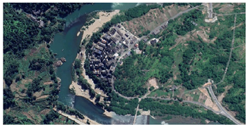 |
| 131 | Lingshang Village, Yongjia County, Wenzhou City, Zhejiang Province | 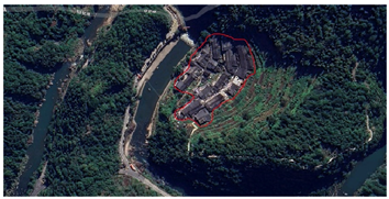 |
| 132 | Pan Er Village, Yongjia County, Wenzhou City, Zhejiang Province | 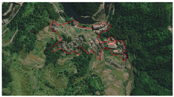 |
| 133 | Yanmen Village, Yongjia County, Wenzhou City, Zhejiang Province | 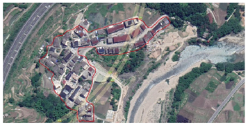 |
| 134 | Yuantou Village, Yongjia County, Wenzhou City, Zhejiang Province |  |
| 135 | Changyuan Village, Yongjia County, Wenzhou City, Zhejiang Province |  |
| 136 | Meikeng Village, Yongjia County, Wenzhou City, Zhejiang Province | 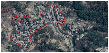 |
| 137 | Shaoyuan Village, Yongjia County, Wenzhou City, Zhejiang Province | 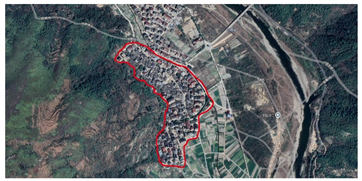 |
| 138 | Gushan Village, Yongjia County, Wenzhou City, Zhejiang Province | 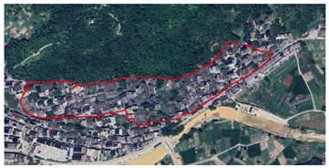 |
| 139 | Dongao Village, Yongjia County, Wenzhou City, Zhejiang Province | 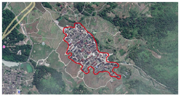 |
| 140 | Dong’an Village, Yongjia County, Wenzhou City, Zhejiang Province | 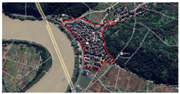 |
| 141 | Wanli Village, Yongjia County, Wenzhou City, Zhejiang Province | 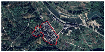 |
| 142 | Xiazhuang Village, Yongjia County, Wenzhou City, Zhejiang Province |  |
| 143 | Jingzhou Village, Yongjia County, Wenzhou City, Zhejiang Province | 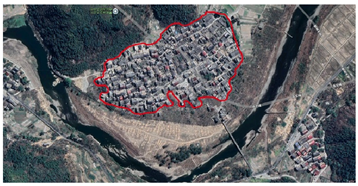 |
| 144 | Yingyi Village, Yongjia County, Wenzhou City, Zhejiang Province |  |
| 145 | Chaipi Village, Yongjia County, Wenzhou City, Zhejiang Province | 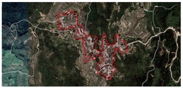 |
| 146 | Shengshan Village, Yongjia County, Wenzhou City, Zhejiang Province | 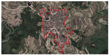 |
| 147 | Nikeng Village, Yongjia County, Wenzhou City, Zhejiang Province |  |
| 148 | Mashang Village, Yongjia County, Wenzhou City, Zhejiang Province | 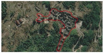 |
| 149 | Shaokeng Village, Yongjia County, Wenzhou City, Zhejiang Province |  |
| 150 | Baishini Village, Yongjia County, Wenzhou City, Zhejiang Province | 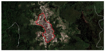 |
| 151 | Ma Village, Yongjia County, Wenzhou City, Zhejiang Province | 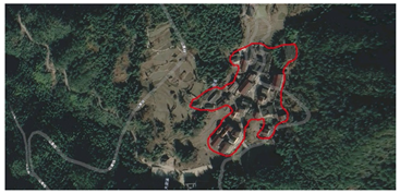 |
| 152 | Fuyuan Village, Yongjia County, Wenzhou City, Zhejiang Province | 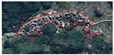 |
| 153 | Biaoshan Village, Yongjia County, Wenzhou City, Zhejiang Province |  |
| 154 | Xixia Village, Yongjia County, Wenzhou City, Zhejiang Province | 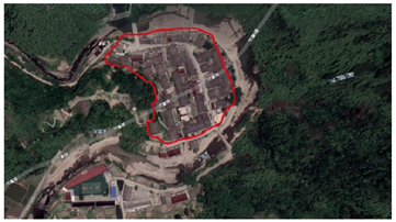 |
References
- Ji, Z.; Xu, Y.; Sun, M.; Liu, C.; Lu, L.; Huang, A.; Duan, Y.; Liu, L. Spatiotemporal characteristics and dynamic mechanism of rural settlements based on typical transects: A case study of Zhangjiakou City, China. Habitat Int. 2022, 123, 102545. [Google Scholar] [CrossRef]
- Long, H.; Liu, Y.; Li, X.; Chen, Y. Building new countryside in China: A geographical perspective. Land Use Policy 2010, 27, 457–470. [Google Scholar] [CrossRef]
- Yin, X.; Chen, J.; Li, J. Rural innovation system: Revitalize the countryside for a sustainable development. J. Rural Stud. 2022, 93, 471–478. [Google Scholar] [CrossRef]
- Zuo, Y.; Zhang, L. Research on Local Ecosystem Cultural Services in the Jiangnan Water Network Rural Areas: A Case Study of the Ecological Green Integration Demonstration Zone in the Yangtze River Delta, China. Land 2023, 12, 1373. [Google Scholar] [CrossRef]
- Buzan, B.; Lawson, G. China through the lens of modernity. Chin. J. Int. Politics 2020, 13, 187–217. [Google Scholar] [CrossRef]
- Ge, H.; Wang, Z.; Bao, Y.; Huang, Z.; Chen, X.; Wu, B.; Qiao, Y. Study on space diversity and influencing factors of Tunpu settlement in central Guizhou Province of China. Herit. Sci. 2022, 10, 85. [Google Scholar] [CrossRef]
- Śleszyński, P.; Gibas, P.; Sudra, P. The problem of mismatch between the CORINE Land Cover data classification and the development of settlement in Poland. Remote Sens. 2020, 12, 2253. [Google Scholar] [CrossRef]
- Carta, M.; Gisotti, M.R.; Lucchesi, F. Settlements and urban morphological quality in landscape planning–analytical models and regulating tools in the landscape plan of regione toscana. Sustainability 2022, 14, 1851. [Google Scholar] [CrossRef]
- Gkartzios, M.; Gallent, N.; Scott, M. A capitals framework for rural areas: ‘Place-planning’ the global countryside. Habitat Int. 2022, 127, 102625. [Google Scholar] [CrossRef]
- Hu, Z.; Josef, S.; Min, Q.; Tan, M.; Cheng, F. Visualizing the cultural landscape gene of traditional settlements in China: A semiotic perspective. Herit. Sci. 2021, 9, 115. [Google Scholar] [CrossRef]
- McCarthy, J. Rural geography: Globalizing the countryside. Prog. Hum. Geogr. 2008, 32, 129–137. [Google Scholar] [CrossRef]
- Roche, M. Rural geography: Searching rural geographies. Prog. Hum. Geogr. 2002, 26, 823–829. [Google Scholar] [CrossRef]
- Baker, S. Paul Vidal de la Blache. Geogr. Biobibliograph. Stud. 2015, 12, 189. Available online: https://www.torrossa.com/en/resources/an/5205428#page=203 (accessed on 9 November 2024).
- Nelson, L. Geographical perspectives on development studies. In Oxford Research Encyclopedia of International Studies; Oxford University Press (OUP): Oxford, UK, 2010. [Google Scholar] [CrossRef]
- Preston, R.E. Christaller’s research on the geography of administrative areas. Prog. Hum. Geogr. 1992, 16, 523–539. [Google Scholar] [CrossRef]
- Rösslør, M. Applied geography and area research in Nazi Society; central place theory and planning, 1933 to 1945. Environ. Plan. D Soc. Space 1989, 7, 419–431. [Google Scholar] [CrossRef]
- Irwin, E.G.; Isserman, A.M.; Kilkenny, M.; Partridge, M.D. A century of research on rural development and regional issues. Am. J. Agric. Econ. 2010, 92, 522–553. [Google Scholar] [CrossRef]
- Woods, M. Rural geography: Processes, responses and experiences in rural restructuring. Rural. Geogr. 2004, 1–352. Available online: https://www.torrossa.com/en/resources/an/5019319 (accessed on 5 November 2024).
- Mackay, M.D.; Perkins, H.C.; Espiner, S.R. The Study of Rural Change from a Social Scientific Perspective: A Literature Review and Annotated Bibliography. 2009. Available online: https://hdl.handle.net/10182/1132 (accessed on 2 November 2024).
- Kosiba, S.; Bauer, A.M. Mapping the political landscape: Toward a GIS analysis of environmental and social difference. J. Archaeol. Method Theory 2013, 20, 61–101. [Google Scholar] [CrossRef]
- Lorimer, J. Multinatural geographies for the Anthropocene. Prog. Hum. Geogr. 2012, 36, 593–612. [Google Scholar] [CrossRef]
- Fu, B.; Tian, T.; Liu, Y.; Zhao, W. New developments and perspectives in physical geography in China. Chin. Geogr. Sci. 2019, 29, 363–371. [Google Scholar] [CrossRef]
- Long, H.; Liu, Y.; Wu, X.; Dong, G. Spatio-temporal dynamic patterns of farmland and rural settlements in Su–Xi–Chang region: Implications for building a new countryside in coastal China. Land Use Policy 2009, 26, 322–333. [Google Scholar] [CrossRef]
- Antrop, M. Landscape change and the urbanization process in Europe. Landsc. Urban Plan. 2004, 67, 9–26. [Google Scholar] [CrossRef]
- De Block, G. Ecological infrastructure in a critical-historical perspective: From engineering ‘social’ territory to encoding ‘natural’ topography. Environ. Plan. A 2016, 48, 367–390. [Google Scholar] [CrossRef]
- Yavan, N.; Anli, C.K. (un) making human geography in Turkey under the dominance of environmental determinism. Posseible 2018, 13, 77–98. [Google Scholar] [CrossRef]
- Bassin, M. Geographical determinism in Fin-de-siècle Marxism: Georgii Plekhanov and the environmental basis of Russian history. Ann. Assoc. Am. Geogr. 1992, 82, 3–22. [Google Scholar] [CrossRef]
- Williamson, T. Environment, Society and Landscape in Early Medieval England: Time and Topography; Boydell & Brewer, 2015; Volume 19, Available online: https://boydellandbrewer.com/ (accessed on 2 November 2024).
- Crane, T.A. Of models and meanings: Cultural resilience in social–ecological. Ecol. Soc. 2010, 15. Available online: https://www.jstor.org/stable/26268225 (accessed on 7 November 2024). [CrossRef]
- Wang, R.; Li, F.; Hu, D.; Li, B.L. Understanding eco-complexity: Social-economic-natural complex ecosystem approach. Ecol. Complex. 2011, 8, 15–29. [Google Scholar] [CrossRef]
- Anas, A.; Arnott, R.; Small, K.A. Urban spatial structure. J. Econ. Lit. 1998, 36, 1426–1464. Available online: https://www.jstor.org/stable/2564805 (accessed on 2 November 2024).
- Lawrence, D.L.; Low, S.M. The built environment and spatial form. Annu. Rev. Anthropol. 1990, 453–505. Available online: https://www.jstor.org/stable/2155973 (accessed on 9 November 2024). [CrossRef]
- Nguluma, H. Housing Themselves: Transformations, Modernisation and Spatial Qualities in Informal Settlements in Dar es Salaam, Tanzania. Infrastruktur. 2003. Available online: https://www.diva-portal.org/smash/record.jsf?pid=diva2%3A9299&dswid=-6443 (accessed on 4 November 2024).
- Vardopoulos, I.; Ioannides, S.; Georgiou, M.; Voukkali, I.; Salvati, L.; Doukas, Y.E. Shaping sustainable cities: A long-term GIS-emanated spatial analysis of settlement growth and planning in a coastal Mediterranean European city. Sustainability 2023, 15, 11202. [Google Scholar] [CrossRef]
- An, Y.; Wu, X.; Liu, R.; Liu, L.; Liu, P. Quantitative Analysis Village Spatial Morphology Using “SPSS+ GIS” Approach: A Case Study of Linxia Hui Autonomous Prefecture. Sustainability 2023, 15, 16828. [Google Scholar] [CrossRef]
- Hu, S.; Ge, Y.; Liu, M.; Ren, Z.; Zhang, X. Village-level poverty identification using machine learning, high-resolution images, and geospatial data. Int. J. Appl. Earth Obs. Geoinf. 2022, 107, 102694. [Google Scholar] [CrossRef]
- Gajić, A.; Krunić, N.; Protić, B. Classification of rural areas in Serbia: Framework and implications for spatial planning. Sustainability 2021, 13, 1596. [Google Scholar] [CrossRef]
- Xu, H.; Guo, Q.; Siqin, C.; Li, Y.; Gao, F. Study of Settlement Patterns in Farming–Pastoral Zones in Eastern Inner Mongolia Using Planar Quantization and Cluster Analysis. Sustainability 2023, 15, 15077. [Google Scholar] [CrossRef]
- Bai, R.; Shi, Y.; Pan, Y. Land-use classifying and identification of the production-living-ecological space of island villages—A case study of islands in the western sea area of Guangdong province. Land 2022, 11, 705. [Google Scholar] [CrossRef]
- Chen, L.; Yingmei, W.; Binpin, G.; Yan, W.; Kejun, Z.; Chan, L. Spatial differentiation and driving factors of rural settlement in plateau lake: A case study of the area around the Erhai. Econ. Geogr. 2022, 42, 220–229. [Google Scholar] [CrossRef]
- Fu, J.; Zhou, J.; Deng, Y. Heritage values of ancient vernacular residences in traditional villages in Western Hunan, China: Spatial patterns and influencing factors. Build. Environ. 2021, 188, 107473. [Google Scholar] [CrossRef]
- Rodwin, L. Shelter, Settlement & Development; Taylor & Francis: London, UK, 2022. [Google Scholar] [CrossRef]
- Griffiths, S.; Vaughan, L. Mapping spatial cultures: Contributions of space syntax to research in the urban history of the nineteenth-century city. Urban Hist. 2020, 47, 488–511. [Google Scholar] [CrossRef]
- Parcero-Oubiña, C.; Nión-Álvarez, S. Forms of settlement inequality over space. A GIS-based method for measuring differences among settlements. J. Archaeol. Sci. Rep. 2021, 35, 102739. [Google Scholar] [CrossRef]


| Research Methods | Year | Research Object | Classification Method or Basis | Limitation |
|---|---|---|---|---|
| Empirical induction method | 2009 | Sernikaki, a vernacular settlement in Greece | The use of vernacular building materials and construction techniques, and climate impacts on settlement space. | It is highly regional and lacks universal theoretical application. It focuses on intuitive spatial morphological characteristics, but is easily affected by subjective judgment and has vague classification standards. |
| 2019 | Manla, Manbie, and Manting villages in Xishuangbanna, Yunnan, China | Natural environment settlement form-building structure. | ||
| 2021 | Vernacular architecture in Cyprus | Methods to enrich the protection of vernacular housing and settlement form in terms of sustainability. | ||
| 2023 | Ancient settlements in Xiangxi, China | Genetic analysis methods to identify the impact of the environment on traditional Chinese natural living patterns and decode their environmental significance and cultural connotations. | ||
| 2022 | Informal settlements in Manshiet Nasser, Cairo, Egypt | Evaluation indices of building density, diversity, and accessibility. | ||
| 2022 | The development of Hui-Chou Prefecture 800 to 1800 | Regional case studies over a long period of time, in-depth analysis of the complex causal relationship between settlement development and historical social culture. | ||
| Geographical classification method | 2016 | The forms of different contemporary urban spaces | Differences in the morphology of streets, urban blocks, plots, and buildings in the different historical periods of ancient settlements, modern settlements, and contemporary settlements. | Failure to fully consider social, cultural, and other humanistic factors. |
| 2023 | Rural settlements in Yunnan Province | Six terrain factors, namely elevation, slope, slope aspect, landform amplitude, incision depth, and surface roughness combined with distribution index method. | ||
| 2022 | Tianshui City, Longzhong Loess Hilly Region, China | A new method for terrain gradient analysis of micro-geomorphic units. | ||
| 2022 | Traditional rural settlement landscape in Xinjiang, China | Analysis of the overall pattern of the village, street network, central landmarks, and special public spaces. | ||
| Functional classification method | 2017 | 804 typical villages in Shandong Province, China | The structure and spatial differentiation of multifunctional settlements reveal their formation mechanism in rural areas. | It can reflect the social and economic functions of the settlements, but it often ignores the spatial form and historical and cultural background of the settlements. |
| 2020 | Fengzhou Town, a typical coastal rural area in southeastern China | Based on the recognized “ecological production life” function in sustainable development, a unified land use classification and value evaluation system for rural land use planning and management in China was established. | ||
| 2022 | 3042 administrative villages in Tai’an City, Shandong Province | A land use type and rural regional sub-function mapping system was established and its multifunctional type was identified through cluster analysis. Its influencing factors were quantitatively analyzed by multivariate logistic regression and its spatial structural characteristics were summarized. | ||
| 2022 | 289 villages in Datong County, Shanxi Province, China | The settlement development index of population, land, economy, agricultural development, and living environment was used to divide the settlement natural living space into five settlement types. | ||
| 2020 | Taizhou City has three county-level cities, namely Jingjiang, Taixing, and Xinghua, and three districts, namely Hailing, Gaogang, and Jiangyan, with a total of 75 towns and 17 streets | An analytical framework was proposed to understand the impact of rural production function on the spatial distribution of rural settlements, and the binary Moran’s I method was used for quantitative analysis at the township level. |
| Research Methods | Year | Research Object | Classification Method or Basis | Limitation |
|---|---|---|---|---|
| Geographic information system (GIS) and spatial analysis methods | 2023 | Urban expansion in Paphos, Cyprus, between 1993 and 2021 | Average population, population density, land density, fragmentation, polycentric distance, dispersed population ratio, change in population density. | Depends on the accuracy of data and the rationality of the analysis model. May lack the authenticity and variability of field surveys and mapping in detail identification. |
| 2023 | 177 traditional villages in Linxia Hui Autonomous Prefecture, Gansu Province | Ratio, boundary, saturation, building density, and dispersion coefficient of settlement space form. | ||
| Remote sensing image classification method | 2022 | 338 villages in Yunyang County, Hubei Province, Central China | Identify and classify poor settlements using high-resolution imagery (HRI), points of interest (POI), OpenStreetMap (OSM), and digital surface model (DSM) data. | The method is relatively complex, the source and descriptive analysis of indicators are relatively strict, and high data quality is required. |
| Principal component analysis and structural equation model | 2021 | Rural areas in Serbia | Multivariate indicators reflect the main demographic, economic, and physical geographical characteristics of rural areas in Serbia, identify the main factors for the demarcation and classification of rural and urban areas, and identify six regional types. | Depends on the selected feature variables and the settings of the clustering algorithm, and has weak explanatory power. |
| 2023 | 28 settlements in the agricultural and pastoral areas of eastern Inner Mongolia, China | Quantitative indicators of settlement boundary form, spatial structure, and architectural order. | Depends on the accuracy of data and the rationality of the analysis model. |
| Natural Environment Characteristics (Only Considering Space Without Adding Functional Factors) | |||
|---|---|---|---|
| Step | Identification Content | Category | Description |
| Step 1 | Topography and landforms |
|
|
| Step 2 | Distance between settlements and water systems |
| The relationship between the watershed system and the daily 1 km travel distance of the settlements. |
| Step 3 | Overall form |
|
|
| No. | Content | Description |
|---|---|---|
| 1 | Major categories | According to the macro-geographical environment where the settlement is located, a preliminary classification is carried out to divide the overall types of settlements, laying the foundation for subsequent sub-class analysis. |
| 2 | Subcategories | Combined with the micro-features of the settlement, a detailed classification is carried out to highlight the individual differences and spatial organization characteristics of each type. |
| 3 | Site selection characteristics | The location characteristics of the settlement in the natural geographical environment are analyzed, including geographical location methods such as being close to mountains and rivers, and being close to fields and forests. At the same time, its functional characteristics are examined, such as defense, transportation, production, etc., and the interactive relationship between settlements and the environment is explored. |
| 4 | Distribution location | The relationship between settlement distribution and the spatial pattern of the Nanxi River Basin. |
| 5 | Abstract map | By refining the core spatial structure and morphological characteristics of the settlement, a simplified abstract diagram is constructed to compare the spatial patterns and common characteristics of different types of settlements. |
| 6 | Sectional pattern | From the perspective of vertical space, the internal structure and hierarchical relationship of the settlement are analyzed, including the height of buildings, the height difference of roads, etc., to show the spatial organization of the settlement and its adaptability to the terrain. |
| 7 | Village layout | Typical settlements are selected as the analysis object, their representative morphological characteristics are displayed, and the classification results of major categories and subcategories are combined to conduct in-depth individual analysis as an example support for type analysis. |
| 8 | Representative settlement code | The coding method is X (topography) − X (water system relationship) − X (settlement form) − Xx (settlement name). |
| Coding Object | Coding Content and Specific Division |
|---|---|
| Landforms and topography |
|
| Relationship with water systems |
|
| Morphology (P) |
|
| Settlement name | This is composed of the initials of the settlement; for example, Yubei Village is “Yb”. |
| No. | Content | Year | Data Sources | Description |
|---|---|---|---|---|
| 1 | Rural settlement list data | 2023 |
| Overlay screening, eliminating non-compliant lists through field research |
| 2 | Rural settlement preliminary list data | 2023 | The first to fourth batches of the “Yongjia County Historical Building List” (Yongjia County Natural Resources and Planning Bureau). | Overlay of settlement data |
| 3 | Settlement patch data | 2024 | 2024 Google satellite data 10 m precision satellite map combined with drone aerial photography data. | Boundary morphology screening |
| 4 | Administrative division data | 2020 | Administrative division vector data-administrative division (Baidu electronic map crawling). | Zoning definition |
| 5 | Altitude data | 2024 | DEM elevation data ASTER GDEM 30M (Geospatial Data Cloud). | Altitude division and statistics |
| 6 | Topography data | 2024 | Japan’s ALOS satellite data (12.5 m accuracy). | Topography and geomorphology determination |
| 7 | Water system data | 2024 | Provided by Yongjia County Water Conservancy Bureau. | Watershed calculation |
| 8 | Area data statistics | 2024 | Statistics by GIS unit area grid. | Area calculation |
| 9 | Representative settlement space data | 2024 | UAV aerial photography, Yongjia County Natural Resources and Planning Bureau 1:2000 topographic map data, field surveying, and exploration. | Settlement surveying and mapping data |
| Landforms and Topography | Water System Relationship | Settlement Form | Number | Proportion (%) | Subtotal | Proportion (%) |
|---|---|---|---|---|---|---|
| Plains | Waterfront |
| 12 | 7.54 | 85 | 53.46 |
| 12 | 7.54 | ||||
| 14 | 8.80 | ||||
| 5 | 3.14 | ||||
| 13 | 8.18 | ||||
| 29 | 18.24 | ||||
| Inland |
| 5 | 3.14 | 14 | 8.80 | |
| 1 | 0.63 | ||||
| 0 | 0 | ||||
| 1 | 0.63 | ||||
| 1 | 0.63 | ||||
| 6 | 3.77 | ||||
| Hills | Waterfront |
| 4 | 2.52 | 23 | 14.47 |
| 2 | 1.26 | ||||
| 1 | 0.63 | ||||
| 1 | 0.63 | ||||
| 2 | 1.26 | ||||
| 13 | 8.18 | ||||
| Inland |
| 2 | 1.26 | 14 | 8.80 | |
| 1 | 0.63 | ||||
| 0 | 0 | ||||
| 2 | 1.26 | ||||
| 3 | 1.89 | ||||
| 6 | 3.77 | ||||
| Mountains | Waterfront |
| 1 | 0.63 | 13 | 8.18 |
| 0 | 0 | ||||
| 2 | 1.26 | ||||
| 1 | 0.63 | ||||
| 5 | 3.14 | ||||
| 4 | 2.52 | ||||
| Inland |
| 2 | 1.26 | 10 | 6.29 | |
| 2 | 1.26 | ||||
| 0 | 0 | ||||
| 1 | 0.63 | ||||
| 2 | 1.26 | ||||
| 3 | 1.89 | ||||
| Total | 159 | |||||
Disclaimer/Publisher’s Note: The statements, opinions and data contained in all publications are solely those of the individual author(s) and contributor(s) and not of MDPI and/or the editor(s). MDPI and/or the editor(s) disclaim responsibility for any injury to people or property resulting from any ideas, methods, instructions or products referred to in the content. |
© 2025 by the authors. Licensee MDPI, Basel, Switzerland. This article is an open access article distributed under the terms and conditions of the Creative Commons Attribution (CC BY) license (https://creativecommons.org/licenses/by/4.0/).
Share and Cite
Huang, Y.; Huang, Y.; Chen, Y.; Yan, Y.; Zheng, L.; Ying, Z. Interpretation of the Jiangnan Landscape and Countryside (Shan-Shui) Pattern: Evidence from the Classification and Spatial Form of Traditional Settlements in the Nanxi River Basin. Buildings 2025, 15, 413. https://doi.org/10.3390/buildings15030413
Huang Y, Huang Y, Chen Y, Yan Y, Zheng L, Ying Z. Interpretation of the Jiangnan Landscape and Countryside (Shan-Shui) Pattern: Evidence from the Classification and Spatial Form of Traditional Settlements in the Nanxi River Basin. Buildings. 2025; 15(3):413. https://doi.org/10.3390/buildings15030413
Chicago/Turabian StyleHuang, Yuhao, Yingying Huang, Yile Chen, Yu Yan, Liang Zheng, and Ziyi Ying. 2025. "Interpretation of the Jiangnan Landscape and Countryside (Shan-Shui) Pattern: Evidence from the Classification and Spatial Form of Traditional Settlements in the Nanxi River Basin" Buildings 15, no. 3: 413. https://doi.org/10.3390/buildings15030413
APA StyleHuang, Y., Huang, Y., Chen, Y., Yan, Y., Zheng, L., & Ying, Z. (2025). Interpretation of the Jiangnan Landscape and Countryside (Shan-Shui) Pattern: Evidence from the Classification and Spatial Form of Traditional Settlements in the Nanxi River Basin. Buildings, 15(3), 413. https://doi.org/10.3390/buildings15030413