Article

Landslide Susceptibility Mapping Using the Slope Unit for Southeastern Helong City, Jilin Province, China: A Comparison of ANN and SVM

1
College of Construction Engineering, Jilin University, Changchun 130026, China
2
Jilin Team of Geological Survey Center of China Building Materials Industrial, Changchun 130026, China
*
Author to whom correspondence should be addressed.
Symmetry 2020, 12(6), 1047; https://doi.org/10.3390/sym12061047
Submission received: 1 June 2020 / Revised: 19 June 2020 / Accepted: 21 June 2020 / Published: 23 June 2020

Abstract

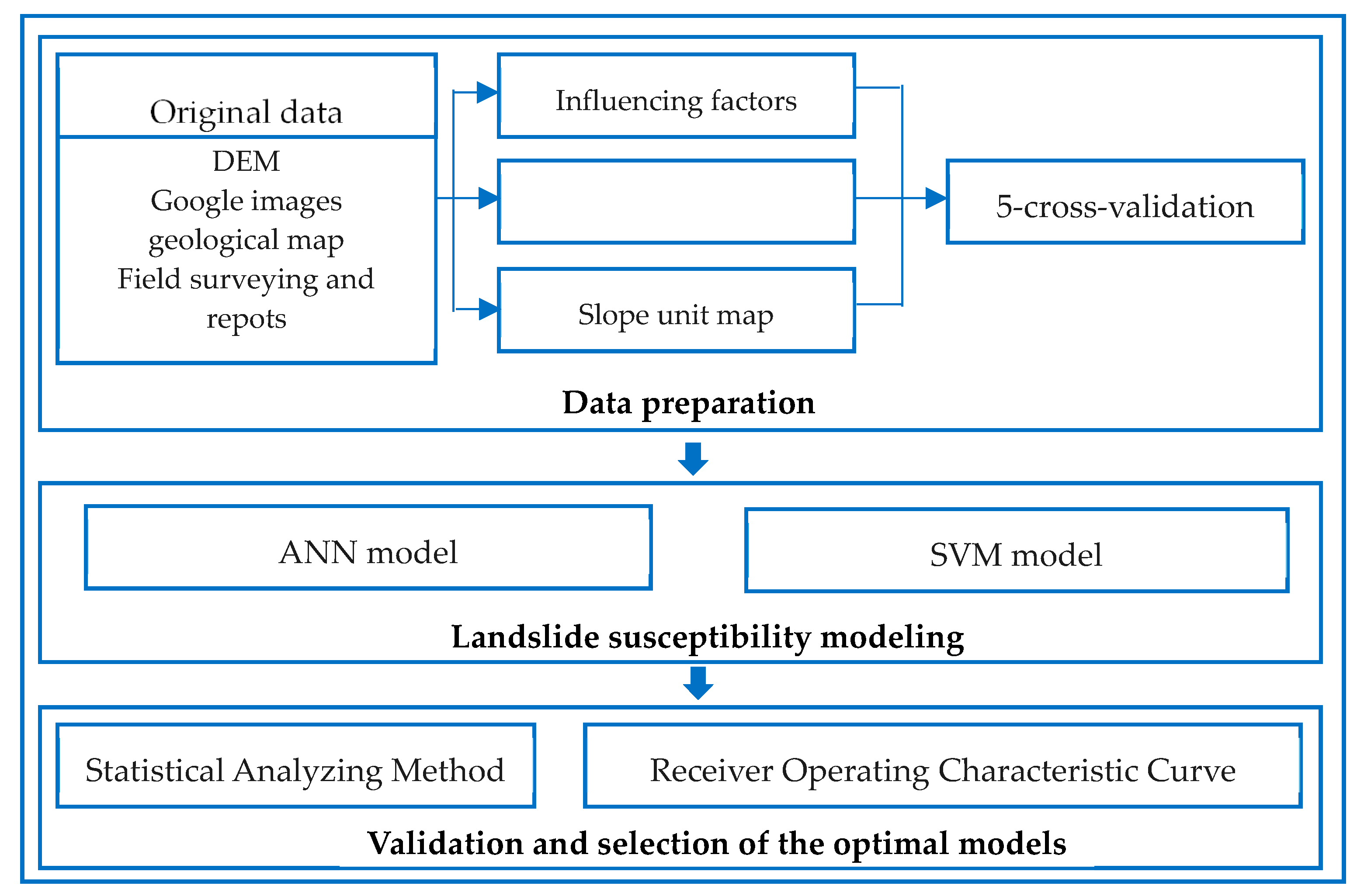
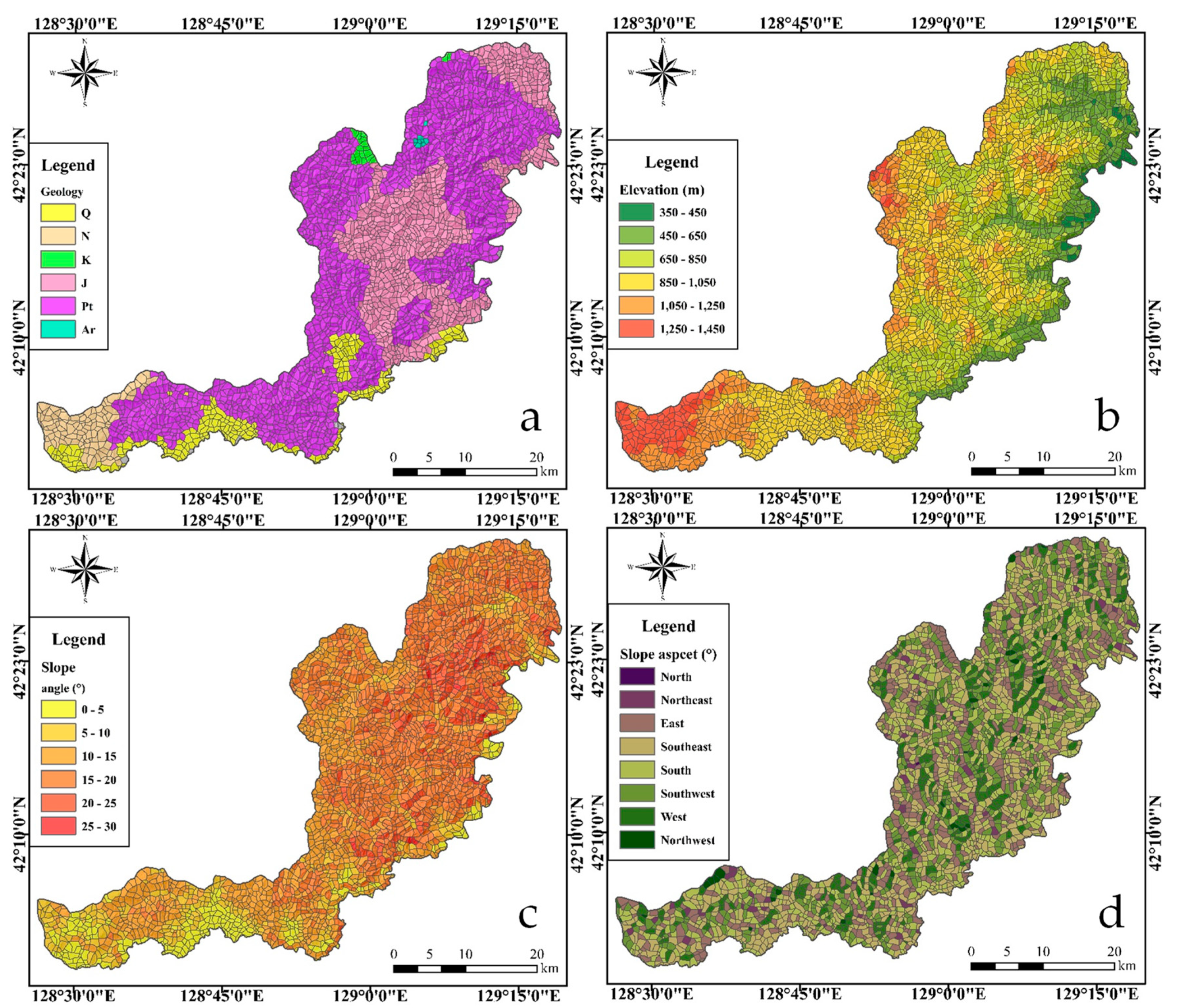
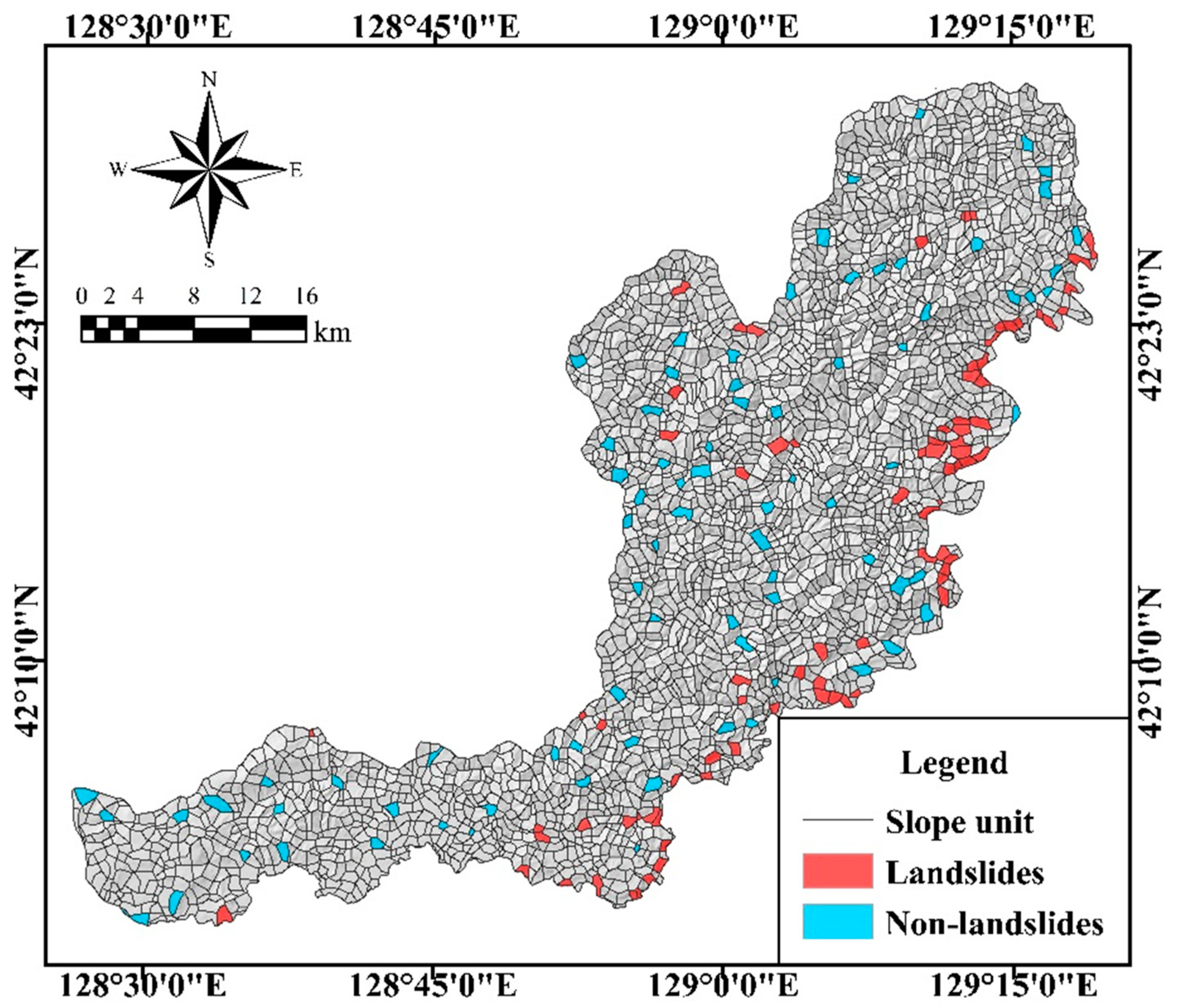
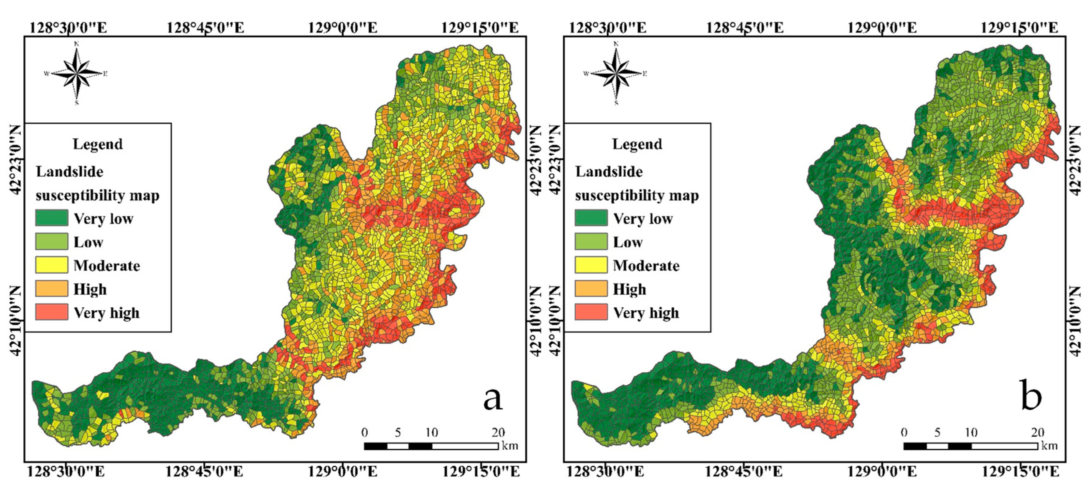
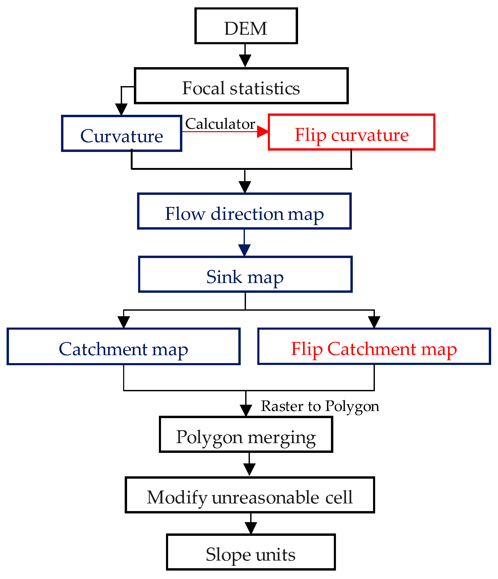
The purpose of this study is to produce a landslide susceptibility map of Southeastern Helong City, Jilin Province, Northeastern China. According to the geological hazard survey (1:50,000) project of Helong city, a total of 83 landslides were mapped in the study area. The slope unit, which is classified based on the curvature watershed method, is selected as the mapping unit. Based on field investigations and previous studies, three groups of influencing Factors—Lithological factors, topographic factors, and geological environment factors (including ten influencing factors)—are selected as the influencing factors. Artificial neural networks (ANN’s) and support vector machines (SVM’s) are introduced to build the landslide susceptibility model. Five-fold cross-validation, the receiver operating characteristic curve, and statistical parameters are used to optimize model. The results show that the SVM model is the optimal model. The landslide susceptibility maps produced using the SVM model are classified into five grades—very high, high, moderate, low, and very low—and the areas of the five grades were 127.43, 151.60, 198.77, 491.19, and 506.91 km2, respectively. The very high and high susceptibility areas included 79.52% of the total landslides, demonstrating that the landslide susceptibility map produced in this paper is reasonable. Consequently, this study can serve as a guide for landslide prevention and for future land planning in the southeast of Helong city.
Keywords: landslide susceptibility mapping; artificial neural networks; support vector machines; five-fold cross-validation; receiver operating characteristic curve; statistical parameters landslide susceptibility mapping; artificial neural networks; support vector machines; five-fold cross-validation; receiver operating characteristic curve; statistical parameters