Assessing the Landscape’s Ability to Support the Agroecological Transition of Bio-Distretto Delle Lame
Abstract
1. Introduction
1.1. Background
1.2. Problem Statement
1.3. Research Aim
2. Materials and Methods
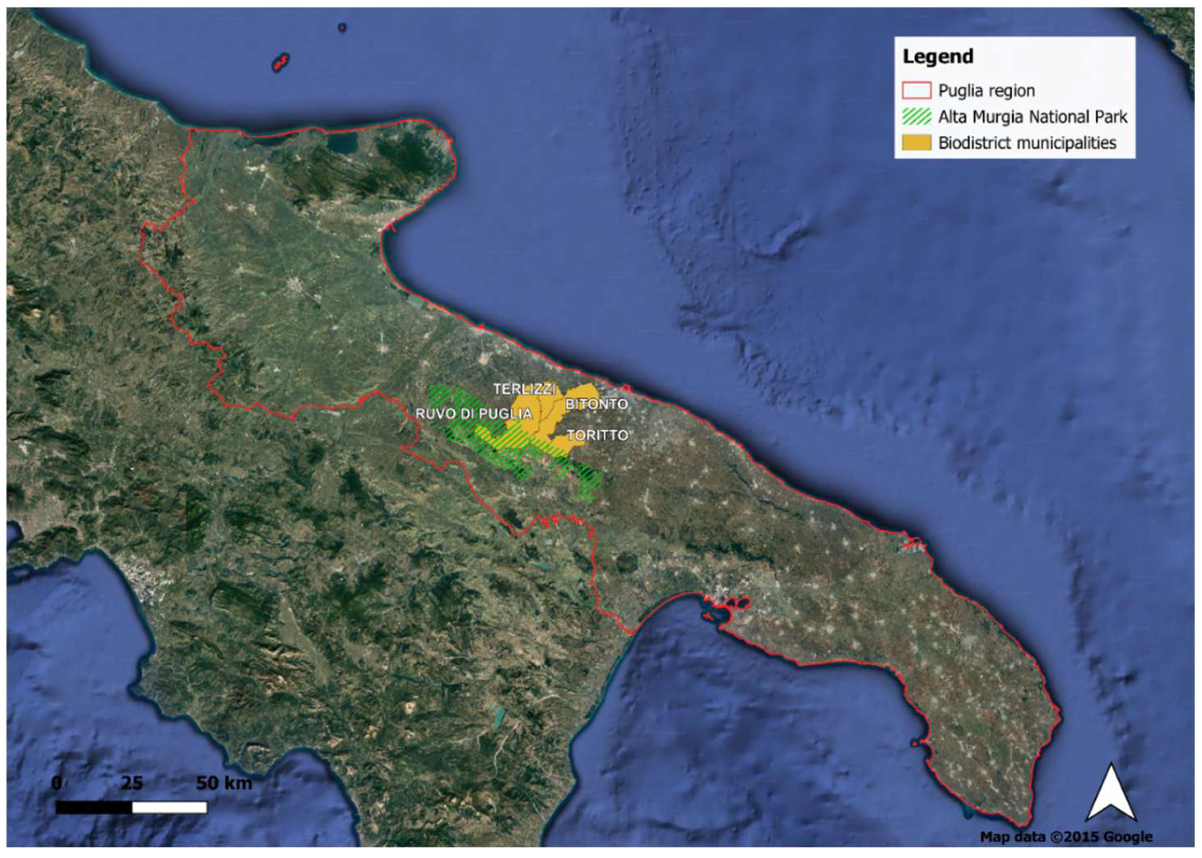
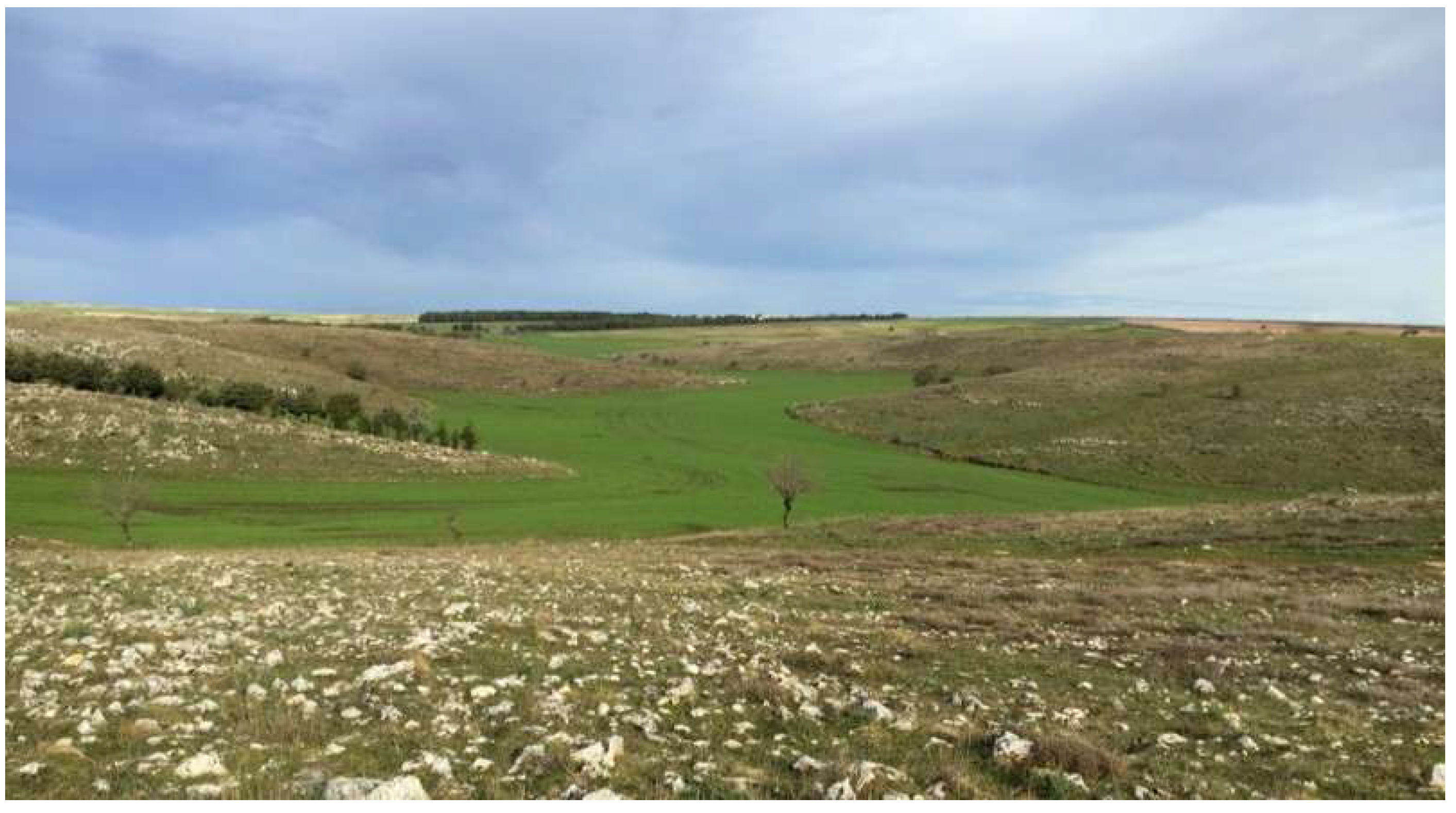
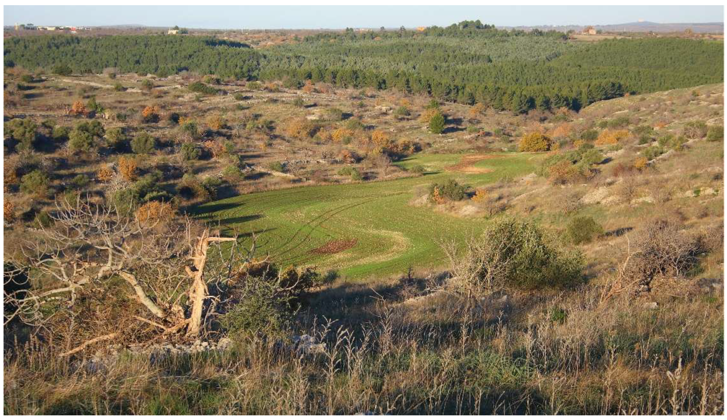
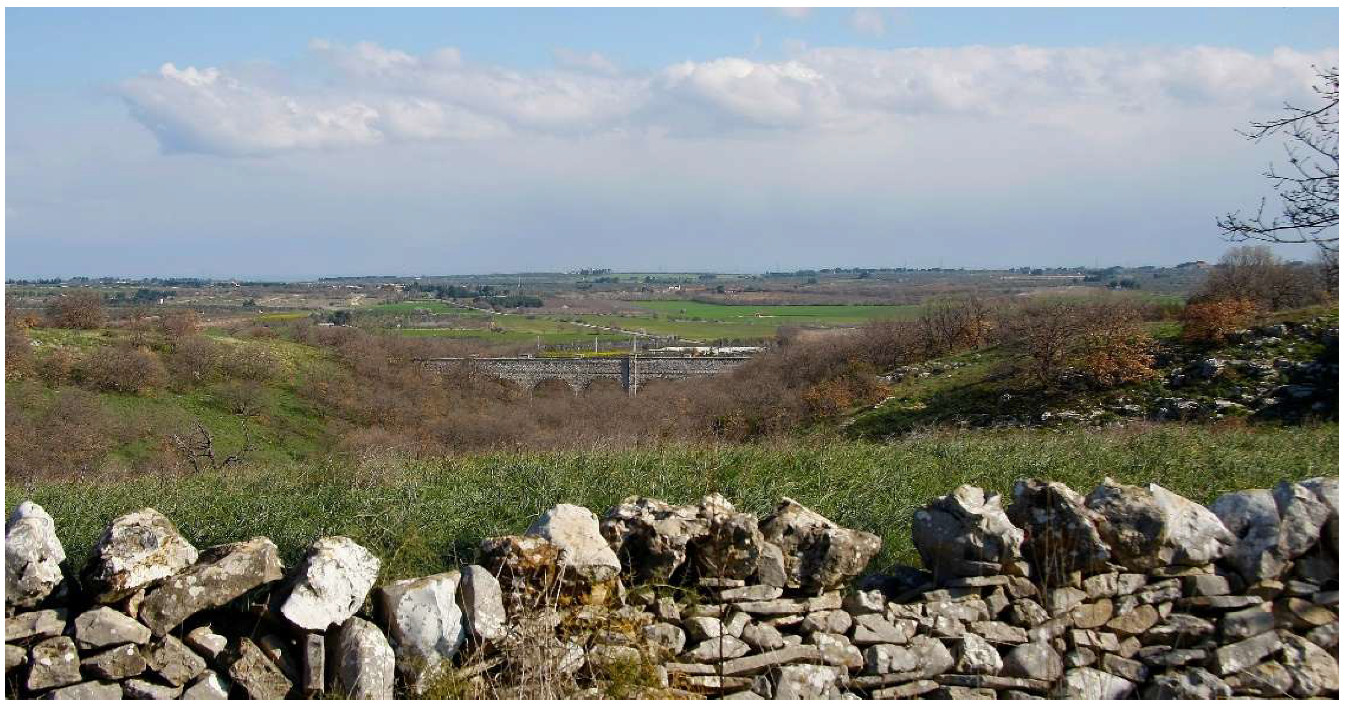
2.1. Study Area


2.2. Data Collection
2.3. Data Acquisition Procedures
2.4. Data Processing and Classification
2.4.1. Pre-Processing of Satellite Images
2.4.2. Obtaining Land Cover Classes
2.4.3. Accuracy Assessment
2.5. Biodiversity Analysis
2.6. Validation Phase
3. Results
3.1. Results from Classification of Satellite Images
3.2. Calculation of the Indicators of Diversity at Landscape Level
4. Discussion
5. Conclusions
Supplementary Materials
Author Contributions
Funding
Data Availability Statement
Acknowledgments
Conflicts of Interest
Abbreviations
| UAV | Unmanned Aerial Vehicle |
| NDVI | Normalized Difference Vegetation Index |
| GEOBIA | Geographic Object-Based Image Analysis |
| QGIS | Quantum Geographic Information System |
| DTM | Digital Terrain Model |
| DEM | Digital Elevation Model |
| RF | Random Forest |
| OTB | Orfeo ToolBox |
| SCP | Semi-Automatic Classification Plugin |
| CLC | Corine Land Cover |
| UA | User’s Accuracy |
| MP | Megapixel |
References
- Bathaei, A.; Štreimikienė, D. A Systematic Review of Agricultural Sustainability Indicators. Agriculture 2023, 13, 241. [Google Scholar] [CrossRef]
- Alarcon-Segura, V.; Grass, I.; Feuerbacher, A.; Gonzales-Chavez, A.; Mupepele, A.-C. Semi-natural habitats and their contribution to crop productivity through pollination and pest control: A systematic review. Landsc. Ecol. 2025, 40, 137. [Google Scholar] [CrossRef]
- Guareschi, M.; Maccari, M.; Sciurano, J.P.; Arfini, F.; Pronti, A. A Methodological Approach to Upscale Toward an Agroecology System in EU-LAFSs: The Case of the Parma Bio-District. Sustainability 2020, 12, 5398. [Google Scholar] [CrossRef]
- Kumawat, A. Bio-Diversity: Classification, threats to biodiversity and its onservation. Int. J. Sci. Res. 2023, 12, 1031–1032. [Google Scholar] [CrossRef]
- Haan, N.L.; Iuliano, B.G.; Gratton, C.; Landis, D.A. Chapter Five—Designing agricultural landscapes for arthropod-based ecosystem services in North America. In Advances in Ecological Research; Bohan, D.A., Vanbergen, A.J., Eds.; Academic Press: Cambridge, MA, USA, 2021; Volume 64, pp. 191–250. [Google Scholar] [CrossRef]
- ESCAP; UN. SDG 15: Life on land: Protect, restore and promote sustainable use of terrestrial ecosystems, sustainably manage forests, combat desertification, and halt and reverse land degradation and halt biodiversity loss. In Sustainable Development Goals; United Nations: Baden-Baden, Germany, 2022; pp. 554–581. [Google Scholar] [CrossRef]
- Dara Guccione, G.; Sturla, A.; Bergamelli, C.; Vaccaro, A.; Viganò, L. Approccio agroecologico e Biodistretti, Analisi di Due Casi Studio; Ministero delle Politiche Agricole Alimentari e Forestali: Roma, Italy, 2021. [Google Scholar]
- Regione Puglia Sistema Informativo Territoriale. Available online: https://pugliacon.regione.puglia.it/ (accessed on 25 June 2025).
- Filchev, L.; Pashova, L.; Kolev, V.; Frye, S. Surveys, catalogues, databases/archives, and state-of-the-art methods for geoscience data processing. In Knowledge Discovery in Big Data from Astronomy and Earth Observation; Elsevier: Amsterdam, The Netherlands, 2020; pp. 103–136. [Google Scholar]
- Congedo, L. Semi-Automatic Classification Plugin: A Python tool for the download and processing of remote sensing images in QGIS. J. Open Source Softw. 2021, 6, 3172. [Google Scholar] [CrossRef]
- Momsen, E.; Metz, M.; GRASS Development Team. Addon i. Segment. Geographic Resources Analysis Support System (GRASS) Software, Version 7.8, 2020. Available online: https://grass.osgeo.org/grass-stable/manuals/addons/i.segment.stats.html (accessed on 25 June 2025).
- Calabrese, G.; Ceglie, F.; Perrino, E.; Verrastro, V.; Giannini, P.; La Notte Notte, P. Correlation between grape and wine quality, landscape diversity, on-field biodiversity, in doc Gioia del Colle, Italy. In Proceedings of Terroir 2014; IVES, Gioia del Colle, Italy, 2014; pp. 248–256. [Google Scholar]
- Turner, M.G.; Gardner, R.H.; O’Neill, R.V. Landscape Ecology in Theory and Practice: Pattern and Process; Springer: Frostburg, MD, USA, 2001. [Google Scholar]
- Rempel, R.S.; Elkie, P.C.; Carr, A. Patch Analyst User’s Manual: A Tool for Quantifying Landscape Structure; Ontario Ministry of Natural Resources, Boreal Science: Thunder Bay, ON, USA, 1999. [Google Scholar]
- McGarigal, K.; Marks, B.J. Spatial Pattern Analysis Program for Quantifying Landscape Structure; U.S. Department of Agriculture, Forest Service: Portland, OR, USA, 1995; Volume 10, pp. 1–122. [Google Scholar]
- UNEP; CBD. SBSsTA. In Proceedings of the Main Theme: Forest Biological Diversity, Report of the Adec Technical Expem Group on Forest Biological Diversity SBSTTA Seventh Meeting, Montreal, QC, Canada, 12–16 November 2001; pp. 12–16. [Google Scholar]
- Altieri, M.A.; Nicholls, C.I.; Molina, M.G.; de Rojas, A.S. Landscape Agroecology: Methodologies and Applications for the Design of Sustainable Agroecosystems. Land 2024, 13, 1746. [Google Scholar] [CrossRef]
- Priyadarshana, T.S.; Martin, E.A.; Sirami, C.; Woodcock, B.A.; Goodale, E.; Martínez-Núñez, C.; Lee, M.; Pagani-Núñez, E.; Raderschall, C.A.; Brotons, L. Crop and landscape heterogeneity increase biodiversity in agricultural landscapes: A global review and meta-analysis. Ecol. Lett. 2024, 27, e14412. [Google Scholar] [PubMed]
- Anderson, J.; Hardy, E.; Roach, J.; Witmer, R. A Land Use and Land Cover Classification System for Use with Remote Sensor Data; U.S. Geological Survey: Reston, VA, USA, 1976. [Google Scholar] [CrossRef]
- De Luca, G.; Silva, J.M.N.; Di Fazio, S.; Modica, G. Integrated use of Sentinel-1 and Sentinel-2 data and open-source machine learning algorithms for land cover mapping in a Mediterranean region. Eur. J. Remote Sens. 2022, 55, 52–70. [Google Scholar] [CrossRef]
- Nikolakopoulos, I.A.; Petropoulos, G.P. Obtaining a Land Use/Cover Cartography in a Typical Mediterranean Agricultural Field Combining Unmanned Aerial Vehicle Data with Supervised Classifiers. Land 2025, 14, 643. [Google Scholar] [CrossRef]
- Bazrafkan, A.; Igathinathane, C.; Bandillo, N.; Flores, P. Optimizing integration techniques for UAS and satellite image data in precision agriculture—A review. Front. Remote Sens. 2025, 6, 1622884. [Google Scholar]
- Blaschke, T. Object based image analysis for remote sensing. ISPRS J. Photogramm. Remote Sens. 2010, 65, 2–16. [Google Scholar] [CrossRef]
- Kucharczyk, M.; Hay, G.J.; Ghaffarian, S.; Hugenholtz, C.H. Geographic object-based image analysis: A primer and future directions. Remote Sens. 2020, 12, 2012. [Google Scholar] [CrossRef]
- Kuppala, N.; Navneet Krishna, C.; Sajith Variyar, V.V.; Sivanpillai, R. Mapping Vegetation Dynamics in Wyoming: A Multi-Temporal Analysis using Landsat NDVI and Clustering. Int. Arch. Photogramm. Remote Sens. Spat. Inf. Sci. 2025, XLVIII–M-5, 87–94. [Google Scholar] [CrossRef]
- Jassoom, H.; Abdoon, R. Investigating the Effectiveness of Supervised and Unsupervised Classification for Landsat Images Utilizing Classification Accuracy Assessment. Kirkuk J. Sci. 2024, 19, 15–28. [Google Scholar] [CrossRef]
- Ismail, M.H.; Pakhriazad, H.Z.; Shahrin, M. Evaluating supervised and unsupervised techniques for land cover mapping using remote sensing data. Geogr. Malays. J. Soc. Space 2009, 5. [Google Scholar]
- Venter, Z.S.; Barton, D.N.; Chakraborty, T.; Simensen, T.; Singh, G. Global 10 m land use land cover datasets: A comparison of dynamic world, world cover and esri land cover. Remote Sens. 2022, 14, 4101. [Google Scholar] [CrossRef]
- SinanetCLC2018_shapefile. Available online: https://groupware.sinanet.isprambiente.it/uso-copertura-e-consumo-di-suolo/library/copertura-del-suolo/corine-land-cover/clc2018_shapefile/ (accessed on 10 September 2025).
- Verma, A. Biodiversity: Its different levels and values. Int. J. Environ. Sci. 2020, 7, 143–145. [Google Scholar]
- Lecis, R.; Chirichella, R.; Dondina, O.; Orioli, V.; Azzu, S.; Canu, A.; Torretta, E.; Bani, L.; Apollonio, M.; Scandura, M. Same landscape, different connectivity: Contrasting patterns of gene flow in two sympatric ungulates in a mountain area. Eur. J. Wildl. Res. 2024, 70, 42. [Google Scholar] [CrossRef]
- Avanzi, C.; Vitali, A.; Piovani, P.; Spanu, I.; Urbinati, C.; Vendramin, G.G.; Garbarino, M.; Piotti, A. Genetic consequences of landscape features in two rear edge, highly fragmented metapopulations of a mediterranean conifer. Landsc. Ecol. 2024, 39, 87. [Google Scholar] [CrossRef]
- Albero, L.; Martinez-Solano, I.; Hermida, M.; Vera, M.; Tarroso, P.; Bécares, E. Open areas associated with traditional agriculture promote functional connectivity among amphibian demes in Mediterranean agrosystems. Landsc. Ecol. 2023, 38, 3045–3059. [Google Scholar] [CrossRef]
- Phiri, D.; Simwanda, M.; Salekin, S.; Nyirenda, V.R.; Murayama, Y.; Ranagalage, M. Sentinel-2 Data for Land Cover/Use Mapping: A Review. Remote Sens. 2020, 12, 2291. [Google Scholar] [CrossRef]
- Pfiffner, L.; Balmer, O. Organic Agriculture and Biodiversity; Research Institute of Organic Agriculture (FiBL): Frick, Switzerland, 2011. [Google Scholar]
- Lavigne, C. Agroecology landscapes. Landsc. Ecol. 2021, 36, 2235–2257. [Google Scholar] [CrossRef] [PubMed]
- Chmielewski, S.; Bochniak, A.; Natapov, A.; Wężyk, P. Introducing GEOBIA to landscape imageability assessment: A multi-temporal case study of the nature reserve “Kozki”, Poland. Remote Sens. 2020, 12, 2792. [Google Scholar] [CrossRef]
- Estrada-Carmona, N.; Sánchez, A.C.; Remans, R.; Jones, S.K. Complex agricultural landscapes host more biodiversity than simple ones: A global meta-analysis. Proc. Natl. Acad. Sci. USA 2022, 119, e2203385119. [Google Scholar] [CrossRef] [PubMed]


| Macrocategories | Cover Classes |
|---|---|
| MA | artifacts (urban fabric and other man-made categories) |
| EN | natural herbaceous vegetation |
| AN | natural arboreous vegetation |
| ASN | natural herbaceous and arboreous |
| W | wetlands |
| CP | permanents crops |
| CE | herbaceous crops |
| CA | associated crops |
| Indicators of composition | 1 | Relative Richness Number (RR) [13] |
| 2 | Relative Richness Area (RA) [13] | |
| 3 | Land Use Sustainability (LUS) | |
| Indicators of fragmentations | 4 | Patch Average Area (PAA) [14] |
| 5 | Patch Average Area (for individual classes) [14] | |
| 6 | Patch Density (PD) [15] | |
| 7 | Patch Density (for individual classes) [15] | |
| 8 | Sustainability of the Ecotone System (SES) | |
| 9 | Agricultural Ecotope Composition (CEtopeC) | |
| 10 | Road Density (RD) | |
| Indicators of connection | 11 | Crop Ecotone Composition (CEtopeC) |
| 12 | Water Body Density (WBD) [16] | |
| 13 | Ecotone Length (EL) | |
| 14 | Ecotone Intensity (EI) |
| Map ID | Overall Accuracy (%) | Kappa | Lowest PA Class | PA (%) | Lowest UA Class | UA (%) |
|---|---|---|---|---|---|---|
| A1 | 90.20 | 0.78 | natural vegetation | 3 | arable land | 21 |
| A2 | 91.76 | 0.81 | artificial surfaces | 1 | natural vegetation | 3 |
| A3 | 88.21 | 0.71 | artificial surfaces | 1 | arable land | 21 |
| B1 | 63.17 | 0.26 | natural vegetation | 3 | arable land | 21 |
| B2 | 60.43 | 0.25 | arable land | 21 | arable land | 21 |
| B3 | 60.60 | 0.21 | artificial surfaces | 1 | arable land | 21 |
| B4 | 56.83 | 0.17 | arable land | 21 | arable land | 21 |
| Approach | Map ID | Method | Features | Spatial Resolution |
|---|---|---|---|---|
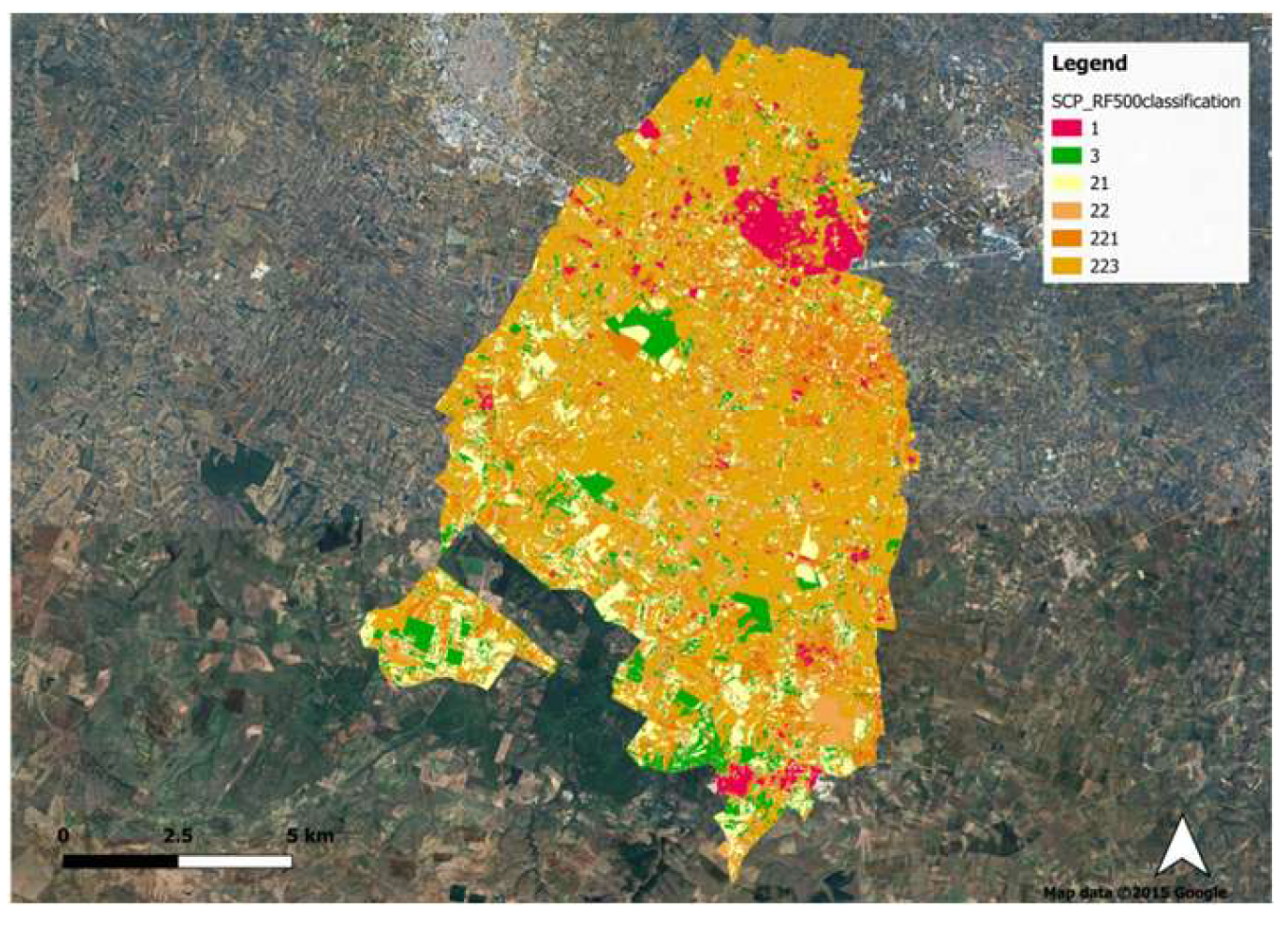
| A | A1 | Supervised SCP | Sentinel-2 (May) | 10 × 10 m |
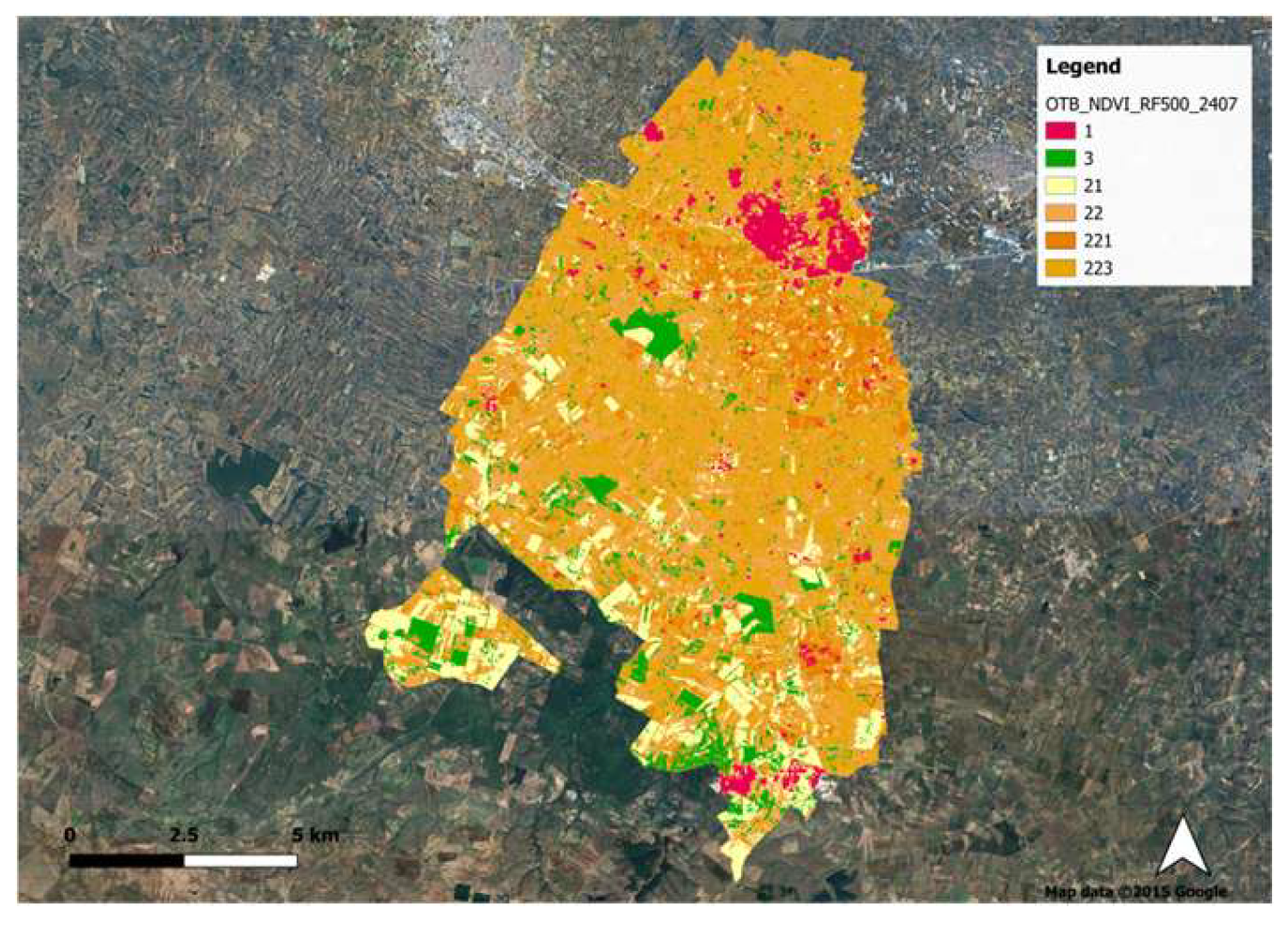
| A | A2 | Supervised OTB | NDVI (July) | 10 × 10 m |
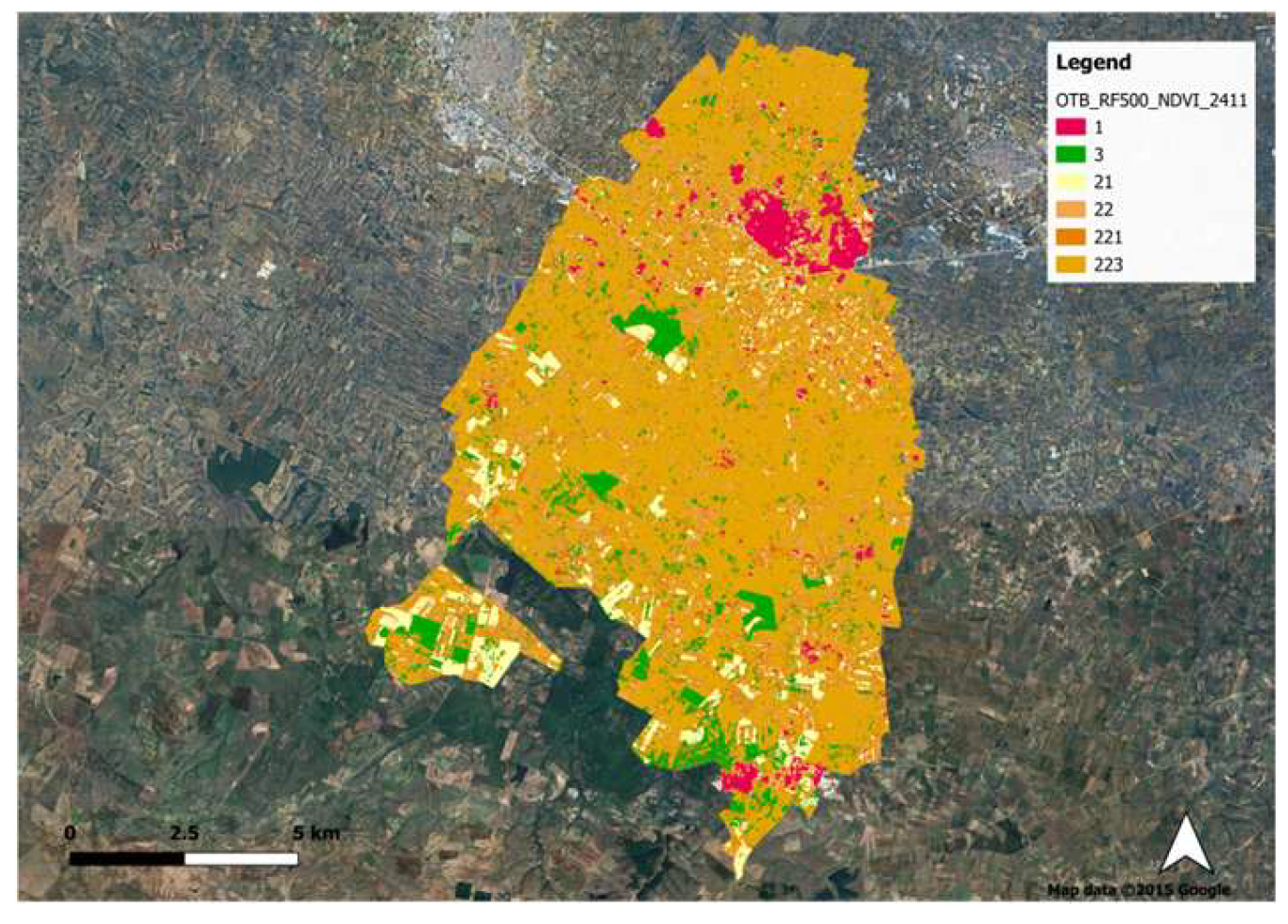
| A | A3 | Supervised OTB | NDVI (November) | 10 × 10 m |
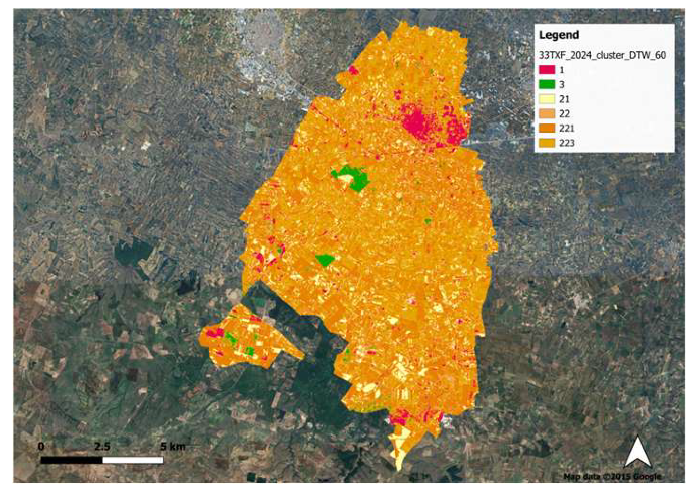
| B | B1 | Unsupervised GEOBIA + Supervised OTB | 60 clusters | 10 × 10 m |
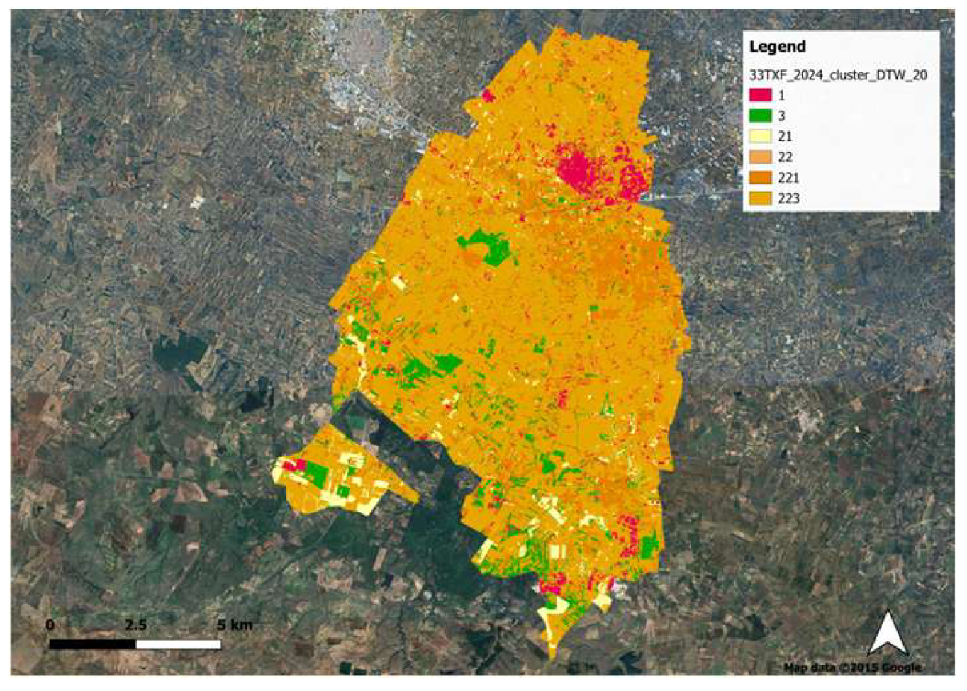
| B | B2 | Unsupervised GEOBIA + Supervised OTB | 20 clusters | 10 × 10 m |
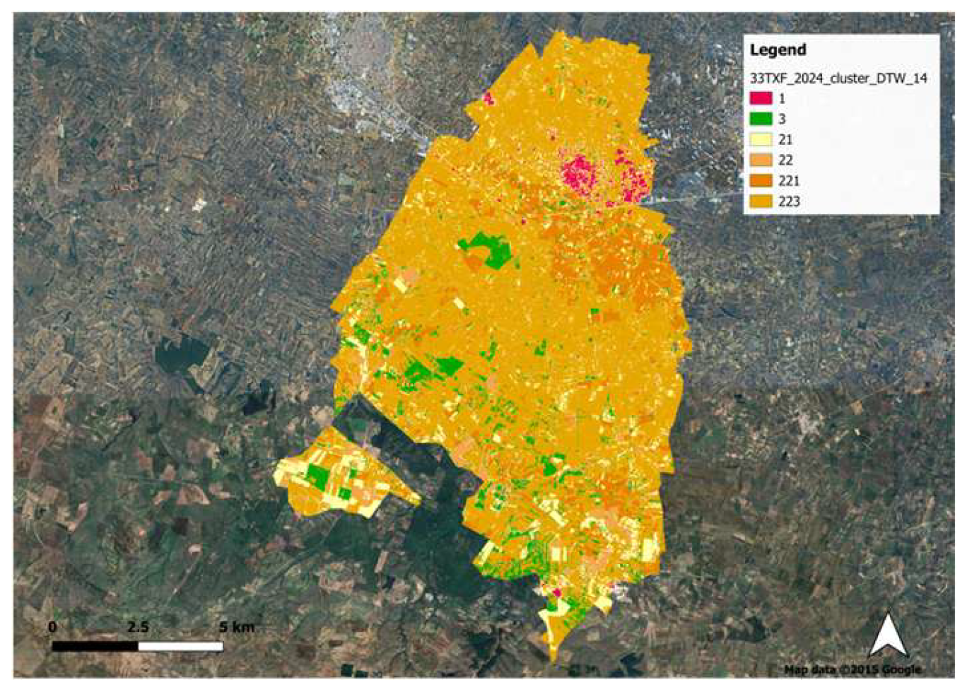
| B | B3 | Unsupervised GEOBIA + Supervised OTB | 14 clusters | 10 × 10 m |
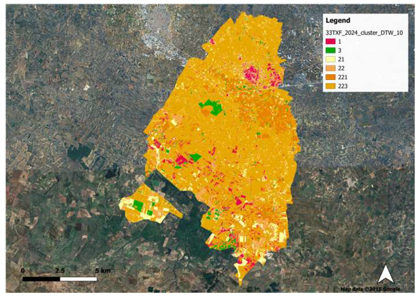
| B | B4 | Unsupervised GEOBIA + Supervised OTB | 10 clusters | 10 × 10 m |
| Region of Interest | RR-MA | RR-EN | RR-AN | RR-CP | RR-CE | RR-CA | RA-MA | RA-EN | RA-AN | RA-CP | RA-CE | RA-CA | LUS (%) | CEC |
|---|---|---|---|---|---|---|---|---|---|---|---|---|---|---|
| A2 | 2.76 | 0.00 | 10.31 | 75.53 | 11.40 | 0.00 | 4.03 | 0.00 | 7.52 | 75.50 | 12.95 | 0.00 | 8.50 | 5.83 |
| Region of Interest | PAA | PAA-MA | PAA-EN | PAA-AN | PAA-CP | PAA-CE | PAA-CA | PD | PD-MA | PD-EN | PD-AN | PD-CP | PD-CE | PD-CA | SES | CEC |
|---|---|---|---|---|---|---|---|---|---|---|---|---|---|---|---|---|
| A2 | 0.25 | 0.37 | 0.00 | 0.18 | 0.25 | 0.28 | 0.00 | 399.86 | 273.52 | 0.00 | 548.18 | 400.02 | 352.12 | 0.00 | 0.09 | 8.00 |
| Region of Interest | EL | EL-MA | EL-EN | EL-AN | EL-CP | EL-CE | EL-CA | EI | EI-MA | EI-EN | EI-AN | EI-CP | EI-CE | EI-CA |
|---|---|---|---|---|---|---|---|---|---|---|---|---|---|---|
| A2 | 0.20 | 0.19 | 0.00 | 0.16 | 0.22 | 0.18 | 0.00 | 489.78 | 530.08 | 0.00 | 641.78 | 464.56 | 561.11 | 0.00 |
Disclaimer/Publisher’s Note: The statements, opinions and data contained in all publications are solely those of the individual author(s) and contributor(s) and not of MDPI and/or the editor(s). MDPI and/or the editor(s) disclaim responsibility for any injury to people or property resulting from any ideas, methods, instructions or products referred to in the content. |
© 2026 by the authors. Licensee MDPI, Basel, Switzerland. This article is an open access article distributed under the terms and conditions of the Creative Commons Attribution (CC BY) license.
Share and Cite
Deressa, A.T.; Perrino, A.; Ranieri, C.; Favia, G.; Fracchiolla, M.; Santoro, F.; Calabrese, G. Assessing the Landscape’s Ability to Support the Agroecological Transition of Bio-Distretto Delle Lame. Land 2026, 15, 1199. https://doi.org/10.3390/land15071199
Deressa AT, Perrino A, Ranieri C, Favia G, Fracchiolla M, Santoro F, Calabrese G. Assessing the Landscape’s Ability to Support the Agroecological Transition of Bio-Distretto Delle Lame. Land. 2026; 15(7):1199. https://doi.org/10.3390/land15071199
Chicago/Turabian StyleDeressa, Ayantu Tadesse, Alessia Perrino, Carlo Ranieri, Gabriele Favia, Mariano Fracchiolla, Franco Santoro, and Generosa Calabrese. 2026. "Assessing the Landscape’s Ability to Support the Agroecological Transition of Bio-Distretto Delle Lame" Land 15, no. 7: 1199. https://doi.org/10.3390/land15071199
APA StyleDeressa, A. T., Perrino, A., Ranieri, C., Favia, G., Fracchiolla, M., Santoro, F., & Calabrese, G. (2026). Assessing the Landscape’s Ability to Support the Agroecological Transition of Bio-Distretto Delle Lame. Land, 15(7), 1199. https://doi.org/10.3390/land15071199