Article

Decoding the Spatial–Temporal Coupling Dynamics of Land Use Intensity and Balance in China’s Chengdu–Chongqing Economic Circle: A 1 km Grid-Based Analysis

College of Resources, Sichuan Agricultural University, Chengdu 611130, China
*
Author to whom correspondence should be addressed.
Land 2025, 14(8), 1597; https://doi.org/10.3390/land14081597
Submission received: 1 June 2025 / Revised: 31 July 2025 / Accepted: 31 July 2025 / Published: 5 August 2025
(This article belongs to the Special Issue Integration of Remote Sensing and GIS for Land Use Change Assessment)

Abstract

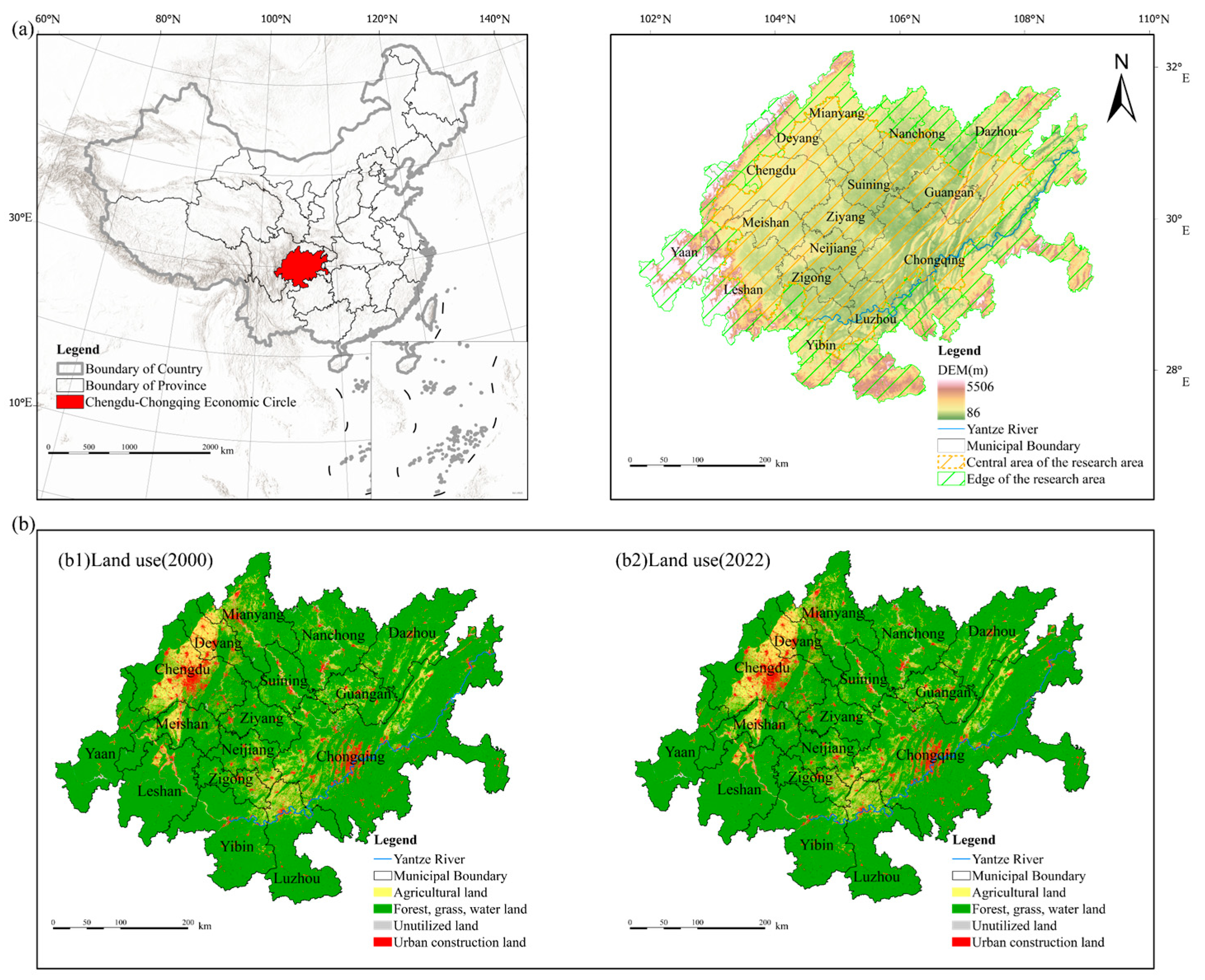
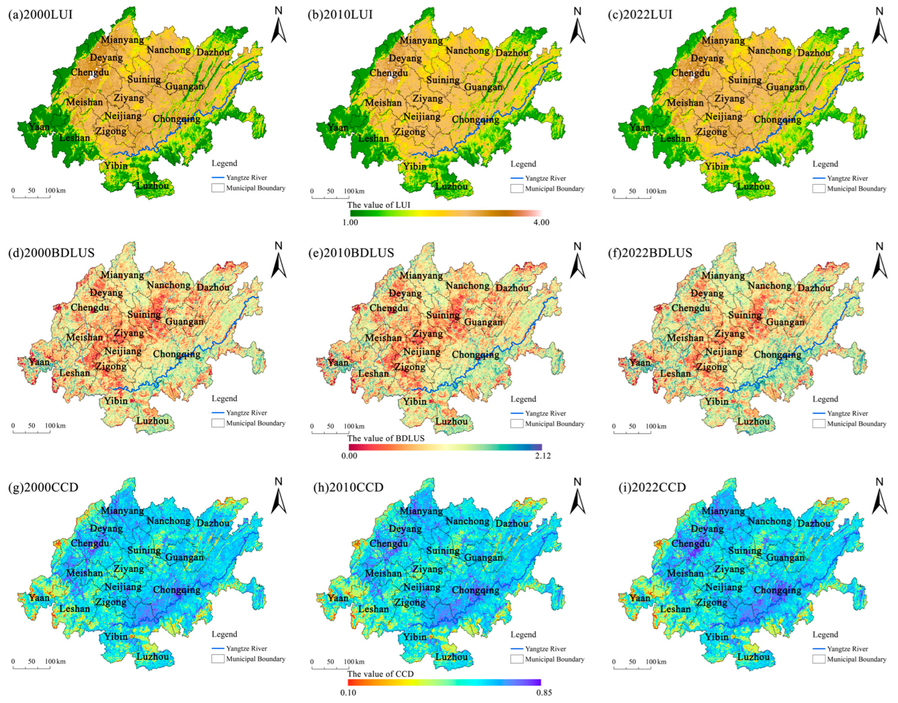
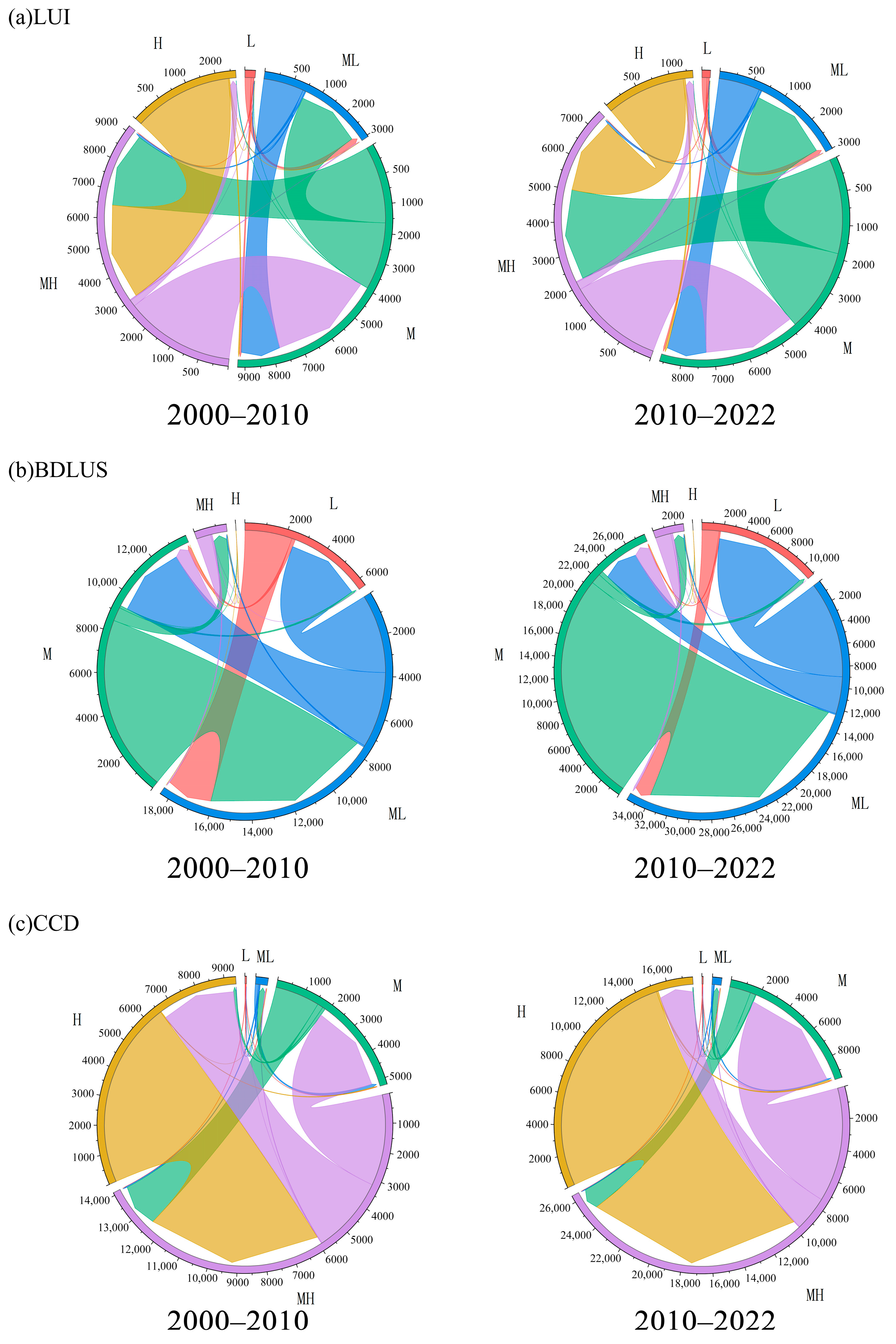
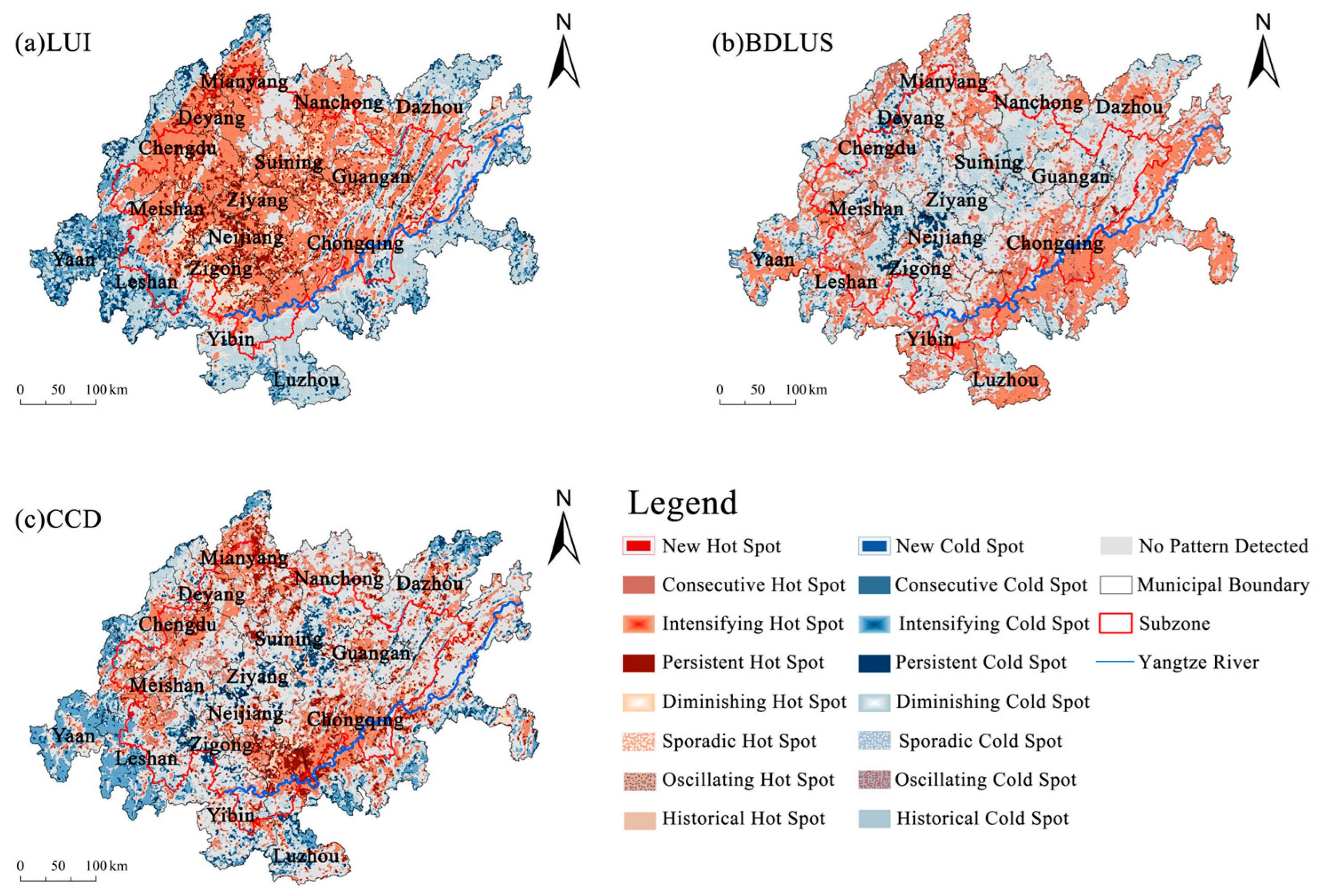
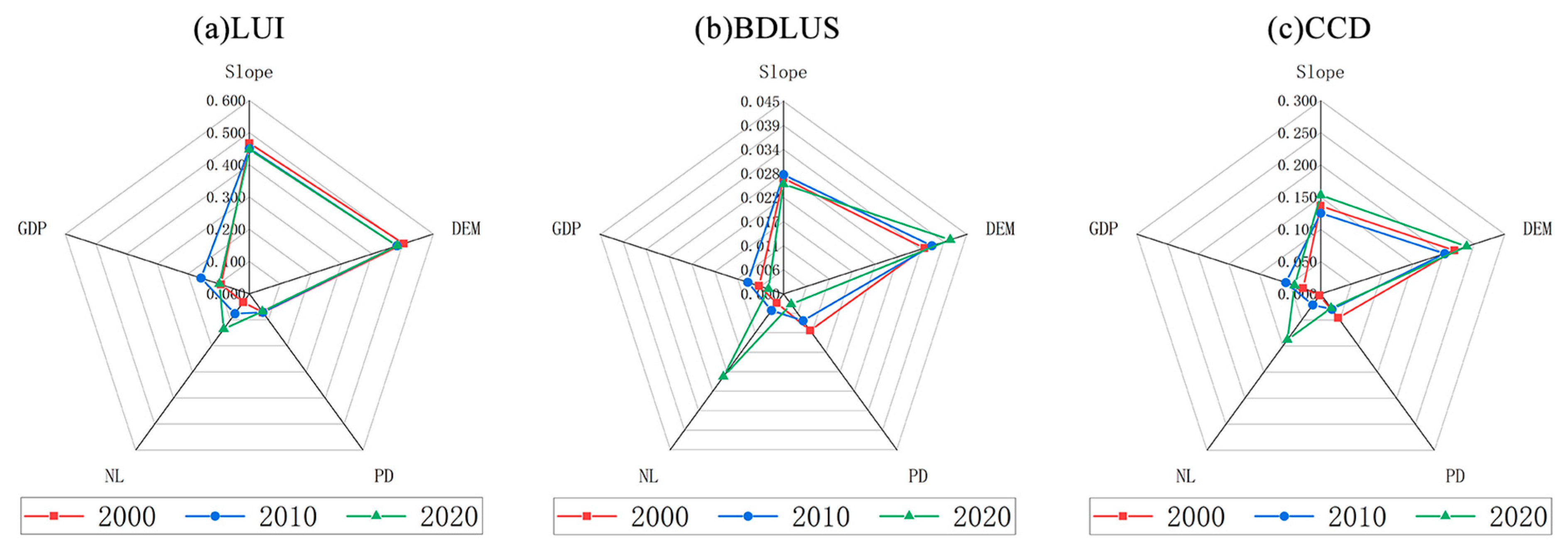
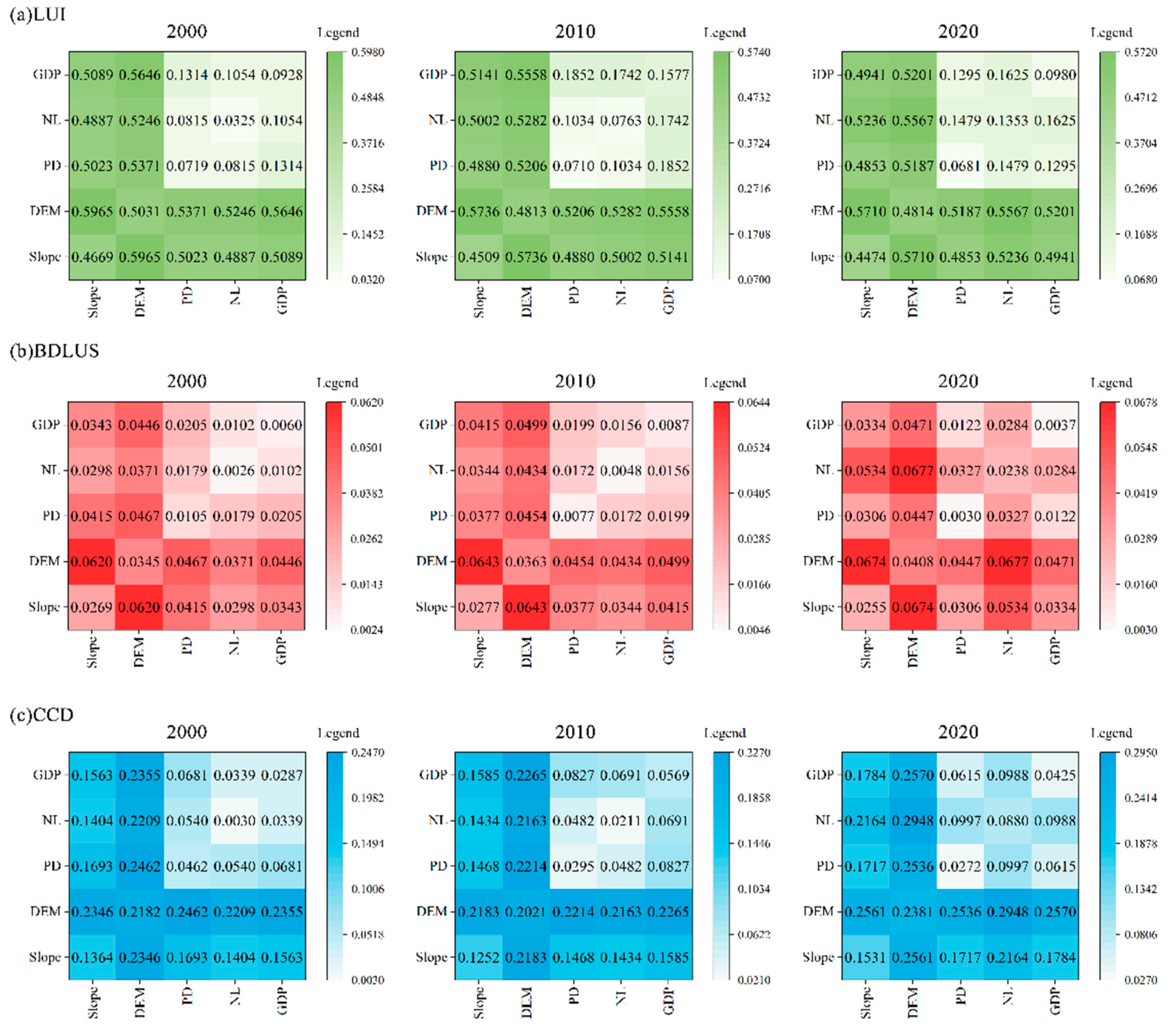
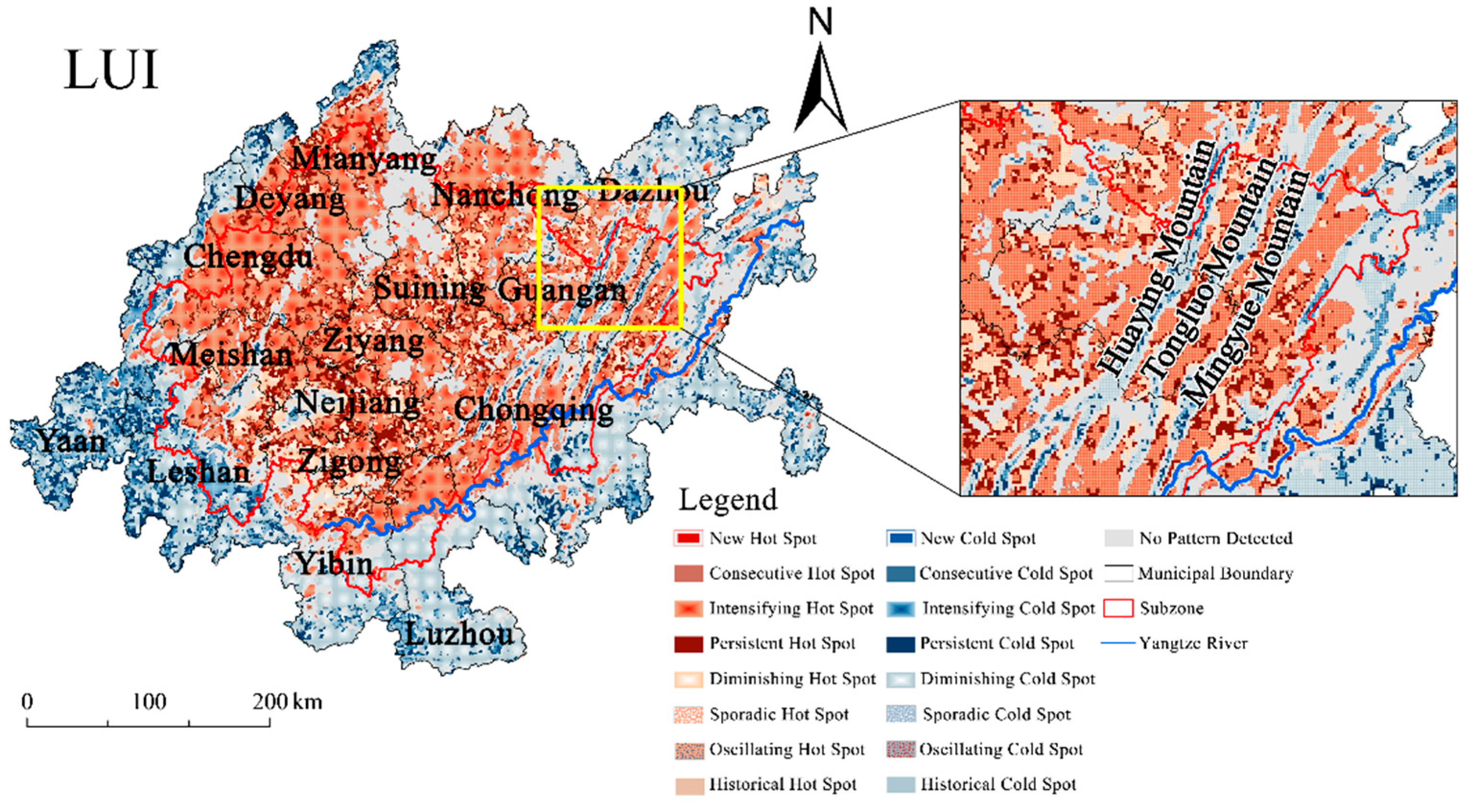
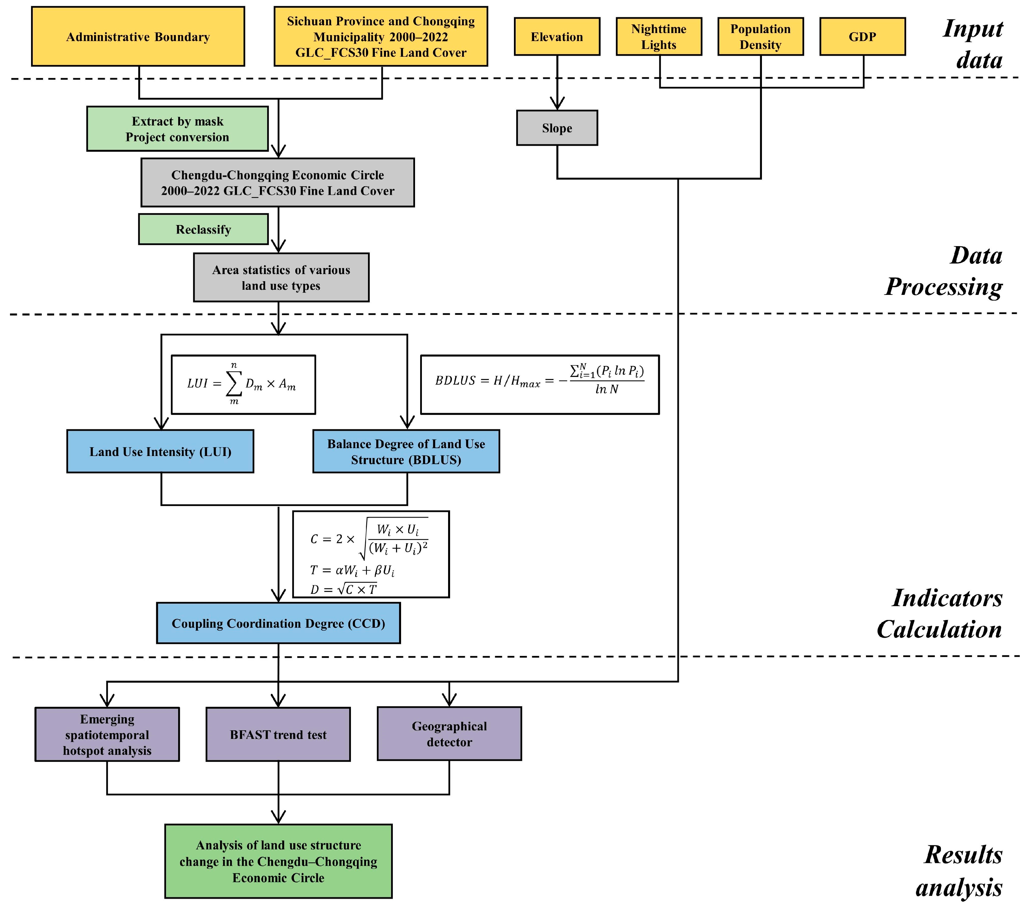
Amid China’s national strategic prioritization of the Chengdu–Chongqing Economic Circle and accelerated territorial spatial planning, this study deciphered the synergistic evolution of Land Use Intensity (LUI) and Balance Degree of Land Use Structure (BDLUS) during rapid urbanization. Leveraging 1 km grid units and integrating emerging spatiotemporal hotspot analysis, BFAST, and geographic detectors, we systematically analyzed spatiotemporal patterns and drivers of LUI, BDLUS, and their Coupling Coordination Degree (CCD) from 2000 to 2022. Key findings: (1) LUI strongly correlated with economic growth, with core areas reaching high-intensity development (average > 2.96) versus ecologically constrained marginal zones (<2.42), marked by abrupt changes during 2011–2014; (2) BDLUS improvements covered 82.22% of the study area, driven by the Yangtze River Economic Belt strategy (21.96% hotspot concentration), yet structural imbalance persisted in transitional zones (18.81% cold spots); (3) CCD exhibited center-edge dichotomy, contrasting high-value cores (CCD > 0.68) with ecologically sensitive edges (9.80% cold spots), peaking in regulatory shifts around 2010; (4) terrain constraints and intensified human activities (the interaction effect between nighttime lighting and population density increased by 219.49% after 2020) jointly governed coupling mechanisms, with urbanization and industrial transition becoming dominant drivers. This research advances an “intensity–structure–coordination” framework and elucidates “dual-core resonance” dynamics, offering theoretical foundations for spatial optimization and ecological civilization.
Keywords: land use change; land use intensity; balance degree of land use structure; coupling coordination degree; law of temporal and spatial differentiation; driving mechanism land use change; land use intensity; balance degree of land use structure; coupling coordination degree; law of temporal and spatial differentiation; driving mechanism