1. Introduction
In the current rapid urbanization process in China, the government has been making efforts to promote rural revitalization in recent years, putting forward new requirements for the planning, construction, and development of rural areas. Under these circumstances, rural layout planning should adopt approaches adapted to local conditions and rationally utilize local natural conditions. China’s ethnic minorities predominantly live in rural areas. The site selection and layout characteristics of ethnic minority settlements reflect the traditional culture and need to be inherited in the process of rural construction. At the same time, traditional ethnic minority settlements are also in urgent need of protection and development. The resolution of these issues fundamentally depends on a comprehensive understanding of geographical environments and in-depth research on village–geography relationships.
The cultural characteristics and conservation/development of ethnic minority rural settlements have attracted significant attention from scholars worldwide. International research has primarily focused on settlement typology and transformation process [
1,
2,
3], the preservation of ethnic settlements and architecture [
4,
5], the protection and inheritance of ethnic culture [
6,
7], etc. Domestic scholars mainly concentrate on the conservation and development of ethnic minority villages [
8,
9,
10], spatial morphological characteristics and evolutionary patterns of settlements [
11,
12,
13,
14,
15,
16], spatial distribution features and influencing factors [
17,
18,
19]. Hotspot analysis, the geographic detector method, the nearest neighbor index, kernel density estimation, correlation analysis and clustering analysis are widely used in the research [
20,
21,
22,
23,
24,
25,
26,
27]. Numerous studies have found that the internal elements and spatial distribution features of rural settlements are closely related to natural environments [
28]. Many of them have investigated the impacts of natural environments, production factors, and lifestyles on rural settlements, specifically including terrain, sunlight exposure [
29], farming practices [
30], land fertility [
31], population density [
32], transportation factors [
33], socio-historical and cultural factors [
34,
35], etc. Relevant studies indicate that factors such as elevation, slope gradient, slope direction, and proximity to rivers [
18,
36] significantly influence the spatial morphology of settlements. Additionally, settlement location is mainly affected by the elevation, distance to cultivated land, and distance to main roads, while settlement scale is mainly affected by slope, the relief degree of land surface, and the distance to urban centers [
21].
Previous studies have predominantly focused on the spatial distribution of settlements in relatively large geographical areas. Moreover, spatial layout characteristics have mainly been presented through inter-settlement positional relationships, while research on individual settlements and their three-dimensional spatial features remains scarce. Research on the distribution patterns of ethnic minority settlements and their relationship with geographical conditions still needs to be enriched. Due to the dual influence of culture and region [
37,
38,
39], the relationship between spatial layout characteristics and geographical features of ethnic minority rural settlements has become increasingly complex, and their interrelationships are also affected by multiple factors. Therefore, it is necessary to conduct relevant research at a more detailed level.
The aforementioned findings demonstrate a clear correlation between the site selection and layout characteristics of rural settlements and their geographical environments, which has been further validated through studies on ethnic minority settlements. These established correlations can scientifically guide the planning and development of ethnic minority rural settlements, facilitating both the preservation and revitalization of traditional culture and the sustainable utilization of territorial resources. Based on this, the present study focuses on ethnic minority rural settlements in southern China, investigating their influencing factors from the perspectives of both planar and spatial layout characteristics at the individual settlement level. This study examines 34 representative ethnic minority rural settlements located in the multicultural convergence zone of Liuzhou, Guangxi. This paper employs fractal theory and a GIS analysis method to obtain the planar morphology, spatial layout, and topographic characteristics of representative settlements. In addition, statistical analysis methods were applied to investigate the interrelationships among key factors including ethnic composition, the natural environment, settlement morphology, and location selection. The influencing patterns of these factors on the spatial layout characteristics of settlements are systematically summarized. On the one hand, the findings of this study reveal the correlations between planar morphological characteristics and spatial layout features of settlements. On the other hand, they provide both theoretical foundations and practical guidance for research on the spatial patterns and influencing factors of ethnic minority rural settlements in general regions of southern China.
2. Study Area Overview and Data Sources
2.1. Study Area Overview
Guangxi is a typical multi-ethnic settlement area in China, and is characterized not only by its diverse ethnic groups but also by its complex mountainous terrain. Various ethnic groups coexist here, forming a convergence zone of multiple cultures, including Baiyue culture, Miao-Yao culture, Central Plains culture, and marine culture [
40,
41,
42,
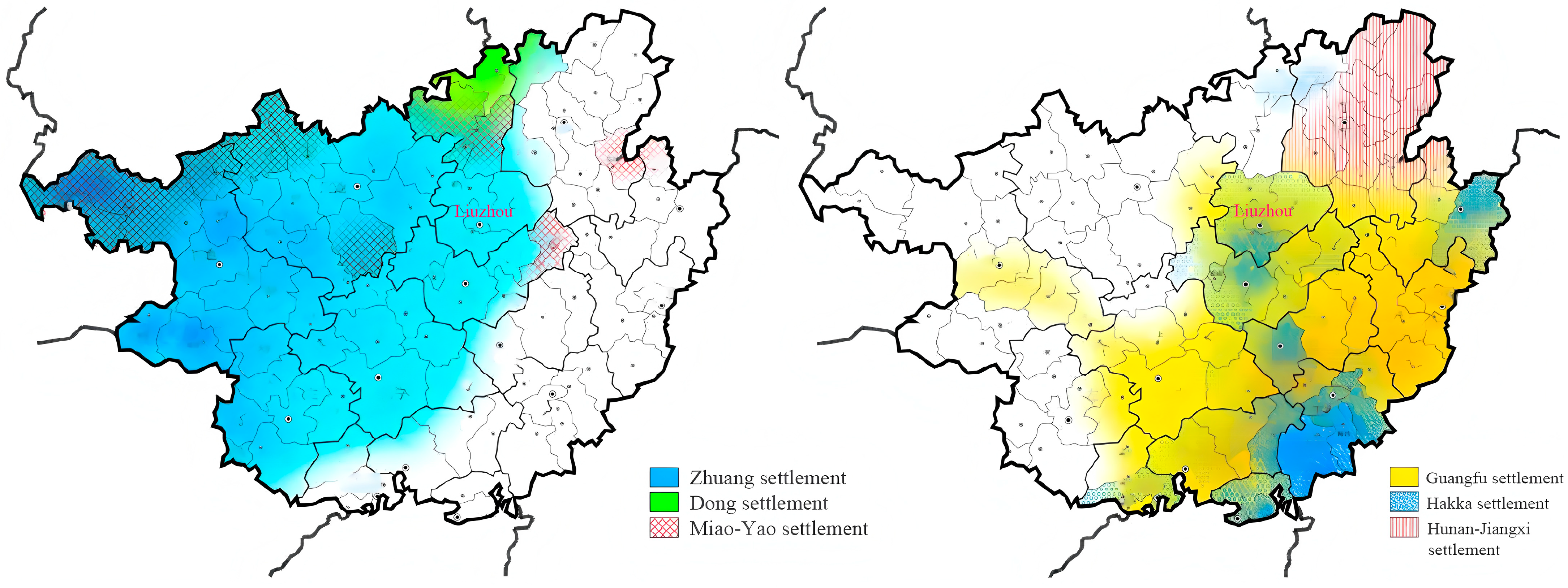
43]. Liuzhou is located in north-central Guangxi. The city’s mountainous and hilly areas are home to a significant population of ethnic groups, particularly the Han, Zhuang, Miao, and Dong peoples. The local ethnic minorities in Liuzhou are also representative of those in Guangxi. The distribution of various ethnic groups in Guangxi is illustrated in
Figure 1.
2.2. The Physical-Geographical Conditions of Guangxi and Liuzhou
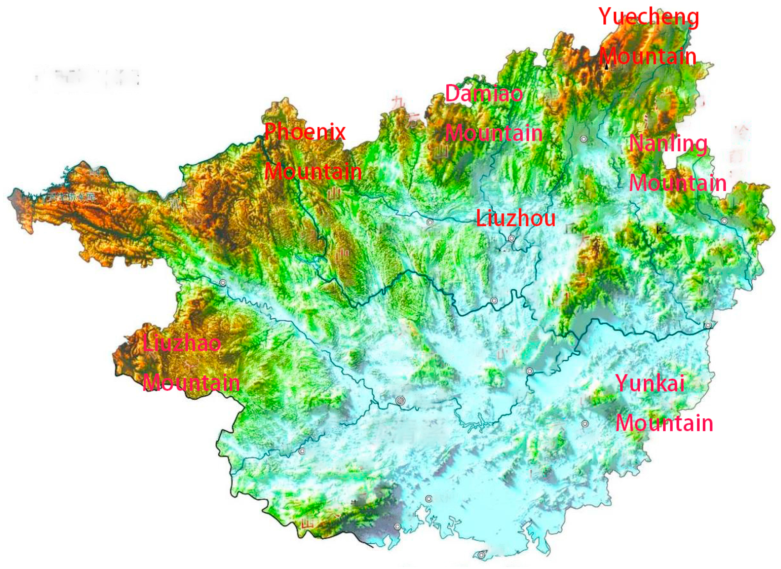
Guangxi is located in the south of China and is surrounded by numerous mountain ranges, resulting in a general topographic pattern of higher elevations along the periphery and lower terrain in the central region. Overall, Guangxi can be characterized as a predominantly mountainous region with limited plains, which means that the northern areas consist of more rugged highlands while the southern parts are composed of plains and basins, as illustrated in
Figure 2.
Overall, the distribution patterns and influencing factors of ethnic minority rural settlements in Guangxi can be studied through two primary aspects: the region’s natural environment and its multicultural interactions. Firstly, the predominantly mountainous terrain with limited plains has resulted in uneven economic development across Guangxi. The western and northern regions of Guangxi are covered with predominantly mountainous terrain with limited flatland; in addition, the climatic conditions are complex and the transportation infrastructure is poor. Under these circumstances, the production and livelihood systems are relatively underdeveloped. However, in the hilly river valleys of Sanjiang Dong Autonomous County in northwestern Guangxi, where the terrain gradually tends to be gentle and water resources are abundant, agricultural and economic development is more robust. Secondly, with the development of Guangxi and the migration of the population, the early indigenous ethnic groups in Guangxi engaged in cultural exchange and integration with the Han residents and other ethnic minorities who moved in, resulting in the formation of multicultural convergence in the settlement pattern. For instance, in northeastern Guangxi, the indigenous Baiyue settlements gradually adopted the Han characteristics in their form and distribution due to the migration of Han people. Similarly, the Miao settlements in Rongshui Miao Autonomous County have adopted the form of tile-roofed houses in their residential buildings, no longer being limited to stilt houses.
2.3. Research Data Sources and Selection of Representative Settlements
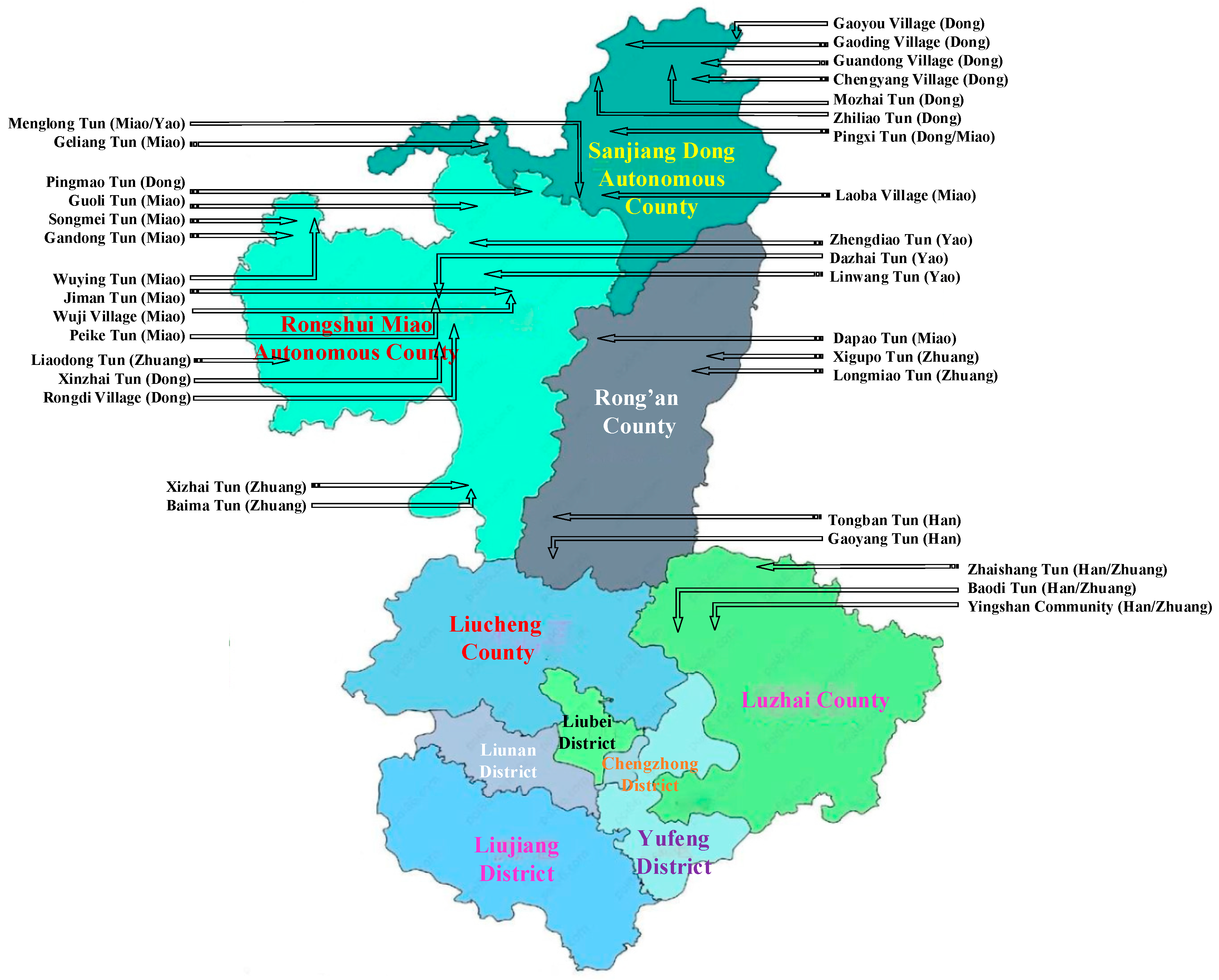
Liuzhou in Guangxi is a multi-ethnic cultural convergence area with rich and diverse ethnic characteristics. The ethnic minority settlements in Liuzhou exhibit both typical and representative features, which can provide a sufficient data basis for this study. Therefore, Liuzhou is selected as the research area in this paper. This study focuses on several major ethnic groups with large populations in Liuzhou (Han, Zhuang, Miao, Dong, and Yao) and selects regions with significant ethnic integration as the study areas. Representative rural settlements were selected as research samples within these typical ethnic groups and regions. When selecting samples, we included both single-ethnic settlements and multi-ethnic mixed settlements, while also taking into account the distribution of each ethnic group in various counties.
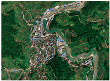
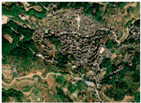
The research data resources of this paper are divided into planar land data, digital elevation data, and social development data. The planar land data is derived from the land use data and geographic information software of Liuzhou in 2023. In this way, geographic information such as rural settlements, river systems, and road topography can be obtained, which is used for geographic feature acquisition. The digital elevation data is derived from a geospatial database. On this basis, the terrain analysis is carried out. The social development data are derived from the “Liuzhou Statistical Yearbook-2023”. Social data such as the population and economic development status of each village in the study area are extracted from the book for the analysis of influencing factors.
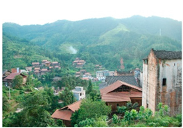
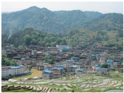
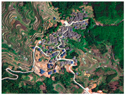
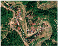
Table 1 presents the ethnic composition and distribution across Liuzhou’s districts and counties. The data reveals that urban districts and Liucheng County are predominantly inhabited by Han and Zhuang populations, with other ethnic minorities constituting minimal proportions. In contrast, Rongshui Miao Autonomous County and Sanjiang Dong Autonomous County exhibit greater ethnic diversity, with Miao and Dong ethnic groups forming the major populations, respectively. Based on the aforementioned sample selection principles and the actual conditions of Liuzhou, we selected 34 representative rural settlements and obtained basic data for these settlements. The selected ethnic settlements in this study comprehensively represent these ethnic groups and regions, effectively reflecting the correlations between the spatial layout features and geographical conditions. The sample size fully meets research requirements. The spatial distribution of the 34 studied settlements is shown in
Figure 3.
3. Materials and Methods
The purpose of this study is to investigate the correlation between geographic characteristics and spatial layout patterns for ethnic minority rural settlements. Therefore, it is necessary to describe the geographical conditions and the spatial layouts of the settlements, respectively. We applied fractal theory and GIS analysis methods to quantitatively characterize the planar morphological features and topographic conditions of the settlements, respectively [
45,
46]. Correlation analysis is a quantitative method, which can be applied to assess the degree of association between two variables. The application requires representing both geographic features and spatial layout characteristics of settlements as quantifiable variables. Therefore, we will classify these features into distinct categories and employ numerical coding for systematic characterization.
Firstly, this section employs fractal theory and GIS analysis methods, utilizing AutoCAD 2022 and ArcGIS 10.2 software to calculate various characteristic parameters of rural settlements in
Figure 3. Based on multi-source data including the land use, digital elevation, and social development of Liuzhou, this paper measures both planar morphological features (such as the length–width ratio) and spatial distribution characteristics (such as the slope gradient and slope direction) of each rural settlement. This analytical process integrates both planar morphological features and spatial layout characteristics into the framework of settlement spatial layout. On this basis, we can analyze the influencing factors shaping the spatial patterns of ethnic minority rural settlements in Liuzhou.
3.1. Fractal Theory
Fractal theory, which studies complex and irregular geometric objects [
47], has been increasingly applied in recent years to investigate the planar morphological characteristics of rural settlements [
48,
49]. Researchers have applied relevant concepts in fractal geometry and landscape ecology to extract elements such as residential buildings, roads, rivers and lakes in the settlement, thereby obtaining the geometric dimension information of each element. In this way, the values of quantitative indicators are derived based on the corresponding definitions and calculation formulas. Scholars classify the morphological characteristics of settlements based on the magnitude and range of indicator values. The specific indicators include the length–width ratio, shape index, circularity ratio, aggregation degree [
50,
51,
52], etc.
3.2. GIS Analysis Method
As an integrated system of geographic information, the GIS synthesizes the spatial data of diverse regions and presents them intuitively. In recent years, this methodology has been widely adopted by researchers across multiple disciplines. This study employs quantitative indicators derived from the literature [
53] and utilizes ArcGIS 10.2 software to extract, calculate, and visualize the geographic information of rural settlements listed in
Figure 3, with a focus on elevation, slope gradient, slope direction, and surface characteristics. Based on the quantitative results, the characteristic elements of ethnic minority rural settlements are classified and represented, enabling the quantitative analysis of the spatial distribution patterns. The quantitative indicators used in this study to characterize the planar morphology and topographic conditions of rural settlements are presented in
Table 2. Among them, the length–width ratio is derived from settlement planar maps, while all other quantitative indicators are computed using ArcGIS 10.2 software. The subsequent analysis will classify the geographic condition types of settlements based on the calculated indicators. Notably, this classification does not merely rely on a single indicator, but rather on the combination of indicators—an approach previously studied in Reference [
45].
3.3. Pearson Correlation Analysis
Some scholars have found that the topography of settlement locations has a relatively significant impact on settlement morphology. However, the correspondence between the specific type of terrain and settlement morphology is neither fixed nor unique. This is because, in addition to topography, settlement morphology is influenced by other natural and human geographical factors, such as altitude, river distance, settlement scale, slope gradient, architectural layout, and other factors. Therefore, this correlation feature analysis requires the sample size to reach a certain level. Under these circumstances, we can summarize and deduce the relationship between settlement patterns and influencing factors from the distribution trends of a large number of samples. The correlation analysis method makes it possible to achieve the research objectives of this paper. Correlation analysis can only be conducted if there is a certain inherent connection or probability among the elements of correlation. Through correlation analysis, we can not only determine whether there is a clear mathematical relationship between different characteristic factors but also assess the strength of this correlation. Through an analysis of the variable types in the study objects of this paper, we adopted the Pearson correlation analysis method. The Pearson correlation coefficient is a statistical measure that evaluates the degree of linear correlation between two continuous variables [
23,
24,
25].
Building upon current research [
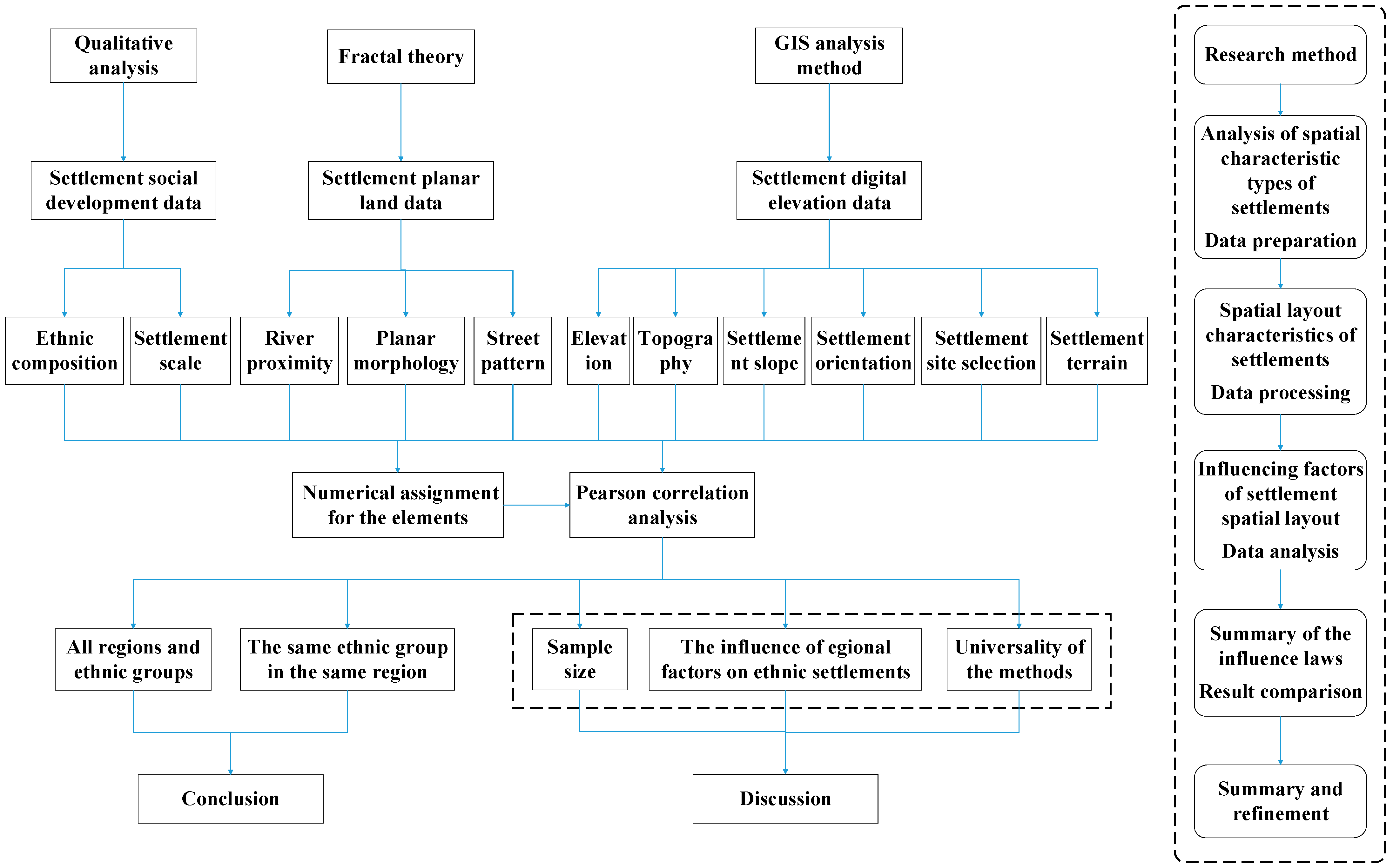
30], this study establishes an evaluation index system for factors influencing the spatial layout of rural settlements. Based on the spatial scale of rural settlements, 11 indicators are selected, covering aspects such as ethnic composition, natural environment, settlement patterns, and site selection characteristics. Pearson correlation coefficients between these variables are then calculated to explore the influencing factors of spatial layout characteristics. In summary, the technical research routine of this paper is illustrated in
Figure 4, and the specific meanings of the 11 indicators in
Figure 4 will be detailed in
Section 4.3.
4. Results
4.1. Topographic and Geomorphic Analysis of Rural Settlements in Liuzhou
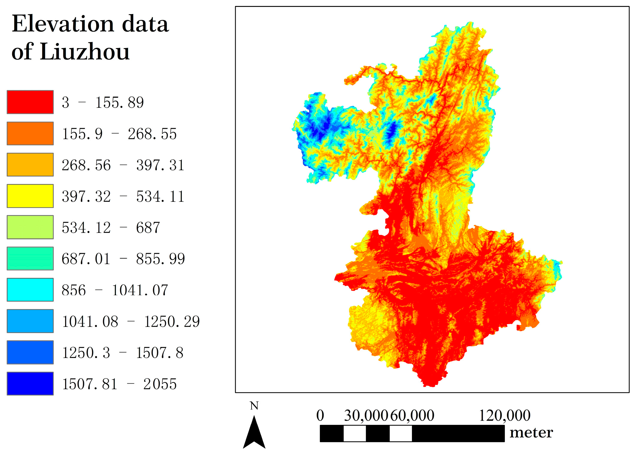
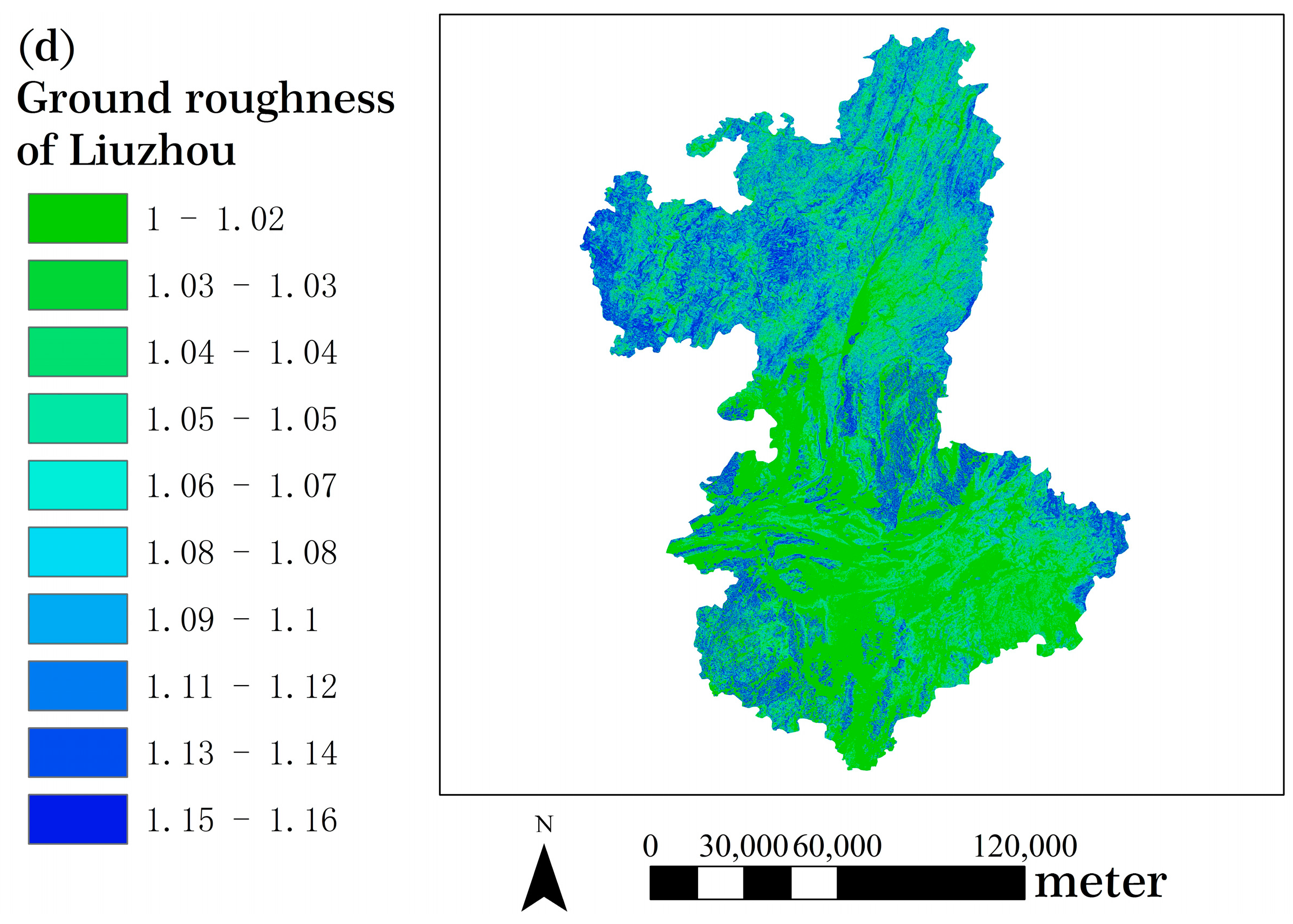
The original data is the digital elevation model (DEM) with a resolution of 12.5 m, as shown in
Figure 5. This section utilizes ArcGIS 10.2 software to calculate topographic and geomorphic indicators for Liuzhou and the results are presented in
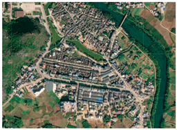
Figure 6. Based on field surveys and GIS analytical data, ethnic minority rural settlements in Liuzhou demonstrate remarkable geomorphological diversity. According to the spatial relationships between rural settlements and nearby mountains/rivers, these settlements can be categorized as follows, with representative examples illustrated in
Table 3.
4.2. The Planar and Spatial Layout Characteristics of Rural Settlements
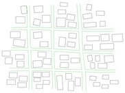
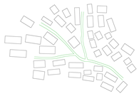
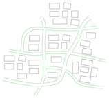
The traditional settlements in Liuzhou, Guangxi exhibit diverse overall morphological patterns. The length–width ratio serves as the most representative indicator of their distribution characteristics, allowing these settlements to be broadly categorized into three types: a clustered type, a clustered-banded type, and a banded type [
45]. Moreover, the layout of these streets and alleys significantly influences the overall morphology of the settlements. The street and alley structures of traditional settlements in Liuzhou can generally be categorized into three types: a checkerboard pattern, a branch pattern, and an irregular network pattern. Detailed classifications with corresponding examples are presented in
Table 4. In this study, the spatial layout characteristics of rural settlements are mainly reflected in the slope gradient and slope direction, as well as the settlement siting patterns and topographic position. Specifically, settlement siting focuses on the mountain–water spatial configuration around the settlements, while settlement terrain examines the relative positional relationship between settlements and the mountains where they are located. The classification and characterization of these spatial layout features have been comprehensively elaborated on in the literature [
46], and thus will not be reiterated here.
4.3. Classification and Feature Extraction of Ethnic Minority Rural Settlements in Liuzhou, Guangxi
Based on the preceding analysis of the natural environment and spatial layout characteristics of traditional ethnic minority settlements in Liuzhou, this study now proceeds to classify the spatial morphology of these rural settlements. Building upon previous research on the fundamental characteristics of traditional settlements in Liuzhou [
53,
54], this study selects 11 feature elements listed in
Table 5. By applying fractal theory and GIS analytical methods to calculate settlement distribution and spatial characteristics, specific value ranges are determined for each feature element, with numerical assignments as shown in
Table 5. Based on the specific number of categories under each characteristic element, we represent them with an equal number. In
Table 5, the assigned values represent the specific ranges of each characteristic element, and their magnitudes are also positively correlated with the values of each quantitative indicator. For indicators that cannot be quantified specifically, such as river proximity, settlement orientation, and planar morphology, values are assigned according to a definite qualitative sequence (e.g., river proximity is assigned in the order from near to far distance, and planar morphology is assigned in the order from a clustered to a banded pattern).
4.4. Research on Correlation Analysis and Influence Laws
This section employs SPSS 19.0 to conduct bivariate correlation analysis on 11 quantitative indicators across 34 research samples, including ethnic composition, topography, elevation, river proximity, settlement scale, settlement orientation, settlement slope, planar morphology, street pattern, settlement site selection, and settlement terrain (as detailed in
Table 6). Furthermore, given the substantial number of Miao settlements in Rongshui Miao Autonomous County and Dong settlements in Sanjiang Dong Autonomous County, this study specifically focuses on settlements within these two counties.
Table 7 and
Table 8 present the correlation analysis results for Rongshui and Sanjiang autonomous counties, respectively. Since the data table for correlation analysis is symmetrical about the diagonal, only the data in the lower left corner are analyzed in this section. Statistically significant correlations are marked by bold fonts in the table for emphasis.
As shown in
Table 6, when considering the traditional settlements of various ethnic groups and regions in Liuzhou as a whole, the sample size is sufficient to reflect the correlations among spatial layout characteristics. As the elevation of settlement locations progressively increases, the terrain gradually transitions from plains to hills and mountains. Concurrently, the distance between settlements and river systems grows larger, the slope gradient of settlement sites becomes steeper, and slope directions shift from dispersed to concentrated patterns. Notably, the evolutionary trend of slope directions is north→west→south→east. With the increase in settlement elevation, the site selection of settlements gradually shifts from valley floors to mountain peaks. Moreover, a significant positive correlation exists between the specific position of residential buildings on mountain slopes and the local elevation. It should be noted that the terrain of dwellings differs conceptually from their geographic location—even within the same mountainous area, diverse patterns emerge in site selection and spatial organization. Similarly, for valley-clustered settlements, their topographic and geomorphic conditions also vary significantly. In terms of street network patterns, distinct differences emerge among different ethnic groups. In Han and Zhuang mixed settlements, the street patterns are more regular, while Miao/Dong and Miao/Yao mixed settlements show irregular and chaotic street patterns. The remaining Miao, Dong, and Yao ethnic settlements are primarily characterized by dendritic and irregular network patterns. No significant correlation was observed between settlement scale/planar morphology and the aforementioned factors for the selected settlements, indicating dispersed distribution patterns across settlements at different elevations and topographic conditions. In summary, the correlation analysis demonstrates a clear relationship between the siting characteristics and their geographical environment. This indicates that natural environmental factors have significant influences on settlement location selection. Furthermore, the aforementioned correlation analysis has quantitatively substantiated this relationship.
Table 7 and
Table 8 present the correlation analysis results conducted within the designed geographical regions and ethnic groups. Compared with
Table 6, the current conclusions with clear correlations are fewer, but
Table 7 and
Table 8 demonstrate certain associations in specific aspects that were not revealed in the overall study. For instance, in Miao settlements of Rongshui Miao Autonomous County, a distinct correlation exists between the planar morphology and river proximity. As the distance from rivers increases, settlement configurations transition progressively from clustered patterns to banded patterns. In addition, the settlement scale has a relatively obvious impact on the slope and the layout of the streets and alleys where the settlement is located. Settlement scale shows significant negative correlation with slope gradient and positive correlation with street network complexity, which means that larger settlements would occupy gentler slopes and develop more disordered street patterns. As the elevation of settlement increases, its layout gradually shifts from a clustered form to a linear strip-like pattern. In the Dong settlements of Sanjiang Dong Autonomous County, there is a significant negative correlation between topography and settlement slope. Specifically, as the landform transitions from hills to mountains, the slope gradient of the settlement location becomes gentler. Additionally, a notable negative correlation exists between settlement scale and settlement terrain: the higher the settlement terrain, the smaller the scale of the settlement.
The weakening of correlation conclusions in
Table 7 and
Table 8 indicates that settlements within the same region and ethnic group demonstrate high degrees of similarity in these characteristic elements. For instance, the Dong settlements in Sanjiang Dong Autonomous County generally exhibit relatively large-scale layouts, with most adopting dendritic street networks. These settlements are predominantly sited at mountain–water intersections or along foothills. However, significant variations exist in their planar morphology and in their spatial relationships with rivers. The Miao settlements in Rongshui Miao Autonomous County generally occupy higher elevations, demonstrating notable consistency in slope gradients, street network patterns, and settlement siting. However, significant variations are observed in their planar morphology and spatial relationships with adjacent rivers. These findings indicate that even under similar topographic and site-selection conditions, different settlements can exhibit distinct planar morphological characteristics. This underscores the necessity of studying planar morphological features and their correlations with geographic elements, thereby verifying that planar and spatial characteristics form an organic entirety.
Based on the comprehensive correlation analysis, we can conclude that there exists a strong association between the spatial layout characteristics and geographical features. Although different regions and ethnic groups exhibit distinct influencing patterns, the overall trend of influence remains largely consistent. Firstly, the specific position of settlements on the mountains emerges as the primary determinant, exhibiting a positive correlation with elevation. Secondly, the settlement site selection of different ethnic groups is determined by their unique historical and cultural backgrounds. In addition, there exists a significant correlation between settlement slope gradient/direction and settlement terrain. Moreover, settlements located at higher relative positions on mountains tend to be situated farther from water systems. Thirdly, for single-ethnic settlements within a specific region, there exists a strong correlation between their planar morphological characteristics (or settlement scale) and the terrain features of the settlement site.
5. Discussion
This paper investigates the influencing factors of spatial layout characteristics in representative ethnic minority rural settlements of Liuzhou, conducting analysis from two distinct perspectives: the overall settlements and the settlements of the same ethnic group in the same region. However, the ethnic minority rural settlements in Liuzhou exhibit multi-ethnic coexistence characteristics, making them affected by dual influences from both geographical and ethnic factors [
53,
54]. Previous study on human–land relationships in multi-ethnic symbiotic settlements has adopted coupling approaches to incorporate various interrelationships, thereby addressing the limitations of single-factor analysis in superficial research [
55].
This study selects 34 ethnic minority settlements within representative ethnic groups and regions as research samples. The sample size is sufficient to demonstrate the proposed methodology and meets the accuracy and rigor requirements for analyzing the correlation between spatial layout characteristics and geographical conditions for ethnic minority settlements. As evidenced in
Table 7 and
Table 8, the number of statistically significant correlations can be improved further. To enhance the comprehensiveness of research findings, it is recommended to increase the sample size of Miao and Dong settlements in Rongshui Miao Autonomous County and Sanjiang Dong Autonomous County, respectively. Furthermore, to enhance the scientific validity and generalizability of the research findings, the selection of settlement samples should thoroughly consider the complexity and diversity of topographic conditions. This approach will ensure that the research samples possess broader representativeness.
Section 4 investigates the correlation between spatial patterns and geographical features within settlements of the same ethnic group in the same area. However, considering that China’s ethnic minority settlements are typically distributed across multiple locations, it is worth further studying whether the spatial layout of the settlements within the same ethnic group will present completely different characteristics by integrating local customs and traditions after villagers migrate to different areas. One research approach involves conducting horizontal qualitative comparisons. This method is particularly suitable for settlements exhibiting common characteristics in spatial layout. By comparing the spatial features of settlements of the same ethnic group in different regions, whether differences exist can be determined. For settlements with dispersed spatial layout characteristics, quantitative research should be conducted. This involves employing correlation analysis to examine the relationship between the layout features and geographic conditions for settlements within the same ethnic group across different regions. By identifying both commonalities and distinctions in these correlations, relevant conclusions can be subsequently drawn.
This study focuses on Liuzhou, Guangxi, but the research methodology is not constrained by ethnic or regional factors. It remains applicable whether it is employed in single-ethnic regions or multi-ethnic settlements. The key distinction lies in separating ethnic factors based on the actual situation. Therefore, the research methods in this paper can be promoted and applied to future studies in other ethnic groups. The planar maps of settlements and the topographic data of their surrounding areas exhibit limited variations within a certain time frame. Since this study primarily focuses on the variation range of data and the correlations between datasets, these minor variations will not affect the validity of the conclusions. The research approaches in this paper are applicable within a certain ethnic group, region, and time range. While the research data may vary over time, such variation will not affect the applicability of the methods in this paper.
6. Conclusions
This study takes Liuzhou in Guangxi Zhuang Autonomous Region as a case study, and applies fractal theory and a GIS analysis method to calculate the planar morphological and spatial layout features of representative settlements. In terms of spatial morphology types, this study further extracts relevant factors influencing spatial layout characteristics and provides numerical assignment. Using Pearson correlation analysis, the research establishes the relationships between spatial morphological features and physical-geographical factors for traditional settlements. Furthermore, it analyzes the influencing patterns of various elements on settlement spatial morphology. The main research findings are summarized as follows:
(1) The ethnic minority traditional settlements in Liuzhou have evolved under the combined influence of multiple factors including transportation networks, topography, and rivers. When analyzing the traditional settlements of Han, Zhuang, Miao, Dong, and Yao ethnic groups as an integrated research entity, the study identifies significant correlations between their settlement siting/terrain characteristics and both geomorphological and altitude features.
(2) Given significant variations across ethnic groups and geographical regions, coupled with the wide distribution of planar characteristics and topographic features, this study specifically examines Miao settlements in Rongshui Miao Autonomous County and Dong settlements in Sanjiang Dong Autonomous County as separate case studies. The results demonstrate significant correlations between planar characteristics and topographic features in Miao settlements of Rongshui Miao Autonomous County. As mountain elevations increase and the distance from river systems grows, settlement planar morphology gradually transitions from clustered to linear patterns. For the Dong settlements in Sanjiang Dong Autonomous County, strong negative correlations exist between topography and settlement slopes, as well as those between settlement scale and terrain characteristics.
(3) The study reveals that rural settlements within the same region and ethnic group demonstrate a certain degree of concentration in terms of elevation, site selection, and terrain features, while exhibiting significant variations in river proximity and planar morphology. Furthermore, comparative analysis shows substantial differences in spatial layout between different ethnic settlements, which are influenced not only by physical-geographical factors but are also shaped by distinct ethnic cultures. This study establishes a general framework for investigating the influencing factors of spatial layout characteristics in ethnic minority rural settlements across southern China.
Based on the research on ethnic minority rural settlements, the following recommendations should be implemented for their planning and conservation: (1) The site selection characteristics of various ethnic settlements demonstrate significant diversity. Consequently, protection planning for different topographic regions should adopt unified standards. (2) When conducting new village planning, it is essential to incorporate the general characteristics of corresponding ethnic groups. For instance, Dong settlements typically feature larger scales, while Miao settlements are generally situated at higher elevations. Based on this, scientific planning can be conducted. (3) Areas adjacent to water sources and low-lying terrains constitute high-frequency settlement zones. It is necessary to strengthen environmental management and transportation construction to improve land utilization efficiency and residents’ quality of life.
Author Contributions
Conceptualization, X.L.; methodology, X.L.; software, X.L.; validation, X.L.; formal analysis, X.L.; investigation, X.L.; writing—review and editing, X.L.; resources, J.Z.; data curation, J.Z. All authors have read and agreed to the published version of the manuscript.
Funding
This research received no external funding.
Data Availability Statement
The DEM data of representative ethnic minority settlements in Liuzhou, Guangxi in this paper were obtained from National Earth System Data Center in 2022. The DEM data covers about 5–10 years. The satellite images of the studied settlements in this paper were obtained in December 2024, and the satellite images cover about 2–3 years.
Conflicts of Interest
The authors declare no conflicts of interest.
Appendix A
Table A1.
Numerical assignment of characteristic elements for each settlement in Luzhai County.
Table A1.
Numerical assignment of characteristic elements for each settlement in Luzhai County.
|
No.
|
Settlement
|
EC
|
TO
|
AE
|
RP
|
SS1
|
SO
|
SS2
|
PM
|
SP
|
SSS
|
ST
|
|---|
| 1 | Zhaishang Tun (Zhuang/Han) | 6 | 2 | 2 | 3 | 5 | 7 | 1 | 3 | 2 | 1 | 1 |
| 2 | Yingshan Community (Zhuang/Han) | 6 | 2 | 1 | 2 | 5 | 7 | 1 | 1 | 1 | 1 | 1 |
| 3 | Baodi Tun (Zhuang/Han) | 6 | 2 | 1 | 4 | 2 | 7 | 1 | 1 | 1 | 1 | 1 |
Table A2.
Numerical assignment of characteristic elements for each settlement in Rong’an County.
Table A2.
Numerical assignment of characteristic elements for each settlement in Rong’an County.
|
No.
|
Settlement
|
EC
|
TO
|
AE
|
RP
|
SS1
|
SO
|
SS2
|
PM
|
SP
|
SSS
|
ST
|
|---|
| 1 | Tongban Tun (Han) | 1 | 2 | 3 | 4 | 1 | 2 | 3 | 1 | 3 | 2 | 5 |
| 2 | Gaoyang Tun (Han) | 1 | 2 | 1 | 3 | 2 | 2 | 2 | 3 | 3 | 2 | 4 |
| 3 | Longmiao Tun (Zhuang) | 2 | 2 | 1 | 1 | 4 | 3 | 2 | 3 | 2 | 1 | 1 |
| 4 | Xigupo Tun (Zhuang) | 2 | 2 | 2 | 1 | 1 | 2 | 2 | 2 | 2 | 1 | 5 |
| 5 | Dapao Tun (Miao) | 3 | 2 | 2 | 2 | 3 | 5 | 3 | 2 | 2 | 1 | 2 |
Table A3.
Numerical assignment of characteristic elements for each settlement in Rongshui Miao Autonomous County.
Table A3.
Numerical assignment of characteristic elements for each settlement in Rongshui Miao Autonomous County.
|
No.
|
Settlement
|
EC
|
TO
|
AE
|
RP
|
SS1
|
SO
|
SS2
|
PM
|
SP
|
SSS
|
ST
|
|---|
| 1 | Baima Tun (Zhuang) | 2 | 1 | 1 | 1 | 3 | 7 | 1 | 2 | 3 | 1 | 1 |
| 2 | Xizhai Tun (Zhuang) | 2 | 1 | 1 | 1 | 3 | 7 | 1 | 3 | 3 | 1 | 1 |
| 3 | Liaodong Tun (Zhuang) | 2 | 3 | 3 | 1 | 4 | 1 | 2 | 3 | 2 | 2 | 2 |
| 4 | Pingmao Tun (Dong) | 4 | 2 | 3 | 2 | 5 | 1 | 3 | 1 | 2 | 1 | 2 |
| 5 | Xinzhai Tun (Dong) | 4 | 3 | 4 | 3 | 3 | 7 | 1 | 1 | 3 | 2 | 2 |
| 6 | Rongdi Village (Dong) | 4 | 3 | 6 | 3 | 2 | 1 | 2 | 1 | 2 | 2 | 5 |
| 7 | Gandong Tun (Miao) | 3 | 2 | 5 | 1 | 5 | 1 | 2 | 1 | 3 | 3 | 3 |
| 8 | Guoli Tun (Miao) | 3 | 3 | 5 | 4 | 3 | 1 | 3 | 3 | 2 | 3 | 6 |
| 9 | Songmei Tun (Miao) | 3 | 3 | 6 | 4 | 4 | 2 | 3 | 3 | 3 | 3 | 6 |
| 10 | Wuying Tun (Miao) | 3 | 2 | 5 | 1 | 3 | 4 | 3 | 2 | 2 | 2 | 5 |
| 11 | Peike Tun (Miao) | 3 | 3 | 5 | 3 | 5 | 6 | 2 | 2 | 3 | 2 | 5 |
| 12 | Jiman Tun (Miao) | 3 | 3 | 5 | 3 | 5 | 2 | 2 | 2 | 3 | 3 | 4 |
| 13 | Wuji Village (Miao) | 3 | 3 | 5 | 3 | 5 | 2 | 2 | 2 | 3 | 2 | 5 |
| 14 | Linwang Tun (Yao) | 5 | 3 | 6 | 3 | 3 | 4 | 2 | 1 | 2 | 2 | 4 |
| 15 | Dazhai Tun (Yao) | 5 | 3 | 6 | 4 | 2 | 1 | 3 | 1 | 2 | 2 | 5 |
| 16 | Zhengdiao Tun (Yao) | 5 | 3 | 5 | 3 | 2 | 1 | 3 | 2 | 2 | 2 | 5 |
Table A4.
Numerical assignment of characteristic elements for each settlement in Sanjiang Dong Autonomous County.
Table A4.
Numerical assignment of characteristic elements for each settlement in Sanjiang Dong Autonomous County.
|
No.
|
Settlement
|
EC
|
TO
|
AE
|
RP
|
SS1
|
SO
|
SS2
|
PM
|
SP
|
SSS
|
ST
|
|---|
| 1 | Gaoding Village (Dong) | 4 | 3 | 4 | 4 | 5 | 4 | 2 | 1 | 3 | 3 | 3 |
| 2 | Gaoyou Village (Dong) | 4 | 2 | 4 | 4 | 5 | 5 | 4 | 2 | 2 | 3 | 4 |
| 3 | Guandong Village (Dong) | 4 | 3 | 2 | 2 | 5 | 7 | 2 | 3 | 2 | 2 | 2 |
| 4 | Chengyang Village (Dong) | 4 | 3 | 2 | 2 | 5 | 7 | 2 | 4 | 2 | 3 | 3 |
| 5 | Mozhai Tun (Dong) | 4 | 3 | 3 | 1 | 5 | 1 | 2 | 3 | 2 | 2 | 2 |
| 6 | Zhiliao Tun (Dong) | 4 | 3 | 5 | 4 | 3 | 2 | 3 | 3 | 2 | 3 | 6 |
| 7 | Pingxi Tun (Dong/Miao) | 6 | 3 | 2 | 1 | 4 | 4 | 2 | 3 | 3 | 2 | 4 |
| 8 | Laoba Village (Miao) | 3 | 3 | 4 | 3 | 5 | 4 | 3 | 1 | 3 | 2 | 5 |
| 9 | Geliang Tun (Miao) | 3 | 3 | 2 | 1 | 4 | 4 | 2 | 3 | 2 | 2 | 2 |
| 10 | Menglong Tun (Miao/Yao) | 6 | 3 | 4 | 4 | 3 | 4 | 3 | 3 | 2 | 2 | 5 |
References
- Logan, J.R.; Spielman, S.; Xu, H.W.; Klein, P.N. Identifying and bounding ethnic neighborhood. Urban Geogr. 2011, 32, 334–359. [Google Scholar] [CrossRef] [PubMed]
- Masella, P. National identity and ethnic diversity. J. Popul. Econ. 2013, 26, 437–454. [Google Scholar] [CrossRef]
- Miranda, D.E.; García-Ramirez, M.; Albar-Marín, M.J. Building meaningful community advocacy for ethnic-based health equity: The RoAd4Health experience. Am. J. Community Psychol. 2020, 66, 347–357. [Google Scholar] [CrossRef] [PubMed]
- Risatti, H. A Theory of Craft: Function and Aesthetic Expression; The University of North Carolina Press: Chapel Hill, NC, USA, 2007. [Google Scholar]
- Li, J.J.; Auchincloss, A.H.; Hirsch, J.A.; Melly, S.J.; Moore, K.A.; Peterson, A.; Sanchez, B.N. Exploring the Spatial Scale Effects of Built Environments on Transport Walking: Multi-Ethnic Study of Atherosclerosis. Health Place 2022, 73, 102722. [Google Scholar] [CrossRef]
- Nichols, J.M. A major urban earthquake: Planning for Armageddon. Landsc. Urban Plann. 2005, 73, 136–154. [Google Scholar] [CrossRef]
- Thubthun, N.; Tansuwanrat, K. Cultural interactions among diverse ethnic groups in a frontier region of a mainstream culture: A case study of Thai Korat, Laotian, and Tai Yuan vernacular houses in the central Lamtakong watershed, Nakhon Ratchasima. Front. Archit. Res. 2024, 13, 543–560. [Google Scholar] [CrossRef]
- Chen, P.D.; Nutteera, P.; Yan, Y.Y.; Chai, C.T. Research on driving factors and mechanism of Minority Village tourism development in Guizhou Province, China1. Heliyon 2023, 9, e20483. [Google Scholar] [CrossRef]
- Dai, G.Z. Subject gaze in tourism reproduction in ethnic villages: Taking the development of ten-year tourism in tongren village and shadong village of Guizhou as an example. J. Southwest Minzu Univ. Humanit. Soc. Sci. 2019, 40, 34–40. [Google Scholar]
- Rao, Y.F.; Zou, Y.F.; Yi, C.F.; Luo, F.; Song, Y.; Wu, P.Q. Optimization of rural settlements based on rural revitalization elements and rural residents’ social mobility: A case study of a township in western China. Habitat Int. 2023, 137, 102851. [Google Scholar] [CrossRef]
- Mao, L.Q.; Zhang, X.; Ma, J.J.; Jia, Y.H. Cultural relationship between rural soundscape and space in Hmong villages in Guizhou. Heliyon 2022, 8, e11641. [Google Scholar] [CrossRef]
- Liu, X.Q.; Li, Y.; Wu, Y.; Li, C. The spatial pedigree in traditional villages under the perspective of urban regeneration—Taking 728 villages in Jiangnan region, China as cases. Land 2022, 11, 1561. [Google Scholar] [CrossRef]
- Fu, J.; Zhou, J.L.; Deng, Y.Y. Heritage values of ancient vernacular residences in traditional villages in Western Hunan, China: Spatial patterns and influencing factors. Build. Environ. 2021, 188, 107473. [Google Scholar] [CrossRef]
- Zhang, L.; Lu, P.; Yan, L.J.; Li, X.; Yang, R.X.; Chen, P.P.; Wang, X. Unique traditional villages on the Loess Plateau of China: Historic evolution and challenges to sustainable development of silo-caves. Herit. Sci. 2021, 9, 118. [Google Scholar] [CrossRef]
- Zhao, Y.; Ni, Z.; Zhang, Y.; Wan, P.; Geng, C.; Yu, W.; Li, Y.; Long, Z. Exploring the Spatiotemporal Evolution Patterns and Determinants of Construction Land in Mianning County on the Eastern Edge of the Qinghai–Tibet Plateau. Land 2024, 13, 993. [Google Scholar] [CrossRef]
- Zou, Y.F.; Rao, Y.F.; Luo, F.; Yi, C.F.; Du, P.P.; Liu, H.Y.; Wu, P.Q.; Song, Y.; Zhou, Y. Evolution of rural settlements and its influencing mechanism in the farming-pastoral ecotone of Inner Mongolia from a production-living-ecology perspective. Habitat Int. 2024, 151, 103137. [Google Scholar] [CrossRef]
- Zhao, Y.; Tian, Y. Spatial distribution and influencing factors of ethnic minority villages in Guizhou. Dev. Small Cities Towns 2019, 37, 71–78. [Google Scholar]
- Xu, X.; Genovese, P.V.; Zhao, Y.; Liu, Y.; Woldesemayat, E.M.; Zoure, A.N. Geographical distribution characteristics of ethnic-minority villages in Fujian and their relationship with topographic factors. Sustainability 2022, 14, 7727. [Google Scholar] [CrossRef]
- Li, T.; Li, C.K.; Zhang, R.; Cong, Z.; Mao, Y. Spatial heterogeneity and influence factors of traditional villages in the Wuling mountain area, Hunan Province, China based on multiscale geographically weighted regression. Buildings 2023, 13, 294. [Google Scholar] [CrossRef]
- Chen, S.; Mehmood, M.S.; Liu, S.; Gao, Y. Spatial Pattern and Influencing Factors of Rural Settlements in Qinba Mountains, Shaanxi Province, China. Sustainability 2022, 14, 10095. [Google Scholar] [CrossRef]
- Chen, S.; Wang, X.Y.; Lin, Q. Spatial pattern characteristics and influencing factors of mountainous rural settlements in metropolitan fringe area: A case study of Pingnan County, Fujian Province. Heliyon 2024, 10, e26606. [Google Scholar] [CrossRef]
- Qu, Y.B.; Jiang, G.H.; Yang, Y.T.; Zheng, Q.Y.; Li, Y.L.; Ma, W.Q. Multi-scale analysis on spatial morphology differentiation and formation mechanism of rural residential land: A case study in Shandong Province, China. Habitat Int. 2018, 71, 135–146. [Google Scholar]
- Zhao, Y.; Liu, J.; Zhang, J.; Zhang, X.; Li, H.; Gao, F.; Zhan, Y. Spatial Identification and Evaluation of Land Use Multifunctions and Their Interrelationships Improve Territorial Space Zoning Management in Harbin, China. Land 2024, 13, 1092. [Google Scholar] [CrossRef]
- Ullah, M.; Tang, B.; Huangfu, W.; Yang, D.; Wei, Y.; Qiu, H. Machine Learning-Driven Landslide Susceptibility Mapping in the Himalayan China–Pakistan Economic Corridor Region. Land 2024, 13, 1011. [Google Scholar] [CrossRef]
- Li, D.; Zhang, Y.; Gao, Y.; Duan, L.; Li, H.; Zhang, H.; Gao, Q.; Zhao, M.; Liu, Q. Coupling Land Use with Multiple Geographical Factors Drives the Evolution of Habitat Quality: Case Study from Resource-Exhausted City—Jiawang District, East China. Sustainability 2025, 17, 2954. [Google Scholar] [CrossRef]
- Yang, L.P.; Ou, C.; Wang, Z.; Du, Z.R.; Yao, X.C.; Du, Z.B. Unveiling patterns and drivers of long-term rural settlement changes from the urban-rural gradient perspective: A case study of the Beijing-Tianjin-Hebei region in China. Habitat Int. 2025, 156, 103300. [Google Scholar] [CrossRef]
- Shi, Z.H.; Ma, L.B.; Zhang, W.B.; Gong, M. Differentiation and correlation of spatial pattern and multifunction in rural settlements considering topographic gradients: Evidence from Loess Hilly Region, China. J. Environ. Manag. 2022, 315, 115127. [Google Scholar] [CrossRef]
- Brunhes, J. Principles of Human Geoscience; Zhongshan Bookstore: Nanjing, China, 1935. [Google Scholar]
- Jin, Q. Rural Settlement Geography; Science Press: Beijing, China, 1988. [Google Scholar]
- Paquette, S.; Domon, G. Changing ruralities, changing landscapes: Exploring social recomposition using a multi-scale approach. J. Rural. Stud. 2003, 19, 425–444. [Google Scholar] [CrossRef]
- Hoskins, W.G. The Making of the English Landscape; Hodder: London, UK, 1955. [Google Scholar]
- Argent, N.M.; Smailes, P.J.; Griffin, T. Tracing the Density Impulse in Rural Settlement Systems: A Quantitative Analysis of the Factors Underlying Rural Population Density Across SouthEastern Australia, 1981–2001. Popul. Environ. 2006, 27, 151–190. [Google Scholar] [CrossRef]
- Gilg, A. An Introduction to Rural Geography; Edward Amold: London, UK, 1985. [Google Scholar]
- McLaughlin, D.K.; Stokes, C.S.; Nonoyama, A. Residence and income inequality: Effects on mortality among U.S. counties. Rural. Sociol. 2001, 66, 579–598. [Google Scholar] [CrossRef]
- Martinho, I. Historic Anthropogenic Factors Shaping the Rural Landscape of Portugal’s Interior Alenteio; Arizona University Press: Tucson, AZ, USA, 2001. [Google Scholar]
- Li, B.L.; Lu, Y.F.; Li, Y.D.; Zuo, H.Y.; Ding, Z.Q. Research on the Spatiotemporal Distribution Characteristics and Accessibility of Traditional Villages Based on Geographic Information Systems—A Case Study of Shandong Province, China. Land 2024, 13, 1049. [Google Scholar] [CrossRef]
- Liu, S.Y. Study on the Construction of Spatial Morphology Gene Map of Hanzhong Towns in Southern Shaanxi. Master’s Thesis, Xi’an University of Architecture and Technology, Xi’an, China, 2021. [Google Scholar]
- Wang, H.B. Study on the Characteristic Map and Protection Planning Strategy of Traditional Settlements in Southern Shaanxi. Master’s Thesis, Chang’an University, Xi’an, China, 2022. [Google Scholar]
- Qu, Y.B.; Jiang, G.H.; Zhao, Q.L.; Ma, W.Q.; Zhang, R.J.; Yang, Y.T. Geographic identification, spatial differentiation, and formation mechanism of multifunction of rural settlements: A case study of 804 typical villages in Shandong Province, China. J. Clean. Prod. 2017, 166, 1202–1215. [Google Scholar] [CrossRef]
- Hu, J.L.; Teng, Y.B.; Fan, Y.M.; Li, L.P. Spatial distribution and influencing factors of traditional villages in Guangxi Zhuang Autonomous Region. J. Guilin Univ. Technol. 2021, 41, 580–588. [Google Scholar]
- Wei, Y.C. Comparative Study on Public Space of Zhuang’s Traditional Settlement in Guangxi. Dev. Small Cities Towns 2016, 10, 73–77. [Google Scholar]
- Wei, Y.H. Analysis on the Protection of the Historical Relics of the Traditional Villages of Guangxi Minority Nationalities. Herit. Conserv. Res. 2018, 3, 4–6. [Google Scholar]
- Liu, Z.H.; Lee, J.K. Study on analysis of the traditional villages in Guangxi. Shanxi Archit. 2017, 43, 1–3. [Google Scholar]
- Wei, Y.C. The Research of Public Space Among Minority Ethnic Rroups in Guangxi, China. Ph.D. Thesis, South China University of Technology, Guangzhou, China, 2017. [Google Scholar]
- Luo, X.; Huang, C.P.; Huang, J.Y. A Quantitative Study on the Morphological Characteristics of Rural Settlements: Taking the Ethnic Minority Villages in Liuzhou, Guangxi as the Example. Planners 2023, 39, 88–94. [Google Scholar]
- Luo, X.; Zhang, J. A Quantitative Method for Characterizing the Spatial Layout Features of Ethnic Minority Rural Settlements in Southern China. Land 2025, 14, 1144. [Google Scholar] [CrossRef]
- Zhang, X.J. Research on Spatial Form Design of Traditional Residence of South Hebei Province Based on Fractal Theory. Master’s Thesis, South China University of Technology, Guangzhou, China, 2020. [Google Scholar]
- Huang, L. Quantitative Analysis on the Plane Form of Linpan Settlements in Chengdu. Master’s Thesis, Southwest Jiaotong University, Chengdu, China, 2022. [Google Scholar]
- Liu, C.Y. The Quantitative Analysis of Settlement Space of Dingcun Village in XiangFen County Based on the Two-Dimensional Form of Built-Up Area and Geographic Information Integration. Master’s Thesis, Beijing Jiaotong University, Beijing, China, 2019. [Google Scholar]
- Li, Y.T.; Zhu, Y.Q.; Zhou, Y.; Sun, Z.Q. Quantitative Study of the Spatial Morphological Characteristics of Villages Based on Fractal Theory: Nanning Village as an Example. South Archit. 2020, 5, 64–69. [Google Scholar]
- Yuan, J.L.; Chen, C.; Zhou, Q.Y.; Li, B.H. Research on Landscape Gene Identification and Morphological Quantification of Traditional Settlement Dwellings—A Case of Zhongtian Village Hengyang. Urban. Archit. 2021, 18, 102–105. [Google Scholar]
- Luo, X. Research on Construction Method of Genetic Map for Rural Settlement Heritage Under the Confluence of Multi-Culture in Liuzhou, Guangxi. Ph.D. Thesis, Shanghai Jiao Tong University, Shanghai, China, 2024. [Google Scholar]
- Zhang, J.; Long, B.; Chen, Q.Y. Research on the landscape characteristics of southeast Chongqing traditional settlement under the influence of geography and ethnicity, Chin. Landsc. Archit. 2023, 39, 85–91. [Google Scholar]
- Lin, G.R.; Yu, X.H.; Li, Y. Social network dynamics in rural public spaces of multi-ethnic settlements: A case study from Tongren, China. Alex. Eng. J. 2024, 102, 132–148. [Google Scholar] [CrossRef]
- Wang, T.; Li, J.; Li, L.X.; Chen, C.Y. Study on the “Coupling Rubik’s Cube” in the living space of farmers in multi-ethnic symbiotic villages: Taking Zhengjiazhuang in Eryuan County as a sample. World Reg. Stud. 2021, 30, 399–409. [Google Scholar]
| Disclaimer/Publisher’s Note: The statements, opinions and data contained in all publications are solely those of the individual author(s) and contributor(s) and not of MDPI and/or the editor(s). MDPI and/or the editor(s) disclaim responsibility for any injury to people or property resulting from any ideas, methods, instructions or products referred to in the content. |
© 2025 by the authors. Licensee MDPI, Basel, Switzerland. This article is an open access article distributed under the terms and conditions of the Creative Commons Attribution (CC BY) license (https://creativecommons.org/licenses/by/4.0/).


