Review

Advancements in Forest Monitoring: Applications and Perspectives of Airborne Laser Scanning and Complementarity with Satellite Optical Data


1
Department of Agriculture, Food, Environment and Forest Science and Technology (DAGRI), University of Florence, 500145 Florence, Italy
2
Fondazione per il Futuro delle Città, 50121 Firenze, Italy
3
Department of Science and Technology of Agriculture and Environment (DISTAL), University of Bologna, 40126 Bologna, Italy
4
Department of Forest Resource Management, Swedish University of Agricultural Sciences, 90183 Umea, Sweden
*
Author to whom correspondence should be addressed.
Land 2025, 14(3), 567; https://doi.org/10.3390/land14030567
Submission received: 21 January 2025 / Revised: 6 February 2025 / Accepted: 5 March 2025 / Published: 8 March 2025

Abstract

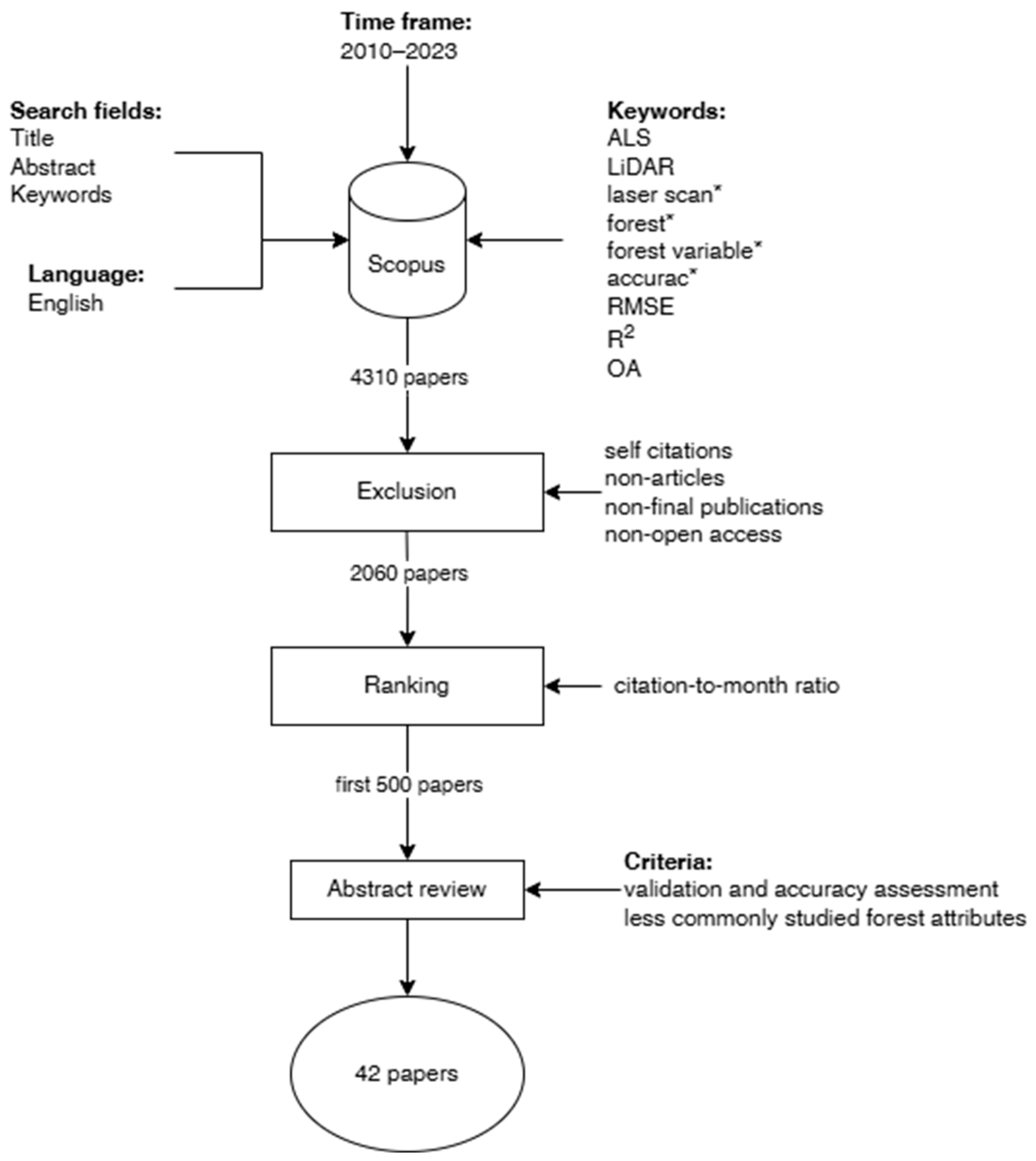
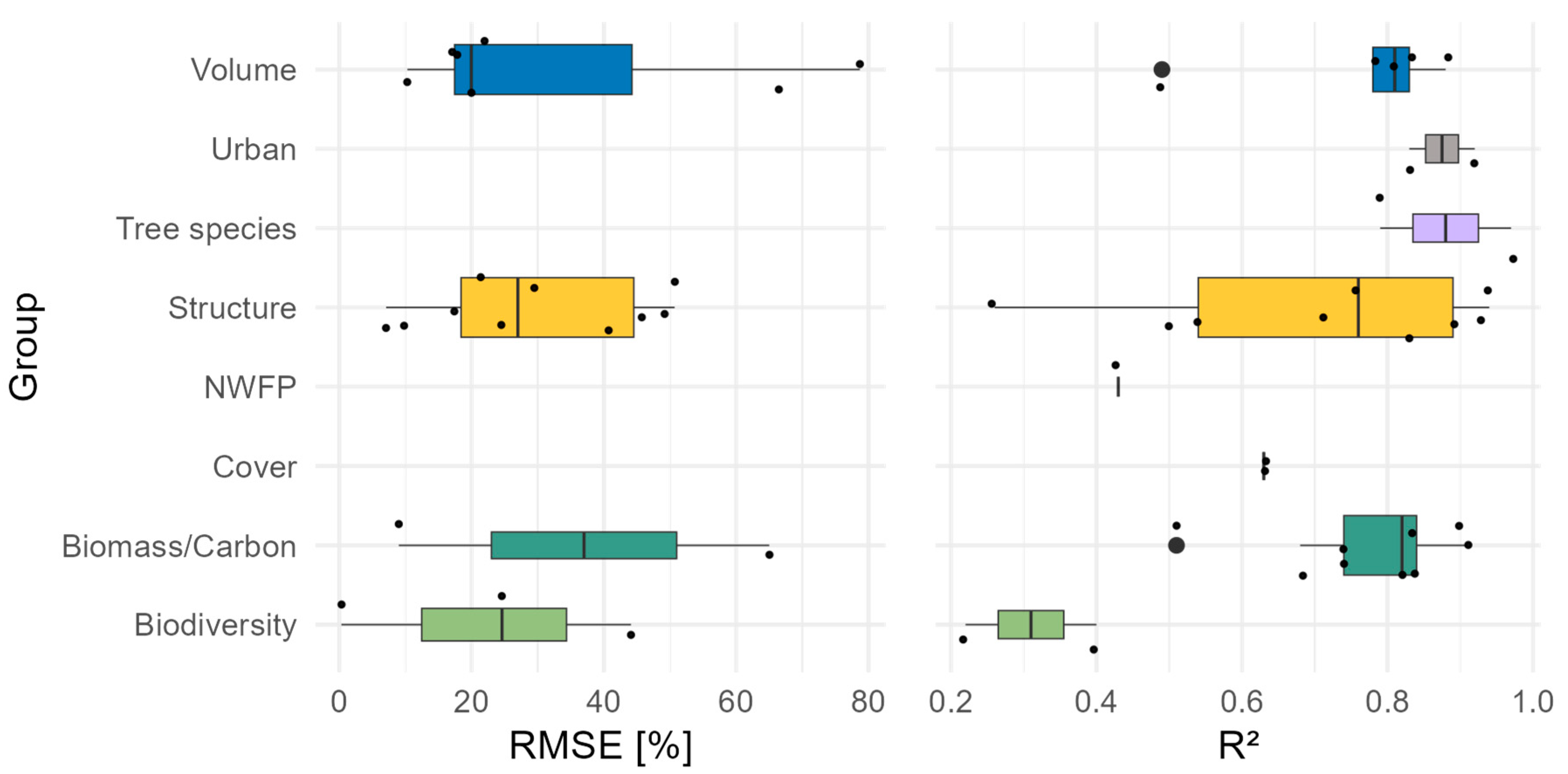
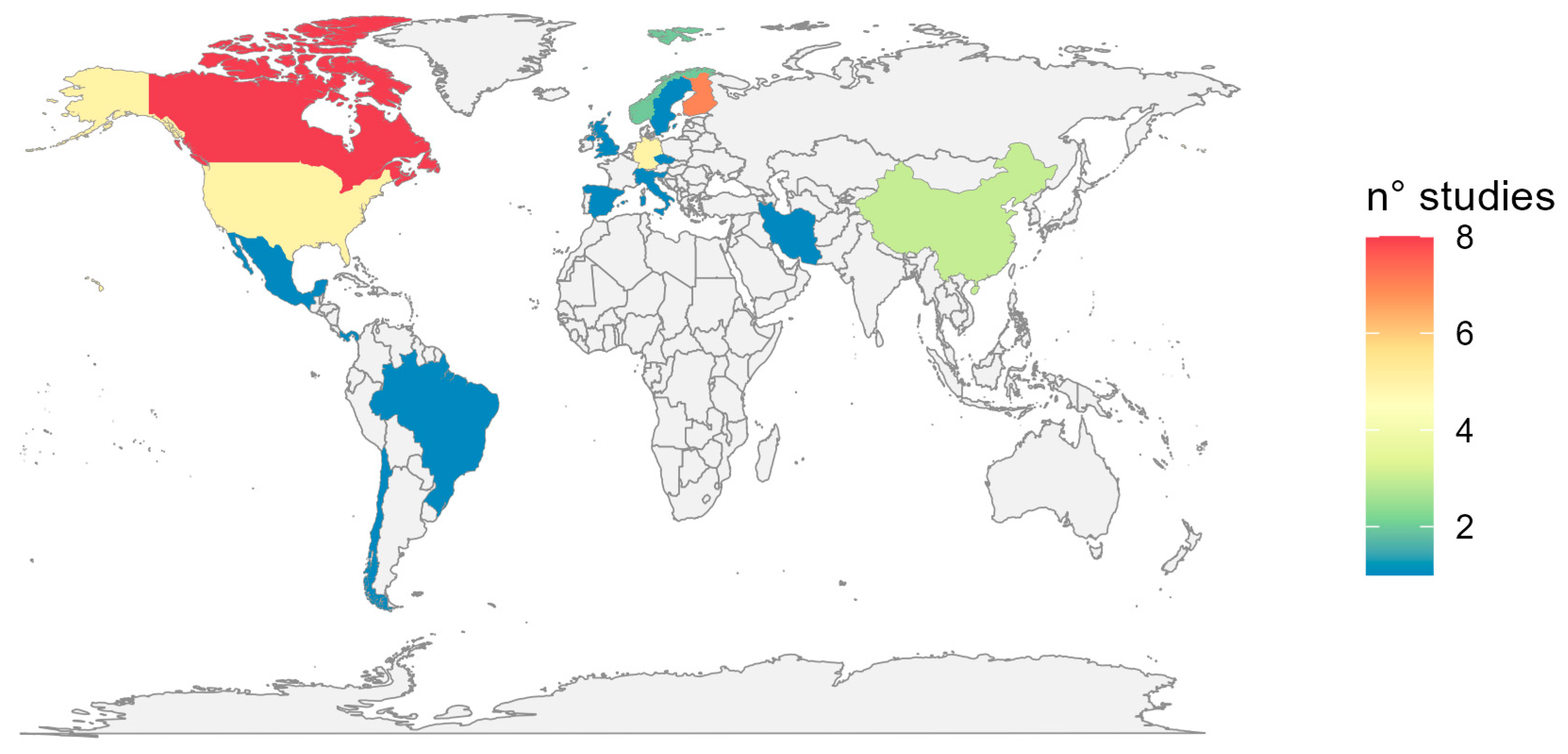
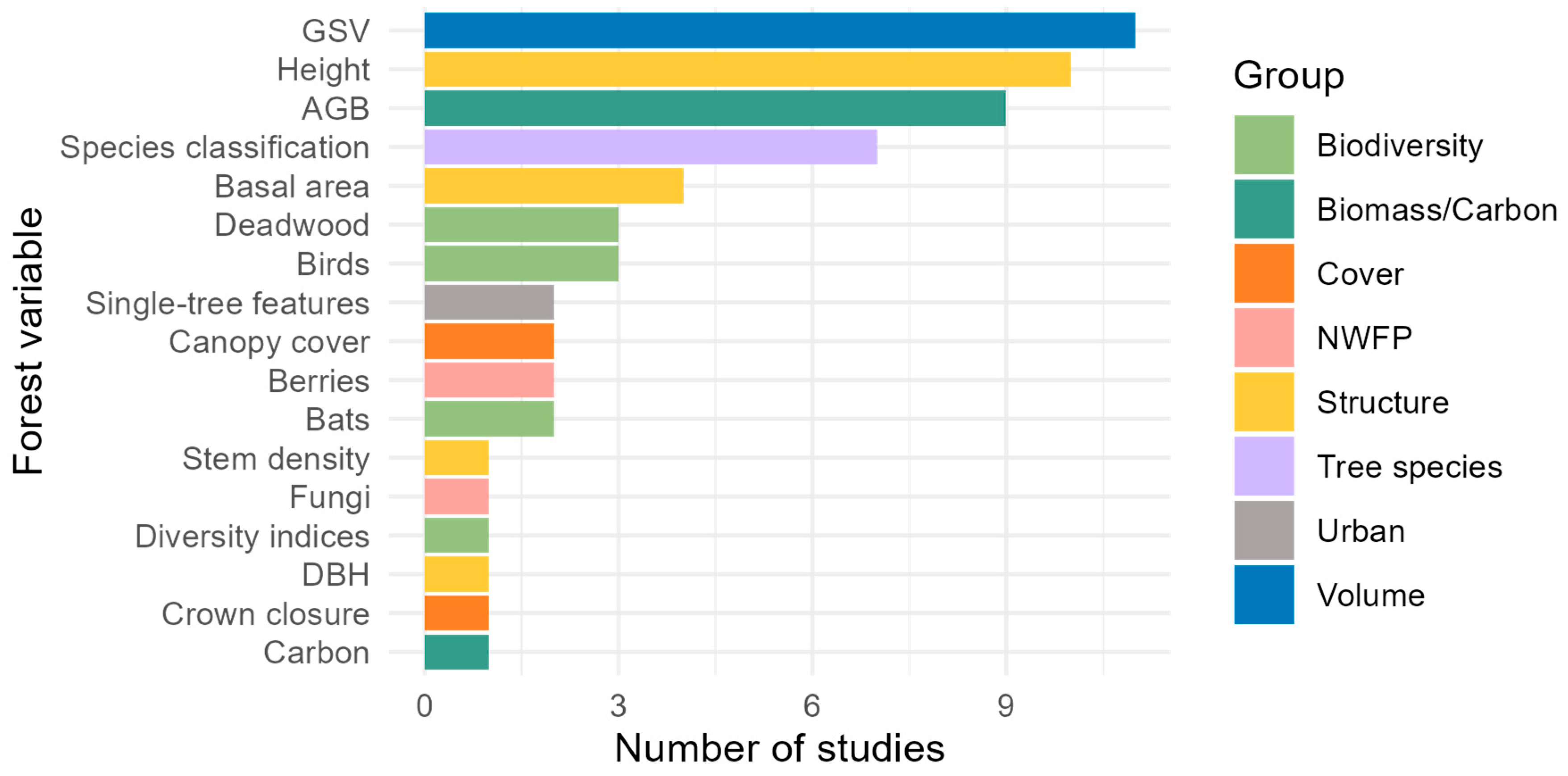
This study reviews research from 2010 to 2023 on the integration of airborne laser scanning (ALS) metrics with satellite and ground-based data for forest monitoring, highlighting the potential of the combined use of ALS and optical remote sensing data in improving the accuracy and the frequency. Following an in-depth screening process, 42 peer-reviewed scientific manuscripts were selected and comprehensively analyzed, identifying how the integration among different sources of information facilitate frequent, large-scale updates, crucial for monitoring forest ecosystems dynamics and changes, aiding in supporting sustainable management and climate smart forestry. The results showed how ALS metrics—especially those related to height and intensity—improved estimates precision of forest volume, biomass, biodiversity, and structural attributes, even in dense vegetation, with an R2 up to 0.97. Furthermore, ALS data were particularly effective for monitoring urban forest variables (R2 0.83–0.92), and for species classification (overall accuracy up to 95%), especially when integrated with multispectral and hyperspectral imagery. However, our review also identified existing challenges in predicting biodiversity variables, highlighting the need for continued methodological improvements. Importantly, while some studies revealed great potential, novel applications aiming at improving ALS-derived information in spatial and temporal coverage through the integration of optical satellite data were still very few, revealing a critical research gap. Finally, the ALS studies’ distribution was extremely biased. Further research is needed to fully explore its potential for global forest monitoring, particularly in regions like the tropics, where its impact could be significant for ecosystem management and conservation.
Keywords: airborne laser scanner; biodiversity; remote sensing; sustainable forest management airborne laser scanner; biodiversity; remote sensing; sustainable forest management