Article

Using Unmanned Aerial Vehicle Data to Improve Satellite Inversion: A Study on Soil Salinity

1
School of Geography and Planning, Ningxia University, Yinchuan 750021, China
2
School of Ecology and Environment, Ningxia University, Yinchuan 750021, China
*
Author to whom correspondence should be addressed.
Land 2024, 13(9), 1438; https://doi.org/10.3390/land13091438
Submission received: 6 July 2024 / Revised: 29 August 2024 / Accepted: 3 September 2024 / Published: 5 September 2024

Abstract

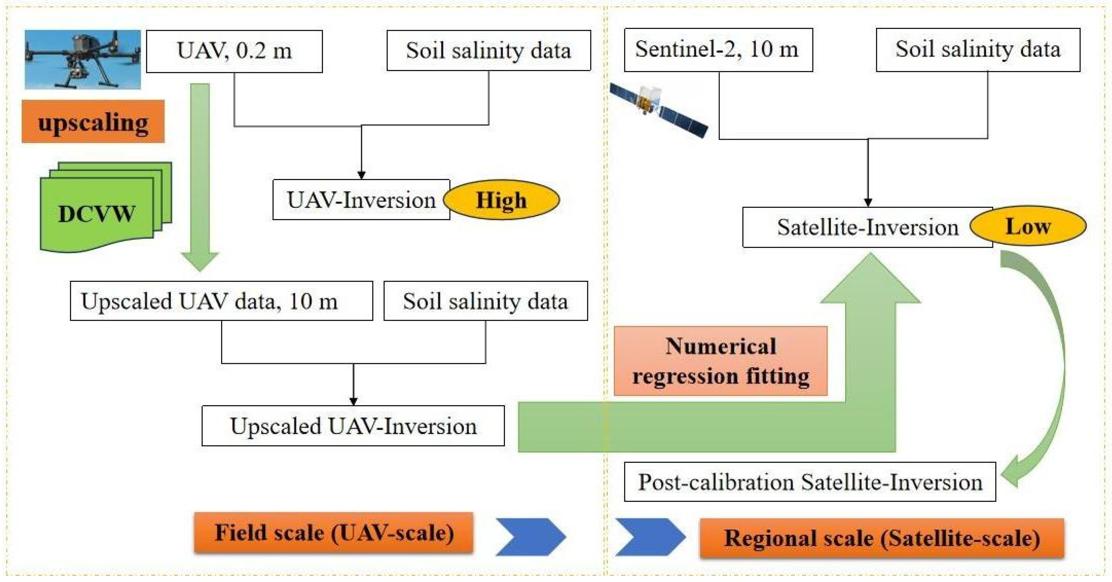
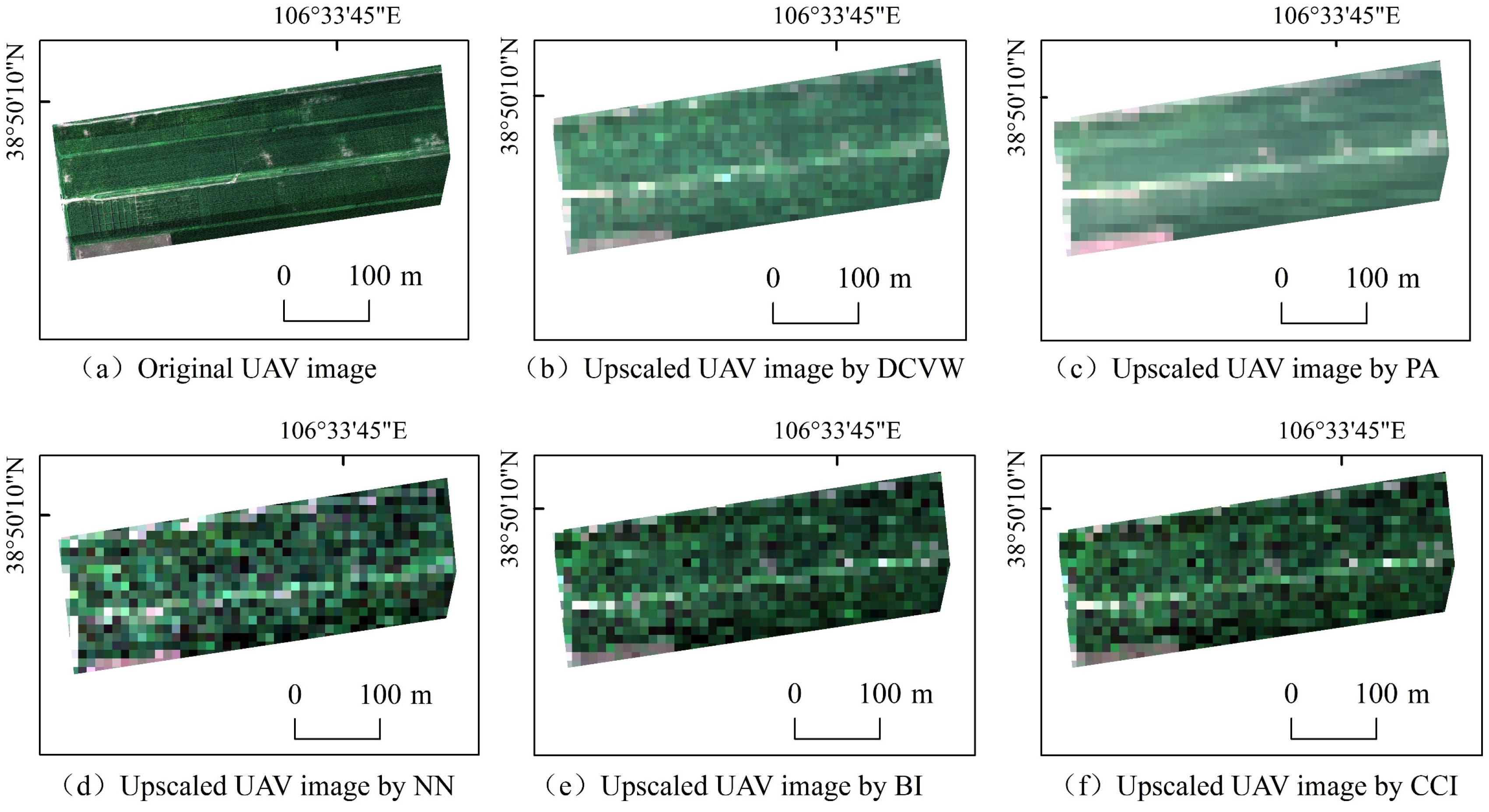
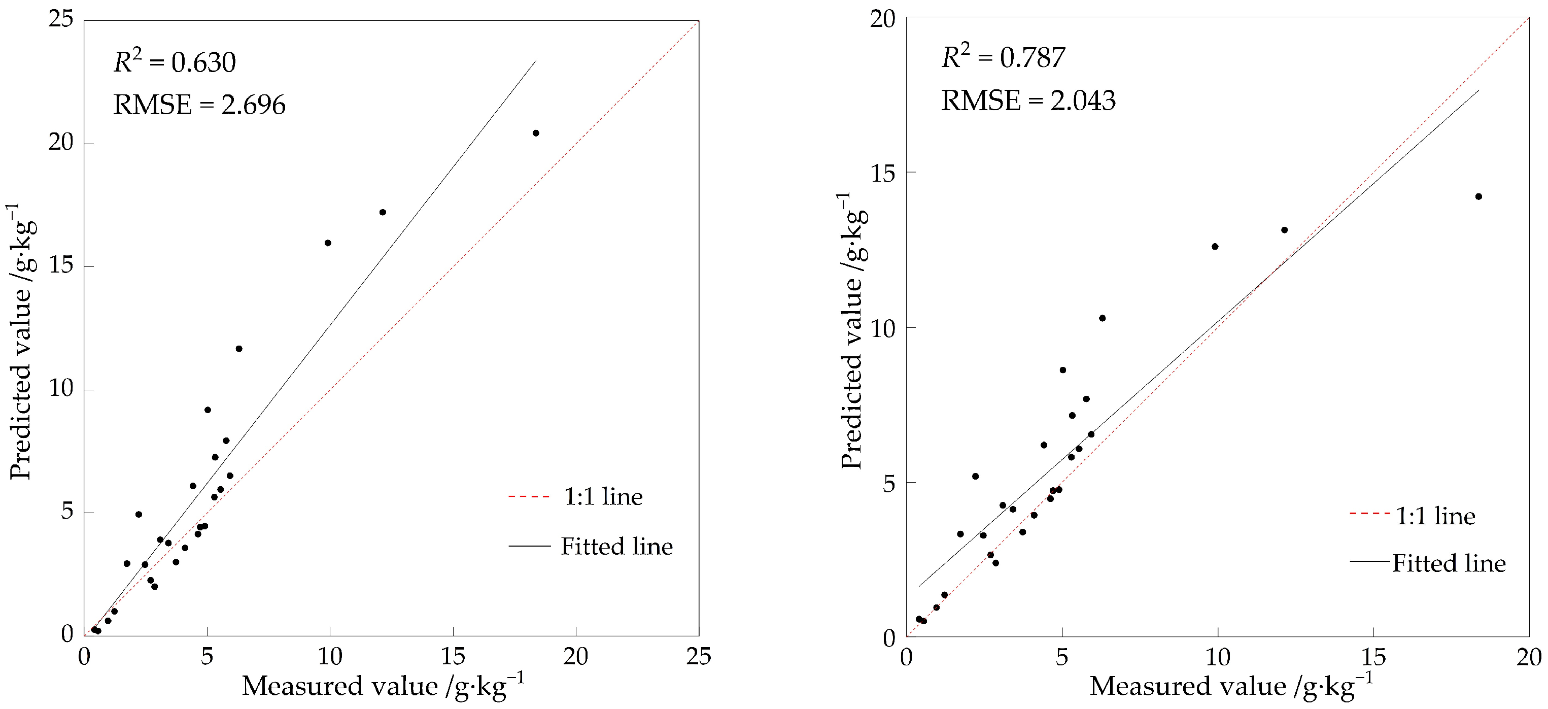
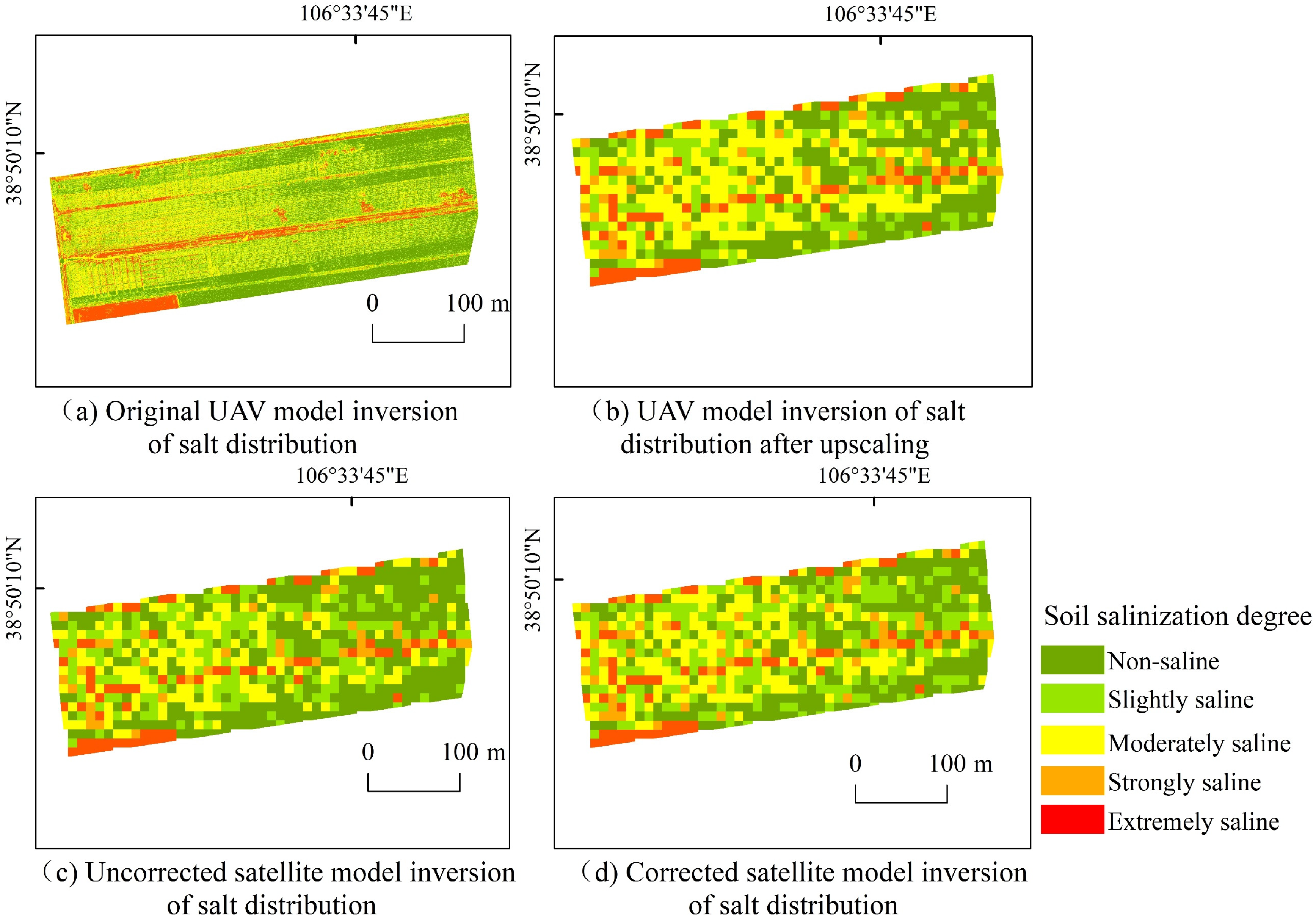
The accurate and extensive monitoring of soil salinization is essential for sustainable agricultural development. It is difficult for single remote sensing data (satellite, unmanned aerial vehicle) to simultaneously meet the requirements of wide-scale and high-precision soil salinity monitoring. Therefore, this paper adopts the upscaling method to upscale the unmanned aerial vehicle (UAV) data to the same pixel size as the satellite data. Based on the optimally upscaled UAV data, the satellite model was corrected using the numerical regression fitting method to improve the inversion accuracy of the satellite model. The results showed that the accuracy of the original UAV soil salinity inversion model (R2 = 0.893, RMSE = 1.448) was higher than that of the original satellite model (R2 = 0.630, RMSE = 2.255). The satellite inversion model corrected with UAV data had an accuracy of R2 = 0.787, RMSE = 2.043, and R2 improved by 0.157. The effect of satellite inversion correction was verified using a UAV inversion salt distribution map, and it was found that the same rate of salt distribution was improved from 75.771% before correction to 90.774% after correction. Therefore, the use of UAV fusion correction of satellite data can realize the requirements from a small range of UAV to a large range of satellite data and from low precision before correction to high precision after correction. It provides an effective technical reference for the precise monitoring of soil salinity and the sustainable development of large-scale agriculture.
Keywords: UAV; Sentinel-2; scale-up; numerical regression fitting; random forest; soil salinity UAV; Sentinel-2; scale-up; numerical regression fitting; random forest; soil salinity