Article

War and Deforestation: Using Remote Sensing and Machine Learning to Identify the War-Induced Deforestation in Syria 2010–2019


by
Angham Daiyoub
1,
Pere Gelabert
2,3,
Sandra Saura-Mas
1,4 and
Cristina Vega-Garcia
2,3,*
1
CREAF (Center for Ecological Research and Forestry Applications), 08193 Cerdanyola del Vallès, Spain
2
Department of Agricultural and Forest Engineering, University of Lleida, Avenida Alcalde Rovira Roure 191, 25198 Lleida, Spain
3
Joint Research Unit CTFC-Agrotecnio, Ctra. Sant Llorenç km.2, 25280 Solsona, Spain
4
Ecology Unit, Department Animal Biology, Plant Biology and Ecology, Autonomous University Barcelona, Building C, UAB Campus, 08193 Cerdanyola del Vallès, Spain
*
Author to whom correspondence should be addressed.
Land 2023, 12(8), 1509; https://doi.org/10.3390/land12081509
Submission received: 3 July 2023 / Revised: 24 July 2023 / Accepted: 26 July 2023 / Published: 28 July 2023
(This article belongs to the Special Issue Feature Papers for Land Planning and Architecture Section)

Abstract

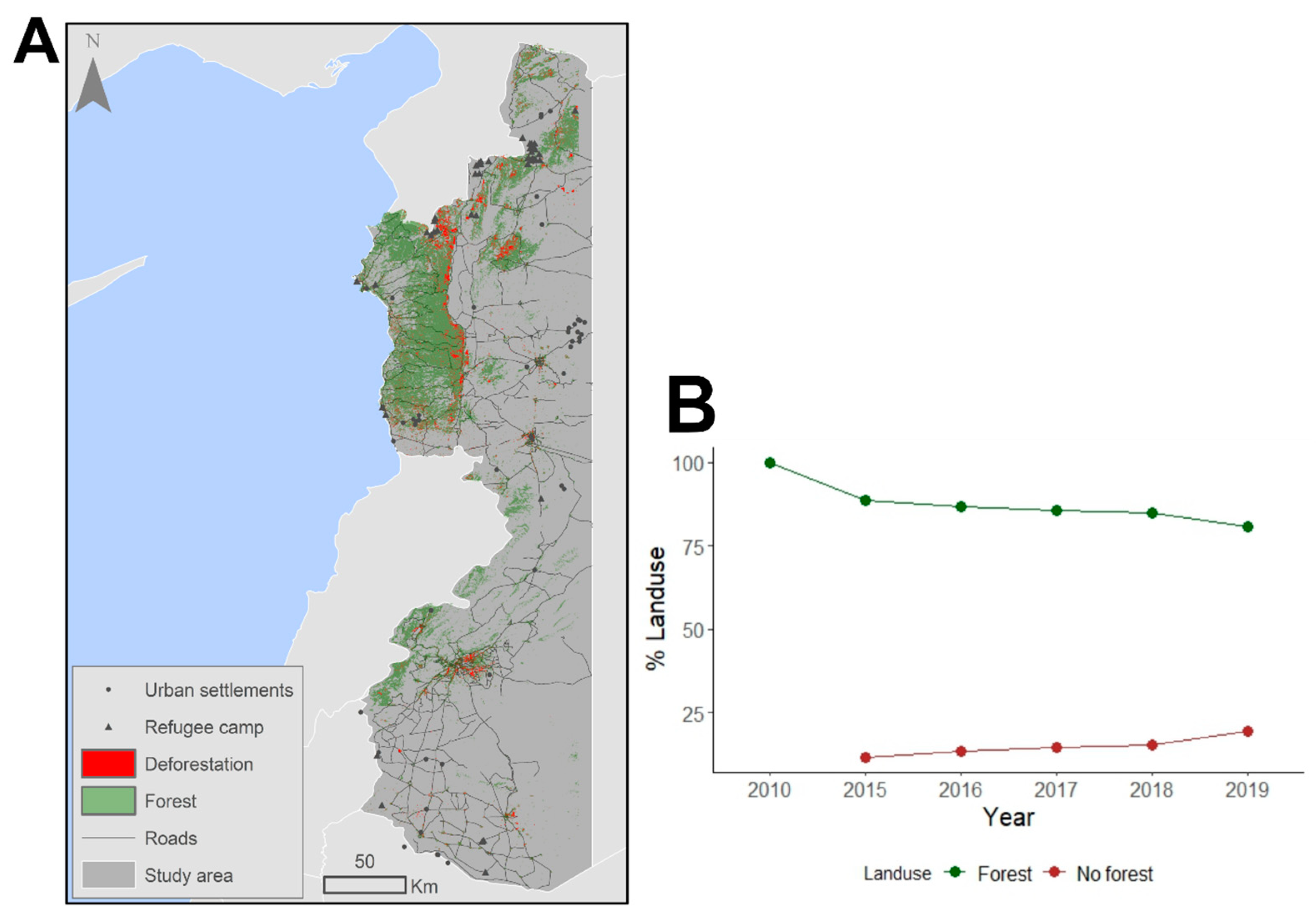
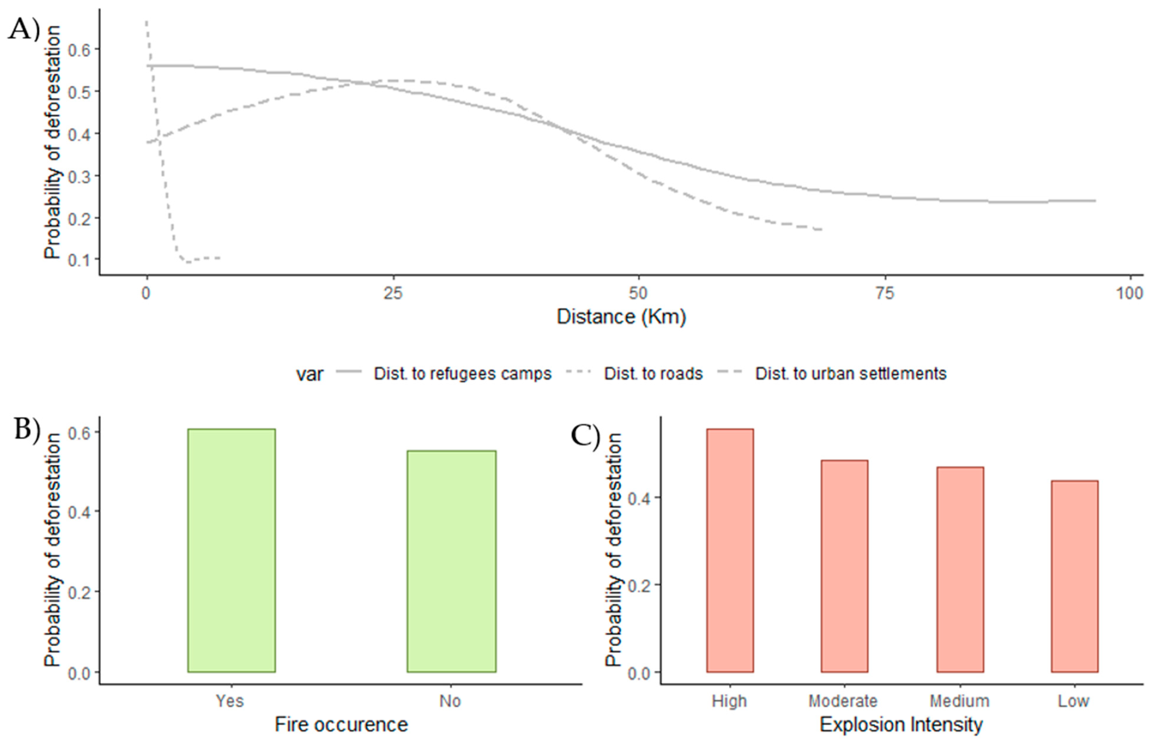
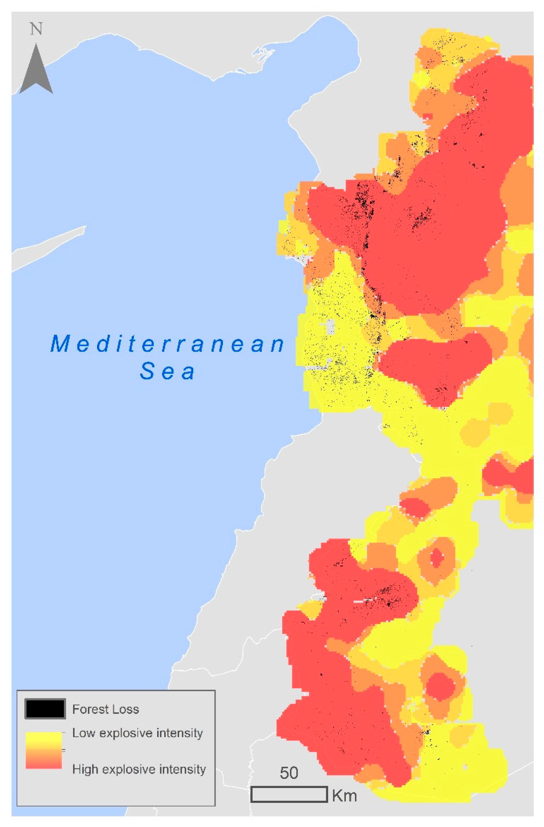
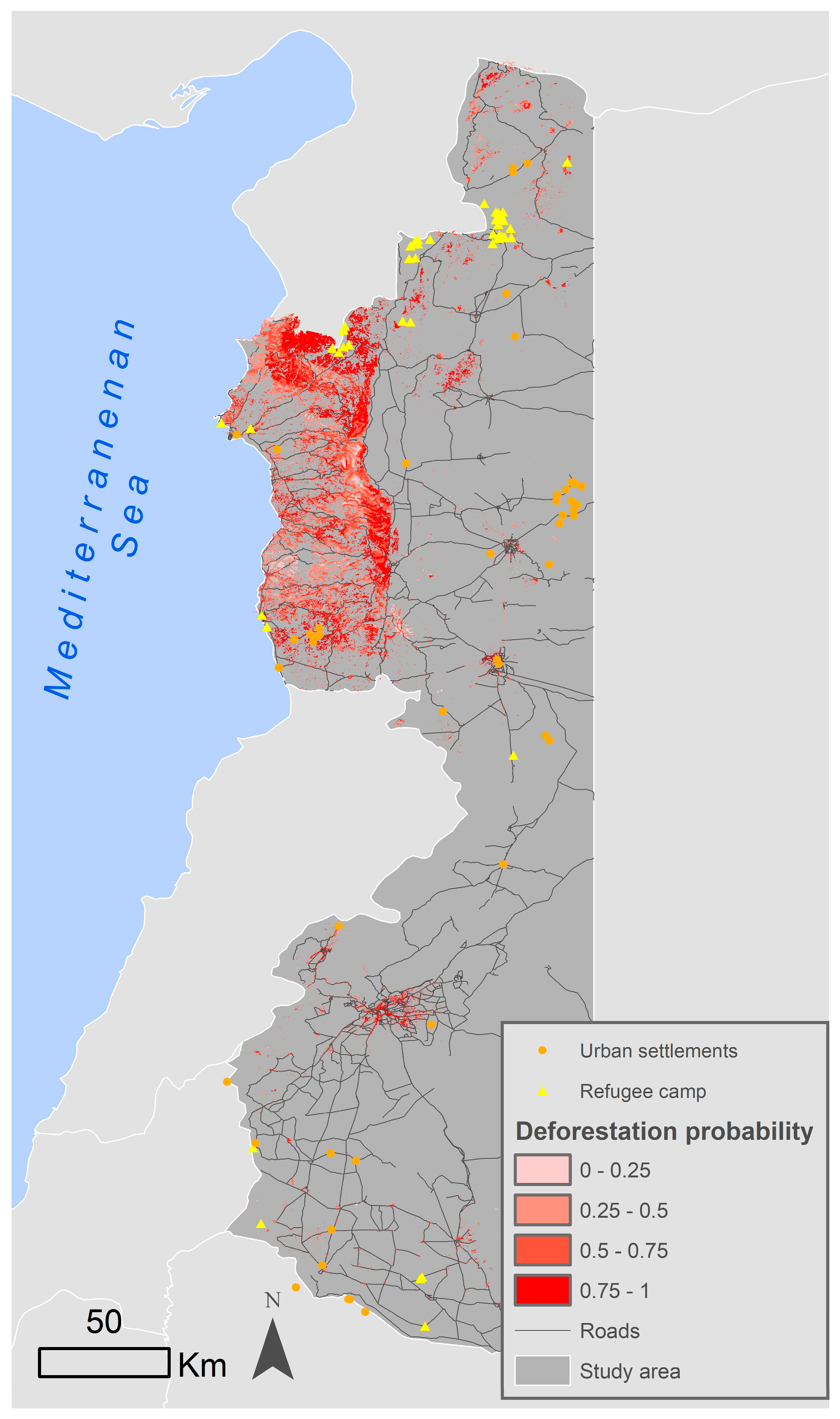
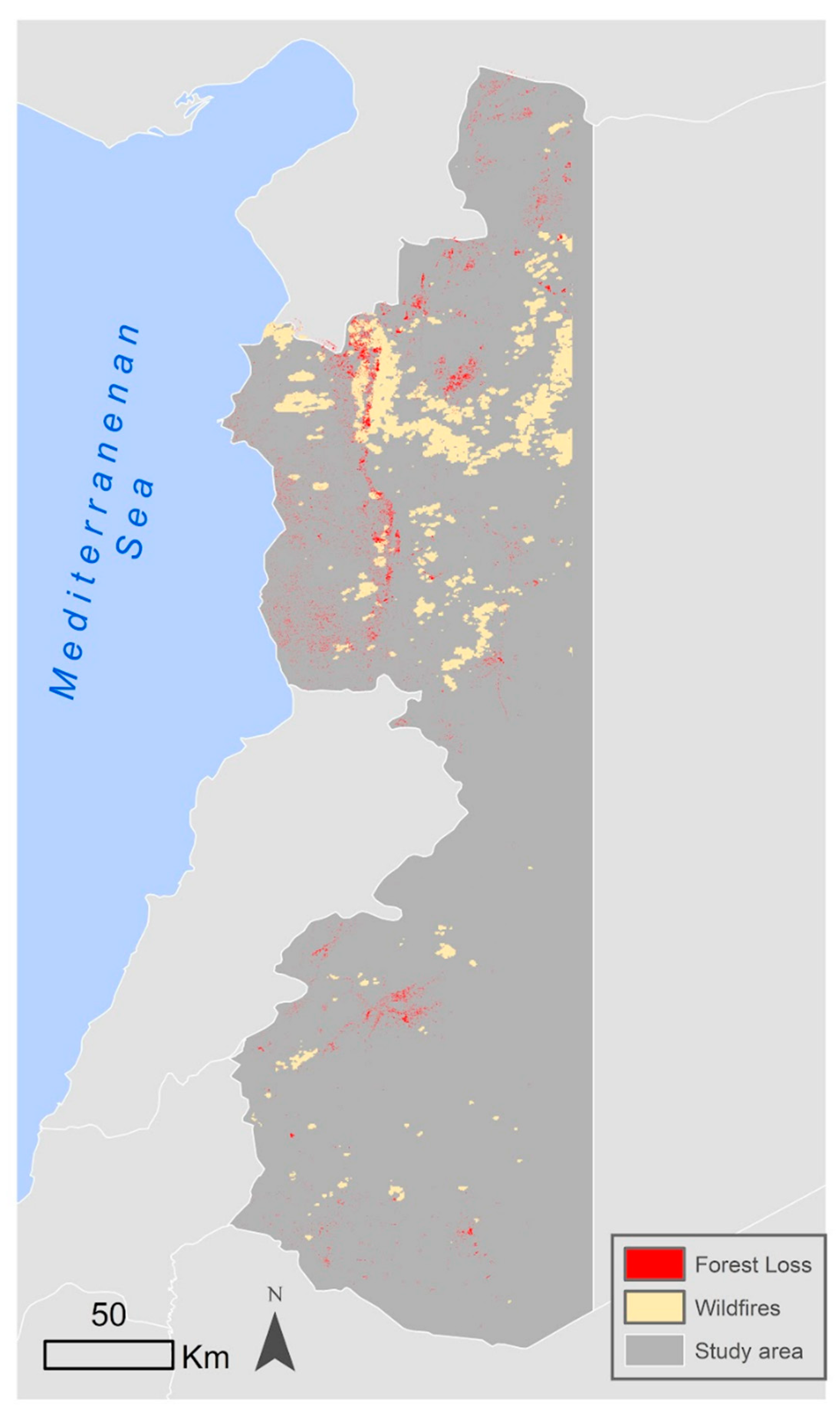
Armed conflicts and other types of violence are key drivers of human-induced landscape change. Since March 2011, Syria has been embroiled in a prolonged and devastating armed conflict causing immense human suffering and extensive destruction. As a result, over five million people have been forced to seek refuge outside the country’s borders, while more than six million have been internally displaced. This study focuses on examining the impact of this conflict on forest cover by identifying the drivers of forest change. To assess this change, Landsat and PALSAR imagery were used to differentiate between forested and non-forested areas. Spectral information was synthetized using the Tasseled Cap transformation and the time series data was simplified and despiked using the LandTrendr algorithm. Our results show that between 2010 and 2019 there was a substantial decrease of 19.3% in forest cover, predominantly concentrated in the northwestern region of Syria. This decline was induced by the armed conflict, with several key drivers contributing to the decline, such as illegal logging activities conducted by both locals and refugees living in nearby forest areas. Drivers such as proximity to refugee camps, roads, and settlements played an important role in producing this change by facilitating access to forests. In addition, the occurrence of explosive events such as bombings and shelling near forests also contributed to this decline by causing forest fires. To mitigate further deforestation and reduce dependence on forests for fuel, it is crucial for local governments in the post-conflict period to offer sustainable alternatives for heating and cooking to both the local populations and refugees. Additionally, governments are recommended to enforce strict laws and regulations to protect forests and combat illegal logging activities. These measures are essential for preserving and restoring forests, promoting environmental sustainability, and ensuring the well-being of both displaced populations and local communities.
Keywords: armed conflict; forest cover change; displacement; remote sensing; deforestation armed conflict; forest cover change; displacement; remote sensing; deforestation