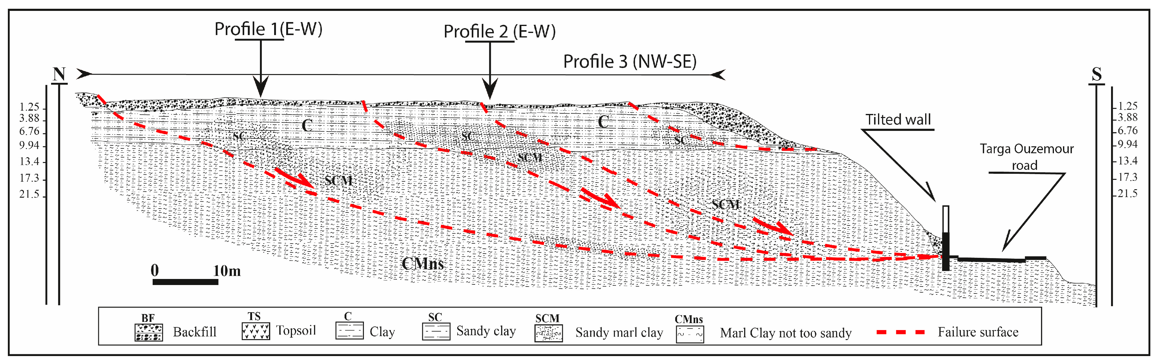
Integrated Geotechnical and Electrical Resistivity Tomography to Map the Lithological Variability Involved and Breaking Surface Evolution in Landslide Context: A Case Study of the Targa Ouzemour (Béjaia)


Abstract
Share and Cite
Nassim, H.; Atmane, L.; Lamine, H.; Mouloud, H.; Anes, M. Integrated Geotechnical and Electrical Resistivity Tomography to Map the Lithological Variability Involved and Breaking Surface Evolution in Landslide Context: A Case Study of the Targa Ouzemour (Béjaia). Water 2024, 16, 682. https://doi.org/10.3390/w16050682
Nassim H, Atmane L, Lamine H, Mouloud H, Anes M. Integrated Geotechnical and Electrical Resistivity Tomography to Map the Lithological Variability Involved and Breaking Surface Evolution in Landslide Context: A Case Study of the Targa Ouzemour (Béjaia). Water. 2024; 16(5):682. https://doi.org/10.3390/w16050682
Chicago/Turabian StyleNassim, Hallal, Lamali Atmane, Hamai Lamine, Hamidatou Mouloud, and Mazari Anes. 2024. "Integrated Geotechnical and Electrical Resistivity Tomography to Map the Lithological Variability Involved and Breaking Surface Evolution in Landslide Context: A Case Study of the Targa Ouzemour (Béjaia)" Water 16, no. 5: 682. https://doi.org/10.3390/w16050682
APA StyleNassim, H., Atmane, L., Lamine, H., Mouloud, H., & Anes, M. (2024). Integrated Geotechnical and Electrical Resistivity Tomography to Map the Lithological Variability Involved and Breaking Surface Evolution in Landslide Context: A Case Study of the Targa Ouzemour (Béjaia). Water, 16(5), 682. https://doi.org/10.3390/w16050682