Article

An Investigation of Near Real-Time Water Vapor Tomography Modeling Using Multi-Source Data
1
Jiangsu Key Laboratory of Resources and Environment Information Engineering, China University of Mining and Technology, No. 1 Daxue Road, Xuzhou 221116, China
2
School of Environment Science and Spatial Informatics, China University of Mining and Technology, No. 1 Daxue Road, Xuzhou 221116, China
3
School of Science (Geospatial), RMIT University, Melbourne, VIC 3001, Australia
4
State Key Laboratory of Hydroscience and Engineering, Tsinghua University, Beijing 100084, China
5
Aerospace Information Research Institute, Chinese Academy of Sciences, No. 9 Dengzhuang South Road, Haidian District, Beijing 100094, China
6
School of Geography, Geomatics and Planning, Jiangsu Normal University, Xuzhou 221116, China
*
Author to whom correspondence should be addressed.
Atmosphere 2022, 13(5), 752; https://doi.org/10.3390/atmos13050752
Submission received: 18 April 2022 / Revised: 2 May 2022 / Accepted: 4 May 2022 / Published: 6 May 2022

Abstract

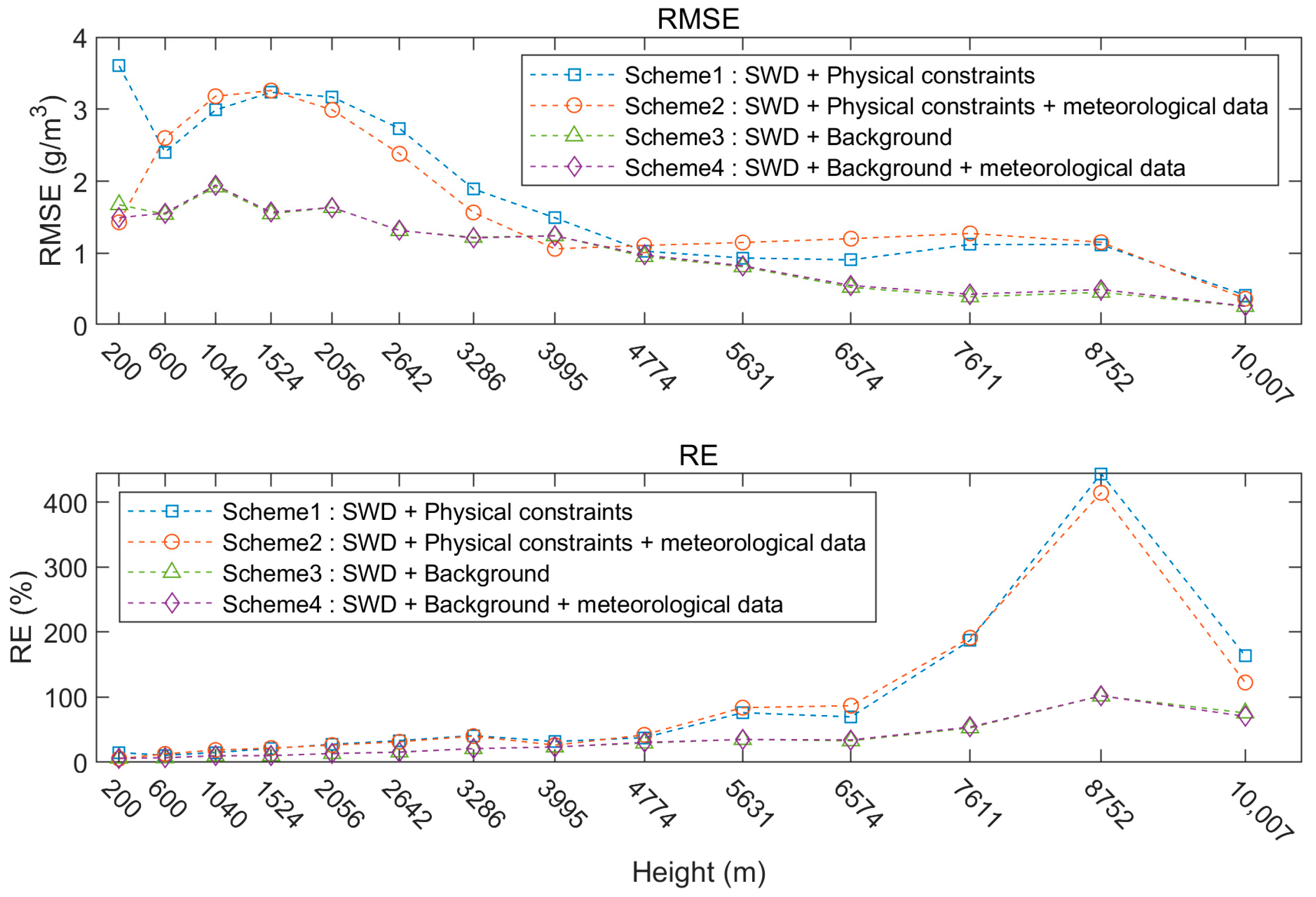
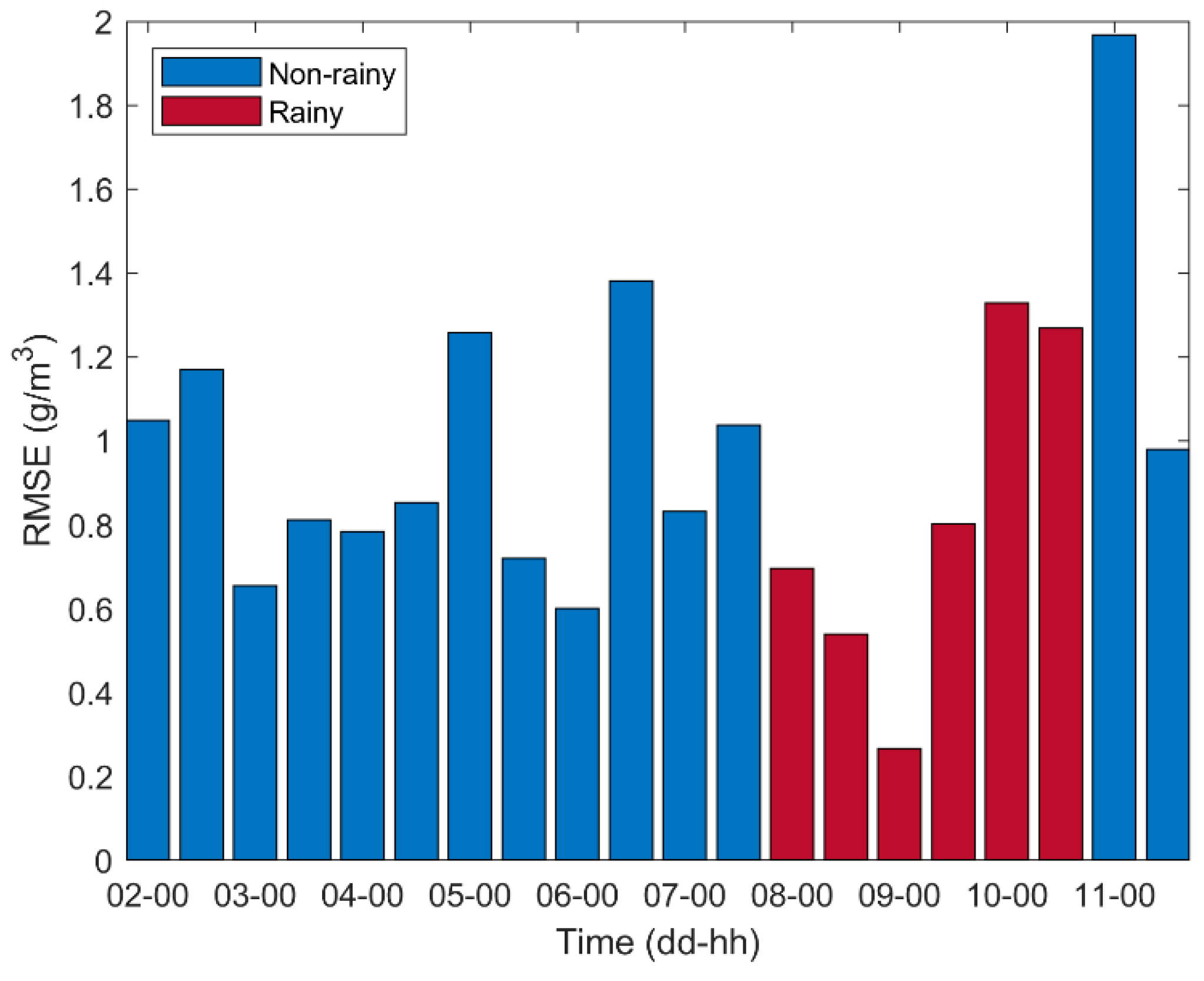
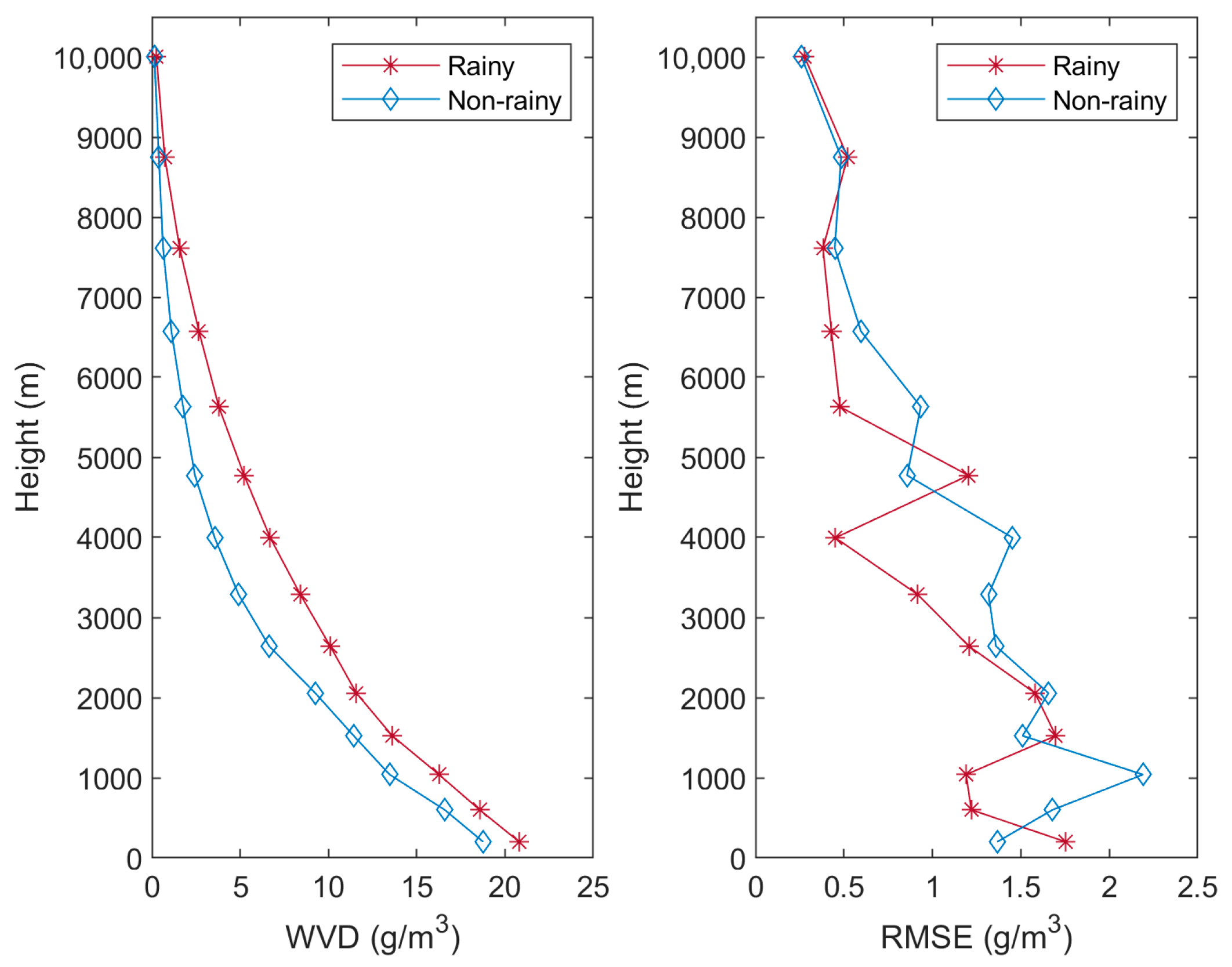
Global Navigation Satellite Systems (GNSS) tomography is a well-recognized modeling technique for reconstruction, which can be used to investigate the spatial structure of water vapor with a high spatiotemporal resolution. In this study, a refined near real-time tomographic model is developed based on multi-source data including GNSS observations, Global Forecast System (GFS) products and surface meteorological data. The refined tomographic model is studied using data from Hong Kong from 2 to 11 October 2021. The result is compared with the traditional model with physical constraints and is validated by the radiosonde data. It is shown that the root mean square error (RMSE) values of the proposed model and traditional model are 0.950 and 1.763 g/m3, respectively. The refined model can decrease the RMSE by about 46%, indicating a better performance than the traditional one. In addition, the accuracy of the refined tomographic model is assessed under both rainy and non-rainy conditions. The assessment shows that the RMSE in the rainy period is 0.817 g/m3, which outperforms the non-rainy period with the RMSE of 1.007 g/m3.
Keywords: near real-time model; water vapor tomography; water vapor density (WVD); GNSS near real-time model; water vapor tomography; water vapor density (WVD); GNSS