Performance Analysis of Ocean Surface Topography Altimetry by Ku-Band Near-Nadir Interferometric SAR


Abstract
:1. Introduction
2. Altimetry Simulation of OST
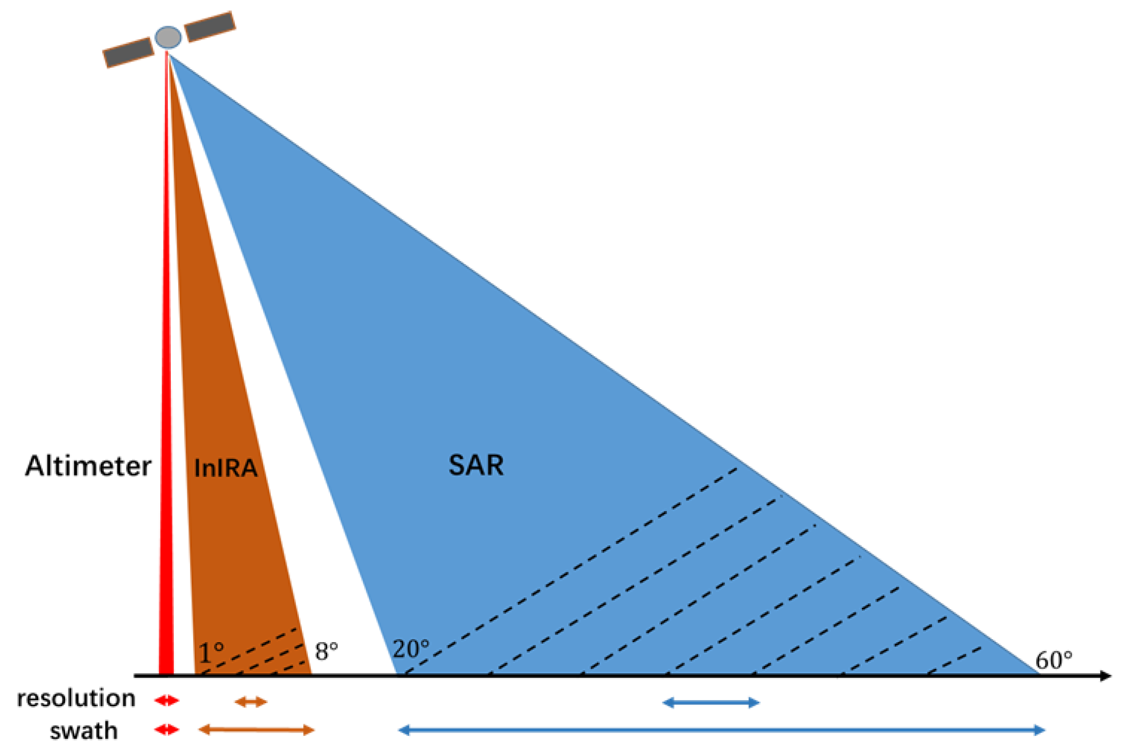
2.1. System Parameters of InIRA
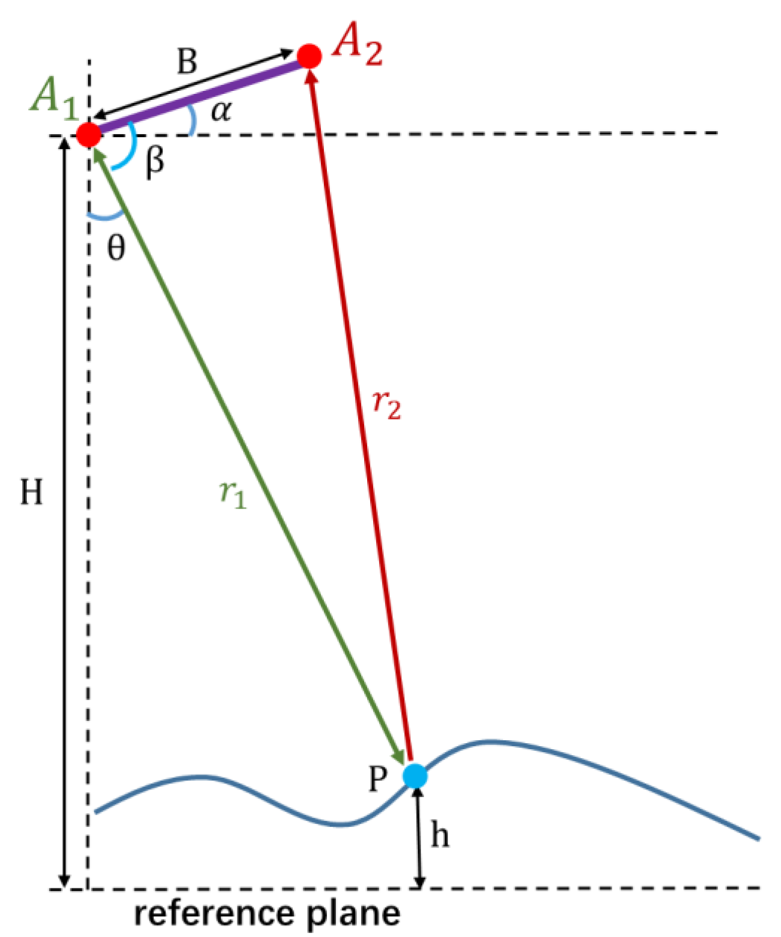
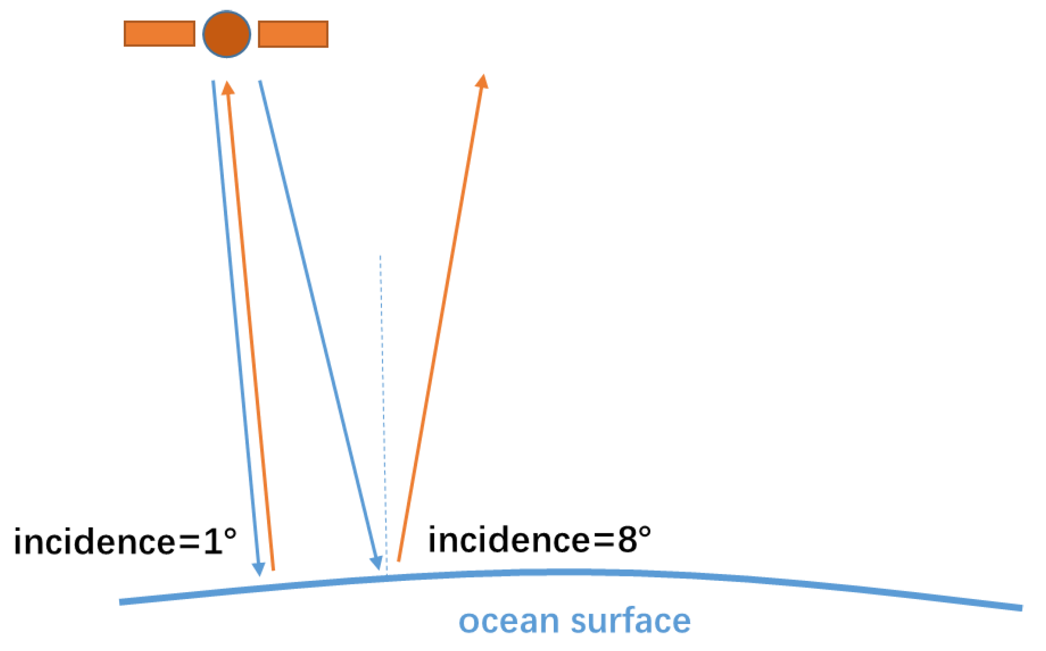
2.2. Altimetry Principle of OST
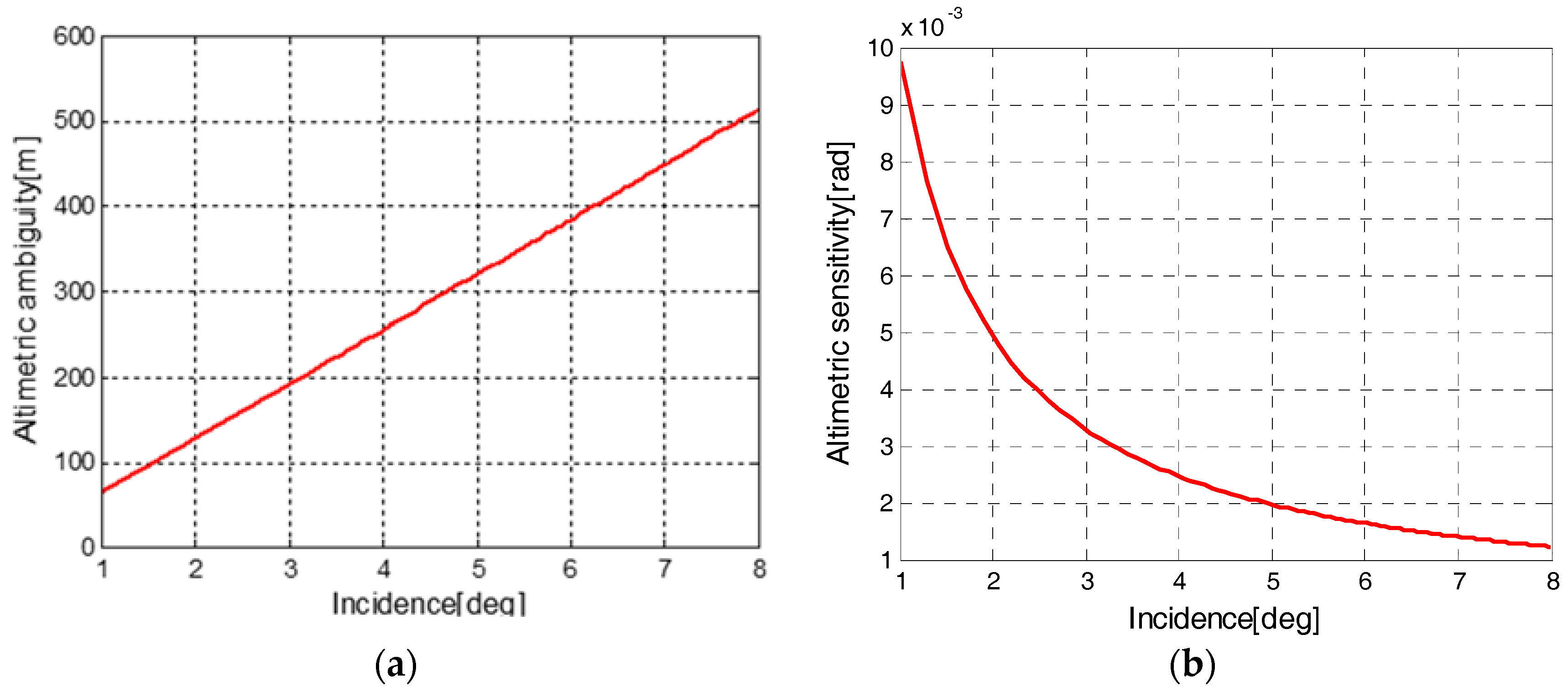
2.3. Altimetric Precision Simulation
3. OST Altimetry Results and Analysis of InIRA
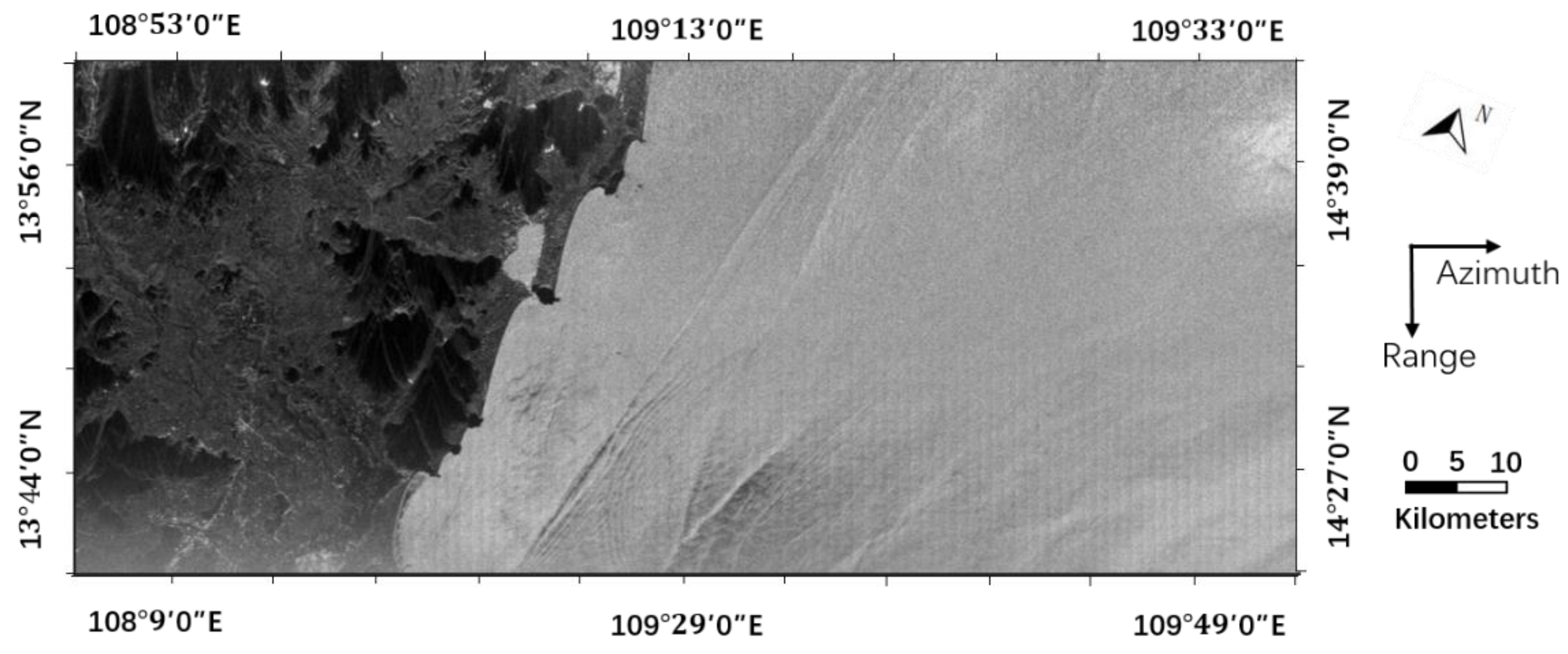
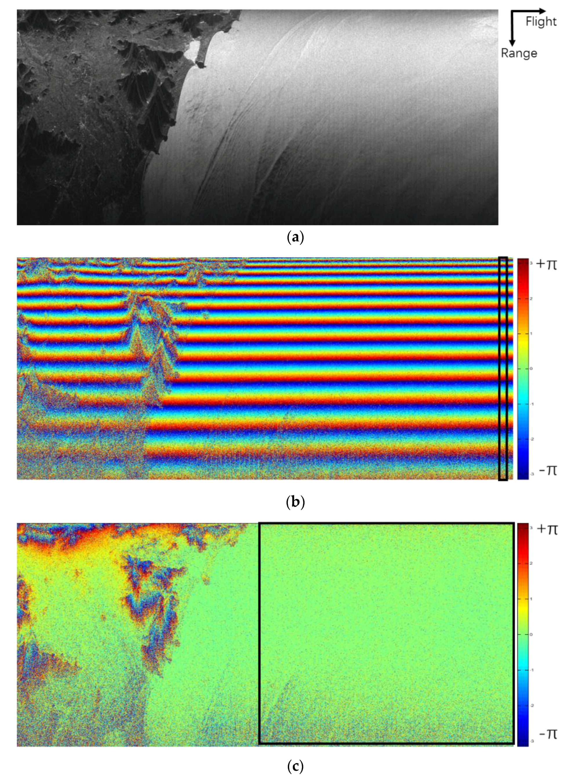
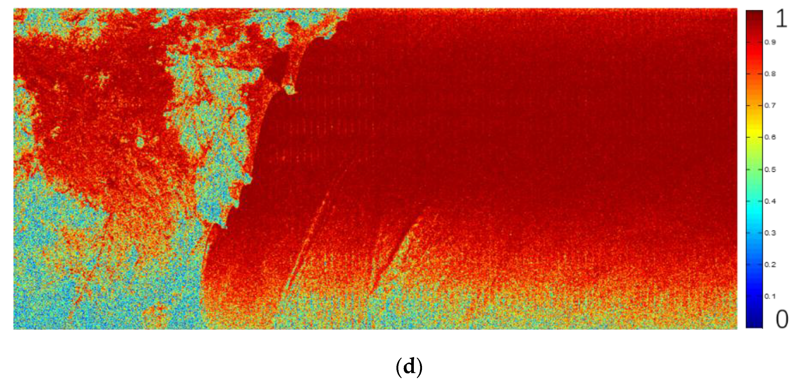
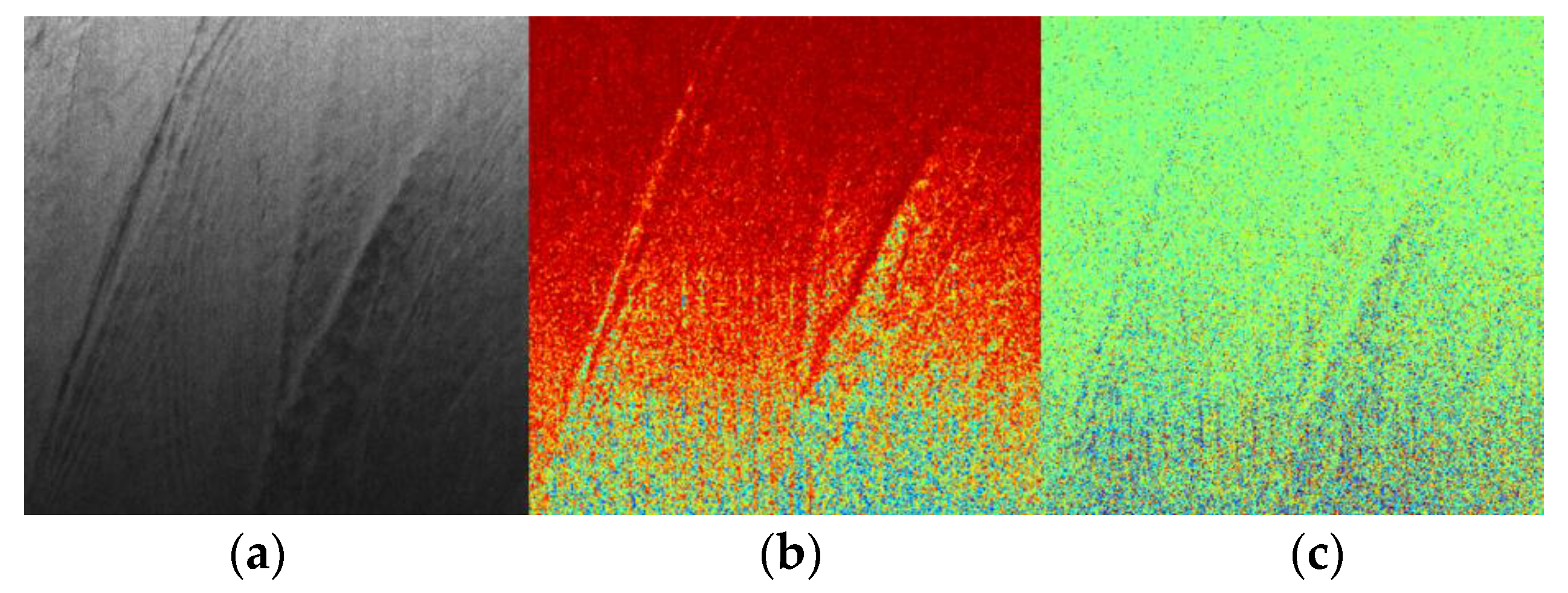
3.1. Interferometric Data Processing
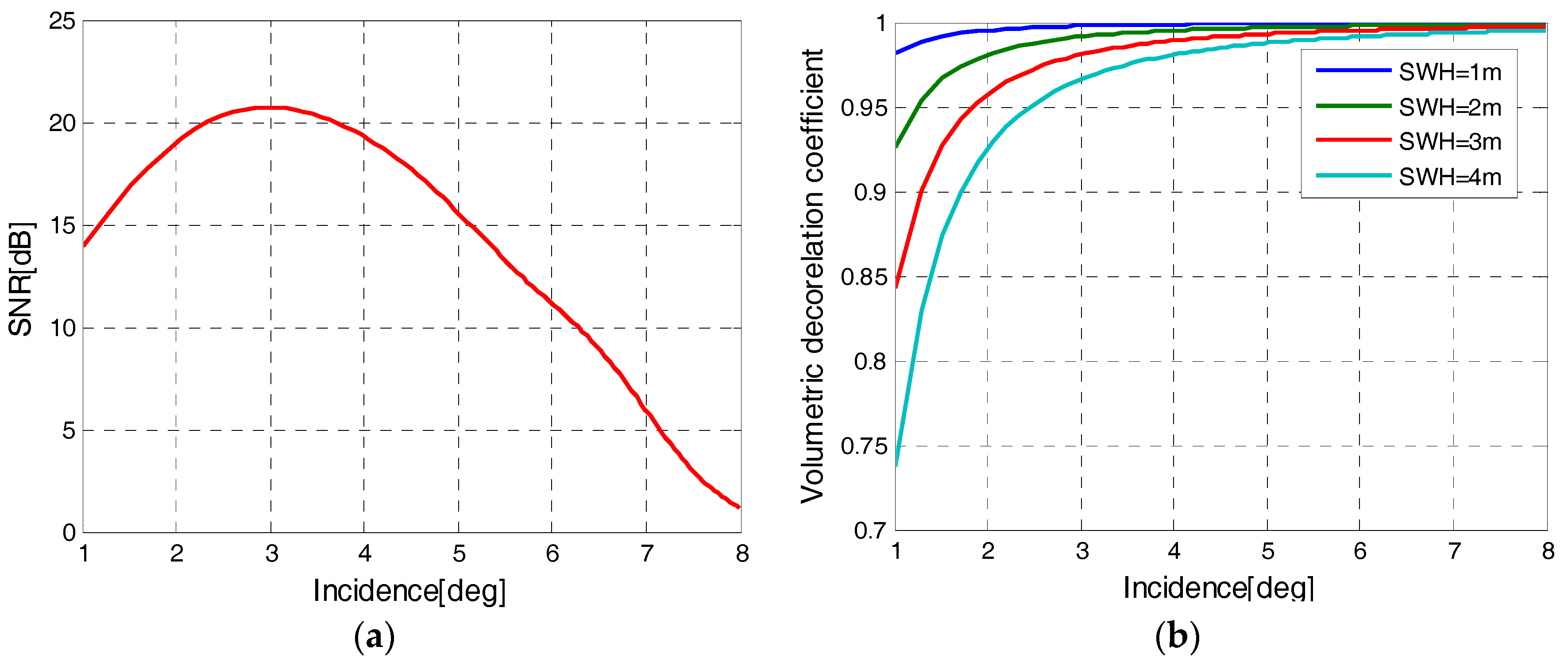
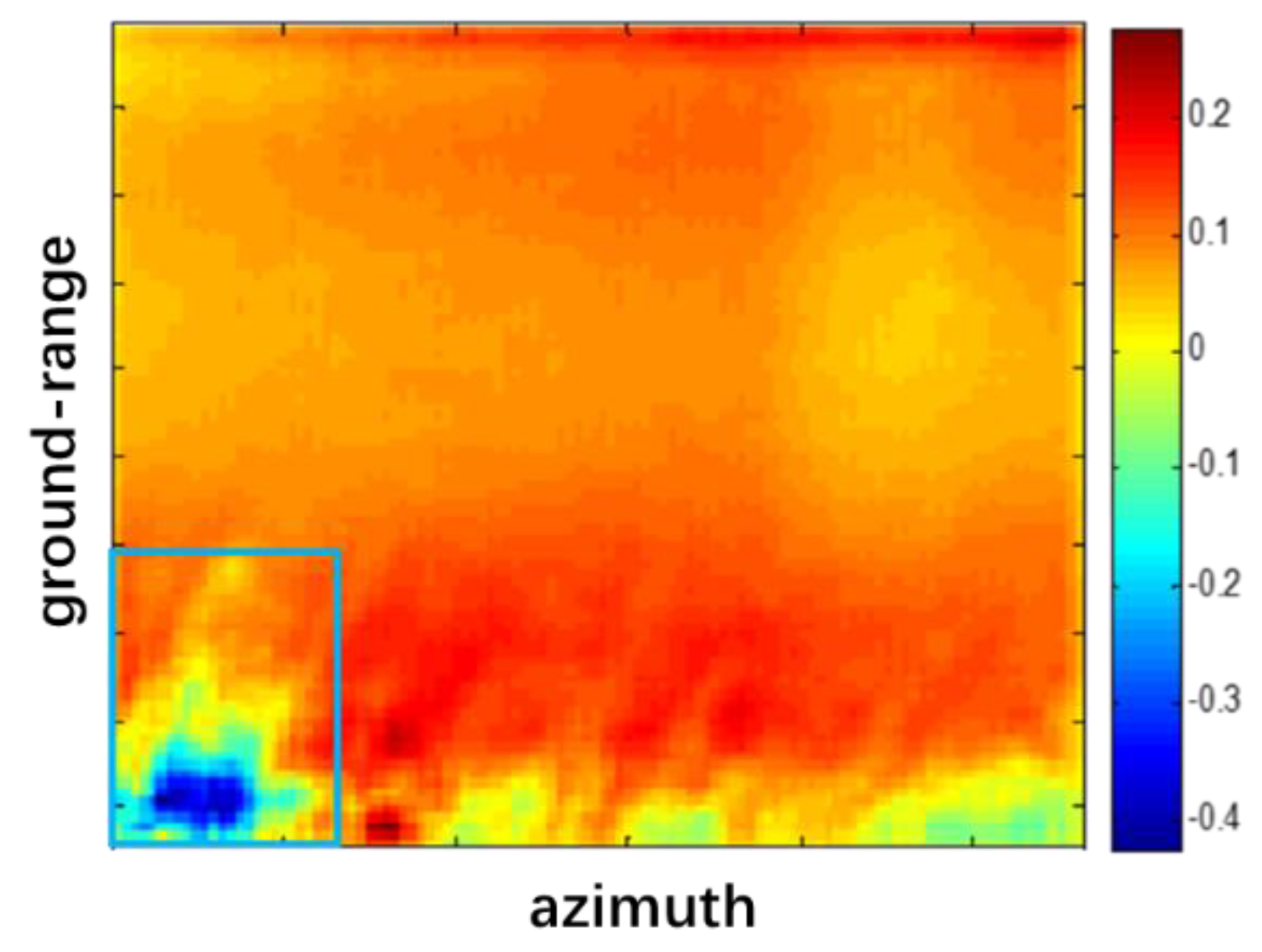
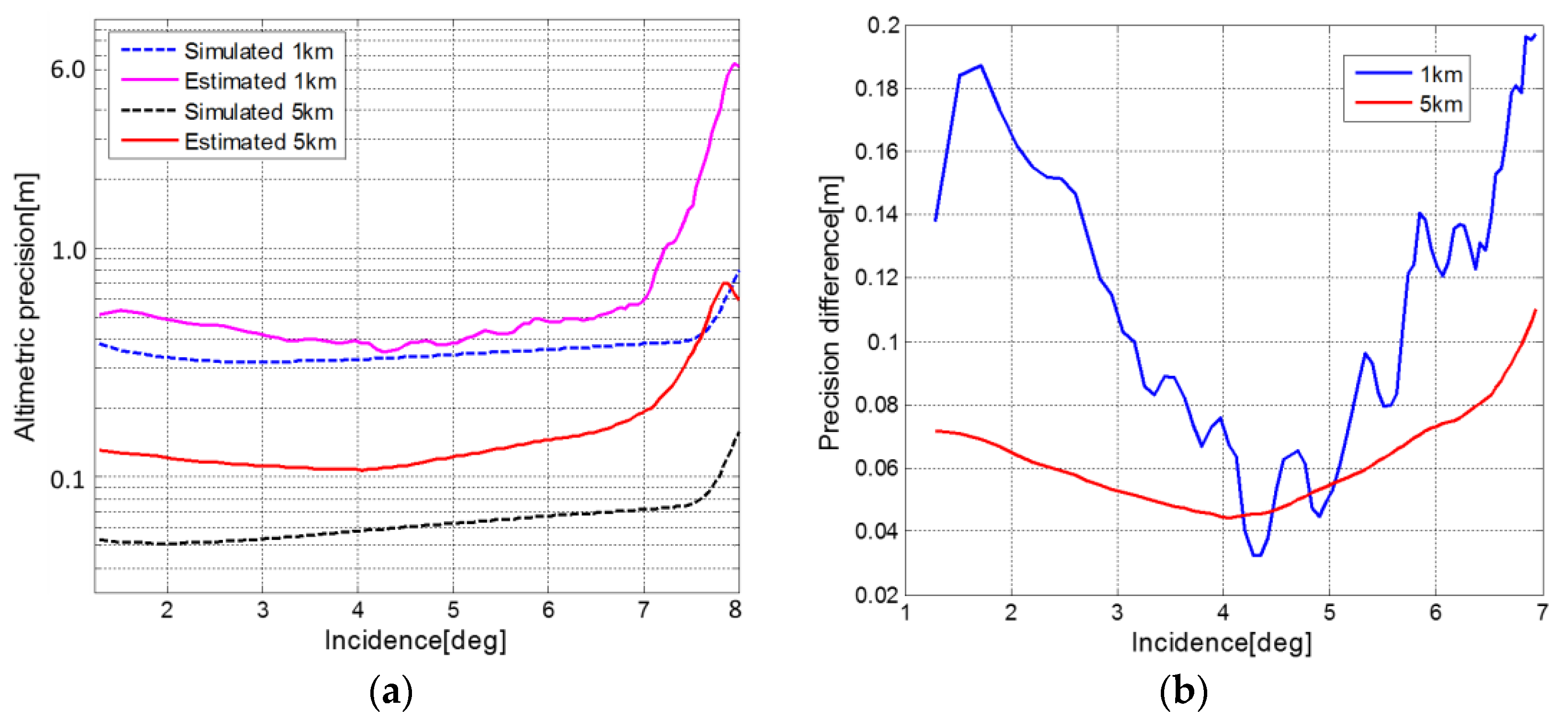
3.2. Altimetric Precision Estimation
4. Discussion
5. Conclusions
- (1)
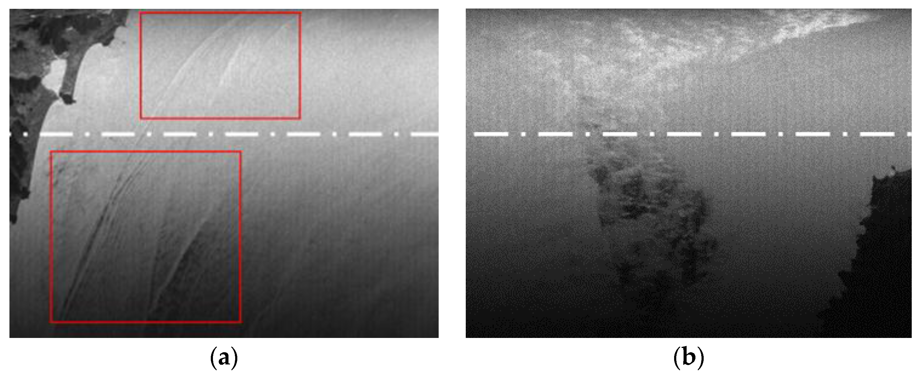
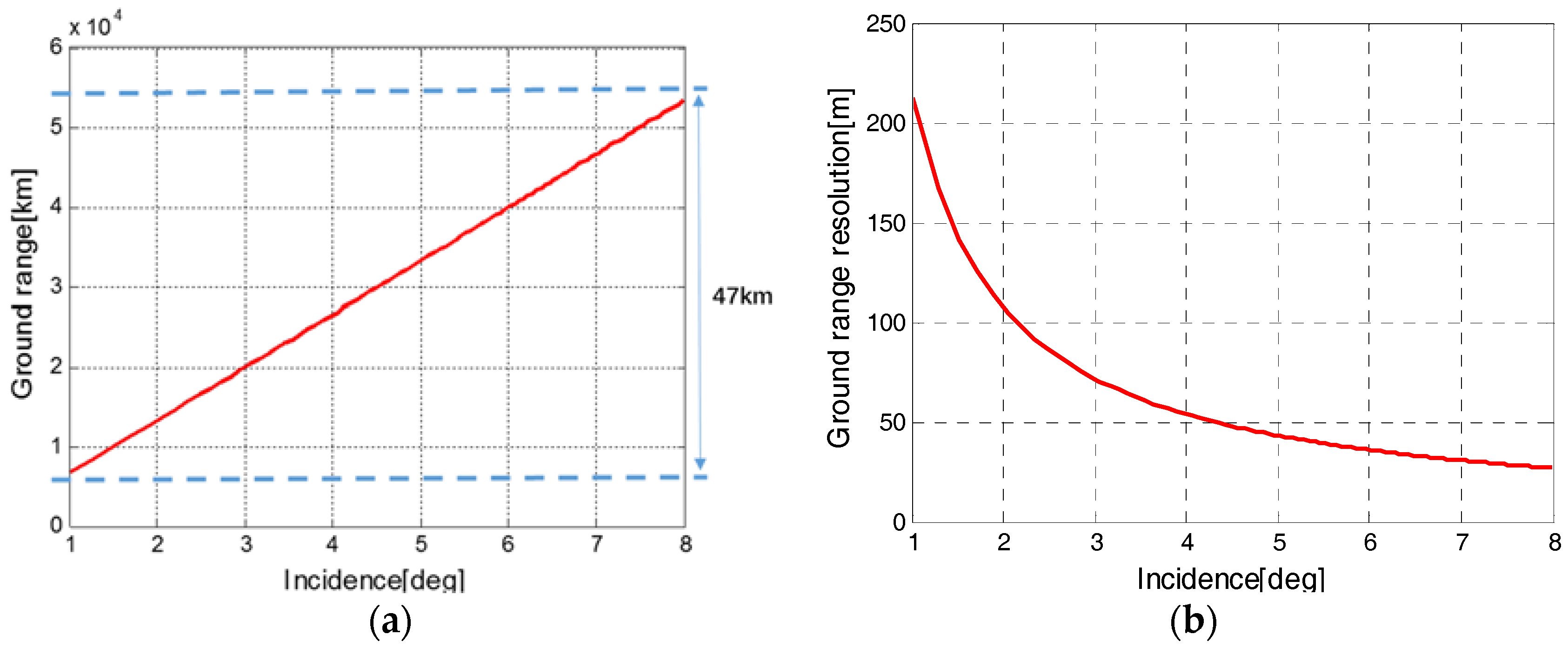
- According to the intensity boundary phenomenon, the available swath of high altimetric precision will be narrower than expected. As for InIRA, when the incidence range is 1°~5°, the swath will decrease to only 20 km. This narrow swath can hardly fulfill the altimetry on sub-mesoscale oceanic processes. Therefore, future near-nadir InSAR could fly on a higher orbit to increase the swath width.
- (2)
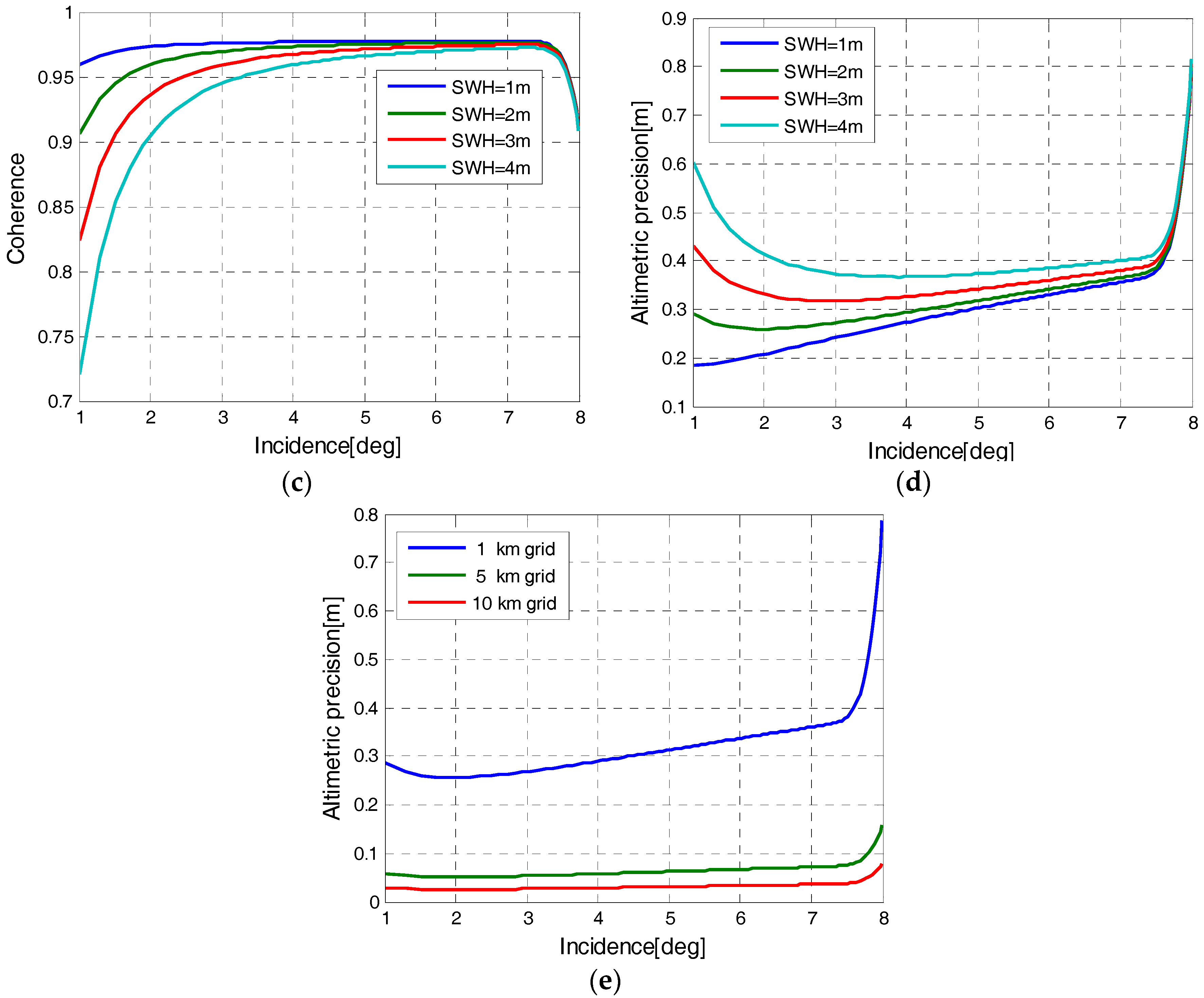
- Flying on a higher orbit means the SNR of the received signal will decrease significantly, thereby definitely increasing the phase noise level. As mentioned before, multi-looking is one of the most effective ways to lower the phase noise, and the 3-cm altimetric precision on a 10-km grid is much higher than that of a 1-km grid, according to the simulation. However, it is quite challenging for the 10-km grid to resolve mesoscale or sub-mesoscale oceanic processes whose physical dimension is only about 15~300 km. Therefore, future near-nadir InSAR should guarantee an even higher intrinsic image resolution so that a larger multi-look number could be acquired on the same grid.
- (3)
- Baseline length is the key parameter which guarantees high altimetric precision for near-nadir InSAR. Meanwhile, a longer baseline will mitigate the stringent requirement for a systematic phase noise level and data processing precision, allowing the near-nadir InSAR to achieve better performance much more easily.
Supplementary Materials
Supplementary File 1Acknowledgments
Author Contributions
Conflicts of Interest
References
- Pitz, I.; Otto, A.; Schmidt, M. Ocean surface topography constellation: The next 15 years in satellite altimetry. Kybern. Praha 2010, 2, 490–493. [Google Scholar]
- Coleman, R. Satellite altimetry and earth sciences: A handbook of techniques and applications. Eos Trans. Am. Geophys. Union 2013, 82, 376. [Google Scholar] [CrossRef]
- Zawadzki, L.; Ablain, M. Accuracy of the mean sea level continuous record with future altimetric missions: Jason-3 vs. Sentinel-3a. Ocean Sci. Discuss. 2016, 12, 1511–1536. [Google Scholar] [CrossRef]
- Fu, L.L.; Stammer, D.; Leben, R.R.; Chelton, D.B. Improved spatial resolution of ocean surface topography from the t/p-jason-1 altimeter mission. Eos Trans. Am. Geophys. Union 2003, 84, 241–248. [Google Scholar] [CrossRef]
- Fu, L.L.; Alsdorf, D.; Morrow, R.; Rodriguez, E.; Mognard, N. Swot: The Surface Water and Ocean Topography Mission: Wide-Swath Altimetric Elevation on Earth; Jet Propulsion Lab: Pasadena, CA, USA, 2012.
- Fu, L.L.; Ferrari, R. Observing oceanic submesoscale processes from space. Eos Trans. Am. Geophys. Union 2008, 89, 488. [Google Scholar] [CrossRef]
- Kim, S.Y. Observations of submesoscale eddies using high-frequency radar-derived kinematic and dynamic quantities. Cont. Shelf Res. 2010, 30, 1639–1655. [Google Scholar] [CrossRef]
- Rodriguez, E.; Morris, C.S.; Belz, E.J. A global assessment of srtm performance. Photogramm. Eng. Remote Sens. 2006, 72, 249–260. [Google Scholar] [CrossRef]
- Ulander, L.M.H.; Askne, J. Repeat-pass sar interferometry over forested terrain. IEEE Trans. Geosci. Remote Sens. 1995, 33, 331–340. [Google Scholar]
- Rodriguez, E.; Martin, J.M. Theory and design of interferometric synthetic aperture radars. Radar Signal Process. IEE Proc. 1992, 39, 147–159. [Google Scholar] [CrossRef]
- Musa, Z.N.; Popescu, I.; Mynett, A. A review of applications of satellite sar, optical, altimetry and dem data for surface water modelling, mapping and parameter estimation. Hydrol. Earth Syst. Sci. Discuss. 2015, 12, 4857–4878. [Google Scholar] [CrossRef]
- Fu, L.L.; Rodriguez, E. Wide-swath altimetric measurement of ocean surface topography. In Proceedings of the 2003 International Union of Geodesy and Geophysics (IUGG) Conference, Sapporo, Japan, 30 June–11 July 2003. [Google Scholar]
- Pollard, B.D.; Rodriguez, E.; Veilleux, L.; Akins, T.; Brown, P.; Kitiyakara, A.; Zawadski, M.; Datthanasombat, S.; Prata, A. The Wide Swath Ocean Altimeter: Radar Interferometry for Global Ocean Mapping with Centimetric Accuracy. In Proceedings of the IEEE Aerospace Conference, Big Sky, MT, USA, 9–16 March 2002; Volume 1002, pp. 1007–1020. [Google Scholar]
- Fjørtoft, R.; Gaudin, J.M.; Pourthie, N.; Lion, C. Karin—The ka-band radar interferometer on swot: Measurement principle, processing and data specificities. In Proceedings of the IEEE International Geoscience and Remote Sensing Symposium, Honolulu, HI, USA, 25–30 July 2010; pp. 4823–4826. [Google Scholar]
- Wu, X.; Hensley, S.; Rodriguez, E.; Moller, D.; Muellerschoen, R.; Michel, T. Near nadir ka-band sar interferometry: Swot airborne experiment. In Proceedings of the Geoscience and Remote Sensing Symposium, Vancouver, BC, Canada, 24–29 July 2011; pp. 2681–2684. [Google Scholar]
- Fjortoft, R.; Gaudin, J.M.; Pourthie, N.; Lalaurie, J.C.; Mallet, A.; Nouvel, J.F.; Martinot-Lagarde, J.; Oriot, H.; Borderies, P.; Ruiz, C. Karin on swot: Characteristics of near-nadir ka-band interferometric sar imagery. IEEE Trans. Geosci. Remote Sens. 2014, 52, 2172–2185. [Google Scholar] [CrossRef]
- Altenau, E.H.; Pavelsky, T.M.; Moller, D.; Lion, C.; Pitcher, L.H.; Allen, G.H.; Bates, P.D.; Calmant, S.; Durand, M.; Smith, L.C. Airswot measurements of river water surface elevation and slope: Tanana River, AK. Geophys. Res. Lett. 2017, 44, 181–189. [Google Scholar] [CrossRef]
- Jackson, C. Synthetic Aperture Radar Marine User's Manual; U.S. Department of Commerce: Washington, DC, USA, 2004; pp. 279–360.
- Doerry, W.A. Atmospheric attenuation and sar operating frequency selection. In Proceedings of the Workshop on Synthetic Aperture Radar Technology, Huntsville, AL, USA, 22–23 October 2003. [Google Scholar]
- Lee, J.S.; Hoppel, K.W.; Mango, S.A.; Miller, A.R. Intensity and phase statistics of multilook polarimetric and interferometric sar imagery. IEEE Trans. Geosci. Remote Sens. 1994, 32, 1017–1028. [Google Scholar]
- Just, D.; Bamler, R. Phase statistics of interferograms with applications to synthetic aperture radar. Appl. Opt. 1994, 33, 4361–4368. [Google Scholar] [CrossRef] [PubMed]
- Esteban Fernandez, D.; Pollard, B.; Vaze, P.; Abelson, R. Swot Project Mission Performance and Error Budget. Available online: https://swot.oceansciences.org/documents.htm (accessed on 8 September 2017).
- Duda, T.F.; Lynch, J.F.; Irish, J.D.; Beardsley, R.C.; Ramp, S.R.; Chiu, C.S.; Tang, T.Y.; Yang, Y.J. Internal tide and nonlinear internal wave behavior at the continental slope in the northern south china sea. IEEE J. Ocean. Eng. 2004, 29, 1105–1130. [Google Scholar] [CrossRef]
- Holzner, J.; Bamler, R. Burst-mode and scansar interferometry. IEEE Trans. Geosci. Remote Sens. 2002, 40, 1917–1934. [Google Scholar] [CrossRef]
- Magalhaes, J.M.; Silva, J.C.B.D. Satellite altimetry observations of large-scale internal solitary waves. IEEE Geosci. Remote Sens. Lett. 2017, 14, 534–538. [Google Scholar] [CrossRef]


© 2017 by the authors. Licensee MDPI, Basel, Switzerland. This article is an open access article distributed under the terms and conditions of the Creative Commons Attribution (CC BY) license (http://creativecommons.org/licenses/by/4.0/).
Share and Cite
Kong, W.; Chong, J.; Tan, H. Performance Analysis of Ocean Surface Topography Altimetry by Ku-Band Near-Nadir Interferometric SAR. Remote Sens. 2017, 9, 933. https://doi.org/10.3390/rs9090933
Kong W, Chong J, Tan H. Performance Analysis of Ocean Surface Topography Altimetry by Ku-Band Near-Nadir Interferometric SAR. Remote Sensing. 2017; 9(9):933. https://doi.org/10.3390/rs9090933
Chicago/Turabian StyleKong, Weiya, Jinsong Chong, and Hong Tan. 2017. "Performance Analysis of Ocean Surface Topography Altimetry by Ku-Band Near-Nadir Interferometric SAR" Remote Sensing 9, no. 9: 933. https://doi.org/10.3390/rs9090933
APA StyleKong, W., Chong, J., & Tan, H. (2017). Performance Analysis of Ocean Surface Topography Altimetry by Ku-Band Near-Nadir Interferometric SAR. Remote Sensing, 9(9), 933. https://doi.org/10.3390/rs9090933