Article

AERO: Arbitrary-Scale Equivariant Resolution Operator for Remote Sensing Image Super-Resolution

1
School of Automation, Wuhan University of Technology, Wuhan 430070, China
2
School of Management, Wuhan University of Technology, Wuhan 430070, China
*
Author to whom correspondence should be addressed.
Remote Sens. 2026, 18(16), 2823; https://doi.org/10.3390/rs18162823
Submission received: 28 June 2026 / Revised: 13 August 2026 / Accepted: 15 August 2026 / Published: 20 August 2026
(This article belongs to the Special Issue AI-Driven Remote Sensing Image Restoration and Generation)

Abstract

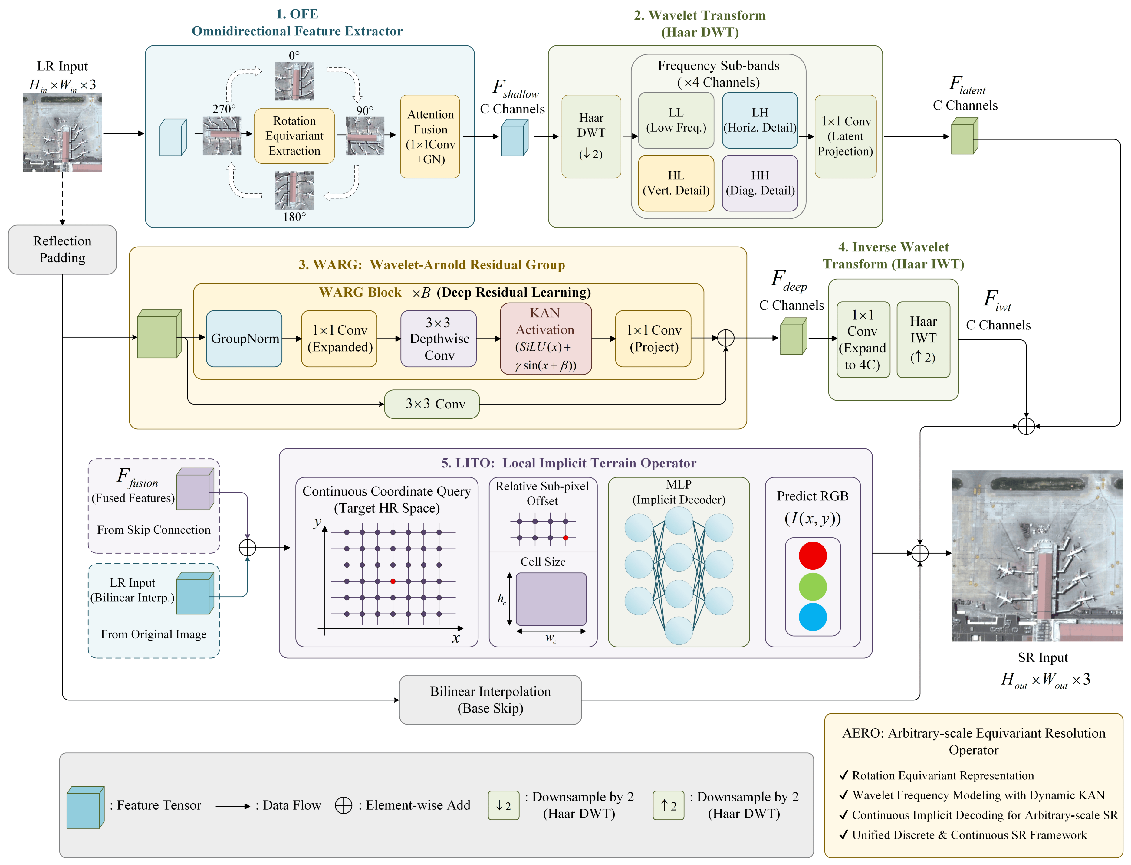
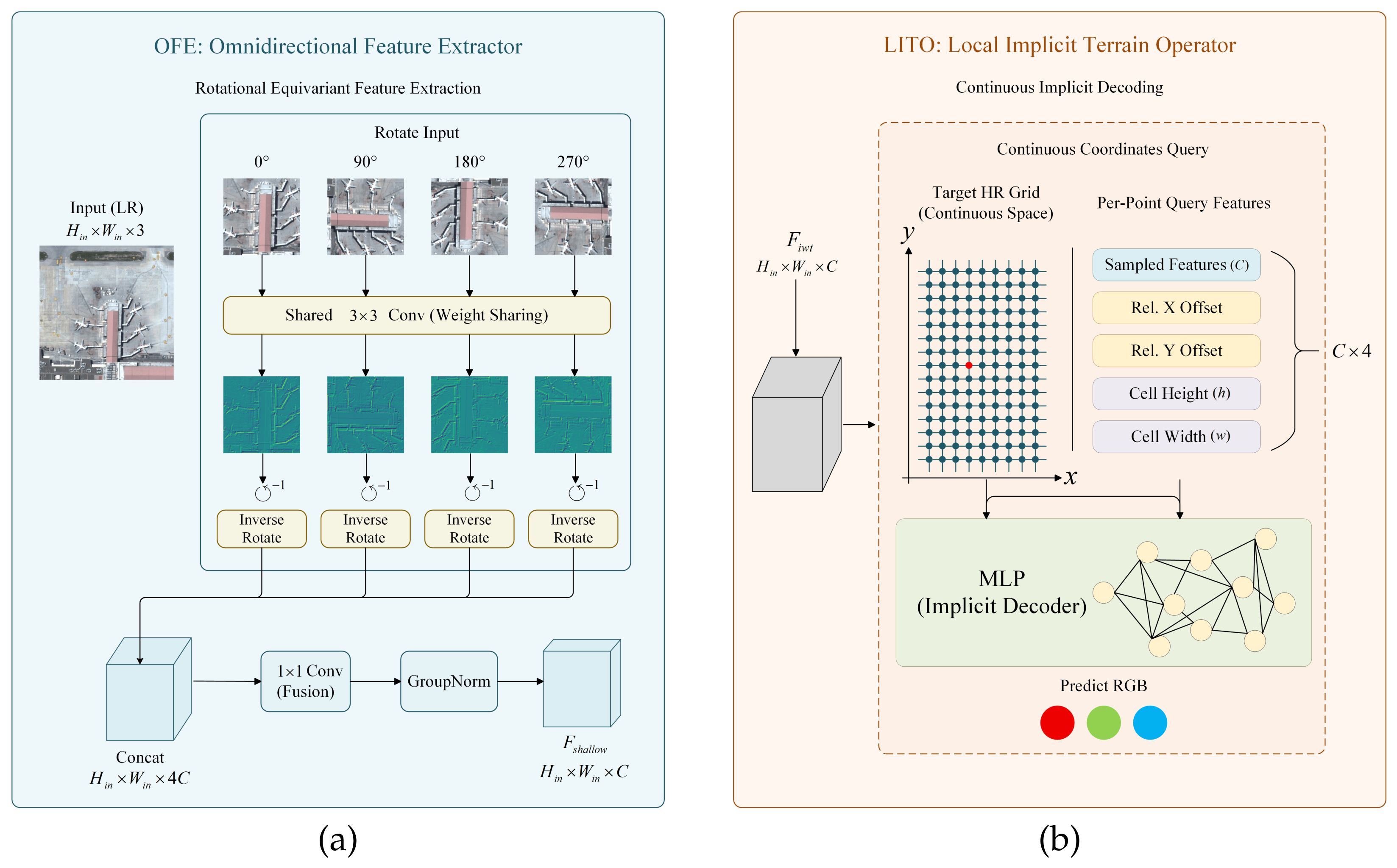
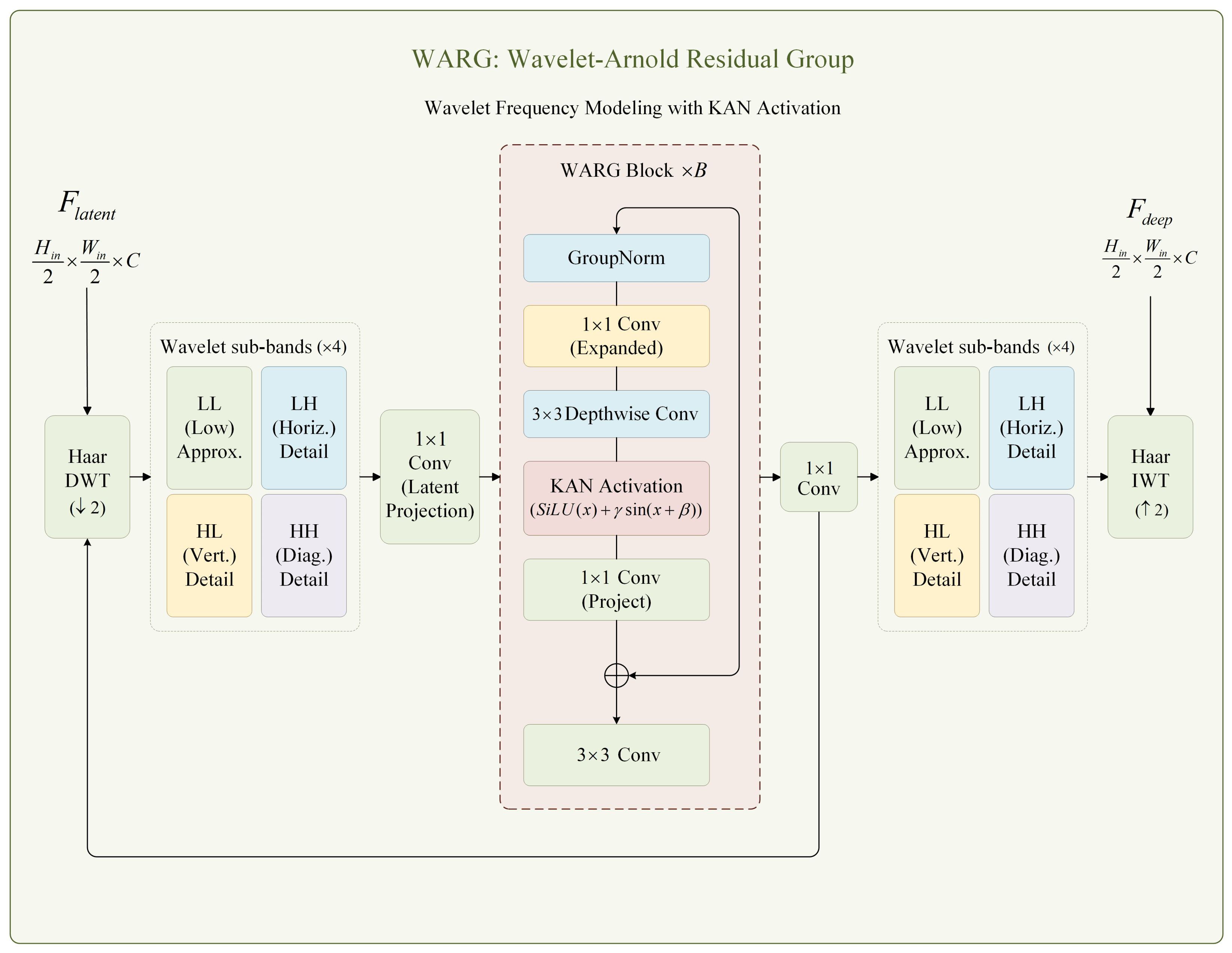
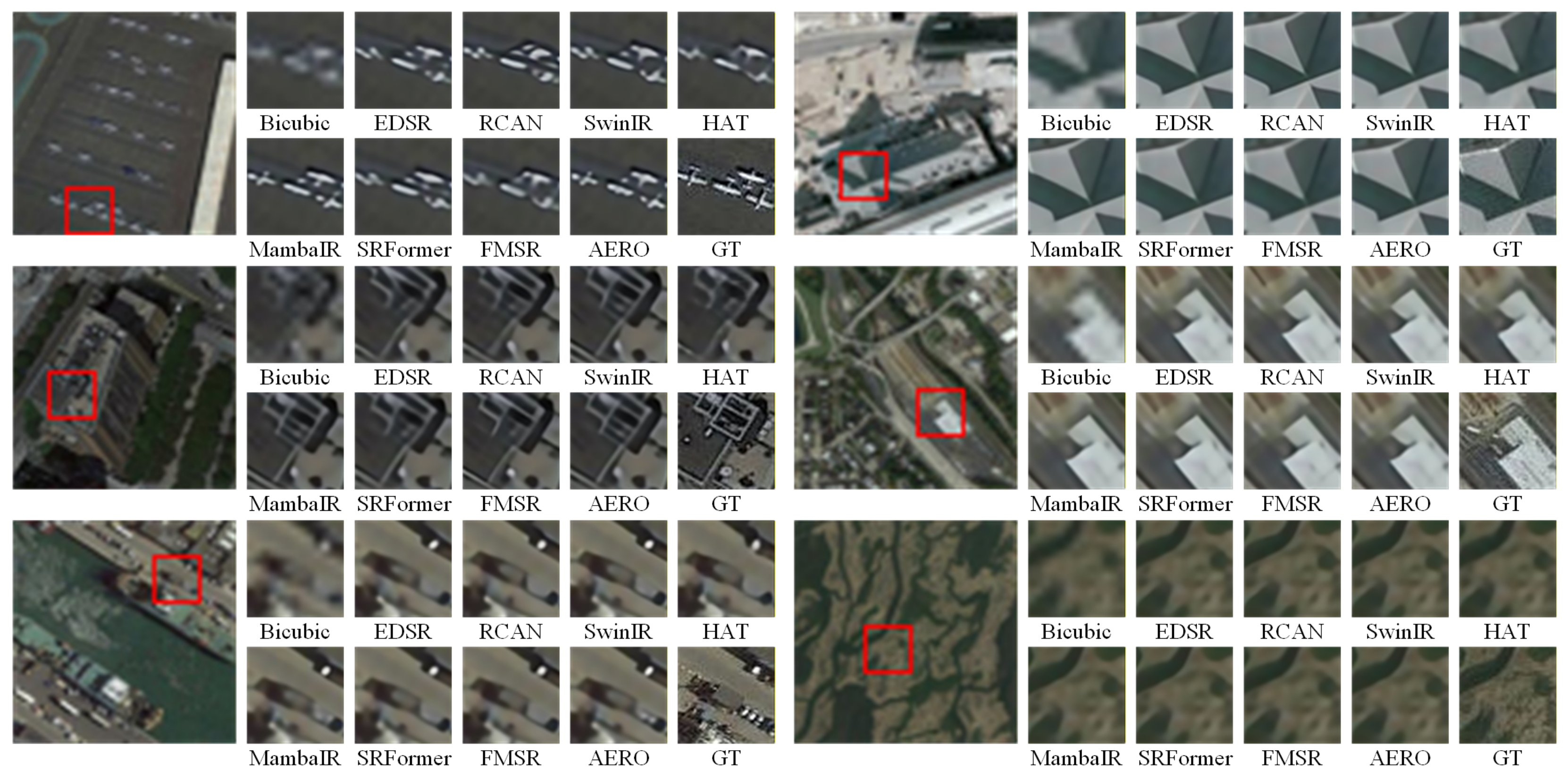
Remote sensing image super-resolution aims to reconstruct high-resolution images from low-resolution observations and is important for image interpretation. Existing fixed-scale methods achieve good performance at predefined integer scales, but their dedicated upsampling modules limit their application to arbitrary-scale scenarios such as interactive GIS and multi-source image fusion. Continuous implicit methods provide scale flexibility but often exhibit spectral bias, resulting in over-smoothed textures and blurred object boundaries. To overcome these limitations, we propose an Arbitrary-scale Equivariant Resolution Operator (AERO) for remote sensing image super-resolution. AERO consists of three components. The Omnidirectional Feature Extractor enhances feature representation under orientation variations. The Wavelet–Arnold Residual Group models low- and high-frequency information in the wavelet domain to preserve textures and geographic boundaries. The Local Implicit Terrain Operator employs relative sub-pixel coordinates for continuous arbitrary-scale reconstruction. Experiments on AID, NWPU-RESISC45, UCMerced, and WHU-RS19 demonstrate that AERO achieves the best performance in the ×4 fixed-scale task. On WHU-RS19, AERO reaches a PSNR of 31.02 dB, exceeding FMSR by 0.64 dB. In rotational robustness experiments, the maximum PSNR fluctuation is reduced from 0.0181 dB to 0.0010 dB. The results show that AERO provides a practical approach for arbitrary-scale remote sensing image super-resolution.
Keywords: remote sensing image super-resolution; arbitrary-scale reconstruction; implicit neural representation; rotational robustness; wavelet-domain modeling remote sensing image super-resolution; arbitrary-scale reconstruction; implicit neural representation; rotational robustness; wavelet-domain modeling