Article

Airborne Point Cloud Fusion with Local Plane Constraints for Advanced Semantic Consistency

1
Geodesy and Geospatial Engineering, Faculty of Science, Technology and Medicine, University of Luxembourg, 1359 Kirchberg, Luxembourg
2
Department of Geoscience and Remote Sensing, Delft University of Technology, 2628 CN Delft, The Netherlands
3
Department of Computer Science, Faculty of Science, Technology and Medicine, University of Luxembourg, 4364 Esch-sur-Alzette, Luxembourg
*
Author to whom correspondence should be addressed.
Remote Sens. 2026, 18(15), 2598; https://doi.org/10.3390/rs18152598
Submission received: 14 May 2026 / Revised: 21 July 2026 / Accepted: 23 July 2026 / Published: 5 August 2026

Abstract

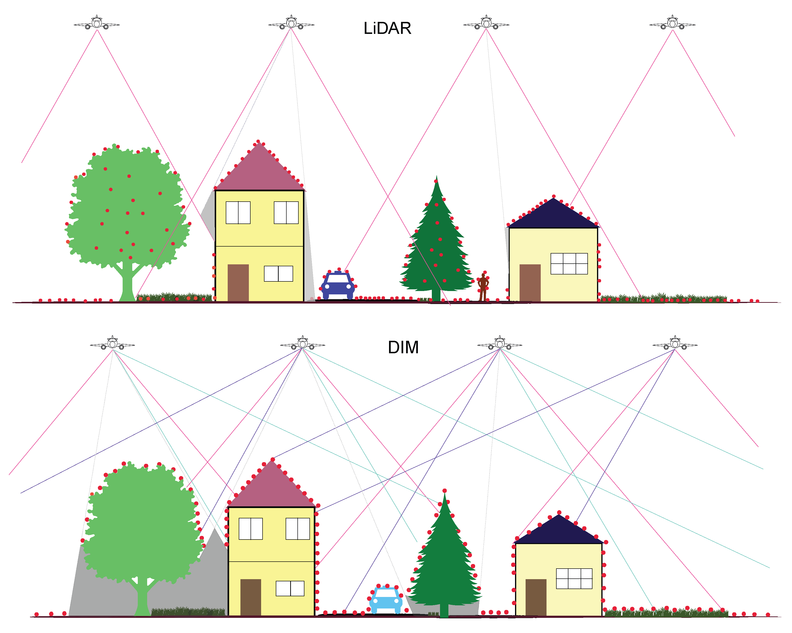
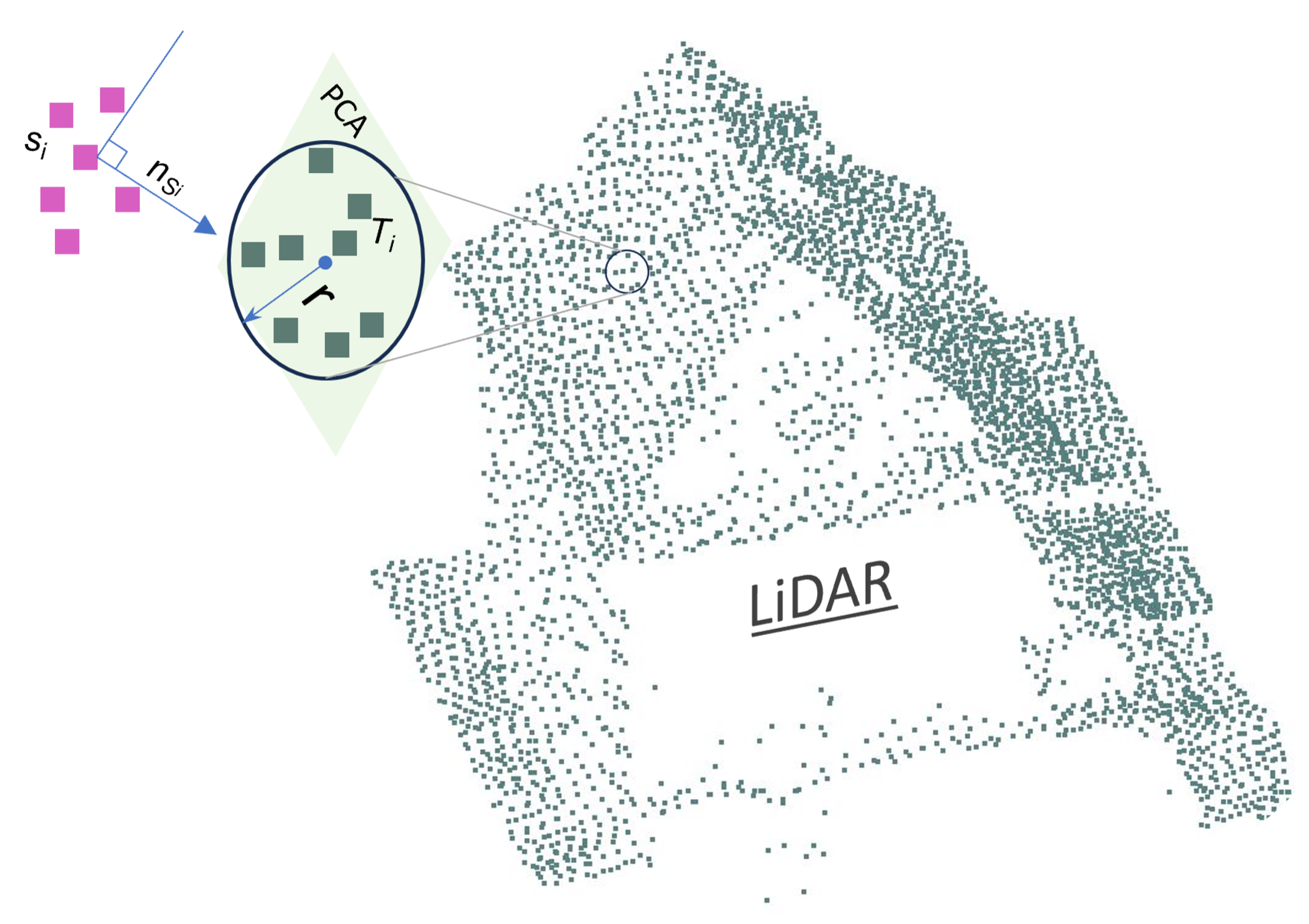
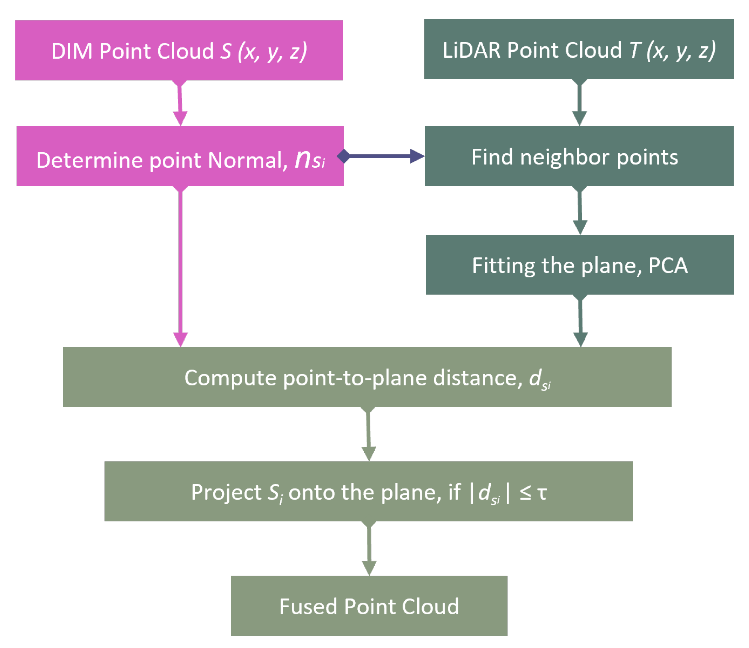
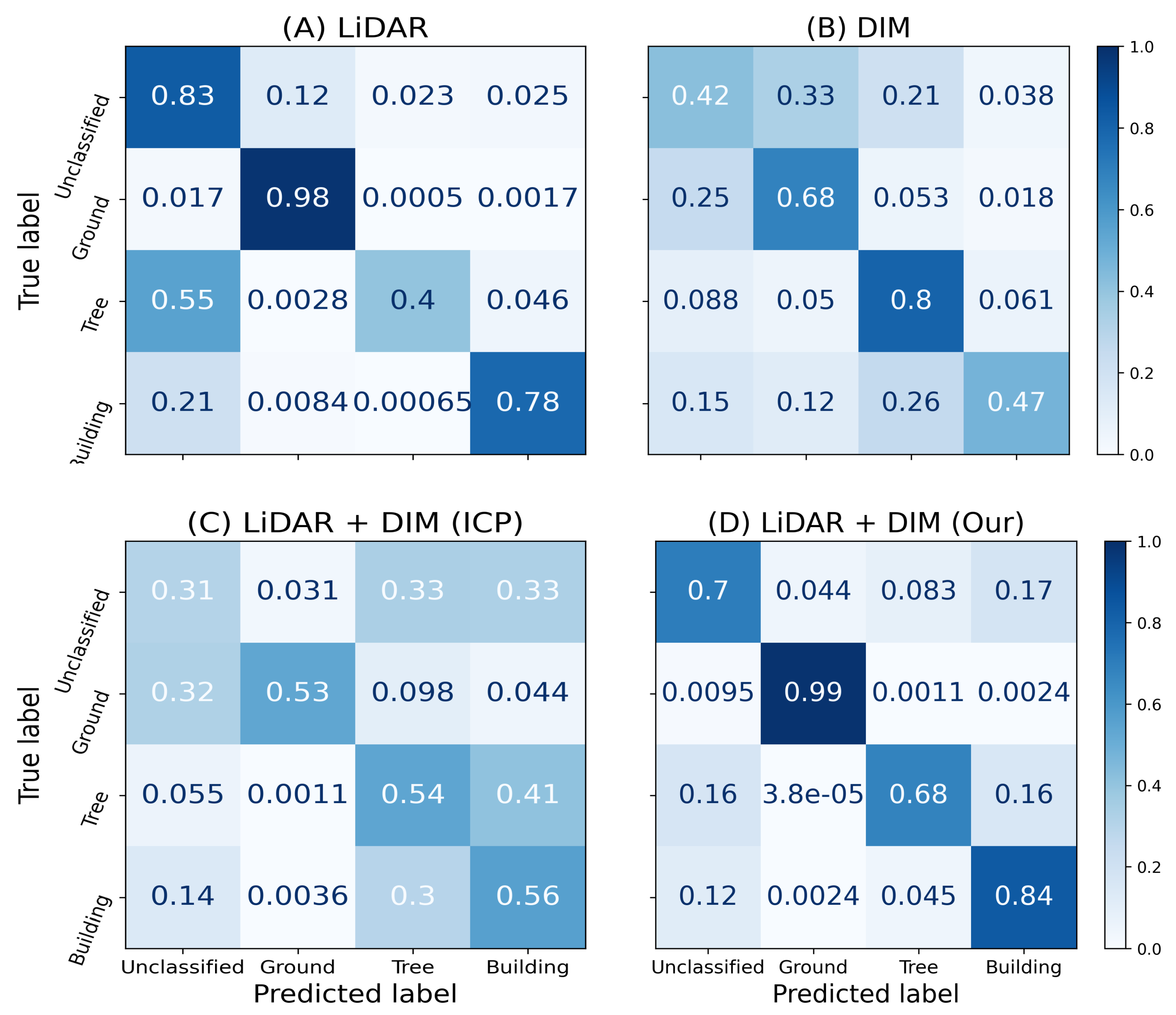
Point cloud fusion is crucial in geospatial analysis, combining data from multiple sources (e.g, LiDAR and photogrammetry) to provide a more complete and accurate environmental representation. However, integrating airborne hybrid sensors or cross-source point clouds remains challenging due to variations in geometric accuracy, data precision, gaps, and sensor attributes. Despite recent advancements, these challenges remain and are among the most demanding aspects in geospatial data processing for remote sensing applications. We propose a new point cloud fusion algorithm that leverages local plane constraints to achieve advanced semantic consistency. The proposed method dynamically fits local planes to the target point clouds, enabling robust alignment of source points to these planes. Evaluation on two real-world datasets demonstrates significant gains in accuracy and preservation of geometric details. Our algorithm also improves the accuracy of downstream tasks such as semantic segmentation. In our experiment, the overall accuracy for the Dudelange dataset increases from 48.5% to 80.1%, and that for the Dublin dataset increases from 72.9% to 88.0%. While challenges persist with sparse and noisy datasets, experimental results highlight the effectiveness of the proposed method, offering valuable insights for maximizing the potential of cross-source point cloud data.
Keywords: ALS; airborne sensor; photogrammetry; geospatial data; feature extraction; cross-source; multi-source data; classification; city modelling ALS; airborne sensor; photogrammetry; geospatial data; feature extraction; cross-source; multi-source data; classification; city modelling