Article

Optimizing Spatial Representativeness of LULC Samples over Complex Karst Terrain Using Remote Sensing Phenology and Landform-Constrained Joint Stratification


1
School of Karst Science, Guizhou Normal University, Guiyang 550001, China
2
Guizhou Provincial Key Laboratory of Intelligent Processing and Application of Remote Sensing Big Data, Guiyang 550001, China
3
School of Geography & Environmental Science, Guizhou Normal University, Guiyang 550001, China
4
Anshun Agricultural Environment Field Observation and Research Station, Ministry of Agriculture and Rural Affairs of the People’s Republic of China, Anshun 551400, China
*
Author to whom correspondence should be addressed.
Remote Sens. 2026, 18(12), 1915; https://doi.org/10.3390/rs18121915
Submission received: 28 April 2026 / Revised: 28 May 2026 / Accepted: 29 May 2026 / Published: 10 June 2026
(This article belongs to the Topic Large-Scale and Long-Term Land Use and Land Cover Mapping)

Abstract

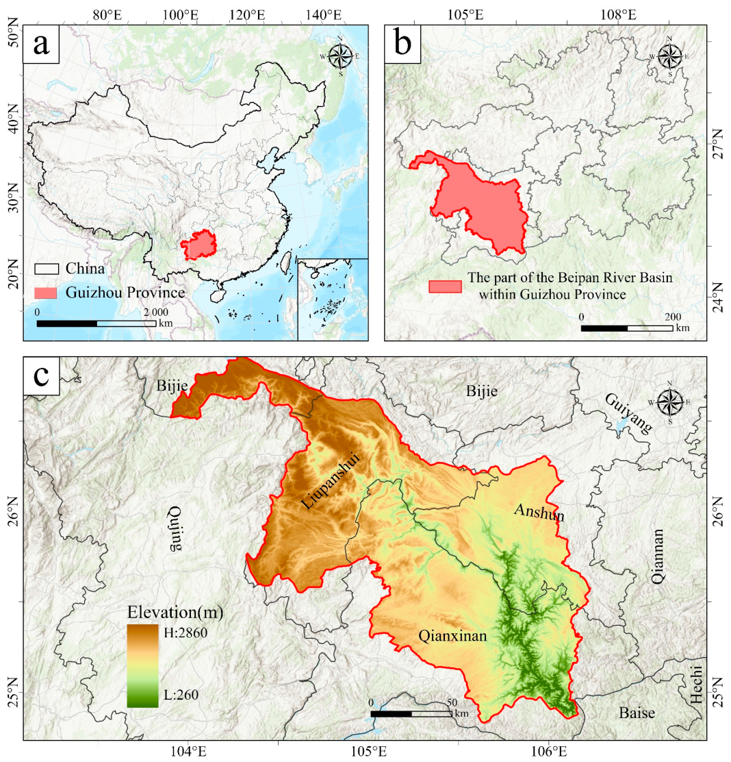
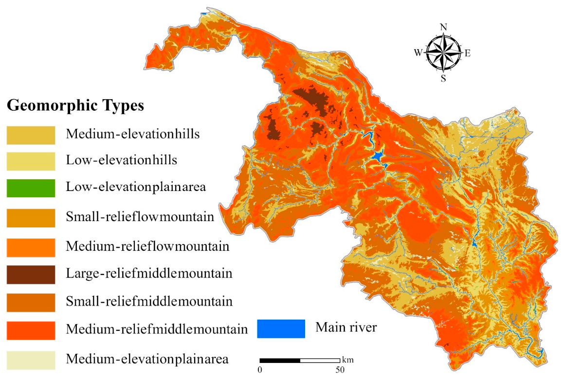
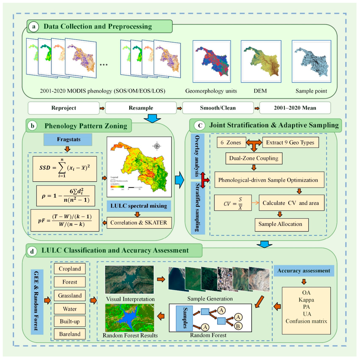
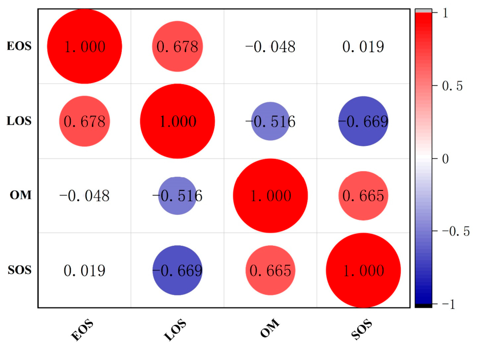
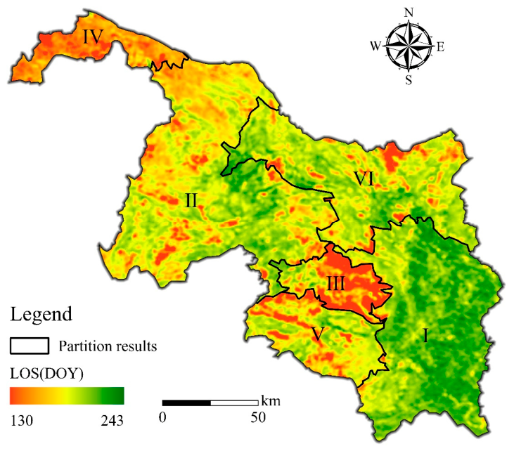
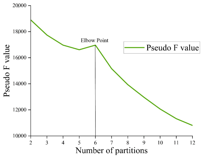
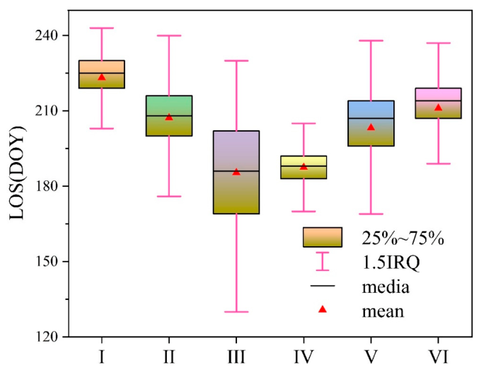
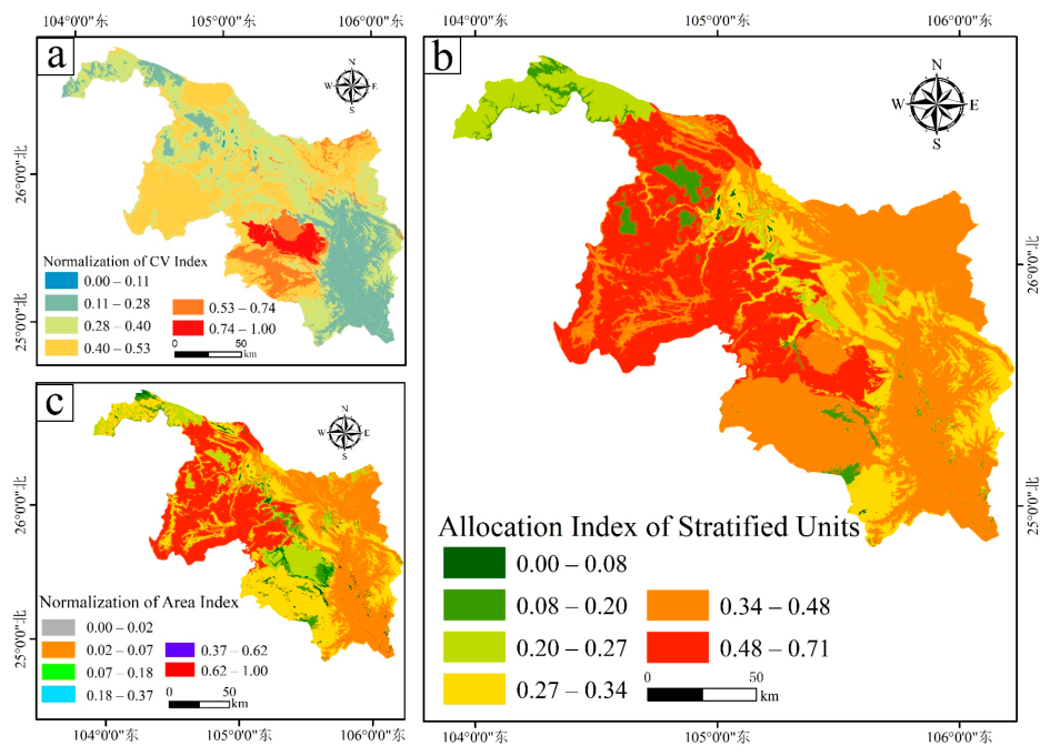
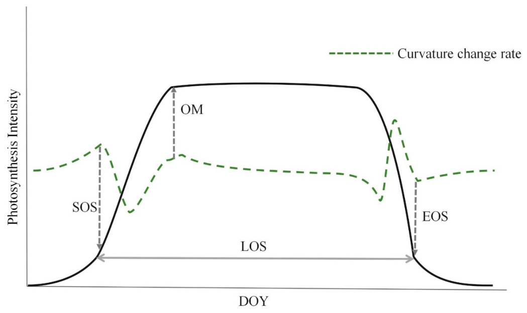
Karst regions are characterized by fragmented topography and significant micro-relief mosaics, leading to prominent spectral aliasing of land features, which can result in insufficient spatial representativeness of remote sensing samples for Land Use and Land Cover (LULC). The accuracy of LULC data directly affects the scientific basis of decision-making for rocky desertification control and ecological conservation. This study selected the Beipanjiang River Basin in Guizhou Province, a typical karst region, as the study area. The study selected the SOS, LOS, OM, and EOS indices from the 2001–2020 MODIS MCD12Q2 phenological dataset, combined with topographic zoning data. This study developed a sample spatial optimization scheme for complex karst terrain by integrating Spearman’s correlation analysis, SKATER spatially constrained clustering, statistical tests, adaptive stratified sampling, and Random Forest classification. The scheme was designed to test a phenology–landform joint stratification strategy for spatial sample allocation. The results indicate that (1) the study area was divided into six phenological pattern subregions, with significant spatial differentiation observed among them; (2) the “phenology–landform joint stratification + dual-weighted sample allocation” method was associated with improved sample representativeness and greater internal homogeneity within sample strata under the current experimental setting; and (3) compared to simple random sampling, the remote sensing phenological pattern-driven spatial optimization scheme improved overall accuracy from 71.33% to 77.55% and increased the Kappa coefficient from 0.43 to 0.62. These results suggest that, under the current study-area, sample-size, and validation settings, the phenology–landform joint stratification and dual-weighted allocation scheme can improve the spatial organization of training samples and classification performance over complex karst terrain, although weakly vegetated or bare classes remain difficult to separate.
Keywords: complex karst surfaces; Land Use and Land Cover (LULC); remote sensing phenology; adaptive stratified sampling; Google Earth Engine complex karst surfaces; Land Use and Land Cover (LULC); remote sensing phenology; adaptive stratified sampling; Google Earth Engine