Article

A Geospatial Livestock-Carrying Capacity Model (GLCC) in the Akmola Oblast, Kazakhstan

by
Jiaguo Qi
1,
Zihan Lin
2,
Mark A. Weltz
3,†,
Kenneth E. Spaeth
4,
Gulnaz Iskakova
5,*,
Jason Nesbit
3,
David Toledo
6,
Tlektes Yespolov
7,†,
Maira Kussainova
8,
Lyazzat K. Makhmudova
9 and
Xiaoping Xin
10
1
Department of Geography, Environment, and Spatial Sciences, Michigan State University, East Lansing, MI 48823, USA
2
Department of Biological, Geological and Environmental Sciences, Cleveland State University, Cleveland, OH 44115, USA
3
Great Basin Rangelands Research Unit, US Department of Agriculture (USDA)—Agricultural Research Service, Reno, NV 89512, USA
4
US Department of Agriculture (USDA)—Natural Resources Conservation Service, Ft. Worth, TX 76115, USA
5
Faculty of Water Resources and IT Technologies, Kazakh National Agrarian Research University (KazNARU), Almaty 050010, Kazakhstan
6
Northern Great Plains Research Laboratory, US Department of Agriculture (USDA)—Agricultural Research Service, Mandan, ND 58554, USA
7
Kazakh National Agrarian Research University (KazNARU), Almaty 050010, Kazakhstan
8
Center for Sustainable Agriculture, Kazakh National Agrarian Research University (KazNARU), Almaty 050010, Kazakhstan
9
Institute of Geography and Water Safety, Almaty 050010, Kazakhstan
10
National Hulunber Grassland Ecosystem Observation and Research Station, Institute of Agricultural Resources and Regional Planning, Chinese Academy of Agricultural Sciences, Beijing 100081, China
*
Author to whom correspondence should be addressed.
Retired.
Remote Sens. 2025, 17(8), 1477; https://doi.org/10.3390/rs17081477
Submission received: 22 February 2025 / Revised: 10 April 2025 / Accepted: 15 April 2025 / Published: 21 April 2025

Abstract

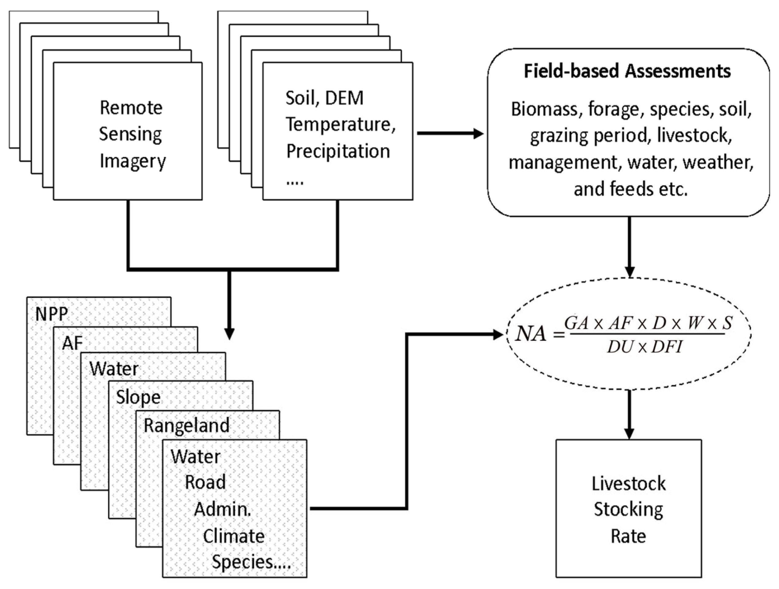
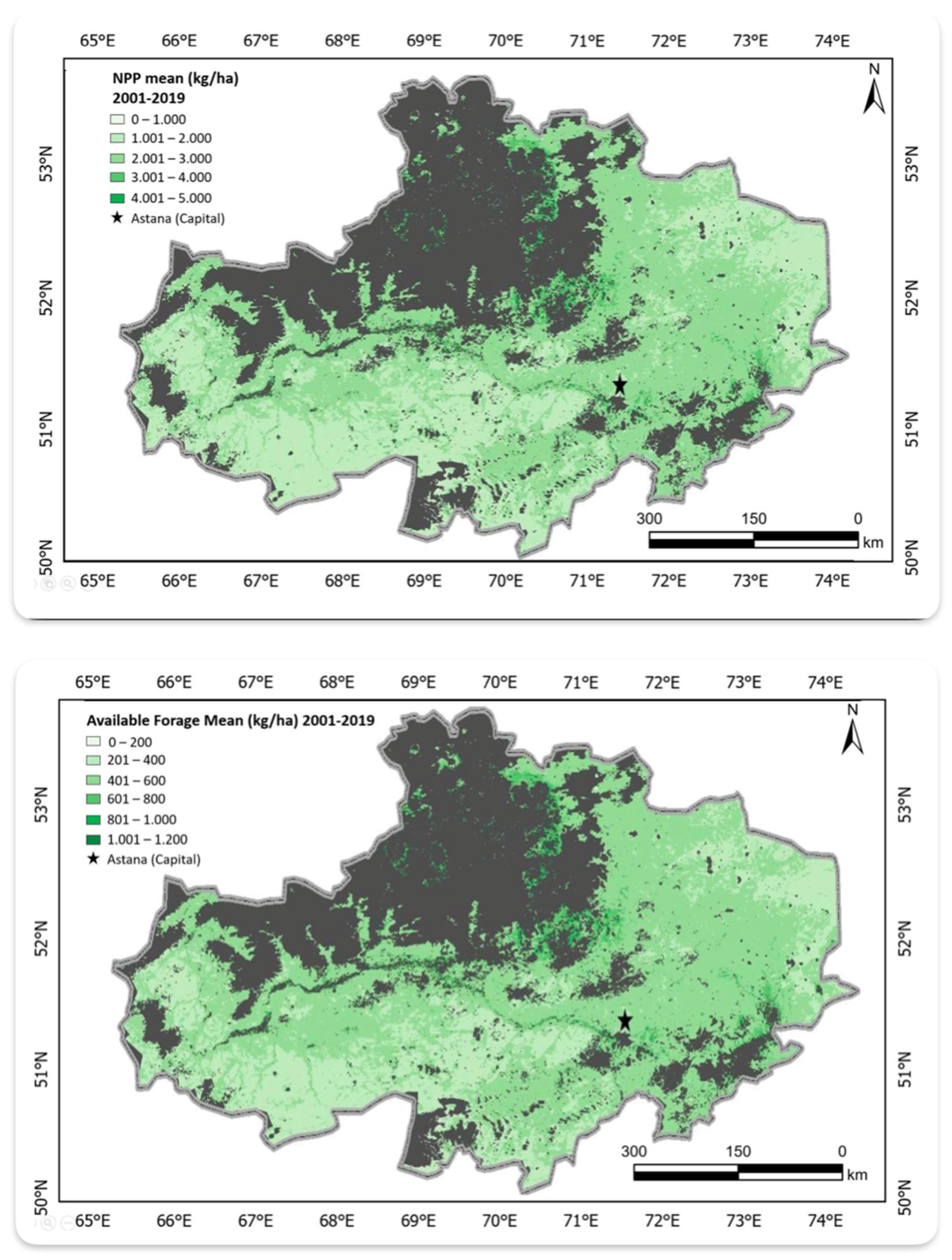
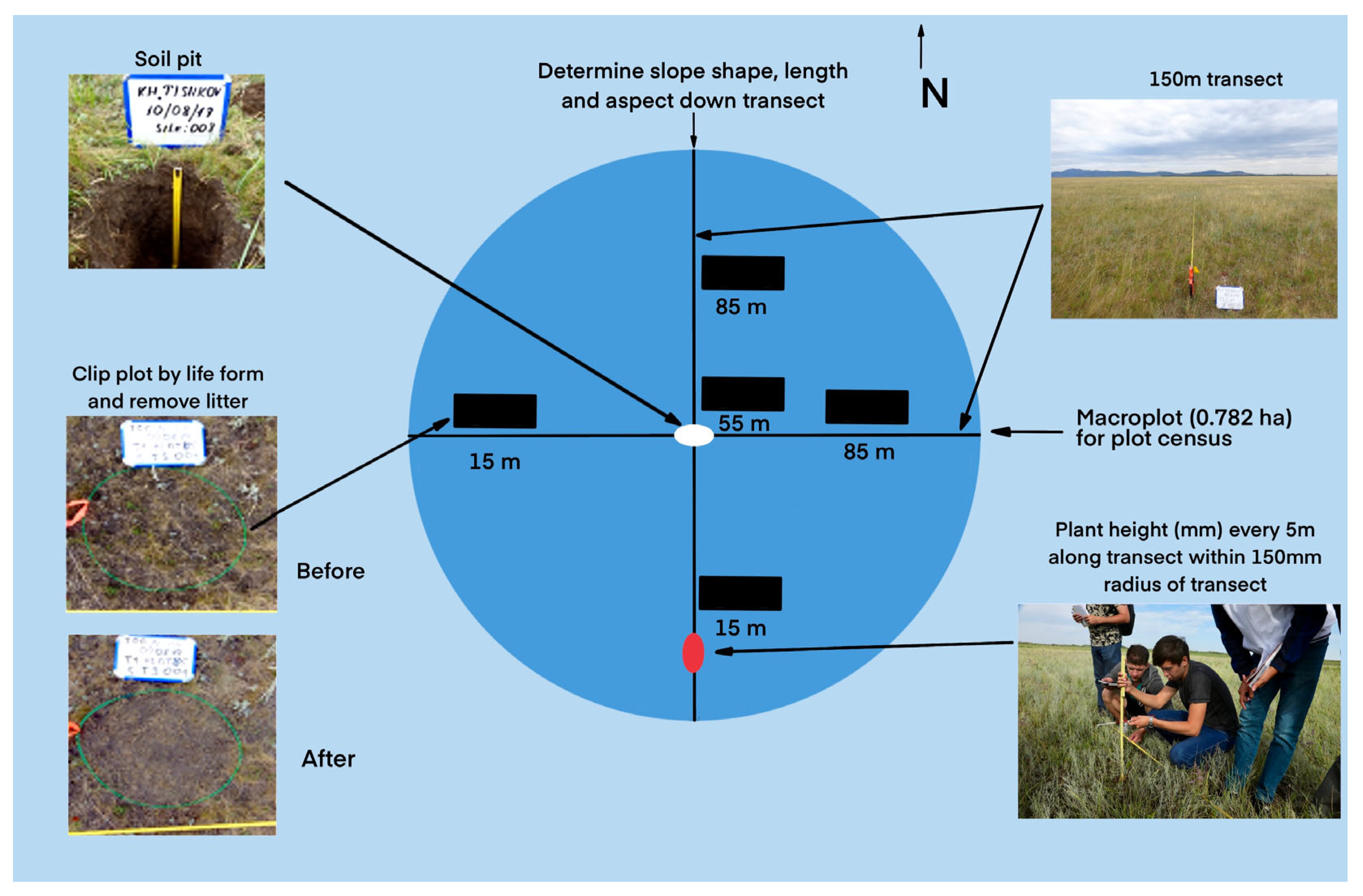
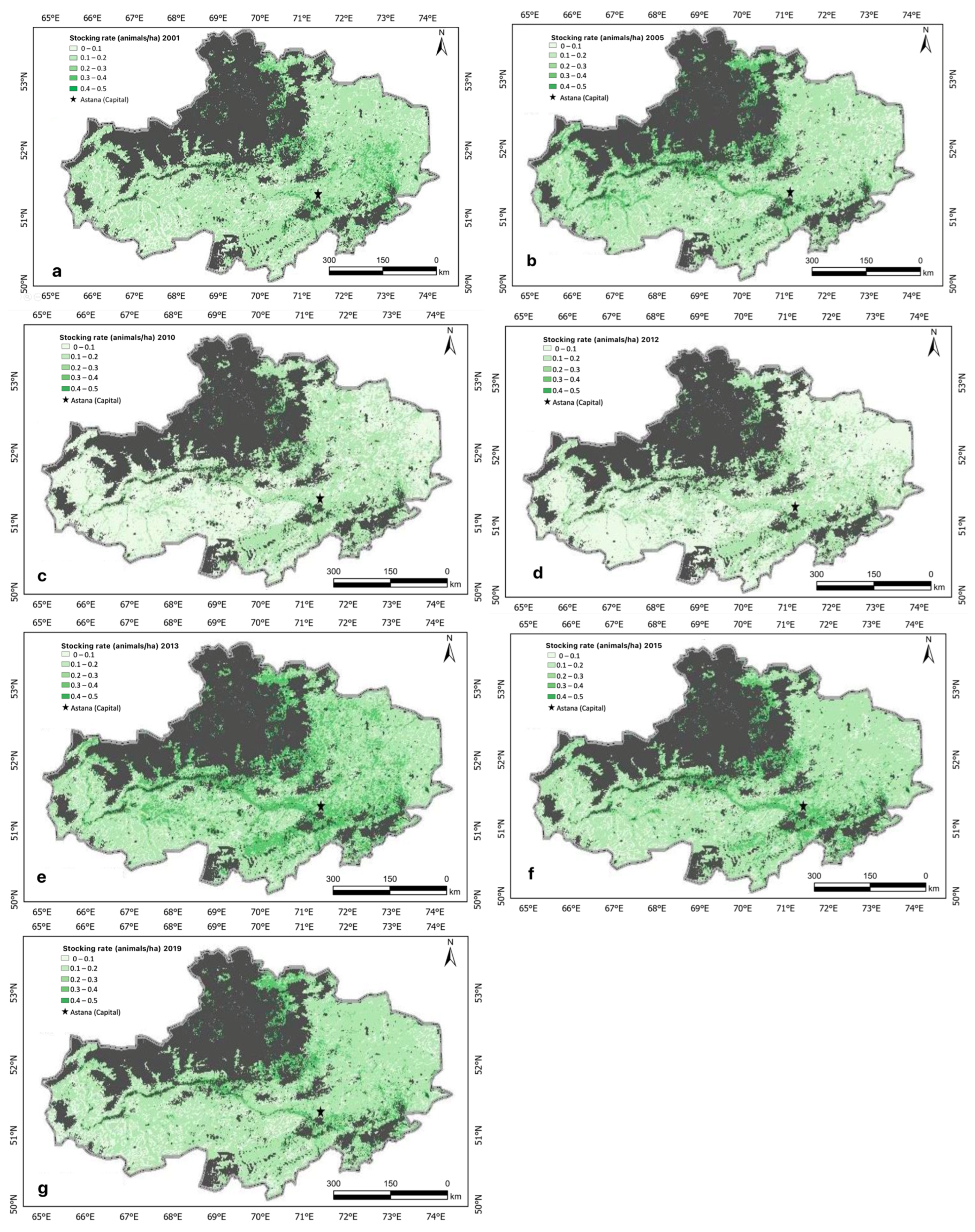
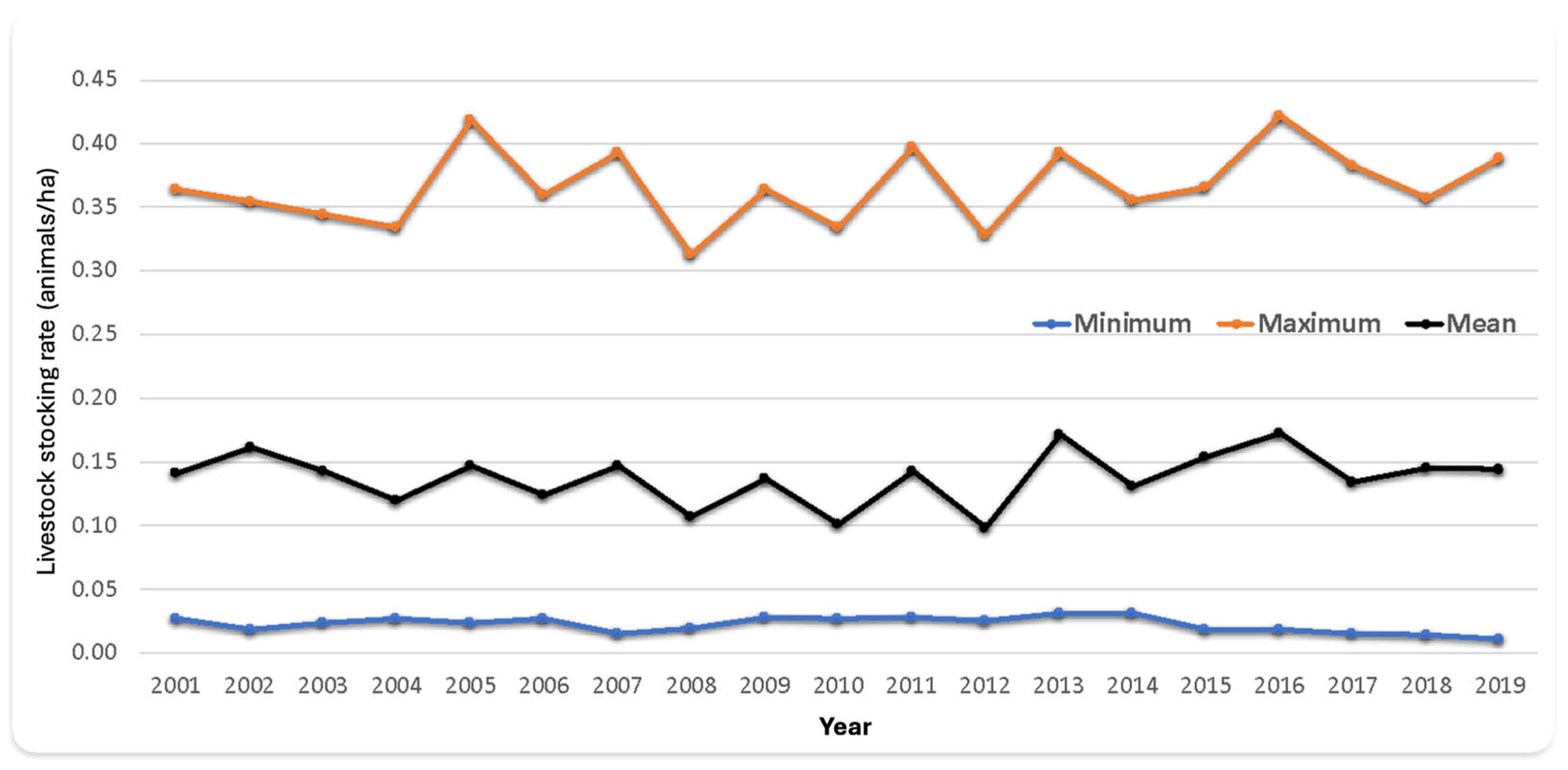
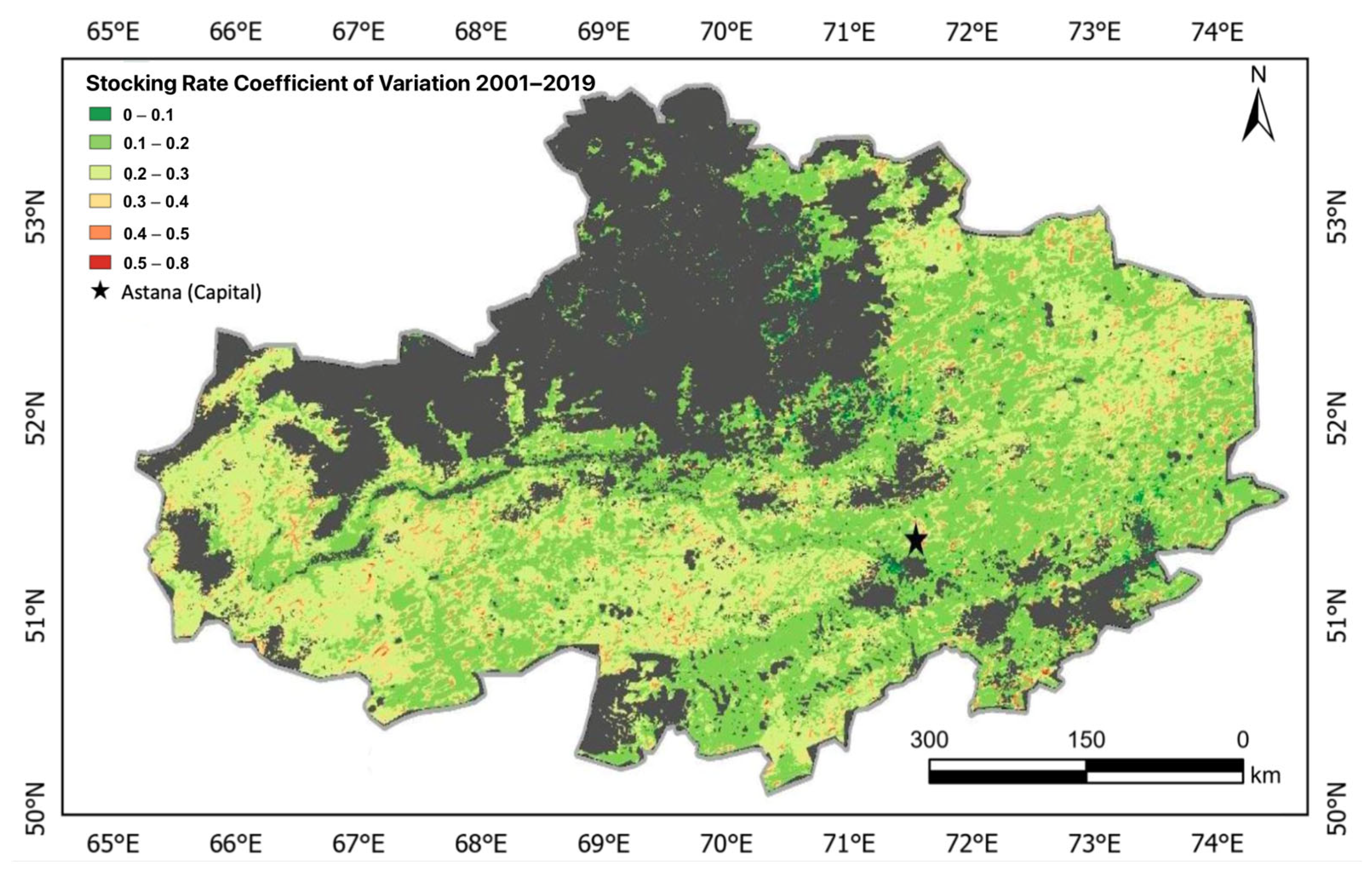
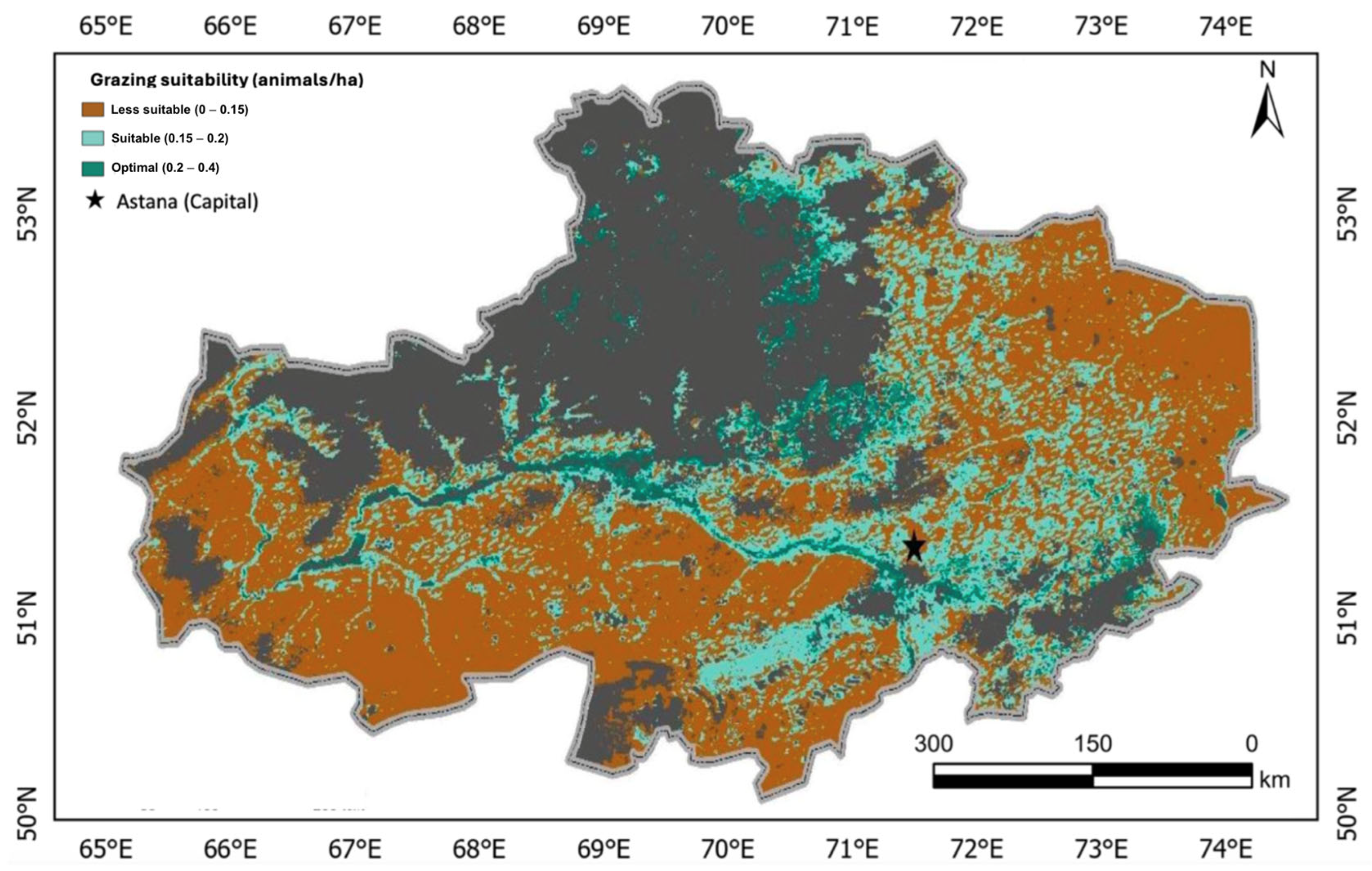
Spatial disparities in rangeland conditions across Kazakhstan complicate field-based assessments of livestock-carrying capacity (LCC), a critical metric for the country’s food security and economic planning. This study developed a geospatial livestock-carrying capacity (GLCC) modeling framework to quantify LCC spatio-temporal dynamics at the Oblast level, by integrating satellite-derived data on vegetation, water resources, and terrain with in situ measurements. By providing ground-truth observations and contextual detail, field-based measurements complement remote sensing data and help to validate estimates and improve the reliability of the GLCC model. The modeling framework was successfully applied and validated in a case study in the Akmola Oblast, Kazakhstan, to specifically map the spatial and temporal distributions of LCC, using publicly available MODIS NPP data and in situ data from 51 field sites. The modeling results showed distinct spatial patterns of LCC across the Oblast, reflecting variability in rangeland productivity with higher values concentrated in southern and southeastern regions (up to 0.5 animals/ha). The results also depicted significant interannual LCC fluctuations (ranging from 0.099 to 0.17 animals/ha) possibly due to rainfall variability, and thus an indicator of climate-related risks for livestock management. Although there is still room for further improvement, particularly in model parameterization to account for grazing pressures, forage quality, and livestock species, the GLCC modeling framework represents a simple modeling tool to map livestock-carrying capacity, a more meaningful indicator to rangeland managers. Further, this work underscores the value of integrating remote sensing with field-based observations to support data-driven rangeland management planning and resilient investment strategies.
Keywords: remote sensing; livestock-carrying capacity (LCC); geospatial modeling; rangeland management; climate variability; food security; spatial analysis; Kazakhstan; vegetation monitoring; sustainable agriculture remote sensing; livestock-carrying capacity (LCC); geospatial modeling; rangeland management; climate variability; food security; spatial analysis; Kazakhstan; vegetation monitoring; sustainable agriculture