Article

Comparison of UAV-Based LiDAR and Photogrammetric Point Cloud for Individual Tree Species Classification of Urban Areas


1
College of Geography and Environment, Shandong Normal University, Jinan 250014, China
2
Jinan Environmental Research Institute, Jinan 250098, China
3
Remote Sensing and Earth Science Research Institute, Hangzhou Normal University, Hangzhou 311121, China
4
Department of Geography and the Environment, University of North Texas, Denton, TX 76203, USA
5
Shandong Provincial Institute of Land Surveying and Mapping, Jinan 250100, China
*
Author to whom correspondence should be addressed.
Remote Sens. 2025, 17(7), 1212; https://doi.org/10.3390/rs17071212
Submission received: 27 January 2025 / Revised: 19 March 2025 / Accepted: 26 March 2025 / Published: 28 March 2025

Abstract

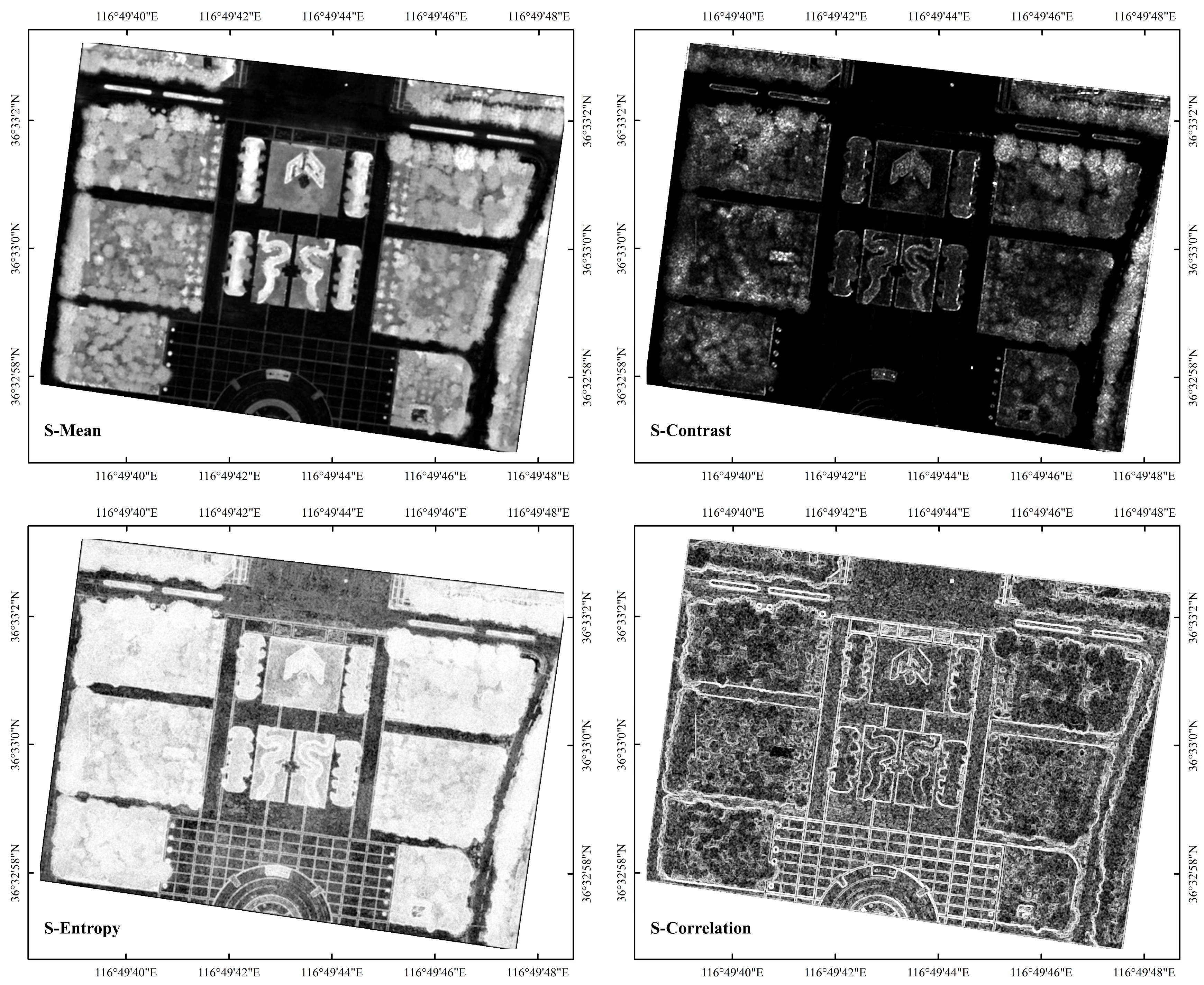
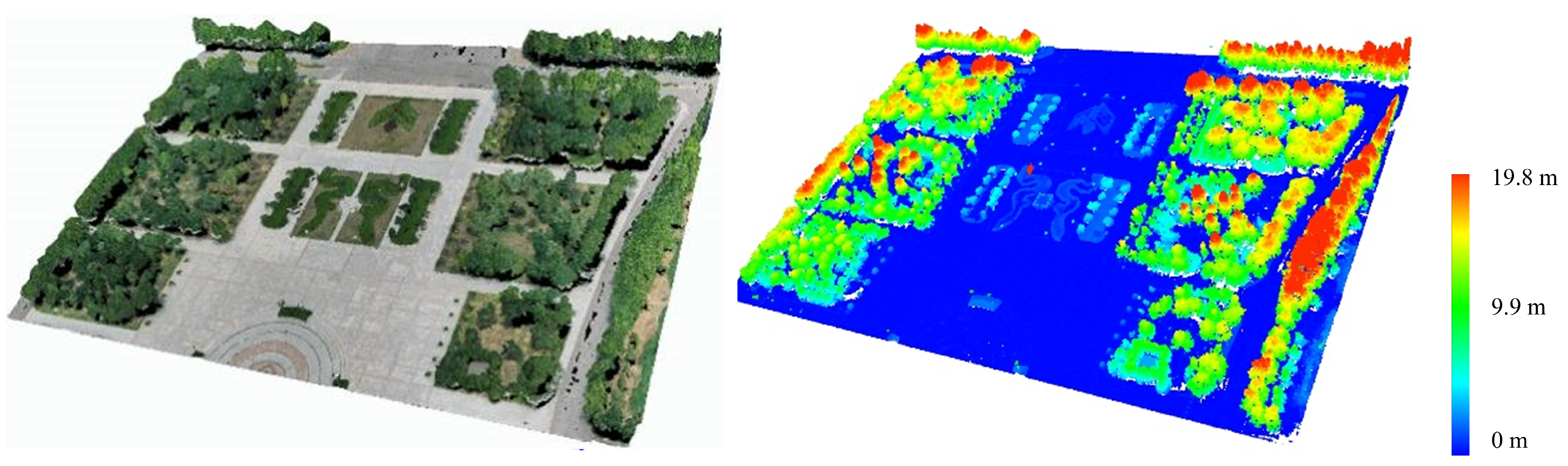
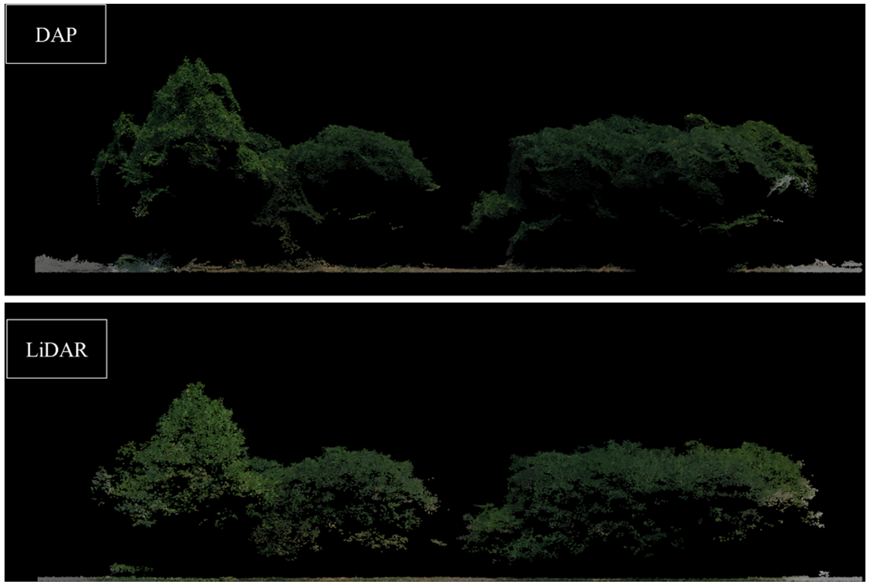
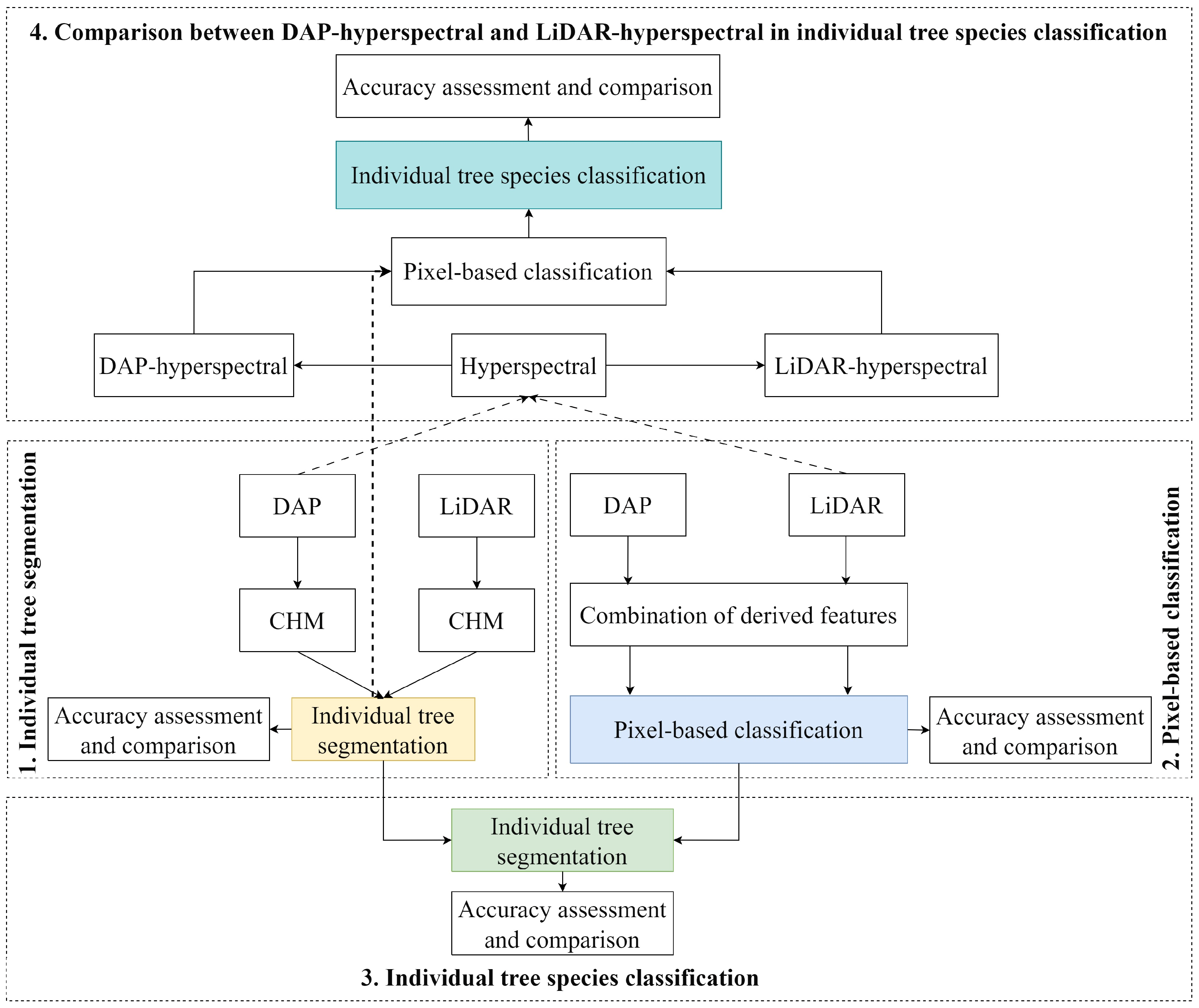
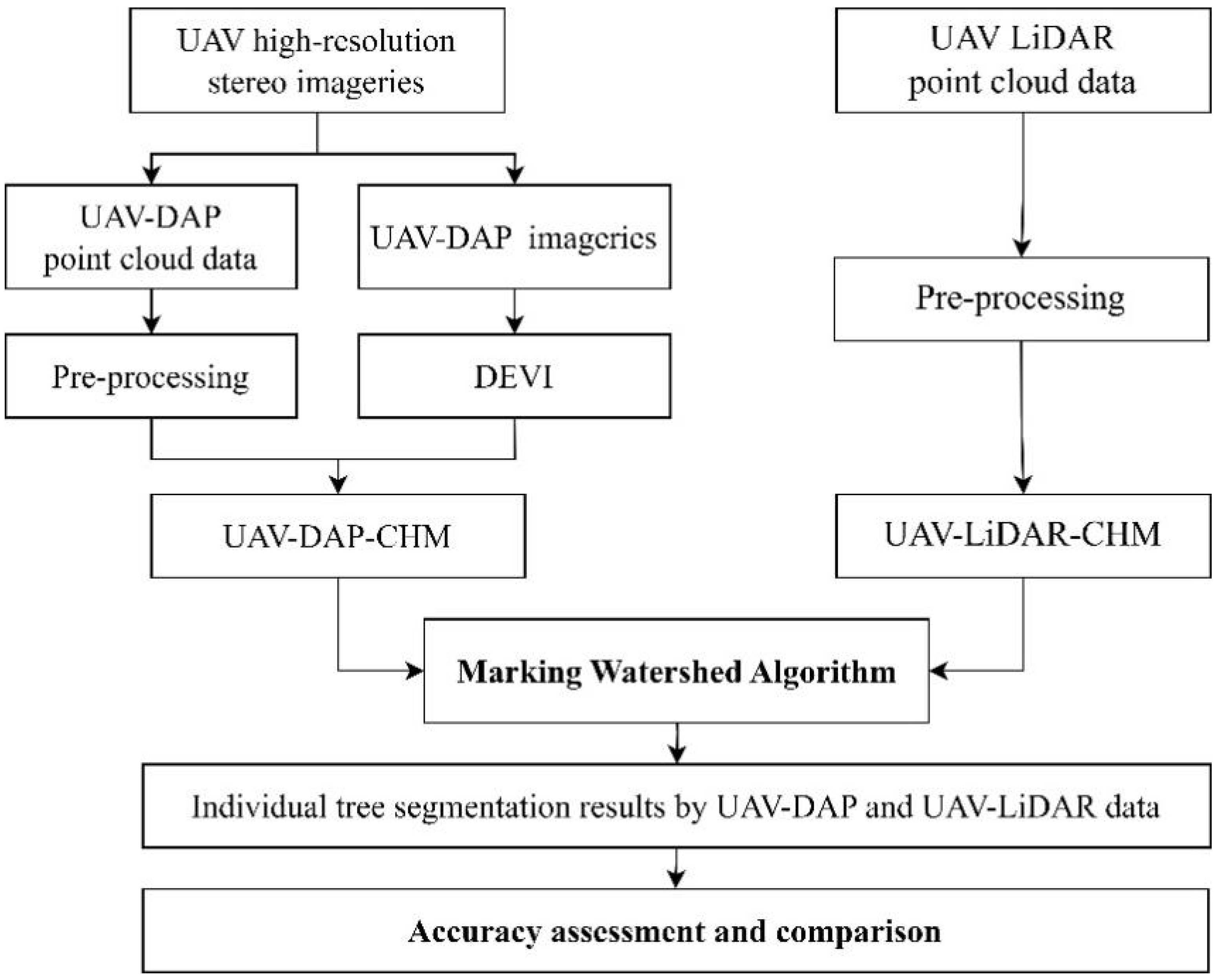
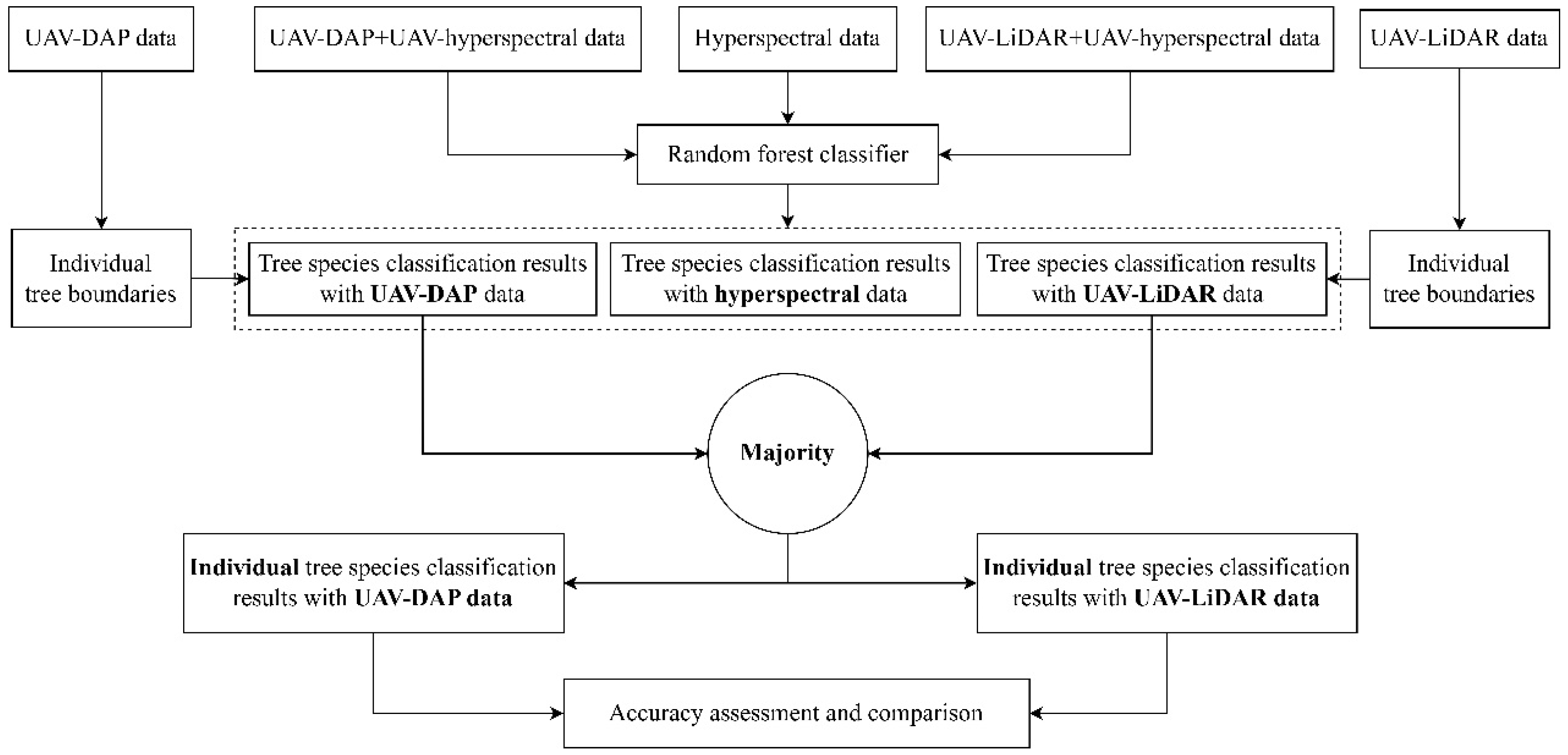
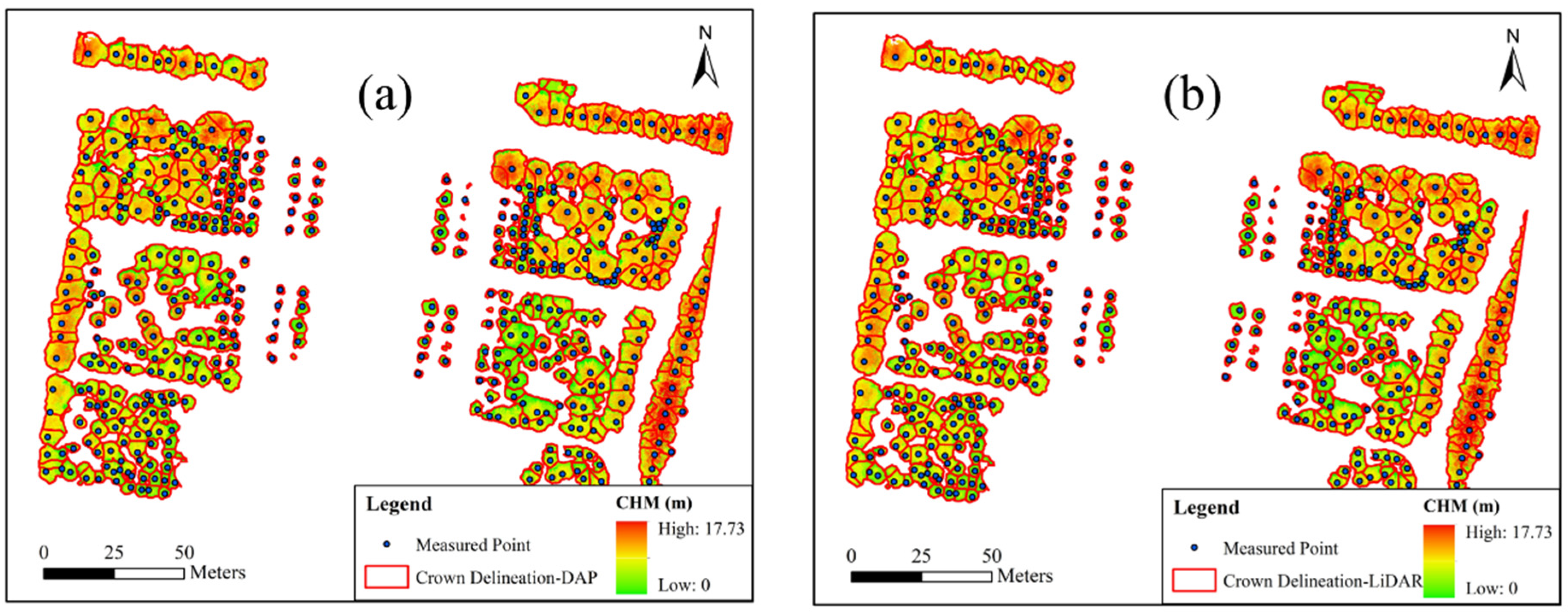
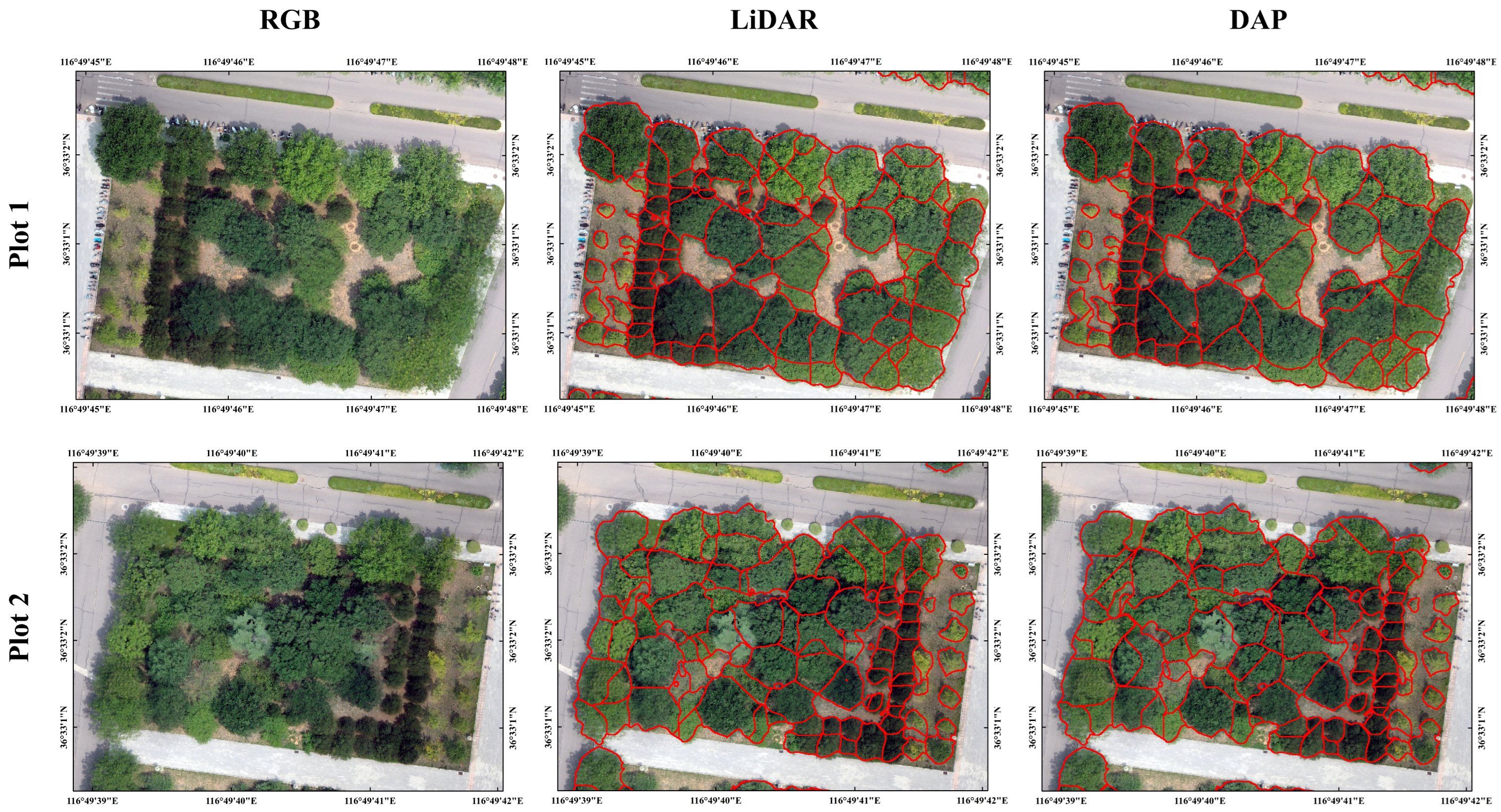
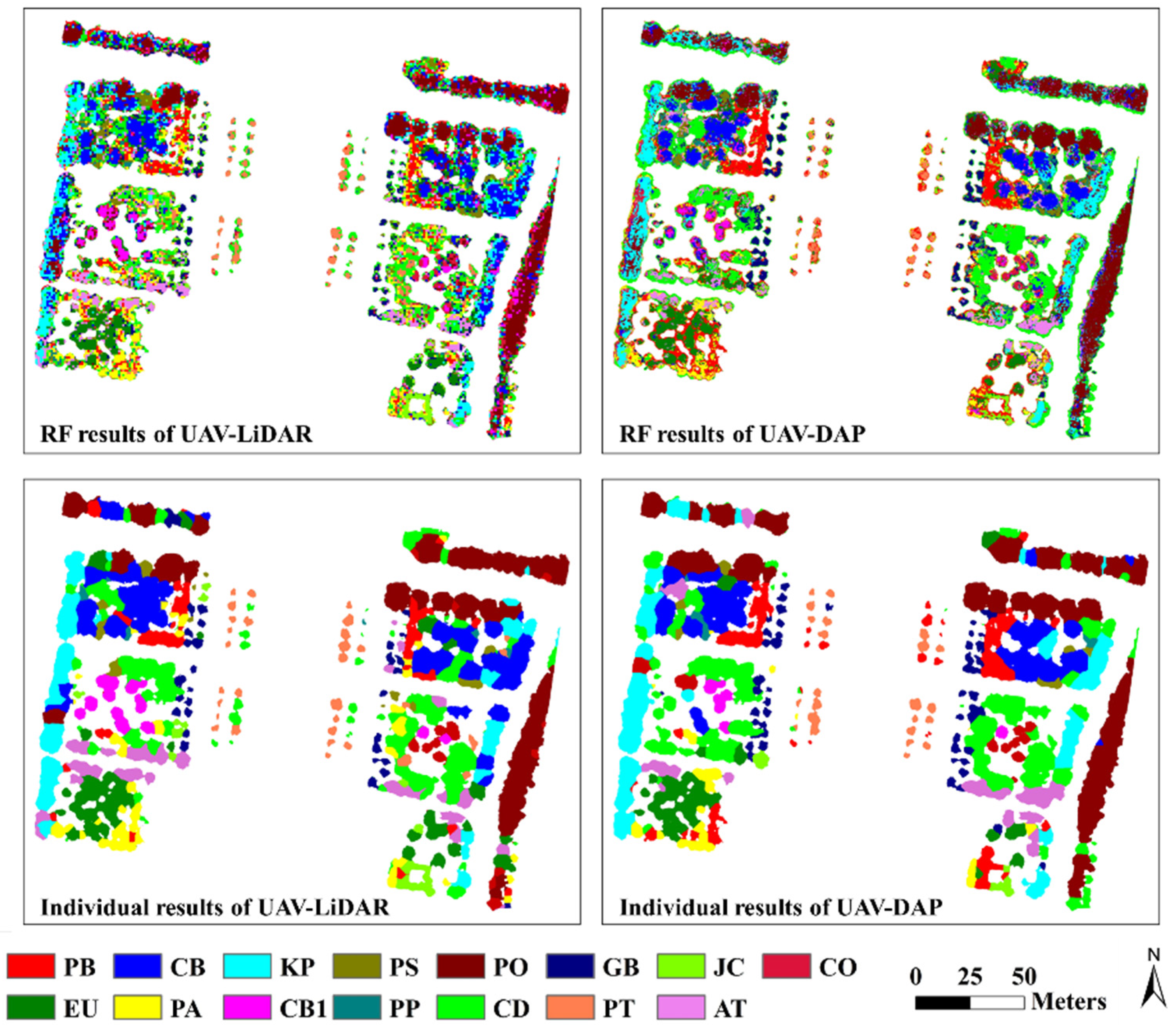
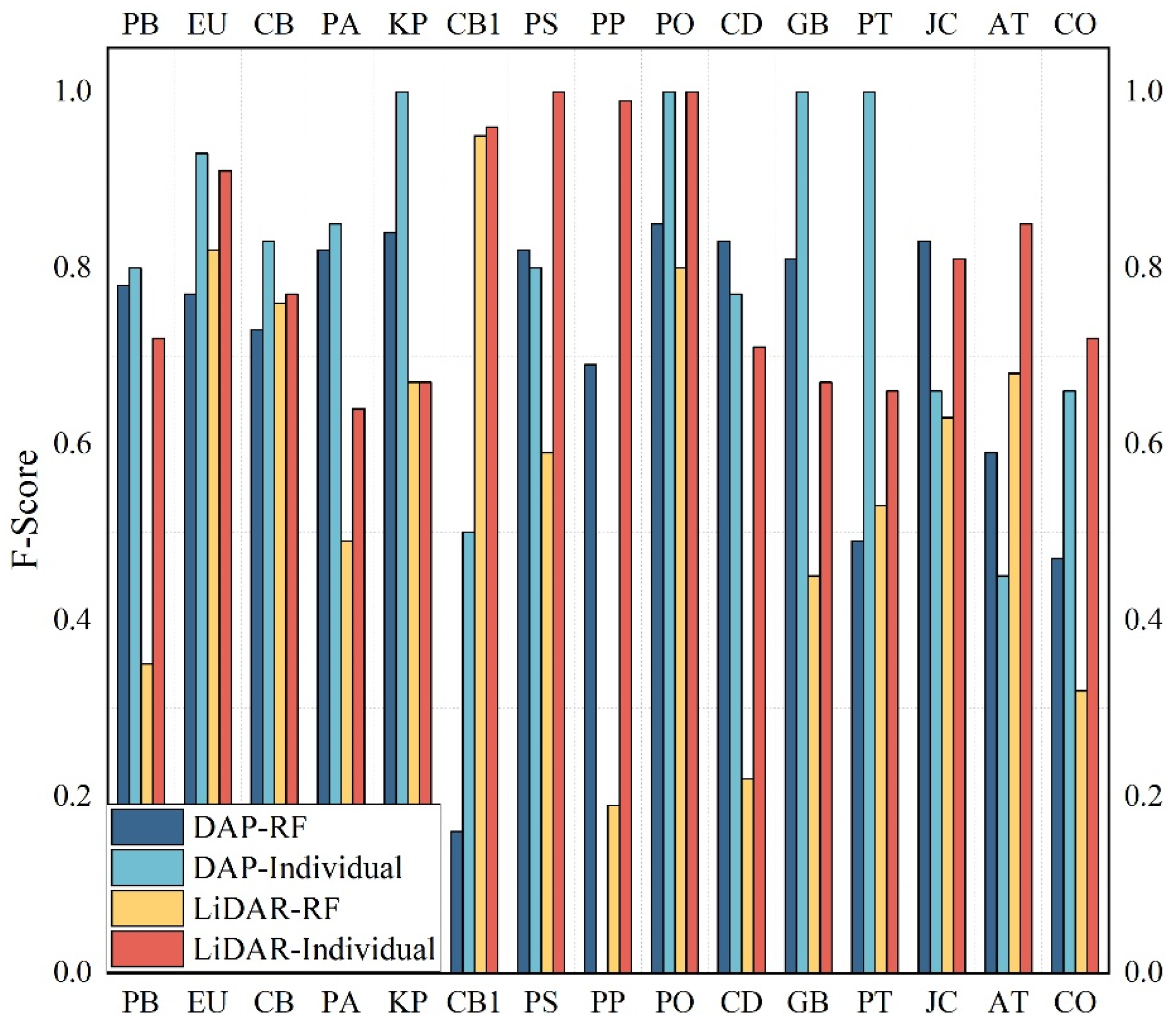
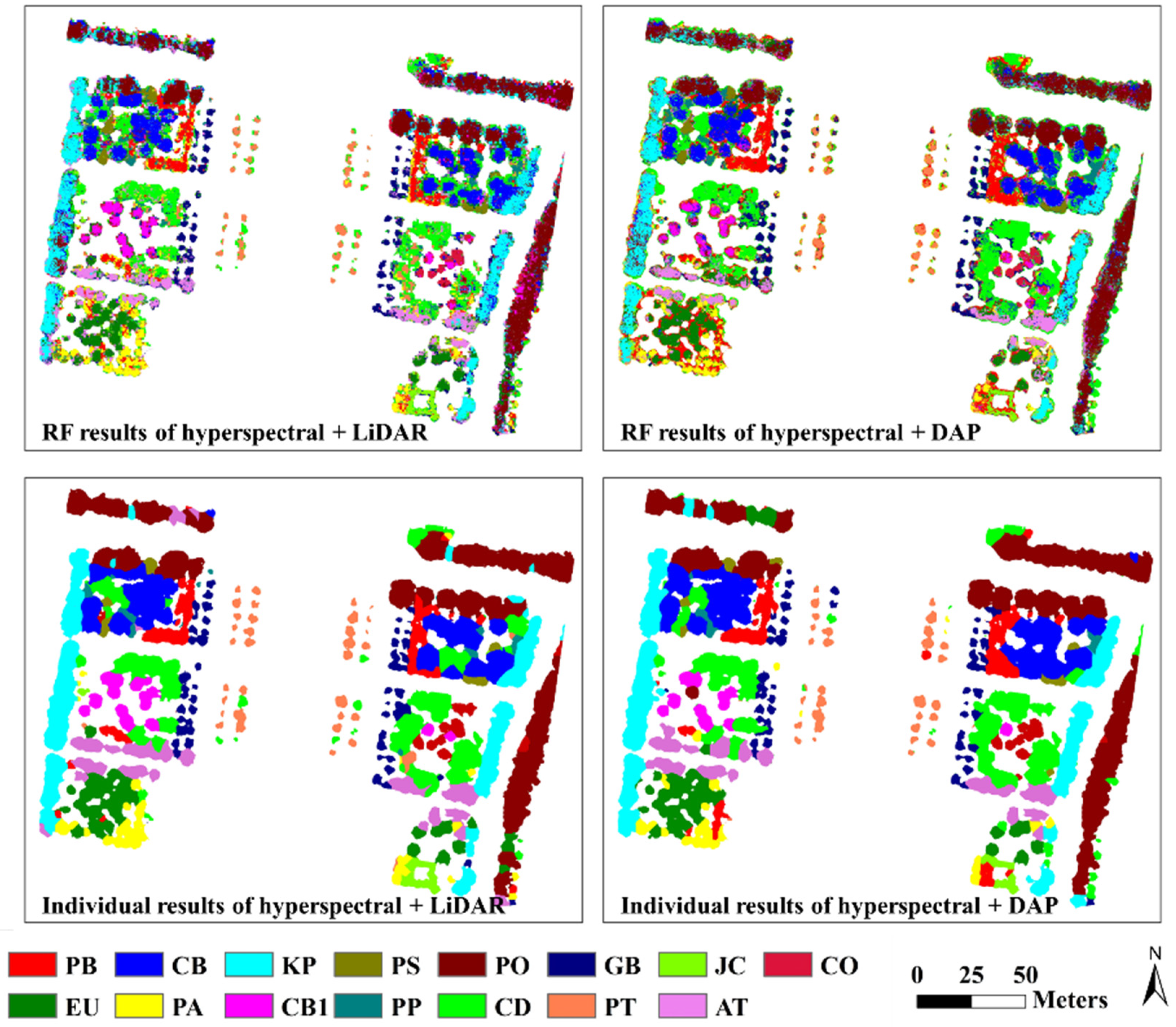
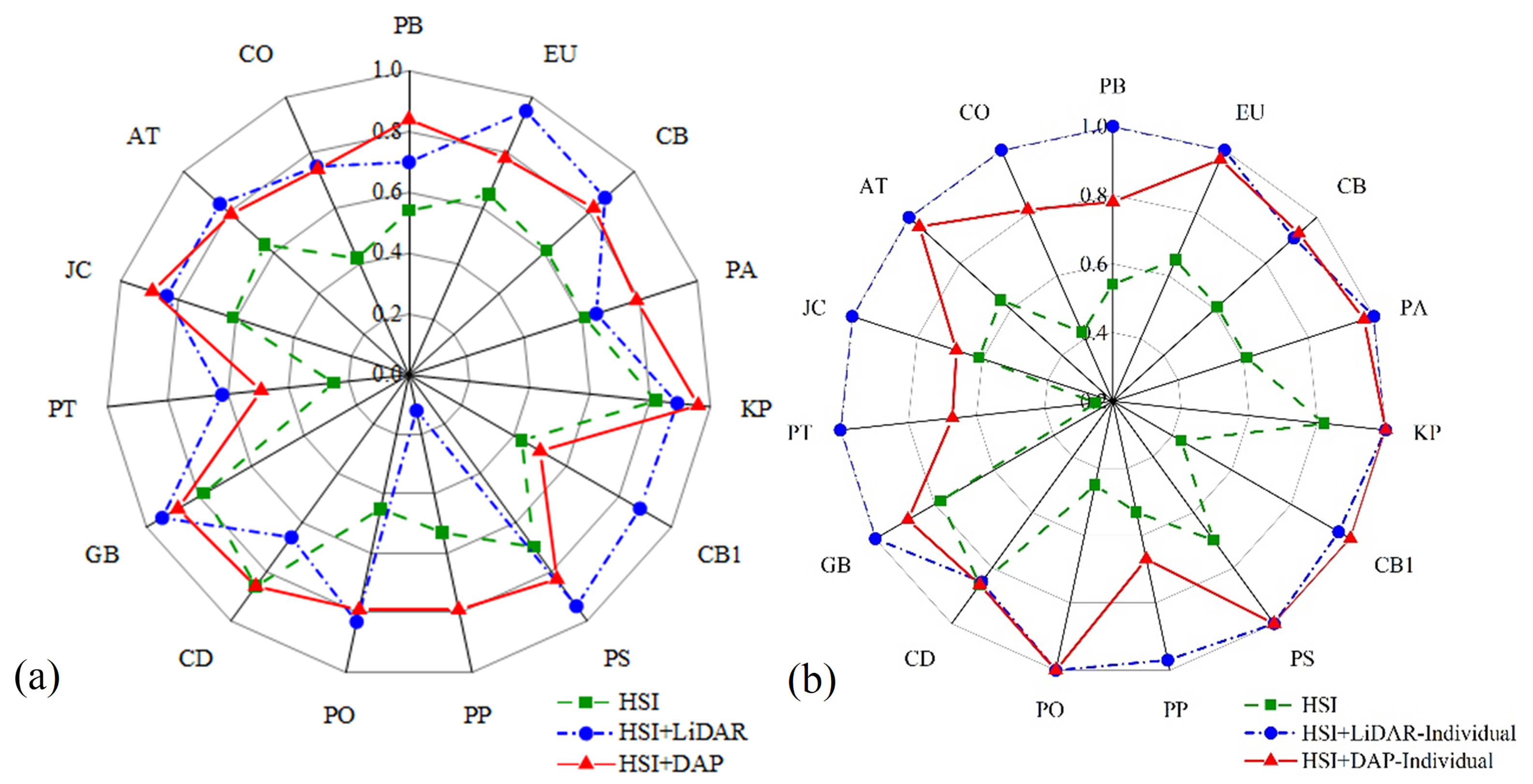
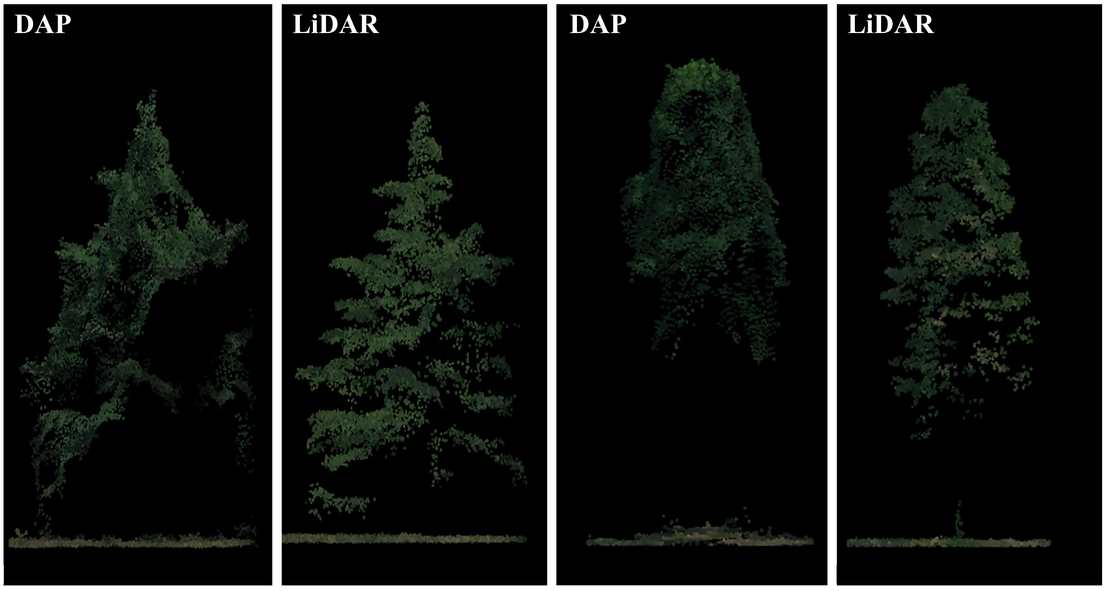
UAV LiDAR and digital aerial photogrammetry (DAP) have shown great performance in forest inventory due to their advantage in three-dimensional information extraction. Many studies have compared their performance in individual tree segmentation and structural parameters extraction (e.g. tree height). However, few studies have compared their performance in tree species classification. Therefore, we have compared the performance of UAV LiDAR and DAP-based point clouds in individual tree species classification with the following steps: (1) Point cloud data processing: Denoising, smoothing, and normalization were conducted on LiDAR and DAP-based point cloud data separately. (2) Feature extraction: Spectral, structural, and texture features were extracted from the pre-processed LiDAR and DAP-based point cloud data. (3) Individual tree segmentation: The marked watershed algorithm was used to segment individual trees on canopy height models (CHM) derived from LiDAR and DAP data, respectively. (4) Pixel-based tree species classification: The random forest classifier (RF) was used to classify urban tree species with features derived from LiDAR and DAP data separately. (5) Individual tree species classification: Based on the segmented individual tree boundaries and pixel-based classification results, the majority filtering method was implemented to obtain the final individual tree species classification results. (6) Fused with hyperspectral data: LiDAR-hyperspectral and DAP-hyperspectral fused data were used to conduct individual tree species classification. (7) Accuracy assessment and comparison: The accuracy of the above results were assessed and compared. The results indicate that LiDAR outperformed DAP in individual tree segmentation (F-score 0.83 vs. 0.79), while DAP achieved higher pixel-level classification accuracy (73.83% vs. 57.32%) due to spectral-textural features. Fusion with hyperspectral data narrowed the gap, with LiDAR reaching 95.98% accuracy in individual tree classification. Our findings suggest that DAP offers a cost-effective alternative for urban forest management, balancing accuracy and operational costs.
Keywords: UAV; LiDAR; digital aerial photogrammetry; individual tree segmentation; individual tree species classification UAV; LiDAR; digital aerial photogrammetry; individual tree segmentation; individual tree species classification