Article

Effective Cultivated Land Extraction in Complex Terrain Using High-Resolution Imagery and Deep Learning Method

1
College of Geographical Sciences, Faculty of Geographical Science and Engineering, Henan University, Zhengzhou 450046, China
2
Key Laboratory of Geospatial Technology for the Middle and Lower Yellow River Regions, Ministry of Education, Henan University, Kaifeng 475004, China
3
Henan Technology Innovation Center of Spatial-Temporal Big Data, Henan University, Zhengzhou 450046, China
4
Aerospace Information Research Institute, Chinese Academy of Sciences, Beijing 100094, China
5
Institute of Crop Science, Chinese Academy of Agricultural Sciences, Beijing 100081, China
6
Information Technology Group, Wageningen University & Research, 6708 PB Wageningen, The Netherlands
*
Author to whom correspondence should be addressed.
Remote Sens. 2025, 17(5), 931; https://doi.org/10.3390/rs17050931
Submission received: 19 January 2025 / Revised: 24 February 2025 / Accepted: 4 March 2025 / Published: 6 March 2025
(This article belongs to the Special Issue Advances in Remote Sensing for Crop Monitoring and Food Security)

Abstract

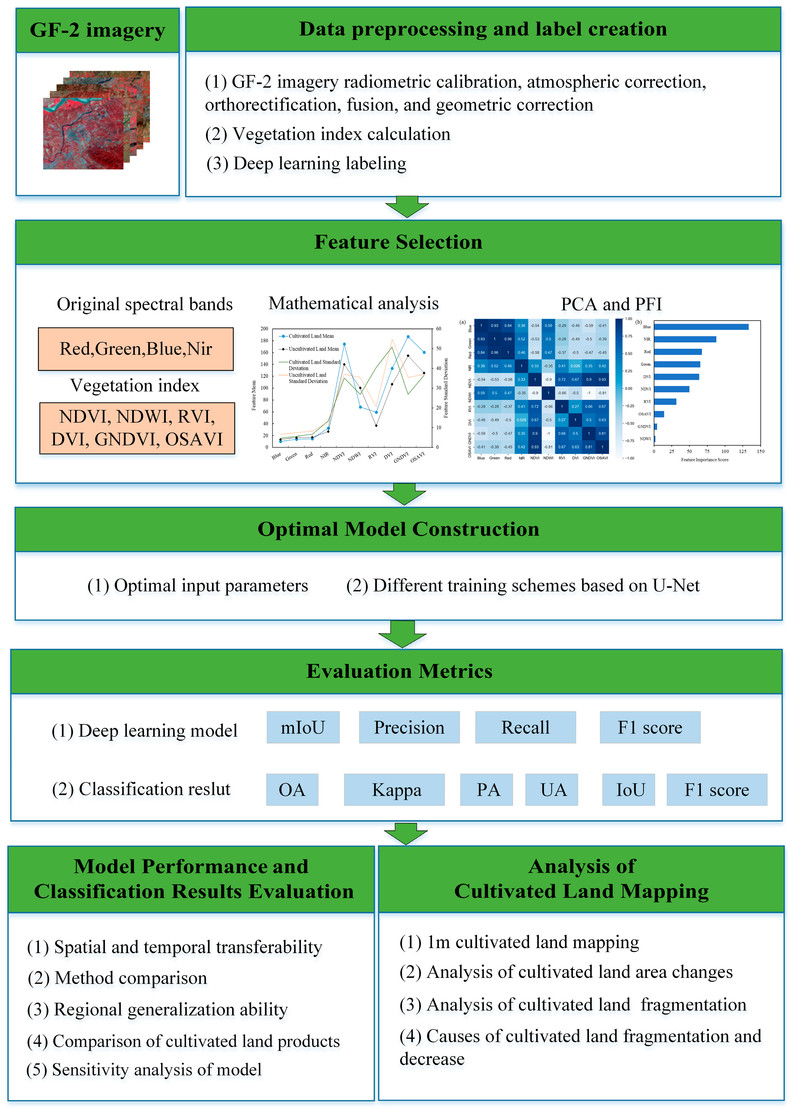
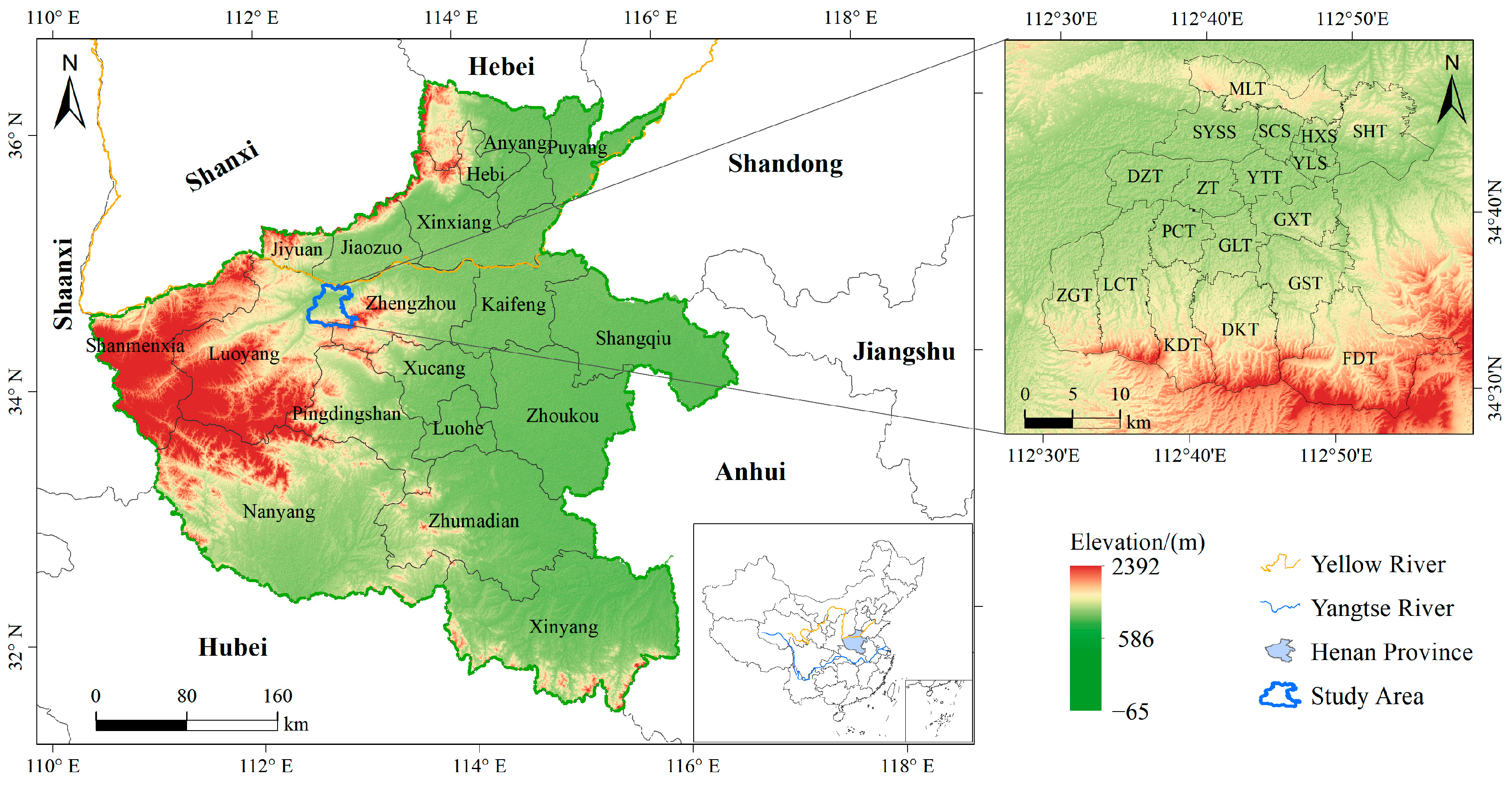
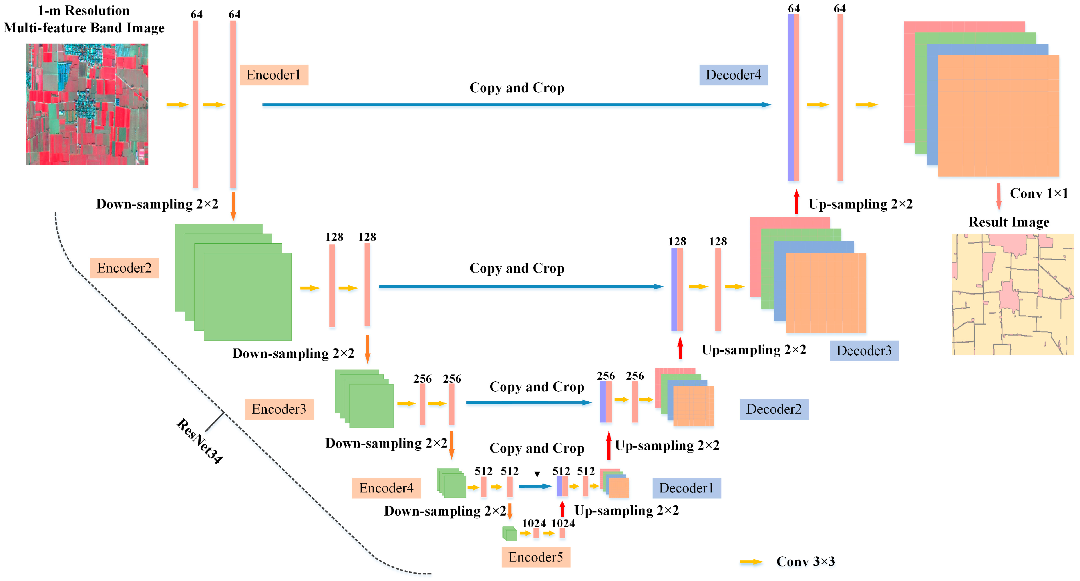
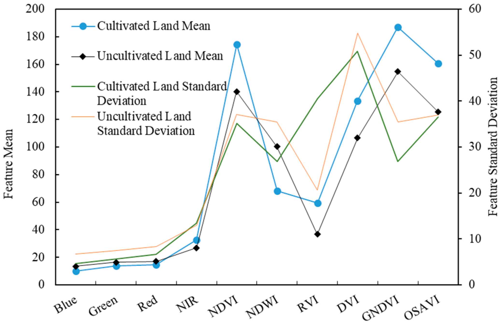
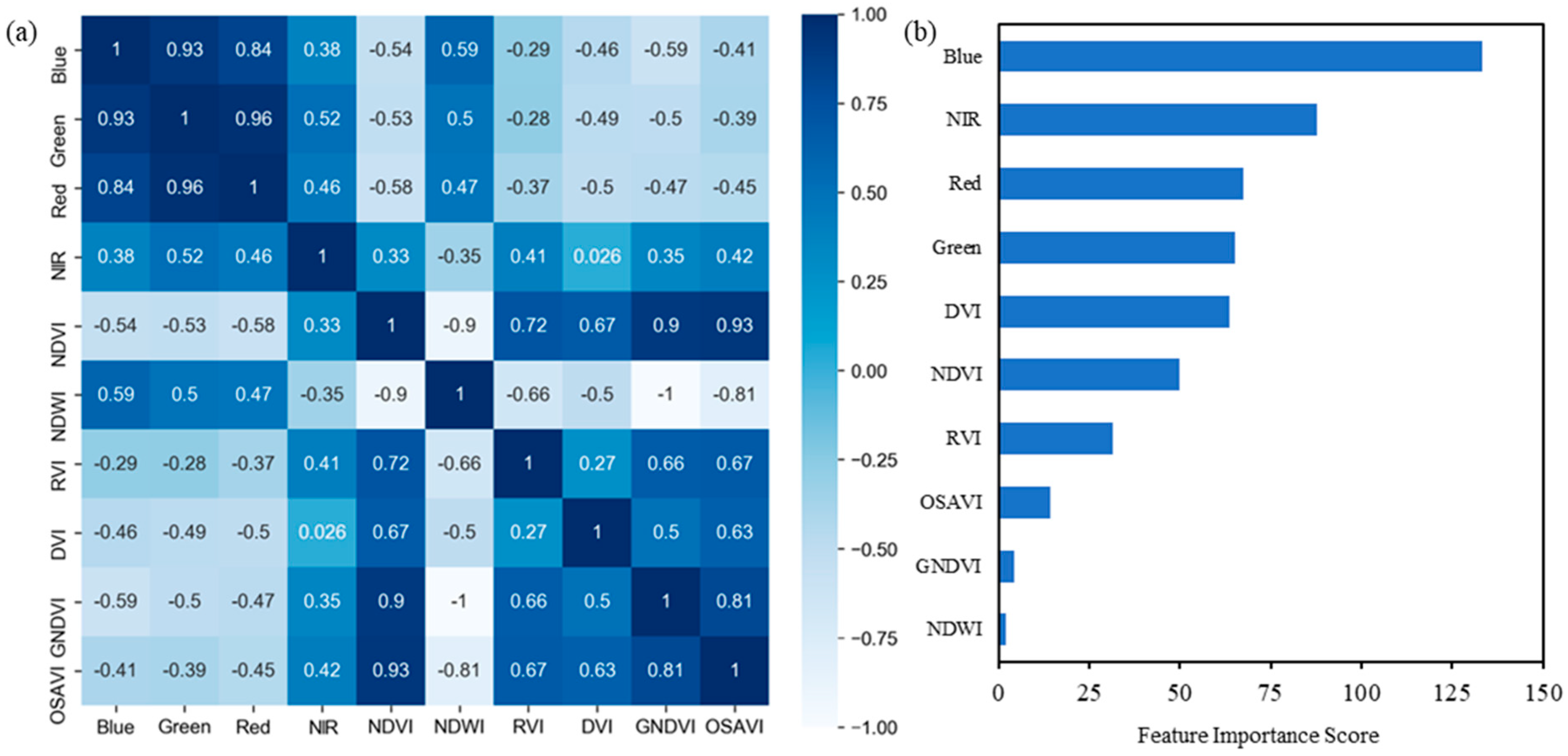
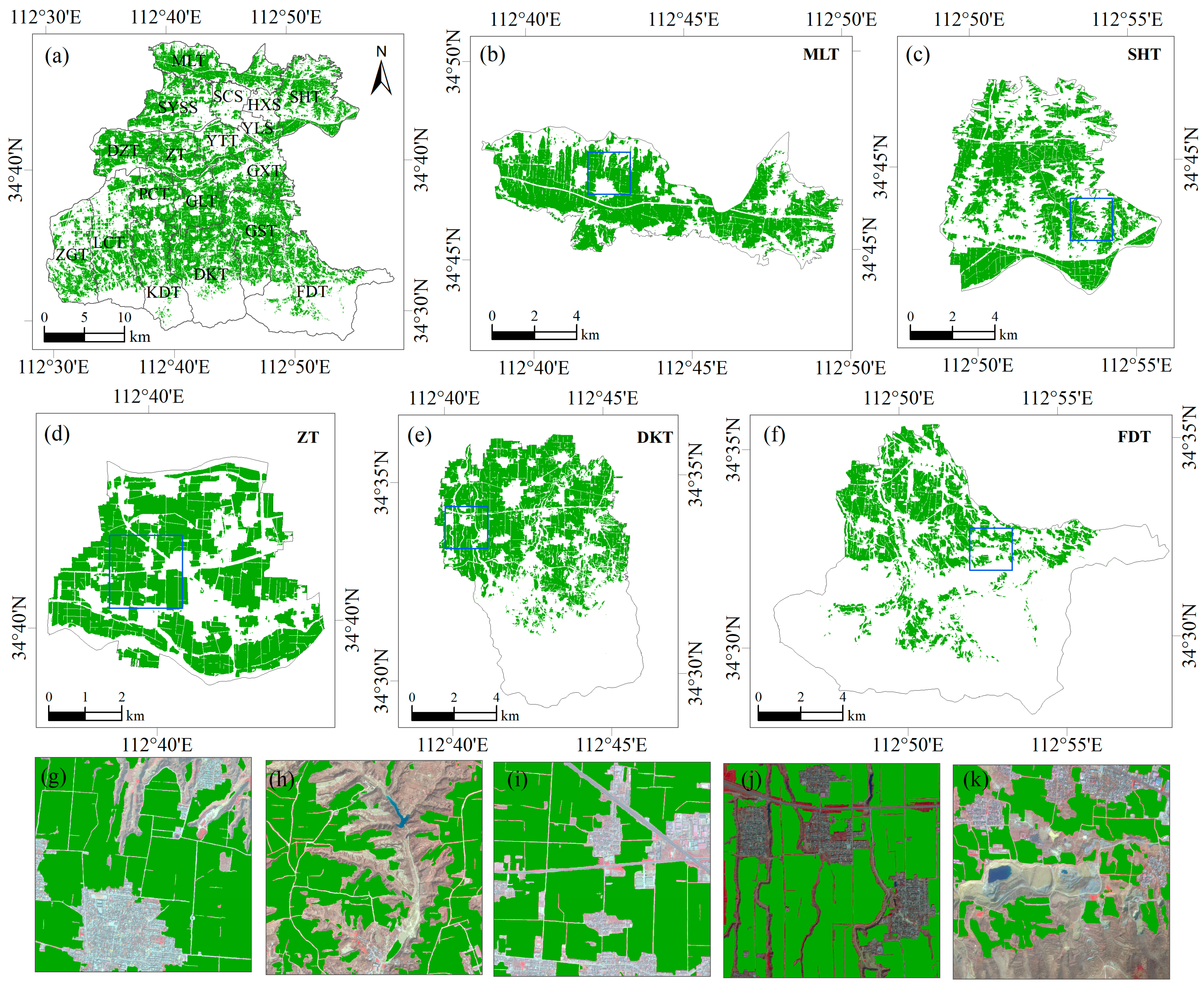
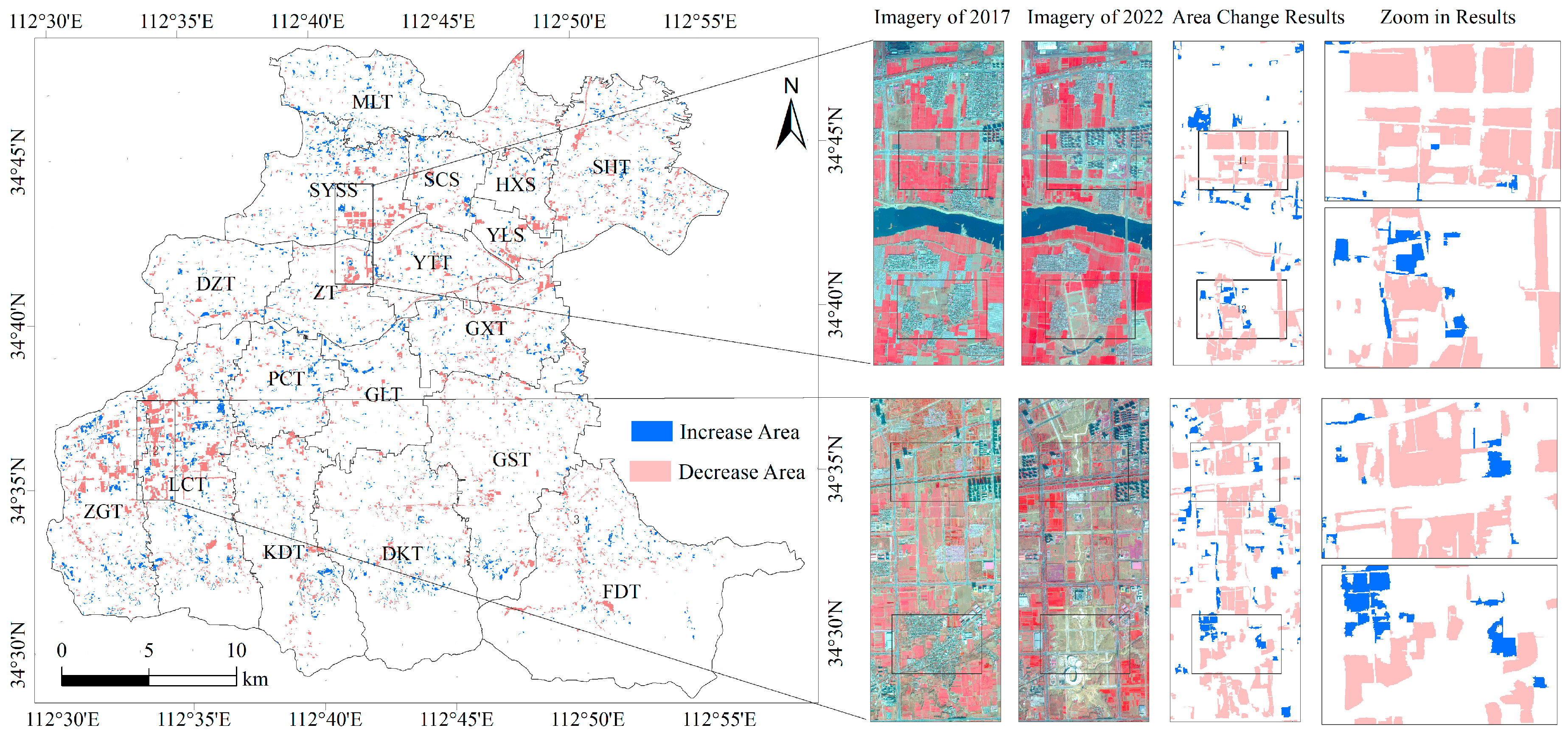
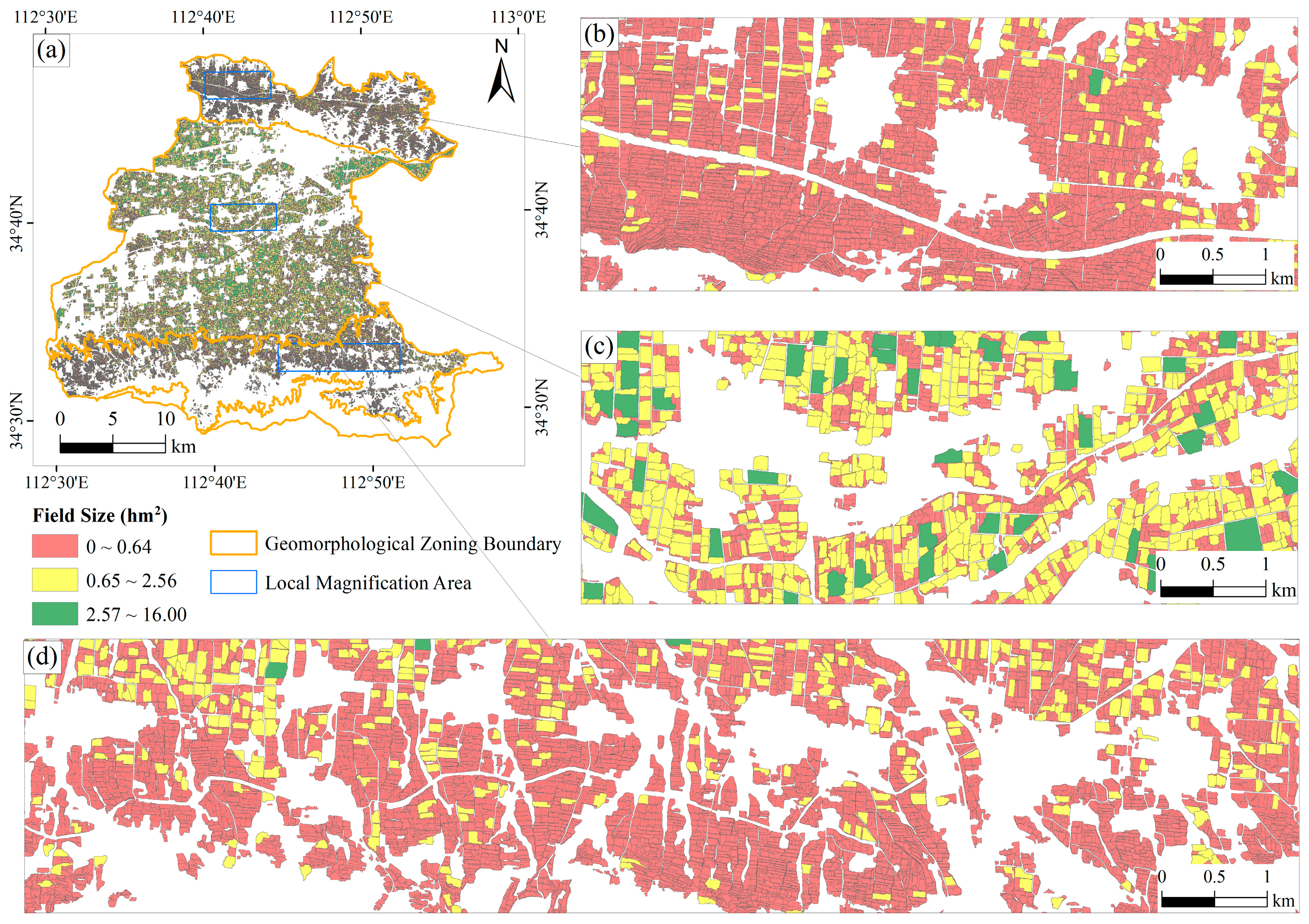
The accurate extraction of cultivated land information is crucial for optimizing regional farmland layouts and enhancing food supply. To address the problem of low accuracy in existing cultivated land products and the poor applicability of cultivated land extraction methods in fragmented, small parcel agricultural landscapes and complex terrain mapping, this study develops an advanced cultivated land extraction model for the western part of Henan Province, China, utilizing Gaofen-2 (GF-2) imagery and an improved U-Net architecture to achieve a 1 m resolution regional mapping in complex terrain. We obtained optimal input data for the U-Net model by fusing spectral features and vegetation index features from remote sensing images. We evaluated and validated the effectiveness of the proposed method from multiple perspectives and conducted a cultivated land change detection and agricultural landscape fragmentation assessment in the study area. The experimental results show that the proposed method achieved an F1 score of 89.55% for the entire study area, with an F1 score ranging from 83.84% to 90.44% in the hilly or transitional zones. Compared to models that solely rely on spectral features, the feature selection-based model demonstrates superior performance in hilly and adjacent mountainous regions, with improvements of 4.5% in Intersection over Union (IoU). Cultivated land mapping results show that 83.84% of the cultivated land parcels are smaller than 0.64 hectares. From 2017 to 2022, the overall cultivated land area decreased by 15.26 km2, with the most significant reduction occurring in the adjacent hilly areas, where the land parcels are small and fragmented. This trend highlights the urgent need for effective land management strategies to address fragmentation and prevent further loss of cultivated land in these areas. We anticipate that the findings can contribute to precision agriculture management and agricultural modernization in complex terrains of the world.
Keywords: Gaofen-2 imagery; deep learning; feature selection; cultivated land extraction; farmland fragmentation Gaofen-2 imagery; deep learning; feature selection; cultivated land extraction; farmland fragmentation