Article

Multi-Temporal Relative Sea Level Rise Scenarios up to 2150 for the Venice Lagoon (Italy)

by
Marco Anzidei
1,2,*,
Cristiano Tolomei
1,
Daniele Trippanera
1,
Tommaso Alberti
1,
Alessandro Bosman
3,1,
Carlo Alberto Brunori
1,
Enrico Serpelloni
1,
Antonio Vecchio
1,4,5,
Antonio Falciano
6 and
Giuliana Deli
2
1
Istituto Nazionale di Geofisica e Vulcanologia, 00143 Roma, Italy
2
MARVE—Marine Archaeology Research Venice Equipe, Cannaregio 2999, Fondamenta Moro, 30121 Venice, Italy
3
Istituto di Geologia Ambientale e Geoingegneria, Consiglio Nazionale Delle Ricerche, CNR-IGAG, RU Sapienza DICEA, 00184 Rome, Italy
4
Radboud Radio Lab, Department of Astrophysics, IMAPP, Radboud University, 6500 GL Nijmegen, The Netherlands
5
Lesia Observatoire de Paris, Université PSL, CNRS, Sorbonne Université, Université de Paris, 92195 Meudon, France
6
Center of Integrated Geomorphology for the Mediterranean Area (CGIAM), 85100 Potenza, Italy
*
Author to whom correspondence should be addressed.
Remote Sens. 2025, 17(5), 820; https://doi.org/10.3390/rs17050820
Submission received: 23 December 2024 / Revised: 21 February 2025 / Accepted: 24 February 2025 / Published: 26 February 2025
(This article belongs to the Section Environmental Remote Sensing)

Abstract

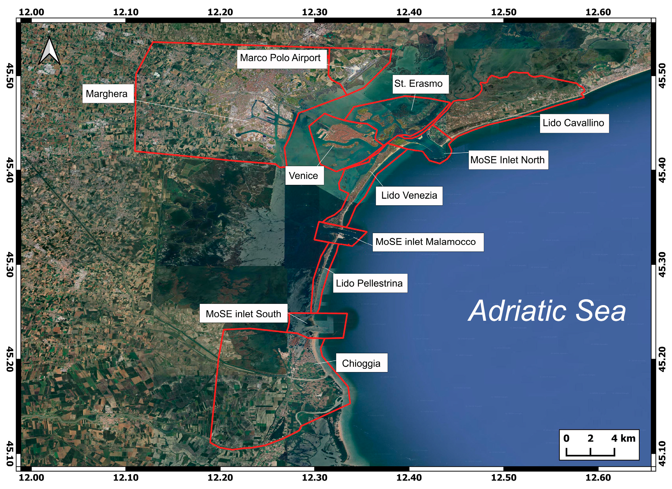
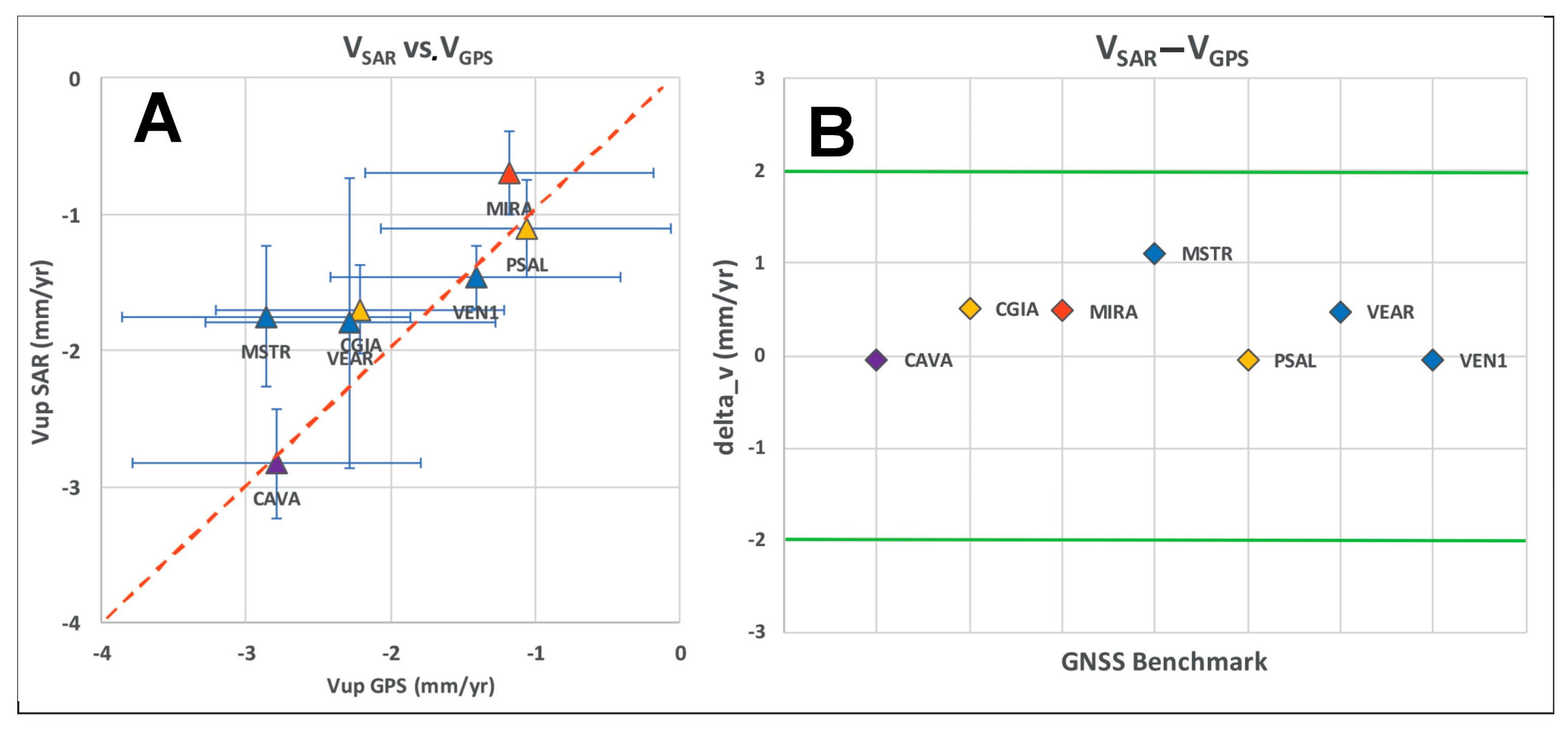
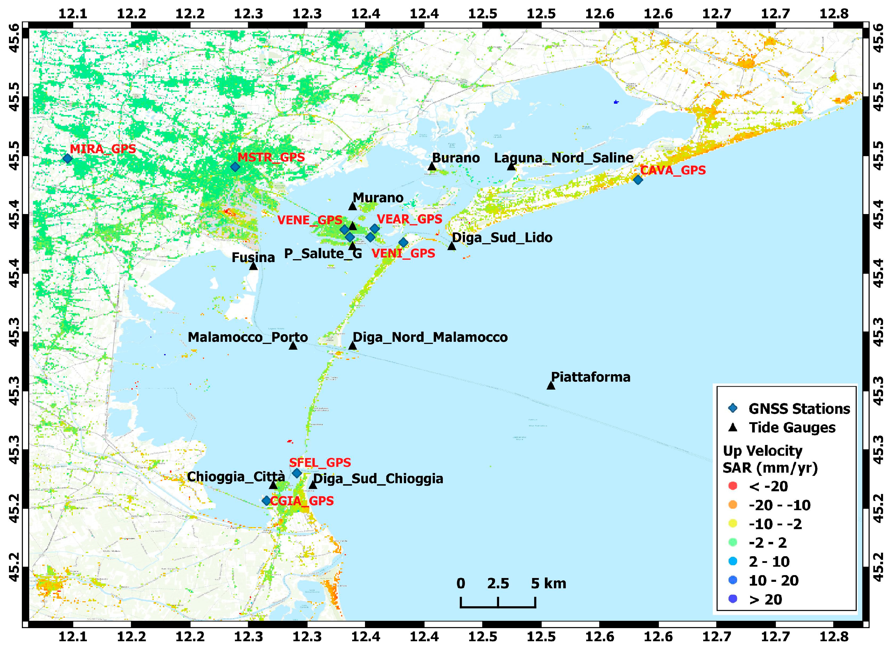
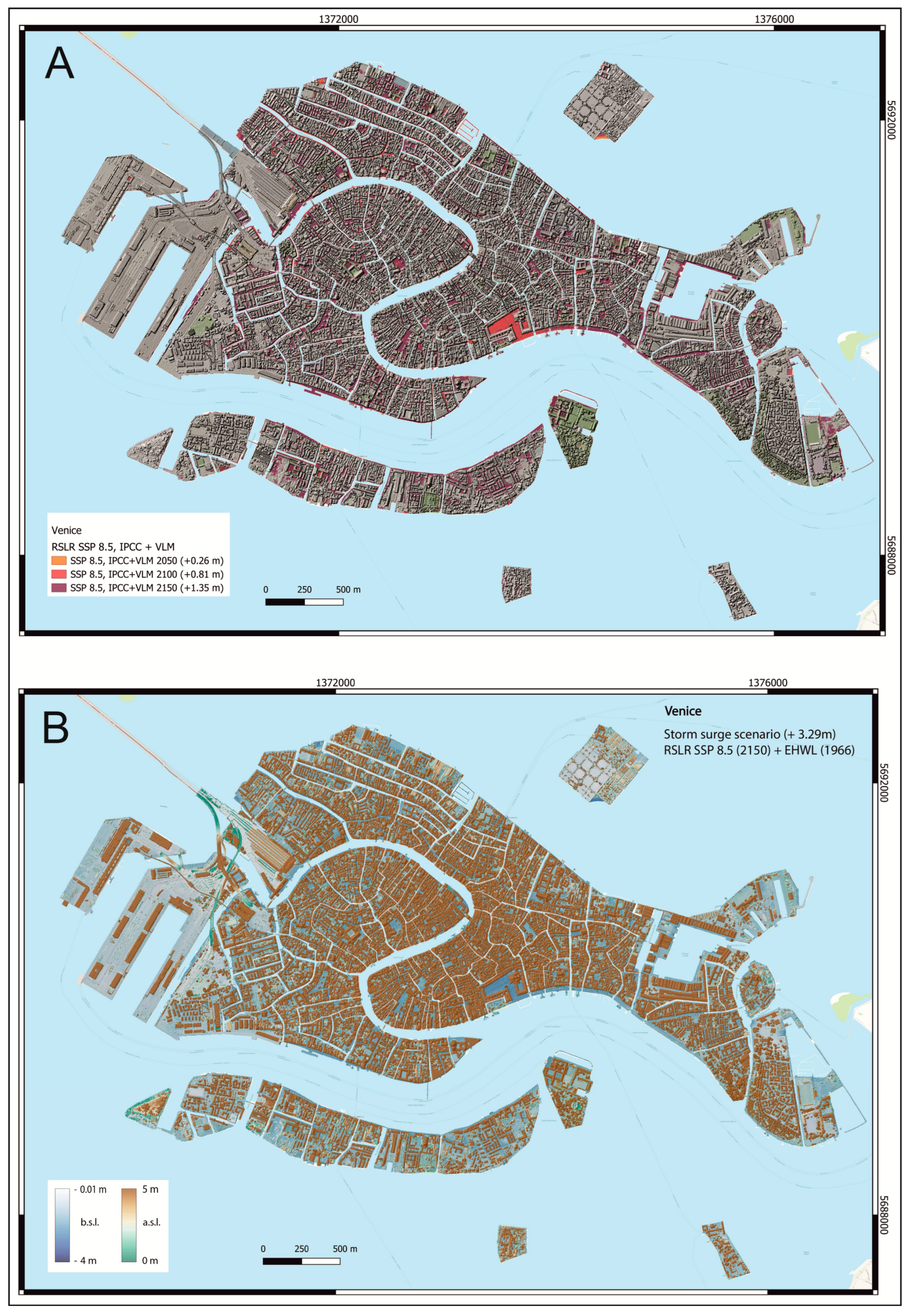
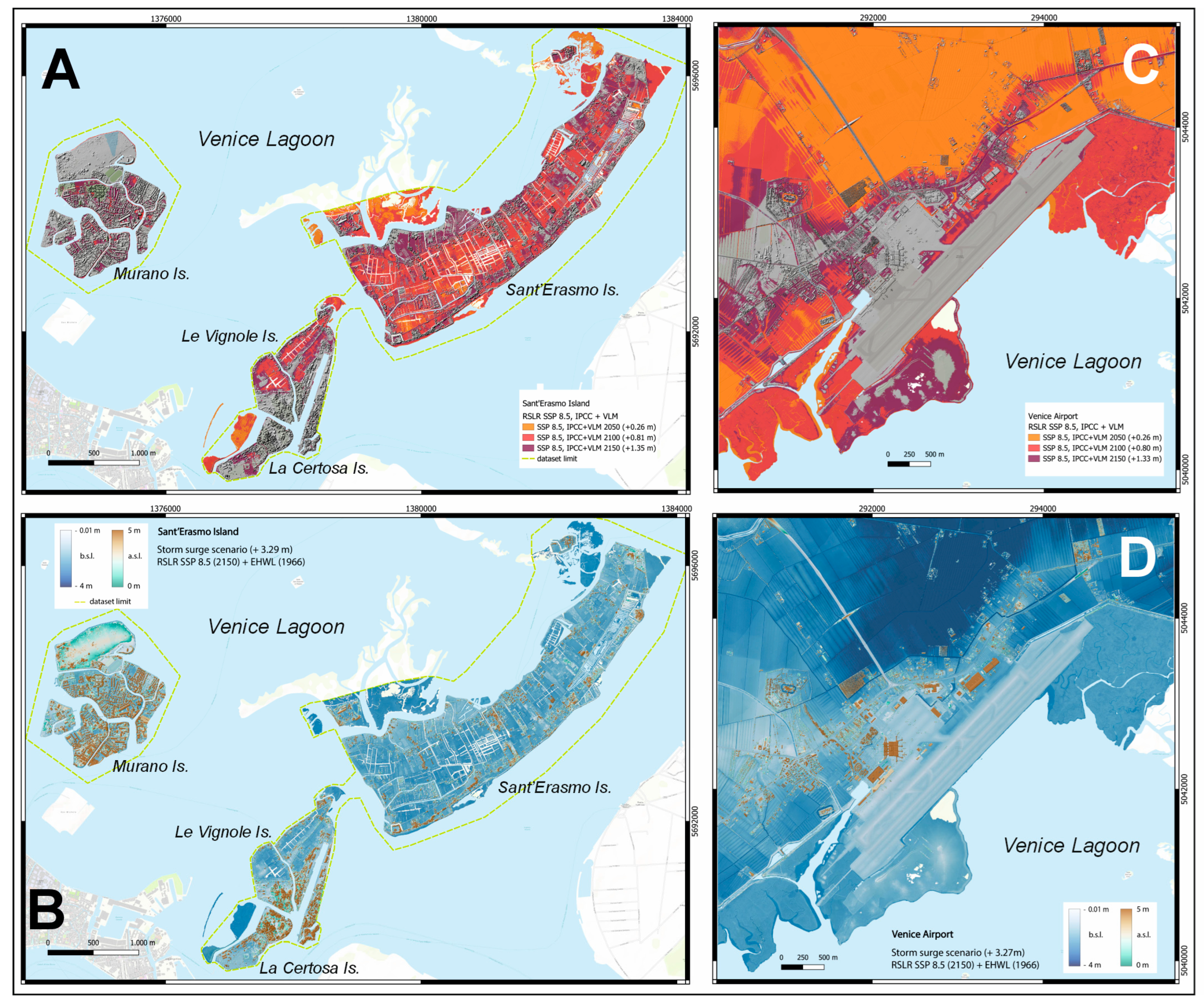
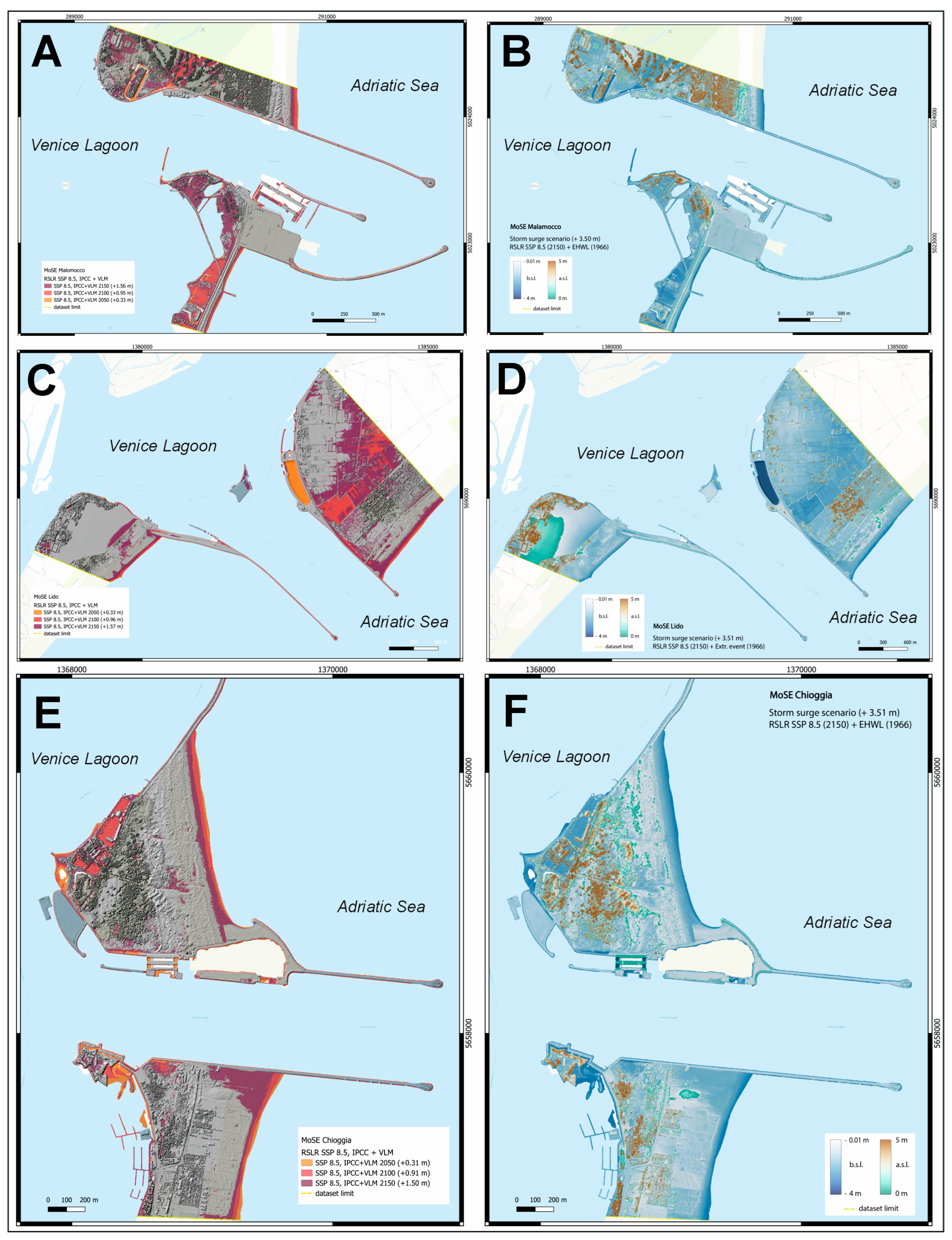
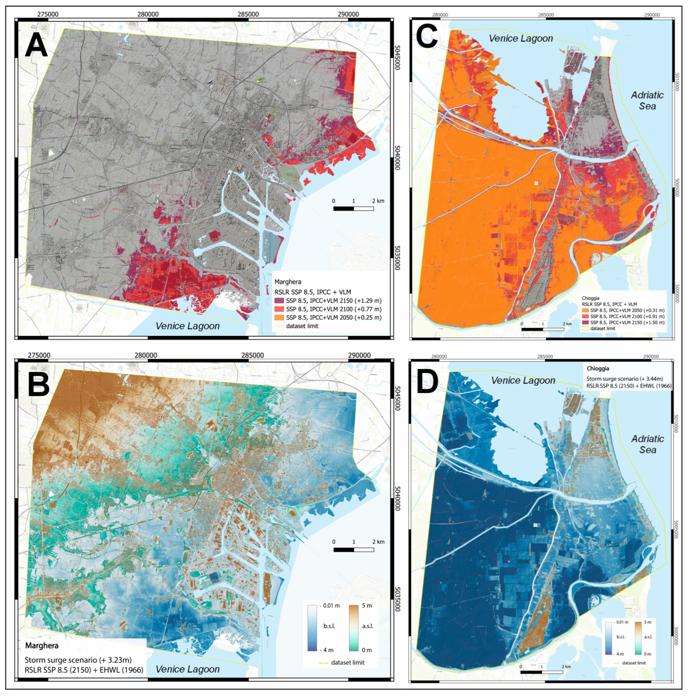
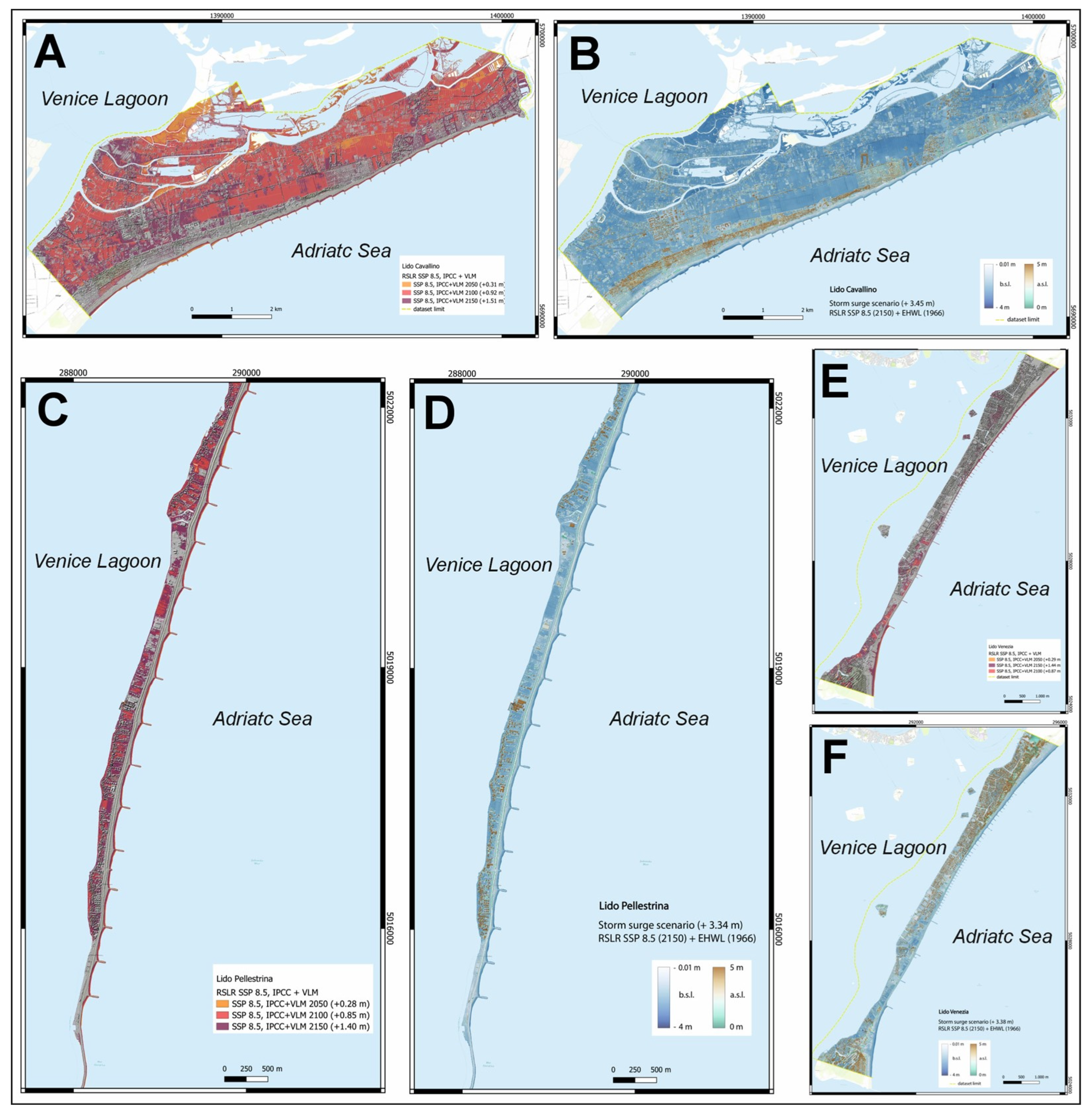
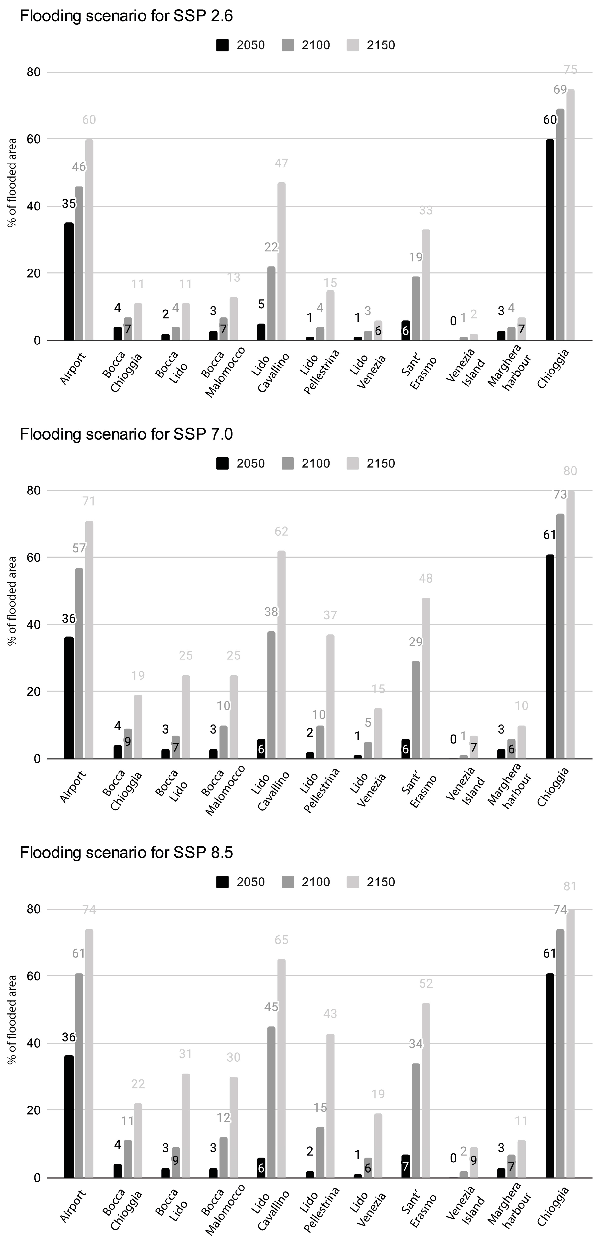
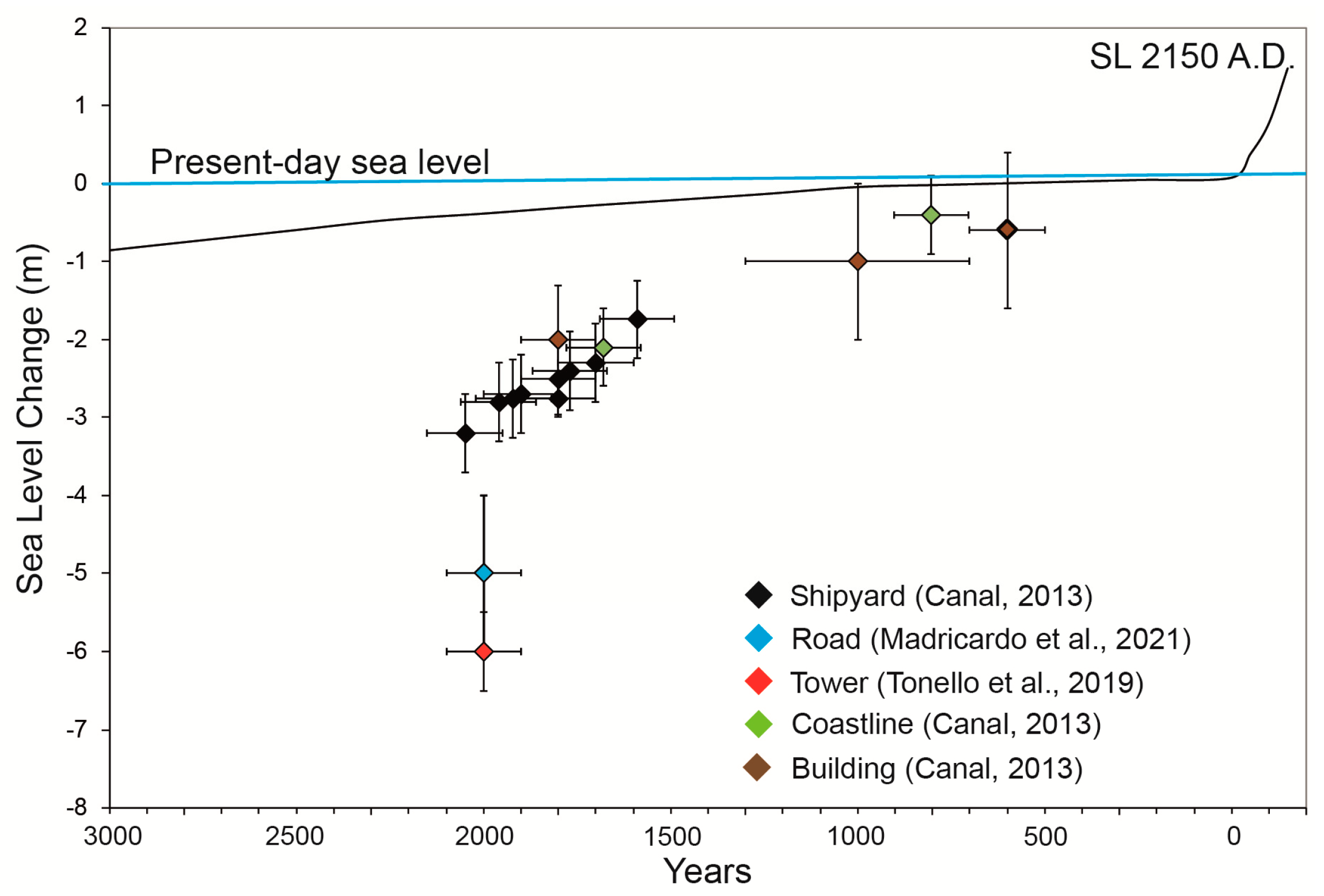
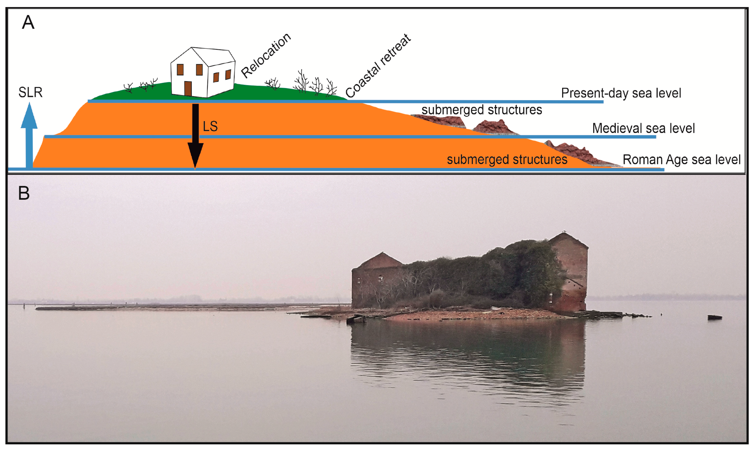
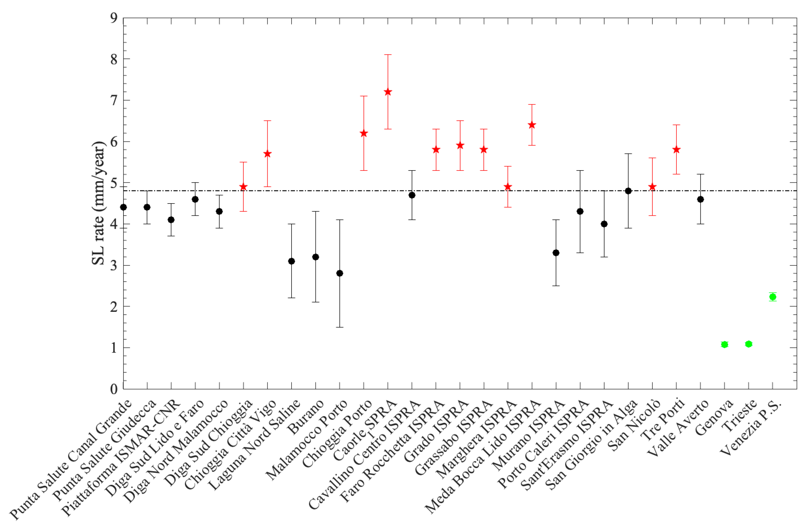
The historical City of Venice, with its lagoon, has been severely exposed to repeated marine flooding since historical times due to the combined effects of sea level rise (SLR) and land subsidence (LS) by natural and anthropogenic causes. Although the sea level change in this area has been studied for several years, no detailed flooding scenarios have yet been realized to predict the effects of the expected SLR in the coming decades on the coasts and islands of the lagoon due to global warming. From the analysis of geodetic data and climatic projections for the Shared Socioeconomic Pathways (SSP1-2.6; SSP3-7.0 and SSP5-8.5) released in the Sixth Assessment Report (AR6) of the Intergovernmental Panel on Climate Change (IPCC), we estimated the rates of LS, the projected local relative sea level rise (RSLR), and the expected extent of flooded surfaces for 11 selected areas of the Venice Lagoon for the years 2050, 2100, and 2150 AD. Vertical Land Movements (VLM) were obtained from the integrated analysis of Global Navigation Satellite System (GNSS) and Interferometry Synthetic Aperture Radar (InSAR) data in the time spans of 1996–2023 and 2017–2023, respectively. The spatial distribution of VLM at 1–3 mm/yr, with maximum values up to 7 mm/yr, is driving the observed variable trend in the RSLR across the lagoon, as also shown by the analysis of the tide gauge data. This is leading to different expected flooding scenarios in the emerging sectors of the investigated area. Scenarios were projected on accurate high-resolution Digital Surface Models (DSMs) derived from LiDAR data. By 2150, over 112 km2 is at risk of flooding for the SSP1-2.6 low-emission scenario, with critical values of 139 km2 for the SSP5-8.5 high-emission scenario. In the case of extreme events of high water levels caused by the joint effects of astronomical tides, seiches, and atmospheric forcing, the RSLR in 2150 may temporarily increase up to 3.47 m above the reference level of the Punta della Salute tide gauge station. This results in up to 65% of land flooding. This extreme scenario poses the question of the future durability and effectiveness of the MoSE (Modulo Sperimentale Elettromeccanico), an artificial barrier that protects the lagoon from high tides, SLR, flooding, and storm surges up to 3 m, which could be submerged by the sea around 2100 AD as a consequence of global warming. Finally, the expected scenarios highlight the need for the local communities to improve the flood resiliency plans to mitigate the consequences of the expected RSLR by 2150 in the UNESCO site of Venice and the unique environmental area of its lagoon.
Keywords: Venice Lagoon; sea level rise; land subsidence; flooding scenario 2150 AD; InSAR; GNSS; tide gauges; LiDAR; Copernicus Venice Lagoon; sea level rise; land subsidence; flooding scenario 2150 AD; InSAR; GNSS; tide gauges; LiDAR; Copernicus