Article

Construction of Remote Sensing Early Warning Knowledge Graph Based on Multi-Source Disaster Data


1
State Key Laboratory of Remote Sensing and Digital Earth, Faculty of Geographical Science, Beijing Normal University, Beijing 100875, China
2
Beijing Engineering Research Center for Global Land Remote Sensing Products, Faculty of Geographical Science, Beijing Normal University, Beijing 100875, China
*
Author to whom correspondence should be addressed.
Remote Sens. 2025, 17(21), 3594; https://doi.org/10.3390/rs17213594
Submission received: 12 September 2025 / Revised: 20 October 2025 / Accepted: 27 October 2025 / Published: 30 October 2025

Abstract

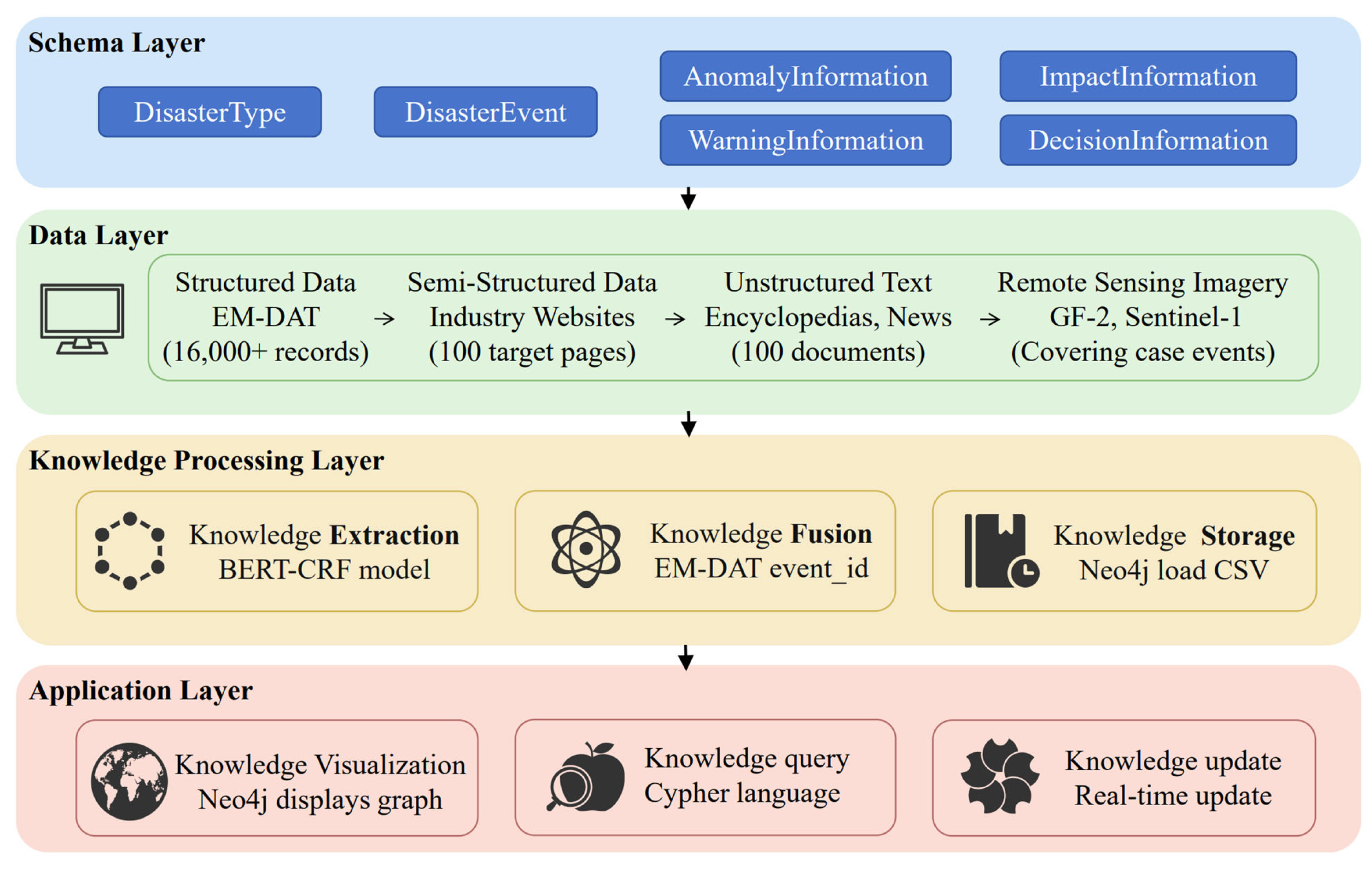
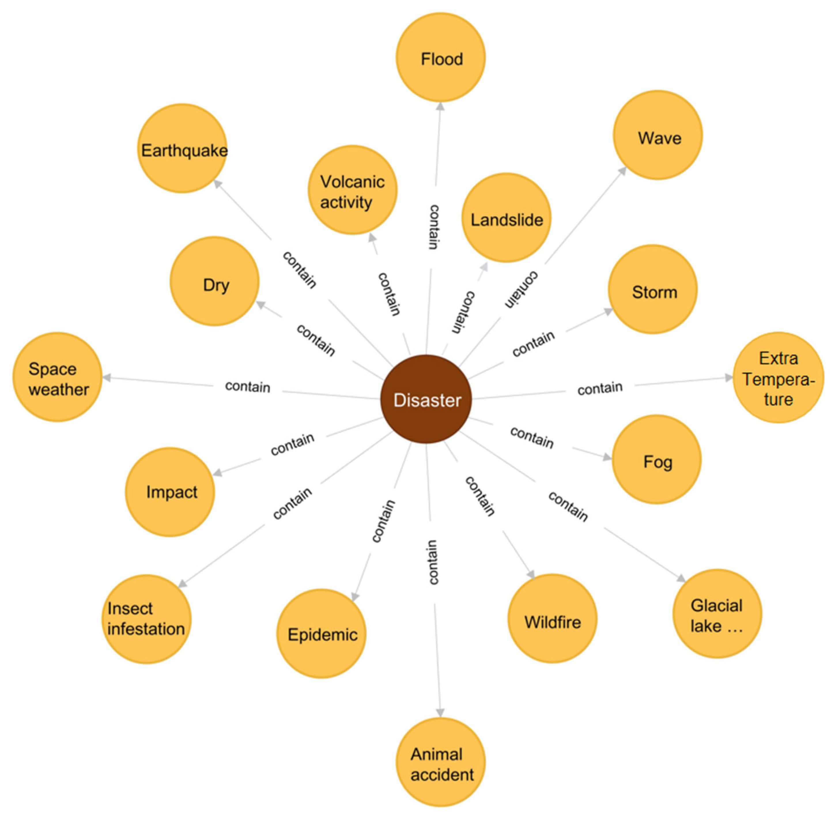
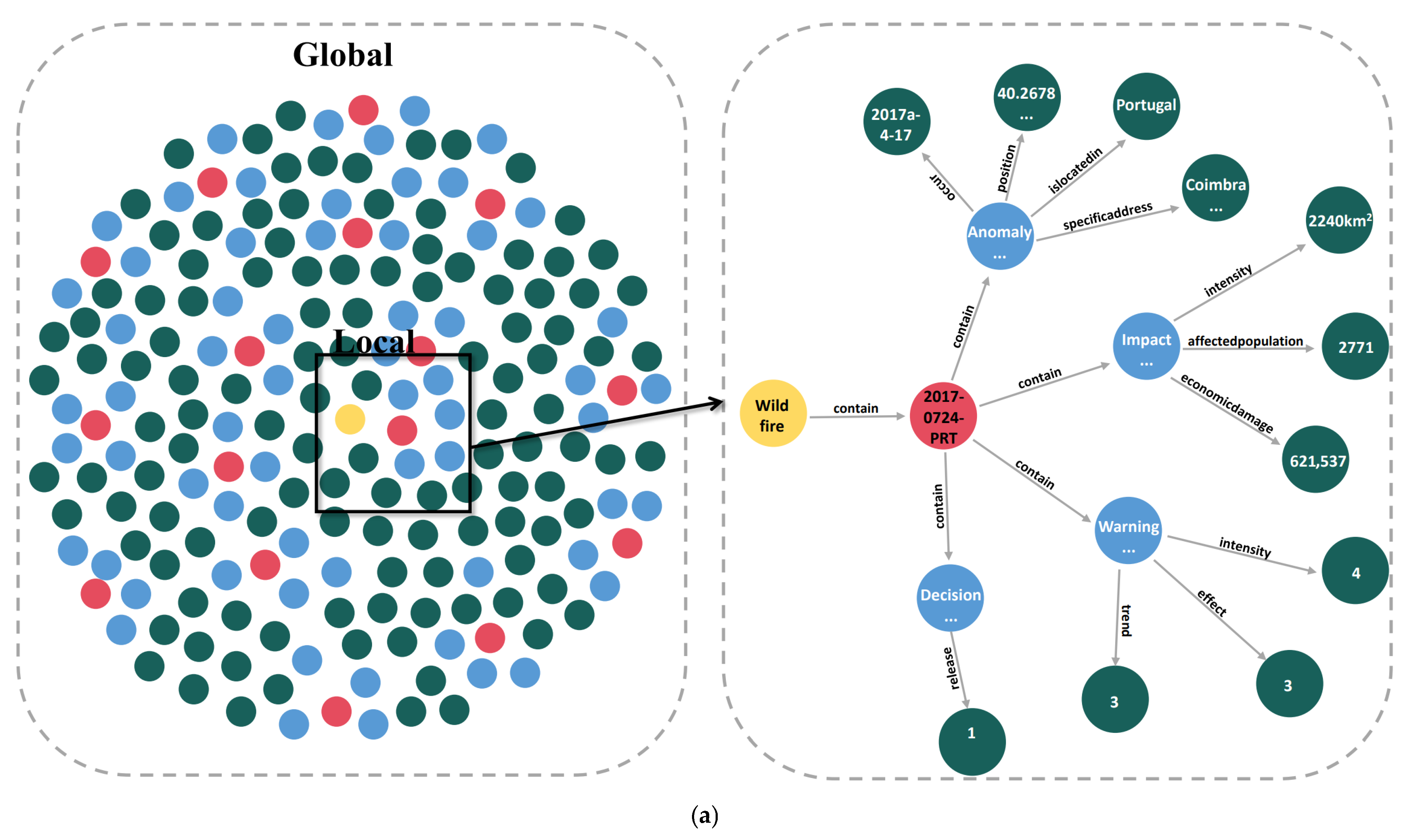
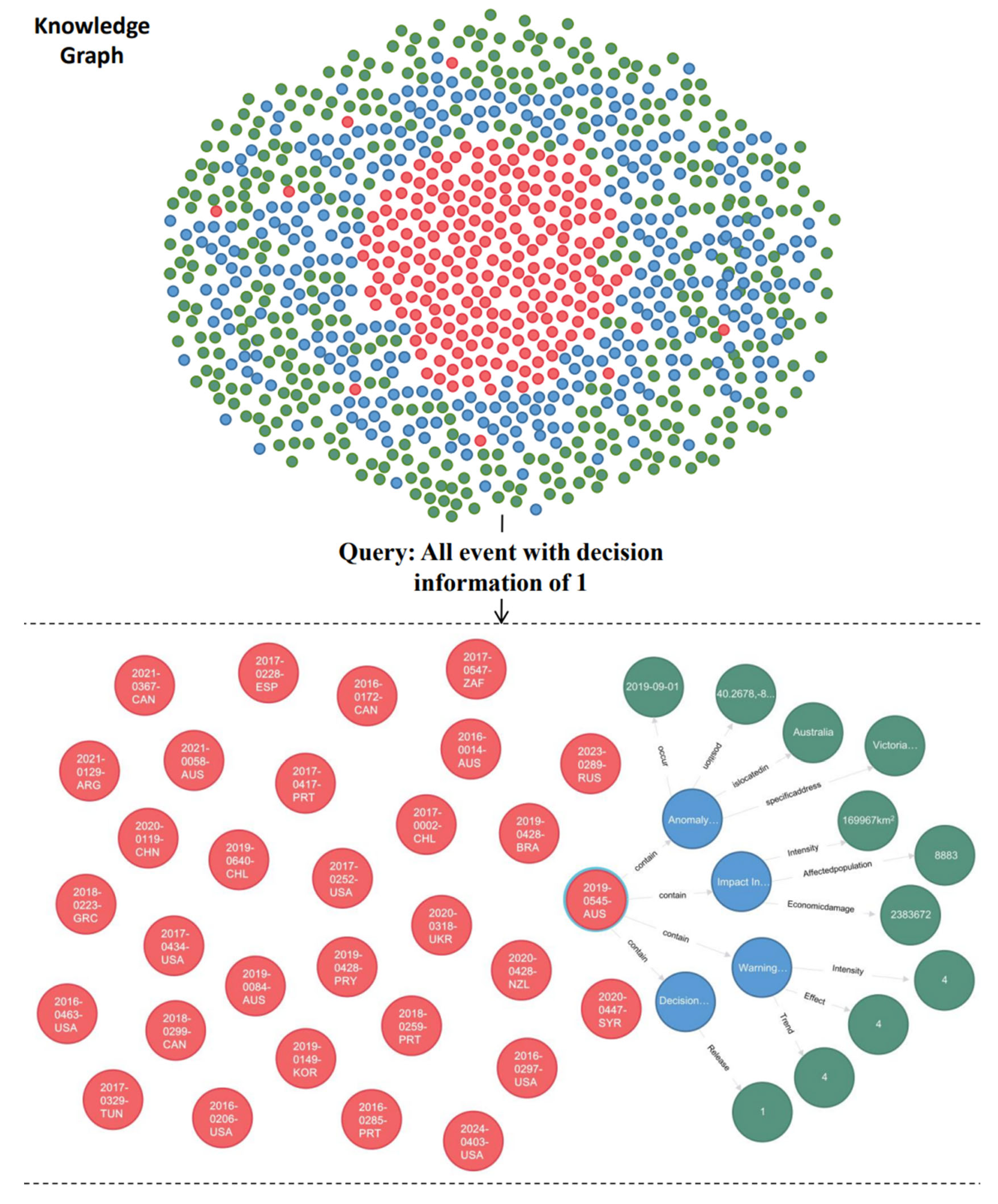
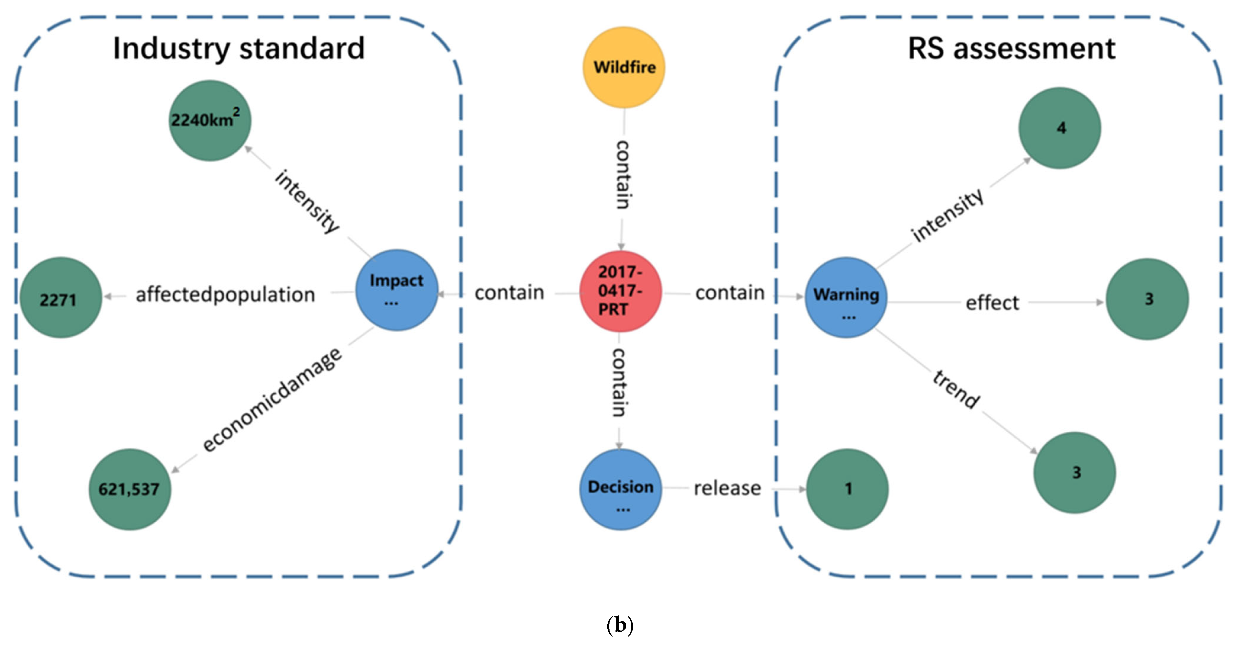
Natural disasters occur continuously across the globe, posing severe threats to human life and property. Remote sensing technology has provided powerful technical means for large-scale and rapid disaster monitoring. However, the deep integration of remote sensing observations with sector-specific disaster statistical data to construct a knowledge system that supports early warning decision-making remains a significant challenge. This study aims to address the bottleneck in the “data-information-knowledge-service” transformation process by constructing an integrated natural disaster early warning knowledge graph that incorporates multi-source heterogeneous data. We first designed an ontological schema layer comprising six core elements: disaster type, event, anomaly information, impact information, warning information, and decision information. Subsequently, multi-source data were integrated from various sources, including the Emergency Events Database (EM-DAT), sector-specific websites, encyclopedic pages, and remote sensing imagery such as Gaofen-2 (GF-2) and Sentinel-1. A Bidirectional Encoder Representations from Transformers with a Conditional Random Field layer (BERT-CRF) model was employed for entity and relation extraction, and the knowledge was stored and visualized using the Neo4j graph database. The core innovation of this research lies in proposing a quantitative methodology for assessing disaster intensity, impact, and trends based on remote sensing evaluation, establishing a knowledge conversion mechanism with sector-specific warning levels, and designing explicit warning issuance rules. A case study on a specific wildfire event (2017-0417-PRT, Coimbra, Portugal) demonstrates that the knowledge graph not only achieves organic integration and visual querying of multi-source disaster knowledge but also facilitates warning decision-making driven by remote sensing assessment indicators. For this event, quantitative analysis of Gaofen-2 imagery yielded intensity, impact, and trend levels of 4, 3, and 3, respectively, which, when applied to our warning rule (intensity ≥ 1 or impact ≥ 1 or trend ≥ 3), automatically triggered an early warning, thereby validating the rule’s practicality. A preliminary performance evaluation on 50 historical wildfire events demonstrated promising results, with an F1-score of 74.3% and an average query response time of 128 ms, confirming the system’s practical responsiveness and detection capability. In conclusion, this study offers a novel and operational technical pathway for the deep interdisciplinary integration of remote sensing and disaster science, effectively bridging the gap between data silos and actionable warning knowledge.
Keywords: knowledge graph; natural disasters; remote sensing; early warning model; knowledge fusion; multi-source data knowledge graph; natural disasters; remote sensing; early warning model; knowledge fusion; multi-source data