Article

Satellite-Derived Indicators of Drought Severity and Water Storage in Estuarine Reservoirs: A Case Study of Qingcaosha Reservoir, China

1
School of Ocean Science and Engineering, Shanghai Maritime University, 1550 Haigang Ave., Shanghai 201306, China
2
Shanghai Marine Monitoring and Forecasting Center, Shanghai 200062, China
3
State Key Laboratory of Estuarine and Coastal Research, East China Normal University, Shanghai 200241, China
*
Author to whom correspondence should be addressed.
Remote Sens. 2024, 16(6), 980; https://doi.org/10.3390/rs16060980
Submission received: 8 January 2024 / Revised: 14 February 2024 / Accepted: 6 March 2024 / Published: 11 March 2024
(This article belongs to the Section Remote Sensing in Geology, Geomorphology and Hydrology)

Abstract

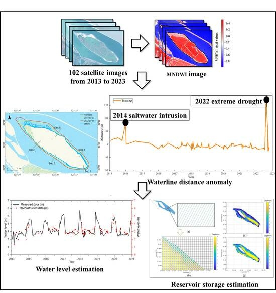
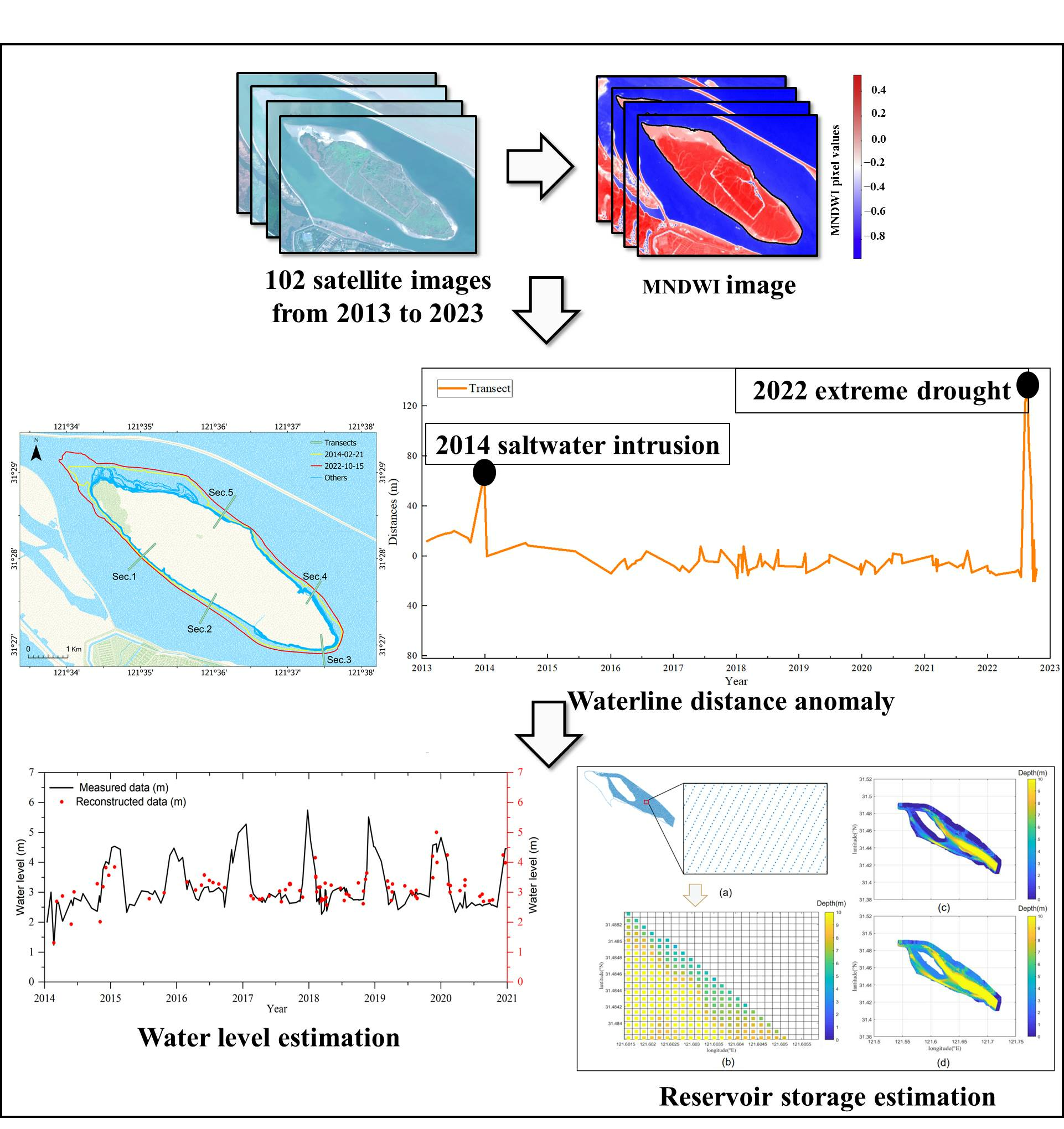
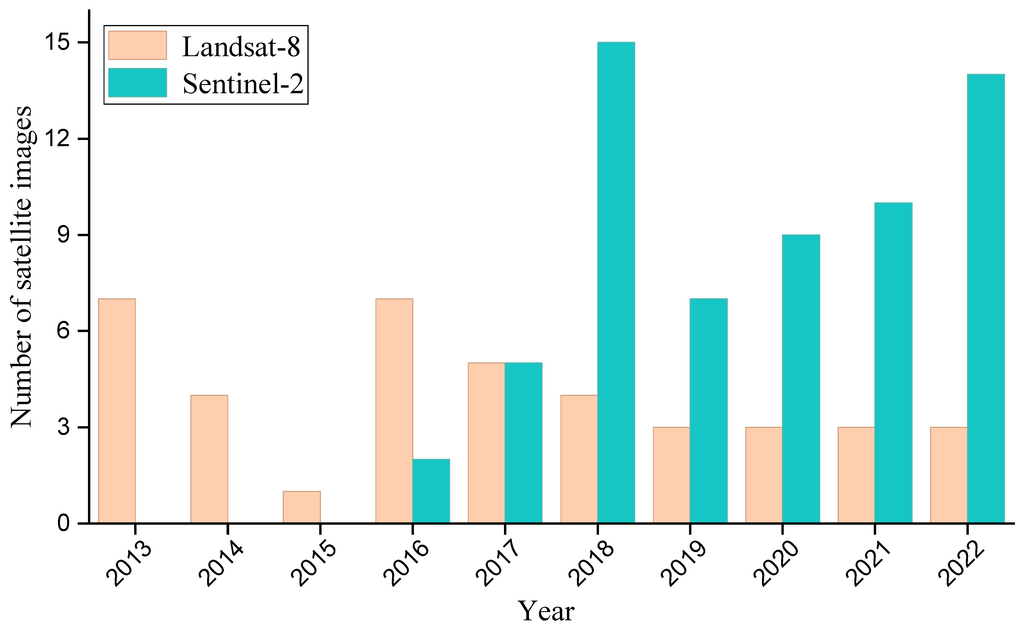
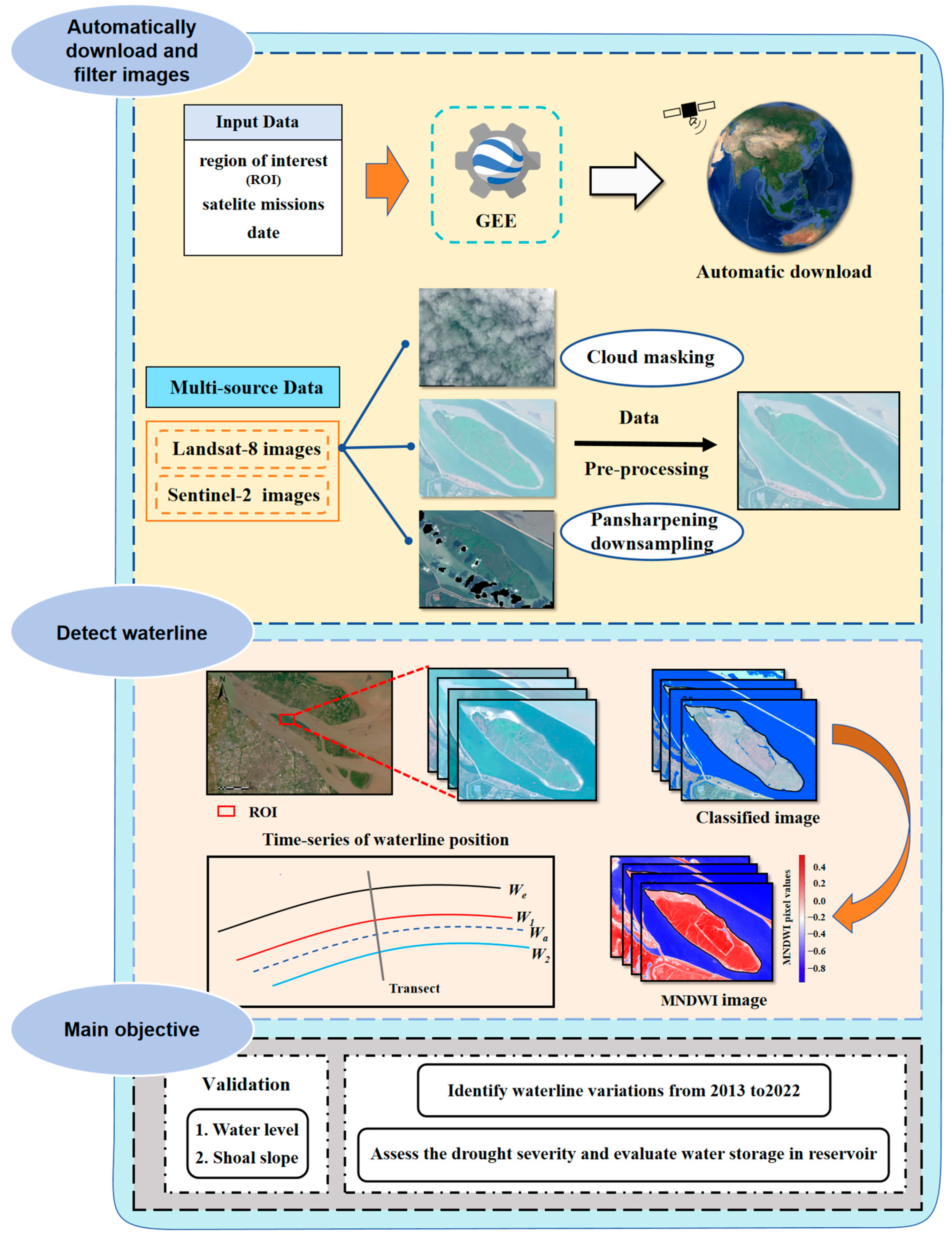
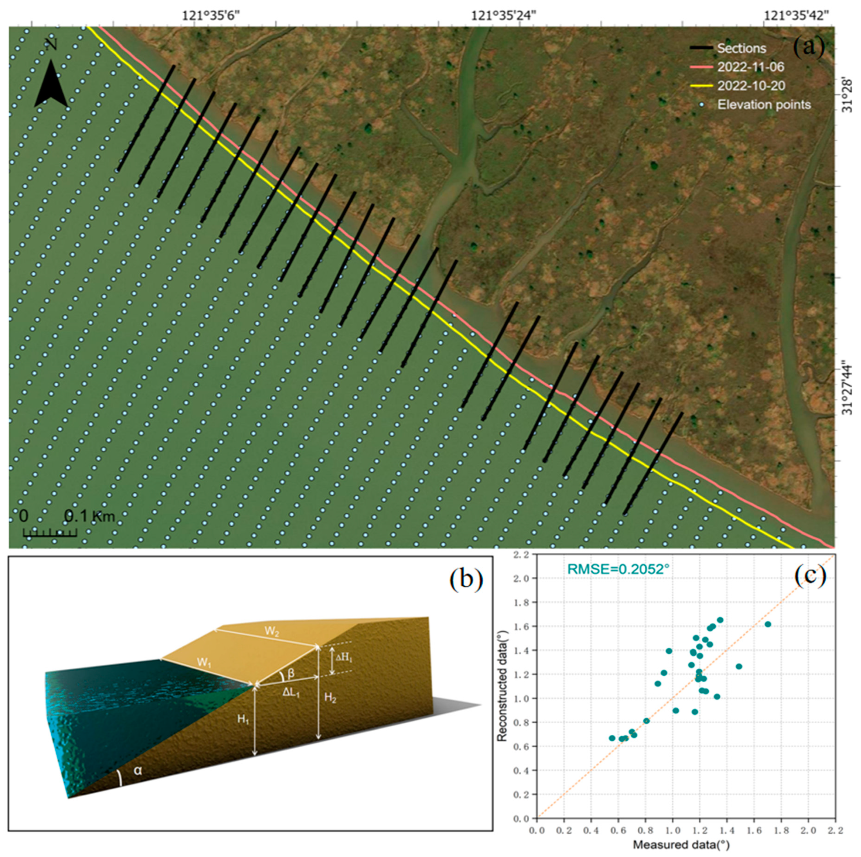
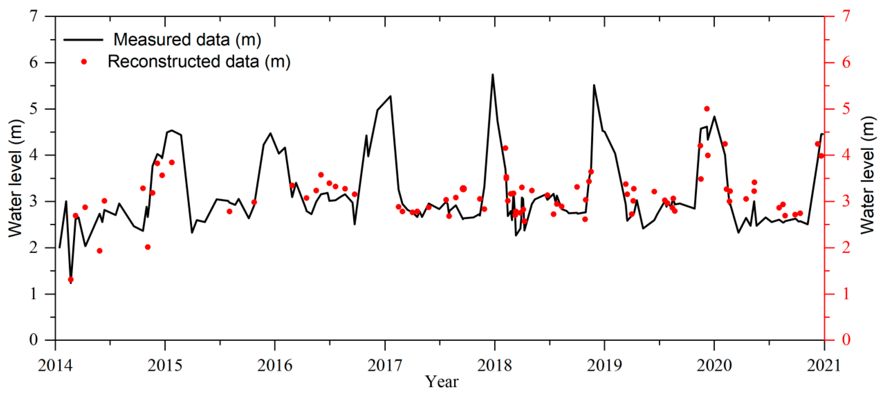
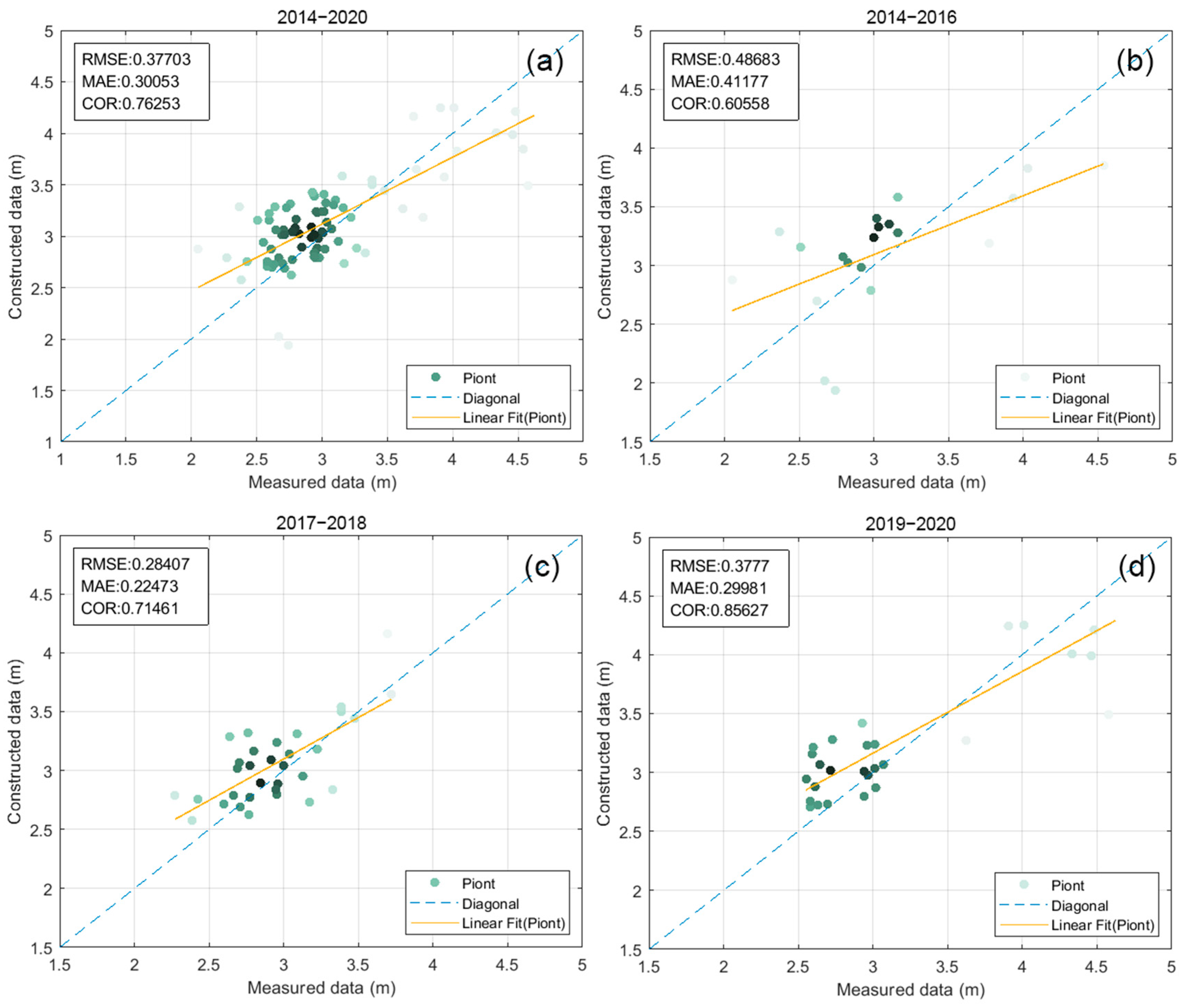
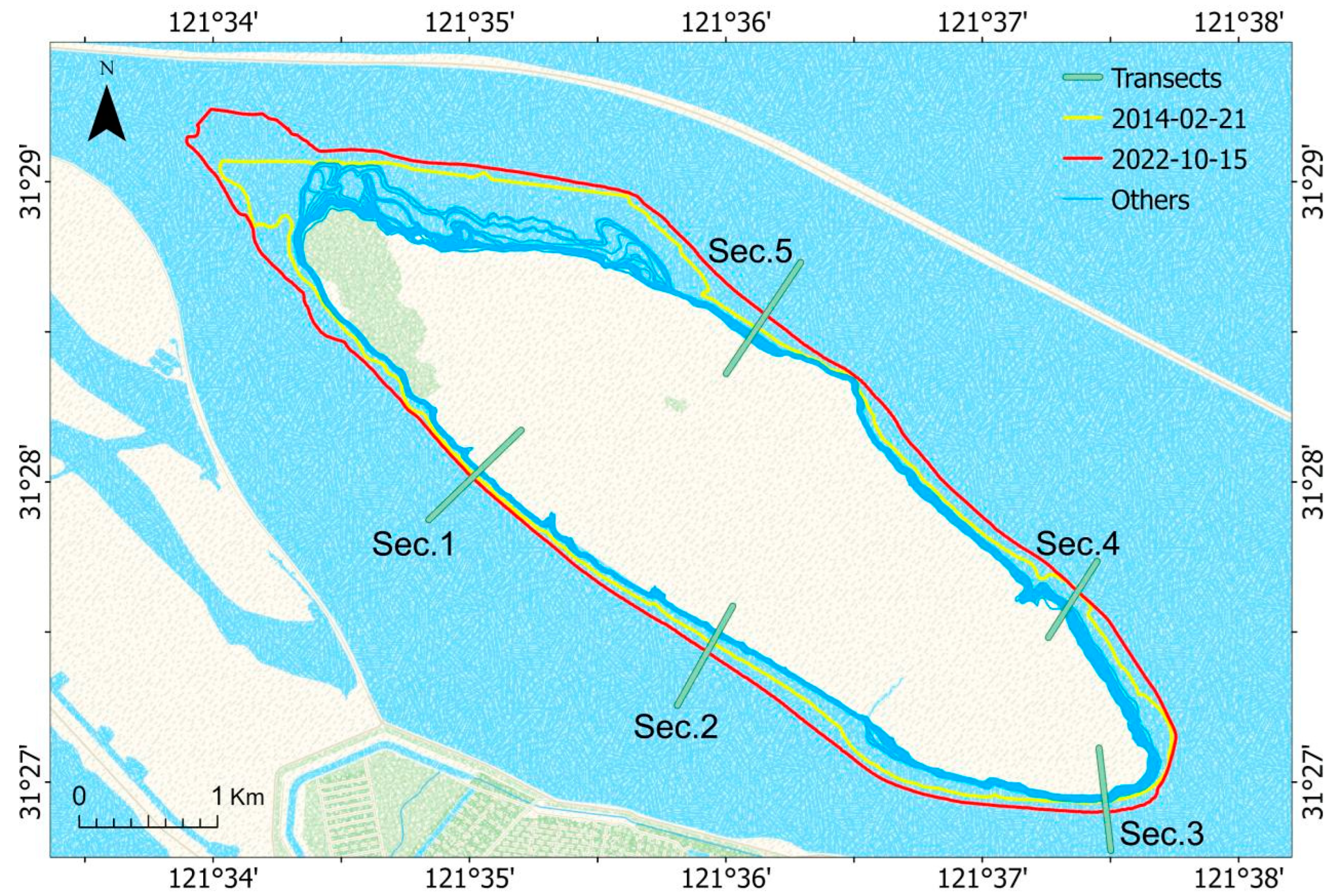
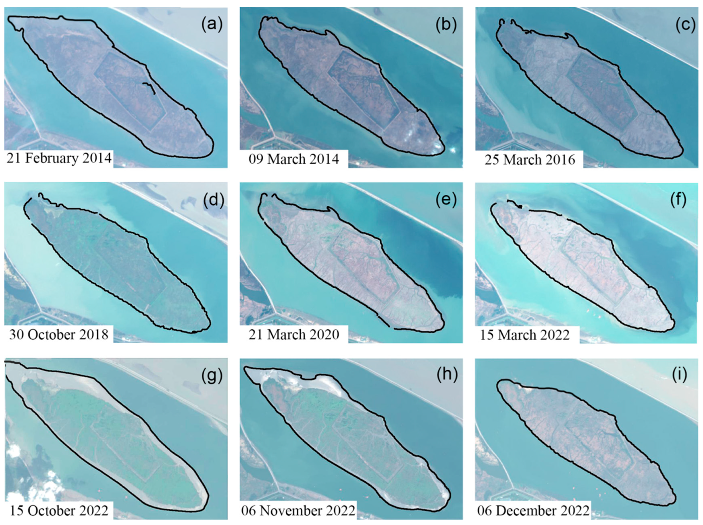
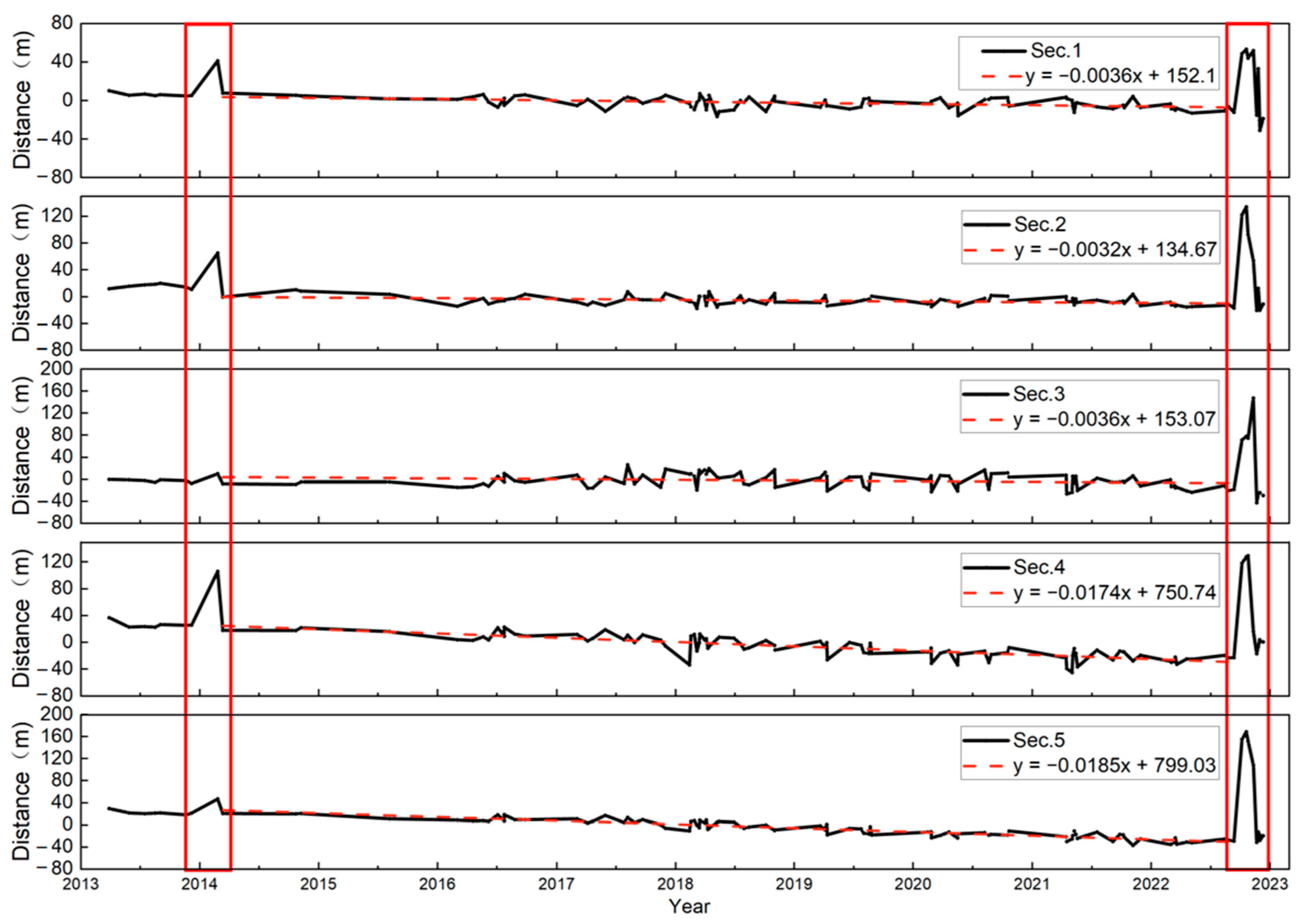
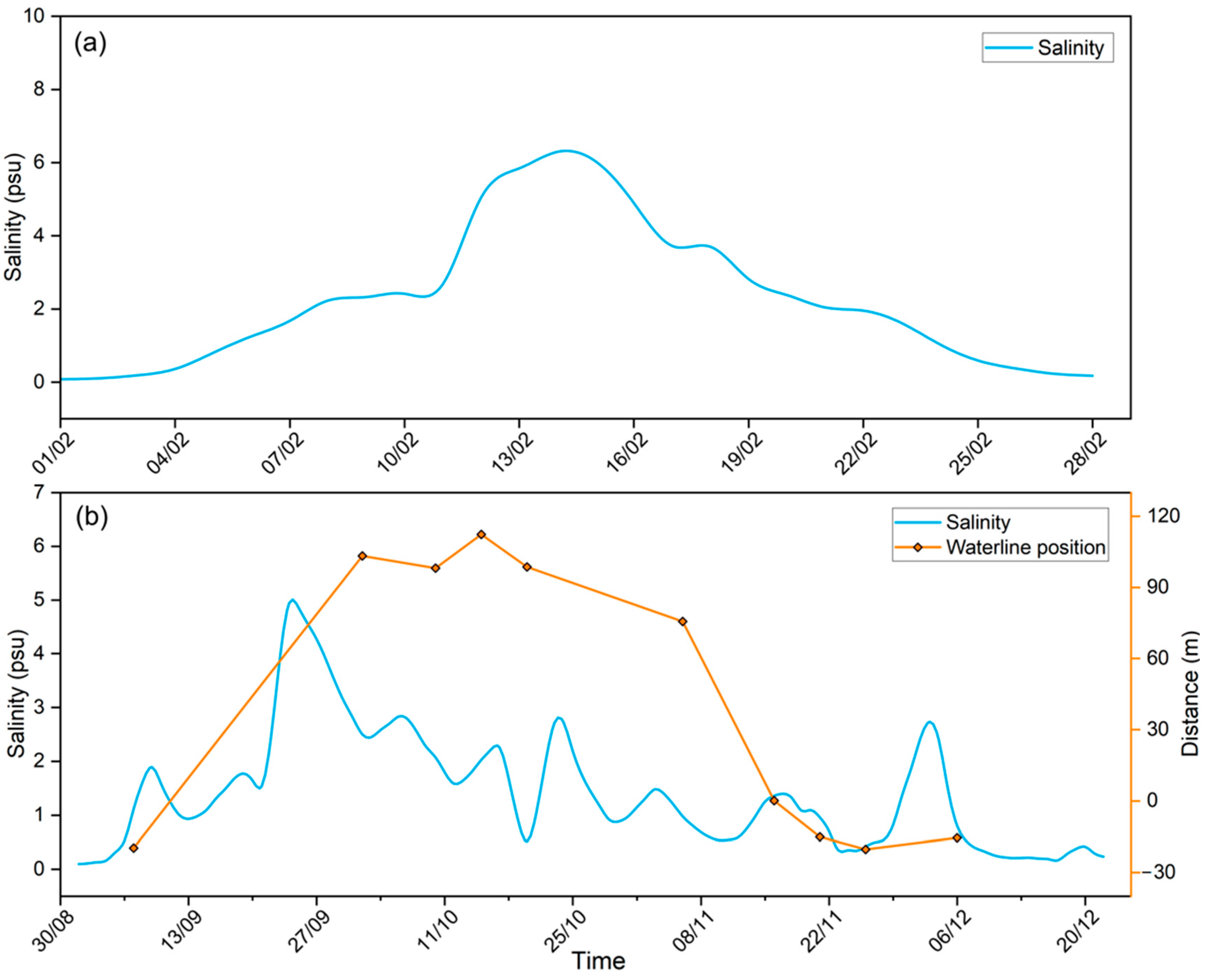
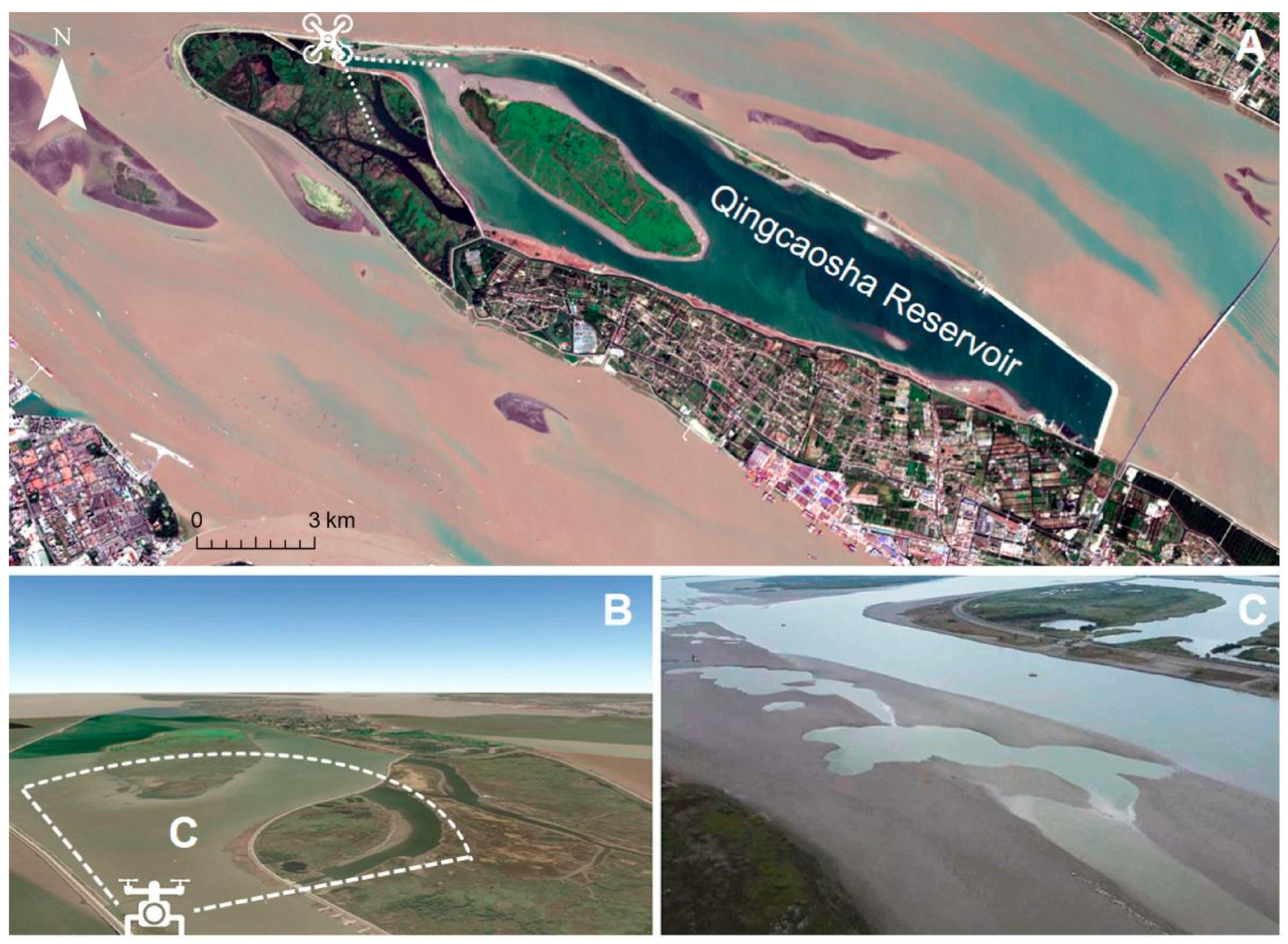
Estuarine reservoirs are critical for freshwater supply and security, especially for regions facing water scarcity challenges due to climate change and population growth. Conventional methods for assessing drought severity or monitoring reservoir water level and storage are often limited by data availability, accessibility and quality. We present an approach for monitoring estuarine reservoir water levels, storage and extreme drought via satellite remote sensing and waterline detection. Based on the CoastSat algorithm, Landsat-8 and Sentinel-2 images from 2013 to 2022 were adopted to extract the waterline of Qingcaosha Reservoir, the largest estuarine reservoir in the world and a key source of freshwater for Shanghai, China. This study confirmed the accuracy of the satellite-extracted results through two main methods: (1) calculating the angle of the central shoal slope in the reservoir using the extracted waterline data and measured water levels and (2) inverting the time series of water levels for comparison with measured data. The correlation coefficient of the estimated water level reached ~0.86, and the root mean square error (RMSE) of the estimated shoal slope was ~0.2°, indicating that the approach had high accuracy and reliability. We analyzed the temporal and spatial patterns of waterline changes and identified two dates (21 February 2014 and 15 October 2022) when the reservoir reached the lowest water levels, coinciding with periods of severe saltwater intrusions in the estuary. The extreme drought occurrences in the Qingcaosha Reservoir were firstly documented through the utilization of remote sensing data. The results also indicate a strong resilience of the Qingcaosha Reservoir and demonstrate that the feasibility and utility of using satellite remote sensing and waterline detection for estuarine reservoir storage can provide timely and accurate information for water resource assessment, management and planning.
Keywords: estuarine reservoir; extreme low water level events; waterline extraction; water resource; saltwater intrusion estuarine reservoir; extreme low water level events; waterline extraction; water resource; saltwater intrusion
Graphical Abstract