Article

Validation and Error Minimization of Global Ecosystem Dynamics Investigation (GEDI) Relative Height Metrics in the Amazon


1
Department of Ecology, Montana State University, Bozeman, MT 59717, USA
2
School of Informatics, Computing and Cyber Systems, Northern Arizona University, Flagstaff, AZ 86011, USA
3
Department of Land Resources and Environmental Sciences, Montana State University, Bozeman, MT 59717, USA
4
NASA Goddard Space Flight Center, Biospheric Sciences Lab, Greenbelt, MD 20771, USA
5
Departamento de Biología, Facultad de Ciencias, Universidad Nacional de Colombia, Bogotá 111321, Colombia
*
Author to whom correspondence should be addressed.
Remote Sens. 2024, 16(19), 3550; https://doi.org/10.3390/rs16193550
Submission received: 29 July 2024 / Revised: 8 September 2024 / Accepted: 18 September 2024 / Published: 24 September 2024

Abstract

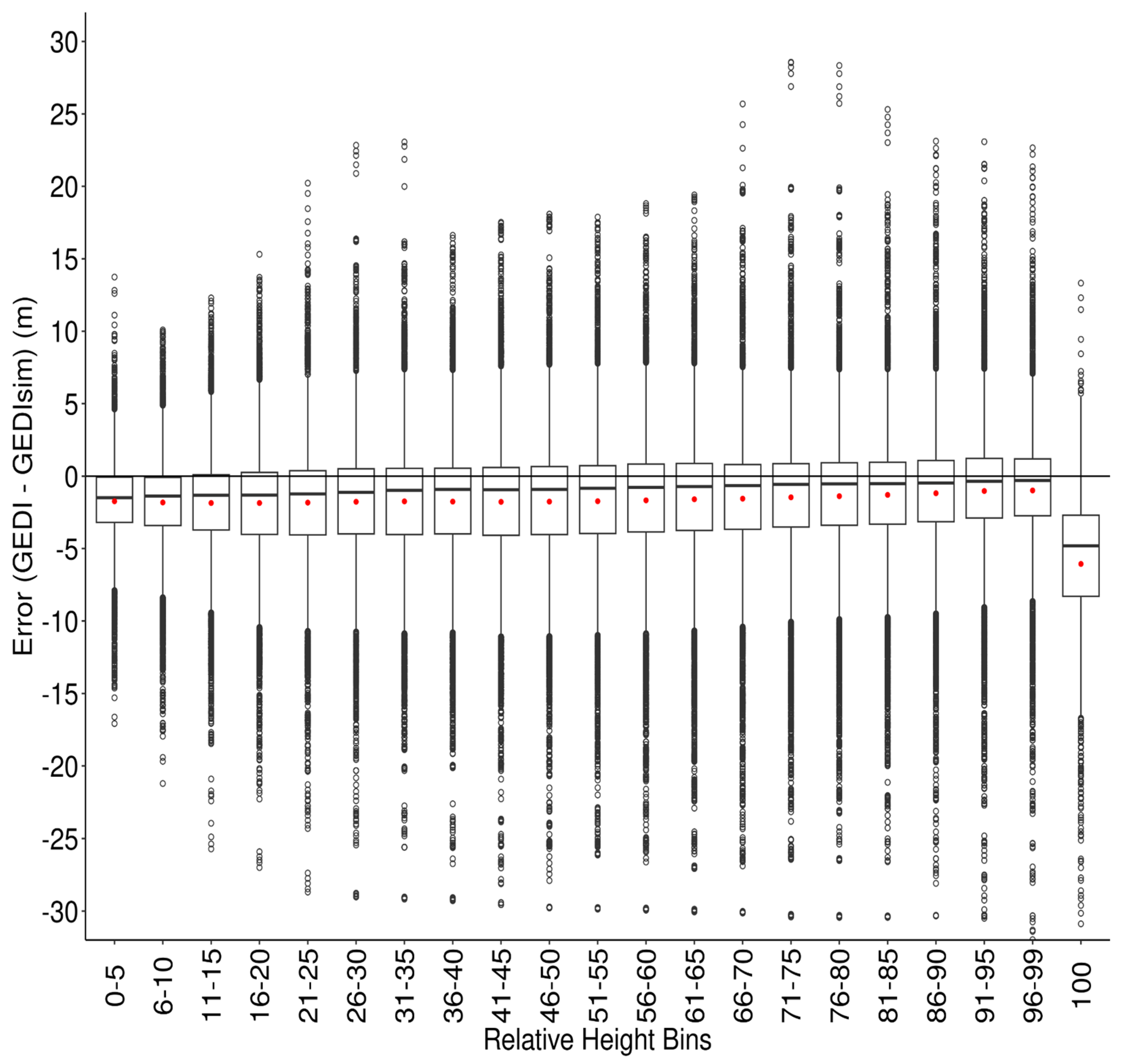
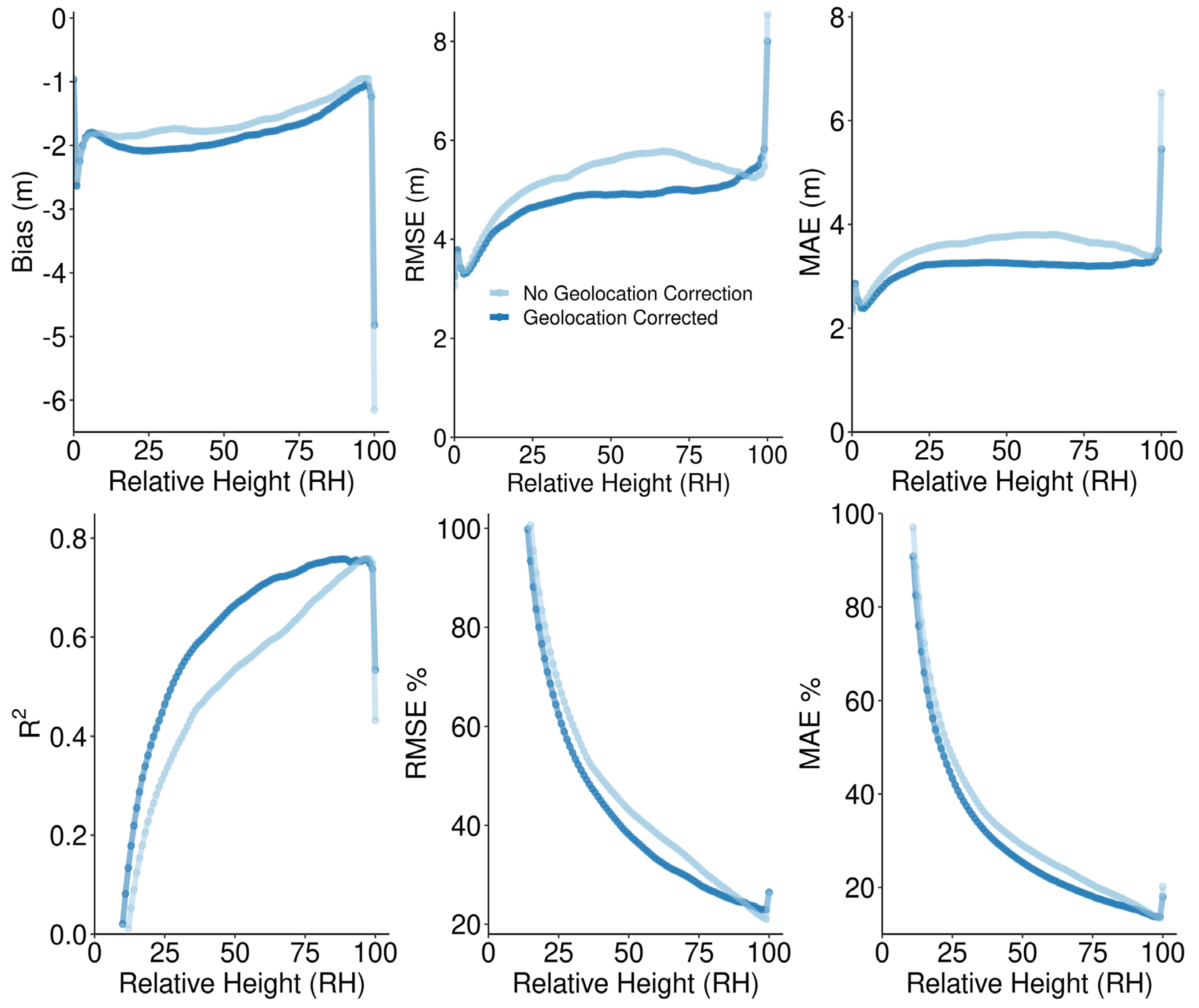
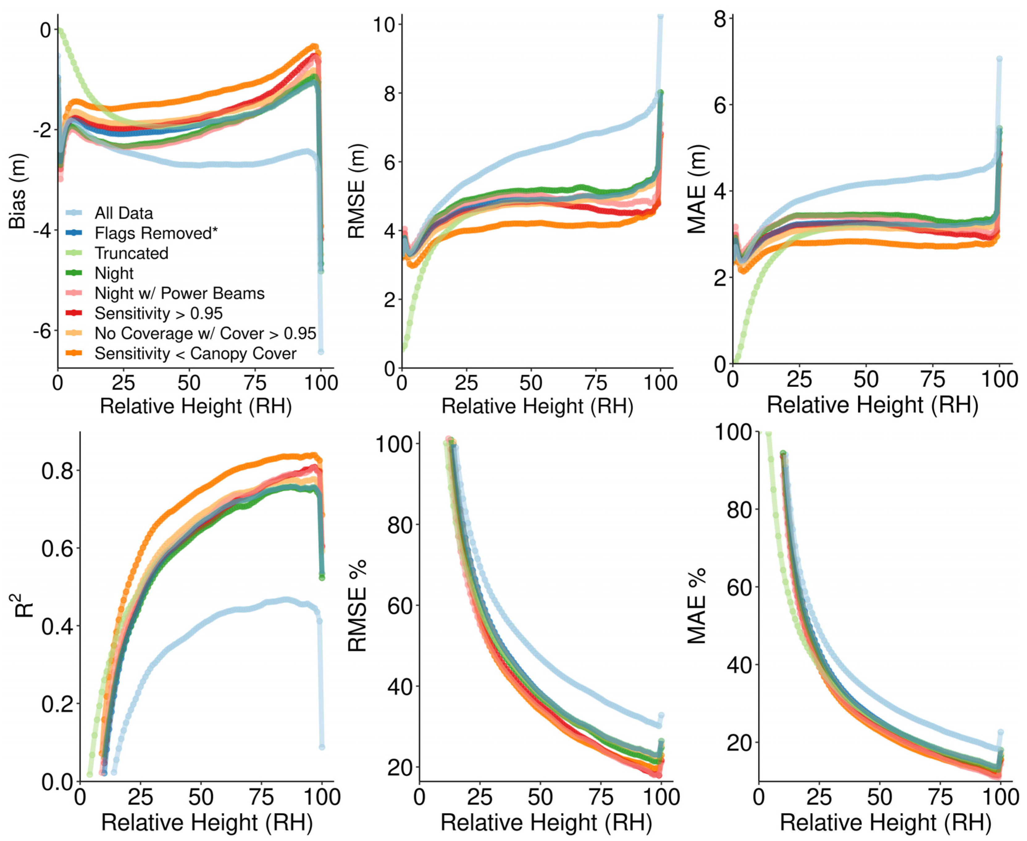
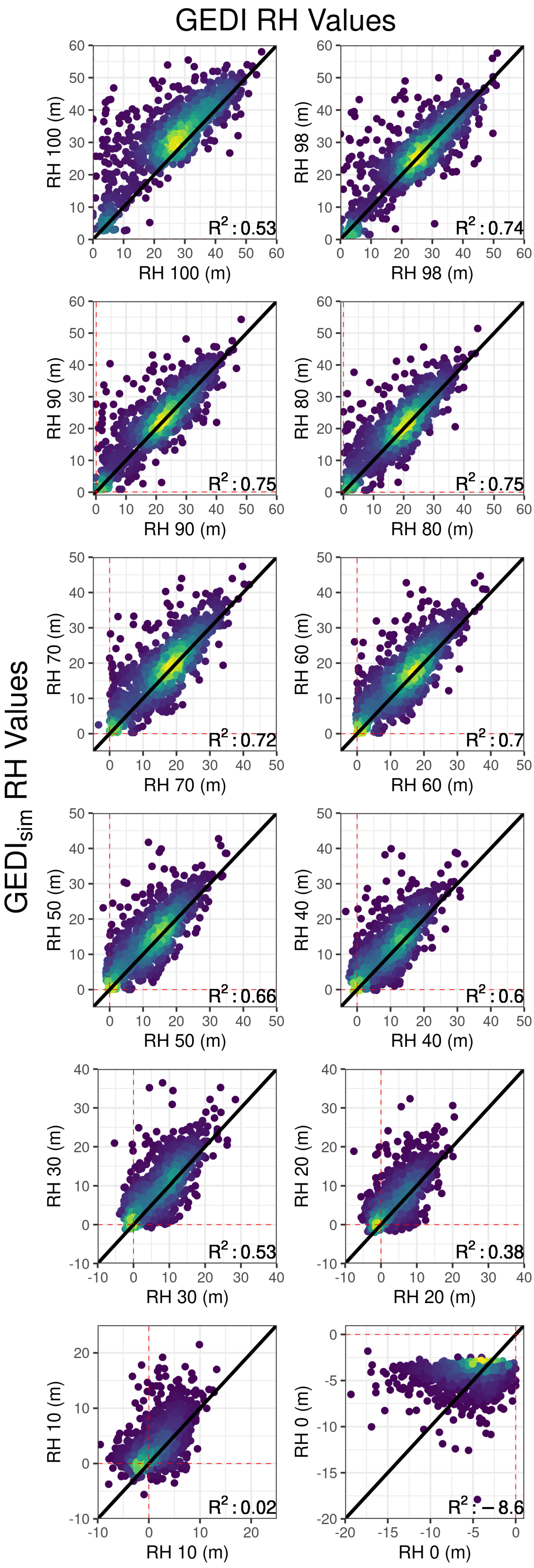
Global Ecosystem Dynamics Investigation (GEDI) is a relatively new technology for global forest research, acquiring LiDAR measurements of vertical vegetation structure across Earth’s tropical, sub-tropical, and temperate forests. Previous GEDI validation efforts have largely focused on top of canopy accuracy, and findings vary by geographic region and forest type. Despite this, many applications utilize measurements of vertical vegetation distribution from the lower canopy, with a wide diversity of uses for GEDI data appearing in the literature. Given the variability in data requirements across research applications and ecosystems, and the regional variability in GEDI data quality, it is imperative to understand GEDI error to draw strong inferences. Here, we quantify the accuracy of GEDI relative height metrics through canopy layers for the Brazilian Amazon. To assess the accuracy of on-orbit GEDI L2A relative height metrics, we utilize the GEDI waveform simulator to compare detailed airborne laser scanning (ALS) data from the Sustainable Landscapes Brazil project to GEDI data collected by the International Space Station. We also assess the impacts of data filtering based on biophysical and GEDI sensor conditions and geolocation correction on GEDI error metrics (RMSE, MAE, and Bias) through canopy levels. GEDI data accuracy attenuates through the lower percentiles in the relative height (RH) curve. While top of canopy (RH98) measurements have relatively high accuracy (R2 = 0.76, RMSE = 5.33 m), the accuracy of data decreases lower in the canopy (RH50: R2 = 0.54, RMSE = 5.59 m). While simulated geolocation correction yielded marginal improvements, this decrease in accuracy remained constant despite all error reduction measures. Some error rates for the Amazon are double those reported in studies from other regions. These findings have broad implications for the application of GEDI data, especially in studies where forest understory measurements are particularly challenging to acquire (e.g., dense tropical forests) and where understory accuracy is highly important.
Keywords: GEDI; LiDAR; validation; tropics; forest canopy GEDI; LiDAR; validation; tropics; forest canopy