Article

Land Cover Mapping in a Mangrove Ecosystem Using Hybrid Selective Kernel-Based Convolutional Neural Networks and Multi-Temporal Sentinel-2 Imagery

1
School of Surveying and Geospatial Engineering, College of Engineering, University of Tehran, Tehran 14399-57131, Iran
2
Department of Photogrammetry and Remote Sensing, Faculty of Geodesy and Geomatics Engineering, K. N. Toosi University of Technology, Tehran 19967-15433, Iran
3
WSP Environment and Infrastructure Canada Limited, Ottawa, ON K2E 7L5, Canada
4
Canada Center for Mapping and Earth Observation, Ottawa, ON K1S 5K2, Canada
*
Author to whom correspondence should be addressed.
Remote Sens. 2024, 16(15), 2849; https://doi.org/10.3390/rs16152849
Submission received: 13 May 2024 / Revised: 26 July 2024 / Accepted: 30 July 2024 / Published: 3 August 2024

Abstract

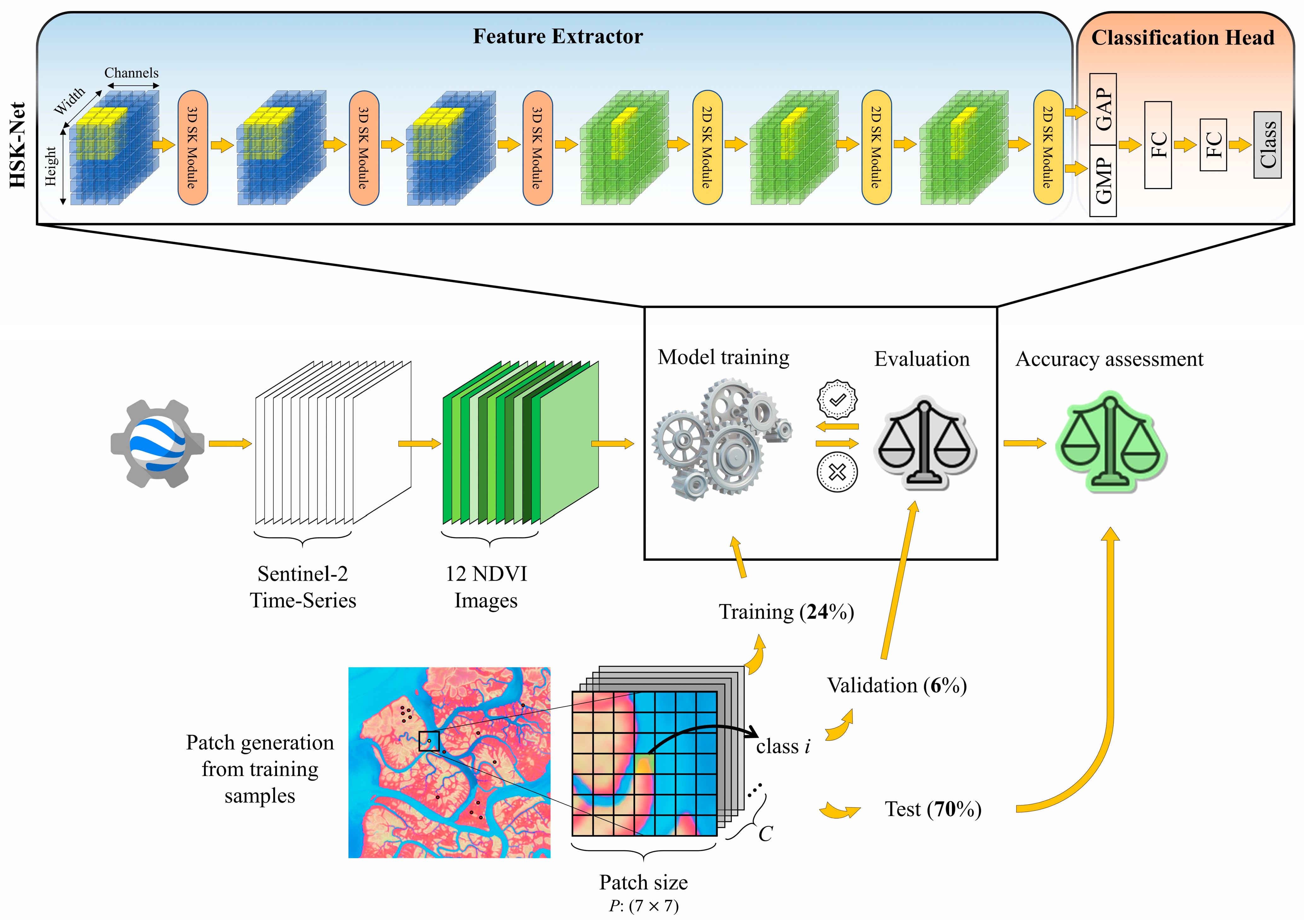
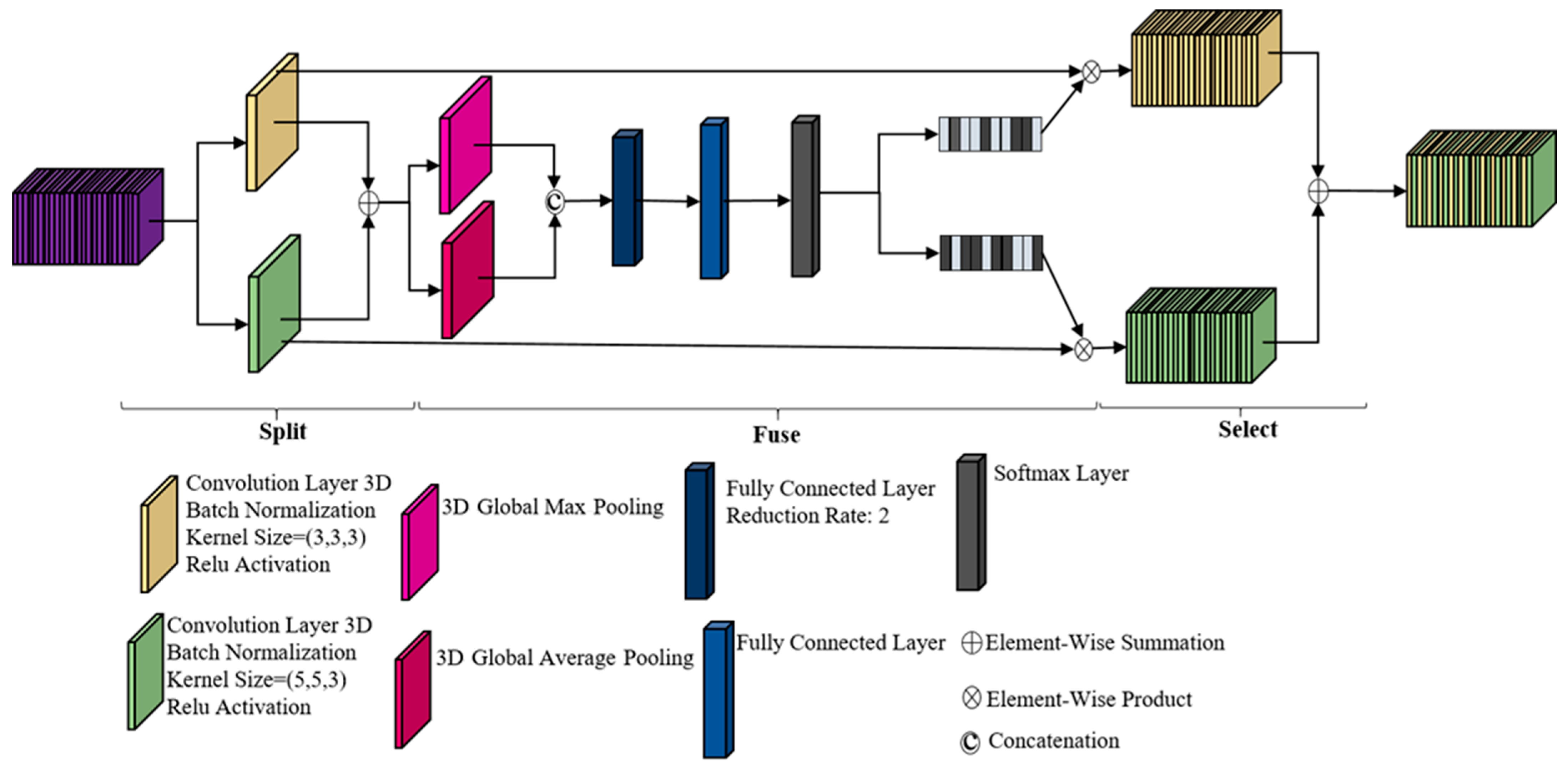
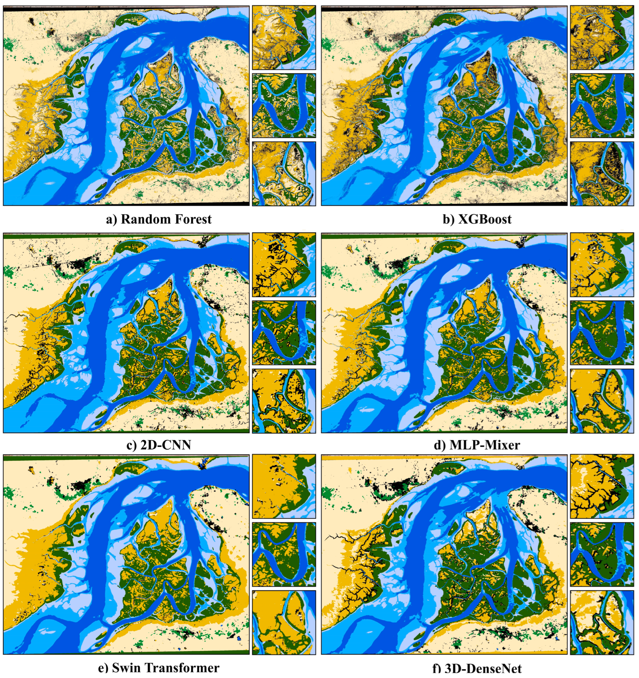
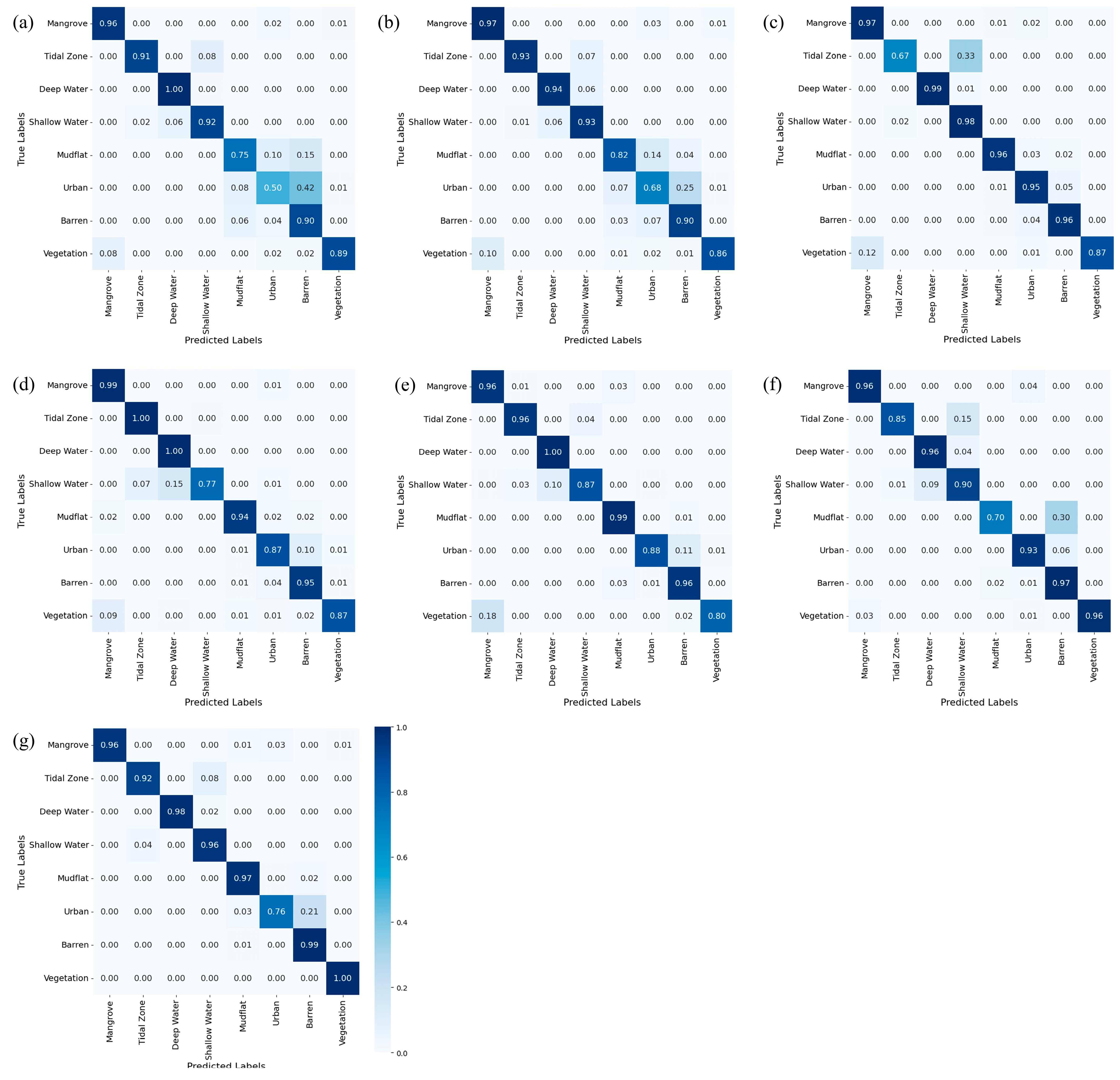
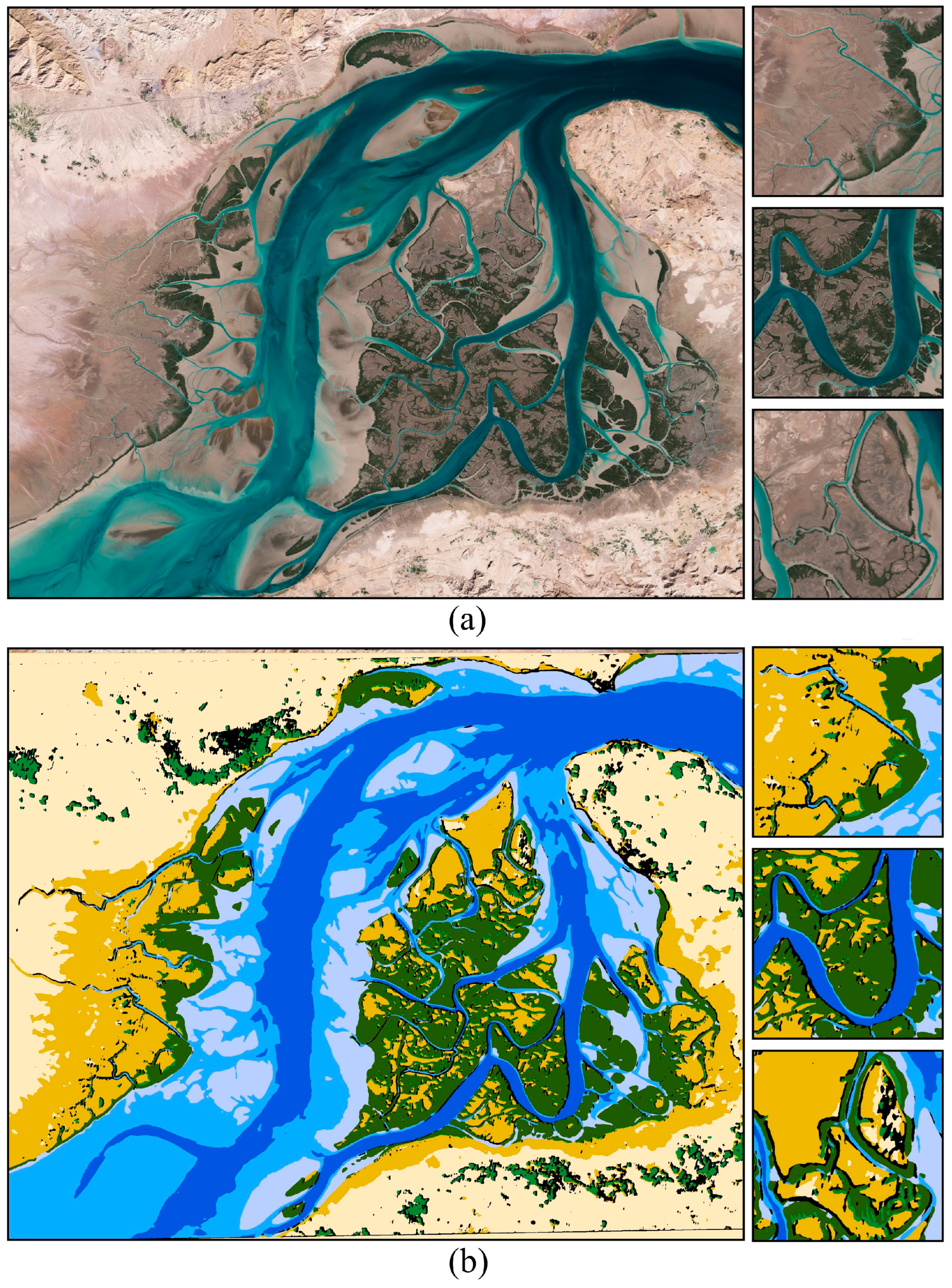
Mangrove ecosystems provide numerous ecological services and serve as vital habitats for a wide range of flora and fauna. Thus, accurate mapping and monitoring of relevant land covers in mangrove ecosystems are crucial for effective conservation and management efforts. In this study, we proposed a novel approach for mangrove ecosystem mapping using a Hybrid Selective Kernel-based Convolutional Neural Network (HSK-CNN) framework and multi-temporal Sentinel-2 imagery. A time series of the Normalized Difference Vegetation Index (NDVI) products derived from Sentinel-2 imagery was produced to capture the temporal behavior of land cover types in the dynamic ecosystem of the study area. The proposed algorithm integrated Selective Kernel-based feature extraction techniques to facilitate the effective learning and classification of multiple land cover types within the dynamic mangrove ecosystems. The model demonstrated a high Overall Accuracy (OA) of 94% in classifying eight land cover classes, including mangrove, tidal zone, water, mudflat, urban, and vegetation. The HSK-CNN demonstrated superior performance compared to other algorithms, including random forest (OA = 85%), XGBoost (OA = 87%), Three-Dimensional (3D)-DenseNet (OA = 90%), Two-Dimensional (2D)-CNN (OA = 91%), Multi-Layer Perceptron (MLP)-Mixer (OA = 92%), and Swin Transformer (OA = 93%). Additionally, it was observed that the structure of the network, such as the types of convolutional layers and patch sizes, affected the classification accuracy using the proposed model and, thus, the optimum scenarios and values of these parameters should be determined to obtain the highest possible classification accuracy. Overall, it was observed that the produced map could offer valuable insights into the distribution of different land cover types in the mangrove ecosystem, facilitating informed decision-making for conservation and sustainable management efforts.
Keywords: mangrove ecosystem; Convolutional Neural Networks (CNNs); Sentinel-2; multi-temporal; coastal wetland; classification; remote sensing mangrove ecosystem; Convolutional Neural Networks (CNNs); Sentinel-2; multi-temporal; coastal wetland; classification; remote sensing